Extended Description of the Vector Map
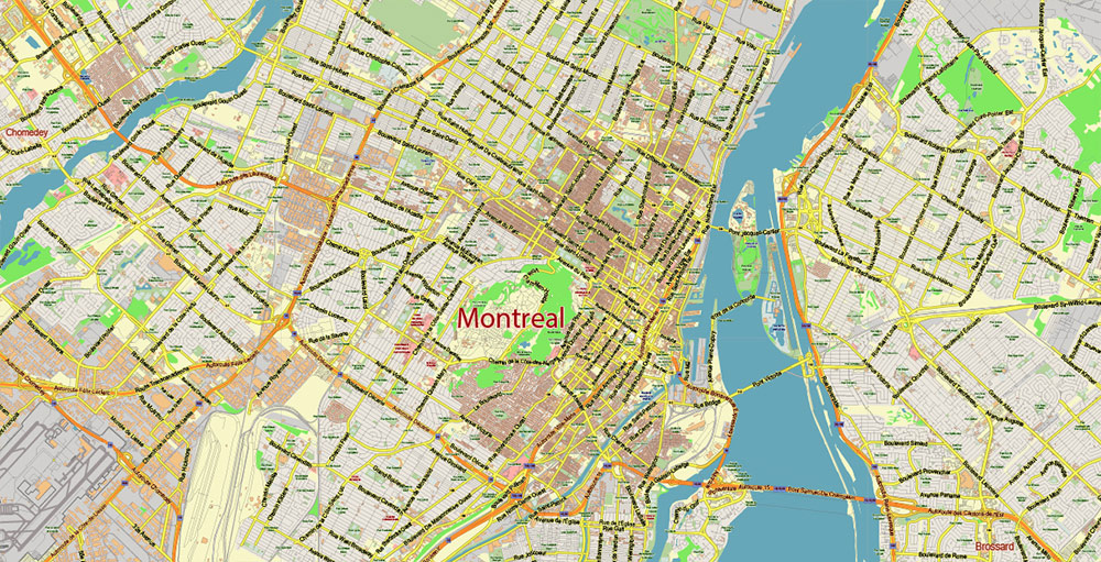
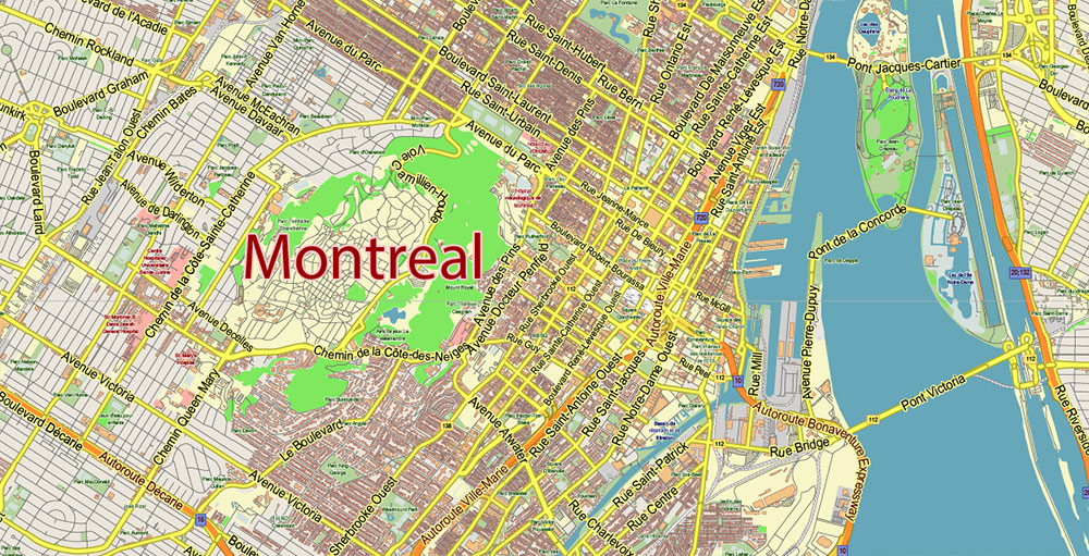
Printable Vector Map of Montreal Quebec Canada detailed City Plan scale 1:52660 full editable Adobe Illustrator Street Map in layers, scalable, text/curves format all names, 31 MB ZIP
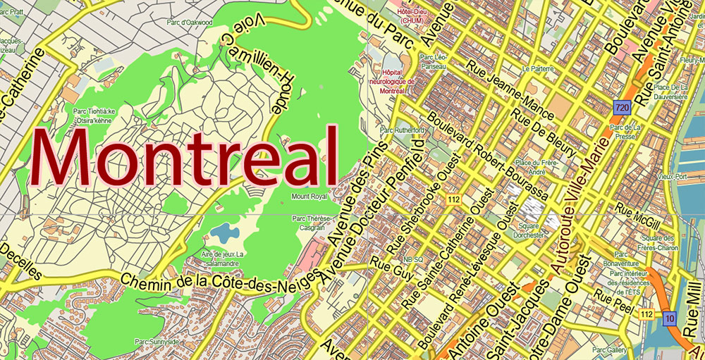
Principal street names, Main Objects, Buildings. Map for design, printing, arts, projects, presentations, for architects, designers, and builders, business, logistics.
If you need: We can add some objects to this map (add-on layers) – for example, zip codes areas with numbers, or any other.
Free for our customers.
Need AutoCAD DWG / DXF or any other format? Please, contact us!
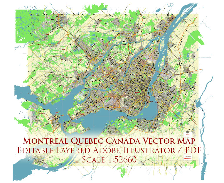
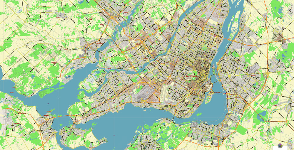
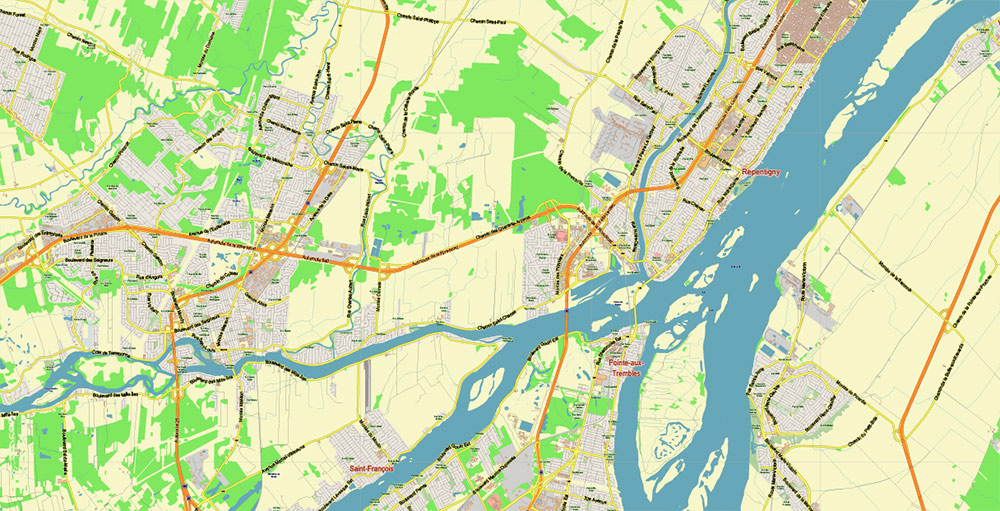
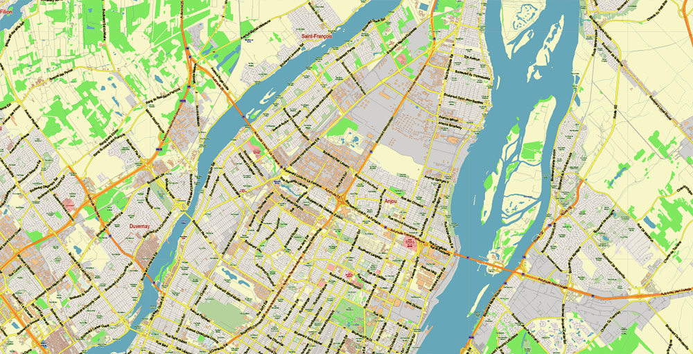
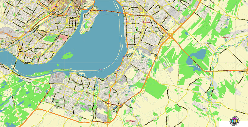
Montreal Quebec Canada Map Vector City Plan Low Detailed (for small print size) Street Map editable Adobe Illustrator in layers
Layers list:
- Legend
- Grids
- Labels of roads
- Names of places (city, hamlet, etc.)
- Names of objects (hospitals, parks, water)
- Names of main streets
- Halo names 1,2,3
- Main Streets, roads
- Civil streets
- Railroads
- Buildings
- Airports and heliports
- Water objects (rivers, lakes, ponds)
- Waterways
- Color fills (parks, hospital areas, land use, etc.)
- Background
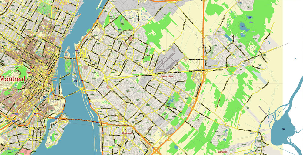
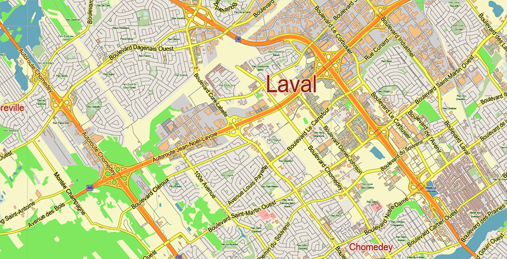
Montreal Quebec Canada Map Vector City Plan Low Detailed (for small print size) Street Map editable Adobe Illustrator in layers
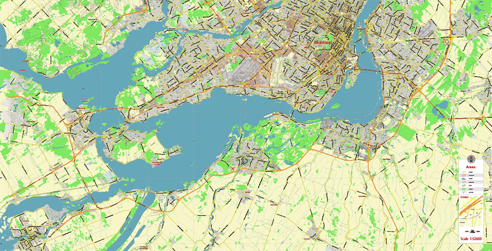
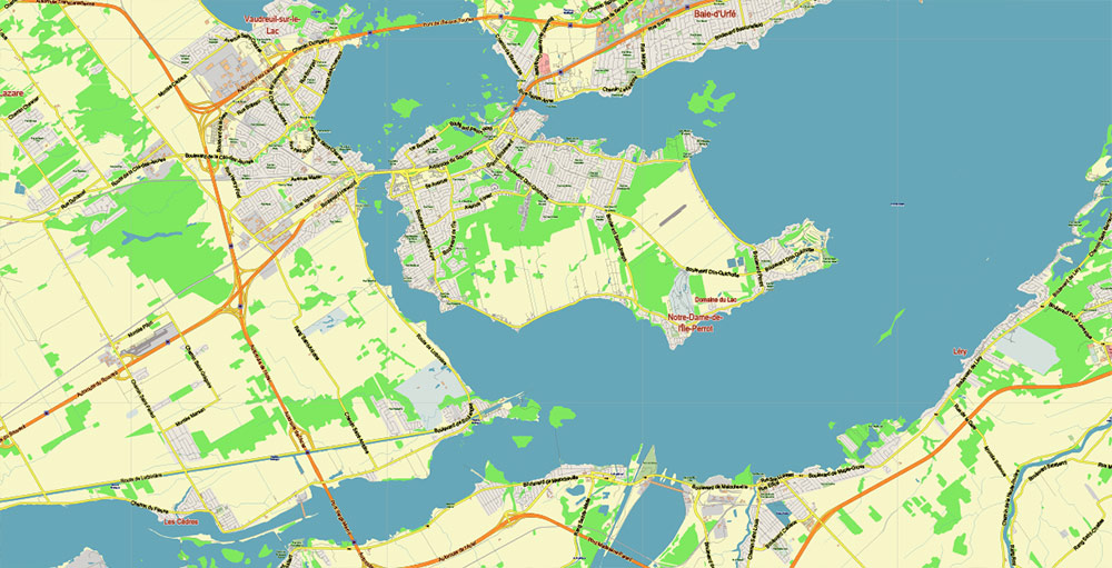
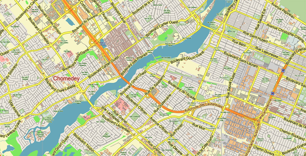
Montreal Quebec Canada Map Vector City Plan Low Detailed (for small print size) Street Map editable Adobe Illustrator in layers
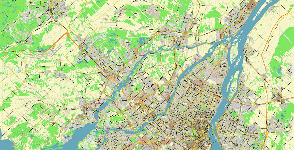
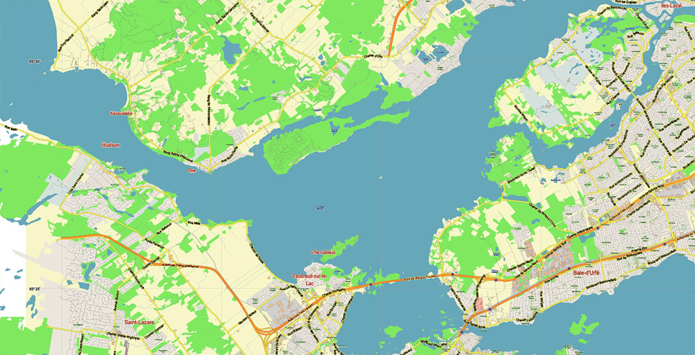
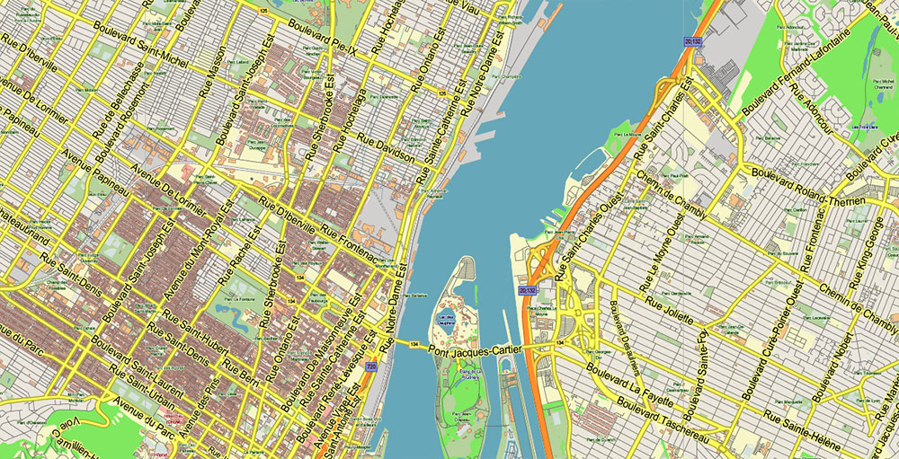
Montreal Quebec Canada Map Vector City Plan Low Detailed (for small print size) Street Map editable Adobe Illustrator in layers
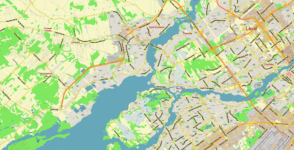
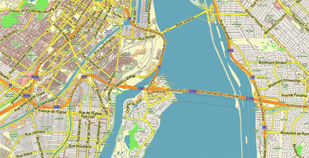
Montreal Quebec Canada Map Vector City Plan Low Detailed (for small print size) Street Map editable Adobe Illustrator in layers
Montreal Quebec Canada Map Vector City Plan Low Detailed (for small print size) Street Map editable Adobe Illustrator in layers
Montreal Quebec Canada Map Vector City Plan Low Detailed (for small print size) Street Map editable Adobe Illustrator in layers
Montreal Quebec Canada Map Vector City Plan Low Detailed (for small print size) Street Map editable Adobe Illustrator in layers
Montreal Quebec Canada Map Vector City Plan Low Detailed (for small print size) Street Map editable Adobe Illustrator in layers
Montreal Quebec Canada Map Vector City Plan Low Detailed (for small print size) Street Map editable Adobe Illustrator in layers
Montreal Quebec Canada Map Vector City Plan Low Detailed (for small print size) Street Map editable Adobe Illustrator in layers
Montreal Quebec Canada Map Vector City Plan Low Detailed (for small print size) Street Map editable Adobe Illustrator in layers
Montreal Quebec Canada Map Vector City Plan Low Detailed (for small print size) Street Map editable Adobe Illustrator in layers
Montreal Quebec Canada Map Vector City Plan Low Detailed (for small print size) Street Map editable Adobe Illustrator in layers
Montreal Quebec Canada Map Vector City Plan Low Detailed (for small print size) Street Map editable Adobe Illustrator in layers
Montreal Quebec Canada Map Vector City Plan Low Detailed (for small print size) Street Map editable Adobe Illustrator in layers
Montreal Quebec Canada Map Vector City Plan Low Detailed (for small print size) Street Map editable Adobe Illustrator in layers
Montreal Quebec Canada Map Vector City Plan Low Detailed (for small print size) Street Map editable Adobe Illustrator in layers

 Author: Kirill Shrayber, Ph.D. FRGS


