Montreal, located in the province of Quebec, Canada, has a rich political and transportation history that spans centuries.
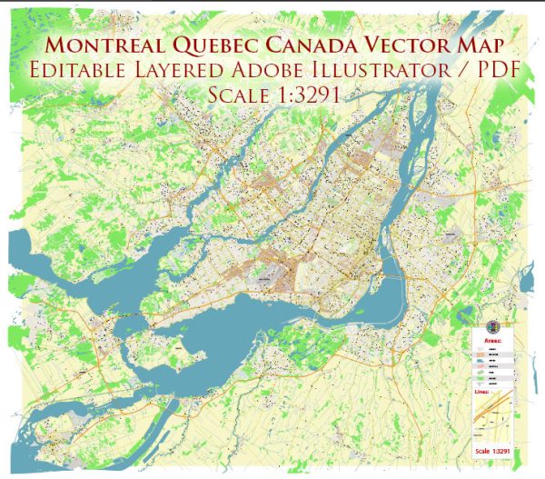
Vectormap.Net provide you with the most accurate and up-to-date vector maps in Adobe Illustrator, PDF and other formats, designed for editing and printing. Please read the vector map descriptions carefully.
Here’s a detailed overview:
Political History:
1. Indigenous Peoples:
- Before European colonization, the area now known as Montreal was inhabited by the Indigenous peoples, including the Kanien’kehá:ka (Mohawk) and Anishinaabe.
2. Early European Settlement:
- French explorer Jacques Cartier arrived in the region in 1535. However, it was not until 1642 that Paul de Chomedey de Maisonneuve founded Ville-Marie, the precursor to Montreal, as a missionary and trading post.
3. French Rule:
- Montreal remained a French colony until 1760 when it was surrendered to the British after the Battle of the Plains of Abraham.
4. British Rule:
- Under British rule, Montreal grew as a major trading hub. The city played a crucial role in the fur trade, and its population increased with the arrival of settlers and immigrants.
5. Confederation and the 20th Century:
- Quebec became one of the founding provinces of the Canadian Confederation in 1867. Montreal continued to thrive as a cultural and economic center.
6. Quiet Revolution:
- In the 1960s, Quebec underwent a period of significant social and political change known as the Quiet Revolution. This era saw a shift towards secularization, modernization, and a growing sense of Quebec nationalism.
7. Language and Cultural Identity:
- Montreal has been a focal point for language and cultural debates in Canada. The city has a significant English-speaking minority, leading to political tensions over language policies.
8. 20th Century Protests:
- Montreal was a center for political protests and social movements, including the anti-Vietnam War protests in the 1960s and the protests during the 1976 Olympics against apartheid in South Africa.
9. Modern Political Landscape:
- Today, Montreal remains a vibrant and diverse city, with a strong cultural identity. It is the largest city in Quebec and the second-largest in Canada.
Transportation History:
1. Fur Trade Routes:
- Montreal was a key point in the fur trade, with its location along the St. Lawrence River providing access to interior waterways.
2. Canals and Waterways:
- The Lachine Canal, opened in 1825, facilitated transportation around the rapids of the St. Lawrence River and contributed to Montreal’s economic growth.
3. Railways:
- The arrival of the railway in the mid-19th century further enhanced Montreal’s role as a transportation hub. The Canadian Pacific Railway and Canadian National Railway played crucial roles in connecting the city to the rest of Canada.
4. Port of Montreal:
- The Port of Montreal, one of the largest inland ports in the world, has been a vital component of the city’s transportation infrastructure, facilitating trade and commerce.
5. Montreal Metro:
- The Montreal Metro, inaugurated in 1966, marked the city’s entry into modern urban transportation. It has since expanded, serving as a vital component of the public transit system.
6. Bridges and Highways:
- Montreal is connected by several bridges, including the iconic Jacques Cartier Bridge. Highways, such as the Trans-Canada Highway and Autoroute 20, contribute to the city’s connectivity.
7. Modern Transportation Challenges:
- Like many major cities, Montreal faces challenges related to traffic congestion and public transportation infrastructure. Efforts are ongoing to improve and expand the city’s transit systems.
In summary, Montreal’s political history reflects its evolution from a French colonial outpost to a vibrant, cosmopolitan city within the Canadian federation. Its transportation history highlights the crucial role it has played in trade and commerce, from fur trading routes to modern urban infrastructure.

 Author: Kirill Shrayber, Ph.D.