The area of the state of Montana – 381,156 km2 (4th place in the United States)
The length of the state of Montana:
from north to south-410 km
from east to west-1015 km
Region of the state of Montana – the Mountain States of the United States
The highest point in the state of Montana – 3,904 meters above sea level
The lowest point of the state of Montana – 549 meters above sea level
The abbreviation of the state of Montana is MT
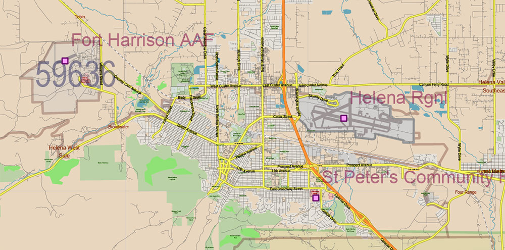
The capital of the state of Montana is Helena
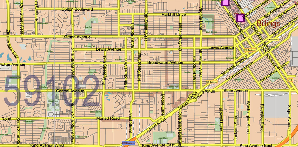
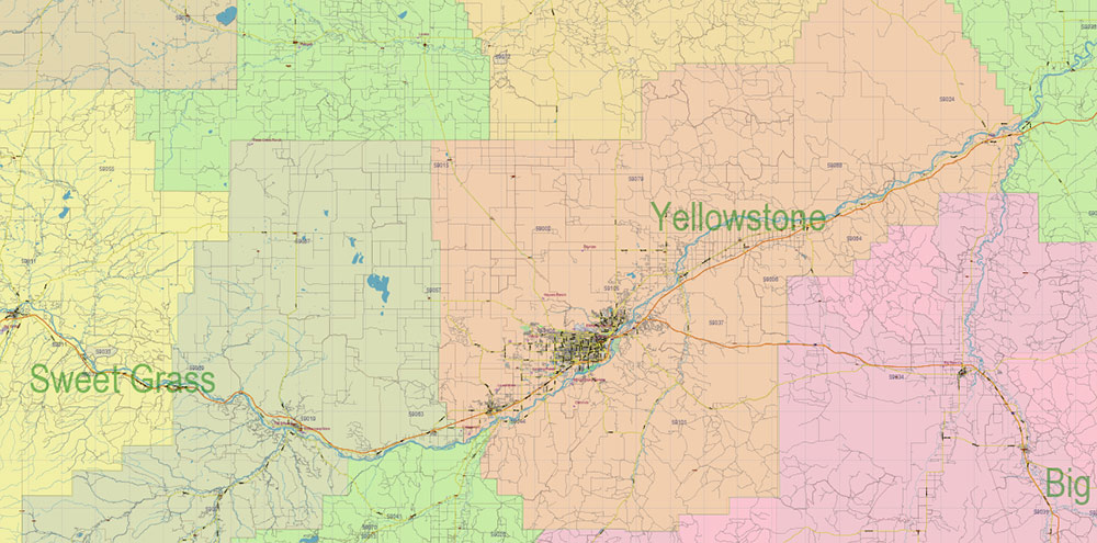
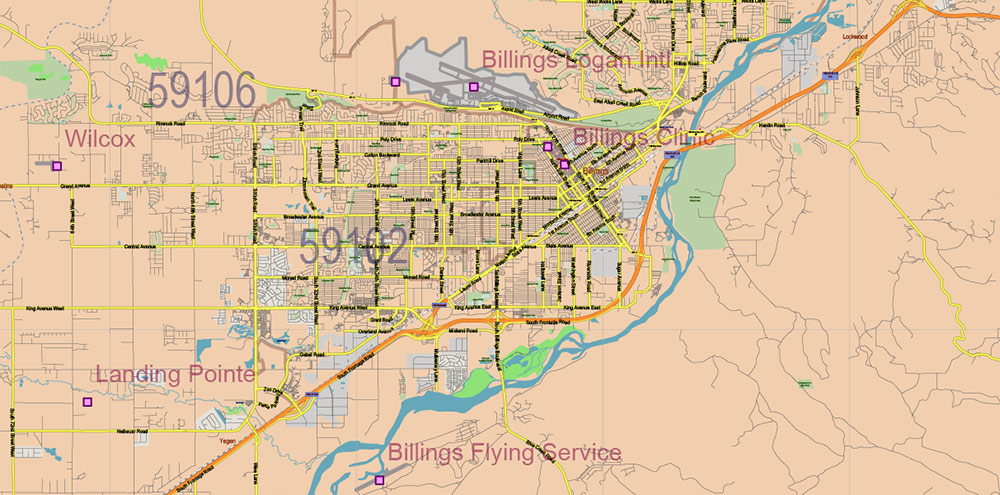
The largest city in the state of Montana – Billings
Date of formation of the state of Montana – November 8, 1889 (41 in the United States)
The population of the state of Montana is about 1,000,000 people (44th place in the United States)
The population density in the state of Montana is 2.5 people per km2 (48th place in the United States)
The motto of the state of Montana – Oro Y Plata (“Gold and silver”)
The nickname of the state of Montana – “The country of the big sky”, ” The State of treasures”
The state of Montana is a mountainous state, with more than seventy Rocky Mountain ranges located in central and western Montana.
Therefore, it is not surprising that the name of the state of Montana comes from the Spanish word “montana”, which means “mountains”.
The state of Montana is home to about a million people (forty-fourth among US states), with an average population density of about 2.5 people per km2 (48th in the US, less only in Alaska and neighboring Wyoming).
The largest cities in Montana are Billings (over 100,000 residents), Missoula (about 70,000 residents), Great Falls (about 60,000 residents), Bozeman (about 40,000 residents), and Butte (about 35,000 residents). The state capital, Helena, is home to nearly thirty thousand people.
The largest urban agglomerations in Montana were formed around the cities of Billings (about 160,000 people), Missoula (about 110,000 people), Kalispell, and Bozeman (about 90,000 people each).
There are seven Native American reservations in the state of Montana. They are inhabited by the Kootenai, Blackfoot, Crow (Absaroka), Grovantra, Assiniboine, Cheyenne, and others. Montana has one of the highest percentages of Native Americans in the United States.
The largest ethnic (national) groups among the population of the state of Montana:
Germans – about 30%
Irish – about 16%
English – about 13%
Norwegians – about 10%
Most of the descendants of immigrants from the Scandinavian countries live on the plains of the eastern part of the state. In the west, in the mountainous regions of Montana, the ethnic composition of the population is more diverse. Here you can meet Chinese, Slavs, Finns, Scots, and representatives of many other nationalities. The relatively few Mexicans in Montana live mostly in the Billings area, while the majority of African Americans live in Great Falls.
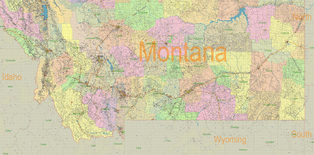
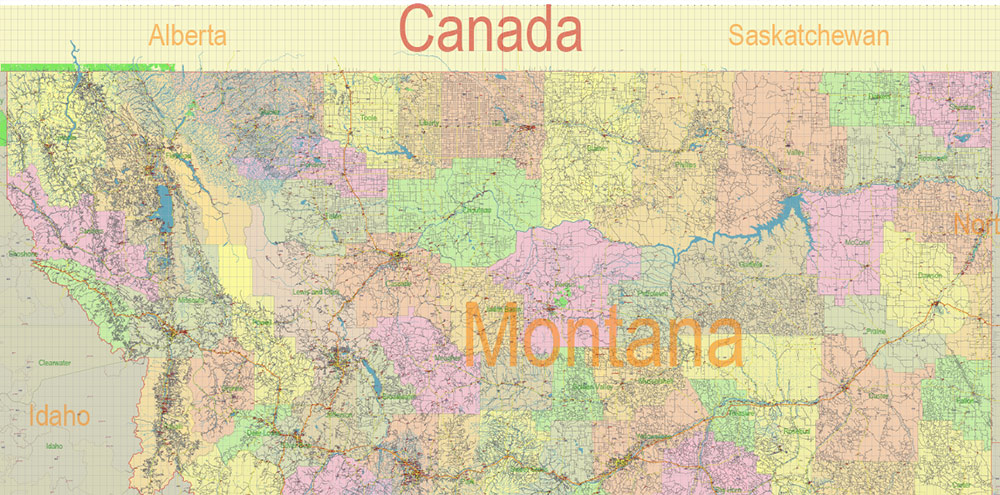
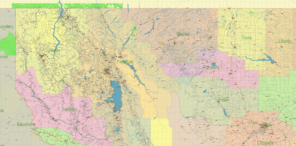
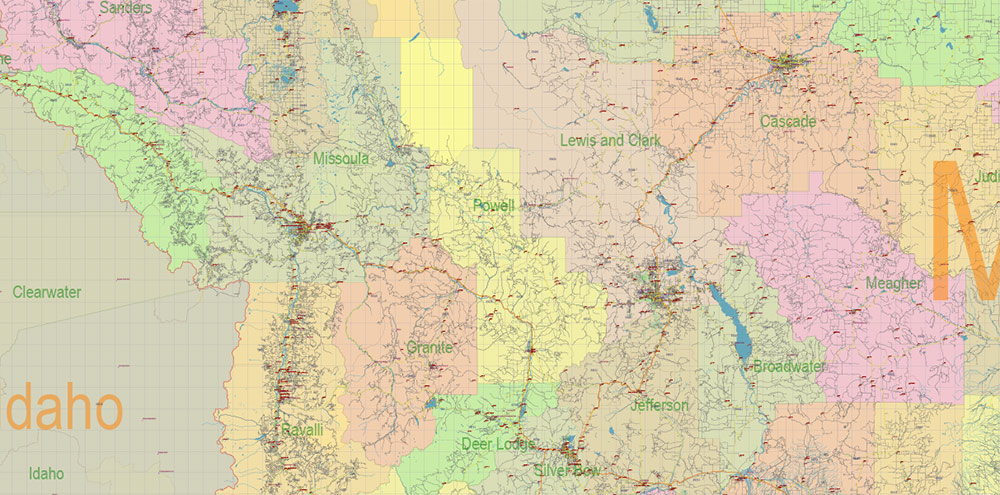
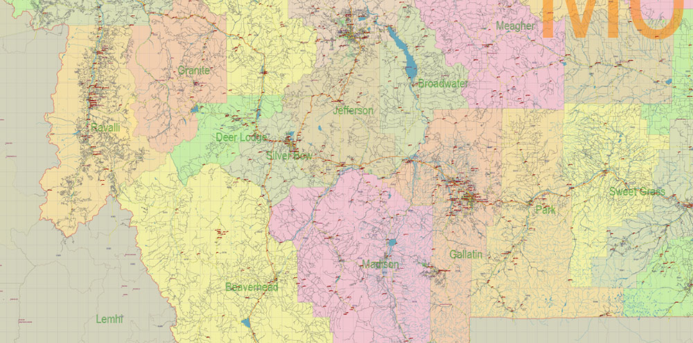
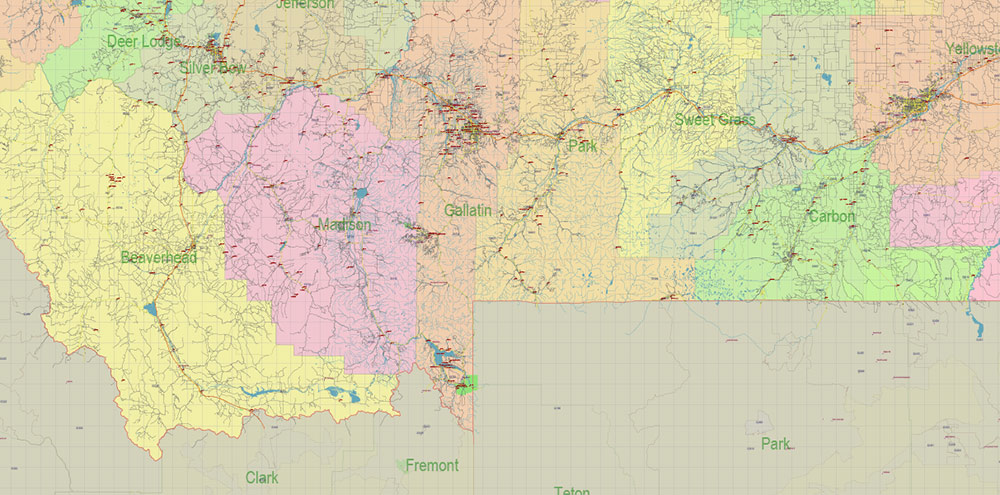
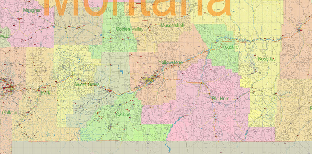
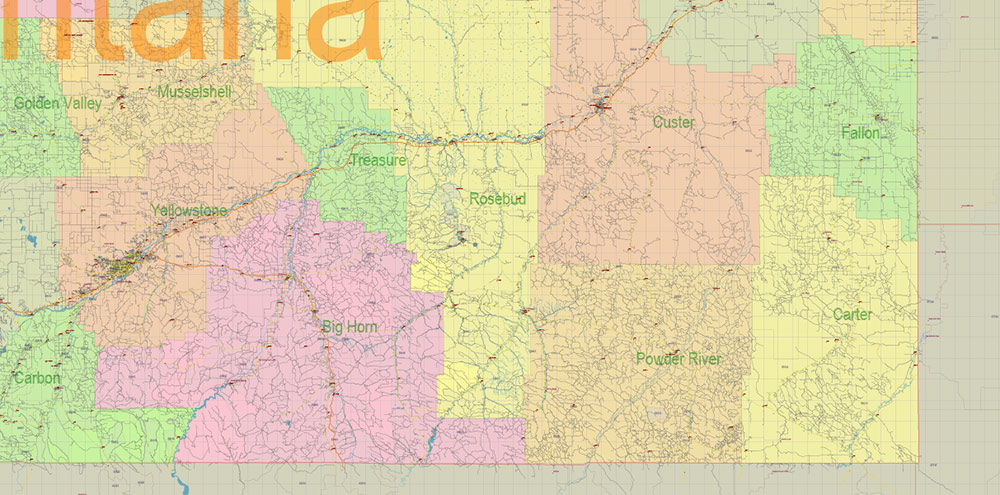
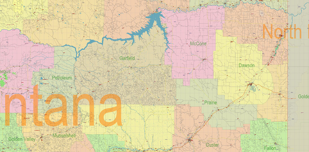
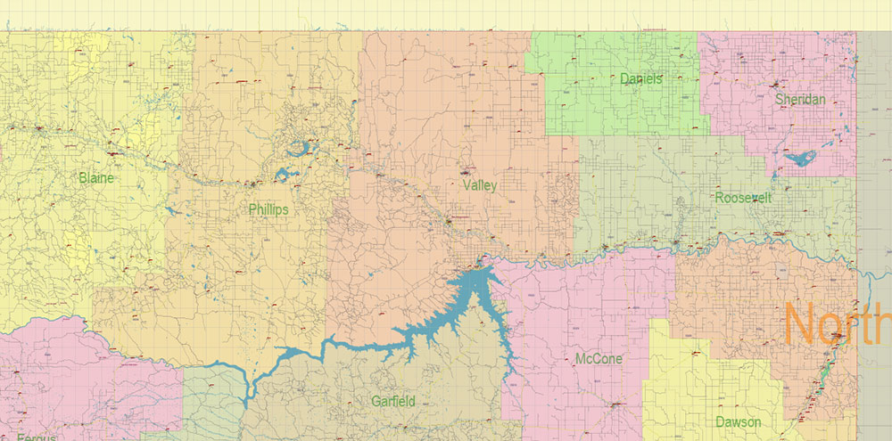
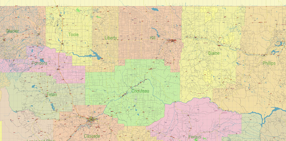
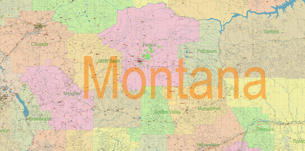
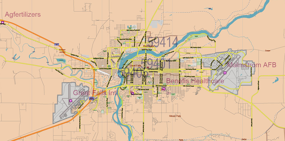
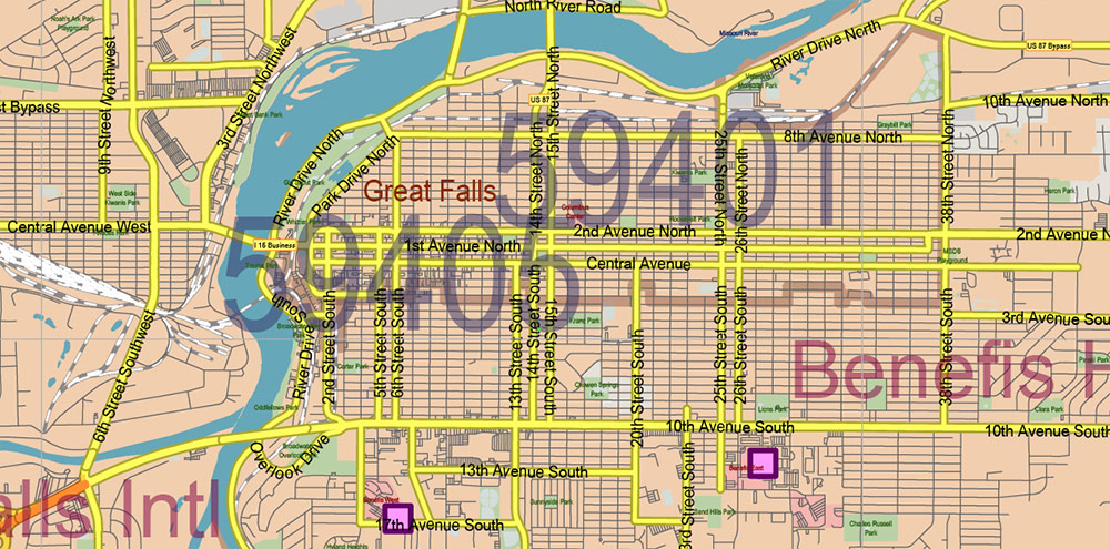
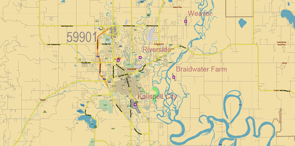
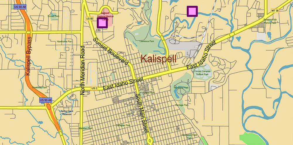
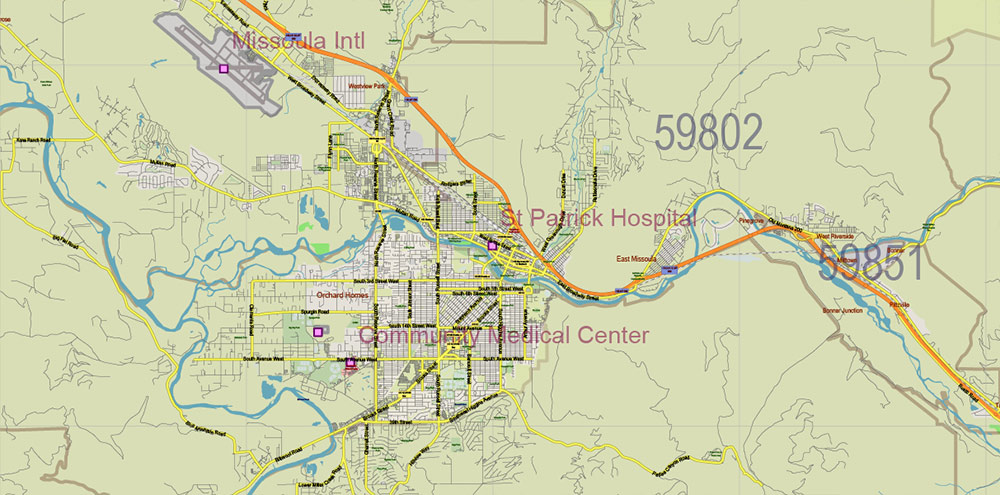
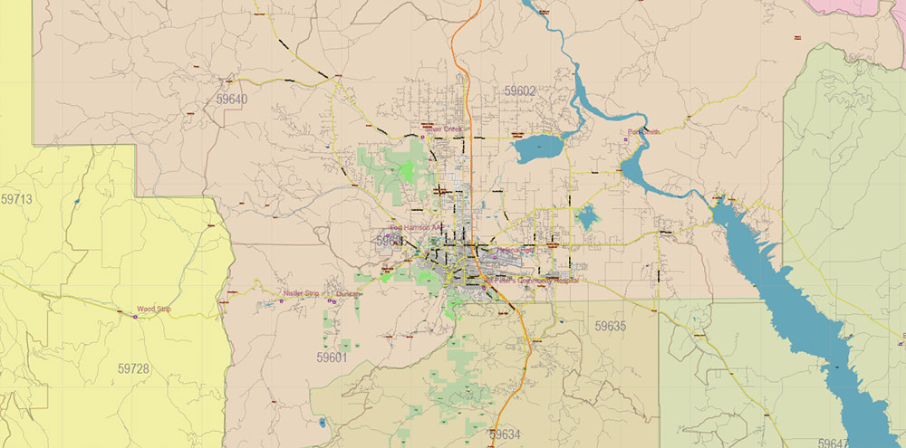
Printable PDF Vector Map of Montana Full State US: All Streets and Roads + counties areas + zip-codes areas, fully editable Adobe PDF Map in layers, scalable, 149 MB ZIP
Scale: 1:51406
All streets and roads, Names of Principal streets, All Cities and Towns, Counties, All Geonames, airports, and heliports. Map for design, printing, arts, projects, presentations, for architects, designers, and builders, business, logistics.
NOTE! All objects are located on separate layers by type. The preview shows them all together. When you work with this map, just turn off or delete those layers that are not needed for your project.
For Editing and High-Quality Printing, Royalty free
Need AutoCAD DWG / DXF, CDR, or any other format? Please, contact us!
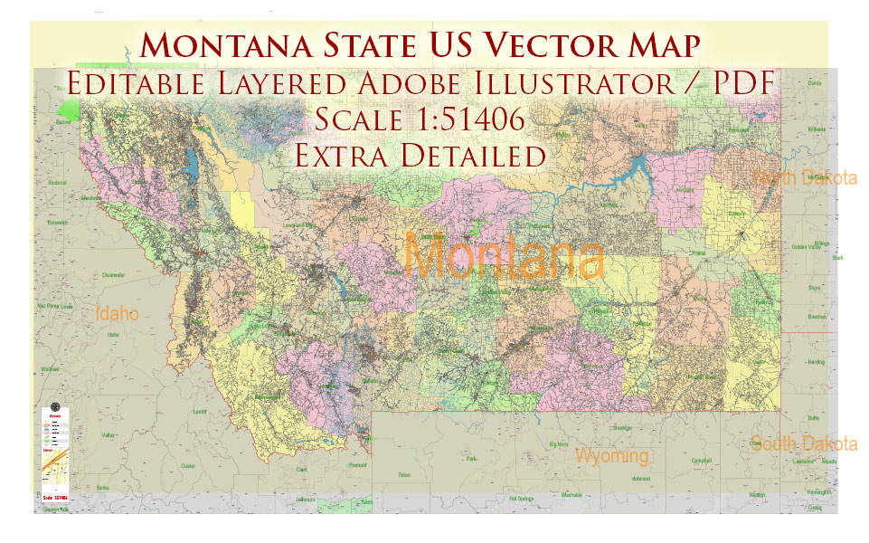
Montana Full State US PDF Vector Map: Full Extra High Detailed (all roads, zipcodes, airports) + Admin Areas editable Adobe PDF in layers
Layers list:
- Legend
- Grids
- Labels of roads (numbers) – highways, interstate
- All Geonames (cities, towns, villages, hamlets, islands)
- Points of the Geonames (cities, towns, villages, hamlets, islands)
- Names places: Names of all Cities, towns, villages and hamlets
- Names of the Airports and Heliports
- Points of the Airports and Heliports
- Numbers of ZIP codes
- Names of objects (water, park, hospital)
- Names of States
- Names of Counties
- Names of the Main Streets
- Major Roads and Streets – Highways
- Minor Roads and residential streets
- Railroads
- State boundaries
- Water objects (rivers, lakes, ponds, swamps, reefs)
- Waterways
- Ground objects (urban areas, parks, hospitals, etc.)
- ZIP-codes areas
- Counties areas (colored)
- States areas
- Background
Montana Full State US PDF Vector Map: Full Extra High Detailed (all roads, zipcodes, airports) + Admin Areas editable Adobe PDF in layers
Montana Full State US PDF Vector Map: Full Extra High Detailed (all roads, zipcodes, airports) + Admin Areas editable Adobe PDF in layers
Montana Full State US PDF Vector Map: Full Extra High Detailed (all roads, zipcodes, airports) + Admin Areas editable Adobe PDF in layers
Montana Full State US PDF Vector Map: Full Extra High Detailed (all roads, zipcodes, airports) + Admin Areas editable Adobe PDF in layers
Montana Full State US PDF Vector Map: Full Extra High Detailed (all roads, zipcodes, airports) + Admin Areas editable Adobe PDF in layers
Montana Full State US PDF Vector Map: Full Extra High Detailed (all roads, zipcodes, airports) + Admin Areas editable Adobe PDF in layers
Montana Full State US PDF Vector Map: Full Extra High Detailed (all roads, zipcodes, airports) + Admin Areas editable Adobe PDF in layers
Montana Full State US PDF Vector Map: Full Extra High Detailed (all roads, zipcodes, airports) + Admin Areas editable Adobe PDF in layers
Montana Full State US PDF Vector Map: Full Extra High Detailed (all roads, zipcodes, airports) + Admin Areas editable Adobe PDF in layers
Montana Full State US PDF Vector Map: Full Extra High Detailed (all roads, zipcodes, airports) + Admin Areas editable Adobe PDF in layers
Montana Full State US PDF Vector Map: Full Extra High Detailed (all roads, zipcodes, airports) + Admin Areas editable Adobe PDF in layers
Montana Full State US PDF Vector Map: Full Extra High Detailed (all roads, zipcodes, airports) + Admin Areas editable Adobe PDF in layers
Montana Full State US PDF Vector Map: Full Extra High Detailed (all roads, zipcodes, airports) + Admin Areas editable Adobe PDF in layers
Montana Full State US PDF Vector Map: Full Extra High Detailed (all roads, zipcodes, airports) + Admin Areas editable Adobe PDF in layers
Montana Full State US PDF Vector Map: Full Extra High Detailed (all roads, zipcodes, airports) + Admin Areas editable Adobe PDF in layers
Montana Full State US PDF Vector Map: Full Extra High Detailed (all roads, zipcodes, airports) + Admin Areas editable Adobe PDF in layers
Montana Full State US PDF Vector Map: Full Extra High Detailed (all roads, zipcodes, airports) + Admin Areas editable Adobe PDF in layers
Montana Full State US PDF Vector Map: Full Extra High Detailed (all roads, zipcodes, airports) + Admin Areas editable Adobe PDF in layers
Montana Full State US PDF Vector Map: Full Extra High Detailed (all roads, zipcodes, airports) + Admin Areas editable Adobe PDF in layers
Montana Full State US PDF Vector Map: Full Extra High Detailed (all roads, zipcodes, airports) + Admin Areas editable Adobe PDF in layers
Montana Full State US PDF Vector Map: Full Extra High Detailed (all roads, zipcodes, airports) + Admin Areas editable Adobe PDF in layers
Montana Full State US PDF Vector Map: Full Extra High Detailed (all roads, zipcodes, airports) + Admin Areas editable Adobe PDF in layers

 Author: Kirill Shrayber, Ph.D. FRGS

 + Admin Areas editable Adobe Illustrator in layers")