The state of Montana is located in the Western United States and belongs to the mountain states of the United States. The territory of the state is 381,156 km2, Montana is the fourth largest land area among the US states (after Alaska, Texas, and California) and is the largest landlocked state.
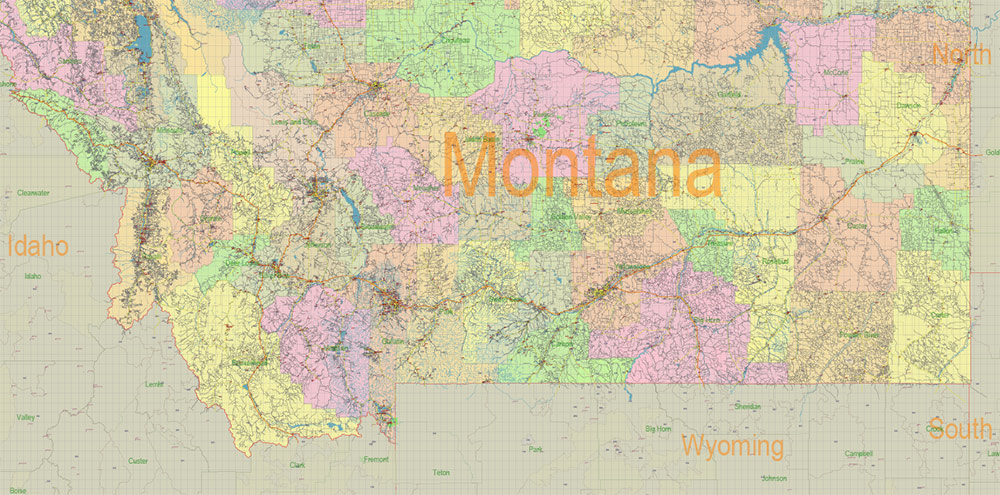
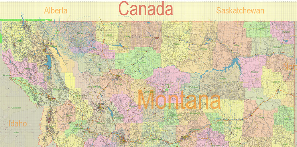
Montana is bordered by the states of North Dakota to the east, South Dakota to the southeast, Wyoming to the south, and Idaho to the southwest and west. To the north, the state of Montana borders Canada.
According to the features of the terrain, the state of Montana can be divided into two large areas: the mountains in the west of the state and the plains in the east.
The main industries of the state of Montana are mining, agriculture, and tourism.
Montana is not accidentally called the “Treasure State”, the bowels of the state are extremely rich in minerals. In the plains of eastern Montana, coal, oil, and natural gas are extracted; in the mountains of the western part of the state – gold, silver, copper, lead, tungsten, and molybdenum. Montana is the largest U.S. supplier of talc and the only supplier of platinum and palladium.
The state has a well-developed oil processing industry, the production of timber and wood products.
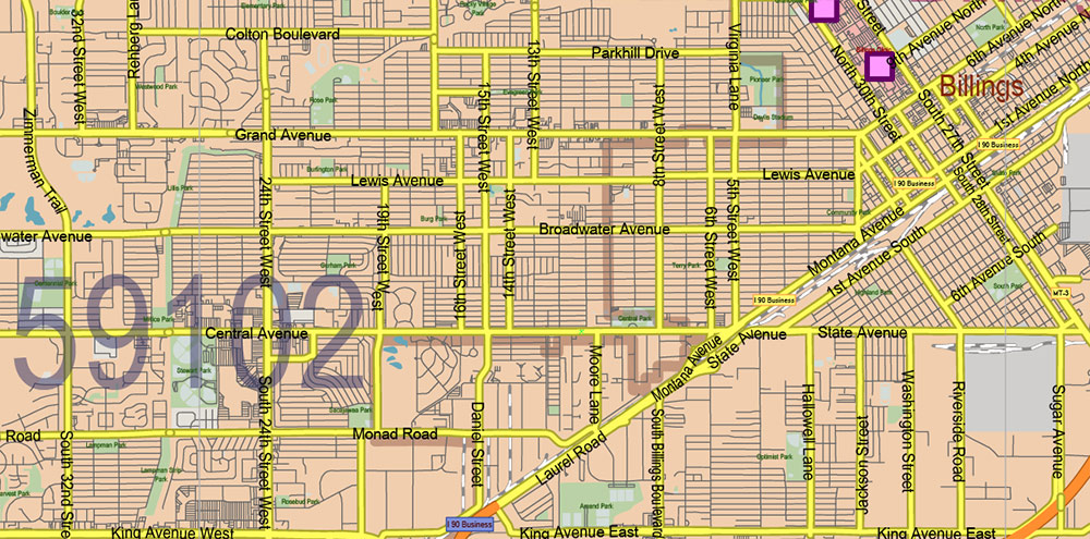
The largest city in Montana, Billings, is also the state’s economic capital. A number of financial organizations, machine-building, and petrochemical plants, construction, and many other companies are located here.
In the city of Bozeman, where the University of Montana is located, there are a number of companies that lead developments in the field of high technology. They are engaged in the production of laser equipment, software, and biotechnology. Also in Bozeman, there is a factory of the famous guitar manufacturer Gibson.
Montana’s main agricultural crop is wheat. In addition, in the fields of Montana, barley, beans, potatoes, and sugar beets are grown.
Traditionally, the most important branch of agriculture in Montana remains the breeding of cattle for meat. Dairy farming is also well developed in the state, where sheep, pigs, and even llamas are raised.
The state has a well-developed food industry, including the processing of meat, milk, grain, and sugar beet. There are many relatively small breweries in Montana.
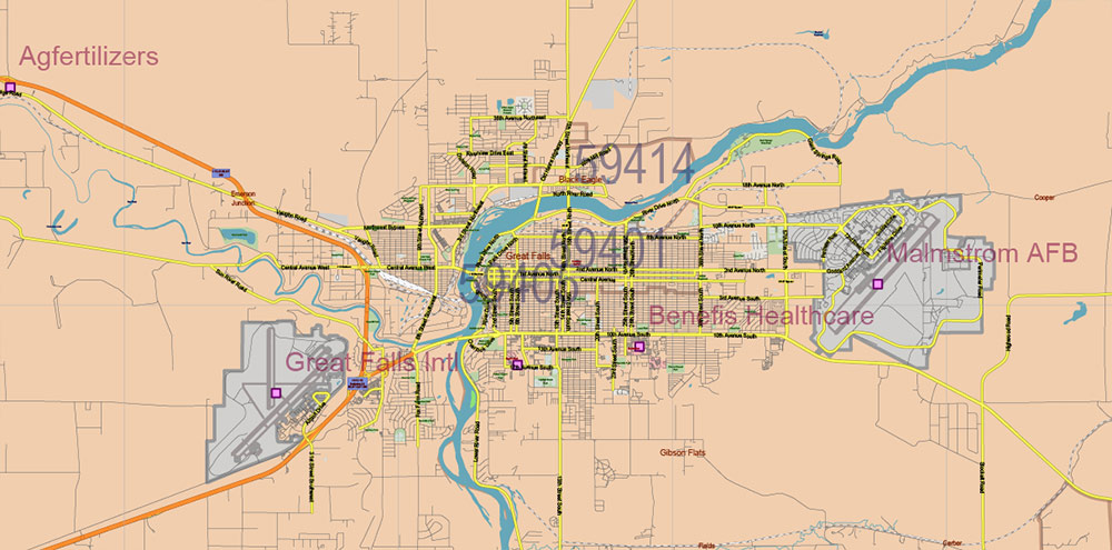
The United States Air Force Base Malmstrom is located near Great Falls. The Malmstrom base is home to the Minuteman intercontinental ballistic missile launchers.
The most important sector of the economy of the state of Montana is tourism, the ” Big Sky Country”, as the state is often called, is visited by millions of tourists every year. The state is home to several very popular tourist attractions, both natural and related to the history of Montana.
Among the unique natural sites of Montana are the world-famous Yellowstone National Park, Glacier National Park, Bison National Reserve, Lewis and Clark Cave, Flathead Lake, and many others. The rivers of Montana are very popular with fishing enthusiasts. Montana’s most famous historical landmark is the Battle of the Little Bighorn National Monument.
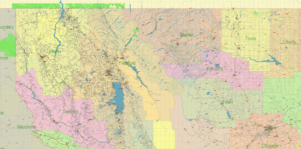
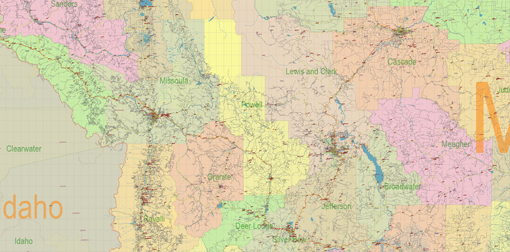
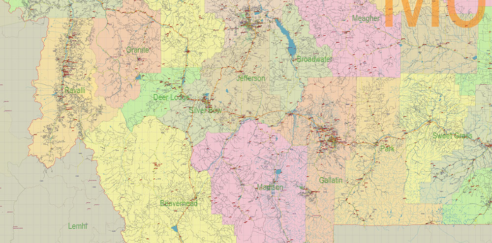
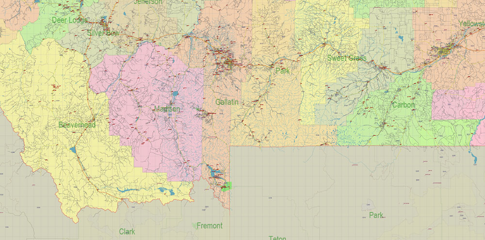
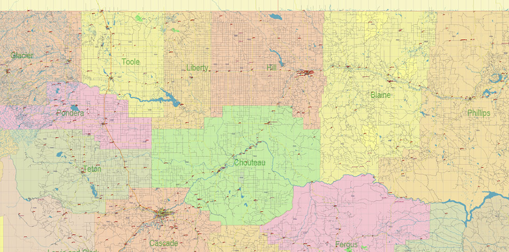
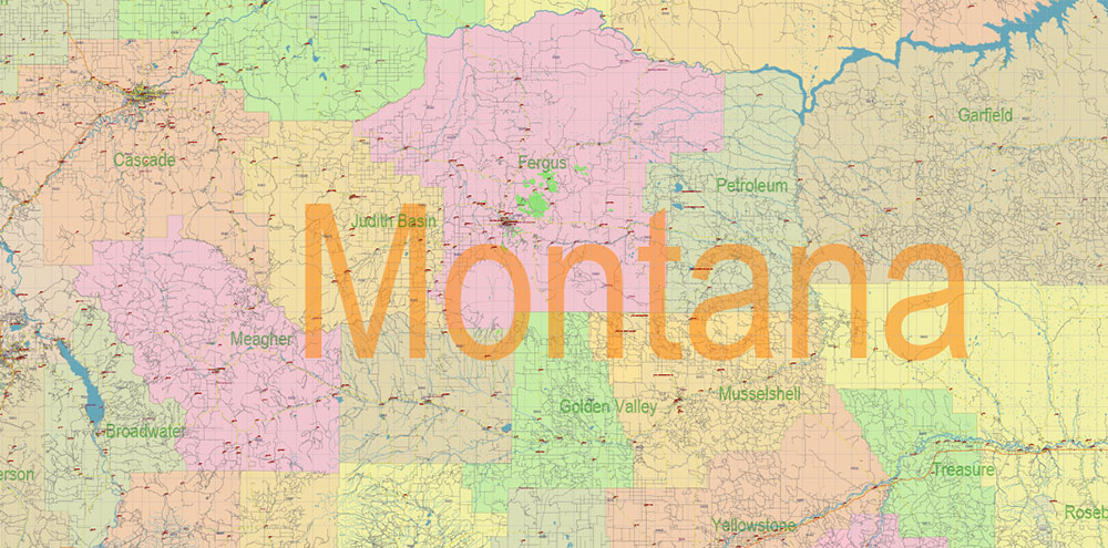
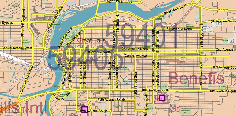
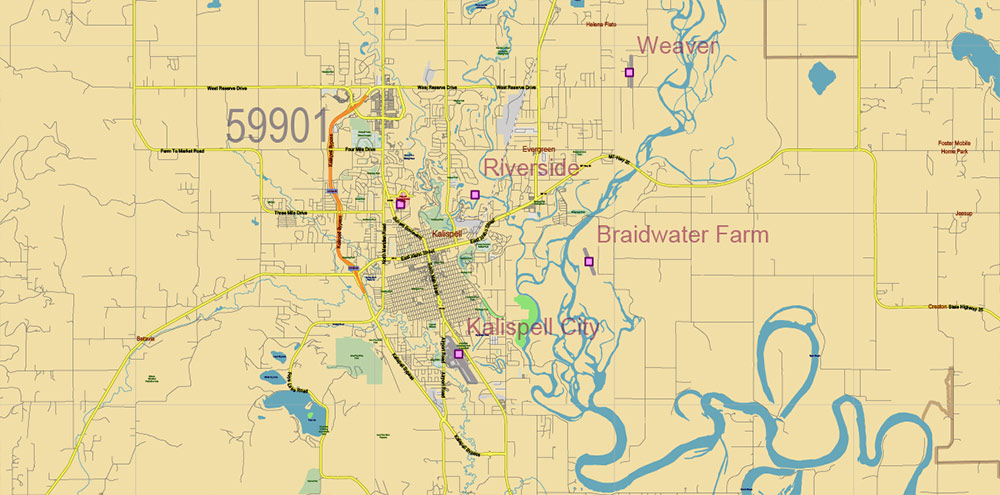
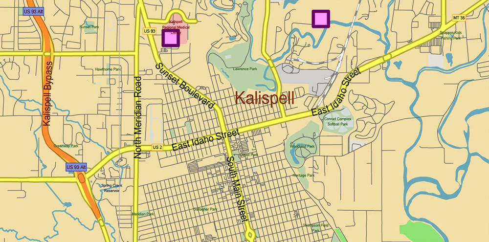
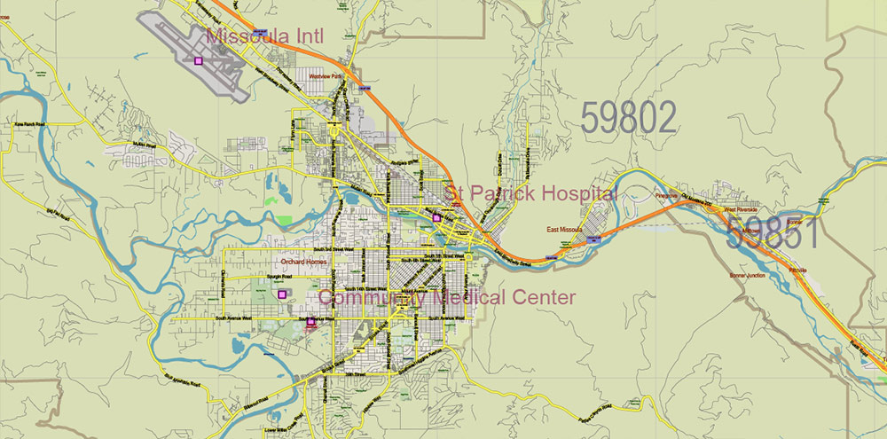
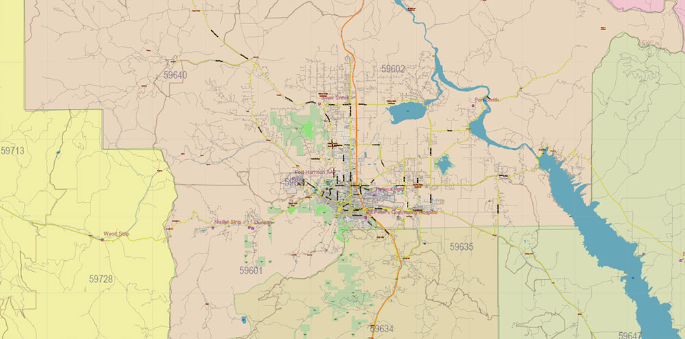
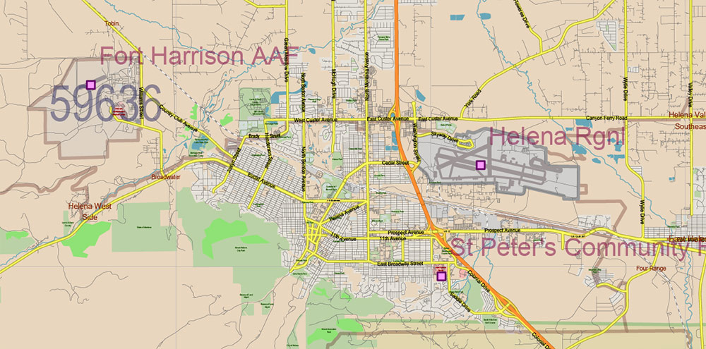
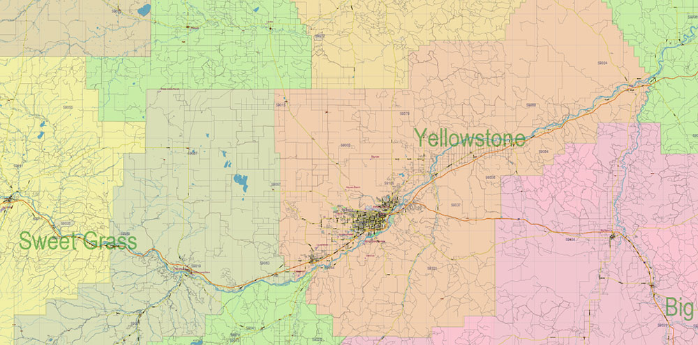
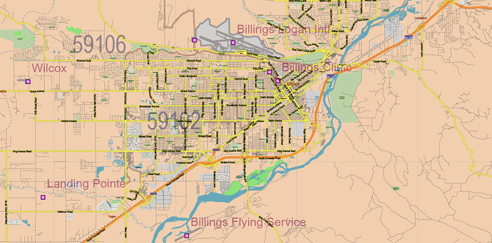
Printable Vector Map of Montana Full State US: All Streets and Roads + counties areas + zip-codes areas, fully editable Adobe Illustrator Map in layers, scalable, 66 MB ZIP
Scale: 1:51406
All streets and roads, Names of Principal streets, All Cities and Towns, Counties, All Geonames, airports, and heliports. Map for design, printing, arts, projects, presentations, for architects, designers, and builders, business, logistics.
NOTE! All objects are located on separate layers by type. The preview shows them all together. When you work with this map, just turn off or delete those layers that are not needed for your project.
For Editing and High-Quality Printing, Royalty free
Need AutoCAD DWG / DXF, CDR, or any other format? Please, contact us!
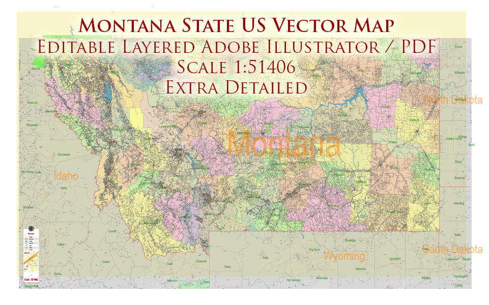
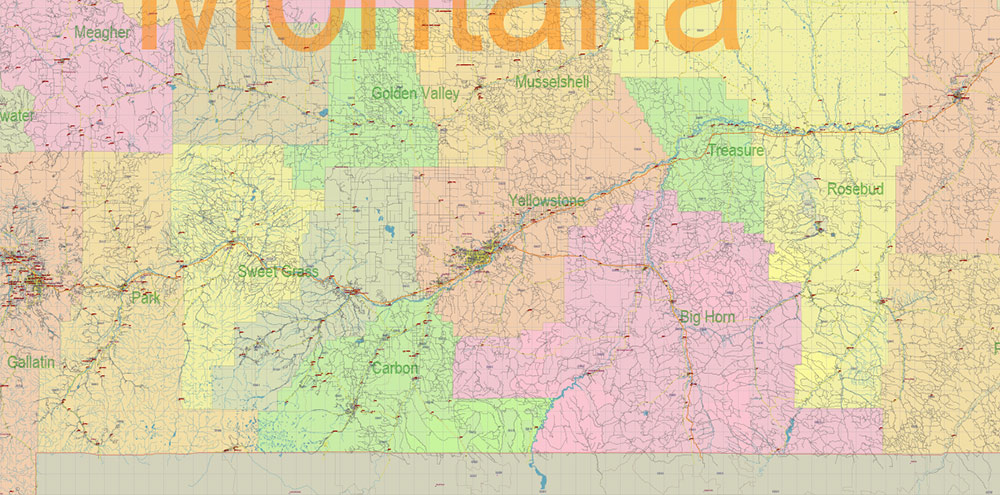
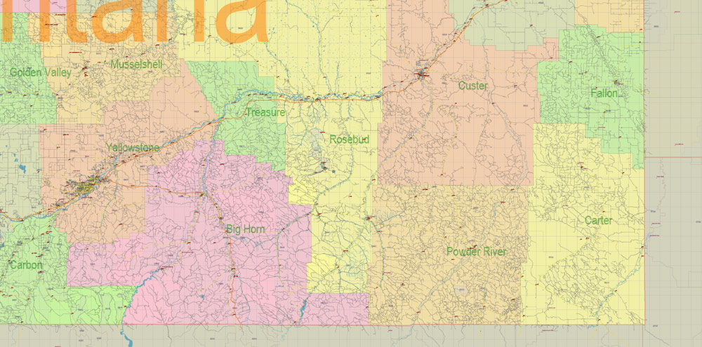
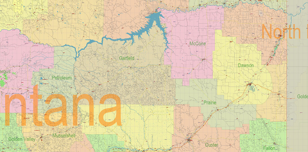
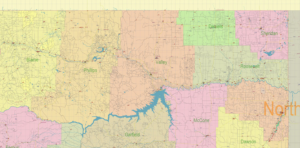
Montana Full State US Vector Map: Full Extra High Detailed (all roads, zipcodes, airports) + Admin Areas editable Adobe Illustrator in layers
Layers list:
- Legend
- Grids
- Labels of roads (numbers) – highways, interstate
- All Geonames (cities, towns, villages, hamlets, islands)
- Points of the Geonames (cities, towns, villages, hamlets, islands)
- Names places: Names of all Cities, towns, villages and hamlets
- Names of the Airports and Heliports
- Points of the Airports and Heliports
- Numbers of ZIP codes
- Names of objects (water, park, hospital)
- Names of States
- Names of Counties
- Names of the Main Streets
- Major Roads and Streets – Highways
- Minor Roads and residential streets
- Railroads
- State boundaries
- Water objects (rivers, lakes, ponds, swamps, reefs)
- Waterways
- Ground objects (urban areas, parks, hospitals, etc.)
- ZIP-codes areas
- Counties areas (colored)
- States areas
- Background
Montana Full State US Vector Map: Full Extra High Detailed (all roads, zipcodes, airports) + Admin Areas editable Adobe Illustrator in layers
Montana Full State US Vector Map: Full Extra High Detailed (all roads, zipcodes, airports) + Admin Areas editable Adobe Illustrator in layers
Montana Full State US Vector Map: Full Extra High Detailed (all roads, zipcodes, airports) + Admin Areas editable Adobe Illustrator in layers
Montana Full State US Vector Map: Full Extra High Detailed (all roads, zipcodes, airports) + Admin Areas editable Adobe Illustrator in layers
Montana Full State US Vector Map: Full Extra High Detailed (all roads, zipcodes, airports) + Admin Areas editable Adobe Illustrator in layers
Montana Full State US Vector Map: Full Extra High Detailed (all roads, zipcodes, airports) + Admin Areas editable Adobe Illustrator in layers
Montana Full State US Vector Map: Full Extra High Detailed (all roads, zipcodes, airports) + Admin Areas editable Adobe Illustrator in layers
Montana Full State US Vector Map: Full Extra High Detailed (all roads, zipcodes, airports) + Admin Areas editable Adobe Illustrator in layers
Montana Full State US Vector Map: Full Extra High Detailed (all roads, zipcodes, airports) + Admin Areas editable Adobe Illustrator in layers
Montana Full State US Vector Map: Full Extra High Detailed (all roads, zipcodes, airports) + Admin Areas editable Adobe Illustrator in layers
Montana Full State US Vector Map: Full Extra High Detailed (all roads, zipcodes, airports) + Admin Areas editable Adobe Illustrator in layers
Montana Full State US Vector Map: Full Extra High Detailed (all roads, zipcodes, airports) + Admin Areas editable Adobe Illustrator in layers
Montana Full State US Vector Map: Full Extra High Detailed (all roads, zipcodes, airports) + Admin Areas editable Adobe Illustrator in layers
Montana Full State US Vector Map: Full Extra High Detailed (all roads, zipcodes, airports) + Admin Areas editable Adobe Illustrator in layers
Montana Full State US Vector Map: Full Extra High Detailed (all roads, zipcodes, airports) + Admin Areas editable Adobe Illustrator in layers
Montana Full State US Vector Map: Full Extra High Detailed (all roads, zipcodes, airports) + Admin Areas editable Adobe Illustrator in layers
Montana Full State US Vector Map: Full Extra High Detailed (all roads, zipcodes, airports) + Admin Areas editable Adobe Illustrator in layers
Montana Full State US Vector Map: Full Extra High Detailed (all roads, zipcodes, airports) + Admin Areas editable Adobe Illustrator in layers
Montana Full State US Vector Map: Full Extra High Detailed (all roads, zipcodes, airports) + Admin Areas editable Adobe Illustrator in layers
Montana Full State US Vector Map: Full Extra High Detailed (all roads, zipcodes, airports) + Admin Areas editable Adobe Illustrator in layers
Montana Full State US Vector Map: Full Extra High Detailed (all roads, zipcodes, airports) + Admin Areas editable Adobe Illustrator in layers
Montana Full State US Vector Map: Full Extra High Detailed (all roads, zipcodes, airports) + Admin Areas editable Adobe Illustrator in layers

 Author: Kirill Shrayber, Ph.D. FRGS

 + Admin Areas editable Adobe Illustrator in layers")