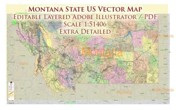
Montana is a state located in the western region of the United States. Here is a description of some of its principal cities, major waterways, and main roads:
Principal Cities:
- Billings: Located in south-central Montana, Billings is the state’s largest city. It serves as a hub for commerce and is situated along the Yellowstone River.
- Missoula: Situated in western Montana, Missoula is known for its vibrant arts scene and outdoor recreational opportunities. It is located at the confluence of the Clark Fork River and the Bitterroot River.
- Great Falls: Located along the Missouri River in north-central Montana, Great Falls is known for its proximity to natural wonders like the Great Falls of the Missouri River and the nearby mountains.
- Bozeman: Bozeman is in the southwestern part of the state and is recognized for its connection to outdoor activities and as a gateway to Yellowstone National Park.
- Helena: Serving as the state capital, Helena is located in west-central Montana. It lies between the Missouri River and the Helena National Forest.
- Kalispell: Situated in the northwestern part of the state, Kalispell is near Flathead Lake and Glacier National Park, making it a popular destination for outdoor enthusiasts.
Major Waterways:
- Missouri River: The Missouri River flows through the eastern and central parts of Montana. It is the longest river in North America and is a significant waterway for transportation and recreation.
- Yellowstone River: The Yellowstone River originates in Yellowstone National Park and flows through southern Montana, passing by cities like Billings. It is a major tributary of the Missouri River.
- Clark Fork River: This river flows through western Montana and eventually joins the Pend Oreille River in Idaho. It passes through Missoula and is known for its scenic beauty.
- Flathead Lake: Located in northwestern Montana, Flathead Lake is the largest natural freshwater lake in the western United States. It is fed by the Flathead River and surrounded by mountains.
Main Roads:
- Interstate 90 (I-90): This east-west interstate highway traverses through southern Montana, connecting cities like Billings and Bozeman.
- Interstate 15 (I-15): Running north-south, I-15 passes through cities such as Butte and Great Falls.
- U.S. Route 2: This highway spans the northern part of the state, connecting cities like Kalispell and Glasgow.
- U.S. Route 93: Running north-south, U.S. 93 connects cities like Missoula and Kalispell, passing through the scenic Flathead Valley.
- Montana Highway 200: This highway runs east-west, connecting cities like Missoula and Great Falls.
Vectormap.Net provide you with the most accurate and up-to-date vector maps in Adobe Illustrator, PDF and other formats, designed for editing and printing. Please read the vector map descriptions carefully.


 Author: Kirill Shrayber, Ph.D.