Extended Description of the Vector Map
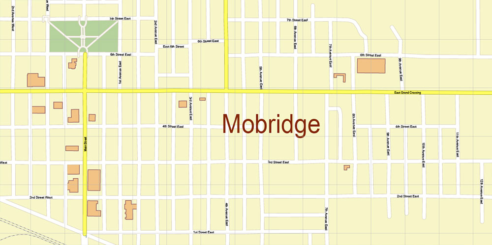
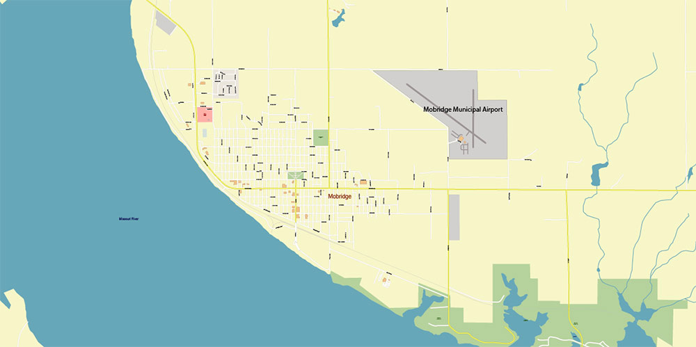
Printable PDF Vector Map of Mobridge South Dakota USA High detailed street map scale 1:3290 fully editable Layered Adobe PDF scalable, text format all names, 2 MB ZIP
All street names, Main Objects, Buildings. Map for design, printing, arts, projects, presentations, for architects, designers, and builders, business, logistics.
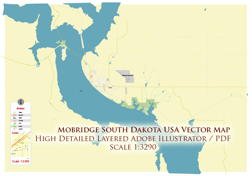
Mobridge South Dakota USA PDF Map Vector Exact Plan High Detailed Street Map editable Adobe PDF in layers
Layers list:
- Legend
- Names of places (city, hamlet, etc.)
- Names of objects (parks, hospital, water)
- Names of main streets
- Names of residential streets
- Arrows of streets
- Main Streets, roads
- Residential streets
- Buildings
- Railroads
- Water objects (rivers, lakes, ponds)
- Waterways
- Color fills (parks, land use, etc.)
- Background
The most exact and detailed map of the Mobridge South Dakota USA in scale.
For Editing and High-Quality Printing
Overview
Mobridge is a small city in the United States, located in Walworth County, South Dakota, in the north‐central part of the state. It lies near the eastern bank of the Missouri River (along the reservoir known as Lake Oahe) and serves as a local hub for the surrounding rural area.
Geography & Roads
-
The city is situated along the Missouri River valley; the terrain around Walworth County is described as semi‐arid rolling hills carved by gullies and drainage, with the western edge dropping into the river valley.
-
According to the U.S. Census Bureau, the total area of the city is just under 2 square miles (about 1.96 sq mi) and is essentially all land.
-
Major roads:
-
U.S. Route 12 (US 12) runs east-west and crosses the Missouri River at/near Mobridge, providing a key link across the river.
-
U.S. Route 83 (US 83) is a significant north-south artery that passes through the region including Walworth County; though the detailed path in this immediate vicinity is part of the broader network.
-
Because of its river and reservoir setting (Lake Oahe) the city has both inland and riverine features in its geography. The shoreline of the reservoir offers recreational and scenic opportunities.
Demographics
-
Population: As of the most recent estimates, Mobridge has about 2,900 – 3,200 residents. For example, 2023 estimate ~2,928.
-
Median age is around 42.3 years.
-
Racial/ethnic composition:
-
White (non-Hispanic) approximately 68–70% of the population.
-
American Indian / Alaska Native about 17–18%.
-
Two or more races around 12–13%.
-
Household & income:
-
Median household income estimated around US $61,556.
-
Poverty rate is relatively high compared to national averages: about 20.2% of the population live below the poverty line.
-
Housing & commuting:
-
Median home value around US $122,000.
-
Average commute time about 13.2 minutes (which is shorter than many U.S. averages).
Key Human Terrain / Social Notes
-
The city has a mix of long‐settled agricultural/rural community alongside a significant Native American presence (given the Native American percentage).
-
The economy is driven in part by local services, education, accommodation & food services, and other support industries.
-
Given its smaller size and river/ reservoir setting, recreational resources (fishing, boating on Lake Oahe) are part of the local lifestyle and draw.
Command Takeaways
For a tactical/operational brief:
-
Location: small city (~3,000 people) in north-central South Dakota, on the Missouri River / Lake Oahe shore.
-
Key communications/roads: US 12 (east-west) through town, US 83 (north-south corridor nearby) — useful for transit/logistics.
-
Terrain: rolling hills with river valley drop to west; the reservoir adds both opportunity (water access) and constraints (shoreline, flooding/controlled levels).
-
Demographics: modest size, ageing median (~42 yrs), significant Native American minority (~17–18%), home-ownership moderate, incomes modest, poverty higher than average.
-
Social/structural: rural service hub, recreational element via reservoir; limited large urban infrastructure; likely moderate resilience but also sensitivity to economic fluctuations.
Mobridge South Dakota USA PDF Map Vector Exact Plan High Detailed Street Map editable Adobe PDF in layers
Mobridge South Dakota USA PDF Map Vector Exact Plan High Detailed Street Map editable Adobe PDF in layers

 Author: Kirill Shrayber, Ph.D. FRGS


