Extended Description of the Vector Map
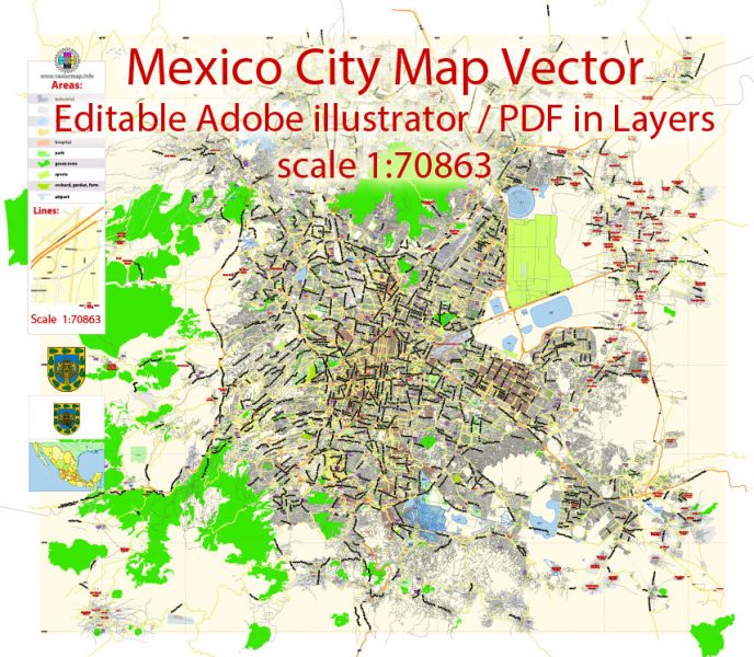
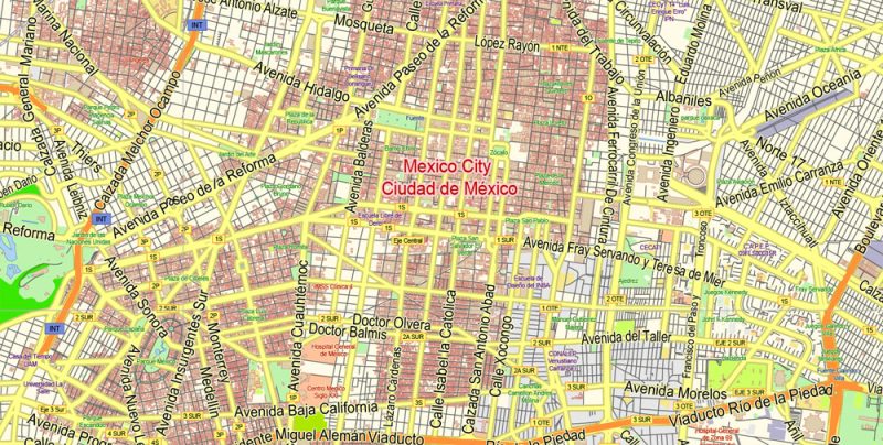
Printable Vector Map of Mexico City low detailed City Plan scale 1:70863 full editable Adobe Illustrator Street Map in layers, scalable, text format all names, 15 MB ZIP
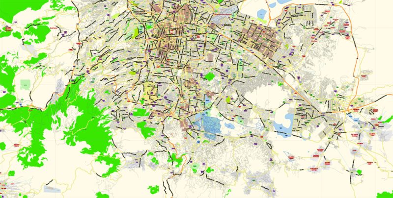
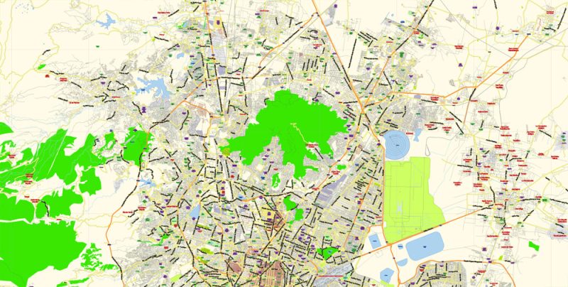
All streets, Principal street names, Main Objects, Buildings. Map for design, printing, arts, projects, presentations, for architects, designers, and builders, business, logistics.
Layers: color_fills, water, main_streets_roads, civil_streets, labels_roads, names_objects, names_streets, names_places, buildings, grids, legend, 3 text halo layers, etc.
The most exact and detailed map of the city in scale.
For Editing and High-Quality Printing
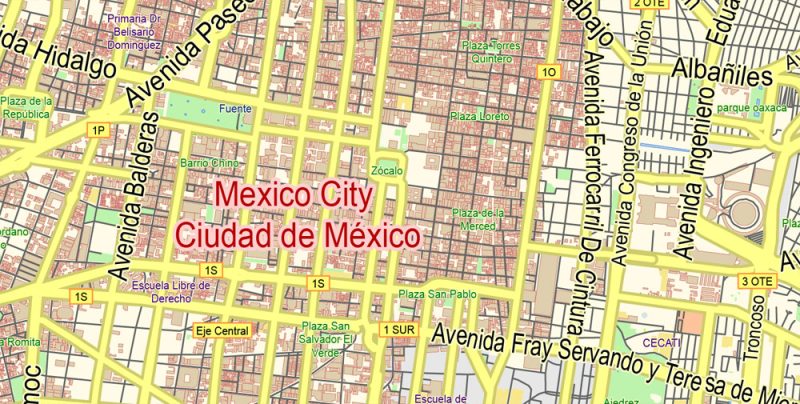
Mexico City
Capital of Mexico
Mexico City is the densely populated, high-altitude capital of Mexico. It’s known for its Templo Mayor (a 13th-century Aztec temple), the baroque Catedral Metropolitana de México of the Spanish conquistadors and the Palacio Nacional, which houses historic murals by Diego Rivera. All of these are situated in and around the Plaza de la Constitución, the massive main square also known as the Zócalo.
Elevation: 2,250 m
Population: 8.851 million
Highest elevation: 3,930 m (12,890 ft)
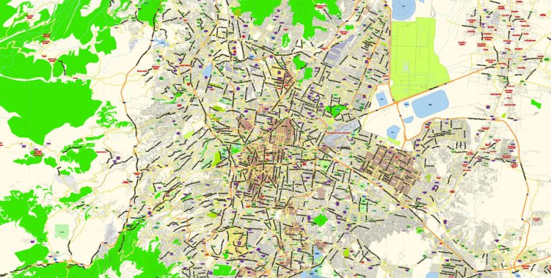
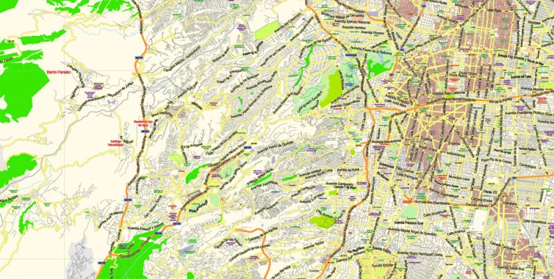
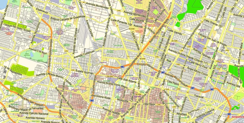
Mexico City Map Vector Exact City Plan Low detailed Street Map editable Adobe Illustrator in layers
Mexico City Map Vector Exact City Plan Low detailed Street Map editable Adobe Illustrator in layers
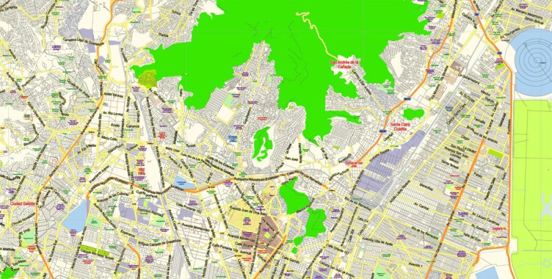
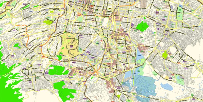
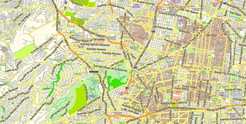
Mexico City Map Vector Exact City Plan Low detailed Street Map editable Adobe Illustrator in layers
Mexico City Map Vector Exact City Plan Low detailed Street Map editable Adobe Illustrator in layers
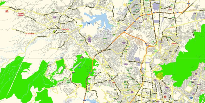
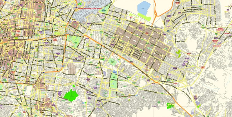
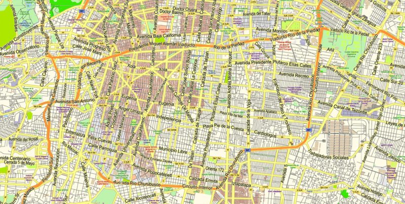
Mexico City Map Vector Exact City Plan Low detailed Street Map editable Adobe Illustrator in layers
Mexico City Map Vector Exact City Plan Low detailed Street Map editable Adobe Illustrator in layers
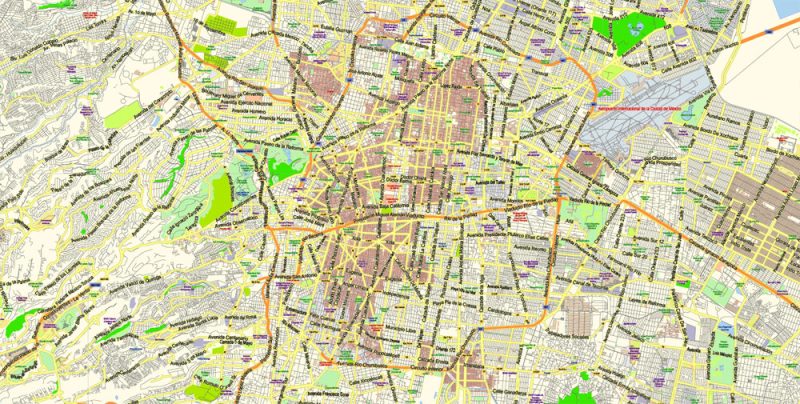
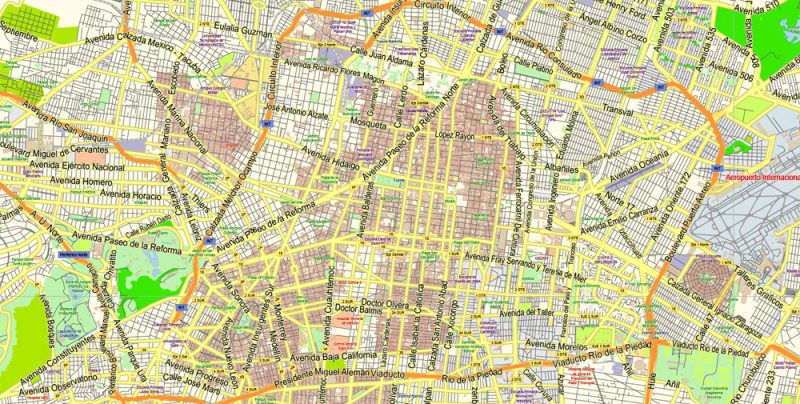
Mexico City Map Vector Exact City Plan Low detailed Street Map editable Adobe Illustrator in layers
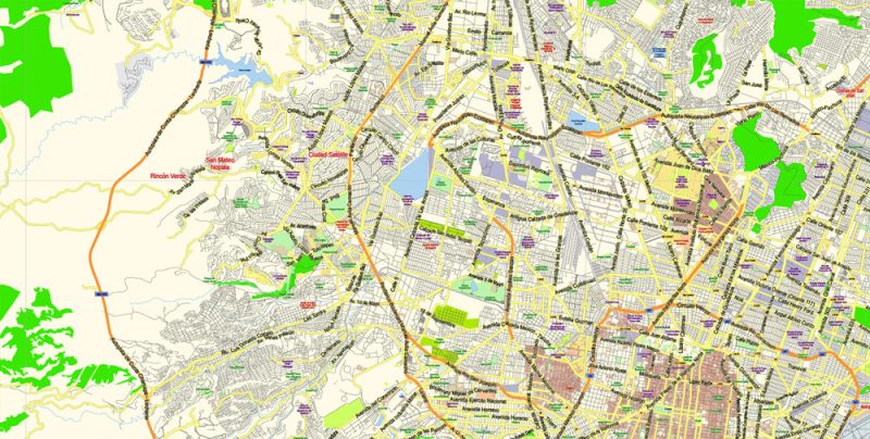
Mexico City Map Vector Exact City Plan Low detailed Street Map editable Adobe Illustrator in layers
Mexico City Map Vector Exact City Plan Low detailed Street Map editable Adobe Illustrator in layers
Mexico City Map Vector Exact City Plan Low detailed Street Map editable Adobe Illustrator in layers
Mexico City Map Vector Exact City Plan Low detailed Street Map editable Adobe Illustrator in layers
Mexico City Map Vector Exact City Plan Low detailed Street Map editable Adobe Illustrator in layers
Mexico City Map Vector Exact City Plan Low detailed Street Map editable Adobe Illustrator in layers
Mexico City Map Vector Exact City Plan Low detailed Street Map editable Adobe Illustrator in layers
Mexico City Map Vector Exact City Plan Low detailed Street Map editable Adobe Illustrator in layers
Mexico City Map Vector Exact City Plan Low detailed Street Map editable Adobe Illustrator in layers
Mexico City Map Vector Exact City Plan Low detailed Street Map editable Adobe Illustrator in layers
Author Rating
Aggregate Rating
no rating based on 0 votes
@vectormapper
Product Name Mexico City Map Vector Exact City Plan Low detailed Street Map editable Adobe Illustrator in layers
Price
USD 52
Product Availability
Available in Stock


 Author: Kirill Shrayber, Ph.D. FRGS


