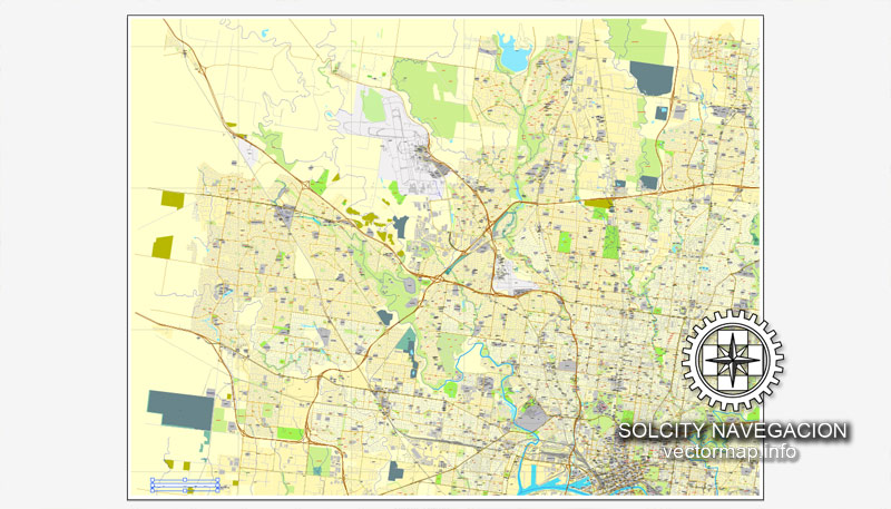
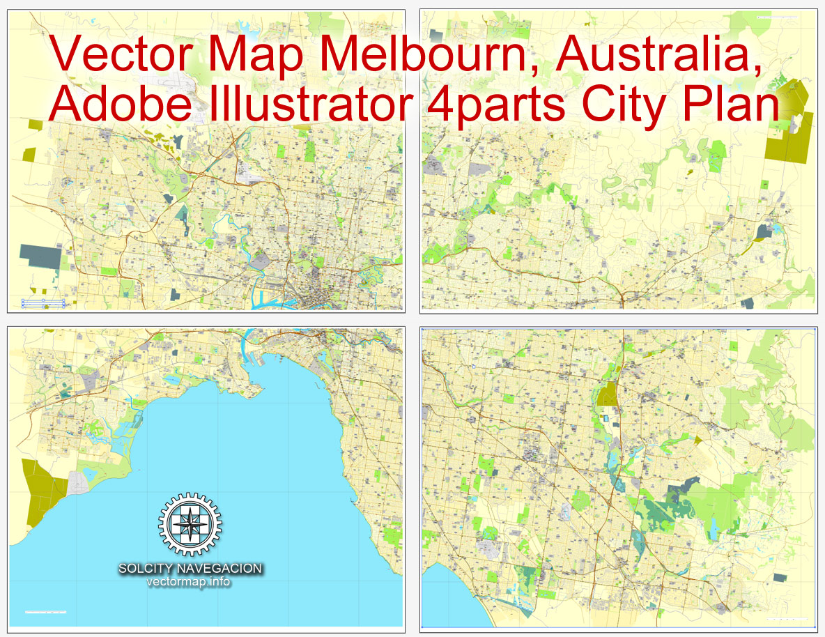
Melbourne, Australia, printable vector street 4 parts City Plan map, full editable, Adobe illustrator, full vector, scalable, editable, text format street names, 21,9 Mb ZIP.
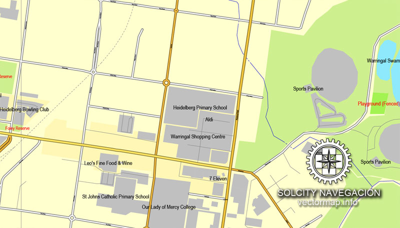
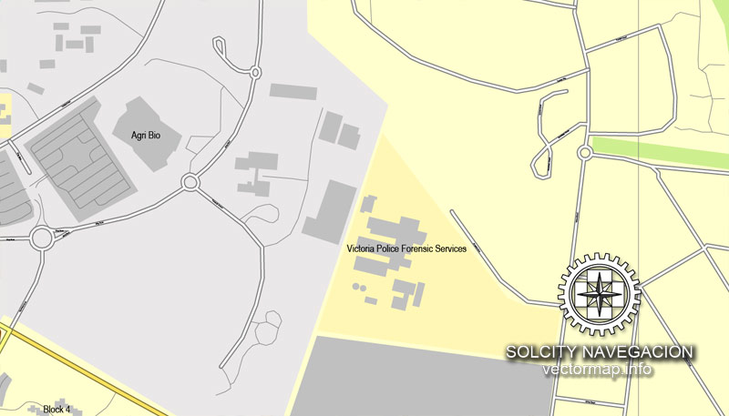
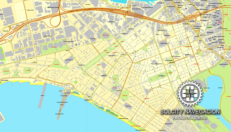
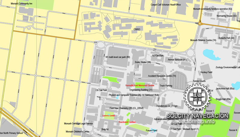
All streets, some more buildings. Map for design, print, arts, projects, presentations, for architects, designers and builders.
PDF, DXF, DWG, CDR and other formats – by request, same price, please contact us.
Melbourne, Australia.
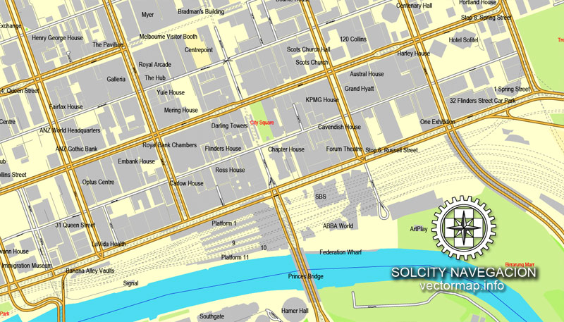
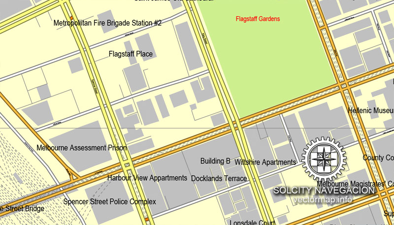
This vector map of Melbourne city is used as a basis for design, editing, and further printing.
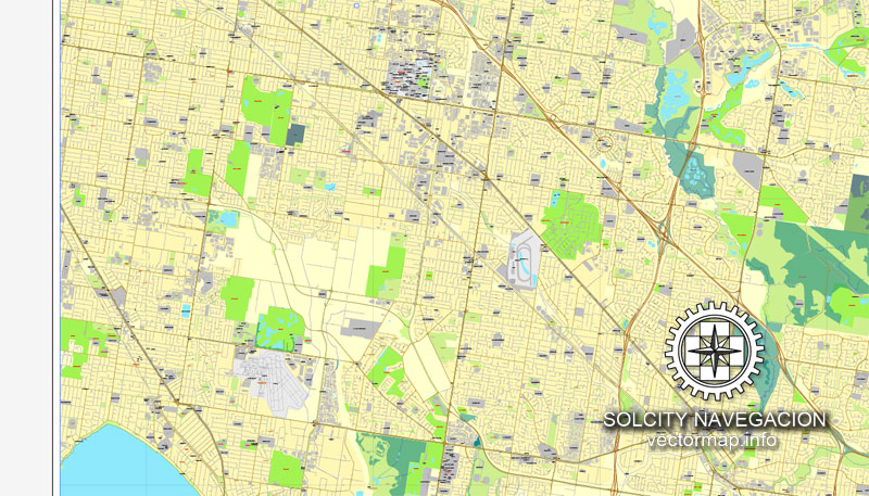
This is the most detailed, exact map of Melbourne city for high-quality printing and polygraphy. You can always clarify the map development date by contacting us.
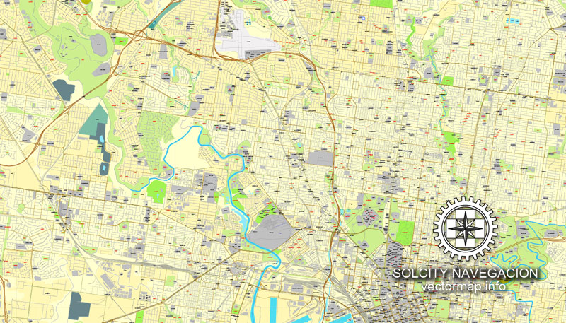
For your convenience, all objects on Melbourne vector city map are divided into layers. And the editing is very easy – colors, lines, etc.
Melbourne is the capital and most populous city of the Australian state of Victoria, and the second-most populous city in Australia and Oceania.
One of the advantages of Melbourne city vector maps of our production is the relevance of cartographic data, we constantly update all our products.
This vector map of Melbourne city is used by:
designers, layout designers, printers, advertisers and architects. Our product – vector maps – is designed for further editing and printing in large formats – from @Wall format (a few meters) to A-0 and A-1, A-2, A-3.
The advertising and presentation map of Melbourne city (usually the final designer marks the routes, and puts the client’s objects (shops, saloons, gas stations etc.)
The undoubted advantage is that people will NEVER throw out this advertising product – the map. In fact, as an advertising medium, a city map is the most “long-playing” of the well-known polygraphic advertising media, with the longest lifespan, and the maximum number of interactions with the customer.
For travelers, maps are sold at the airports and gas stations around the world. Often the source is our vector maps.
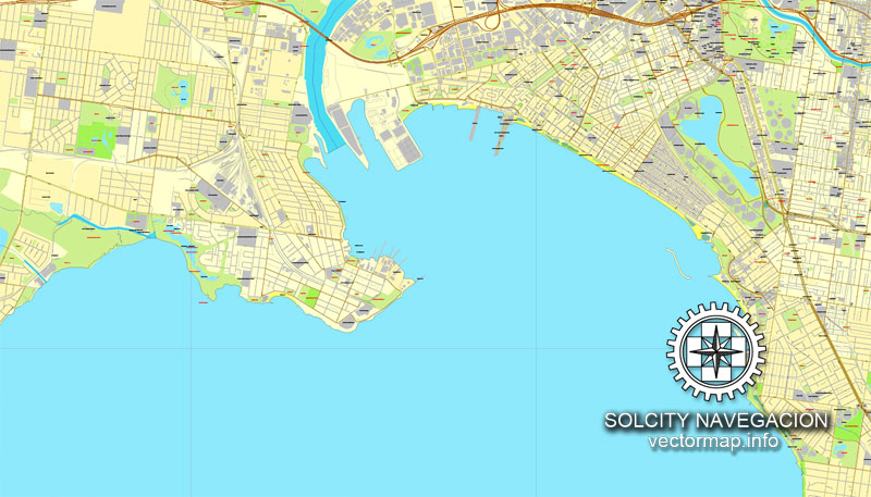
Its name refers to an urban agglomeration of 9,992.5 km2 (3,858.1 sq mi), comprising a metropolitan area with 31 municipalities, and is also the common name for its city centre. The city occupies much of the coastline of Port Phillip bay and spreads into the hinterlands towards the Dandenong and Macedon ranges, Mornington Peninsula and Yarra Valley. It has a population of approximately 5 million (19% of the population of Australia), and its inhabitants are referred to as “Melburnians”.
Take a look, who purchases our vector maps of Melbourne city in “Our Clients and Friends” page – these are large and small companies, from super-brands like Volvo and Starbucks, to small design studios and printing houses.
It’s very easy to work with vector maps of Melbourne city, even for a not very experienced designer who can turn on and off the map layers, add new objects, change the colors of fill and lines according to customer requirements.
The undoubted advantage of Melbourne city vector maps in printing is an excellent and detailed visualization, when customer can expand a large paper map and instantly define his location, find a landmark, an object or address on map, unlike using the popular electronic formats of Google and Yandex maps for example.
Printable vector maps of Melbourne city are much more convenient and efficient than any electronic maps on your smartphone, because ALL DETAILS are displayed in the entire space of Melbourne city map.
The city was founded on 30 August 1835, in what was the British colony of New South Wales, by free settlers from the colony of Van Diemen’s Land. It was incorporated as a Crown settlement in 1837 and named in honour of the British Prime Minister, William Lamb, 2nd Viscount Melbourne. It was declared a city by Queen Victoria in 1847, after which it became the capital of the new colony of Victoria in 1851.
Useful tips on working with vector maps of cities and countries in Adobe Illustrator.
«V» – launches the Selection tool (cursor, black arrow), which makes active any vector line.
«А» – launches the Direct Selection tool (white cursor), allows you to select curve elements and drag them to the desired place.
«R» – activates the Rotate tool, which helps you rotating selected objects around the center point by 360 degrees.
«E» – gives you the opportunity to use the Eraser tool and erase unnecessary parts.
«X» – switches between Fill and Stroke in the Tools section. Try to get used to this hot key and
you will quickly understand that you can’t live and work without it.
Guides are not limited to vertical and horizontal in Adobe Illustrator. You can also create a diagonal guide for example. Moreover, you can turn any contours into guides. Select the outline and go to View > Guides > Make Guides (Create Guides), or simply press Cmd/Ctrl + 5. You can also turn the guides back into an editable object. Go to menu, View > Guides > Unlock Guides (Release Guides), select the guide you want to edit and select View > Guides > Release Guides (Reset Guides), or just press Cmd/Ctrl + Option / Alt + 5).
In the wake of the 1850s Victorian gold rush, the city entered the “Marvellous Melbourne” boom period, transforming into one of the most important cities in the British Empire and one of the largest and wealthiest in the world. After the federation of Australia in 1901, it served as interim seat of government of the new nation until Canberra became the permanent capital in 1927. Today, it is a leading financial centre in the Asia-Pacific region and ranks 20th in the Global Financial Centres Index.
You will probably want to change the color scheme used on our Melbourne vector city map.
To quickly and effectively play with colors.
Of course, you can do it manually, all objects in our Melbourne city vector map are divided according to types and layers, and you can easily change the color gamma of vector objects in groups and layers.
But there is more effective way of working with the whole VECTOR MAP of Melbourne city and all layers:
The overview dialog «Edit colors»/«Repaint Graphic Object» (this dialog box name can change depending on the context):
If you have selected a part or a layer of Melbourne city vector map and open the dialog box by clicking the icon in the Control panel, on the Samples palette or the Color Catalog, or if you choose Edit > Edit Colors> Repaint Graphic Object, then the «Repaint Graphic Object» dialog box appears, and you get access to «Assign» and «Edit» tabs.
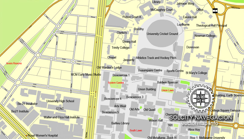
The city is home to many of the best-known cultural institutions in the nation, such as the Melbourne Cricket Ground, the National Gallery of Victoria and the World Heritage-listed Royal Exhibition Building. It is also the birthplace of Australian impressionism, Australian rules football, the Australian film and television industries and Australian contemporary dance.
If a picture or a map fragment is not selected, and you open the dialog box by clicking the icon in the Control panel, on the Samples palette or in the Color Catalog, the «Edit Colors» dialog box appears and you can only access the «Edit» tab.
Regardless of the name at the top of the dialog box, the right-hand side always displays the color group of the current document, as well as two default color groups: Print Color and Grayscale. These color groups can be selected and used any time.
Create and edit color groups of Melbourne city vector map, and also assign colors using the «Edit Colors»/ а «Repaint Graphic Object» dialog box.
A. Creating and editing of a color group on the «Edit» tab
B. Assigning colors on the «Assign» tab
C. Select a group of colors from the «Color groups» list
The option «Repaint a graphic object» in the lower part of the dialog box allows you to preview the colors on a selected layer of Vector map, or a group of elements, and specify whether its colors will be redefined when the dialog box is closed.
More recently, it has been recognised as a UNESCO City of Literature and a global centre for street art, live music and theatre. It is the host city of annual international events such as the Australian Grand Prix, the Australian Open and the Melbourne Cup, and has also hosted the 1956 Summer Olympics and the 2006 Commonwealth Games. Due to it rating highly in entertainment, tourism and sport, as well as education, health care, research and development, the EIU currently ranks it the second most liveable city in the world.
The main areas of the dialog box are:
«Edit»
The «Edit» tab is designed to create a new or edit the existing color groups.
The harmony rules Menu and the Color Wheel are used to conduct experiments with color harmonies. The color wheel shows how colors are related in color harmony, and the color bars allow you to view and manipulate an individual color values. In addition, you can adjust the brightness, add and remove colors, save color groups and view colors on the selected Vector Map of Melbourne city or a separated layers.
«Assign»
The «Assign» tab is used to view and control on how the original colors are replaced with colors from the color group like your corporate colors in the Vector Map of Melbourne city.
The assign color ability is provided only if the entire map, layer or fragment is selected in the document. You can specify which of new colors replace the current colors, whether the spot colors should be preserved and how colors are replaced (for example, you can replace colors completely or changing the color tone while maintaining the brightness). The «Assign» tab allows you to redefine colors in the Vector Map of Melbourne city, or in separate layers and fragments using the current color group or reducing the number of colors in the current Vector Map.
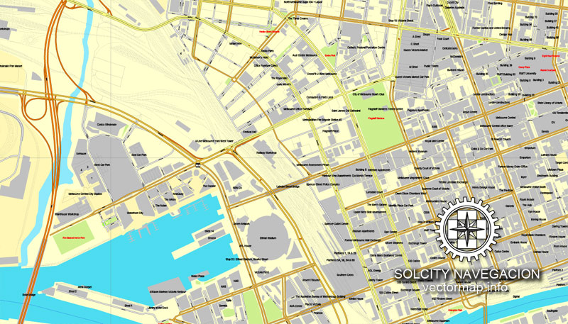
The main airport serving the city is Melbourne Airport (also referred to as Tullamarine Airport), which is the second busiest in Australia, and Australia’s busiest seaport the Port of Melbourne. Its main metropolitan rail terminus is Flinders Street station and its main regional rail and road coach terminus is Southern Cross station. It also has the most extensive freeway network in Australia and the largest urban tram network in the world.
Color groups
Is a list of all saved color groups for current document (the same groups appear in the «Samples» palette). You can edit and delete the existing color groups, as well as creating a new ones using the list of “Color Groups” in the dialog box. All changes appear in the «Samples» palette.
The highlighted color group shows, which color group is currently edited.
Any color group can be selected and edited, or used to redefine the colors in the selected vector map of Melbourne city, its fragments or elements.
Saving a color group adds this group to the specified list.
Opening the «Edit Colors»/«Repaint Graphic Object» dialog box.
Open the «Edit Colors»/«Repaint Graphic Object» dialog box using one of the following methods:
«Edit»> «Edit Colors»> «Repaint Graphic object» or «Repaint With Style».
Geography
Melbourne is in the southeastern part of mainland Australia, within the state of Victoria. Geologically, it is built on the confluence of Quaternary lava flows to the west, Silurian mudstones to the east, and Holocene sand accumulation to the southeast along Port Phillip. The southeastern suburbs are situated on the Selwyn fault which transects Mount Martha and Cranbourne.
Use these commands if you need to edit the colors in the selected vector map of Melbourne city.
«Repaint Graphic object» button on the «Control» panel.
Use this button if you need to adjust colors of Melbourne city vector map using the а «Repaint graphic object» dialog box.
The specified button is available if the selected vector map or its fragment contains two or more colors.
Note. This color editing method is convenient for global color adjustment in a vector map, if global colors were not used when creating a City Map of Melbourne.
The «Edit colors» button or «Edit or apply colors» on the «Color Catalog» palette
Click this button if you need to edit colors on the «Color Catalog» palette or edit and then apply them to the selected Vector Map of Melbourne city or its fragment.
Melbourne extends along the Yarra River towards the Yarra Valley and the Dandenong Ranges to the east. It extends northward through the undulating bushland valleys of the Yarra’s tributaries—Moonee Ponds Creek (toward Tullamarine Airport), Merri Creek, Darebin Creek and Plenty River—to the outer suburban growth corridors of Craigieburn and Whittlesea.
The «Edit color group» button or «Edit or apply color group» on the «Samples» palette.
Click this button if you need to edit the colors in the specific color group or edit and apply them to the selected Vector Map of Melbourne city or a group of its elements, for example, the whole layer “Streets and lines”. You can also double-click the color group in the Samples panel to open the dialog box.
If the map file is too large and your computer freezes or even can’t open it quickly:
1. Try to reduce the color resolution of the video card (display) to 256 colors while working with a large map.
2. Using Windows Task Manager, select all the application you don’t need, while working with map, just turn them off.
3. Launch Adobe Illustrator. (DO NOT OPEN the vector map file)
4. Start the Windows Task Manager using administrator rights > Find the “Illustrator” process > set the «real time» priority,
5. Open the file. When you see the LEGACY FONT popup window – click “OK” (do not update). You can restore the TEXT later.
6. Can also be useful: When file is opened – Edit > Settings > Basic Settings > disable smoothing. /// It looks scary, but works quickly)))
We recommend saving the file in Adobe Illustrator 10 version. It’s much more stable when working with VERY BIG size files.
The city reaches southeast through Dandenong to the growth corridor of Pakenham towards West Gippsland, and southward through the Dandenong Creek valley, the Mornington Peninsula and the city of Frankston taking in the peaks of Olivers Hill, Mount Martha and Arthurs Seat, extending along the shores of Port Phillip as a single conurbation to reach the exclusive suburb of Portsea and Point Nepean. In the west, it extends along the Maribyrnong River and its tributaries north towards Sunbury and the foothills of the Macedon Ranges, and along the flat volcanic plain country towards Melton in the west, Werribee at the foothills of the You Yangs granite ridge south west of the CBD. The Little River, and the township of the same name, marks the border between Melbourne and neighbouring Geelong city.
Melbourne’s major bayside beaches are in the various suburbs along the shores of Port Phillip Bay, in areas like Port Melbourne, Albert Park, St Kilda, Elwood, Brighton, Sandringham, Mentone, Frankston, Altona, Williamstown and Werribee South. The nearest surf beaches are 85 kilometres (53 mi) southeast of the Melbourne CBD in the back-beaches of Rye, Sorrento and Portsea.
Topography
Melbourne extends along the Yarra River towards the Yarra Valley and the Dandenong Ranges to the east. It extends northward through the undulating bushland valleys of the Yarra’s tributaries—Moonee Ponds Creek (toward Tullamarine Airport), Merri Creek, Darebin Creek and Plenty River—to the outer suburban growth corridors of Craigieburn and Whittlesea.
The city reaches south-east through Dandenong to the growth corridor of Pakenham towards West Gippsland, and southward through the Dandenong Creek valley, the Mornington Peninsula and the city of Frankston taking in the peaks of Olivers Hill, Mount Martha and Arthurs Seat, extending along the shores of Port Phillip as a single conurbation to reach the exclusive suburb of Portsea and Point Nepean.
In the west, it extends along the Maribyrnong River and its tributaries north towards Sunbury and the foothills of the Macedon Ranges, and along the flat volcanic plain country towards Melton in the west, Werribee at the foothills of the You Yangs granite ridge and Geelong as part of the greater metropolitan area to the south-west.
Coast
Melbourne’s major bayside beaches are located in the south-eastern suburbs along the shores of Port Phillip Bay, in areas like Port Melbourne, Albert Park, St Kilda, Elwood, Brighton, Sandringham, Mentone and Frankston although there are beaches in the western suburbs of Altona and Williamstown. The nearest surf beaches are located 85 kilometres (53 mi) south-east of the Melbourne CBD in the back-beaches of Rye, Sorrento and Portsea.
See more Australia Cities vector maps for printing and design
For example: Printable map Cairns, Australia
Printable Map Bendigo, Australia, exact vector street map
Printable Map Albury + Wodonga, Australia
PDF Map Adelaide, Australia
Melbourne
City in Victoria, Australia
Melbourne, Victoria’s coastal capital, is a city of stately 19th-century buildings and tree-lined boulevards. Yet at its centre is the strikingly modern Federation Square development, with plazas, bars, restaurants and cultural events along the Yarra River. In Southbank, the Melbourne Arts Precinct is site of Arts Centre Melbourne – a performing arts complex – and National Gallery of Victoria, displaying Australian and Indigenous art.
Population: 4.087 million (2012) UNdata
Geography of Melbourne
Aerial view of the Melbourne metropolitan area at dusk
Aerial view of the city, with the Yarra River traversing through the city centre (the cluster of buildings on the far right)
Map of the urban areas of Melbourne and Geelong and surrounding towns
Melbourne, the capital city of Victoria, Australia, is situated on the southeastern fringe of the Australian landmass and in the southern central part of the state. Melbourne covers an area of approximately 8,694 km². The city itself stands in a region of alpine forests known as the High Country. The city and metropolitan areas of Melbourne printable map also spans along the lower stretches of the Yarra River. Towards eastern Melbourne vector map, Australia is the low-lying mountain ranges known as Dandenong Ranges, 35 km east of the city.
Melbourne extends along the Yarra River towards the Yarra Valley and the Dandenong Ranges to the east. It extends northward through the undulating bushland valleys of the Yarra’s tributaries—Moonee Ponds Creek (toward Tullamarine Airport), Merri Creek, Darebin Creek and Plenty River—to the outer suburban growth corridors of Craigieburn and Whittlesea. The city reaches south-east through Dandenong to the growth corridor of Pakenham towards West Gippsland, and southward through the Dandenong Creek valley, the Mornington Peninsula and the city of Frankston taking in the peaks of Olivers Hill, Mount Martha and Arthurs Seat, extending along the shores of Port Phillip as a single conurbation to reach the exclusive suburb of Portsea and Point Nepean. In the west, it extends along the Maribyrnong River and its tributaries north towards Sunbury and the foothills of the Macedon Ranges, and along the flat volcanic plain country towards Melton in the west, Werribee at the foothills of the You Yangs granite ridge and Geelong as part of the greater metropolitan area to the south-west.
Geologically, it is built on the confluence of Quaternary lava flows to the west, Silurian mudstones to the east, and Holocene sand accumulation to the southeast along Port Phillip. The southeastern suburbs are situated on the Selwyn fault which transects Mount Martha and Cranbourne.
Melbourne‘s major bayside beaches are located in the south-eastern suburbs along the shores of Port Phillip Bay, in areas like Port Melbourne, Albert Park, St Kilda, Elwood, Brighton, Sandringham, Mentone and Frankston although there are beaches in the western suburbs of Altona and Williamstown. The nearest surf beaches are located 85 kilometres (53 mi) south-east of the Melbourne city street map CBD in the back-beaches of Rye, Sorrento and Portsea.
Source
Small guide: How to work with the vector map?
You can: Mass select objects by type and color – for example, the objects type “building” (they are usually dark gray) – and remove them from the map, if you do not need them in your print or design project. You can also easily change the thickness of lines (streets), just bulk selection the road by the line color.
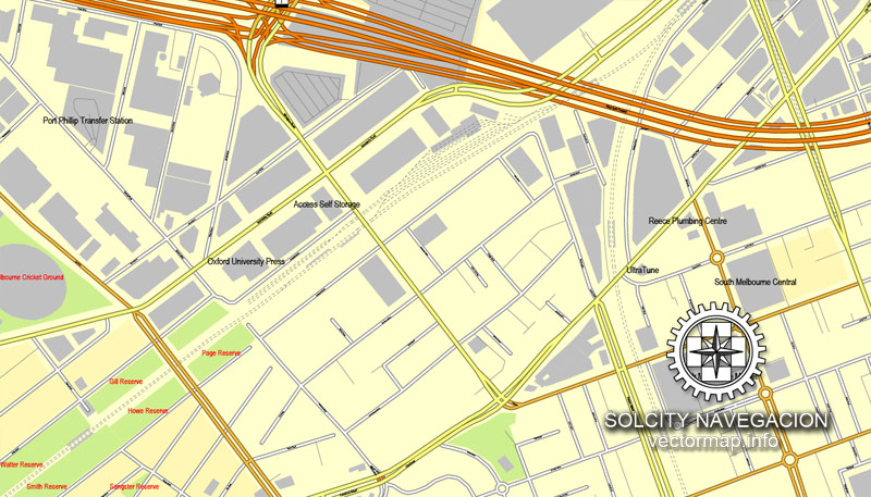
The streets are separated by type, for example, type “residential road” are usually white with a gray stroke. Highway usually orange with a brown or dark gray stroke.
It is easy to change the font of inscriptions, all or each individually. Also, just can be make and any other manipulation of objects on the vector map in Adobe illustrator format.
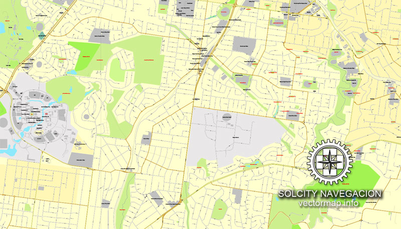
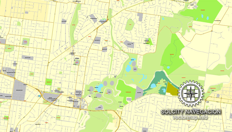
Important: All the proportions on the map are true, that is, the relative sizes of the objects are true, because Map is based on an accurate GPS projection, and It transated into the (usual for all) the Mercator projection.
You can easily change the color, stroke and fill of any object on the map, zoom without loss of quality Image Verification.
Select object

Bulk selection the same objects on the vector map

See the bulk selected objects on the vector map

Bulk delete buildungs from the vector map

Select residencial road (small street) on the vector map

Bulk selection the same lines (streets, roads) on the full map

Create fat lines of the streets on the vector maps (bulk action) 1

Create fat lines of the streets on the vector maps (bulk action) 2

Create fat lines of the streets on the vector maps (bulk action) 3

You can easily change the color, stroke and fill of any object on the map, zoom without loss of quality Image Verification.


 Author: Kirill Shrayber, Ph.D. FRGS

 Street Map editable Adobe Illustrator in layers")
 Street Map editable Adobe Illustrator in layers")
