Extended Description of the Vector Map
Printable PDF Vector Map of Marysville + Yuba City + Olivehurst California USA detailed street map scale 1:3643 full editable Adobe PDF scalable, text all names, 6 MB ZIP
All street names, Main Objects, Buildings. Map for design, printing, arts, projects, presentations, for architects, designers, and builders, business, logistics.
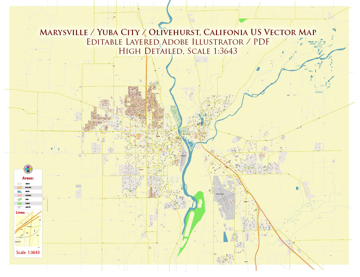
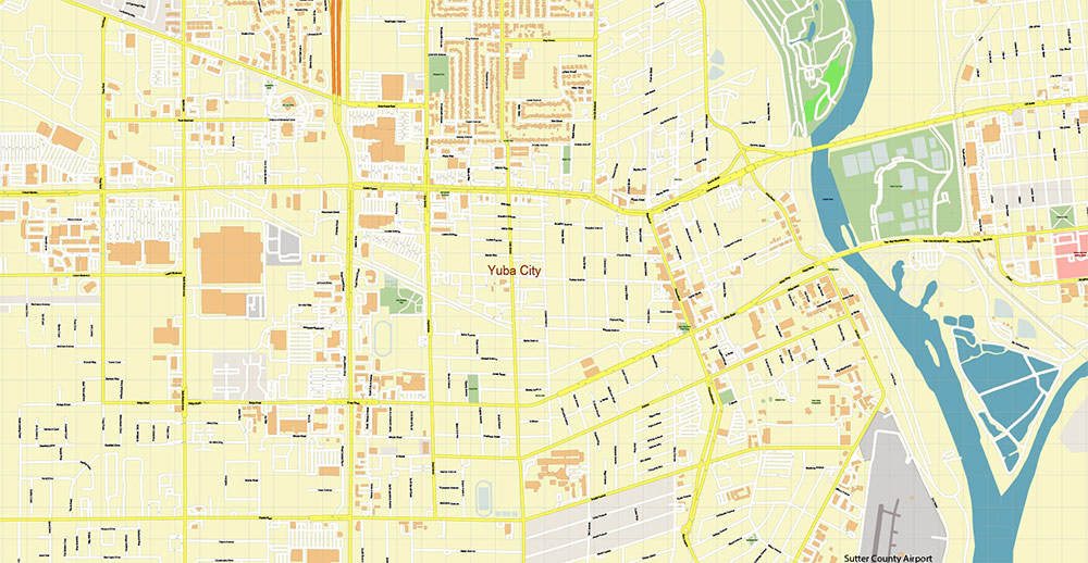
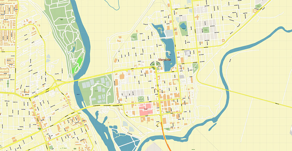
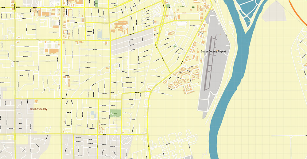
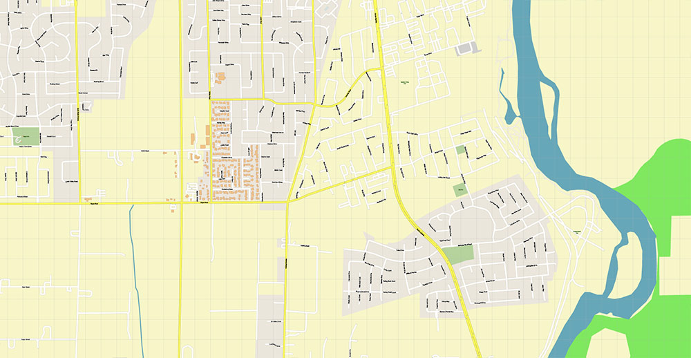
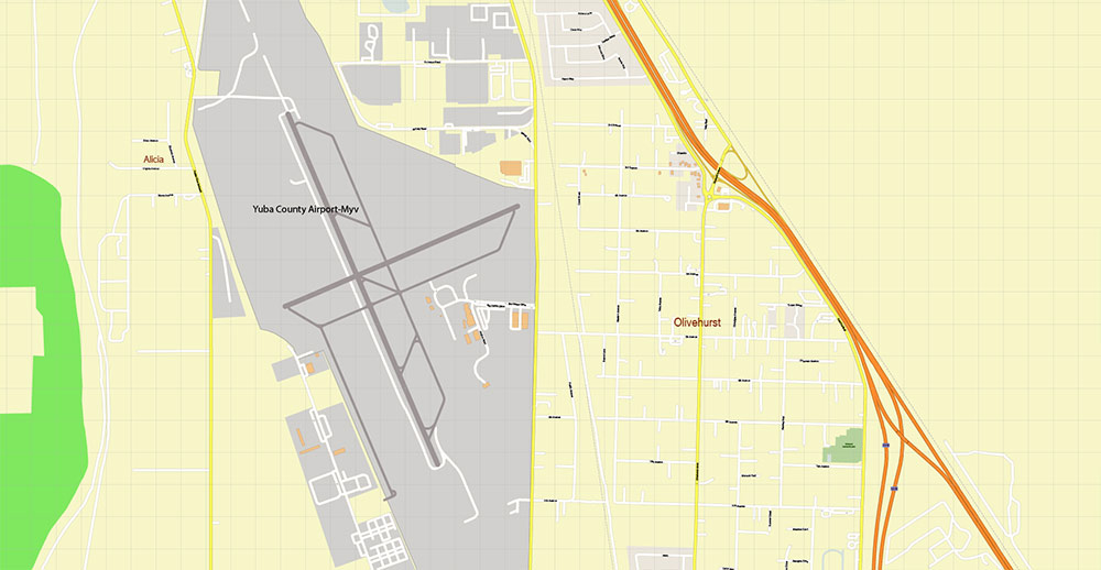
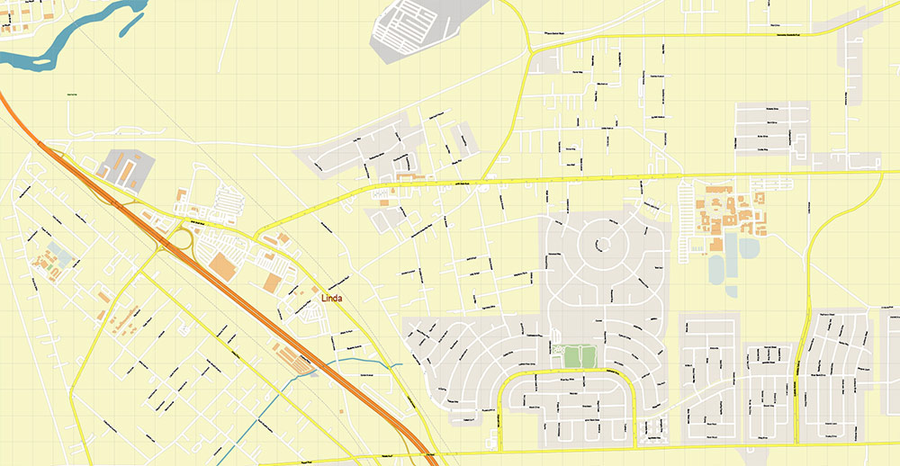
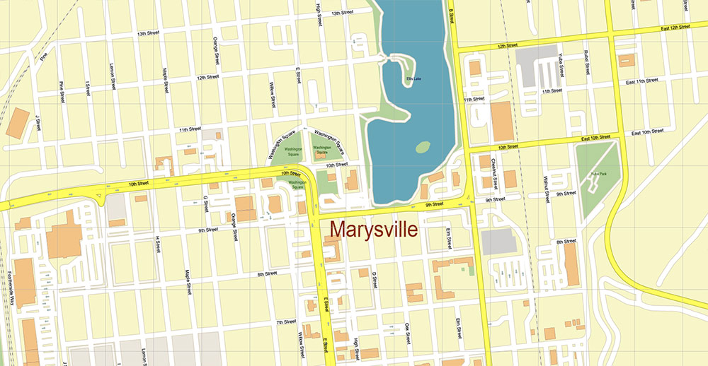
Marysville + Yuba City + Olivehurst California USA PDF Map Vector Exact City Plan High Detailed Street Map editable Adobe PDF in layers
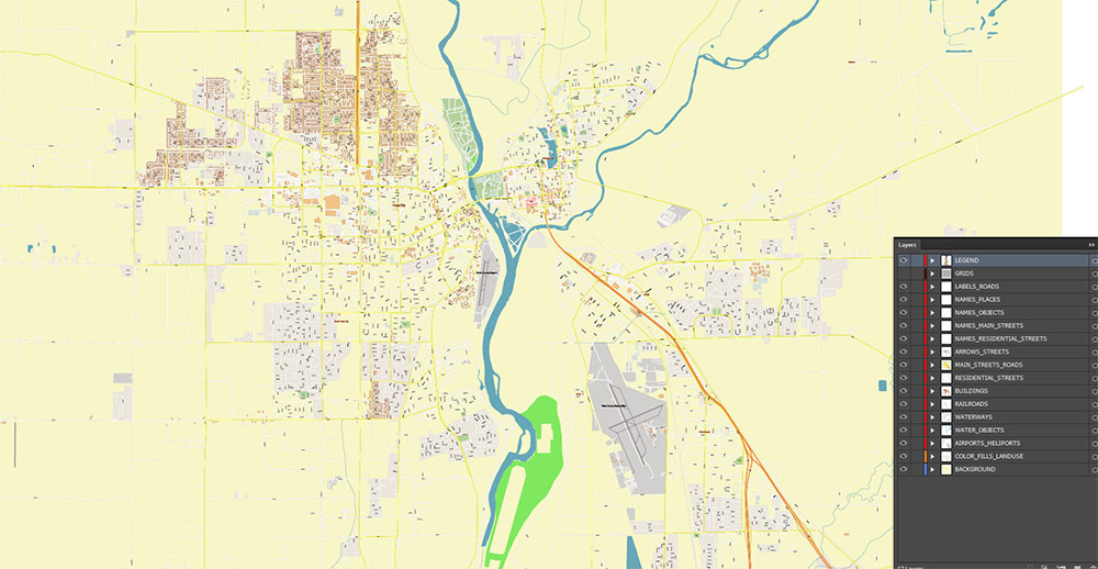
Layers list:
- Legend
- Grids
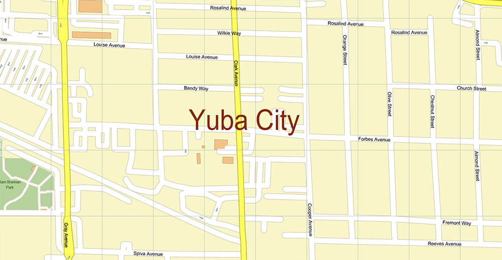
- Labels of roads
- Names of places (city, hamlet, etc.)
- Names of objects (parks, water, Hospitals)
- Names of main streets
- Names of residential streets
- Arrows of streets
- Main Streets, roads
- Residential streets
- Buildings
- Airports and Heliports
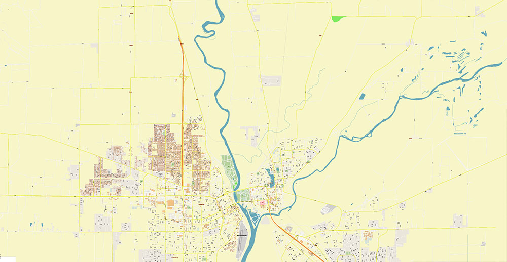
- Water objects (rivers, lakes, ponds)
- Waterways
- Color fills (parks, hospital areas, land use, etc.)
- Background
The most exact and detailed map of the city in scale.
For Editing and High-Quality Printing
🛰️ AO BRIEF
AO NAME: Yuba–Sutter Urban Cluster (Marysville – Yuba City – Olivehurst)
REGION: Northern Sacramento Valley, California
1. 🧭 OVERVIEW (Operational Environment)
-
Twin-city system:
-
Marysville (east, Yuba County)
-
Yuba City (west, Sutter County)
-
Separated by Feather River, connected by multiple bridges
-
Olivehurst — southern suburban / residential expansion zone
-
Regional role: agricultural service hub + commuter belt
2. 🛣️ KEY ROADS / LINES OF COMMUNICATION
Primary corridors:
-
CA-99 (N–S spine)
-
CA-20 (E–W axis)
Secondary network:
Structure:
Transport:
👉 Assessment: limited number of primary corridors → predictable movement channels
3. 🌍 TERRAIN / GEOGRAPHY
Macro:
Hydrography:
Land use:
👉 Key Terrain Feature:
Flat + water-controlled + grid agriculture
4. 🌦️ CLIMATE / SEASONALITY
Summer:
Winter:
Transitional risks:
👉 Operational impact:
Visibility degradation (fog) + seasonal flood pressure
5. 👥 DEMOGRAPHY / HUMAN TERRAIN
Population structure:
-
Yuba City — primary urban center (~70k)
-
Marysville — small historic core (~12k)
-
Olivehurst — expanding residential zone (~15–20k)
Composition:
Socioeconomic profile:
-
Working-class / lower-middle income
-
Agriculture + service sector employment
-
Lower education levels vs state average
👉 Human terrain:
Non-dense, low-resistance, dispersed population clusters
6. ⚠️ HAZARDS / THREATS
PRIMARY:
SECONDARY:
LOW:
👉 Key risk:
Hydrological failure = area-wide disruption
7. 🚜 ECONOMY / LOGISTICS
Core sectors:
Logistics:
8. 🧠 COMMAND TAKEAWAYS
-
Flat terrain → unrestricted maneuverability
-
Levees and rivers define battlespace geometry
-
Bridges over Feather River = critical choke points
-
Limited highway network → predictable routing
-
Flood risk = strategic vulnerability
-
Agricultural grid = clean, structured cartographic framework
🧾 CARTOGRAPHIC SUMMARY (for your workflow)
Must-highlight layers:
-
River system (Yuba + Feather)
-
Levee network
-
Bridge crossings (priority features)
-
CA-99 / CA-20 hierarchy
-
Agricultural parcel grid
-
Urban low-density footprint
-
Floodplain zones
Marysville + Yuba City + Olivehurst California USA PDF Map Vector Exact City Plan High Detailed Street Map editable Adobe PDF in layers
Marysville + Yuba City + Olivehurst California USA PDF Map Vector Exact City Plan High Detailed Street Map editable Adobe PDF in layers
Marysville + Yuba City + Olivehurst California USA PDF Map Vector Exact City Plan High Detailed Street Map editable Adobe PDF in layers
Marysville + Yuba City + Olivehurst California USA PDF Map Vector Exact City Plan High Detailed Street Map editable Adobe PDF in layers
Marysville + Yuba City + Olivehurst California USA PDF Map Vector Exact City Plan High Detailed Street Map editable Adobe PDF in layers
Marysville + Yuba City + Olivehurst California USA PDF Map Vector Exact City Plan High Detailed Street Map editable Adobe PDF in layers
Marysville + Yuba City + Olivehurst California USA PDF Map Vector Exact City Plan High Detailed Street Map editable Adobe PDF in layers
Marysville + Yuba City + Olivehurst California USA PDF Map Vector Exact City Plan High Detailed Street Map editable Adobe PDF in layers
Marysville + Yuba City + Olivehurst California USA PDF Map Vector Exact City Plan High Detailed Street Map editable Adobe PDF in layers
Marysville + Yuba City + Olivehurst California USA PDF Map Vector Exact City Plan High Detailed Street Map editable Adobe PDF in layers

 Author: Kirill Shrayber, Ph.D. FRGS

