Extended Description of the Vector Map
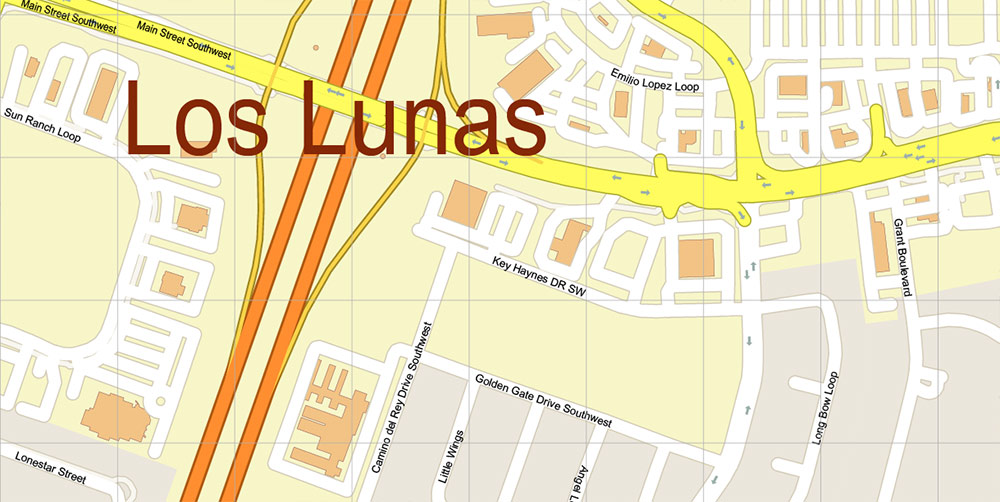
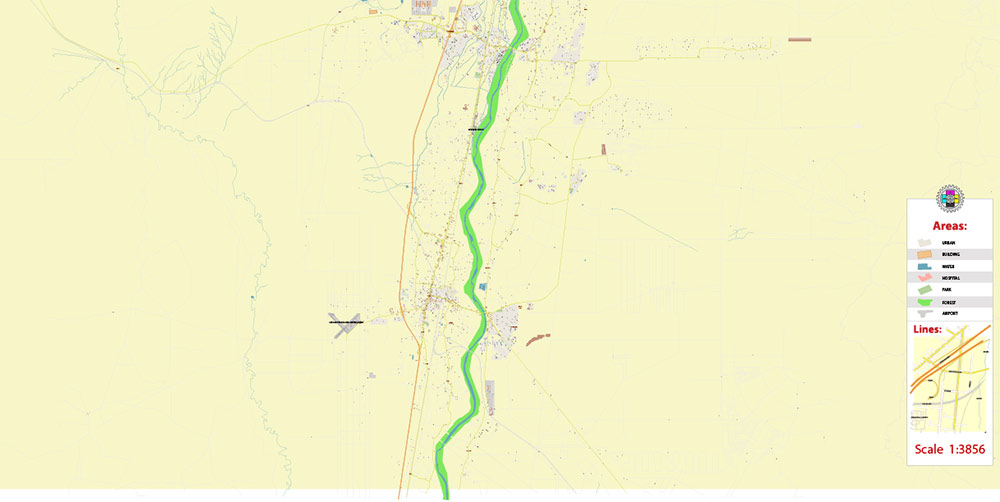
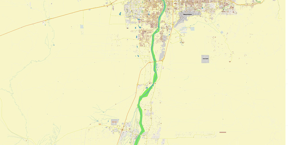
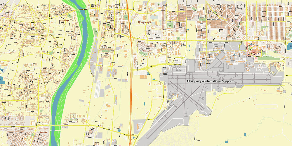
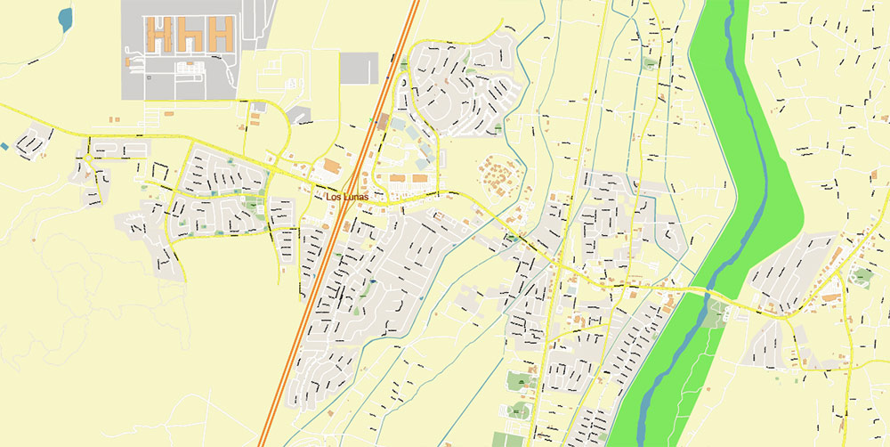
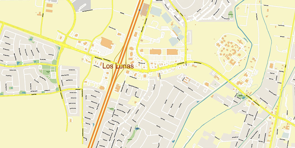
Printable DWG + PDF Vector Map of Los Lunas New Mexico + Albuquerque Airport US detailed City Plan scale 1:3856 full editable CAD DWG + PDF Street Map in layers (2 files in 1 archive), scalable, text/curves format all names, 142 MB ZIP
All street names, Main Objects, Buildings. Map for design, printing, arts, projects, presentations, for architects, designers, and builders, business, logistics.
Also: We can add (additional layer for this map), any other objects for you. It’s free for our customers.
If you need any OTHER format – for example, DXF or Corel, or something else – please, email us

Los Lunas New Mexico + Albuquerque Airport US CAD DWG + PDF Vector Map: High Detailed editable in layers (2 map files in 1 archive)
Layers list:
- Legend
- Grids
- Labels of roads
- Names of places (city, hamlet, etc.)
- Names of objects (hospitals, parks, water)
- Names of main streets
- Names of residential streets
- Arrows of the street directions
- Main Streets, roads
- Residential streets
- Buildings
- Waterways
- Water objects (rivers, lakes, ponds) areas
- Airports and Heliports
- Color fills (parks, hospital areas, land use, etc.)
- Background
Los Lunas, New Mexico, is a village located in Valencia County, approximately 25 miles south of Albuquerque, the state’s largest city. It lies along the western bank of the Rio Grande River, which has historically played a central role in the region’s geography, agriculture, and settlement patterns. The village sits at an elevation of about 4,850 feet, with a semi-arid climate characterized by hot summers, cool winters, and low annual precipitation.
Location and Surroundings
- Geographic Coordinates: Approximately 34.8066° N latitude and 106.7334° W longitude.
- Regional Context: Los Lunas is part of the Albuquerque Metropolitan Statistical Area and serves as a growing suburban and commuter hub for Albuquerque. It is surrounded by a mix of residential developments, agricultural fields, and desert landscapes.
Natural Features
- Rio Grande River:
- The Rio Grande flows through the eastern edge of the village, creating a fertile corridor for farming and ranching.
- The river’s floodplain is dotted with cottonwood trees, providing habitat for diverse wildlife, including birds and amphibians.
- Manzano Mountains (to the east):
- Part of the southern Rocky Mountains, these provide a dramatic backdrop and recreational opportunities such as hiking and camping.
- Key access points include the Manzano Mountains State Park and trails like the Fourth of July Canyon.
- Mesa and Desert Terrain (to the west):
- The western side transitions into desert plateaus and mesas typical of the New Mexican landscape.
- The arid, open spaces feature juniper, sagebrush, and cactus species.
- Bosque del Apache National Wildlife Refuge (nearby):
- Though about an hour’s drive south, this refuge is a major draw for birdwatchers, especially during the annual Sandhill Crane migration.
Infrastructure and Development
- Transportation:
- Interstate 25 (I-25) runs along the western edge of Los Lunas, connecting it to Albuquerque and points south.
- Railway: Los Lunas is served by the New Mexico Rail Runner Express, which provides commuter rail service to Albuquerque and Santa Fe.
- Road Network: NM Highway 6 serves as a main east-west route, linking Los Lunas to the Rio Puerco Valley and beyond.
- Residential Areas:
- The village features a mix of historic homes and newer suburban developments, reflecting its growing population.
Economy and Agriculture
- Agriculture:
- The Rio Grande’s irrigated lands support crops like alfalfa, chile, and corn.
- Farming is supplemented by ranching in the surrounding arid areas.
- Industrial Growth:
- Recent industrial and commercial development includes a major Facebook data center, contributing to the local economy.
Cultural and Historic Highlights
- Historic Route 66:
- Though not directly passing through Los Lunas, the region is part of the broader Route 66 cultural corridor, with ties to its mid-20th-century heyday.
- Los Lunas Decalogue Stone:
- A mysterious artifact with inscriptions resembling ancient Hebrew is located on a mesa west of the village.
Recreation
- Hiking and Outdoor Activities:
- Nearby trails in the Manzano Mountains and desert mesas cater to outdoor enthusiasts.
- Fishing and Birdwatching:
- The Rio Grande and its adjacent Bosque (woodland) areas offer opportunities for nature-related activities.
Regional Connections
Los Lunas serves as a gateway to both rural New Mexico and the Albuquerque metropolitan area, blending small-town charm with growing suburban convenience. Its proximity to the Rio Grande, Manzano Mountains, and the open desert make it an area rich in geographic diversity.
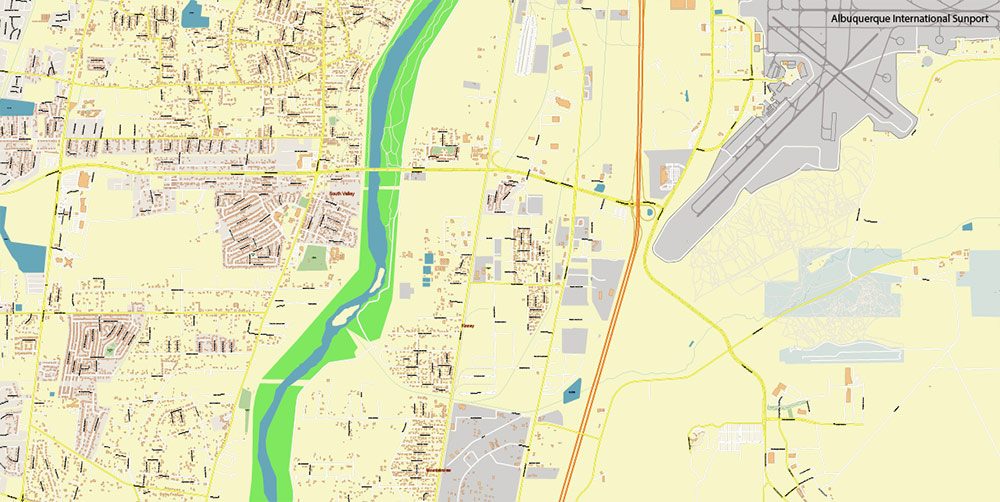
Los Lunas New Mexico + Albuquerque Airport US CAD DWG + PDF Vector Map: High Detailed editable in layers (2 map files in 1 archive)
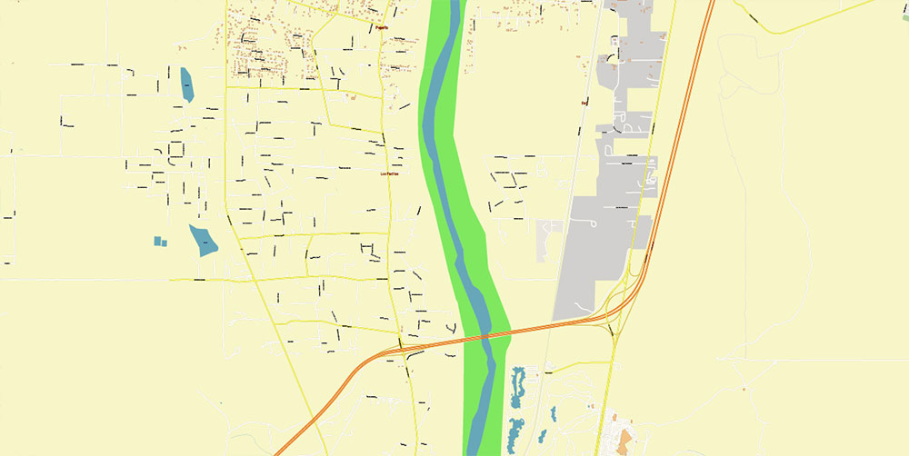
Los Lunas New Mexico + Albuquerque Airport US CAD DWG + PDF Vector Map: High Detailed editable in layers (2 map files in 1 archive)
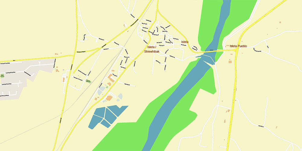
Los Lunas New Mexico + Albuquerque Airport US CAD DWG + PDF Vector Map: High Detailed editable in layers (2 map files in 1 archive)
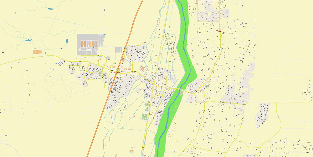
Los Lunas New Mexico + Albuquerque Airport US CAD DWG + PDF Vector Map: High Detailed editable in layers (2 map files in 1 archive)
Los Lunas New Mexico + Albuquerque Airport US CAD DWG + PDF Vector Map: High Detailed editable in layers (2 map files in 1 archive)
Los Lunas New Mexico + Albuquerque Airport US CAD DWG + PDF Vector Map: High Detailed editable in layers (2 map files in 1 archive)
Los Lunas New Mexico + Albuquerque Airport US CAD DWG + PDF Vector Map: High Detailed editable in layers (2 map files in 1 archive)
Los Lunas New Mexico + Albuquerque Airport US CAD DWG + PDF Vector Map: High Detailed editable in layers (2 map files in 1 archive)
Los Lunas New Mexico + Albuquerque Airport US CAD DWG + PDF Vector Map: High Detailed editable in layers (2 map files in 1 archive)
Los Lunas New Mexico + Albuquerque Airport US CAD DWG + PDF Vector Map: High Detailed editable in layers (2 map files in 1 archive)

 Author: Kirill Shrayber, Ph.D. FRGS

