Extended Description of the Vector Map
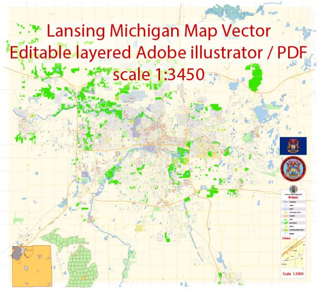
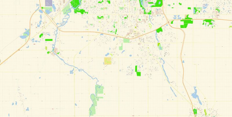
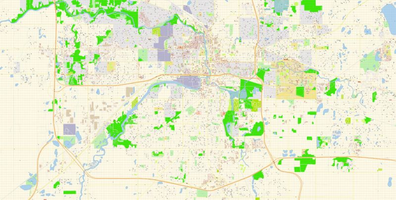
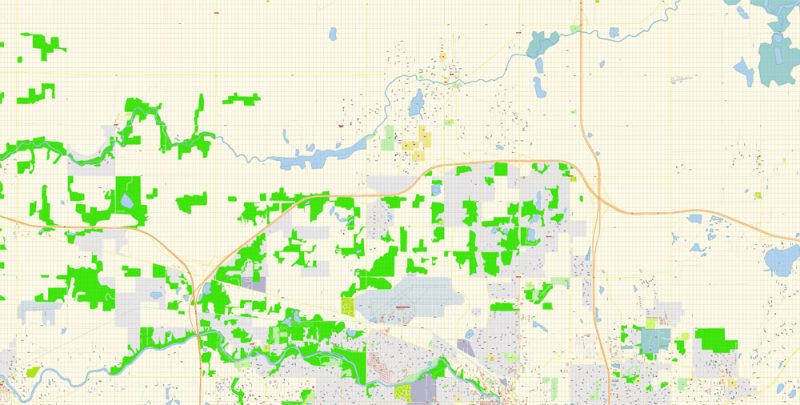
Printable Vector Map of Lansing Michigan US detailed City Plan scale 100 m 1:3450 full editable Adobe Illustrator Street Map in layers, scalable, text format all names, 5 MB ZIP
All street names, Main Objects, Buildings. Map for design, printing, arts, projects, presentations, for architects, designers, and builders, business, logistics.
Layers: color_fills, water, streets_roads, labels_roads, names_objects, names_streets, names_places, arrows_streets, buildings, grids, legend, etc.
The most exact and detailed map of the city in scale.
For Editing and High-Quality Printing
Lansing
City in Michigan
Lansing is the capital city of Michigan. Dating to the 1870s, the Michigan State Capitol building features a cast-iron dome. The Impression 5 Science Center has interactive displays. The collection at the R.E. Olds Transportation Museum includes classic and contemporary Oldsmobile cars. The Potter Park Zoo houses endangered and threatened species such as Magellanic penguins, black rhinos and golden lion tamarins.
Population: 116,986
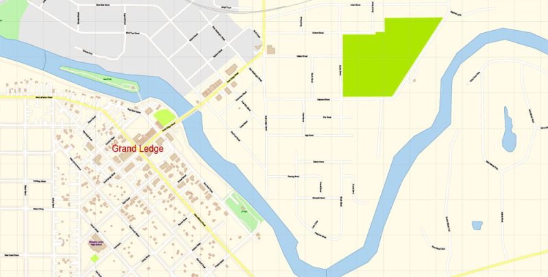
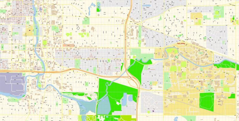
Lansing Michigan Map Vector Exact City Plan detailed Street Map editable Adobe Illustrator in layers
Lansing Michigan Map Vector Exact City Plan detailed Street Map editable Adobe Illustrator in layers
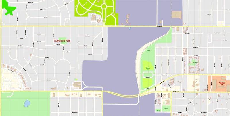
Lansing Michigan Map Vector Exact City Plan detailed Street Map editable Adobe Illustrator in layers
Lansing Michigan Map Vector Exact City Plan detailed Street Map editable Adobe Illustrator in layers
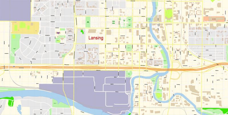
Lansing Michigan Map Vector Exact City Plan detailed Street Map editable Adobe Illustrator in layers
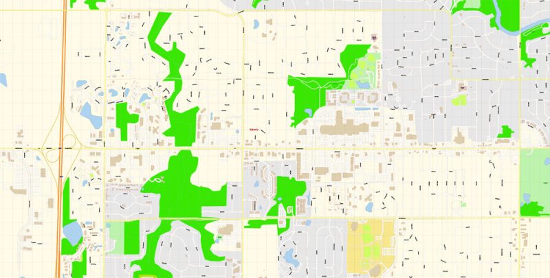
Lansing Michigan Map Vector Exact City Plan detailed Street Map editable Adobe Illustrator in layers
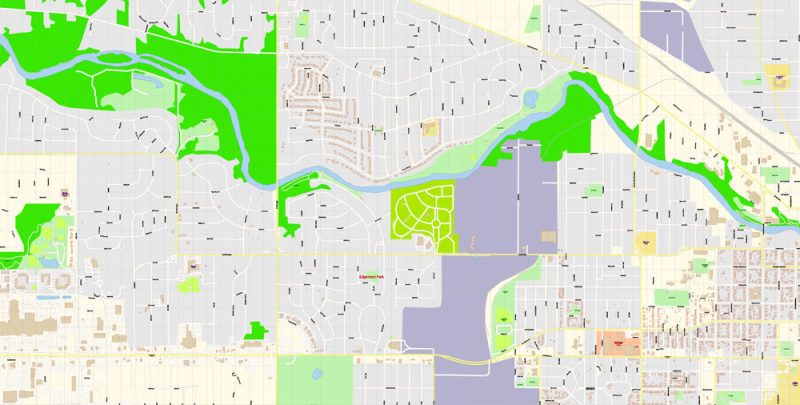
Lansing Michigan Map Vector Exact City Plan detailed Street Map editable Adobe Illustrator in layers
Lansing Michigan Map Vector Exact City Plan detailed Street Map editable Adobe Illustrator in layers
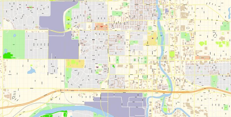
Lansing Michigan Map Vector Exact City Plan detailed Street Map editable Adobe Illustrator in layers
Lansing Michigan Map Vector Exact City Plan detailed Street Map editable Adobe Illustrator in layers
Lansing Michigan Map Vector Exact City Plan detailed Street Map editable Adobe Illustrator in layers
Author Rating
Aggregate Rating
no rating based on 0 votes
@vectormapper
Product Name Lansing Michigan Map Vector Exact City Plan detailed Street Map editable Adobe Illustrator in layers
Price
USD 32
Product Availability
Available in Stock


 Author: Kirill Shrayber, Ph.D. FRGS
 + Counties editable Adobe Illustrator in layers")
 + Admin Areas editable Adobe Illustrator in layers")

