Extended Description of the Vector Map
Printable Vector Map of Lagos State, Nigeria: All Streets and Roads + counties areas, fully editable Adobe Illustrator Map in layers, scalable, 10 MB ZIP
Scale: 1:74641
All streets and roads, Names of Principal streets, All Cities and Towns, Counties, All Geonames. Map for design, printing, arts, projects, presentations, for architects, designers, and builders, business, logistics.
NOTE! All objects are located on separate layers by type. The preview shows all layers together. When you work with this map, just turn off or delete those layers that are not needed for your project.
For Editing and High-Quality Printing, Royalty free
Need AutoCAD DWG / DXF, CDR, or any other format? Please, contact us!
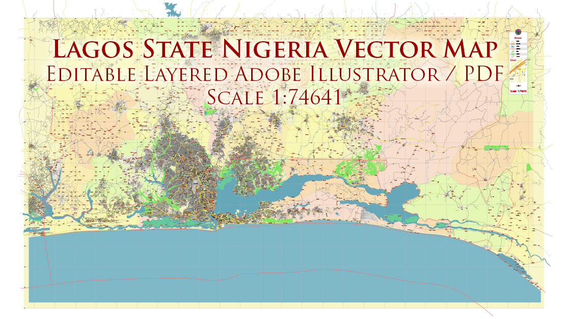
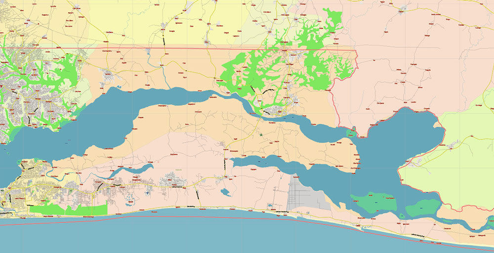
Lagos State, Nigeria Vector Map: Full Extra High Detailed + Admin Areas editable Adobe Illustrator in layers
Layers list:
- Legend
- Grids
- Labels of roads (numbers) – highways, interstate
- All Geonames (cities, towns, villages, hamlets) red font
- Points of the Geonames (cities, towns, villages, hamlets) red points
- Names places: Names of all Cities, towns
- Names of objects (water, park, hospital)
- Halo names 1, 2, 3
- Names of Counties
- Names of the Main Streets
- Major Roads and Streets – Highways
- Minor Roads and residential streets
- Railroads
- State boundaries
- Water objects (rivers, lakes, ponds, swamps, reefs)
- Waterways
- Ground objects (urban areas, parks, hospitals, etc.)
- Counties areas (colored)
- Background and sea
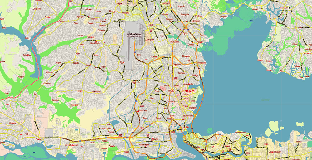
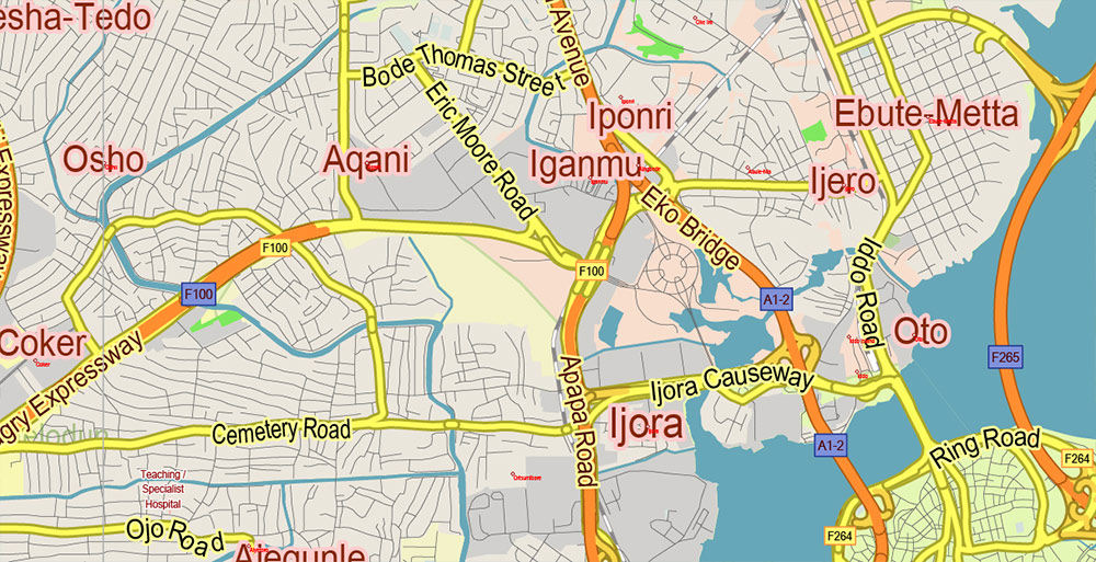
Lagos State, Nigeria Vector Map: Full Extra High Detailed + Admin Areas editable Adobe Illustrator in layers
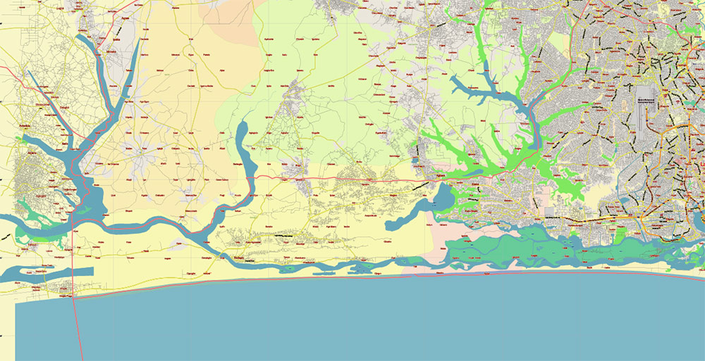
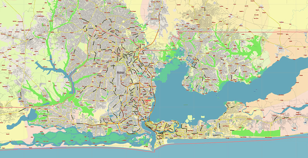
Lagos State, Nigeria Vector Map: Full Extra High Detailed + Admin Areas editable Adobe Illustrator in layers
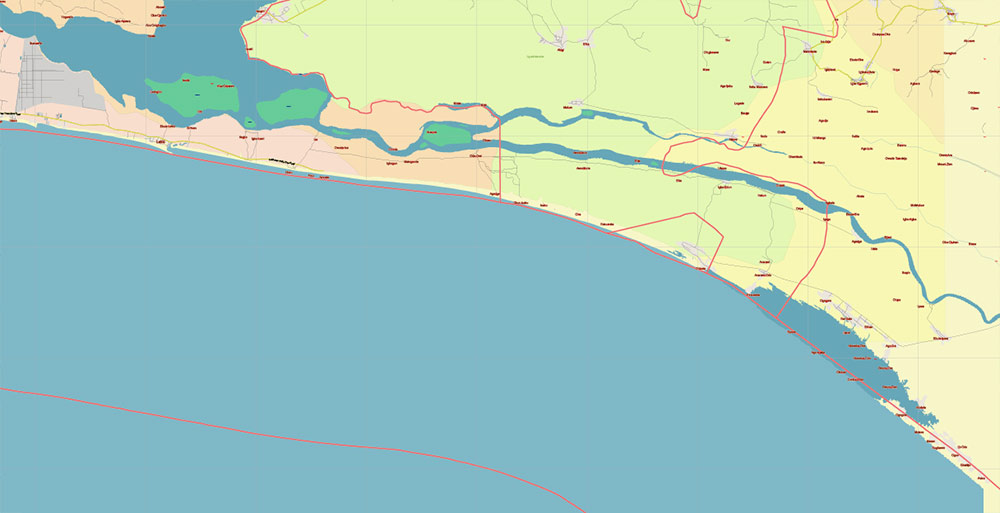
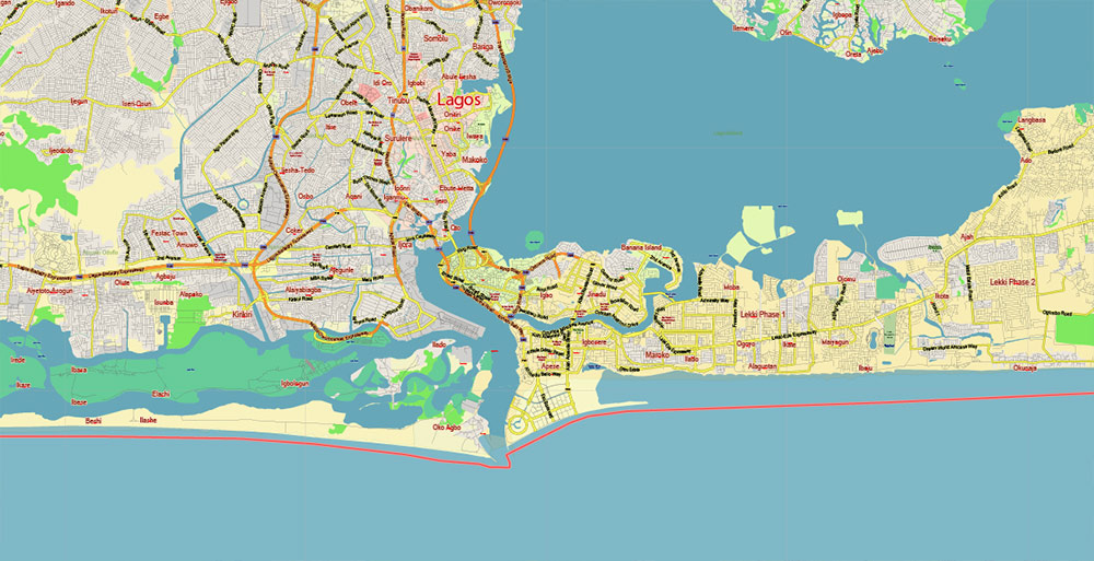
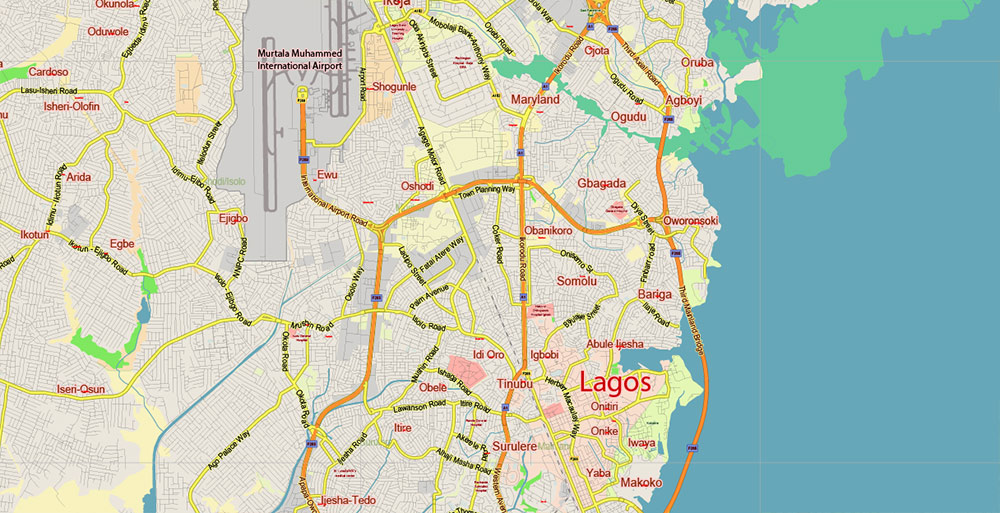
Lagos State, Nigeria Vector Map: Full Extra High Detailed + Admin Areas editable Adobe Illustrator in layers
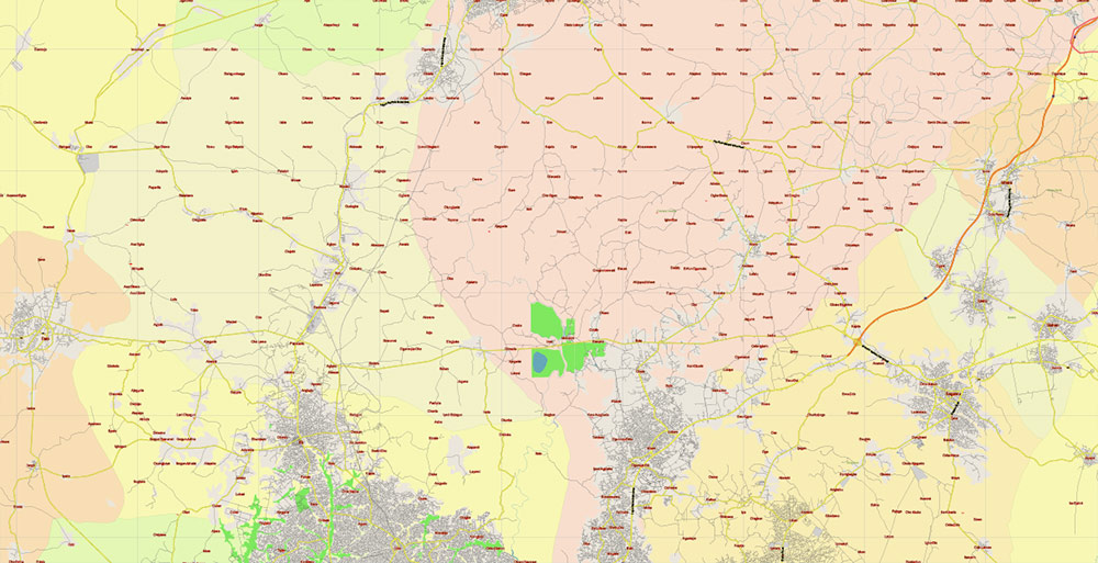
Lagos State, Nigeria Vector Map: Full Extra High Detailed + Admin Areas editable Adobe Illustrator in layers
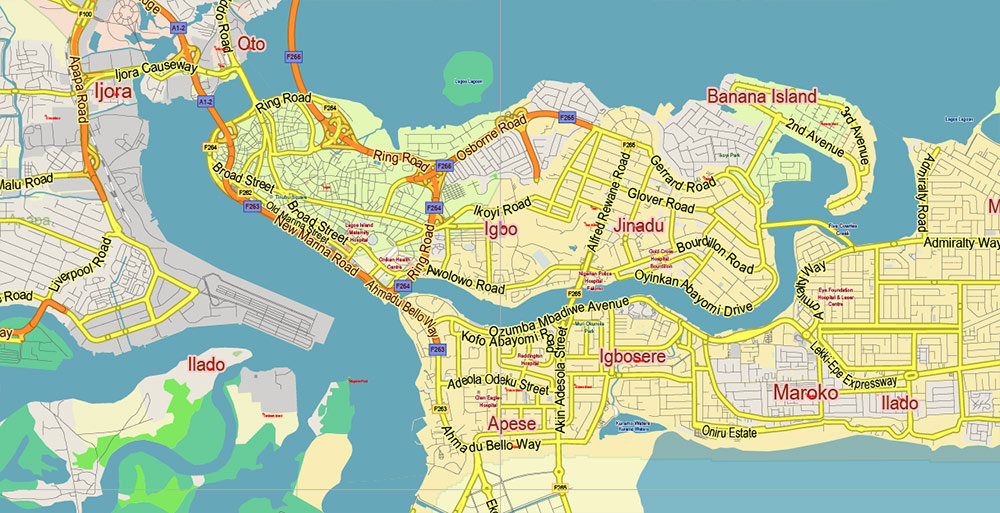
Lagos State, Nigeria Vector Map: Full Extra High Detailed + Admin Areas editable Adobe Illustrator in layers
Lagos State, Nigeria Vector Map: Full Extra High Detailed + Admin Areas editable Adobe Illustrator in layers
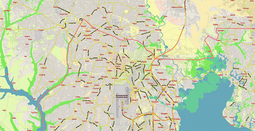
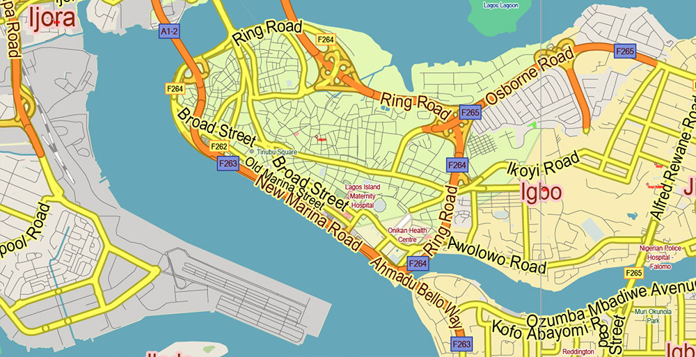
Lagos State, Nigeria Vector Map: Full Extra High Detailed + Admin Areas editable Adobe Illustrator in layers
Lagos State, Nigeria Vector Map: Full Extra High Detailed + Admin Areas editable Adobe Illustrator in layers
Lagos State, Nigeria Vector Map: Full Extra High Detailed + Admin Areas editable Adobe Illustrator in layers
Lagos State, Nigeria Vector Map: Full Extra High Detailed + Admin Areas editable Adobe Illustrator in layers
Lagos State, Nigeria Vector Map: Full Extra High Detailed + Admin Areas editable Adobe Illustrator in layers
Lagos State, Nigeria Vector Map: Full Extra High Detailed + Admin Areas editable Adobe Illustrator in layers
Lagos State, Nigeria Vector Map: Full Extra High Detailed + Admin Areas editable Adobe Illustrator in layers

 Author: Kirill Shrayber, Ph.D. FRGS

