Extended Description of the Vector Map
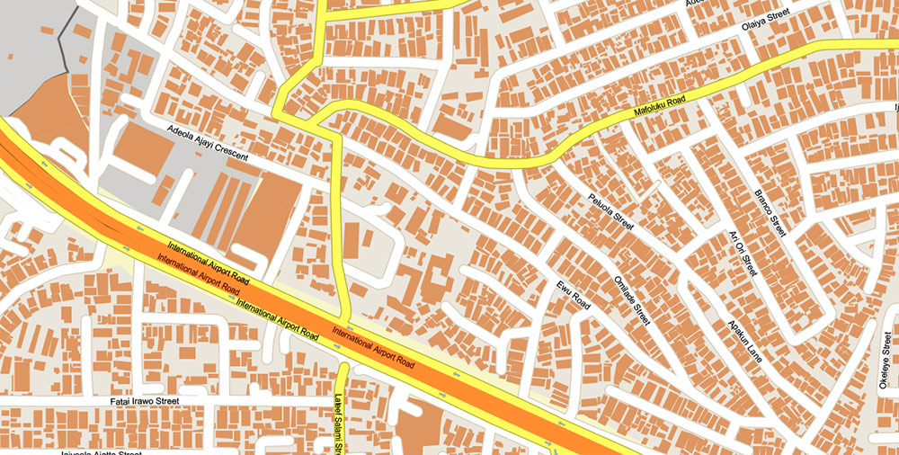
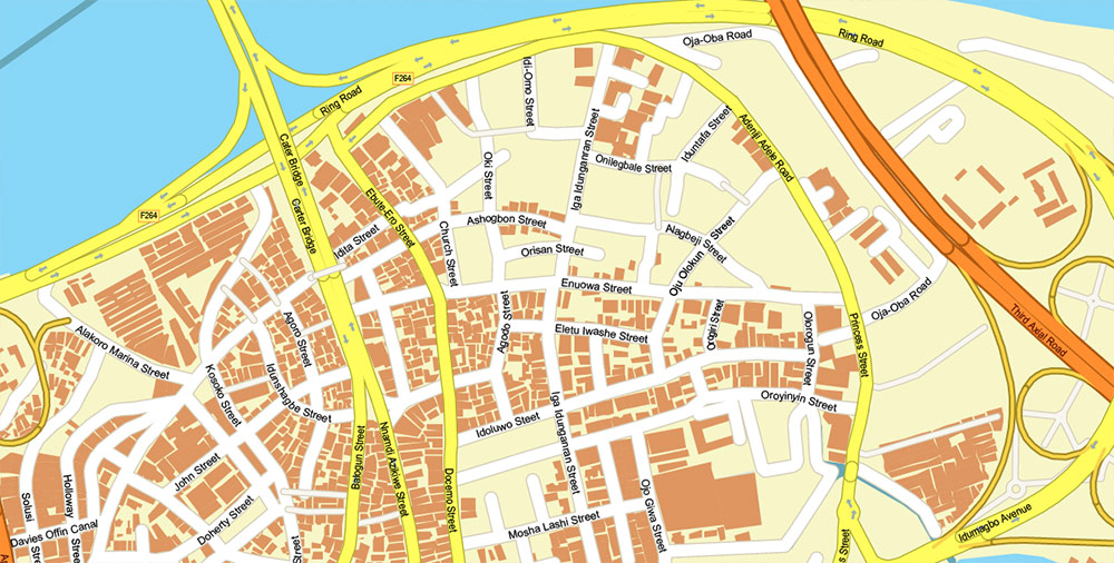
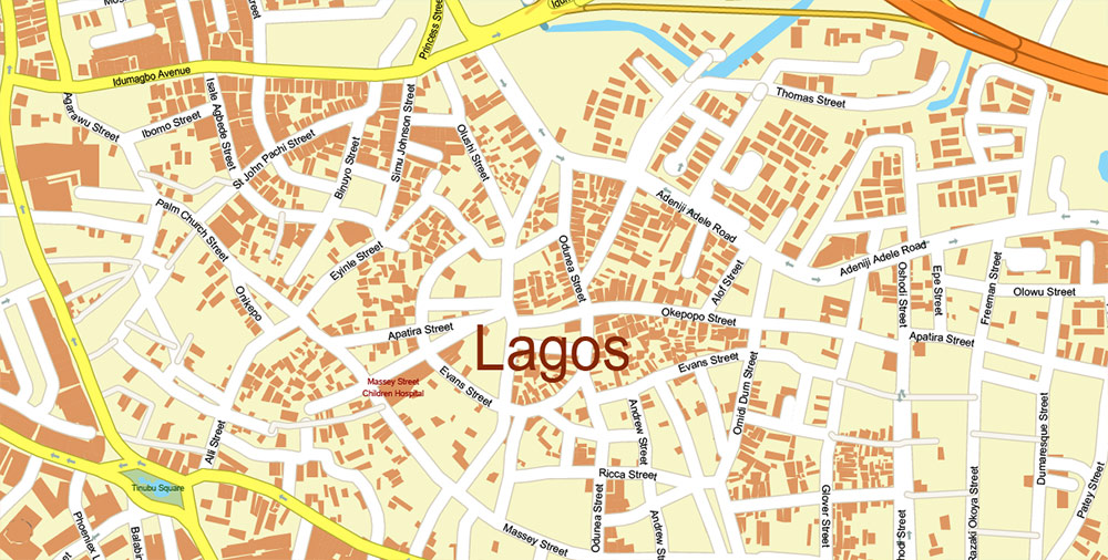
Printable PDF Vector Map of Lagos Nigeria Metro Area High Detailed street map scale 1:4666 fully editable Layered Adobe PDF scalable, text/curves format all names, 108 MB ZIP
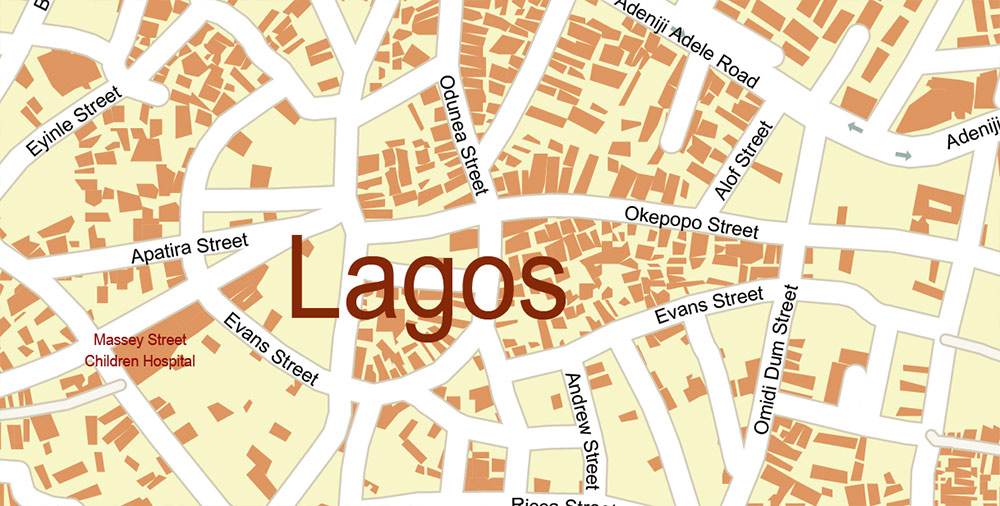
All street names, Main Objects, Buildings. Map for design, printing, arts, projects, presentations, for architects, designers, and builders, business, logistics.
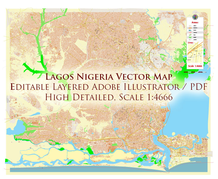
Lagos Nigeria Metro Area PDF Map Vector Exact High Detailed Street Map editable Adobe PDF in layers
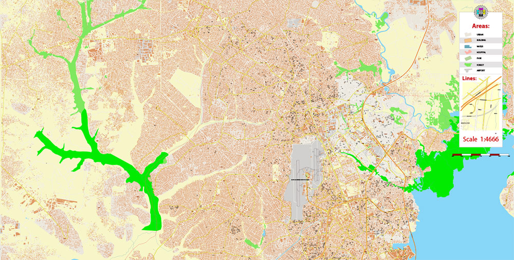
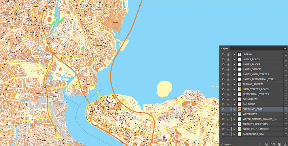
Layers list:
- Legend
- Names of places (city, hamlet, etc.)
- Names of objects (parks, hospital, water)
- Names of main streets
- Names of residential streets
- Main Streets, roads
- Residential streets
- Railroads
- Boundaries
- Buildings
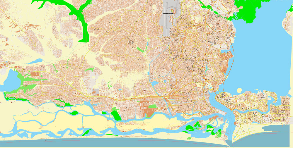
- Water objects (rivers, lakes, ponds)
- Waterways
- Color fills (parks, land use, etc.)
- Islands
- Background and sea
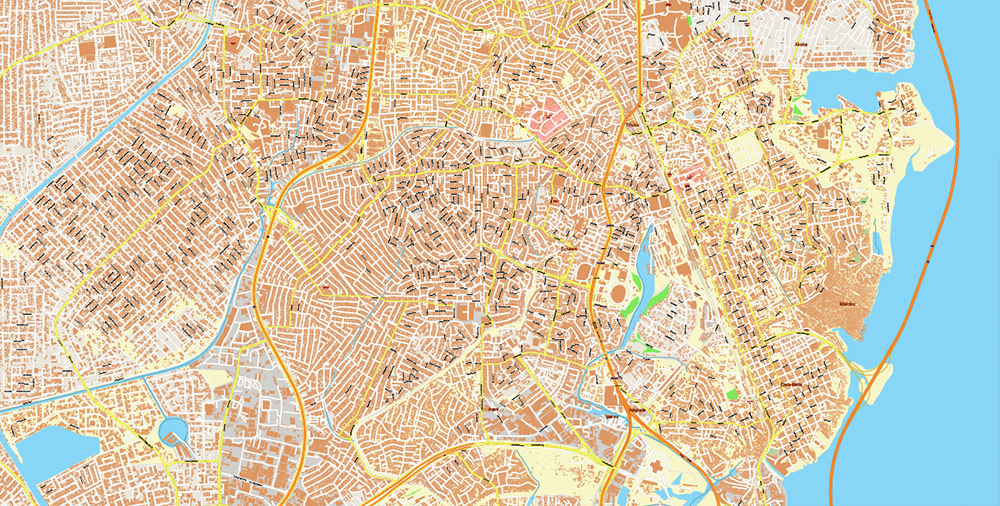
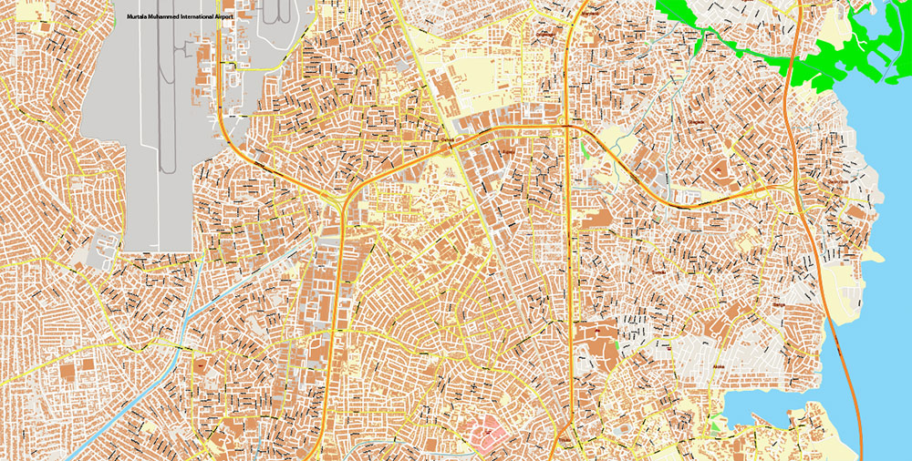
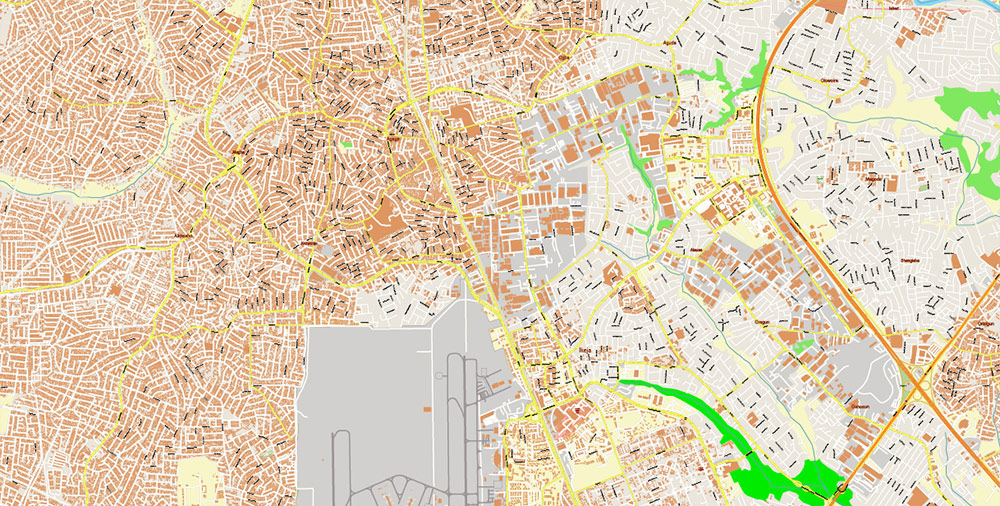
The most exact and detailed map of the Lagos Nigeria Metro Area in scale.
For Editing and High-Quality Printing
Lagos Nigeria Metro Area PDF Map Vector Exact High Detailed Street Map editable Adobe PDF in layers
Lagos – Nigeria
Metro Area | Exact High-Detail Street Vector Map (PDF)
OVERVIEW
-
One of the fastest-growing megacities globally, coastal West Africa
-
Polycentric metro area combining mainland, islands, and lagoon systems
-
Extreme urban density with continuous expansion into peri-urban zones
-
Economic and financial capital of Nigeria with intense daily mobility
KEY ROADS / LINES OF COMMUNICATION
-
Lagos–Ibadan Expressway – primary regional artery and freight corridor
-
Third Mainland Bridge – critical mainland–island connector
-
Eko Bridge and Carter Bridge – core CBD access routes
-
High-capacity arterials feeding dense local street networks
-
Informal connectors and service roads integrated into traffic flow
URBAN STRUCTURE & STREET PATTERN
-
Highly irregular, organic street fabric in older districts
-
Dense informal settlements with fine-grain street geometry
-
Planned estates and business districts with wider grids and arterials
-
Industrial and port zones with heavy-duty road layouts
-
Strong contrast between formal infrastructure and informal expansion
DEMOGRAPHY / HUMAN TERRAIN
-
Population: ~20+ million (metro, estimated)
-
Extremely high population density in mainland districts
-
Young demographic profile with intense commuter pressure
-
Mixed residential, commercial, industrial land use at block level
TRANSPORT & INFRASTRUCTURE
-
Road-dominant transport system with limited rail penetration
-
Extensive use of buses, minibuses, and informal transit routes
-
Water transport corridors across lagoons and creeks
-
Chronic congestion shaping daily movement patterns
TOURISM / KEY COMPOUNDS
-
Victoria Island and Ikoyi as primary business and hospitality zones
-
Coastal corridors with resorts and leisure infrastructure
-
Central markets and commercial hubs with complex access patterns
-
Port and waterfront districts integrated into urban core
HAZARDS / CONSTRAINTS
-
Severe traffic congestion and bottlenecks
-
Flooding risk in low-lying coastal and lagoon-adjacent areas
-
Rapid informal growth complicating infrastructure consistency
-
Limited redundancy in bridge and arterial crossings
LOGISTICS / SUSTAINMENT
-
Major West African logistics and trade gateway
-
Apapa port complex and industrial corridors
-
Road network under constant freight load
-
Strategic choke points at bridges, port access roads, and expressways
MAP SPECIFICATION – OPERATIONAL VALUE
-
Exact high-detail street coverage across entire Lagos metro area
-
Complete road and street hierarchy with dense local detail
-
Fully editable Adobe PDF with structured layers
-
Optimized for large-format print, planning, analytics, and design
-
Suitable for urban studies, logistics, infrastructure, and publishing
COMMAND TAKEAWAYS
-
Lagos is a high-density, high-friction megacity
-
Accurate vector street mapping is essential for usability
-
Fine-grain road detail enables real-world operational clarity
-
Map supports professional planning, logistics analysis, and print production
Lagos Nigeria Metro Area PDF Map Vector Exact High Detailed Street Map editable Adobe PDF in layers
Lagos Nigeria Metro Area PDF Map Vector Exact High Detailed Street Map editable Adobe PDF in layers
Lagos Nigeria Metro Area PDF Map Vector Exact High Detailed Street Map editable Adobe PDF in layers
Lagos Nigeria Metro Area PDF Map Vector Exact High Detailed Street Map editable Adobe PDF in layers
Lagos Nigeria Metro Area PDF Map Vector Exact High Detailed Street Map editable Adobe PDF in layers
Lagos Nigeria Metro Area PDF Map Vector Exact High Detailed Street Map editable Adobe PDF in layers
Lagos Nigeria Metro Area PDF Map Vector Exact High Detailed Street Map editable Adobe PDF in layers
Lagos Nigeria Metro Area PDF Map Vector Exact High Detailed Street Map editable Adobe PDF in layers
Lagos Nigeria Metro Area PDF Map Vector Exact High Detailed Street Map editable Adobe PDF in layers

 Author: Kirill Shrayber, Ph.D. FRGS


