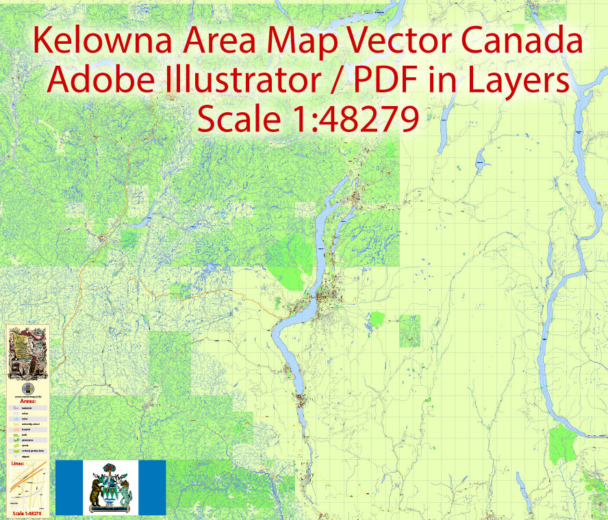
Printable PDF Vector Map Kelowna Large Area, British Columbia Canada scale 1:48279 Street Road Map editable Adobe PDF, scalable, editable text format all names, 78 mb ZIP
All street and roads, named Principal roads, main objects, all buildings. Map for publishing, design, printing, publications, arts, media, projects, presentations, for architects, designers and builders, business, logistics. The most exact and detailed map of the city.
Layers: color_fills, streets_roads, labels_roads, names_places, halo_names_places, halo_names_streets, waterways, buildings, names_objects, grids, legend.
For High Quality Printing
DWG, DXF, CDR and other formats – on request, same price, please, contact.
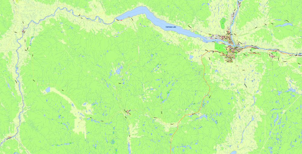
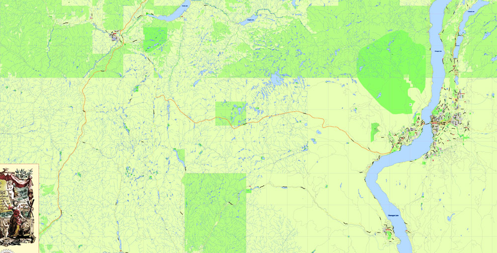
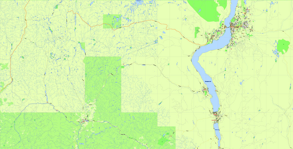
Kelowna, Canada.
This vector map of Kelowna city is used as a basis for design, editing, and further printing.
This is the most detailed, exact map of Kelowna city for high-quality printing and polygraphy. You can always clarify the map development date by contacting us.
For your convenience, all objects on Kelowna vector city map are divided into layers. And the editing is very easy – colors, lines, etc.
You can easily add any objects needed (e.g. shops, salons, sale points, gas station or attraction) on any layer of Kelowna vector map.
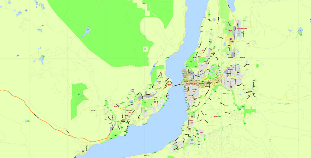
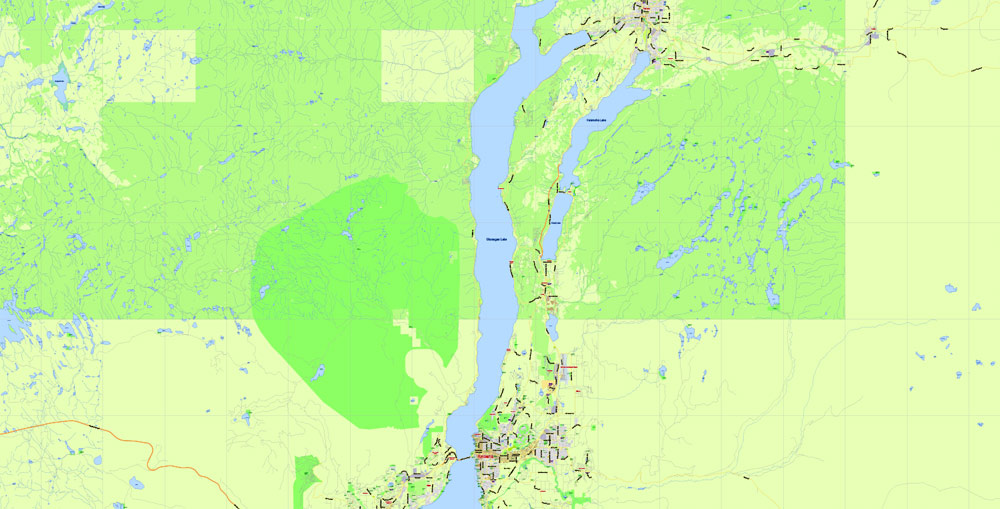
Kelowna is a city on Okanagan Lake in the Okanagan Valley in the southern interior of British Columbia, Canada. It serves as the head office of the Regional District of the Central Okanagan. The name Kelowna derives from an Okanagan language term for “grizzly bear”.
One of the advantages of Kelowna city vector maps of our production is the relevance of cartographic data, we constantly update all our products.
This vector map of Kelowna city is used by:
designers, layout designers, printers, advertisers and architects. Our product – vector maps – is designed for further editing and printing in large formats – from @Wall format (a few meters) to A-0 and A-1, A-2, A-3.
The Kelowna city map in vector format is used for design, urban planning, presentations and media visualizations.
The advertising and presentation map of Kelowna city (usually the final designer marks the routes, and puts the client’s objects (shops, saloons, gas stations etc.)
The undoubted advantage is that people will NEVER throw out this advertising product – the map. In fact, as an advertising medium, a city map is the most “long-playing” of the well-known polygraphic advertising media, with the longest lifespan, and the maximum number of interactions with the customer.
For travelers, maps are sold at the airports and gas stations around the world. Often the source is our vector maps.
Take a look, who purchases our vector maps of Kelowna city in “Our Clients and Friends” page – these are large and small companies, from super-brands like Volvo and Starbucks, to small design studios and printing houses.
It’s very easy to work with vector maps of Kelowna city, even for a not very experienced designer who can turn on and off the map layers, add new objects, change the colors of fill and lines according to customer requirements.
The undoubted advantage of Kelowna city vector maps in printing is an excellent and detailed visualization, when customer can expand a large paper map and instantly define his location, find a landmark, an object or address on map, unlike using the popular electronic formats of Google and Yandex maps for example.
Printable vector maps of Kelowna city are much more convenient and efficient than any electronic maps on your smartphone, because ALL DETAILS are displayed in the entire space of Kelowna city map.
The Kelowna metropolitan area has a population of 194,882; the third-largest metropolitan area in the province, behind only Vancouver and Victoria. Additionally, the City of Kelowna is the seventh-largest city in the province. It ranks as the 22nd-largest in Canada and is the largest city in British Columbia that is located inland.
Useful tips on working with vector maps of cities and countries in Adobe Illustrator.
«V» – launches the Selection tool (cursor, black arrow), which makes active any vector line.
«А» – launches the Direct Selection tool (white cursor), allows you to select curve elements and drag them to the desired place.
«R» – activates the Rotate tool, which helps you rotating selected objects around the center point by 360 degrees.
«E» – gives you the opportunity to use the Eraser tool and erase unnecessary parts.
«X» – switches between Fill and Stroke in the Tools section. Try to get used to this hot key and
you will quickly understand that you can’t live and work without it.
Guides are not limited to vertical and horizontal in Adobe Illustrator. You can also create a diagonal guide for example. Moreover, you can turn any contours into guides. Select the outline and go to View > Guides > Make Guides (Create Guides), or simply press Cmd/Ctrl + 5. You can also turn the guides back into an editable object. Go to menu, View > Guides > Unlock Guides (Release Guides), select the guide you want to edit and select View > Guides > Release Guides (Reset Guides), or just press Cmd/Ctrl + Option / Alt + 5).
Kelowna’s city proper contains 211.82 square kilometres (81.78 sq mi), and the census metropolitan area contains 2,904.86 square kilometres (1,121.57 sq mi). In 2016, the population of Kelowna consisted of 127,380 individuals occupying 53,903 private dwellings.

You will probably want to change the color scheme used on our Kelowna vector city map.
To quickly and effectively play with colors.
Of course, you can do it manually, all objects in our Kelowna city vector map are divided according to types and layers, and you can easily change the color gamma of vector objects in groups and layers.
But there is more effective way of working with the whole VECTOR MAP of Kelowna city and all layers:
The overview dialog «Edit colors»/«Repaint Graphic Object» (this dialog box name can change depending on the context):
If you have selected a part or a layer of Kelowna city vector map and open the dialog box by clicking the icon in the Control panel, on the Samples palette or the Color Catalog, or if you choose Edit > Edit Colors> Repaint Graphic Object, then the «Repaint Graphic Object» dialog box appears, and you get access to «Assign» and «Edit» tabs.
If a picture or a map fragment is not selected, and you open the dialog box by clicking the icon in the Control panel, on the Samples palette or in the Color Catalog, the «Edit Colors» dialog box appears and you can only access the «Edit» tab.
Regardless of the name at the top of the dialog box, the right-hand side always displays the color group of the current document, as well as two default color groups: Print Color and Grayscale. These color groups can be selected and used any time.
Create and edit color groups of Kelowna city vector map, and also assign colors using the «Edit Colors»/ а «Repaint Graphic Object» dialog box.
A. Creating and editing of a color group on the «Edit» tab
B. Assigning colors on the «Assign» tab
C. Select a group of colors from the «Color groups» list
The option «Repaint a graphic object» in the lower part of the dialog box allows you to preview the colors on a selected layer of Vector map, or a group of elements, and specify whether its colors will be redefined when the dialog box is closed.
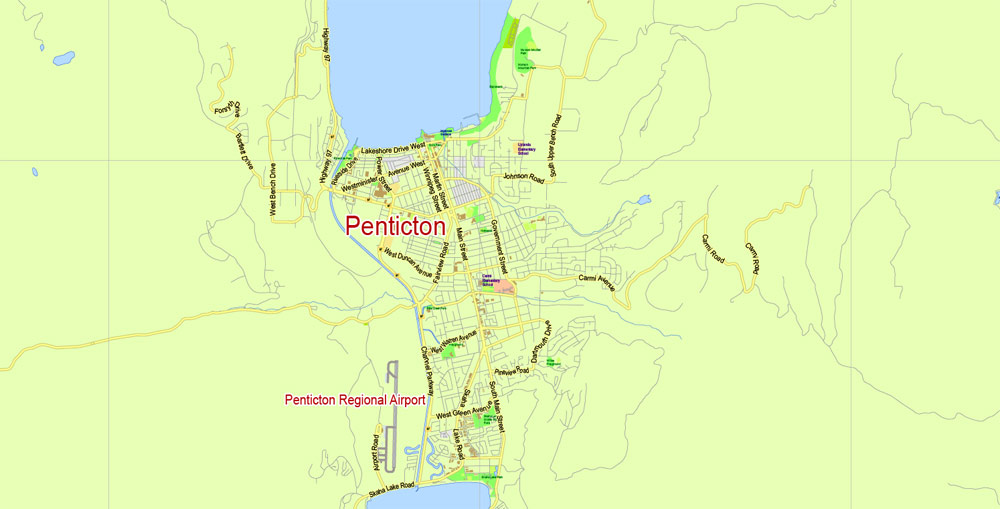
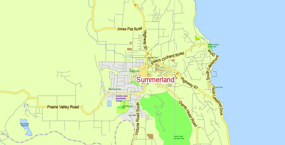
Nearby communities include the City of West Kelowna (also referred to as Westbank, Westside) to the west across Okanagan Lake, Lake Country and Vernon to the north, and Peachland to the southwest, and further to the south, Summerland and Penticton.

The main areas of the dialog box are:
«Edit»
The «Edit» tab is designed to create a new or edit the existing color groups.
The harmony rules Menu and the Color Wheel are used to conduct experiments with color harmonies. The color wheel shows how colors are related in color harmony, and the color bars allow you to view and manipulate an individual color values. In addition, you can adjust the brightness, add and remove colors, save color groups and view colors on the selected Vector Map of Kelowna city or a separated layers.
«Assign»
The «Assign» tab is used to view and control on how the original colors are replaced with colors from the color group like your corporate colors in the Vector Map of Kelowna city.
Geography
Sectors and neighbourhoods
Neighbourhoods of Kelowna
Belgo
Benvoulin
Black Mountain
Braeloch
Central City
Clifton
Crawford
Dilworth
Downtown
East Kelowna
Glenmore
North Glenmore
Kettle Valley
KLO
McKinley Landing
Midtown
Mission
North End
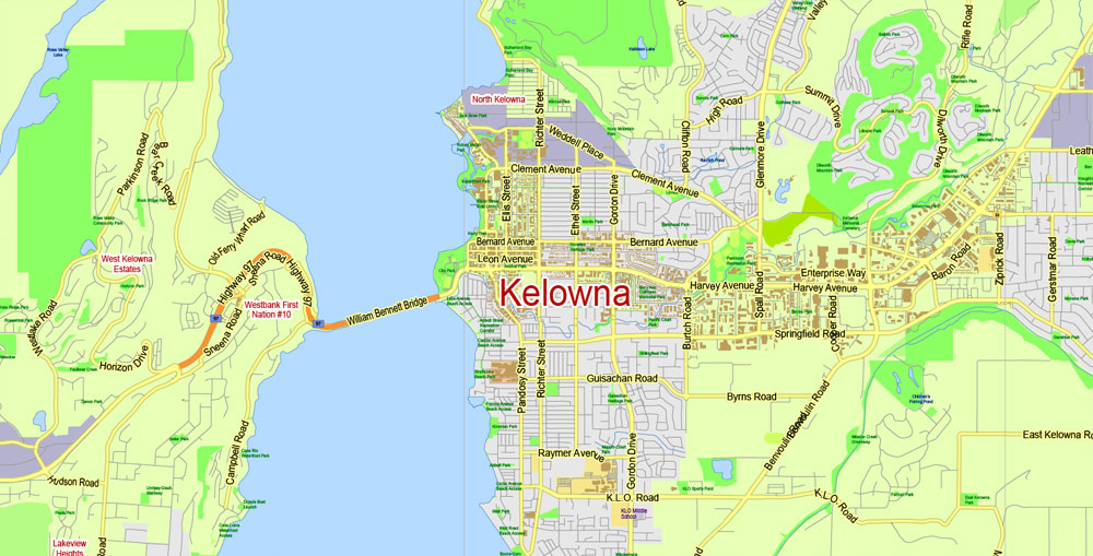
Pandosy
Poplar Point
Rutland
South Kelowna
Southridge
Quail Ridge
Central City
Central City is a linear commercial sector extending along Harvey Avenue from the Downtown to Highway 33. Major commercial developments include the Capri Centre mall, the Landmark buildings, and the Orchard Park Shopping Centre. Commercial activity is particularly concentrated along or very near highway 97 (Harvey).
Dilworth Mountain
The assign color ability is provided only if the entire map, layer or fragment is selected in the document. You can specify which of new colors replace the current colors, whether the spot colors should be preserved and how colors are replaced (for example, you can replace colors completely or changing the color tone while maintaining the brightness). The «Assign» tab allows you to redefine colors in the Vector Map of Kelowna city, or in separate layers and fragments using the current color group or reducing the number of colors in the current Vector Map.
Color groups
Is a list of all saved color groups for current document (the same groups appear in the «Samples» palette). You can edit and delete the existing color groups, as well as creating a new ones using the list of “Color Groups” in the dialog box. All changes appear in the «Samples» palette.
The highlighted color group shows, which color group is currently edited.
Dilworth Mountain is a relatively low and isolated mountain which is located near the geographic center of the city. It lies across from Knox Mountain to the West, and forms part of the eastern heights between which Glenmore Valley lies. While technically a mountain, it rises about one thousand feet or so above the rest of the Okanagan Valley (just over 2000 feet elevation). It has been very extensively developed in recent years; decades of blasting and construction work have resulted in a scenic collection of neighborhoods with suburban character, but located only minutes from Central City.
Any color group can be selected and edited, or used to redefine the colors in the selected vector map of Kelowna city, its fragments or elements.
Saving a color group adds this group to the specified list.
Opening the «Edit Colors»/«Repaint Graphic Object» dialog box.
Open the «Edit Colors»/«Repaint Graphic Object» dialog box using one of the following methods:
«Edit»> «Edit Colors»> «Repaint Graphic object» or «Repaint With Style».
Use these commands if you need to edit the colors in the selected vector map of Kelowna city.
Like many other Kelowna residential districts, Dilworth has gone from relative isolation and wilderness, to hosting many residential roads with hundreds of homes – many of which are considered to be fairly expensive and high-end.
«Repaint Graphic object» button on the «Control» panel.
Use this button if you need to adjust colors of Kelowna city vector map using the а «Repaint graphic object» dialog box.
The specified button is available if the selected vector map or its fragment contains two or more colors.
Note. This color editing method is convenient for global color adjustment in a vector map, if global colors were not used when creating a City Map of Kelowna.
The «Edit colors» button or «Edit or apply colors» on the «Color Catalog» palette
Click this button if you need to edit colors on the «Color Catalog» palette or edit and then apply them to the selected Vector Map of Kelowna city or its fragment.
The «Edit color group» button or «Edit or apply color group» on the «Samples» palette.
Downtown Kelowna is the centre of the city and is a tourist district. It is located alongside Okanagan Lake, and its area is officially defined as all land north of highway 97, south of Clement Avenue, east of Okanagan Lake, and west of Richter Street. There are two main routes through the downtown core along which various attractions and commerce are concentrated.
Click this button if you need to edit the colors in the specific color group or edit and apply them to the selected Vector Map of Kelowna city or a group of its elements, for example, the whole layer “Streets and lines”. You can also double-click the color group in the Samples panel to open the dialog box.
If the map file is too large and your computer freezes or even can’t open it quickly:
1. Try to reduce the color resolution of the video card (display) to 256 colors while working with a large map.
2. Using Windows Task Manager, select all the application you don’t need, while working with map, just turn them off.
3. Launch Adobe Illustrator. (DO NOT OPEN the vector map file)
4. Start the Windows Task Manager using administrator rights > Find the “Illustrator” process > set the «real time» priority,
5. Open the file. When you see the LEGACY FONT popup window – click “OK” (do not update). You can restore the TEXT later.
6. Can also be useful: When file is opened – Edit > Settings > Basic Settings > disable smoothing. /// It looks scary, but works quickly)))
We recommend saving the file in Adobe Illustrator 10 version. It’s much more stable when working with VERY BIG size files.
These include several parks and beaches along the lake, boardwalks and other walking trails, Kelowna Marina and Yacht Club, Delta Grand hotel and casino, and Prospera Place arena. The other main route through downtown is Bernard Avenue from Richter street to the lake. It has more shops and restaurants designed both for locals and tourists. Although Bernard ave. continues east well past the downtown area, it is not part of downtown and is zoned residential. The commercial segment lies within its downtown section between Richter and Abbott streets, the latter of which is lake-adjacent. Kelowna has declared a 1 km2 (0.39 sq mi) downtown area to be a “red-zone”, an area of prolific drug trafficking, assaults and robberies. The red-zone extends from Okanagan Lake to the West, Lake Avenue, Rowcliffe to Ethel and Ethel to Stockwell, Doyle and back to the lake. The red zone in Kelowna was put in place in 1992 to reduce street crime, and within it the RCMP conducts an annual “spring sweep”, arresting low-level drug dealers. Kelowna was the second British Columbia city to declare a red-zone.

Glenmore
Glenmore is a relatively affluent suburb that lies mostly within Glenmore Valley – a subsection of the Okanagan Valley in the Kelowna area. It has experienced extremely rapid housing development within the past two decades – changing from a small suburb with a relatively rural character to extensive suburban neighborhoods, including several elementary schools and a rapidly growing commercial hub. While most of the homes in this part of town lie on the relatively flat valley bottom, there are several large and more recent neighborhoods being built into the adjacent mountains; the community of Wilden is an example of this.
Midtown
The Midtown area bordered by Enterprise Way on the north, and Springfield and Baron Road at the south, is a popular shopping destination for the locals; the largest shopping mall in the interior, Orchard Park, is located in this area. Since most of the Midtown area consists of large, car-oriented big-box stores, Midtown is often criticized for its plainness, urban sprawl and the decline of pedestrian-oriented Downtown. There is also a lack of green space; particularly since the whole area used to be a linear park and golf course.

Mission
Known colloquially as “The Mission” or “Okanagan Mission” in order to differentiate itself from Mission, BC, a city in the Lower Mainland near Abbotsford, the Mission used to be a separate jurisdiction before being amalgamated with the City of Kelowna in the mid to late 20th century. This has caused a fairly vibrant secondary commercial centre to emerge which is entirely separate from Downtown, with low to moderate density residential areas in between. It is often differentiated as the “Lower Mission” and “Upper Mission”, the former of which contains most of the aforementioned commercial areas such as shopping malls, grocery stores, coffee shops and boutiques. The Upper Mission begins to extend into the foothills and higher terrain, and many parts of this area boast magnificent views of the city, mountains and Okanagan Lake. As a result, this part of town is widely regarded as luxurious and is indeed one of the most expensive neighborhoods of Kelowna. It is not unusual to see homes worth one million dollars or more; the most expensive of which can reach 5 million or even slightly above.
Rutland
Rutland is Kelowna’s largest neighborhood by far. Although the majority of the area sits on the valley bottom and is therefore relatively flat, the fringes continue up into the hills and are therefore built at higher elevations and possess more expansive views than the rest of the neighborhood; these homes are correspondingly more expensive. This is the exception, however, as the majority of Rutland is among the most affordable of Kelowna housing. There are also several low-rise apartment buildings which increase the population density relative to most other parts of town. Rutland was a town until it amalgamated with Kelowna in 1973., this has resulted in Rutland having a distinct commercial center with many shops and restaurants. An improvement and gentrification effort has been ongoing for the past decade, with new parks, widened sidewalks, bike lanes, a renovated YMCA, a rebuilt high school, and many new shops and condo buildings being added.


Kelowna
City in Canada
Kelowna is a city in the south of Canada’s British Columbia province. It’s in the Okanagan Valley, on the eastern shore of Okanagan Lake, surrounded by provincial parks, pine forest, vineyards, orchards and mountains. Its downtown area incorporates waterfront City Park and a lakeside cultural district. More than 20 local vineyards offer wine tours and tastings.
Area
• City 211.82 km2 (81.78 sq mi)
• Metro 2,904.86 km2 (1,121.57 sq mi)
Elevation 344 m (1,129 ft)
Population
• City 127,380 (42nd)
• Density 601.3/km2 (1,557/sq mi)
• Urban 151,957
• Metro 194,882 (22nd)
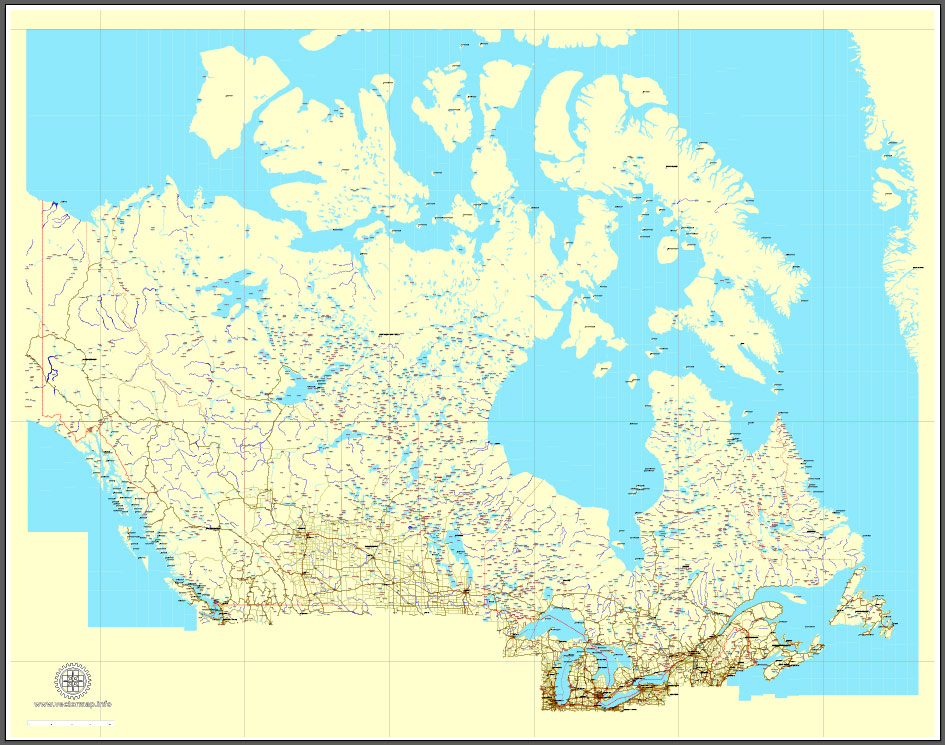
Download Free vector Map Canada, mainroads, cities, borders, province borders, Adobe Illustrator Text format street names, full editable, Layers: grownd, nombres, borders, symbols, halo
vector_map_canada_mainroads_mercator_projection_ai-ai
Download Free PDF Map Canada, mainroads, cities, borders, province borders, Adobe PDF Text format street names, full editable, Layers: grownd, nombres, borders, symbols, halo
vector_map_canada_mainroads_mercator_projection_pdf-pdf
Free vector map World, Adobe Illustrator, download now maps vector clipart
Map for design, projects, presentation free to use as you like.
See also: TERMS & CONDITIONS: SOFTWARE LICENSE AGREEMENT FOR DIGITAL CARTOGRAPHIC DATA.
Need more USA Vector Maps, printable and editable?

 Author: Kirill Shrayber, Ph.D. FRGS
 Street Map editable Adobe Illustrator in layers")
