Harrisburg, Pennsylvania, US printable vector street City Plan map, full editable, Adobe Illustrator, full vector, scalable, editable, text format street names, 4,5 mb ZIP
All streets, All buildings. Map for design, print, arts, projects, presentations.
PDF, DXF, CDR and other formats – on request, same price, please, contact
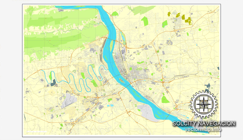
Harrisburg, Pennsylvania, USA.
This vector map of Harrisburg is used as a basis for design, editing, and further printing.
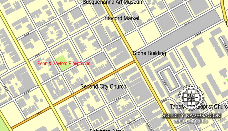
This is the most detailed, exact map of Harrisburg for high-quality printing and polygraphy. You can always clarify the map development date by contacting us.
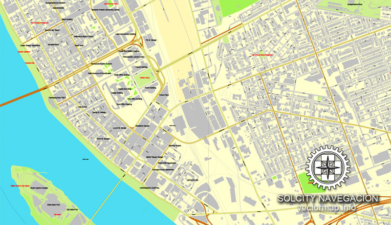
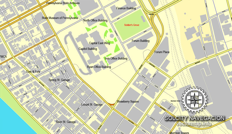
For your convenience, all objects on Harrisburg vector map are divided into layers. And the editing is very easy – colors, lines, etc.
You can easily add any objects needed (e.g. shops, salons, sale points, gas station or attraction) on any layer of Harrisburg vector map.
Harrisburg is the capital city of the Commonwealth of Pennsylvania in the United States, and the county seat of Dauphin County. With a population of 49,192, it is the 15th largest city in the Commonwealth. It lies on the east bank of the Susquehanna River, 107 miles (172 km) west of Philadelphia. Harrisburg is the anchor of the Susquehanna Valley metropolitan area, which had a 2017 estimated population of 571,903, making it the third most populous in Pennsylvania and 96th most populous in the United States.
One of the advantages of Harrisburg vector maps of our production is the relevance of cartographic data, we constantly update all our products.
This vector map of Harrisburg is used by:
designers, layout designers, printers, advertisers and architects. Our product – vector maps – is designed for further editing and printing in large formats – from @Wall format (a few meters) to A-0 and A-1, A-2, A-3.
Harrisburg map in vector format is used for design, urban planning, presentations and media visualizations.
Advertising and presentation map of Harrisburg (usually the final designer marks the routes, and puts the client’s objects (shops, saloons, gas stations etc.)
The undoubted advantage is that people will NEVER throw out this advertising product – the map. In fact, as an advertising medium, a map is the most “long-playing” of the well-known polygraphic advertising media, with the longest lifespan, and the maximum number of interactions with the customer.
For travelers, maps are sold at the airports and gas stations around the world. Often the source is our vector maps.
Take a look, who purchases our vector maps of Harrisburg in “Our Clients and Friends” page – these are large and small companies, from super-brands like Volvo and Starbucks, to small design studios and printing houses.
It’s very easy to work with vector maps of Harrisburg, even for a not very experienced designer who can turn on and off the map layers, add new objects, change the colors of fill and lines according to customer requirements.
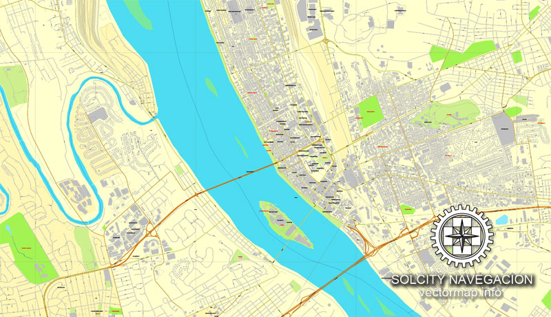
The undoubted advantage of Harrisburg vector maps in printing is an excellent and detailed visualization, when customer can expand a large paper map and instantly define his location, find a landmark, an object or address on map, unlike using the popular electronic formats of Google and Yandex maps for example.
Printable vector maps of Harrisburg are much more convenient and efficient than any electronic maps on your smartphone, because ALL DETAILS are displayed in the entire space of Harrisburg map.
Useful tips on working with vector maps of cities and countries in Adobe Illustrator.
«V» – launches the Selection tool (cursor, black arrow), which makes active any vector line.
«А» – launches the Direct Selection tool (white cursor), allows you to select curve elements and drag them to the desired place.
«R» – activates the Rotate tool, which helps you rotating selected objects around the center point by 360 degrees.
«E» – gives you the opportunity to use the Eraser tool and erase unnecessary parts.
«X» – switches between Fill and Stroke in the Tools section. Try to get used to this hot key and
you will quickly understand that you can’t live and work without it.
Guides are not limited to vertical and horizontal in Adobe Illustrator. You can also create a diagonal guide for example. Moreover, you can turn any contours into guides. Select the outline and go to View > Guides > Make Guides (Create Guides), or simply press Cmd/Ctrl + 5. You can also turn the guides back into an editable object. Go to menu, View > Guides > Unlock Guides (Release Guides), select the guide you want to edit and select View > Guides > Release Guides (Reset Guides), or just press Cmd/Ctrl + Option / Alt + 5).
You will probably want to change the color scheme used on our Harrisburg vector map.
To quickly and effectively play with colors.
Of course, you can do it manually, all objects in our Harrisburg vector map are divided according to types and layers, and you can easily change the color gamma of vector objects in groups and layers.
But there is more effective way of working with the whole VECTOR MAP of Harrisburg and all layers:
The overview dialog «Edit colors»/«Repaint Graphic Object» (this dialog box name can change depending on the context):
If you have selected a part or a layer of Harrisburg vector map and open the dialog box by clicking the icon in the Control panel, on the Samples palette or the Color Catalog, or if you choose Edit > Edit Colors> Repaint Graphic Object, then the «Repaint Graphic Object» dialog box appears, and you get access to «Assign» and «Edit» tabs.
If a picture or a map fragment is not selected, and you open the dialog box by clicking the icon in the Control panel, on the Samples palette or in the Color Catalog, the «Edit Colors» dialog box appears and you can only access the «Edit» tab.
Regardless of the name at the top of the dialog box, the right-hand side always displays the color group of the current document, as well as two default color groups: Print Color and Grayscale. These color groups can be selected and used any time.
Create and edit color groups of Harrisburg vector map, and also assign colors using the «Edit Colors»/ а «Repaint Graphic Object» dialog box.
A. Creating and editing of a color group on the «Edit» tab
B. Assigning colors on the «Assign» tab
C. Select a group of colors from the «Color groups» list
The option «Repaint a graphic object» in the lower part of the dialog box allows you to preview the colors on a selected layer of Vector map, or a group of elements, and specify whether its colors will be redefined when the dialog box is closed.
The main areas of the dialog box are:
«Edit»
The «Edit» tab is designed to create a new or edit the existing color groups.
The harmony rules Menu and the Color Wheel are used to conduct experiments with color harmonies. The color wheel shows how colors are related in color harmony, and the color bars allow you to view and manipulate an individual color values. In addition, you can adjust the brightness, add and remove colors, save color groups and view colors on the selected Vector Map of Harrisburg or a separated layers.
«Assign»
The «Assign» tab is used to view and control on how the original colors are replaced with colors from the color group like your corporate colors in the Vector Map of Harrisburg.
The assign color ability is provided only if the entire map, layer or fragment is selected in the document. You can specify which of new colors replace the current colors, whether the spot colors should be preserved and how colors are replaced (for example, you can replace colors completely or changing the color tone while maintaining the brightness). The «Assign» tab allows you to redefine colors in the Vector Map of Harrisburg, or in separate layers and fragments using the current color group or reducing the number of colors in the current Vector Map.
Color groups
Is a list of all saved color groups for current document (the same groups appear in the «Samples» palette). You can edit and delete the existing color groups, as well as creating a new ones using the list of “Color Groups” in the dialog box. All changes appear in the «Samples» palette.
The highlighted color group shows, which color group is currently edited.
Any color group can be selected and edited, or used to redefine the colors in the selected vector map of Harrisburg , its fragments or elements.
Saving a color group adds this group to the specified list.
Opening the «Edit Colors»/«Repaint Graphic Object» dialog box.
Open the «Edit Colors»/«Repaint Graphic Object» dialog box using one of the following methods:
«Edit»> «Edit Colors»> «Repaint Graphic object» or «Repaint With Style».
Use these commands if you need to edit the colors in the selected vector map of Harrisburg city.
«Repaint Graphic object» button on the «Control» panel.
Use this button if you need to adjust colors of Harrisburg vector map using the а «Repaint graphic object» dialog box.
The specified button is available if the selected vector map or its fragment contains two or more colors.
Note. This color editing method is convenient for global color adjustment in a vector map, if global colors were not used when creating a Map of Harrisburg.
The «Edit colors» button or «Edit or apply colors» on the «Color Catalog» palette
Click this button if you need to edit colors on the «Color Catalog» palette or edit and then apply them to the selected Vector Map of Harrisburg or its fragment.
The «Edit color group» button or «Edit or apply color group» on the «Samples» palette.
Click this button if you need to edit the colors in the specific color group or edit and apply them to the selected Vector Map of Harrisburg or a group of its elements, for example, the whole layer “Streets and lines”. You can also double-click the color group in the Samples panel to open the dialog box.
If the map file is too large and your computer freezes or even can’t open it quickly:
1. Try to reduce the color resolution of the video card (display) to 256 colors while working with a large map.
2. Using Windows Task Manager, select all the application you don’t need, while working with map, just turn them off.
3. Launch Adobe Illustrator. (DO NOT OPEN the vector map file)
4. Start the Windows Task Manager using administrator rights > Find the “Illustrator” process > set the «real time» priority,
5. Open the file. When you see the LEGACY FONT popup window – click “OK” (do not update). You can restore the TEXT later.
6. Can also be useful: When file is opened – Edit > Settings > Basic Settings > disable smoothing. /// It looks scary, but works quickly)))
We recommend saving the file in Adobe Illustrator 10 version. It’s much more stable when working with VERY BIG size files.
Topography
Harrisburg is located at 40°16′11″N 76°52′32″W (40.269789, -76.875613) in South Central Pennsylvania, within a four-hour drive of the metro areas of New York, Washington, Philadelphia, and Pittsburgh. According to the United States Census Bureau, the city has a total area of 11.4 square miles (30 km2), of which, 8.1 square miles (21 km2) of it is land and 3.3 square miles (8.5 km2) of it (29.11%) is water. Bodies of water include Paxton Creek which empties into the Susquehanna River at Harrisburg, as well as Wildwood Lake and Italian Lake parks.
Directly to the north of Harrisburg is the Blue Mountain ridge of the Appalachian Mountains. The Cumberland Valley lies directly to the west of Harrisburg and the Susquehanna River, stretching into northern Maryland. The fertile Lebanon Valley lies to the east. Harrisburg is the northern fringe of the historic Pennsylvania Dutch Country.
The city is the county seat of Dauphin County. The adjacent counties are Northumberland County to the north; Schuylkill County to the northeast; Lebanon County to the east; Lancaster County to the south; and York County to the southwest; Cumberland County to the west; and Perry County to the northwest.
Harrisburg played a notable role in American history during the Westward Migration, the American Civil War, and the Industrial Revolution. During part of the 19th century, the building of the Pennsylvania Canal and later the Pennsylvania Railroad allowed Harrisburg to become one of the most industrialized cities in the Northeastern United States. The U.S. Navy ship USS Harrisburg, which served from 1918 to 1919 at the end of World War I, was named in honor of the city. In the mid-to-late 20th century, the city’s economic fortunes fluctuated with its major industries consisting of government, heavy manufacturing, agriculture, and food services (nearby Hershey is home of the chocolate maker, located just 10 miles (16 km) east).
The Pennsylvania Farm Show, the largest free indoor agriculture exposition in the United States, was first held in Harrisburg in 1917 and has been held there every early-to-mid January since then. Harrisburg also hosts an annual outdoor sports show, the largest of its kind in North America, an auto show, which features a large static display of new as well as classic cars and is renowned nationwide, and Motorama, a two-day event consisting of a car show, motocross racing, remote control car racing, and more. Harrisburg is also known for the Three Mile Island accident, which occurred on March 28, 1979, near Middletown.
In 2010 Forbes rated Harrisburg as the second best place in the U.S. to raise a family. Despite the city’s recent financial troubles, in 2010 The Daily Beast website ranked 20 metropolitan areas across the country as being recession-proof, and the Harrisburg region landed at No. 7. The financial stability of the region is in part due to the high concentration of state and federal government agencies.
Small guide: How to work with the vector map?
You can: Mass select objects by type and color – for example, the objects type “building” (they are usually dark gray) – and remove them from the map, if you do not need them in your print or design project. You can also easily change the thickness of lines (streets), just bulk selection the road by the line color.
The streets are separated by type, for example, type “residential road” are usually white with a gray stroke. Highway usually orange with a brown or dark gray stroke.
It is easy to change the font of inscriptions, all or each individually. Also, just can be make and any other manipulation of objects on the vector map in Adobe illustrator format.
Important: All the proportions on the map are true, that is, the relative sizes of the objects are true, because Map is based on an accurate GPS projection, and It transated into the (usual for all) the Mercator projection.
You can easily change the color, stroke and fill of any object on the map, zoom without loss of quality Image Verification.
Select object

Bulk selection the same objects on the vector map

See the bulk selected objects on the vector map

Bulk delete buildungs from the vector map

Select residencial road (small street) on the vector map

Bulk selection the same lines (streets, roads) on the full map

Create fat lines of the streets on the vector maps (bulk action) 1

Create fat lines of the streets on the vector maps (bulk action) 2

Create fat lines of the streets on the vector maps (bulk action) 3

You can easily change the color, stroke and fill of any object on the map, zoom without loss of quality Image Verification.

 Author: Kirill Shrayber, Ph.D. FRGS


