Extended Description of the Vector Map
Printable PDF Vector Map of Gettysburg South Dakota USA High detailed street map scale 1:3321 fully editable Layered Adobe PDF scalable, text format all names, 3 MB ZIP
All street names, Main Objects, Buildings. Map for design, printing, arts, projects, presentations, for architects, designers, and builders, business, logistics.
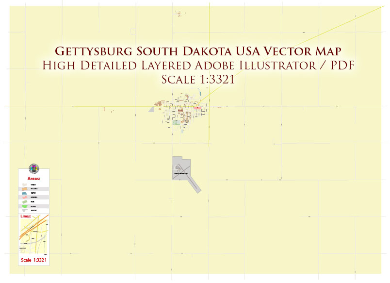
Gettysburg South Dakota USA PDF Map Vector Exact Plan High Detailed Street Map editable Adobe PDF in layers
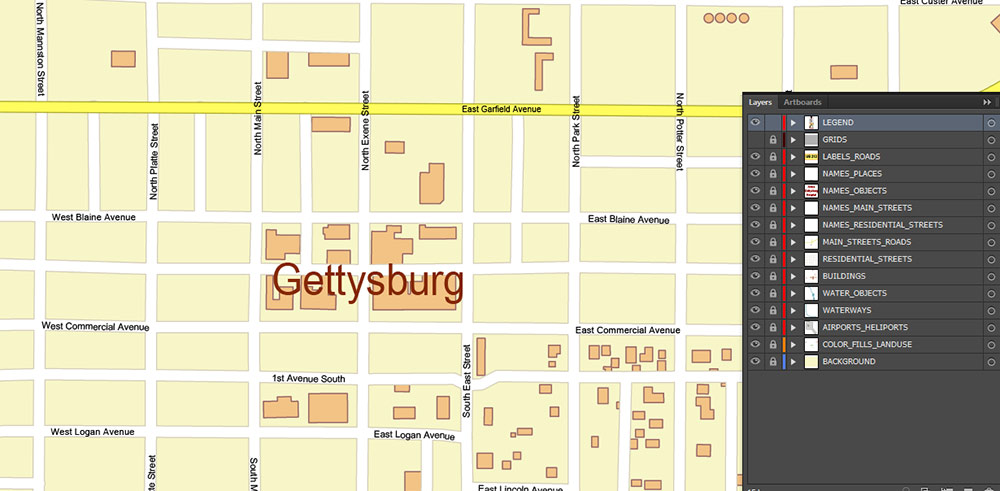
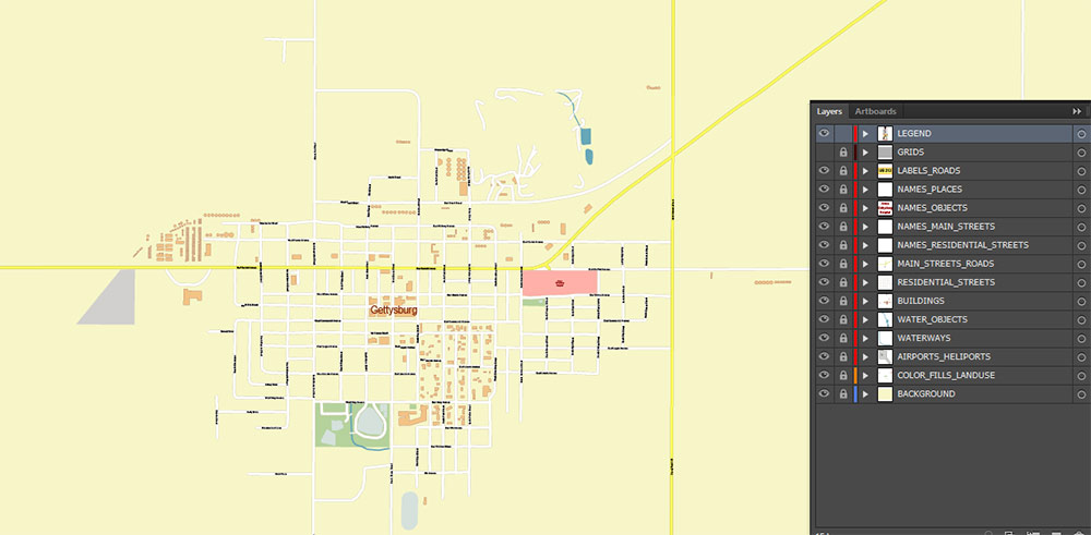
Layers list:
- Legend
- Names of places (city, hamlet, etc.)
- Names of objects (parks, hospital, water)
- Names of main streets
- Names of residential streets
- Main Streets, roads
- Residential streets
- Buildings
- Water objects (rivers, lakes, ponds)
- Waterways
- Color fills (parks, land use, etc.)
- Background
The most exact and detailed map of the Gettysburg South Dakota USA in scale.
For Editing and High-Quality Printing
Overview
Gettysburg is a small city in the north-central part of South Dakota, serving as the county seat of Potter County, South Dakota. The town lies near the 45th parallel north, making it roughly halfway between the equator and the North Pole. The population is modest, reflecting its rural Great Plains context.
Geography & Roads
-
The total land area of the city is about 1.9 square miles (≈4.9 km²) and there is virtually no inland water within the limits.
-
Elevation is approximately 2,060 feet (≈629 m) above sea level.
-
The terrain around Gettysburg is typical of the prairie region: relatively flat to gently rolling, used largely for agriculture and pasture, with minimal forest cover.
-
In terms of major roads:
-
U.S. Route 212 runs east-west through or near the town, acting as a principal corridor for travel and commerce.
-
U.S. Route 83 passes nearby (north-south) and intersects with or is in the vicinity of the town’s road network, providing a regional link.
-
Within the town you’ll find a grid of local streets (e.g., numbered avenues and named streets) branching off from the major highway alignment.
-
The climate is continental, with cold winters and warm summers, and precipitation moderate for the plains — the environment supports grassland and agricultural uses rather than dense forest.
Demographics
-
As of the 2020 census, the population stood at approximately 1,104 residents.
-
More recent estimates (2023) suggest around 1,340 residents, indicating slight fluctuations.
-
Median age is relatively high (mid-40s), reflecting that the community has a substantial older adult component.
-
Household size is small: average persons per household is about 2.2.
-
Racial/ethnic composition: majority White (≈80-90 %), with smaller percentages of African American, Asian, Native American and people of two or more races.
-
Housing: Most homes are owner-occupied; single-family detached dwelling types dominate the residential stock.
-
Income & economy: Median household income is moderate for the region (in the ballpark of US $59,000 in recent years) and poverty levels are lower than some very rural communities though economic opportunity is limited compared to urban areas.
Key Human Terrain & Takeaways
-
The community is small, stable, and rural in character — farming and service-oriented local businesses form much of the economic base.
-
Because of its age profile and small population base, local services (healthcare, education, recreation) are more limited than in larger towns.
-
Being situated along U.S. 212 and near U.S. 83 confers some connectivity advantage for logistics, transport of agricultural goods, and travel relative to more isolated hamlets.
-
For logistical or operational planning: Gettysburg offers predictable prairie terrain, low urban congestion, straightforward road access via the highway corridor, but fewer amenities and a smaller workforce pool than larger regional centres.
Gettysburg South Dakota USA PDF Map Vector Exact Plan High Detailed Street Map editable Adobe PDF in layers
Gettysburg South Dakota USA PDF Map Vector Exact Plan High Detailed Street Map editable Adobe PDF in layers

 Author: Kirill Shrayber, Ph.D. FRGS


