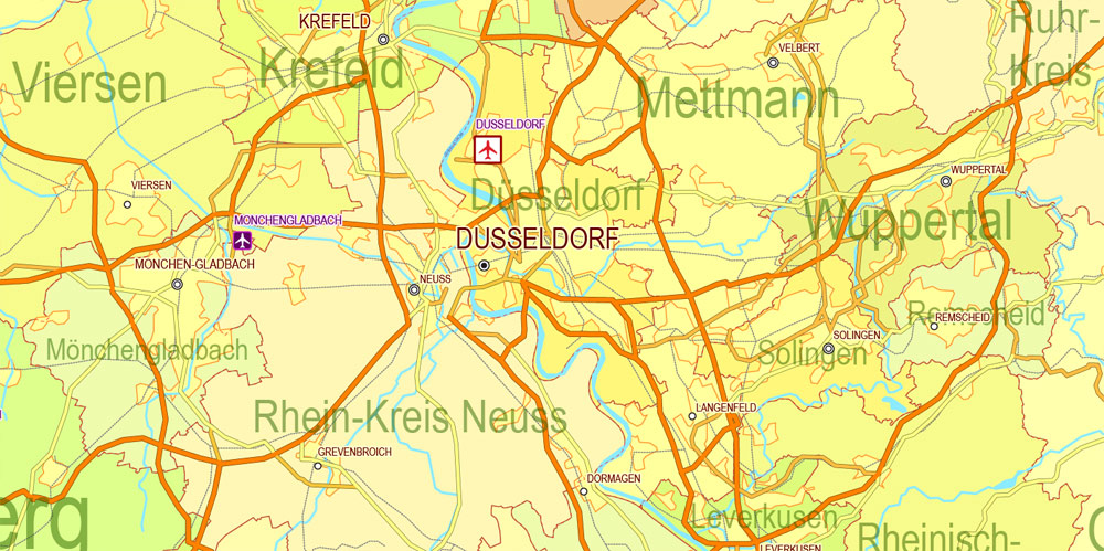
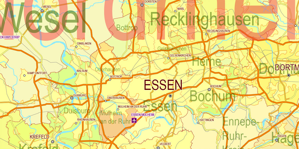
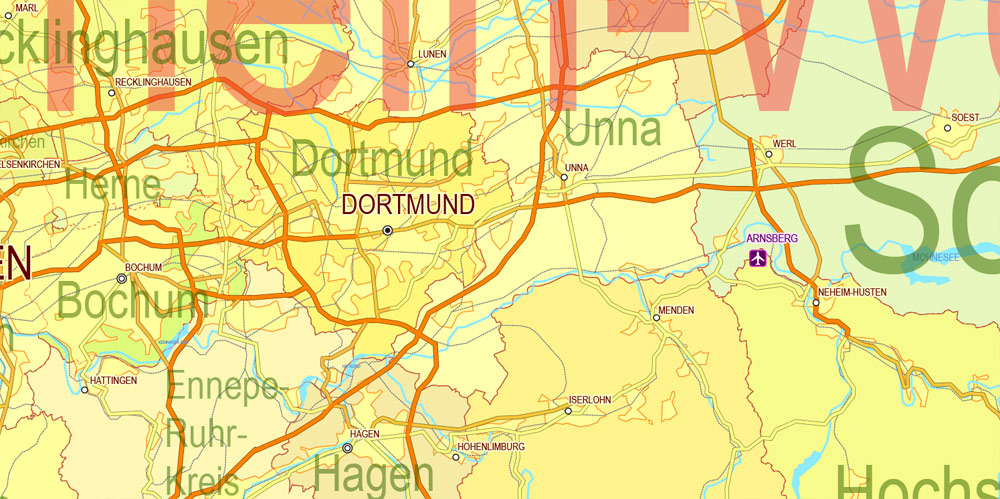
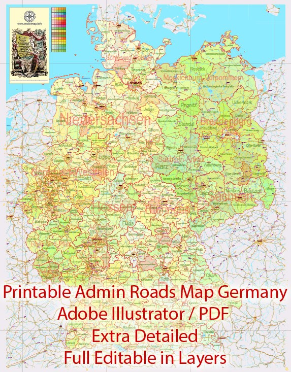
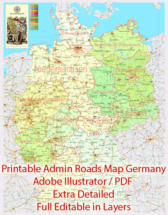
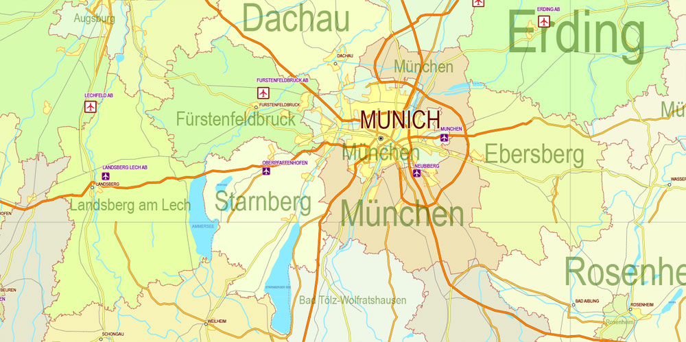
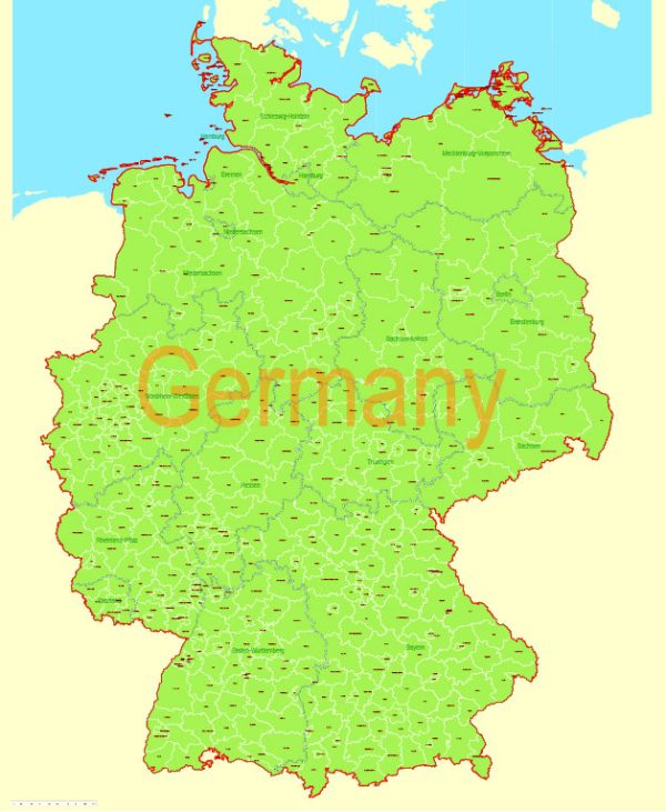
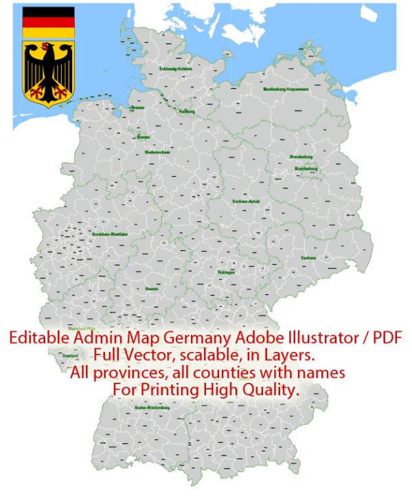
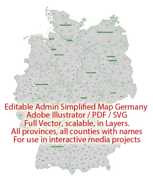
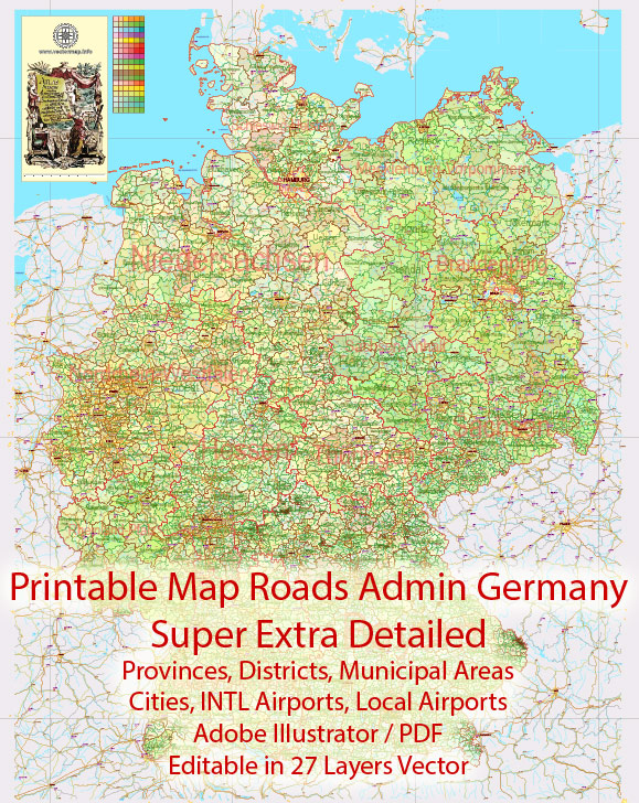
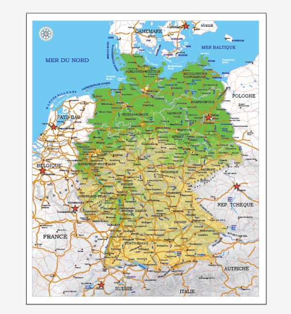
Germany PDF Map Administrative Divisions 01 Provinces (States), Districts Printable Editable Map + Roads, Cities, Airports, Railroads Adobe PDF

  1. Home
  2. Europe maps
  3. Germany cities vector maps: PDF and Adobe Illustrator
  4. Germany PDF Map Administrative Divisions 01 Provinces (States), Districts Printable Editable Map + Roads, Cities, Airports, Railroads Adobe PDF

WhatsApp us! If you have any questions, please, feel free to contact us via WhatsApp +1.829.4100078

We accept PayPal and all  Debit or Credit Cards | Instantly Download Your Map after payment.
Verified Seller 10+ years.

$ 58.00

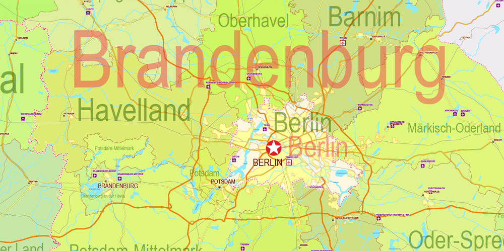
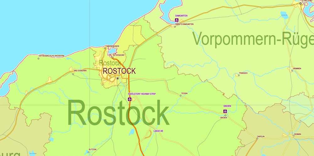
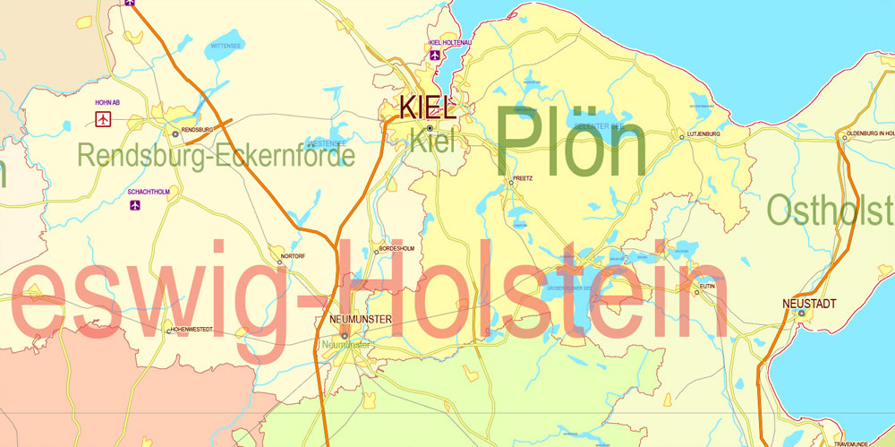
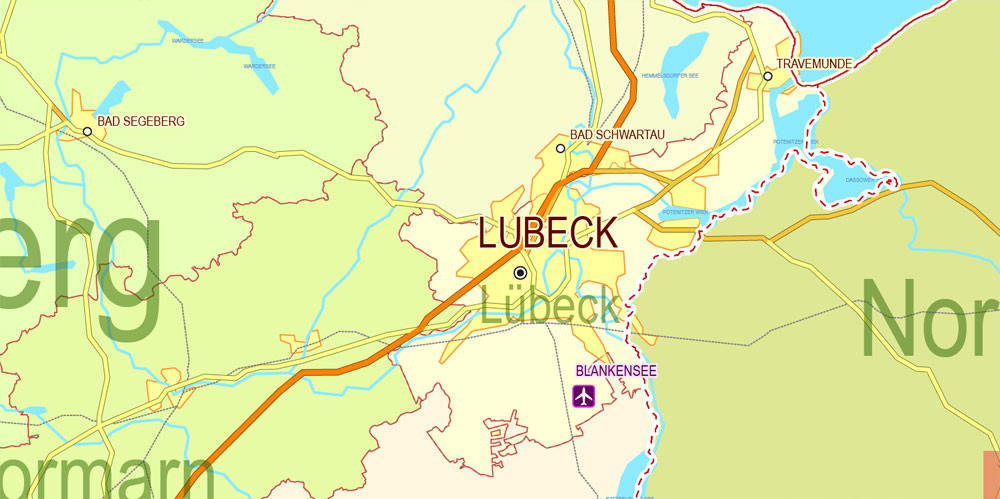
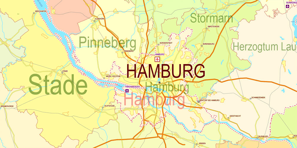
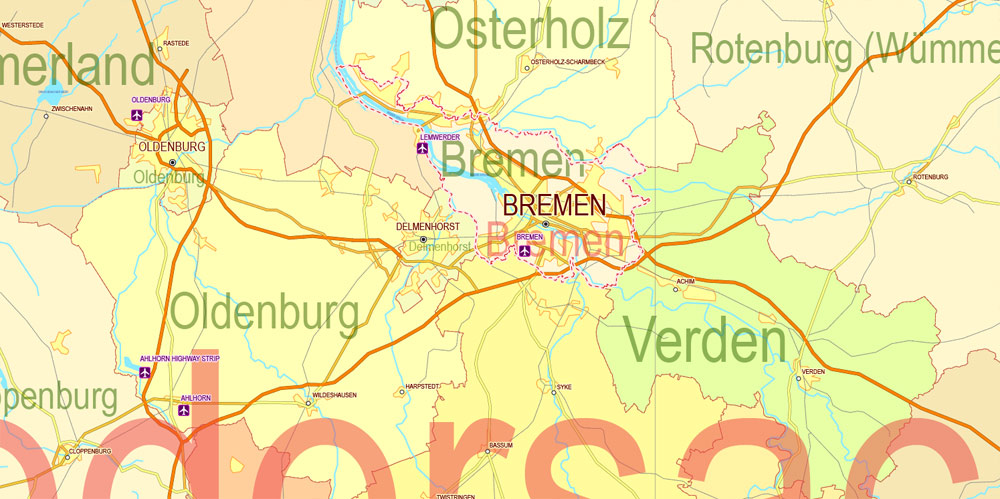
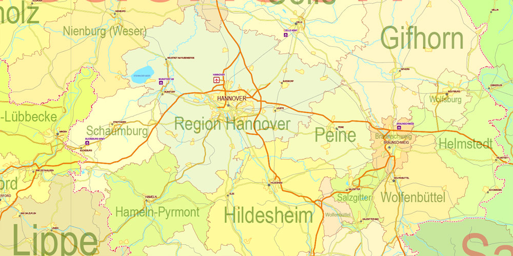
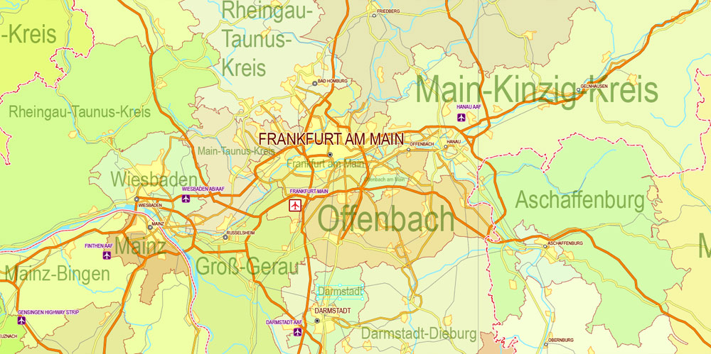
Printable Editable PDF Map Germany Administrative Divisions – Provinces (States), Districts, Roads, Cities, Airports, Railroads Adobe PDF,  scalable, editable text format  names, 57 Mb ZIP.
All provinces and districts named. Map for publishing, design, printing, publications, arts, projects, presentations, for architects, designers and builders, business, logistics. The most exact and detailed map of the Germany administrative divisions.
Separated layers: provinces, borders provinces, districts, water objects, names_water, names provinces, urban_areas, names_districta, grids, roads. railroads, Cities, airports, etc.

SKU: 2018.24.04.GE.ADM.PD.RM.PDF
Share this map for your friends!

Taxonomy: Product Tags for this Vector Map

AutoCAD Map Germany full, City Map Germany full, City Plan Germany full, CorelDraw Map Germany full, DWG Map Germany full, DXF Map Germany full, Editable Map Germany full, Germany full City Vector Map, Germany full Map, Illustrator Map Germany full, Map Germany full for Printing, PDF and Adobe Illustrator Map Germany full: Editable Vector Maps, printable map Germany full, Road Map Germany full, Street Map Germany full, Tourist Map Germany full, Urban Plan Germany full, Vector Map Germany full

Map Categories

Countries full vector maps: PDF and Adobe Illustrator, Europe maps, Germany cities vector maps: PDF and Adobe Illustrator

Extended Description of the Vector Map

Printable Editable PDF Map Germany Administrative Divisions – Provinces (States), Districts, Roads, Cities, Airports, Railroads Adobe PDF,  scalable, editable text format  names, 57 Mb ZIP.
All provinces and districts named. Map for publishing, design, printing, publications, arts, projects, presentations, for architects, designers and builders, business, logistics. The most exact and detailed map of the Germany administrative divisions.
Separated layers: provinces, borders provinces, districts, water objects, names_water, names provinces, urban_areas, names_districta, grids, roads. railroads, Cities, airports, etc.
DWG, DXF, CDR and other formats – by request, same price, please contact.


Germany.

This vector map of Germany is used as a basis for design, editing, and further printing.

This is the most detailed, exact map of Germany for high-quality printing and polygraphy. You can always clarify the map development date by contacting us.

For your convenience, all objects on Germany vector map are divided into layers. And the editing is very easy – colors, lines, etc.

You can easily add any objects needed (e.g. shops, salons, sale points, gas station or attraction) on any layer of Germany vector map.

Germany is a country in Central and Western Europe, lying between the Baltic and North seas to the north, and the Alps to the south. It borders Denmark to the north, Poland and the Czech Republic to the east, Austria and Switzerland to the south, and France, Luxembourg, Belgium and the Netherlands to the west. Germany includes 16 constituent states, covers an area of 357,386 square kilometres (137,988 sq mi), and has a largely temperate seasonal climate.
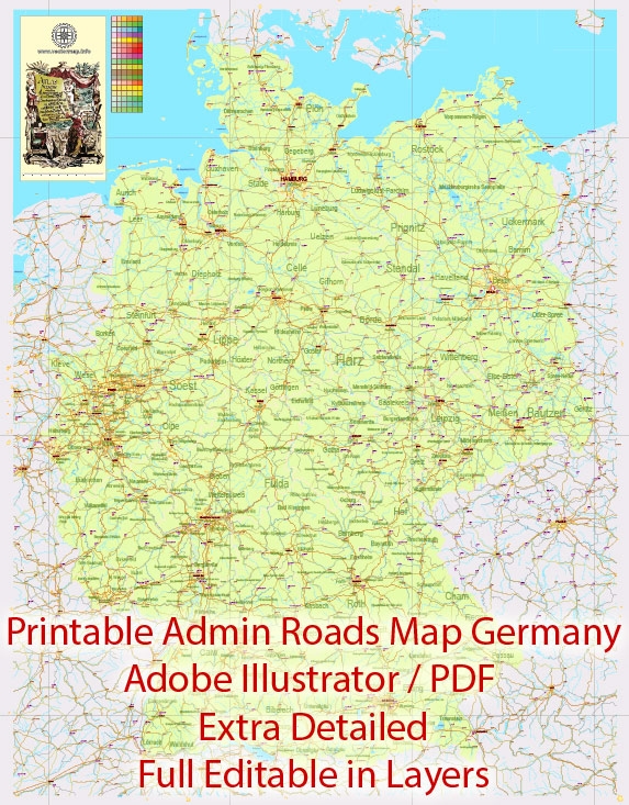
Printable Editable Map Germany Administrative Divisions - Provinces, Districts, Roads, Cities, Airports, Railroads Adobe Illustrator,  scalable, editable text format  names, 26 Mb ZIP.

One of the advantages of Germany vector maps of our production is the relevance of cartographic data, we constantly update all our products.

This vector map of Germany is used by:
designers, layout designers, printers, advertisers and architects. Our product – vector maps – is designed for further editing and printing in large formats – from @Wall format (a few meters) to A-0 and A-1, A-2, A-3.

The Germany map in vector format is used for design, urban planning, presentations and media visualizations.

The advertising and presentation map of Germany (usually the final designer marks the routes, and puts the client’s objects (shops, saloons, gas stations etc.)
The undoubted advantage is that people will NEVER throw out this advertising product – the map. In fact, as an advertising medium, a map is the most “long-playing” of the well-known polygraphic advertising media, with the longest lifespan, and the maximum number of interactions with the customer.
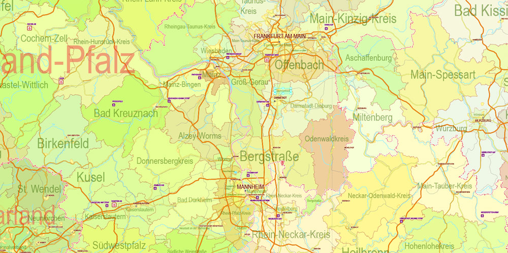
Printable Editable Map Germany Administrative Divisions - Provinces, Districts, Roads, Cities, Airports, Railroads Adobe Illustrator,  scalable, editable text format  names, 26 Mb ZIP.

For travelers, maps are sold at the airports and gas stations around the world. Often the source is our vector maps.

Take a look, who purchases our vector maps of Germany in “Our Clients and Friends” page – these are large and small companies, from super-brands like Volvo and Starbucks, to small design studios and printing houses.

It’s very easy to work with vector maps of Germany city, even for a not very experienced designer who can turn on and off the map layers, add new objects, change the colors of fill and lines according to customer requirements.

The undoubted advantage of Germany vector maps in printing is an excellent and detailed visualization, when customer can expand a large paper map and instantly define his location, find a landmark, an object or address on map, unlike using the popular electronic formats of Google and Yandex maps for example.

Printable vector maps of Germany are much more convenient and efficient than any electronic maps on your smartphone, because ALL DETAILS are displayed in the entire space of Germany map.
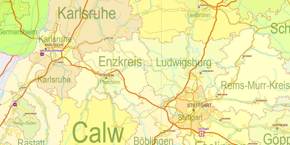
Printable Editable Map Germany Administrative Divisions - Provinces, Districts, Roads, Cities, Airports, Railroads Adobe Illustrator,  scalable, editable text format  names, 26 Mb ZIP.

Useful tips on working with vector maps of cities and countries in Adobe Illustrator.

«V» – launches the Selection tool (cursor, black arrow), which makes active any vector line.
«А» – launches the Direct Selection tool (white cursor), allows you to select curve elements and drag them to the desired place.
«R» – activates the Rotate tool, which helps you rotating selected objects around the center point by 360 degrees.
«E» – gives you the opportunity to use the Eraser tool and erase unnecessary parts.
«X» – switches between Fill and Stroke in the Tools section. Try to get used to this hot key and
you will quickly understand that you can’t live and work without it.

Guides are not limited to vertical and horizontal in Adobe Illustrator. You can also create a diagonal guide for example. Moreover, you can turn any contours into guides. Select the outline and go to View > Guides > Make Guides (Create Guides), or simply press Cmd/Ctrl + 5. You can also turn the guides back into an editable object. Go to menu, View > Guides > Unlock Guides (Release Guides), select the guide you want to edit and select View > Guides > Release Guides (Reset Guides), or just press Cmd/Ctrl + Option / Alt + 5).

With nearly 83 million inhabitants, it is the second most populous state of Europe after Russia, the most populous state lying entirely in Europe, as well as the most populous member state of the European Union. Germany is a very decentralized country. Its capital and largest metropolis is Berlin, while Frankfurt serves as its financial capital and has the country’s busiest airport. Many federal institutions have their (secondary) seat in the Federal city of Bonn. Germany’s largest conurbation is the Ruhr, with its main centres of Dortmund and Essen. The country’s other major cities are Hamburg, Munich, Cologne, Stuttgart, Düsseldorf, Leipzig, Bremen, Dresden, Hannover, and Nuremberg.
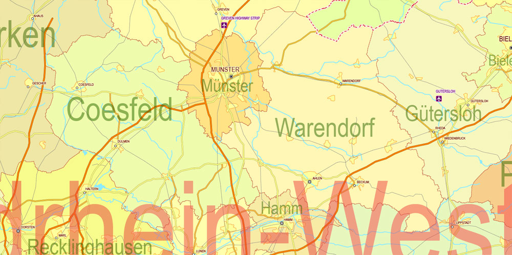
Printable Editable Map Germany Administrative Divisions - Provinces, Districts, Roads, Cities, Airports, Railroads Adobe Illustrator,  scalable, editable text format  names, 26 Mb ZIP.

You will probably want to change the color scheme used on our Germany vector map.

To quickly and effectively play with colors.
Of course, you can do it manually, all objects in our Germany vector map are divided according to types and layers, and you can easily change the color gamma of vector objects in groups and layers.

But there is more effective way of working with the whole VECTOR MAP of Germany and all layers:

The overview dialog «Edit colors»/«Repaint Graphic Object» (this dialog box name can change depending on the context):

If you have selected a part or a layer of Germany vector map and open the dialog box by clicking the icon in the Control panel, on the Samples palette or the Color Catalog, or if you choose Edit > Edit Colors> Repaint Graphic Object, then the «Repaint Graphic Object» dialog box appears, and you get access to «Assign» and «Edit» tabs.
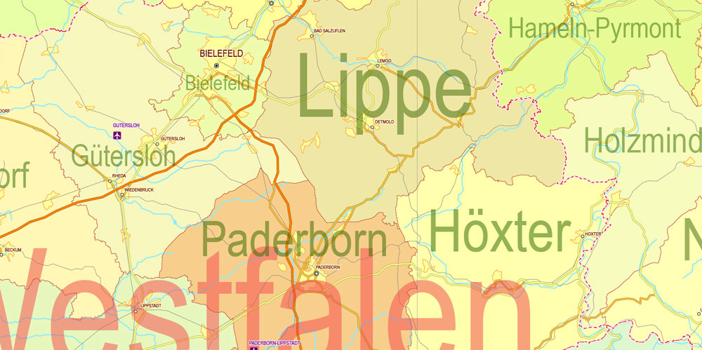
Printable Editable Map Germany Administrative Divisions - Provinces, Districts, Roads, Cities, Airports, Railroads Adobe Illustrator,  scalable, editable text format  names, 26 Mb ZIP.

If a picture or a map fragment is not selected, and you open the dialog box by clicking the icon in the Control panel, on the Samples palette or in the Color Catalog, the «Edit Colors» dialog box appears and you can only access the «Edit» tab.

Regardless of the name at the top of the dialog box, the right-hand side always displays the color group of the current document, as well as two default color groups: Print Color and Grayscale. These color groups can be selected and used any time.

Various Germanic tribes have inhabited the northern parts of modern Germany since classical antiquity. A region named Germania was documented before 100 AD. During the Migration Period, the Germanic tribes expanded southward. Beginning in the 10th century, German territories formed a central part of the Holy Roman Empire. During the 16th century, northern German regions became the centre of the Protestant Reformation. After the collapse of the Holy Roman Empire, the German Confederation was formed in 1815. The German revolutions of 1848–49 resulted in the Frankfurt Parliament establishing major democratic rights.
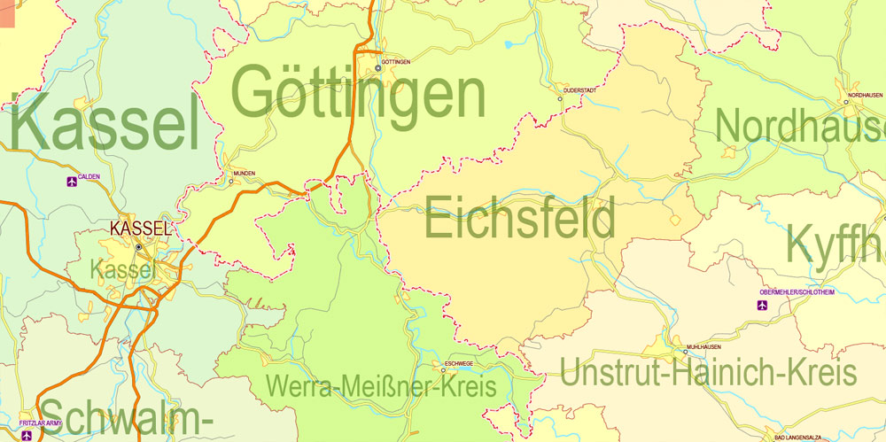
Printable Editable Map Germany Administrative Divisions - Provinces, Districts, Roads, Cities, Airports, Railroads Adobe Illustrator,  scalable, editable text format  names, 26 Mb ZIP.

Create and edit color groups of Germany vector map, and also assign colors using the «Edit Colors»/ а «Repaint Graphic Object» dialog box.

A. Creating and editing of a color group on the «Edit» tab
B. Assigning colors on the «Assign» tab
C. Select a group of colors from the «Color groups» list
The option «Repaint a graphic object» in the lower part of the dialog box allows you to preview the colors on a selected layer of Vector map, or a group of elements, and specify whether its colors will be redefined when the dialog box is closed.

The main areas of the dialog box are:

«Edit»
The «Edit» tab is designed to create a new or edit the existing color groups.
The harmony rules Menu and the Color Wheel are used to conduct experiments with color harmonies. The color wheel shows how colors are related in color harmony, and the color bars allow you to view and manipulate an individual color values. In addition, you can adjust the brightness, add and remove colors, save color groups and view colors on the selected Vector Map of Germany or a separated layers.

«Assign»
The «Assign» tab is used to view and control on how the original colors are replaced with colors from the color group like your corporate colors in the Vector Map of Germany city.

In 1871, Germany became a nation state when most of the German states (most notably excluding Switzerland and Austria) unified into the Prussian-dominated German Empire. After World War I and the revolution of 1918–19, the Empire was replaced by the parliamentary Weimar Republic. The Nazi seizure of power in 1933 led to the establishment of a dictatorship, World War II and the Holocaust. After the end of World War II in Europe and a period of Allied occupation, two German states were founded: West Germany, formed from the American, British, and French occupation zones, and East Germany, formed from the Soviet occupation zone.
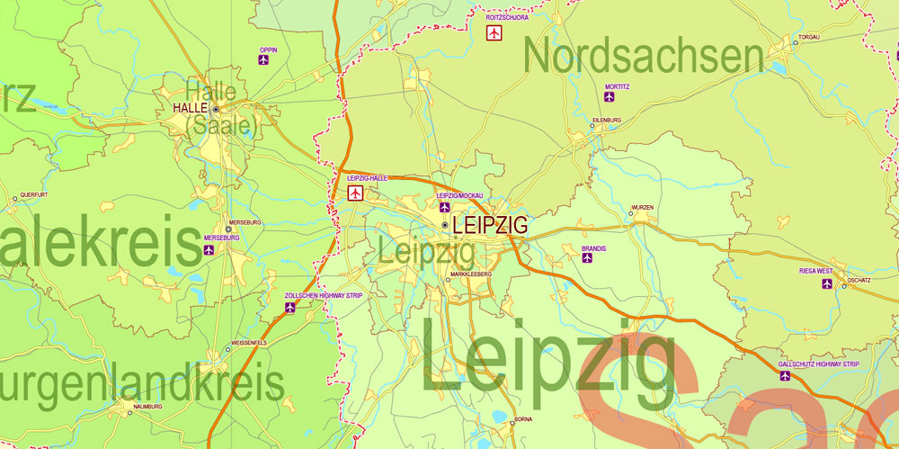
Printable Editable Map Germany Administrative Divisions - Provinces, Districts, Roads, Cities, Airports, Railroads Adobe Illustrator,  scalable, editable text format  names, 26 Mb ZIP.

The assign color ability is provided only if the entire map, layer or fragment is selected in the document. You can specify which of new colors replace the current colors, whether the spot colors should be preserved and how colors are replaced (for example, you can replace colors completely or changing the color tone while maintaining the brightness). The «Assign» tab allows you to redefine colors in the Vector Map of Germany city, or in separate layers and fragments using the current color group or reducing the number of colors in the current Vector Map.

Color groups

Is a list of all saved color groups for current document (the same groups appear in the «Samples» palette). You can edit and delete the existing color groups, as well as creating a new ones using the list of “Color Groups” in the dialog box. All changes appear in the «Samples» palette.
The highlighted color group shows, which color group is currently edited.

Following the Revolutions of 1989 that ended communist rule in Central and Eastern Europe, the country was reunified on 3 October 1990. Today, the sovereign state of Germany is a federal parliamentary republic with an elected president. It is a great power with a strong economy; it has the world’s fourth-largest economy by nominal GDP, and the fifth-largest by PPP. As a global leader in several industrial and technological sectors, it is both the world’s third-largest exporter and importer of goods. A developed country with a very high standard of living, it upholds a social security and universal health care system, environmental protection, and a tuition-free university education.
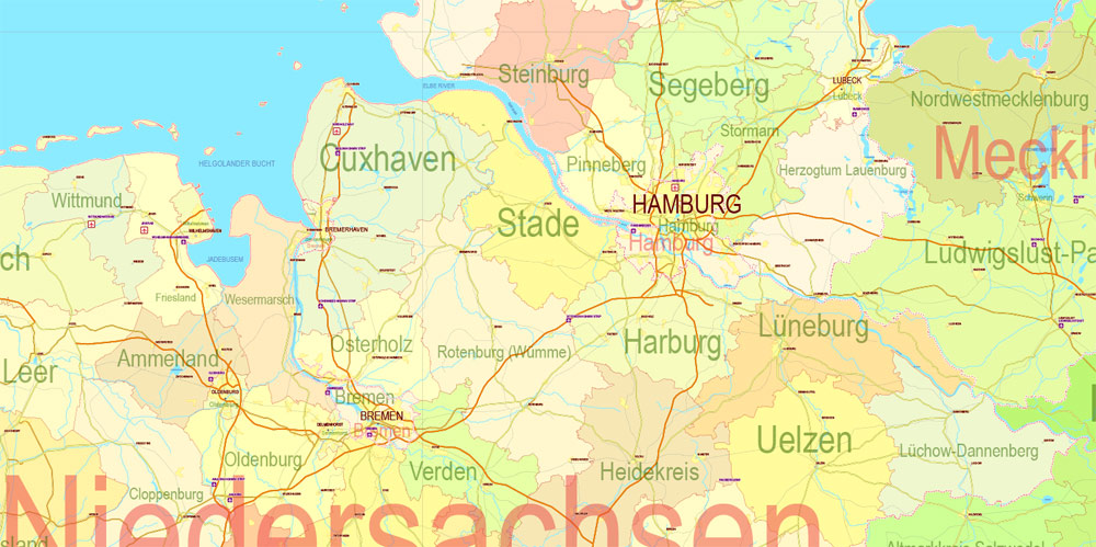
Printable Editable Map Germany Administrative Divisions - Provinces, Districts, Roads, Cities, Airports, Railroads Adobe Illustrator,  scalable, editable text format  names, 26 Mb ZIP.

Any color group can be selected and edited, or used to redefine the colors in the selected vector map of Germany city, its fragments or elements.

Saving a color group adds this group to the specified list.
Opening the «Edit Colors»/«Repaint Graphic Object» dialog box.
Open the «Edit Colors»/«Repaint Graphic Object» dialog box using one of the following methods:
«Edit»> «Edit Colors»> «Repaint Graphic object» or «Repaint With Style».

Use these commands if you need to edit the colors in the selected vector map of Germany city.

«Repaint Graphic object» button on the «Control» panel.
Use this button if you need to adjust colors of Germany vector map using the а «Repaint graphic object» dialog box.

The specified button is available if the selected vector map or its fragment contains two or more colors.

Note. This color editing method is convenient for global color adjustment in a vector map, if global colors were not used when creating a Map of Germany.

The «Edit colors» button or «Edit or apply colors» on the «Color Catalog» palette

Click this button if you need to edit colors on the «Color Catalog» palette or edit and then apply them to the selected Vector Map of Germany or its fragment.
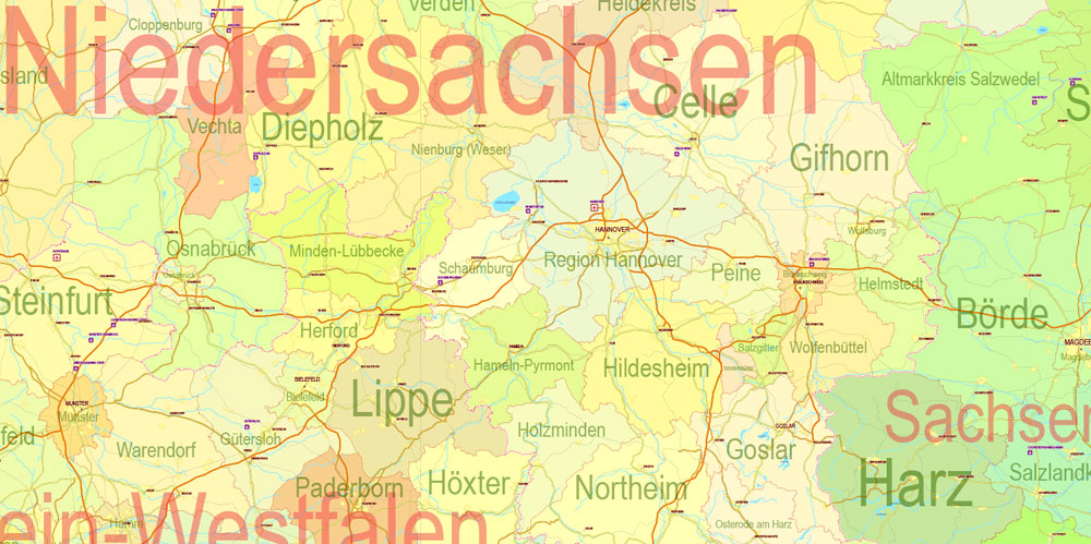
Printable Editable Map Germany Administrative Divisions - Provinces, Districts, Roads, Cities, Airports, Railroads Adobe Illustrator,  scalable, editable text format  names, 26 Mb ZIP.

The «Edit color group» button or «Edit or apply color group» on the «Samples» palette.

Click this button if you need to edit the colors in the specific color group or edit and apply them to the selected Vector Map of Germany or a group of its elements, for example, the whole layer “Streets and lines”. You can also double-click the color group in the Samples panel to open the dialog box.

If the map file is too large and your computer freezes or even can’t open it quickly:

1. Try to reduce the color resolution of the video card (display) to 256 colors while working with a large map.
2. Using Windows Task Manager, select all the application you don’t need, while working with map, just turn them off.
3. Launch Adobe Illustrator. (DO NOT OPEN the vector map file)
4. Start the Windows Task Manager using administrator rights > Find the “Illustrator” process > set the «real time» priority,
5. Open the file. When you see the LEGACY FONT popup window – click “OK” (do not update). You can restore the TEXT later.

6. Can also be useful: When file is opened – Edit > Settings > Basic Settings > disable smoothing. /// It looks scary, but works quickly)))
We recommend saving the file in Adobe Illustrator 10 version. It’s much more stable when working with VERY BIG size files.

The Federal Republic of Germany was a founding member of the European Economic Community in 1957 and the European Union in 1993. It is part of the Schengen Area and became a co-founder of the Eurozone in 1999. Germany is a member of the United Nations, NATO, the G7, the G20, and the OECD. Known for its rich cultural history, Germany has been continuously the home of influential and successful artists, philosophers, musicians, sportspeople, entrepreneurs, scientists, engineers, and inventors.
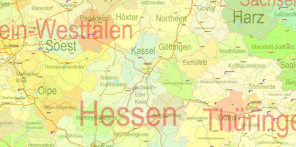
Printable Editable Map Germany Administrative Divisions - Provinces, Districts, Roads, Cities, Airports, Railroads Adobe Illustrator,  scalable, editable text format  names, 26 Mb ZIP.

Geography
Germany is in Western and Central Europe, with Denmark bordering to the north, Poland and the Czech Republic to the east, Austria to the southeast, Switzerland to the south-southwest, France, Luxembourg and Belgium lie to the west, and the Netherlands to the northwest. It lies mostly between latitudes 47° and 55° N and longitudes 5° and 16° E. Germany is also bordered by the North Sea and, at the north-northeast, by the Baltic Sea. With Switzerland and Austria, Germany also shares a border on the fresh-water Lake Constance, the third largest lake in Central Europe. German territory covers 357,021 km2 (137,847 sq mi), consisting of 349,223 km2 (134,836 sq mi) of land and 7,798 km2 (3,011 sq mi) of water. It is the seventh largest country by area in Europe and the 64th largest in the world. Elevation ranges from the mountains of the Alps (highest point: the Zugspitze at 2,962 metres or 9,718 feet) in the south to the shores of the North Sea (Nordsee) in the northwest and the Baltic Sea (Ostsee) in the northeast. The forested uplands of central Germany and the lowlands of northern Germany (lowest point: Wilstermarsch at 3.54 metres or 11.6 feet below sea level) are traversed by such major rivers as the Rhine, Danube and Elbe. Germany’s alpine glaciers are experiencing deglaciation. Significant natural resources include iron ore, coal, potash, timber, lignite, uranium, copper, natural gas, salt, nickel, arable land and water.
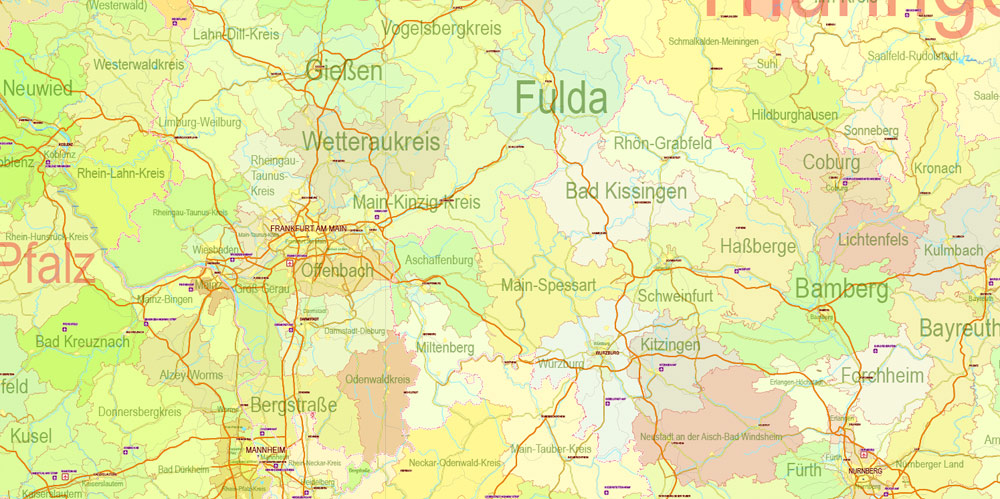
Printable Editable Map Germany Administrative Divisions - Provinces, Districts, Roads, Cities, Airports, Railroads Adobe Illustrator,  scalable, editable text format  names, 26 Mb ZIP.

Physical geography
The northern third of the country lies in the North European Plain, with flat terrain crossed by northward-flowing watercourses (Elbe, Ems, Weser, Oder). Wetlands and marshy conditions are found close to the Dutch border and along the Frisian coast. Sandy Mecklenburg in the northeast has many glacier-formed lakes dating to the last glacial period.
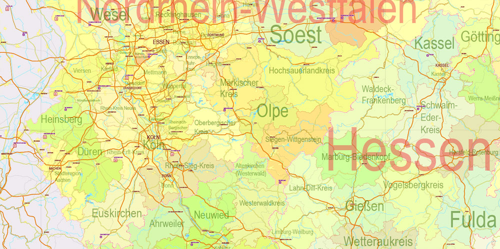
Printable Editable Map Germany Administrative Divisions - Provinces, Districts, Roads, Cities, Airports, Railroads Adobe Illustrator,  scalable, editable text format  names, 26 Mb ZIP.

Moving south, central Germany features rough and somewhat patternless hilly and mountainous countryside, some of it formed by ancient volcanic activity. The Rhine valley cuts through the western part of this region. The central uplands continue east and north as far as the Saale and merge with the Ore Mountains on the border with the Czech Republic. Upland regions include the Eifel, Hunsrück and Palatine Forest west of the Rhine, the Taunus hills north of Frankfurt, the Vogelsberg massif, the Rhön, and the Thüringer Wald. South of Berlin, the east-central part of the country is more like the low northern areas, with sandy soil and river wetlands such as the Spreewald region.
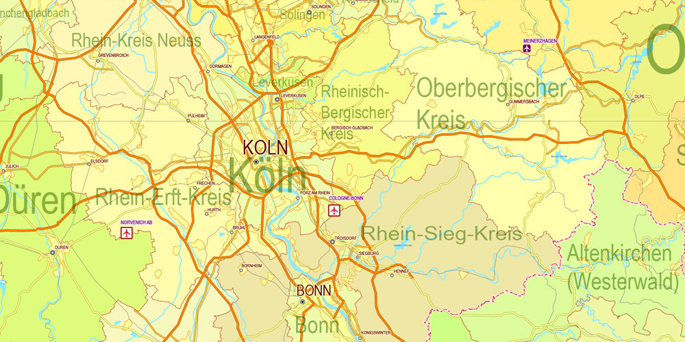
Printable Editable Map Germany Administrative Divisions - Provinces, Districts, Roads, Cities, Airports, Railroads Adobe Illustrator,  scalable, editable text format  names, 26 Mb ZIP.

Southern Germany’s landforms are defined by various linear hill and mountain ranges like the two adjacent ranges of the Swabian and Franconian Alb (reaching approximately from the source of the Danube in the southwest of Baden-Württemberg, south of Stuttgart, across Swabia into Central Franconia and to the valley of the river Main) and the Bavarian Forest along the border between Bavaria and the Czech Republic. The Alps on the southern border are the highest mountains, but relatively little Alpine terrain lies within Germany (in southeastern Swabia and Upper Bavaria) compared to Switzerland and Austria. The Black Forest, on the southwestern border with France, separates the Rhine from the headwaters of the Danube on its eastern slopes.
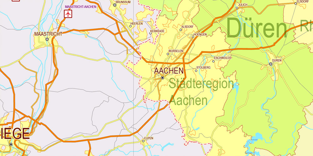
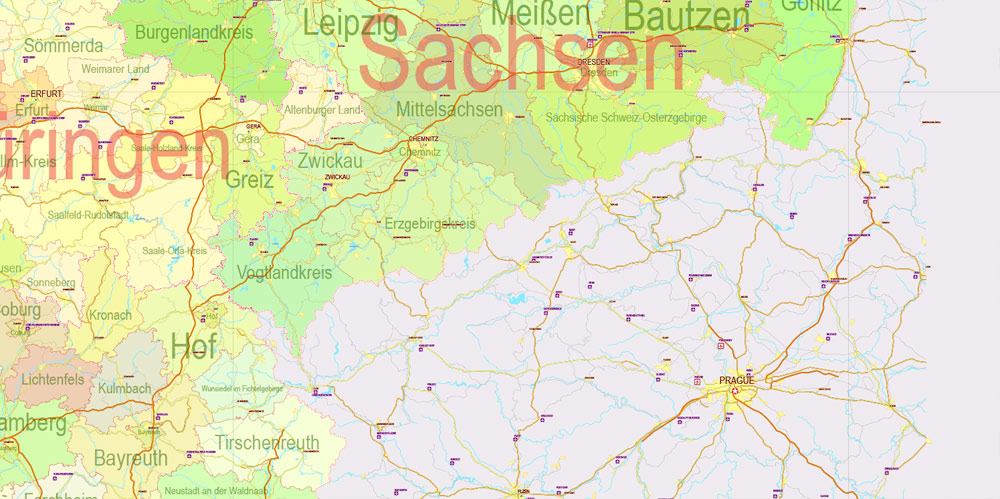
Printable Editable Map Germany Administrative Divisions - Provinces, Districts, Roads, Cities, Airports, Railroads Adobe Illustrator,  scalable, editable text format  names, 26 Mb ZIP.

Printable Editable Map Germany Administrative Divisions - Provinces, Districts, Roads, Cities, Airports, Railroads Adobe Illustrator,  scalable, editable text format  names, 26 Mb ZIP.

Printable Editable Map Germany Administrative Divisions - Provinces, Districts, Roads, Cities, Airports, Railroads Adobe Illustrator,  scalable, editable text format  names, 26 Mb ZIP.

Printable Editable Map Germany Administrative Divisions - Provinces, Districts, Roads, Cities, Airports, Railroads Adobe Illustrator,  scalable, editable text format  names, 26 Mb ZIP.

Printable Editable Map Germany Administrative Divisions - Provinces, Districts, Roads, Cities, Airports, Railroads Adobe Illustrator,  scalable, editable text format  names, 26 Mb ZIP.

Printable Editable Map Germany Administrative Divisions - Provinces, Districts, Roads, Cities, Airports, Railroads Adobe Illustrator,  scalable, editable text format  names, 26 Mb ZIP.

Printable Editable Map Germany Administrative Divisions - Provinces, Districts, Roads, Cities, Airports, Railroads Adobe Illustrator,  scalable, editable text format  names, 26 Mb ZIP.

Printable Editable Map Germany Administrative Divisions - Provinces, Districts, Roads, Cities, Airports, Railroads Adobe Illustrator,  scalable, editable text format  names, 26 Mb ZIP.

Printable Editable Map Germany Administrative Divisions - Provinces, Districts, Roads, Cities, Airports, Railroads Adobe Illustrator,  scalable, editable text format  names, 26 Mb ZIP.

Printable Editable Map Germany Administrative Divisions - Provinces, Districts, Roads, Cities, Airports, Railroads Adobe Illustrator,  scalable, editable text format  names, 26 Mb ZIP.


Germany
Country in Europe
Germany is a Western European country with a landscape of forests, rivers, mountain ranges and North Sea beaches. It has over 2 millennia of history. Berlin, its capital, is home to art and nightlife scenes, the Brandenburg Gate and many sites relating to WWII. Munich is known for its Oktoberfest and beer halls, including the 16th-century Hofbräuhaus. Frankfurt, with its skyscrapers, houses the European Central Bank.

Area
• Total 357,168 km2 (137,903 sq mi) (62nd)
Population
• 30.06.2016 estimate
Increase 82,349,400
• Density
232/km2 (600.9/sq mi)


List of districts of Germany

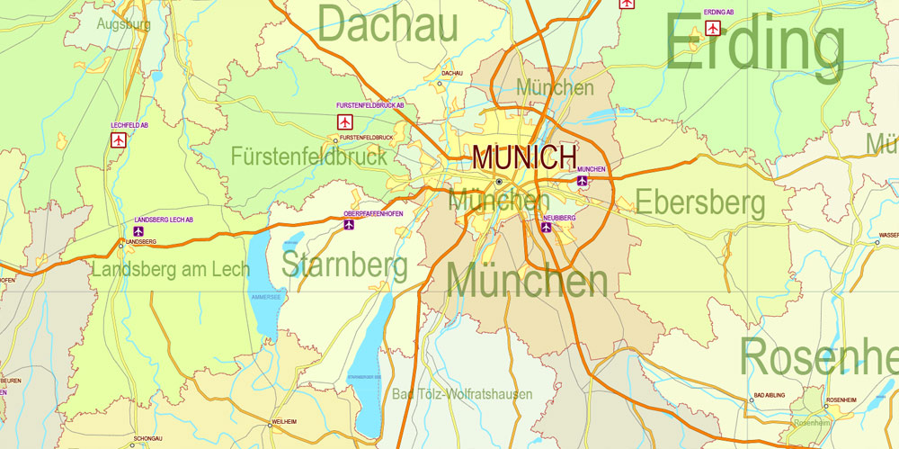
Germany is divided into 401 administrative districts; these consist of 294 rural districts (GermanKreise [in North Rhine-Westphalia and Schleswig-Holstein] and Landkreise), and 107 urban districts (German: Kreisfreie Städte or, in Baden-Württemberg only, Stadtkreise – cities that constitute districts in their own right).
District Form Land Capital
Aachen rural North Rhine-Westphalia Aachen
Aachen urban North Rhine-Westphalia
Ahrweiler rural Rhineland-Palatinate Bad Neuenahr-Ahrweiler
Aichach-Friedberg rural Bavaria Aichach
Alb-Donau rural Baden-Württemberg Ulm
Altenburger Land rural Thuringia Altenburg
Altenkirchen rural Rhineland-Palatinate Altenkirchen
Altmarkkreis Salzwedel rural Saxony-Anhalt Salzwedel
Altötting rural Bavaria Altötting
Alzey-Worms rural Rhineland-Palatinate Alzey
Amberg urban Bavaria
Amberg-Sulzbach rural Bavaria Amberg
Ammerland rural Lower Saxony Westerstede
Anhalt-Bitterfeld rural Saxony-Anhalt Köthen (Anhalt)
Ansbach rural Bavaria Ansbach
Ansbach urban Bavaria
Aschaffenburg rural Bavaria Aschaffenburg
Aschaffenburg urban Bavaria
Augsburg rural Bavaria Augsburg
Augsburg urban Bavaria
Aurich rural Lower Saxony Aurich
Bad Dürkheim rural Rhineland-Palatinate Bad Dürkheim
Bad Kissingen rural Bavaria Bad Kissingen
Bad Kreuznach rural Rhineland-Palatinate Bad Kreuznach
Bad Tölz-Wolfratshausen rural Bavaria Bad Tölz
Baden-Baden urban Baden-Württemberg
Bamberg rural Bavaria Bamberg
Bamberg urban Bavaria
Barnim rural Brandenburg Eberswalde
Bautzen rural Saxony Bautzen
Bayreuth rural Bavaria Bayreuth
Bayreuth urban Bavaria
Berchtesgadener Land rural Bavaria Bad Reichenhall
Bergstraße rural Hesse Heppenheim
Berlin urban Berlin
Bernkastel-Wittlich rural Rhineland-Palatinate Wittlich
Biberach rural Baden-Württemberg Biberach
Bielefeld urban North Rhine-Westphalia
Birkenfeld rural Rhineland-Palatinate Birkenfeld
Böblingen rural Baden-Württemberg Böblingen
Bochum urban North Rhine-Westphalia
Bodenseekreis rural Baden-Württemberg Friedrichshafen
Bonn urban North Rhine-Westphalia
Börde rural Saxony-Anhalt Haldensleben
Borken rural North Rhine-Westphalia Borken
Bottrop urban North Rhine-Westphalia
Brandenburg an der Havel urban Brandenburg
Braunschweig urban Lower Saxony
Breisgau-Hochschwarzwald rural Baden-Württemberg Freiburg
Bremen urban Bremen (state)
Bremerhaven urban Bremen (state)
Burgenlandkreis rural Saxony-Anhalt Naumburg
Calw rural Baden-Württemberg Calw
Celle rural Lower Saxony Celle
Cham rural Bavaria Cham
Chemnitz urban Saxony
Cleves (Kleve) rural North Rhine-Westphalia Cleves (Kleve)
Cloppenburg rural Lower Saxony Cloppenburg
Coburg rural Bavaria Coburg
Coburg urban Bavaria
Cochem-Zell rural Rhineland-Palatinate Cochem
Coesfeld rural North Rhine-Westphalia Coesfeld
Cologne (Köln) urban North Rhine-Westphalia
Cottbus urban Brandenburg
Cuxhaven rural Lower Saxony Cuxhaven
Dachau rural Bavaria Dachau
Dahme-Spreewald rural Brandenburg Lübben
Darmstadt urban Hesse
Darmstadt-Dieburg rural Hesse Darmstadt
Deggendorf rural Bavaria Deggendorf
Delmenhorst urban Lower Saxony
Dessau-Roßlau urban Saxony-Anhalt
Diepholz rural Lower Saxony Diepholz
Dillingen rural Bavaria Dillingen
Dingolfing-Landau rural Bavaria Dingolfing
Dithmarschen rural Schleswig-Holstein Heide
Donau-Ries rural Bavaria Donauwörth
Donnersbergkreis rural Rhineland-Palatinate Kirchheimbolanden
Dortmund urban North Rhine-Westphalia
Dresden urban Saxony
Duisburg urban North Rhine-Westphalia
Düren rural North Rhine-Westphalia Düren
Düsseldorf urban North Rhine-Westphalia
Ebersberg rural Bavaria Ebersberg
Eichsfeld rural Thuringia Heilbad Heiligenstadt
Eichstätt rural Bavaria Eichstätt
Eifelkreis Bitburg-Prüm rural Rhineland-Palatinate Bitburg
Eisenach urban Thuringia
Elbe-Elster rural Brandenburg Herzberg
Emden urban Lower Saxony
Emmendingen rural Baden-Württemberg Emmendingen
Emsland rural Lower Saxony Meppen
Ennepe-Ruhr-Kreis rural North Rhine-Westphalia Schwelm
Enz rural Baden-Württemberg Pforzheim
Erding rural Bavaria Erding
Erfurt urban Thuringia
Erlangen urban Bavaria
Erlangen-Höchstadt rural Bavaria Erlangen
Erzgebirgskreis rural Saxony Annaberg-Buchholz
Essen urban North Rhine-Westphalia
Esslingen rural Baden-Württemberg Esslingen am Neckar
Euskirchen rural North Rhine-Westphalia Euskirchen
Flensburg urban Schleswig-Holstein
Forchheim rural Bavaria Forchheim
Frankenthal urban Rhineland-Palatinate
Frankfurt am Main urban Hesse
Frankfurt an der Oder urban Brandenburg
Freiburg im Breisgau urban Baden-Württemberg
Freising rural Bavaria Freising
Freudenstadt rural Baden-Württemberg Freudenstadt
Freyung-Grafenau rural Bavaria Freyung
Friesland rural Lower Saxony Jever
Fulda rural Hesse Fulda
Fürstenfeldbruck rural Bavaria Fürstenfeldbruck
Fürth rural Bavaria Zirndorf
Fürth urban Bavaria
Garmisch-Partenkirchen rural Bavaria Garmisch-Partenkirchen
Gelsenkirchen urban North Rhine-Westphalia
Gera urban Thuringia
Germersheim rural Rhineland-Palatinate Germersheim
Gießen rural Hesse Gießen
Gifhorn rural Lower Saxony Gifhorn
Göppingen rural Baden-Württemberg Göppingen
Görlitz rural Saxony Görlitz
Goslar rural Lower Saxony Goslar
Gotha rural Thuringia Gotha
Göttingen rural Lower Saxony Göttingen
Göttingen urban Lower Saxony
Grafschaft Bentheim rural Lower Saxony Nordhorn
Greiz rural Thuringia Greiz
Groß-Gerau rural Hesse Groß-Gerau
Günzburg rural Bavaria Günzburg
Gütersloh rural North Rhine-Westphalia Gütersloh
Hagen urban North Rhine-Westphalia
Halle urban Saxony-Anhalt
Hamburg urban Hamburg
Hamelin-Pyrmont (Hameln-Pyrmont) rural Lower Saxony Hamelin (Hameln)
Hamm urban North Rhine-Westphalia
Hanover (Hannover) rural Lower Saxony Hanover (Hannover)
Hanover urban Lower Saxony
Harburg rural Lower Saxony Winsen
Harz rural Saxony-Anhalt Halberstadt
Haßberge rural Bavaria Haßfurt
Havelland rural Brandenburg Rathenow
Heidekreis rural Lower Saxony Bad Fallingbostel
Heidelberg urban Baden-Württemberg
Heidenheim rural Baden-Württemberg Heidenheim
Heilbronn rural Baden-Württemberg Heilbronn
Heilbronn urban Baden-Württemberg
Heinsberg rural North Rhine-Westphalia Heinsberg
Helmstedt rural Lower Saxony Helmstedt
Herford rural North Rhine-Westphalia Herford
Herne urban North Rhine-Westphalia
Hersfeld-Rotenburg rural Hesse Bad Hersfeld
Herzogtum Lauenburg rural Schleswig-Holstein Ratzeburg
Hildburghausen rural Thuringia Hildburghausen
Hildesheim rural Lower Saxony Hildesheim
Hochsauerland rural North Rhine-Westphalia Meschede
Hochtaunuskreis rural Hesse Bad Homburg
Hof rural Bavaria Hof
Hof urban Bavaria
Hohenlohe rural Baden-Württemberg Künzelsau
Holzminden rural Lower Saxony Holzminden
Höxter rural North Rhine-Westphalia Höxter
Ilm-Kreis rural Thuringia Arnstadt
Ingolstadt urban Bavaria
Jena urban Thuringia
Jerichower Land rural Saxony-Anhalt Burg
Kaiserslautern rural Rhineland-Palatinate Kaiserslautern
Kaiserslautern urban Rhineland-Palatinate
Karlsruhe rural Baden-Württemberg Karlsruhe
Karlsruhe urban Baden-Württemberg
Kassel rural Hesse Kassel
Kassel urban Hesse
Kaufbeuren urban Bavaria
Kelheim rural Bavaria Kelheim
Kempten urban Bavaria
Kiel urban Schleswig-Holstein
Kitzingen rural Bavaria Kitzingen
Koblenz urban Rhineland-Palatinate
Konstanz rural Baden-Württemberg Konstanz
Krefeld urban North Rhine-Westphalia
Kronach rural Bavaria Kronach
Kulmbach rural Bavaria Kulmbach
Kusel rural Rhineland-Palatinate Kusel
Kyffhäuserkreis rural Thuringia Sondershausen
Lahn-Dill rural Hesse Wetzlar
Landau urban Rhineland-Palatinate
Landsberg rural Bavaria Landsberg
Landshut rural Bavaria Landshut
Landshut urban Bavaria
Leer rural Lower Saxony Leer
Leipzig rural Saxony Borna
Leipzig urban Saxony
Leverkusen urban North Rhine-Westphalia
Lichtenfels rural Bavaria Lichtenfels
Limburg-Weilburg rural Hesse Limburg
Lindau rural Bavaria Lindau
Lippe rural North Rhine-Westphalia Detmold
Lörrach rural Baden-Württemberg Lörrach
Lübeck urban Schleswig-Holstein
Lüchow-Dannenberg rural Lower Saxony Lüchow
Ludwigsburg rural Baden-Württemberg Ludwigsburg
Ludwigshafen urban Rhineland-Palatinate
Ludwigslust-Parchim rural Mecklenburg-Vorpommern Parchim
Lüneburg rural Lower Saxony Lüneburg
Magdeburg urban Saxony-Anhalt
Main-Kinzig rural Hesse Gelnhausen
Main-Spessart rural Bavaria Karlstadt am Main
Main-Tauber rural Baden-Württemberg Tauberbischofsheim
Main-Taunus rural Hesse Hofheim
Mainz urban Rhineland-Palatinate
Mainz-Bingen rural Rhineland-Palatinate Ingelheim
Mannheim urban Baden-Württemberg
Mansfeld-Südharz rural Saxony-Anhalt Sangerhausen
Marburg-Biedenkopf rural Hesse Marburg
Märkischer Kreis rural North Rhine-Westphalia Lüdenscheid
Märkisch-Oderland rural Brandenburg Seelow
Mayen-Koblenz rural Rhineland-Palatinate Koblenz
Mecklenburgische Seenplatte rural Mecklenburg-Vorpommern Neubrandenburg
Meißen rural Saxony Meißen
Memmingen urban Bavaria
Merzig-Wadern rural Saarland Merzig
Mettmann rural North Rhine-Westphalia Mettmann
Miesbach rural Bavaria Miesbach
Miltenberg rural Bavaria Miltenberg
Minden-Lübbecke rural North Rhine-Westphalia Minden
Mittelsachsen rural Saxony Freiberg
Mönchengladbach urban North Rhine-Westphalia
Mühldorf rural Bavaria Mühldorf
Mülheim an der Ruhr urban North Rhine-Westphalia
Munich (München) rural Bavaria Munich (München)
Munich urban Bavaria
Münster urban North Rhine-Westphalia
Neckar-Odenwald rural Baden-Württemberg Mosbach
Neuburg-Schrobenhausen rural Bavaria Neuburg
Neumarkt rural Bavaria Neumarkt in der Oberpfalz
Neumünster urban Schleswig-Holstein
Neunkirchen rural Saarland Ottweiler
Neustadt (Aisch)-Bad Windsheim rural Bavaria Neustadt (Aisch)
Neustadt an der Weinstraße urban Rhineland-Palatinate
Neustadt (Waldnaab) rural Bavaria Neustadt (Waldnaab)
Neu-Ulm rural Bavaria Neu-Ulm
Neuwied rural Rhineland-Palatinate Neuwied
Nienburg rural Lower Saxony Nienburg
Nordfriesland rural Schleswig-Holstein Husum
Nordhausen rural Thuringia Nordhausen
Nordsachsen rural Saxony Torgau
Nordwestmecklenburg rural Mecklenburg-Vorpommern Wismar
Northeim rural Lower Saxony Northeim
Nuremberg (Nürnberg) urban Bavaria
Nürnberger Land rural Bavaria Lauf an der Pegnitz
Oberallgäu rural Bavaria Sonthofen
Oberbergischer Kreis rural North Rhine-Westphalia Gummersbach
Oberhausen urban North Rhine-Westphalia
Oberhavel rural Brandenburg Oranienburg
Oberspreewald-Lausitz rural Brandenburg Senftenberg
Odenwaldkreis rural Hesse Erbach
Oder-Spree rural Brandenburg Beeskow
Offenbach rural Hesse Dietzenbach
Offenbach am Main urban Hesse
Oldenburg rural Lower Saxony Wildeshausen
Oldenburg urban Lower Saxony
Olpe rural North Rhine-Westphalia Olpe
Ortenaukreis rural Baden-Württemberg Offenburg
Osnabrück rural Lower Saxony Osnabrück
Osnabrück urban Lower Saxony
Ostalbkreis rural Baden-Württemberg Aalen
Ostallgäu rural Bavaria Marktoberdorf
Osterholz rural Lower Saxony Osterholz-Scharmbeck
Ostholstein rural Schleswig-Holstein Eutin
Ostprignitz-Ruppin rural Brandenburg Neuruppin
Paderborn rural North Rhine-Westphalia Paderborn
Passau rural Bavaria Passau
Passau urban Bavaria
Peine rural Lower Saxony Peine
Pfaffenhofen rural Bavaria Pfaffenhofen a.d.Ilm
Pforzheim urban Baden-Württemberg
Pinneberg rural Schleswig-Holstein Pinneberg
Pirmasens urban Rhineland-Palatinate
Plön rural Schleswig-Holstein Plön
Potsdam urban Brandenburg
Potsdam-Mittelmark rural Brandenburg Belzig
Prignitz rural Brandenburg Perleberg
Rastatt rural Baden-Württemberg Rastatt
Ravensburg rural Baden-Württemberg Ravensburg
Recklinghausen rural North Rhine-Westphalia Recklinghausen
Regen rural Bavaria Regen
Regensburg rural Bavaria Regensburg
Regensburg urban Bavaria
Rems-Murr rural Baden-Württemberg Waiblingen
Remscheid urban North Rhine-Westphalia
Rendsburg-Eckernförde rural Schleswig-Holstein Rendsburg
Reutlingen rural Baden-Württemberg Reutlingen
Rhein-Erft-Kreis rural North Rhine-Westphalia Bergheim
Rheingau-Taunus rural Hesse Bad Schwalbach
Rhein-Hunsrück rural Rhineland-Palatinate Simmern
Rheinisch-Bergischer Kreis rural North Rhine-Westphalia Bergisch Gladbach
Rheinkreis Neuss rural North Rhine-Westphalia Neuss
Rhein-Lahn rural Rhineland-Palatinate Bad Ems
Rhein-Neckar rural Baden-Württemberg Heidelberg
Rhein-Pfalz-Kreis rural Rhineland-Palatinate Ludwigshafen
Rhein-Sieg rural North Rhine-Westphalia Siegburg
Rhön-Grabfeld rural Bavaria Bad Neustadt
Rosenheim rural Bavaria Rosenheim
Rosenheim urban Bavaria
Rostock rural Mecklenburg-Vorpommern Güstrow
Rostock urban Mecklenburg-Vorpommern
Rotenburg rural Lower Saxony Rotenburg
Roth rural Bavaria Roth bei Nürnberg
Rottal-Inn rural Bavaria Pfarrkirchen
Rottweil rural Baden-Württemberg Rottweil
Saale-Holzland rural Thuringia Eisenberg
Saalekreis rural Saxony-Anhalt Merseburg
Saale-Orla rural Thuringia Schleiz
Saalfeld-Rudolstadt rural Thuringia Saalfeld
Saarbrücken rural Saarland Saarbrücken
Saarlouis rural Saarland Saarlouis
Saarpfalz rural Saarland Homburg
Sächsische Schweiz-Osterzgebirge rural Saxony Pirna
Salzgitter urban Lower Saxony
Salzlandkreis rural Saxony-Anhalt Bernburg
Sankt Wendel rural Saarland Sankt Wendel
Schaumburg rural Lower Saxony Stadthagen
Schleswig-Flensburg rural Schleswig-Holstein Schleswig
Schmalkalden-Meiningen rural Thuringia Meiningen
Schwabach urban Bavaria
Schwäbisch Hall rural Baden-Württemberg Schwäbisch Hall
Schwalm-Eder rural Hesse Homberg
Schwandorf rural Bavaria Schwandorf
Schwarzwald-Baar rural Baden-Württemberg Villingen-Schwenningen
Schweinfurt rural Bavaria Schweinfurt
Schweinfurt urban Bavaria
Schwerin urban Mecklenburg-Vorpommern
Segeberg rural Schleswig-Holstein Bad Segeberg
Siegen-Wittgenstein rural North Rhine-Westphalia Siegen
Sigmaringen rural Baden-Württemberg Sigmaringen
Soest rural North Rhine-Westphalia Soest
Solingen urban North Rhine-Westphalia
Sömmerda rural Thuringia Sömmerda
Sonneberg rural Thuringia Sonneberg
Speyer urban Rhineland-Palatinate
Spree-Neiße rural Brandenburg Forst
Stade rural Lower Saxony Stade
Starnberg rural Bavaria Starnberg
Steinburg rural Schleswig-Holstein Itzehoe
Steinfurt rural North Rhine-Westphalia Steinfurt
Stendal rural Saxony-Anhalt Stendal
Stormarn rural Schleswig-Holstein Bad Oldesloe
Straubing urban Bavaria
Straubing-Bogen rural Bavaria Straubing
Stuttgart urban Baden-Württemberg
Südliche Weinstraße rural Rhineland-Palatinate Landau
Südwestpfalz rural Rhineland-Palatinate Pirmasens
Suhl urban Thuringia
Teltow-Fläming rural Brandenburg Luckenwalde
Tirschenreuth rural Bavaria Tirschenreuth
Traunstein rural Bavaria Traunstein
Trier urban Rhineland-Palatinate
Trier-Saarburg rural Rhineland-Palatinate Trier
Tübingen rural Baden-Württemberg Tübingen
Tuttlingen rural Baden-Württemberg Tuttlingen
Uckermark rural Brandenburg Prenzlau
Uelzen rural Lower Saxony Uelzen
Ulm urban Baden-Württemberg
Unna rural North Rhine-Westphalia Unna
Unstrut-Hainich rural Thuringia Mühlhausen
Unterallgäu rural Bavaria Mindelheim
Vechta rural Lower Saxony Vechta
Verden rural Lower Saxony Verden
Viersen rural North Rhine-Westphalia Viersen
Vogelsbergkreis rural Hesse Lauterbach
Vogtlandkreis rural Saxony Plauen
Vorpommern-Greifswald rural Mecklenburg-Vorpommern Greifswald
Vorpommern-Rügen rural Mecklenburg-Vorpommern Stralsund
Vulkaneifel rural Rhineland-Palatinate Daun
Waldeck-Frankenberg rural Hesse Korbach
Waldshut rural Baden-Württemberg Waldshut-Tiengen
Warendorf rural North Rhine-Westphalia Warendorf
Wartburgkreis rural Thuringia Eisenach
Weiden in der Oberpfalz urban Bavaria
Weilheim-Schongau rural Bavaria Weilheim
Weimar urban Thuringia
Weimarer Land rural Thuringia Apolda
Weißenburg-Gunzenhausen rural Bavaria Weißenburg
Werra-Meißner rural Hesse Eschwege
Wesel rural North Rhine-Westphalia Wesel
Wesermarsch rural Lower Saxony Brake
Westerwaldkreis rural Rhineland-Palatinate Montabaur
Wetteraukreis rural Hesse Friedberg
Wiesbaden urban Hesse
Wilhelmshaven urban Lower Saxony
Wittenberg rural Saxony-Anhalt Wittenberg
Wittmund rural Lower Saxony Wittmund
Wolfenbüttel rural Lower Saxony Wolfenbüttel
Wolfsburg urban Lower Saxony
Worms urban Rhineland-Palatinate
Wunsiedel rural Bavaria Wunsiedel
Wuppertal urban North Rhine-Westphalia
Würzburg rural Bavaria Würzburg
Würzburg urban Bavaria
Zollernalbkreis rural Baden-Württemberg Balingen
Zweibrücken urban Rhineland-Palatinate
Zwickau rural Saxony Zwickau


Printable Editable Map Germany Administrative Divisions - Provinces, Districts, Roads, Cities, Airports, Railroads Adobe Illustrator,  scalable, editable text format  names, 26 Mb ZIP.

Printable Editable Map Germany Administrative Divisions - Provinces, Districts, Roads, Cities, Airports, Railroads Adobe Illustrator,  scalable, editable text format  names, 26 Mb ZIP.Printable Editable Map Germany Administrative Divisions - Provinces, Districts, Roads, Cities, Airports, Railroads Adobe Illustrator,  scalable, editable text format  names, 26 Mb ZIP.Printable Editable Map Germany Administrative Divisions - Provinces, Districts, Roads, Cities, Airports, Railroads Adobe Illustrator,  scalable, editable text format  names, 26 Mb ZIP.

Author: Kirill Shrayber, Ph.D.

I have been working with vector cartography for over 25 years, including GPS, GIS, Adobe Illustrator and other professional cartographic software.
Linkedin: https://www.linkedin.com/in/kirill-shrayber-0b839325/
Twitter: https://twitter.com/vectormapper

See more maps of this city / area / state / country

Menu