The sunny state of Florida is a state in the southeastern United States with its capital in Tallahassee, located on a long peninsula of the same name between the Gulf of Mexico and the Atlantic Ocean, from the south it is washed by the Florida Strait. It borders the states of Alabama and Georgia. It is the fourth most populous state in the United States and the twenty-second largest by area. The borders run along the entire peninsula, capturing a bit of territory to the north of it and the group of islands of the Florida Keys to the south.
Area – 170,304 km2
Population (2020) – 21,552,860 people.
The largest cities are Jacksonville (the largest), Miami, Tampa, Orlando.
History: Before the arrival of Europeans in America, the peninsula was inhabited by Indians for thousands of years. Spanish conquistador Juan Ponce de Leon, who landed here in 1513, declared the region a possession of the Spanish crown and named it la tierra florida (“blooming land”). The first city on the peninsula was founded in 1564, San Augustine (now St. Augustine). According to the Paris Peace Treaty, Britain exchanged Florida from the Spanish king for Havana, but ceded the peninsula to the Spaniards as a result of the American Liberation War. In 1819, Spain sold Florida to the United States. The agreement entered into force on February 22. In 1845, Florida became the 27th U.S. state.
Geography: Florida borders the states of Alabama and Georgia to the north. Within the peninsula, the border runs along the coastline, in the south also capturing the islands of the Florida Keys. Between the peninsula and the Florida Keys archipelago is the Gulf of Florida. It is bordered on the west by the Gulf of Mexico, on the south by the Strait of Florida, and on the east by the Atlantic Ocean. Most of the state of Florida is located on the peninsula of the same name between the Gulf of Mexico, the Atlantic Ocean, and the Strait of Florida. The highest natural point in the state is Britton Hill, 105 m high. The highest point on the peninsula is Mount Sugarloaf. Most of the state’s territory is lowland, only in the northern part — hilly.
Climate: Climatically, Florida is divided into two zones: for the most part, the climate is humid subtropical, to the south — tropical; in the north, monsoon, to the south — oceanic. Miami’s mild winter makes it one of the top tourist destinations in the winter. The average temperature in summer is from 26 °C in the north to 28 °C in the south and in winter – from 12 °C in the north to 20 °C in the south. The climate of Florida is called the most valuable and important “natural resource”. It is the climate that attracts millions of tourists and new citizens to the state every year – those who love the warmth and evergreen palm trees. But especially many visitors to the state come to Florida in the winter. In winter, South Florida is one of the warmest places on the North American continent. The average January temperatures there are approximately from +18° to +21 °C.
Flora: In the territory of the state of Florida, there are several plant zones that differ markedly from each other: A zone of subtropical open forests, characterized by an abundance of flowers, including a large variety of orchids, of which there are more than 60 varieties. A zone of shrubby forests, consisting mainly of low-growing sand pines. Palmetto, Maryland oak, and black oak also grow in this area. Zones of swamps, among them there are both huge swamps of the Everglades type and relatively small areas of the so-called salt marshes. Zones of forests dominated by both hardwoods and various coniferous trees. The predominant tree species are swamp pine and other types of pines, various types of oaks, and cypresses. A zone of savannas in central Florida, where plants such as lettuce and American lotus grow. There are currently more than 100 species of palm trees growing in southern Florida.
Fauna:
Marine mammals: bottlenose dolphin, North Atlantic smooth whale, American manatee.
Reptiles: American alligator, sharp-winged crocodile, rattlesnake, green turtle,
Mammals: Florida cougar, Canadian otter, mink, Florida rabbit, swamp rabbit, raccoon, squirrels, white-tailed deer, red lynx, gray fox, coyote, wild boar.
Fish: There are more than 150 different fish species in the coastal areas. The inland waters and rivers of Florida contain several dozen species of freshwater fish.
Invertebrates: In Florida, there are more than 300 species of native butterflies alone, while other insects are characterized by woodworm ants, termites, and the imported red fire ant.
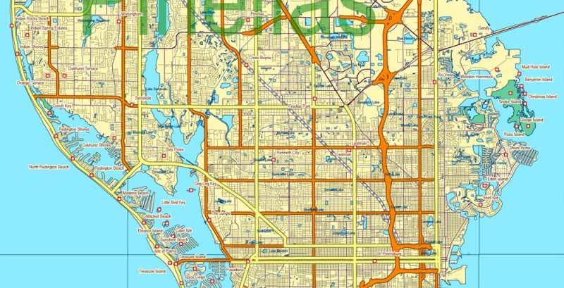
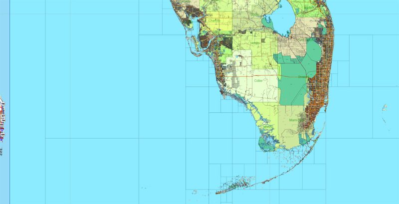
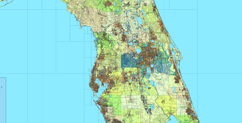
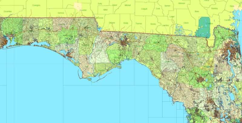
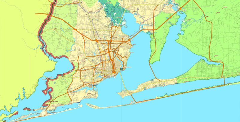
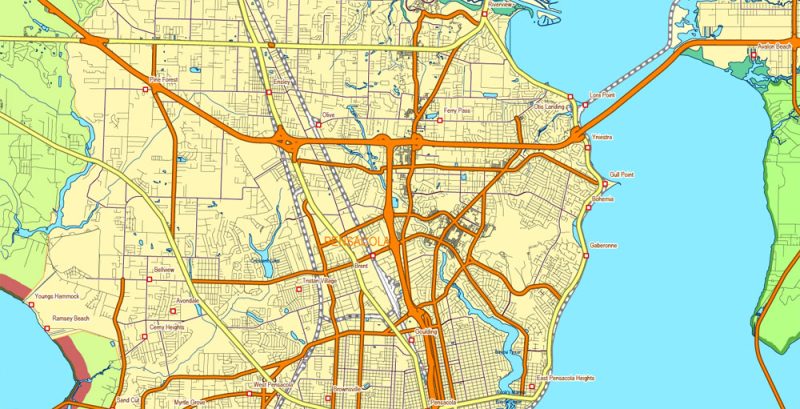
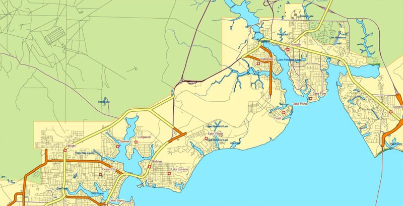
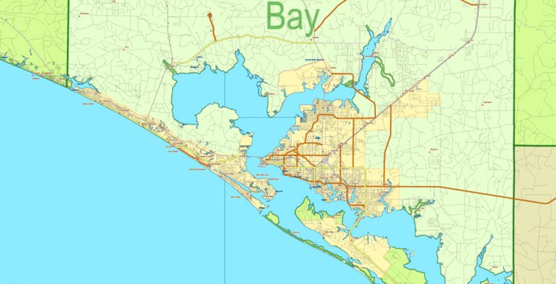
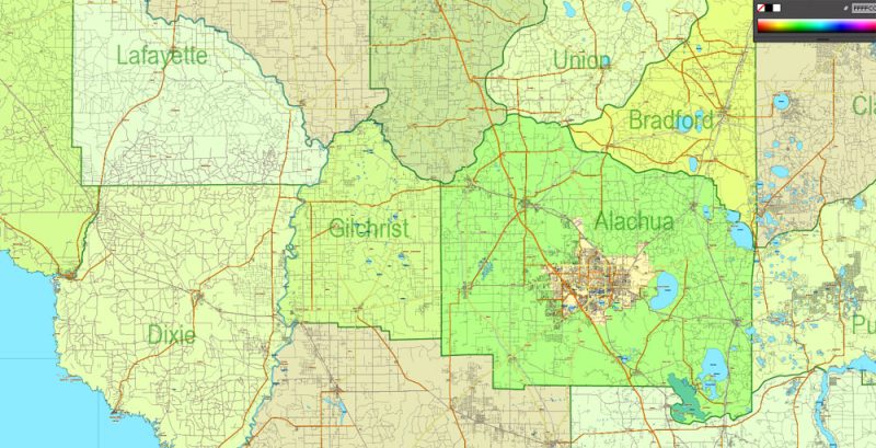
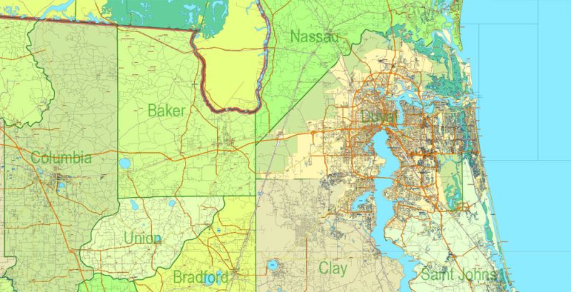
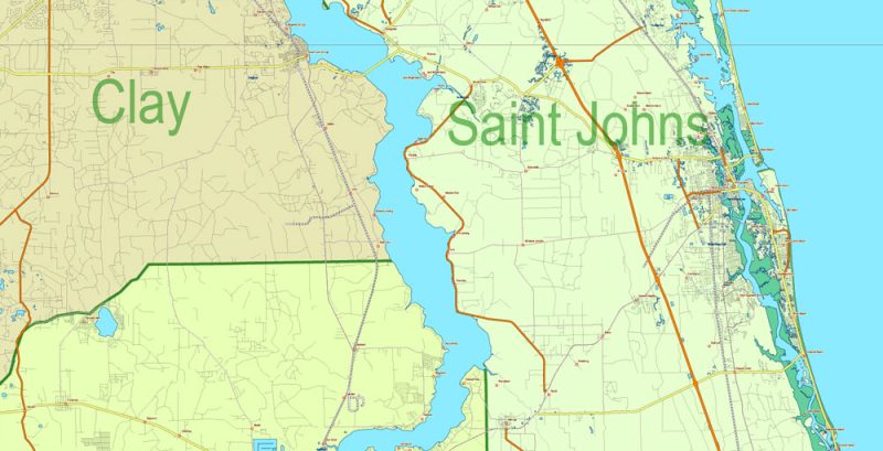
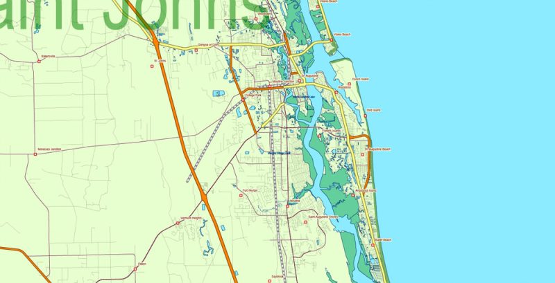
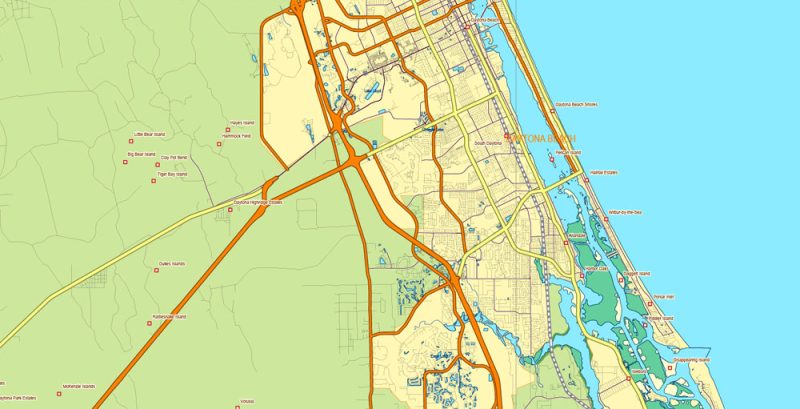
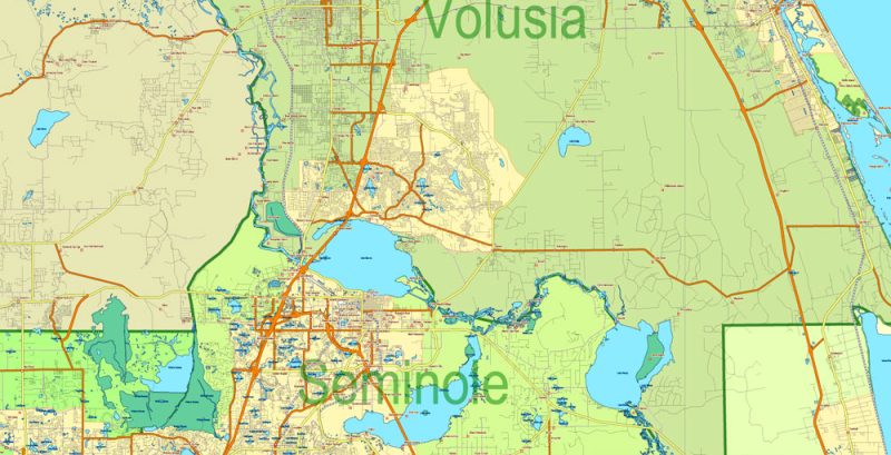
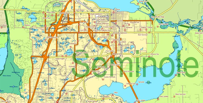
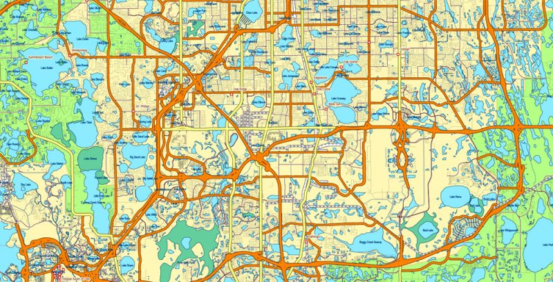
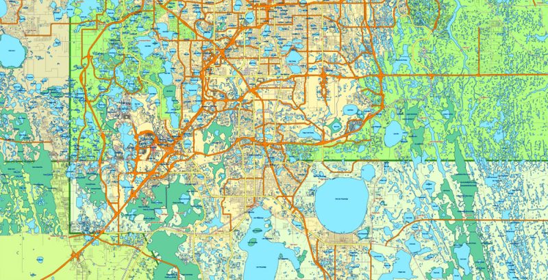
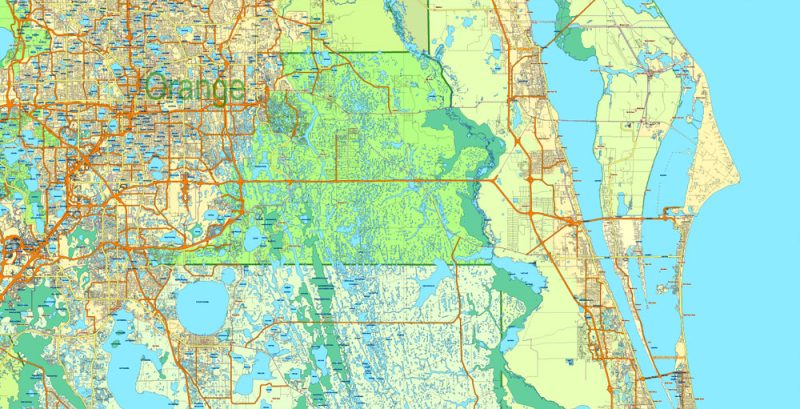
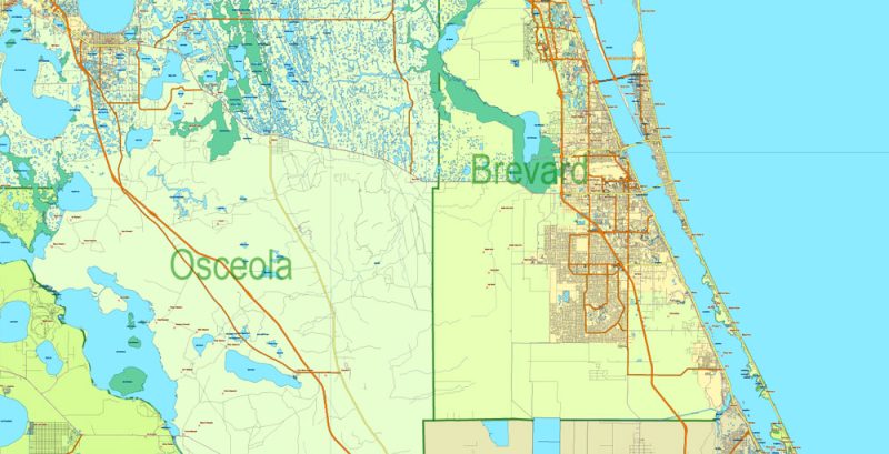
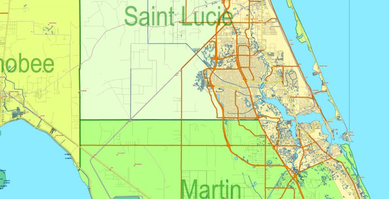
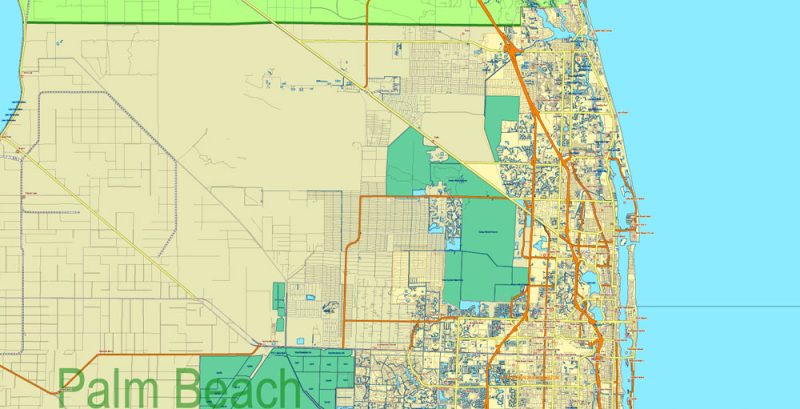
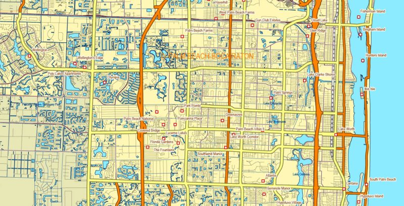
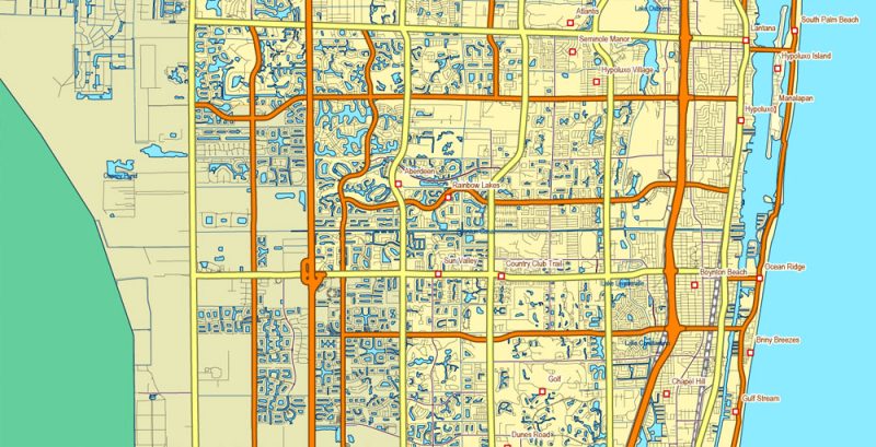
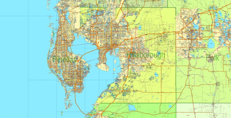
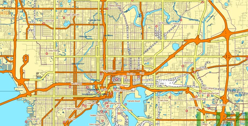
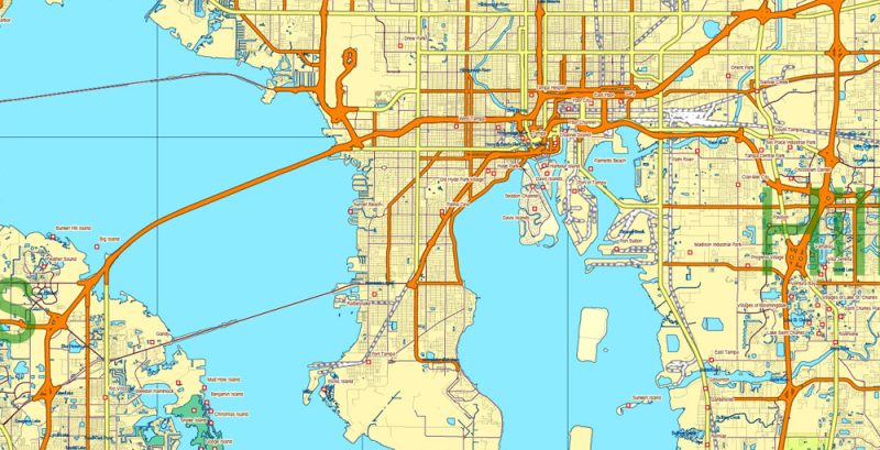
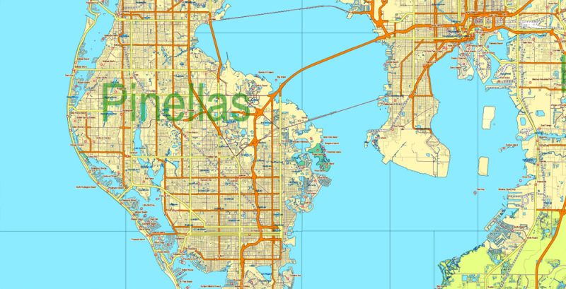
Printable PDF Vector Map Florida State US, exact extra detailed All Roads and Streets, Cities, and Counties map editable Layered Adobe PDF scalable, editable text format all names, 221 MB ZIP
All roads, streets, Cities and towns, Counties, Water objects and Railroads Map for design, printing, arts, projects, presentations, for architects, designers, and builders, business, logistics.
Layers: borders_counties, urban_areas, main_streets_roads, civil_streets_roads, water_objects, waterways, names_places, counties, names_counties, dots_places grids, etc.
The most exact and detailed map of Florida State.
Map for editing and High-Quality Printing
DWG, DXF and other formats – on request, the same price, please, contact
Florida
US State
Florida is the southeasternmost U.S. state, with the Atlantic on one side and the Gulf of Mexico on the other. It has hundreds of miles of beaches. The city of Miami is known for its Latin-American cultural influences and notable arts scene, as well as its nightlife, especially in upscale South Beach. Orlando is famed for theme parks, including Walt Disney World.
Capital: Tallahassee
Population: 21.3 million
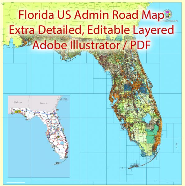
Florida State PDF Vector Map exact extra detailed All Roads, Cities and Counties map editable Layered Adobe PDF
Florida State PDF Vector Map exact extra detailed All Roads, Cities and Counties map editable Layered Adobe PDF
Florida State PDF Vector Map exact extra detailed All Roads, Cities and Counties map editable Layered Adobe PDF
Florida State PDF Vector Map exact extra detailed All Roads, Cities and Counties map editable Layered Adobe PDF
Florida State PDF Vector Map exact extra detailed All Roads, Cities and Counties map editable Layered Adobe PDF
Florida State PDF Vector Map exact extra detailed All Roads, Cities and Counties map editable Layered Adobe PDF
Florida State PDF Vector Map exact extra detailed All Roads, Cities and Counties map editable Layered Adobe PDF
Florida State PDF Vector Map exact extra detailed All Roads, Cities and Counties map editable Layered Adobe PDF
Florida State PDF Vector Map exact extra detailed All Roads, Cities and Counties map editable Layered Adobe PDF
Florida State PDF Vector Map exact extra detailed All Roads, Cities and Counties map editable Layered Adobe PDF
Florida State PDF Vector Map exact extra detailed All Roads, Cities and Counties map editable Layered Adobe PDF
Florida State PDF Vector Map exact extra detailed All Roads, Cities and Counties map editable Layered Adobe PDF
Florida State PDF Vector Map exact extra detailed All Roads, Cities and Counties map editable Layered Adobe PDF
Florida State PDF Vector Map exact extra detailed All Roads, Cities and Counties map editable Layered Adobe PDF
Florida State PDF Vector Map exact extra detailed All Roads, Cities and Counties map editable Layered Adobe PDF
Florida State PDF Vector Map exact extra detailed All Roads, Cities and Counties map editable Layered Adobe PDF
Florida State PDF Vector Map exact extra detailed All Roads, Cities and Counties map editable Layered Adobe PDF
Florida State PDF Vector Map exact extra detailed All Roads, Cities and Counties map editable Layered Adobe PDF
Florida State PDF Vector Map exact extra detailed All Roads, Cities and Counties map editable Layered Adobe PDF
Florida State PDF Vector Map exact extra detailed All Roads, Cities and Counties map editable Layered Adobe PDF
Florida State PDF Vector Map exact extra detailed All Roads, Cities and Counties map editable Layered Adobe PDF
Florida State PDF Vector Map exact extra detailed All Roads, Cities and Counties map editable Layered Adobe PDF
Florida State PDF Vector Map exact extra detailed All Roads, Cities and Counties map editable Layered Adobe PDF
Florida State PDF Vector Map exact extra detailed All Roads, Cities and Counties map editable Layered Adobe PDF
Florida State PDF Vector Map exact extra detailed All Roads, Cities and Counties map editable Layered Adobe PDF
Florida State PDF Vector Map exact extra detailed All Roads, Cities and Counties map editable Layered Adobe PDF
Florida State PDF Vector Map exact extra detailed All Roads, Cities and Counties map editable Layered Adobe PDF
Florida State PDF Vector Map exact extra detailed All Roads, Cities and Counties map editable Layered Adobe PDF
Author Rating
Aggregate Rating
no rating based on 0 votes
@vectormapper
Product Name Florida State PDF Vector Map exact extra detailed All Roads, Cities and Counties map editable Layered Adobe PDF
Price
USD 79
Product Availability
Available in Stock


 Author: Kirill Shrayber, Ph.D. FRGS


