One of the five largest states in terms of population, the state of Florida has a population of 19.5 million people (4th place). On its territory is located one of the most famous resorts in the United States – the city of Miami. And in addition, Florida is famous for many more features and attractions. The state of Florida entered the Union 27th in a row, having acquired this status in early March 1845. The population is very large, but it can not boast of vast territories – the area is 170,304 km2 (22nd place). The state capital is Tallahassee. The largest cities are Jacksonville (ranked first), Miami, Orlando, and others. For the first time, a European foot entered these lands in 1513. Spanish conquistador Juan Ponce de Leon declared the territory a possession of Spain.
In the jurisdiction of Spain, Florida remained until the signing of the Paris Peace Treaty of 1763: under its terms, these lands passed to England in exchange for Havana. However, a few years later, the region again passed into the hands of the Spanish, who sold it to the United States in 1819.
Geography and climate
The state of Florida is located on the peninsula of the same name, the entire territory of which is included in this region. It also includes land in the northern United States outside the peninsula and the island of the Florida Keys. The territory is washed by three major bodies of water at once: the Atlantic Ocean, the Gulf of Mexico, and the Florida Strait. The terrain is mostly low-lying, there are a few hills.
The special geographical location of Florida determines its climate. It is mainly humid tropical, in some places, it turns into tropical, in some places-into oceanic, in some places-into monsoon. The peninsula is warm at any time of the year, which is why the state of Florida is popular not only in summer but also as a winter resort. The average temperature in July is 26-28°C (maximum rises to 38°C), in January-12-20°C.
However, in the summer and autumn, tornadoes are possible, so the winter and spring periods, although not so hot, are safer. Population In the state of Florida, there are three particularly large racial groups. 45% of the population is white, 22% is afro-americans, and 30% is classified as Hispanic (there is a large racial mix). 2% of the residents have Asian roots. Most of the population preaches Christianity. There is an increase in the number of Muslims compared to a number of other states. About 16% of the population are atheists.
The GDP of Florida is comparable to the GDP of Australia, which indicates a high economic development. One of the leading industries is agriculture. Here I grow citrus fruits, tobacco, and sugar cane in large quantities. A huge role is played by marine fishing – the region supplies pink shrimp and a large number of different types of fish to the US markets. The state of Florida is known as one of the largest resorts-tourism is thriving here. Every year, thousands of thousands of tourists flock here, which brings great profit. Banking and phosphate mining are also well developed.
Among the numerous universities, two stand out in particular. The University of Florida was founded in 1853. To date, it has about 50 thousand students. The most popular areas of study are biology, English, economics, chemistry, sociology, mathematics, etc. The University of Miami is private. It was established in 1925. It has a research focus. It includes several colleges, for example, medical, oceanographic.
First of all, the state of Florida is popular as a resort region, which is facilitated by a mild climate, the proximity of the Atlantic and the Gulf of Mexico. There are several major beaches in Miami: Miami Beach, South Beach, etc.
The nature of the state also deserves a lot of attention: here you can admire the sunsets on the coast, see the orange trees, walk through the numerous national parks where wild animals live. It is in this state that one of the most famous entertainment parks in the world is located – “Walt Disney World“. It includes several theme parks, hotels, restaurants, etc.
Orlando is home to the largest water park in the United States.
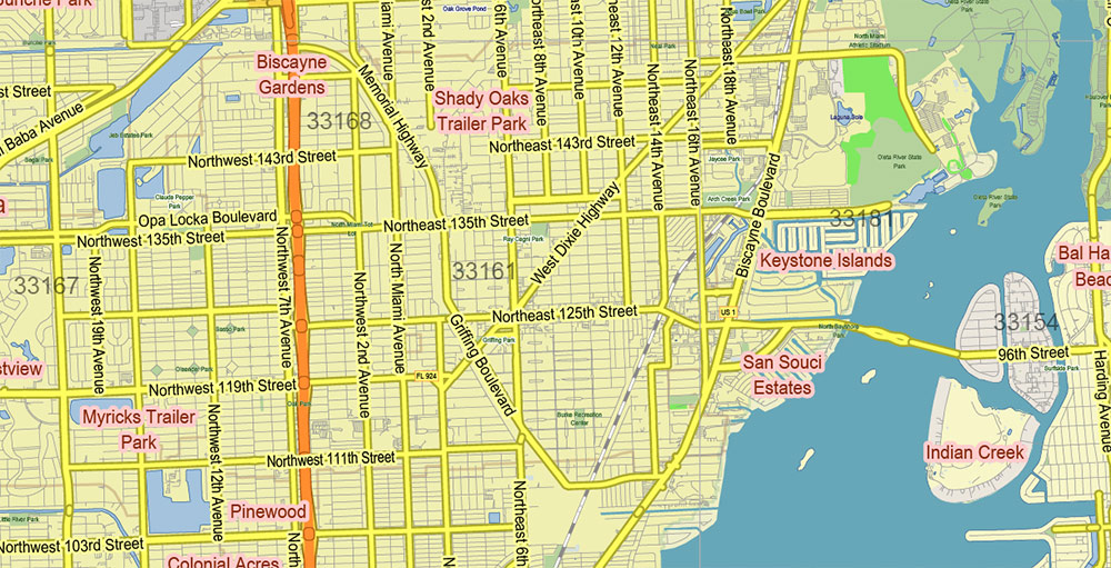
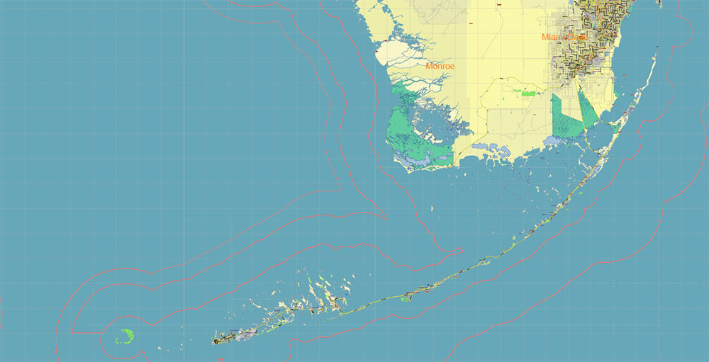
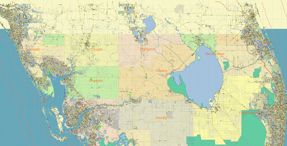
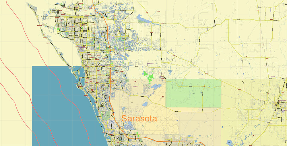
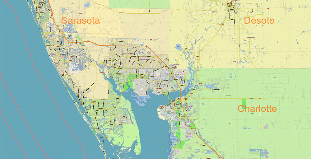
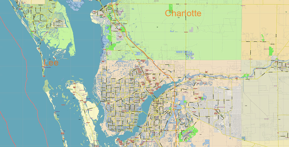
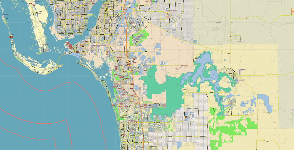
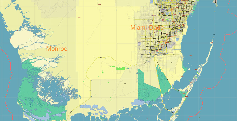
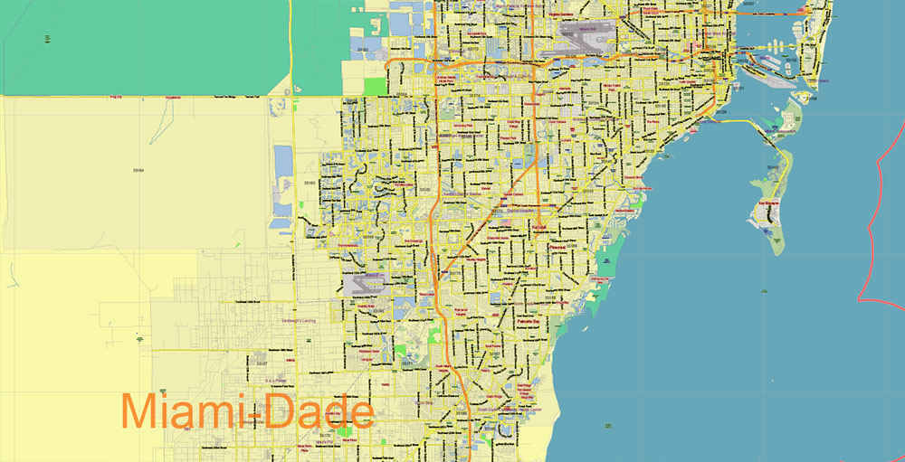
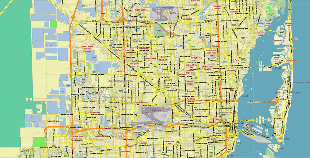
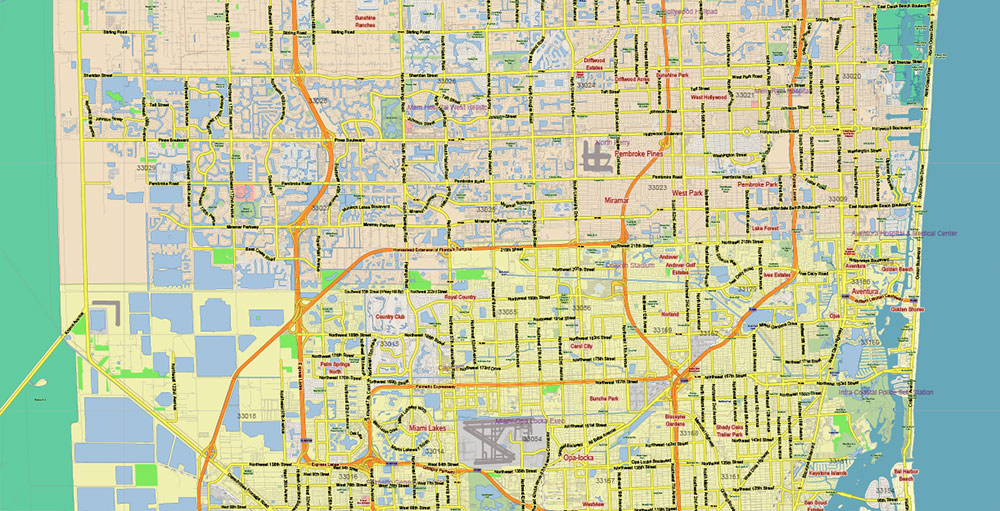
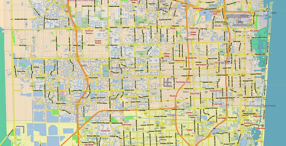
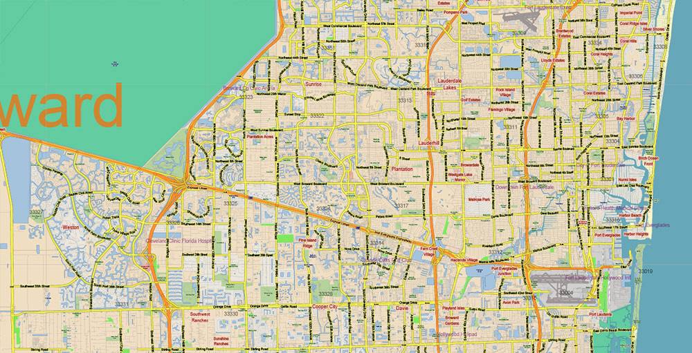
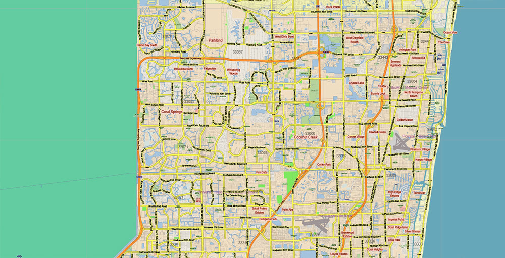
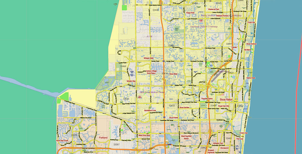
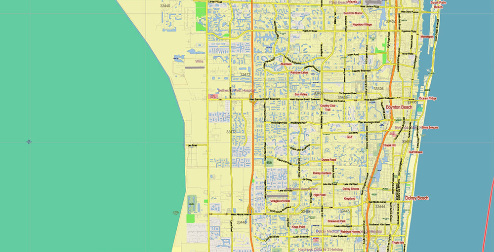
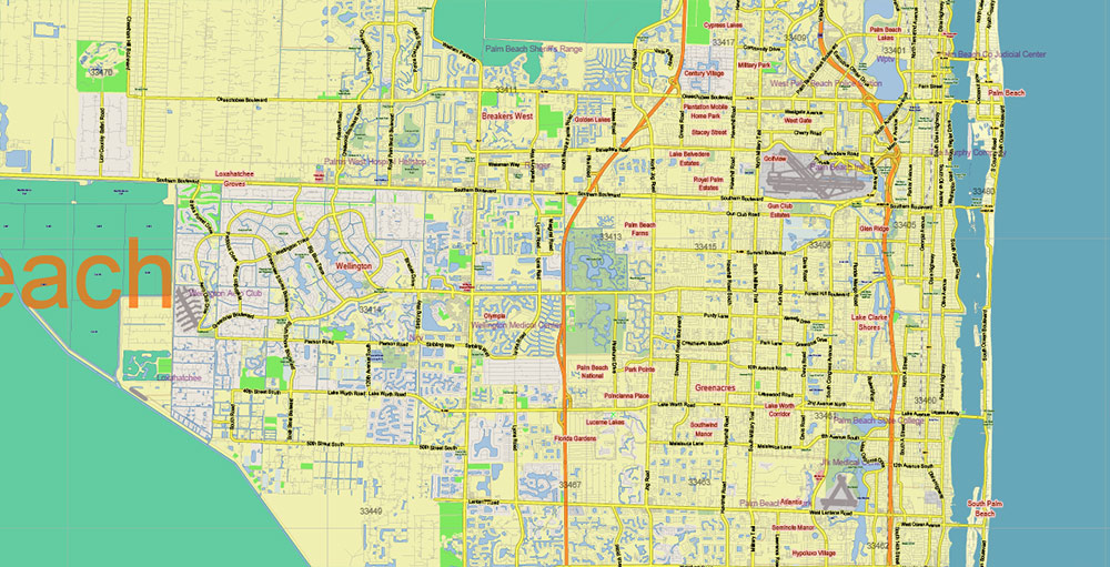
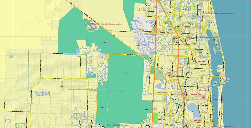
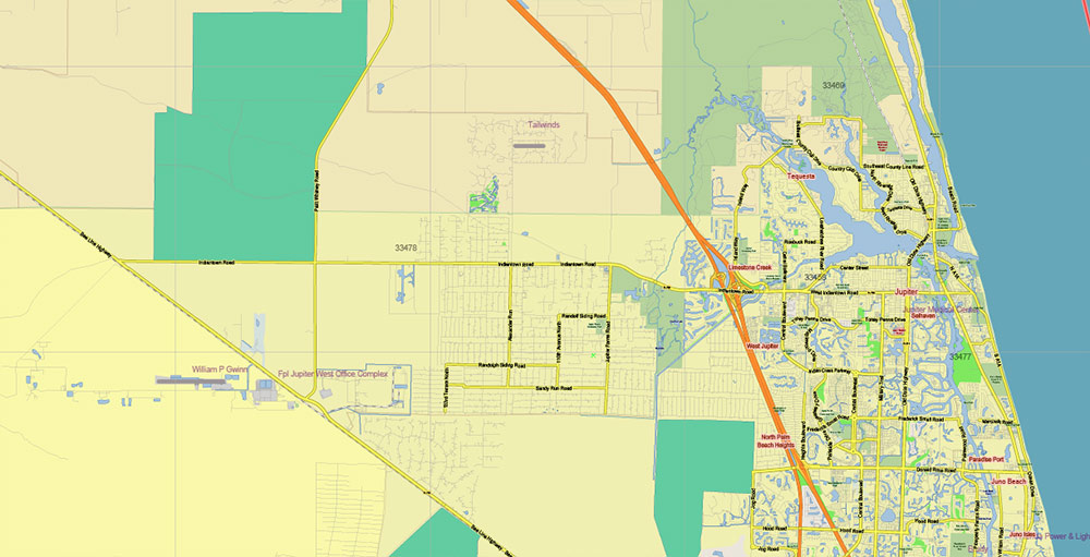
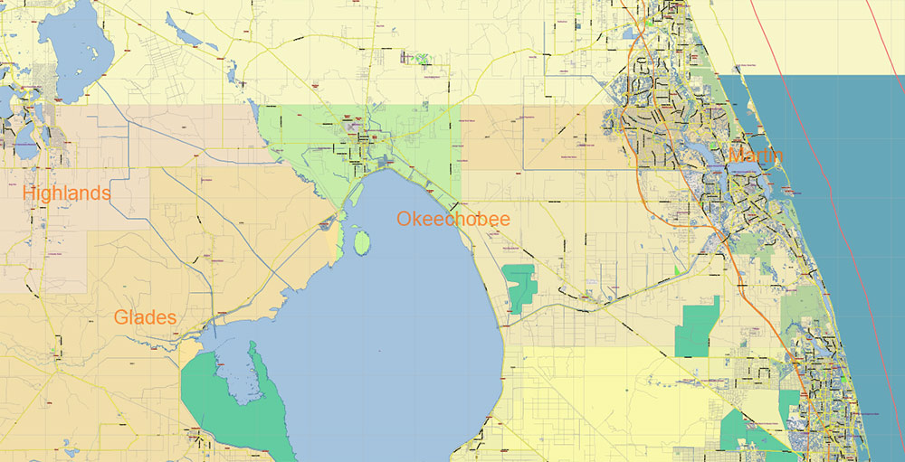
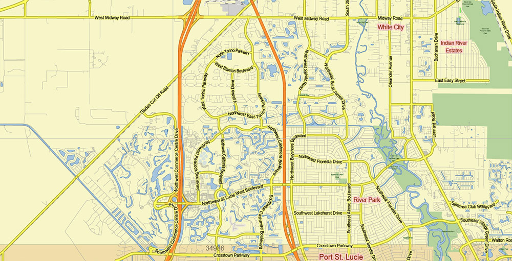
Printable Vector Map of Florida South Part US high detailed Plan + Counties areas + Zipcodes areas and numbers, scale 1:68549 full editable Adobe Illustrator Street Map in layers, scalable, text format all names, 51 MB ZIP
Principal street names, Main Objects, Airports, Counties, ZipCodes. Map for design, printing, arts, projects, presentations, for architects, designers, and builders, business, logistics.
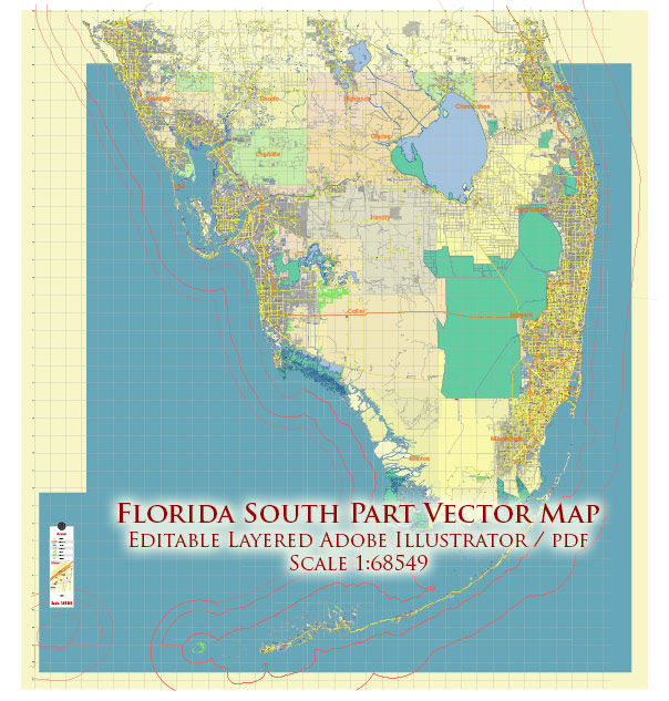
Florida South Part US Map Vector Exact State Plan High Detailed Road Map + admin + Zipcodes editable Adobe Illustrator in layers
Layers list:
- Legend
- Grids
- Labels of roads
- Names of places (city, hamlet, etc.)
- Names of objects (hospitals, parks, water)
- Names of main streets
- Halo names streets, places, objects
- Names of Counties
- Numbers of ZIPcodes
- Main Streets, roads
- Residencial streets
- Railroads
- Boundaries
- Names of airports
- Airports and heliports
- Water objects (rivers, lakes, ponds)
- Waterways
- Color fills (parks, hospital areas, land use, etc.)
- ZIPcodes areas
- Counties areas
- Background
Florida South Part US Map Vector Exact State Plan High Detailed Road Map + admin + Zipcodes editable Adobe Illustrator in layers
Florida South Part US Map Vector Exact State Plan High Detailed Road Map + admin + Zipcodes editable Adobe Illustrator in layers

Florida South Part US Map Vector Exact State Plan High Detailed Road Map + admin + Zipcodes editable Adobe Illustrator in layers
Florida South Part US Map Vector Exact State Plan High Detailed Road Map + admin + Zipcodes editable Adobe Illustrator in layers
Florida South Part US Map Vector Exact State Plan High Detailed Road Map + admin + Zipcodes editable Adobe Illustrator in layers
Florida South Part US Map Vector Exact State Plan High Detailed Road Map + admin + Zipcodes editable Adobe Illustrator in layers
Florida South Part US Map Vector Exact State Plan High Detailed Road Map + admin + Zipcodes editable Adobe Illustrator in layers
Florida South Part US Map Vector Exact State Plan High Detailed Road Map + admin + Zipcodes editable Adobe Illustrator in layers

Florida South Part US Map Vector Exact State Plan High Detailed Road Map + admin + Zipcodes editable Adobe Illustrator in layers
Florida South Part US Map Vector Exact State Plan High Detailed Road Map + admin + Zipcodes editable Adobe Illustrator in layers
Florida South Part US Map Vector Exact State Plan High Detailed Road Map + admin + Zipcodes editable Adobe Illustrator in layers
Florida South Part US Map Vector Exact State Plan High Detailed Road Map + admin + Zipcodes editable Adobe Illustrator in layers
Florida South Part US Map Vector Exact State Plan High Detailed Road Map + admin + Zipcodes editable Adobe Illustrator in layers
Florida South Part US Map Vector Exact State Plan High Detailed Road Map + admin + Zipcodes editable Adobe Illustrator in layers
Florida South Part US Map Vector Exact State Plan High Detailed Road Map + admin + Zipcodes editable Adobe Illustrator in layers
Florida South Part US Map Vector Exact State Plan High Detailed Road Map + admin + Zipcodes editable Adobe Illustrator in layers
Florida South Part US Map Vector Exact State Plan High Detailed Road Map + admin + Zipcodes editable Adobe Illustrator in layers
Florida South Part US Map Vector Exact State Plan High Detailed Road Map + admin + Zipcodes editable Adobe Illustrator in layers
Florida South Part US Map Vector Exact State Plan High Detailed Road Map + admin + Zipcodes editable Adobe Illustrator in layers
Florida South Part US Map Vector Exact State Plan High Detailed Road Map + admin + Zipcodes editable Adobe Illustrator in layers
Florida South Part US Map Vector Exact State Plan High Detailed Road Map + admin + Zipcodes editable Adobe Illustrator in layers
Florida South Part US Map Vector Exact State Plan High Detailed Road Map + admin + Zipcodes editable Adobe Illustrator in layers
Florida South Part US Map Vector Exact State Plan High Detailed Road Map + admin + Zipcodes editable Adobe Illustrator in layers

 Author: Kirill Shrayber, Ph.D. FRGS


