Extended Description of the Vector Map
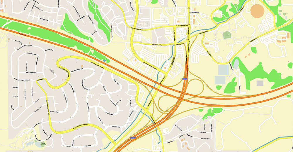
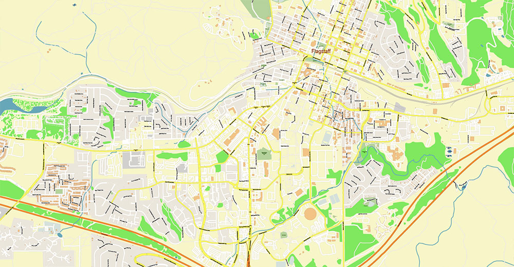
Printable Vector Map of Flagstaff Arizona USA High detailed street map scale 1:3839 fully editable Layered Adobe PDF + DWG + Shapefiles in 1 archive scalable, text format all names, 28 MB ZIP
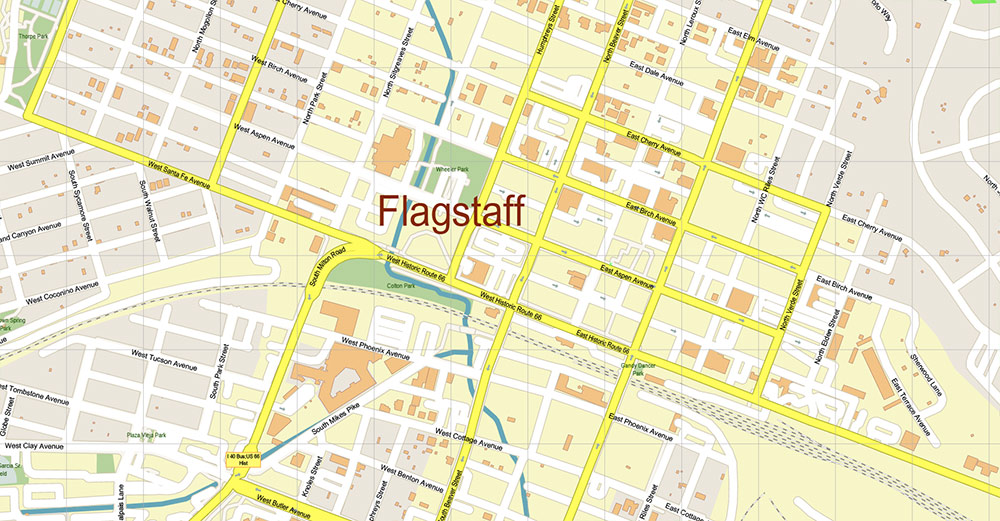
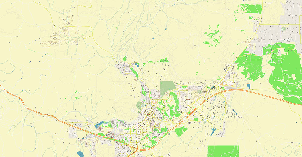
All street names, Main Objects, Buildings. Map for design, printing, arts, projects, presentations, for architects, designers, and builders, business, logistics.
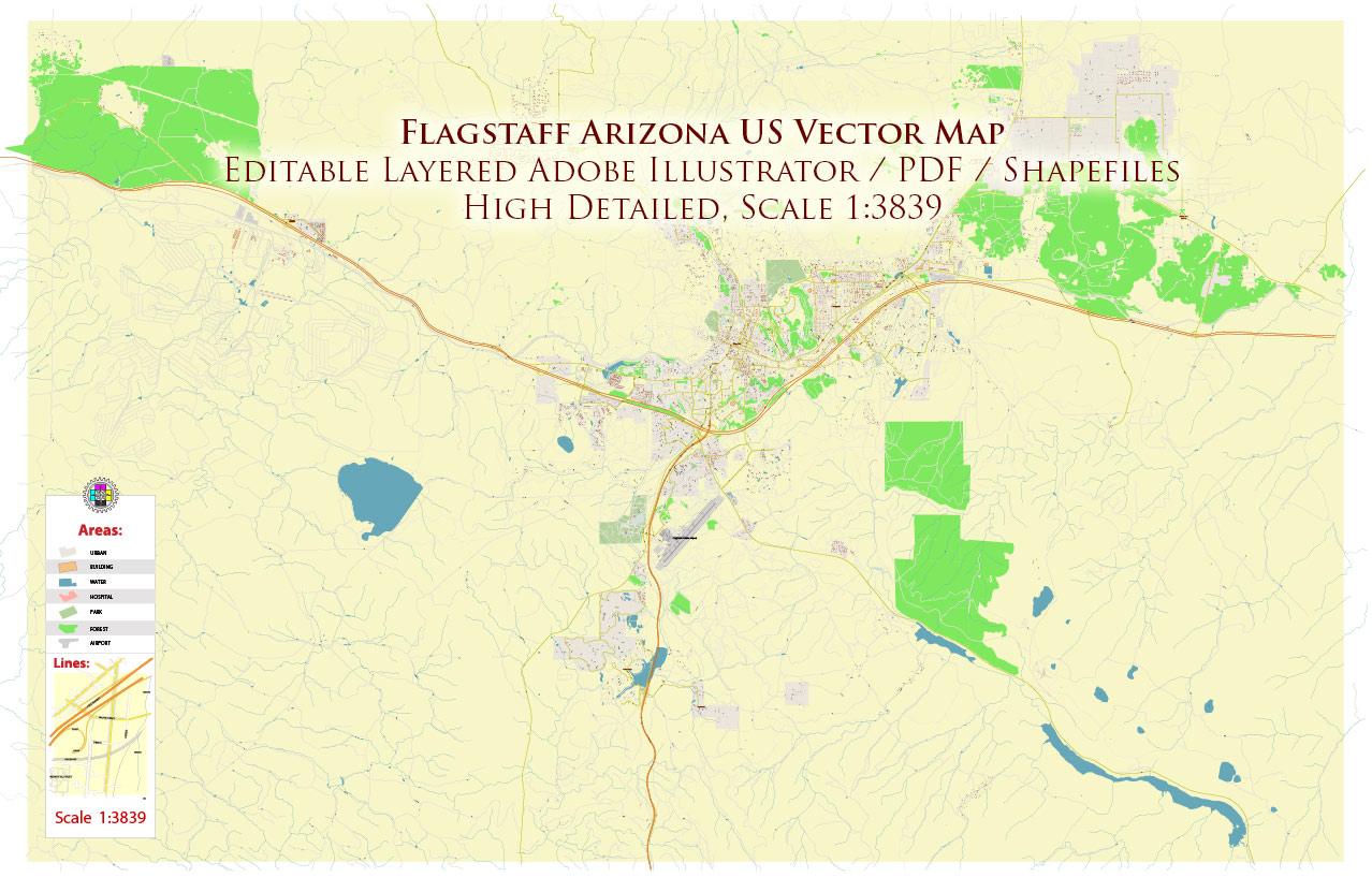
Flagstaff Arizona US Map Vector Exact City Plan detailed Street Map editable layered PDF + DWG + Shapefiles in 1 archive
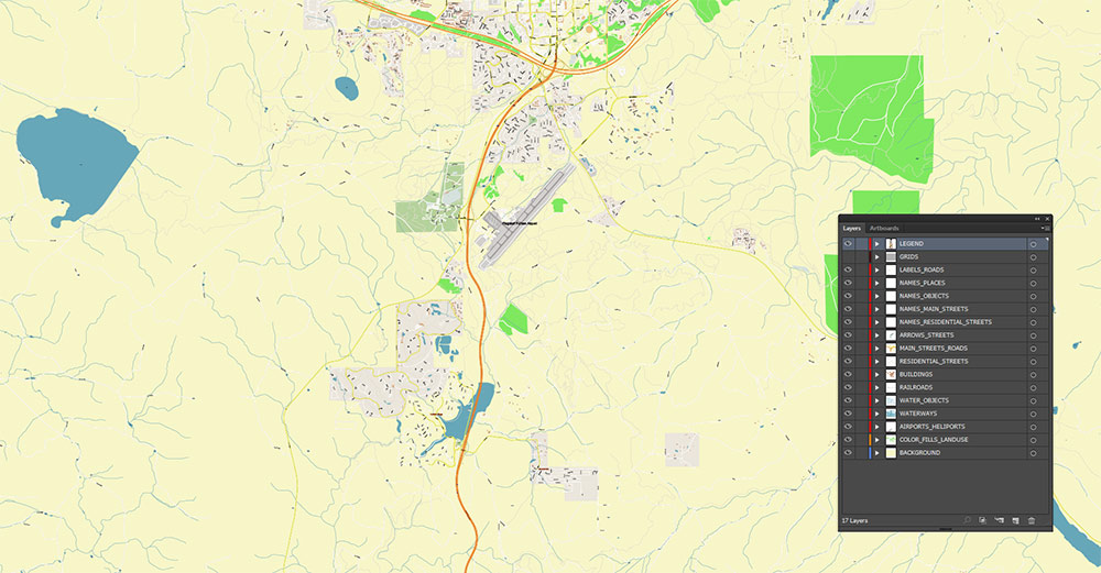
Layers list:
- Legend
- Names of places (city, hamlet, etc.)
- Names of objects (parks, hospital, water)
- Names of main streets
- Names of residential streets
- Main Streets, roads
- Residential streets
- Railroads
- Buildings
- Water objects (rivers, lakes, ponds)
- Waterways
- Color fills (parks, land use, etc.)
- Background
The most exact and detailed map of the Flagstaff Arizona USA in scale.
For Editing and High-Quality Printing
Flagstaff Arizona US Map Vector Exact City Plan detailed Street Map editable layered PDF + DWG + Shapefiles in 1 archive
FLAGSTAFF, ARIZONA — AO BRIEF
1) Overview
-
Type: High-elevation mountain town / regional hub in Northern Arizona
-
Role: Gateway city for the Colorado Plateau (Grand Canyon corridor), NAU college town, logistics node on I-40 and US-89
-
Signature terrain: Ponderosa pine forests + volcanic highlands (San Francisco Peaks) + open plateau edges
-
Operating character: Outdoor/tourism economy, strong seasonal swings, winter-capable transport planning required
2) Terrain & Geography
-
Elevation: ~2,100 m / ~6,900 ft (thin air, cold nights even in warm seasons)
-
Macro-region: Colorado Plateau; sits south of the Grand Canyon approaches and north of central Arizona basins
-
Key terrain features:
-
San Francisco Peaks (dominant high ground N/NW of town)
-
Volcanic field (cinder cones and lava flows; rough ground, limited cross-country movement in places)
-
Forest belt: Dense ponderosa pine = concealment + restricted sight lines; increased wildfire risk in dry periods
-
Hydrology: No large river through town; drainage is mostly seasonal channels and small lakes/reservoirs nearby; water is a strategic constraint in the broader region
3) Lines of Communication (Roads)
-
I-40 (primary east–west):
-
Flagstaff’s main artery; freight spine connecting California ↔ New Mexico/Texas
-
Interchanges concentrate services, hotels, logistics-friendly zones
-
US-89 (primary north–south):
-
Arizona SR-180 / US-180 (to NW):
-
Arizona SR-66 (historic Route 66 alignment):
-
Operational takeaway: The town is effectively a junction box—block or degrade I-40/US-89 and you compress regional movement into limited alternatives.
4) Transport & Mobility
-
Rail:
-
Air:
-
Public transit / local:
-
Winter mobility:
5) Human Terrain & Demography
6) Economy & Key Nodes
-
Primary engines: Tourism, education, healthcare/services, regional logistics, outdoor recreation
-
High-value nodes / activity centers:
-
Downtown / Route 66 corridor: dense commerce, nightlife, events
-
NAU campus: high pedestrian density, scheduled crowd peaks
-
I-40 interchanges: hotels, fuel, big-box retail, distribution-friendly parcels
-
Medical + civic core: typical mid-city essential services cluster
7) Attractions & Points of Interest
-
Flagstaff as a basecamp:
-
Launch point to Grand Canyon, Sedona, Page/Lake Powell, Petrified Forest corridor (regional triangle of iconic sites)
-
Local standouts:
-
Historic downtown / Route 66 feel
-
Lowell Observatory (astronomy heritage)
-
Arizona Snowbowl (seasonal ski operations on the Peaks)
-
Volcanic landscapes: cinder cones, lava caves/tubes in the area
-
Hiking/biking network: extensive forest trails and nearby scenic routes
8) Climate & Seasonality
9) Hazards & Constraints
-
Weather: Snowstorms, black ice, high winds; monsoon lightning and downpours
-
Altitude: Performance impact for visitors and personnel; dehydration risk
-
Wildfire / smoke: Route closures, power impacts, respiratory stress
-
Tourism load: Congestion spikes on I-40 ramps, US-89 and approach roads to recreation areas
10) Logistics & Sustainment
-
Supply posture: Strong (I-40 freight corridor), good retail/service depth for a mountain town
-
Bottlenecks: I-40 incidents (weather or crashes) can paralyze flows; limited alternate corridors
-
Best practices: Winter-ready vehicles, contingency routing, time buffers, and fuel planning for rural stretches outside the city
11) Command Takeaways
-
Flagstaff is high-ground urban logistics: elevation, weather, and junction control shape everything.
-
I-40 + US-89 are the decisive movement levers—protect, monitor, and plan alternates.
-
Seasonal effects (snow/ice + monsoon + wildfire) are not “edge cases” but baseline operational reality.
-
Human terrain is dominated by NAU pulse and tourism surges; plan for crowd-driven congestion around downtown/campus corridors.
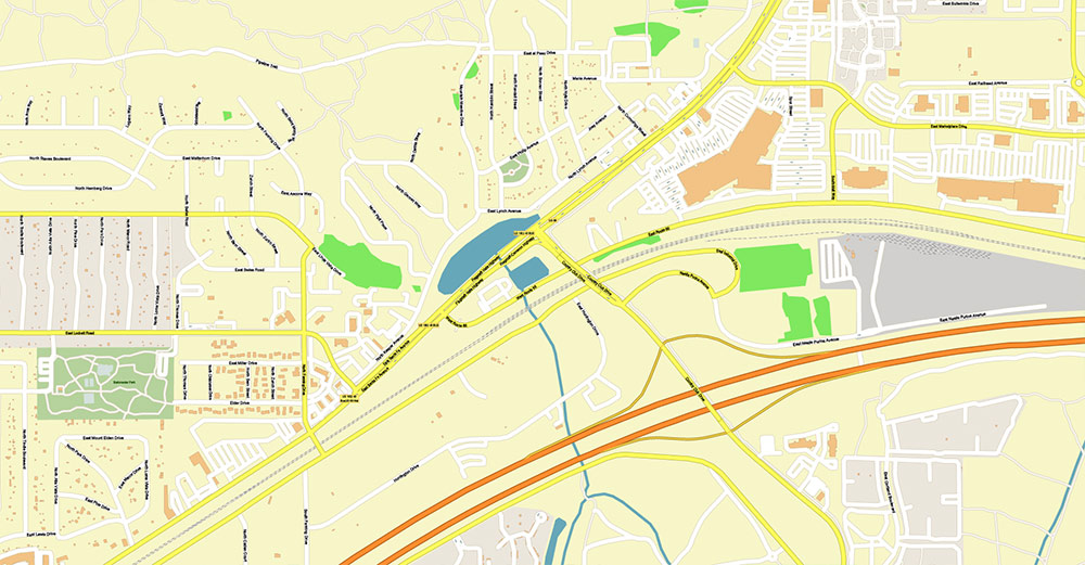
Flagstaff Arizona US Map Vector Exact City Plan detailed Street Map editable layered PDF + DWG + Shapefiles in 1 archive
Flagstaff Arizona US Map Vector Exact City Plan detailed Street Map editable layered PDF + DWG + Shapefiles in 1 archive
Flagstaff Arizona US Map Vector Exact City Plan detailed Street Map editable layered PDF + DWG + Shapefiles in 1 archive
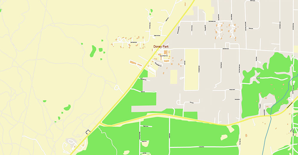
Flagstaff Arizona US Map Vector Exact City Plan detailed Street Map editable layered PDF + DWG + Shapefiles in 1 archive
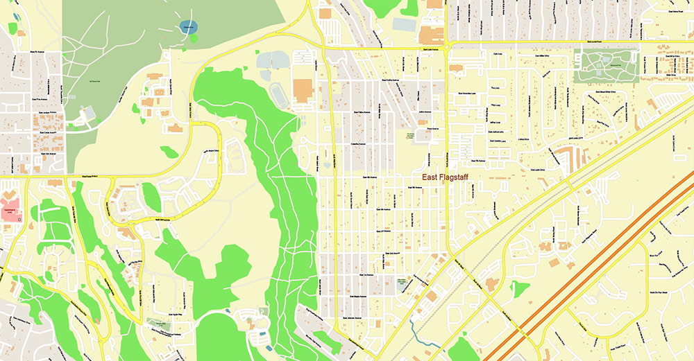
Flagstaff Arizona US Map Vector Exact City Plan detailed Street Map editable layered PDF + DWG + Shapefiles in 1 archive
Flagstaff Arizona US Map Vector Exact City Plan detailed Street Map editable layered PDF + DWG + Shapefiles in 1 archive
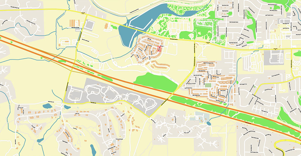
Flagstaff Arizona US Map Vector Exact City Plan detailed Street Map editable layered PDF + DWG + Shapefiles in 1 archive
Flagstaff Arizona US Map Vector Exact City Plan detailed Street Map editable layered PDF + DWG + Shapefiles in 1 archive

 Author: Kirill Shrayber, Ph.D. FRGS

