Extended Description of the Vector Map
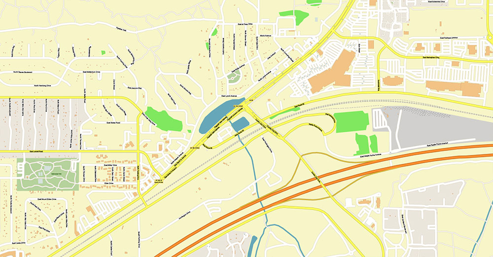
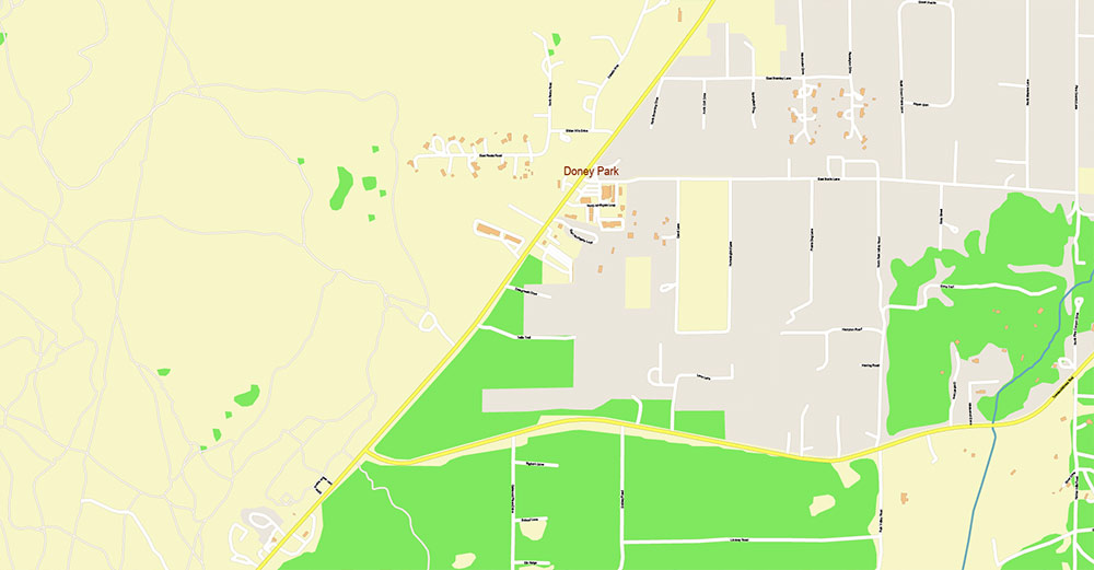
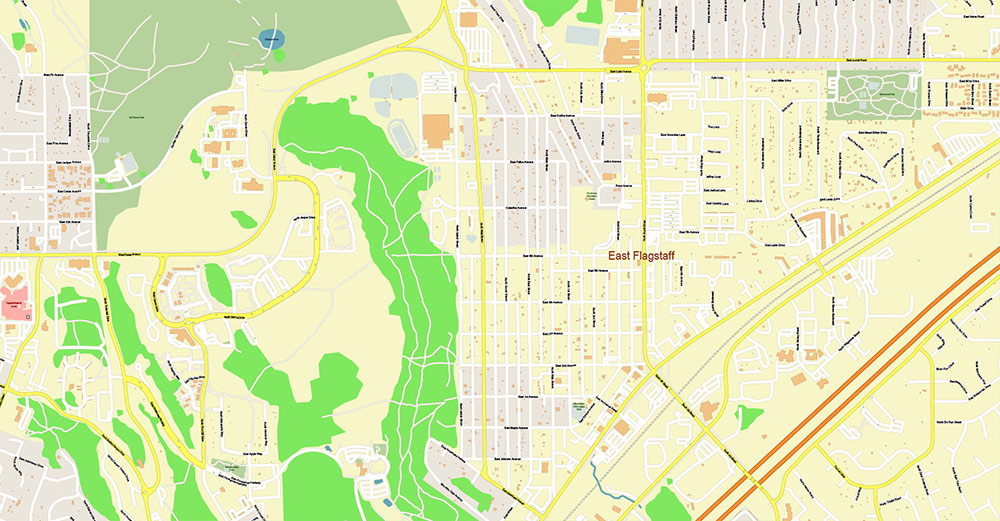
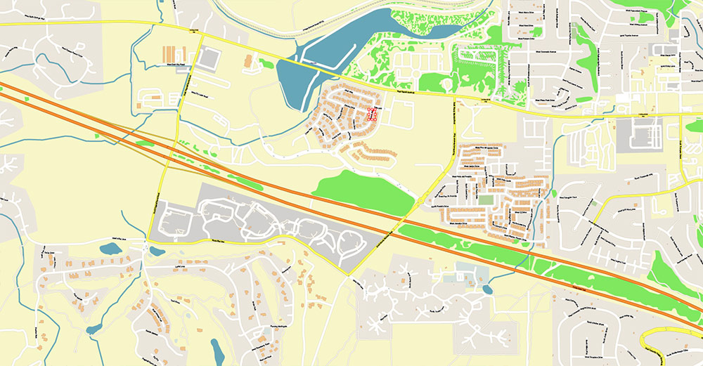
Printable Vector Map of Flagstaff Arizona USA High detailed street map scale 1:3839 fully editable Layered Adobe Illustrator, scalable, text format all names, 5 MB ZIP
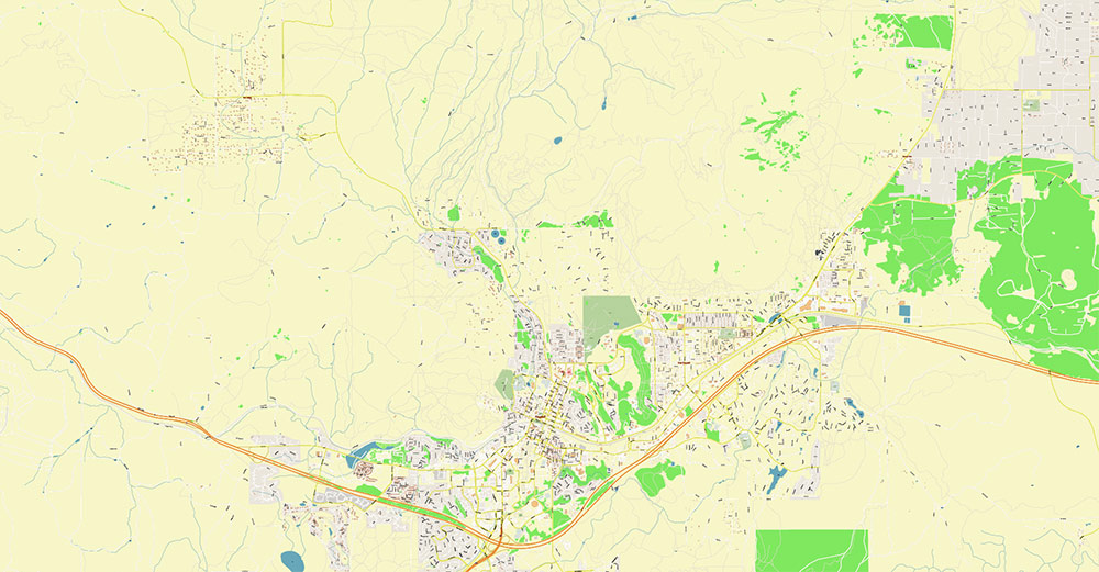
All street names, Main Objects, Buildings. Map for design, printing, arts, projects, presentations, for architects, designers, and builders, business, logistics.
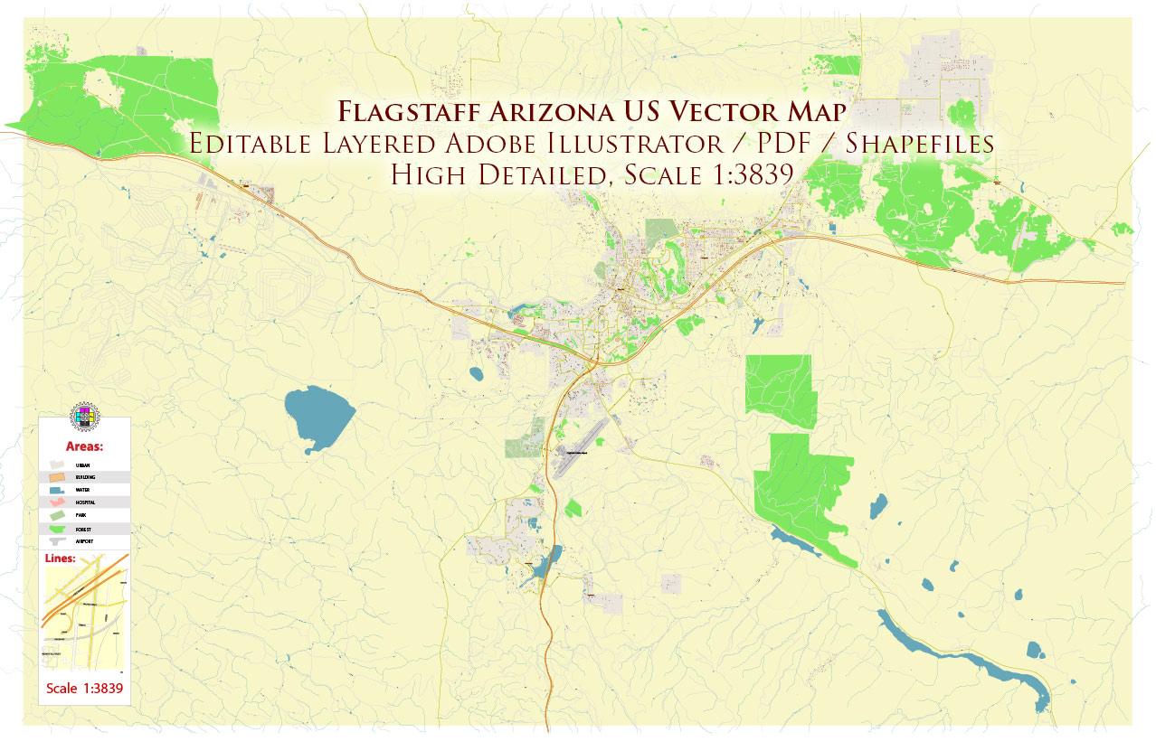
Flagstaff Arizona US Map Vector Exact City Plan detailed Street Map editable layered Adobe Illustrator
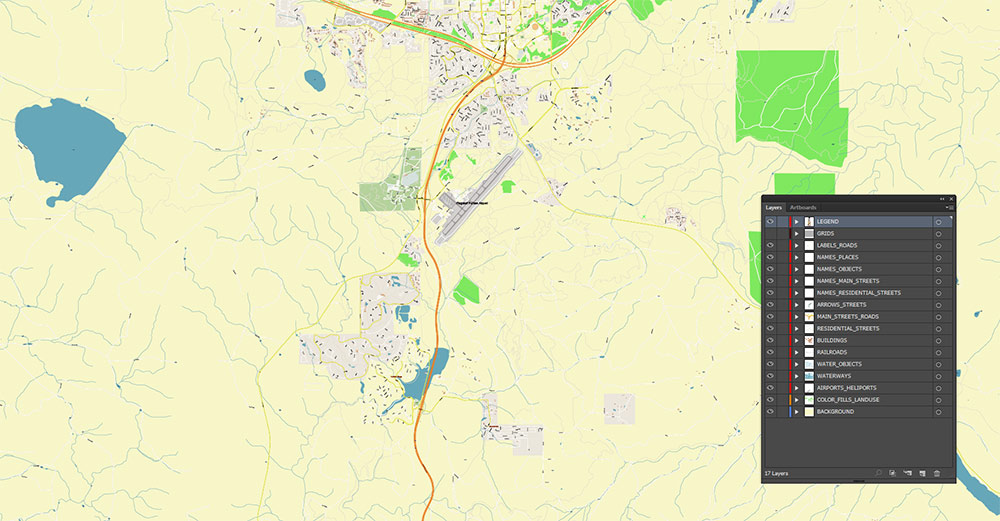
Layers list:
- Legend
- Names of places (city, hamlet, etc.)
- Names of objects (parks, hospital, water)
- Names of main streets
- Names of residential streets
- Main Streets, roads
- Residential streets
- Railroads
- Buildings
- Water objects (rivers, lakes, ponds)
- Waterways
- Color fills (parks, land use, etc.)
- Background
The most exact and detailed map of the Flagstaff Arizona USA in scale.
For Editing and High-Quality Printing
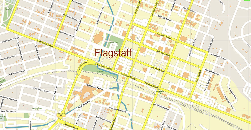
Flagstaff Arizona US Map Vector Exact City Plan detailed Street Map editable layered Adobe Illustrator
FLAGSTAFF, ARIZONA — CARTOGRAPHIC AO BRIEF
1) Spatial Identity
-
Settlement Type: High-elevation mountain city
-
Regional Position: Northern Arizona, south edge of the Colorado Plateau
-
Function on the map: Transportation junction + university city + tourism staging base
-
Landscape Context: Forested volcanic highlands embedded in a vast arid plateau system
Flagstaff sits in a topographic anomaly within Arizona — a cool, forested upland surrounded by desert basins.
2) Relief & Physical Geography
-
Mean Elevation: ~2,100 m (6,900 ft) — one of the highest cities of its size in the U.S.
-
Dominant Landform:
-
Terrain Structure:
-
Volcanic plateau with cinder cones, lava fields, and forested slopes
-
Broken ground limits straight-line movement off-road
-
Physiographic Province: Colorado Plateau volcanic margin
-
Vegetation Belt: Dense ponderosa pine forest (rare in Arizona at this scale)
Cartographic Character:
A green, elevated “island” of forest rising from the tan desert macro-region.
3) Hydrography
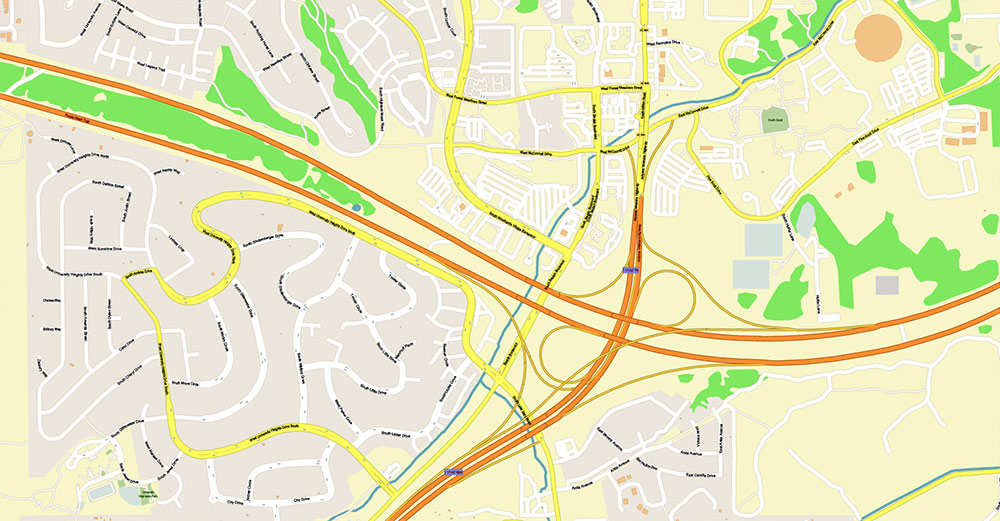
4) Transportation Framework (Primary Map Lines)
Major Axes
| Route |
Orientation |
Cartographic Role |
| I-40 |
East–West |
Continental freight and passenger corridor |
| US-89 |
North–South |
Connects Flagstaff to Grand Canyon corridor and central AZ |
| US-180 / SR-180 |
NW |
Access to high terrain and Grand Canyon approach |
| Historic Route 66 / SR-66 |
Parallel E–W |
Urban/commercial overlay corridor |
Flagstaff is a crossroads node where continental (I-40) and regional (US-89) flows intersect.
5) Rail & Air
-
Rail Line: Transcontinental freight alignment crosses the city east–west
-
Airport: Flagstaff Pulliam Airport (regional aviation node)
These features reinforce the city’s identity as a logistics waypoint rather than an isolated mountain town.
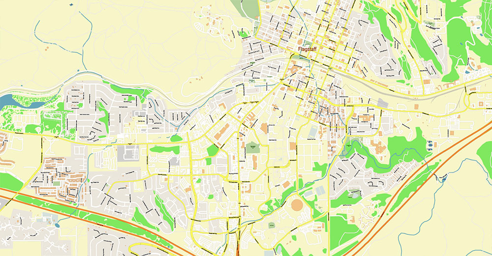
6) Urban Form
7) Human Geography
8) Economic Landscape (Spatial View)
-
Tourism Corridor Zones: Along I-40 interchanges and US-89 approaches
-
Downtown Node: Cultural and commercial core
-
Campus Zone: Major institutional land use
-
Logistics Strip: Highway-adjacent commercial belts
9) Climate Layer (for Map Interpretation)
-
Mountain climate superimposed on desert region
-
Winter snow alters mobility patterns
-
Summer monsoon storms create localized runoff and flash-flood risk in washes
-
Wildfire zones overlap forest belt
Climate is a functional map layer here, affecting road reliability and access.
10) Landmark Features (Cartographic Anchors)
-
San Francisco Peaks — primary terrain reference
-
Lowell Observatory — cultural landmark
-
Arizona Snowbowl — seasonal recreation node
-
Historic Route 66 district — urban heritage corridor
11) Spatial Interpretation Summary
Flagstaff is best mapped as:
A high-altitude forested logistics node on a volcanic plateau, acting as a transport hinge between desert basins and the Grand Canyon region.
Its defining cartographic traits are:
Flagstaff Arizona US Map Vector Exact City Plan detailed Street Map editable layered Adobe Illustrator
Flagstaff Arizona US Map Vector Exact City Plan detailed Street Map editable layered Adobe Illustrator
Flagstaff Arizona US Map Vector Exact City Plan detailed Street Map editable layered Adobe Illustrator
Flagstaff Arizona US Map Vector Exact City Plan detailed Street Map editable layered Adobe Illustrator
Flagstaff Arizona US Map Vector Exact City Plan detailed Street Map editable layered Adobe Illustrator
Flagstaff Arizona US Map Vector Exact City Plan detailed Street Map editable layered Adobe Illustrator
Flagstaff Arizona US Map Vector Exact City Plan detailed Street Map editable layered Adobe Illustrator
Flagstaff Arizona US Map Vector Exact City Plan detailed Street Map editable layered Adobe Illustrator

 Author: Kirill Shrayber, Ph.D. FRGS

