Extended Description of the Vector Map
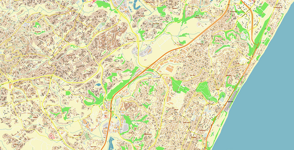
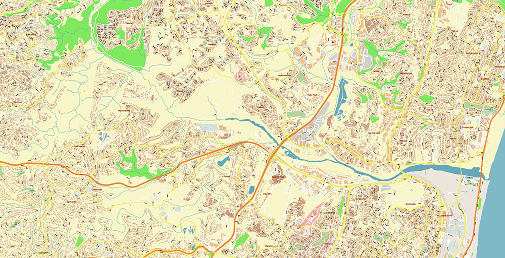
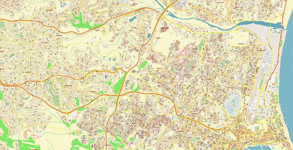
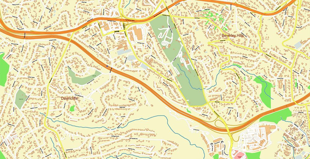
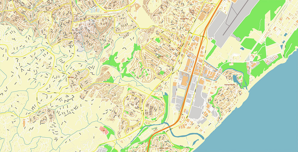
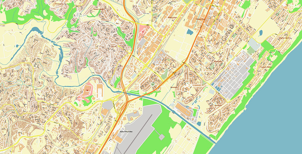
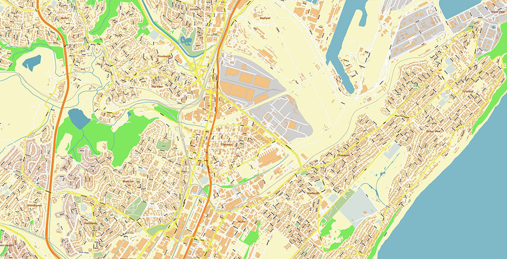
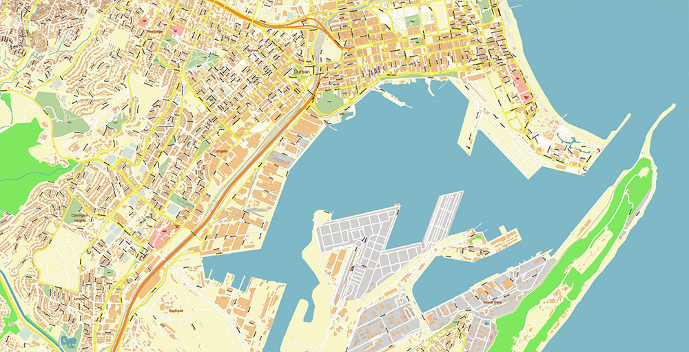
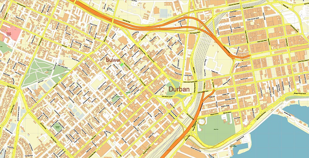
Printable PDF Vector Map of Durban South Africa detailed street map scale 1:4073 fully editable Adobe PDF scalable, text/curves all names, 194 MB ZIP
All street names, Main Objects, Buildings. Map for design, printing, arts, projects, presentations, for architects, designers, and builders, business, logistics.
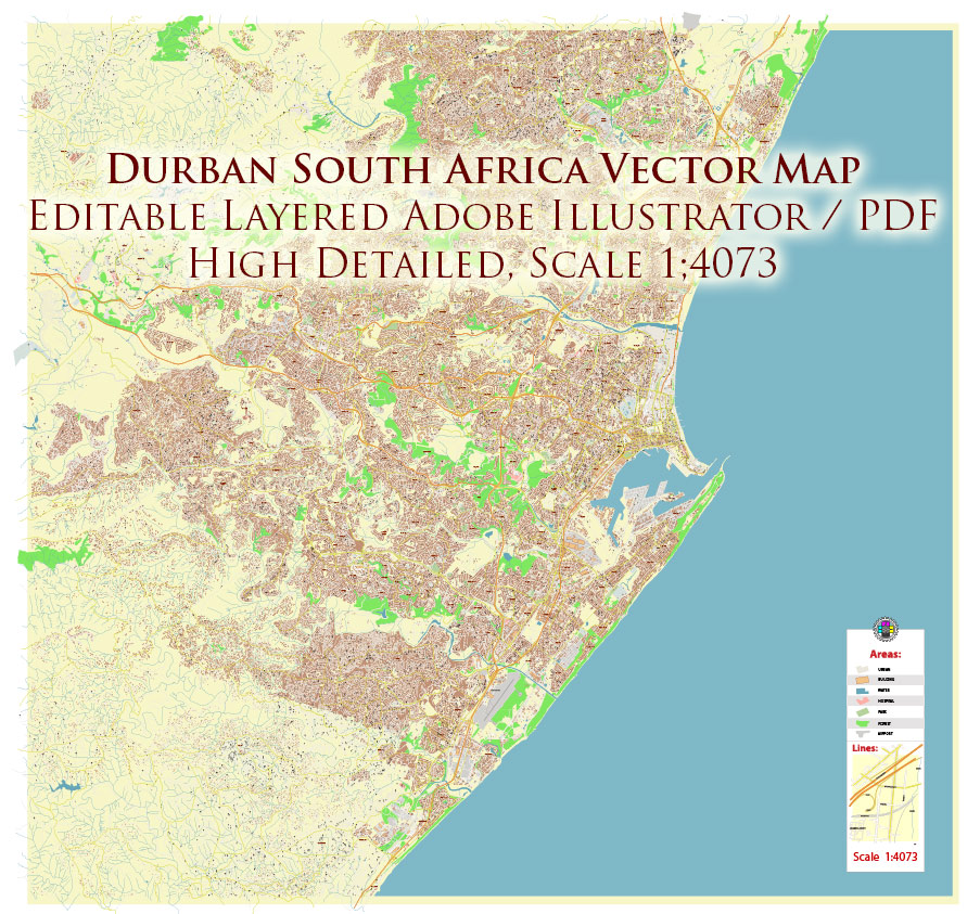
Durban South Africa PDF Map Vector Exact City Plan High Detailed Street Map editable Adobe PDF in layers
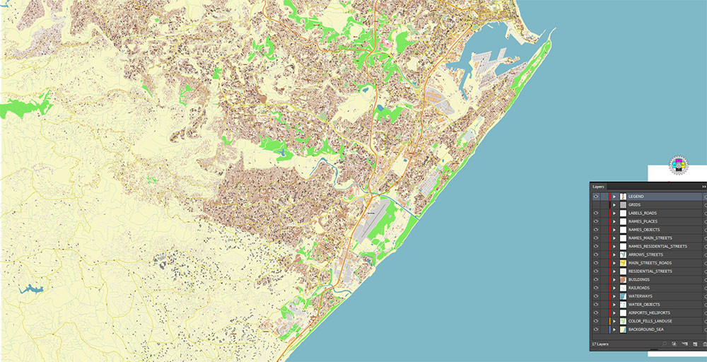
Layers list:
- Legend
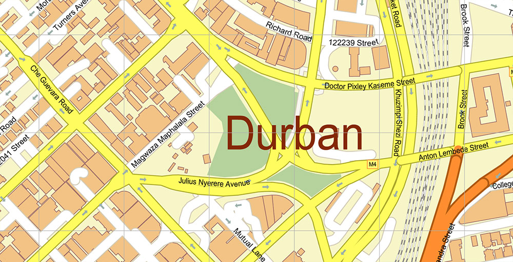
- Labels of roads
- Names of places (city, hamlet, etc.)
- Names of objects (parks, water, hospitals)
- Names of main streets
- Names of residential streets
- Arrows of streets
- Main Streets, roads
- Residential streets
- Railroads
- Buildings
- Airports and Heliports
- Water objects (rivers, lakes, ponds, wetlands)
- Waterways
- Color fills (parks, hospital areas, land use, etc.)
- Background and sea
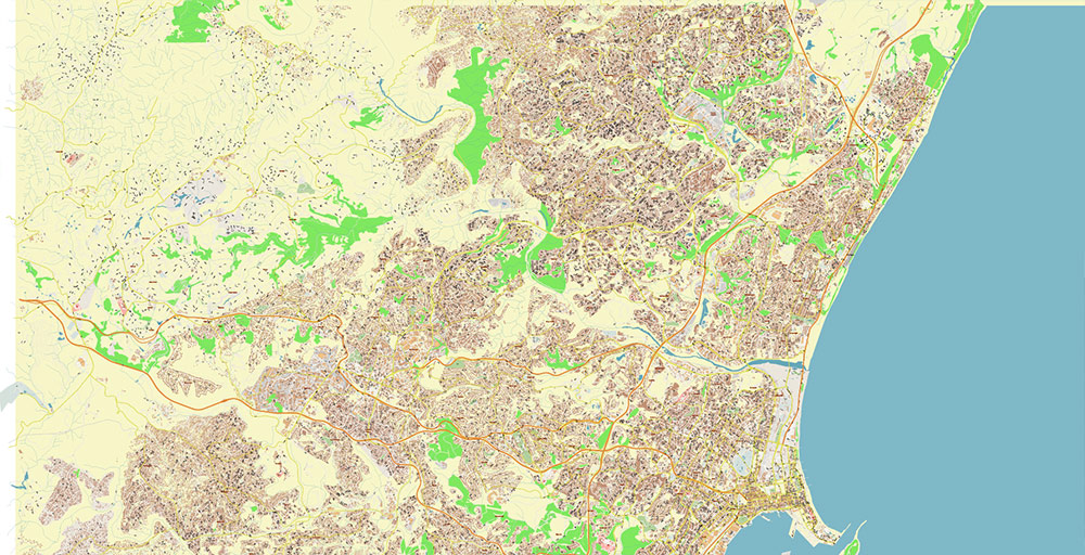
The most exact and detailed map of the city in scale.
For Editing and High-Quality Printing
Durban South Africa PDF Map Vector Exact City Plan High Detailed Street Map editable Adobe PDF in layers
DURBAN, SOUTH AFRICA — AO BRIEF (CARTOGRAPHIC)
Overview
- Coastal metro on the east coast of South Africa, province of KwaZulu-Natal
- Major Indian Ocean port (one of the busiest in Africa)
- Core urban axis: Durban CBD – Berea ridge – Umhlanga corridor (north) / Bluff–Isipingo (south)
Key Roads / Lines of Communication
- N3 (Durban–Johannesburg corridor)
- Strategic inland artery via Pietermaritzburg to Gauteng industrial core
- Heavy freight (containers from port)
- N2 (coastal highway)
- North: Umhlanga → Richards Bay → Mozambique direction
- South: Amanzimtoti → Port Shepstone → Eastern Cape
- Primary coastal spine
- M4 (Ruth First Highway)
- Parallel coastal urban route (CBD ↔ Umhlanga)
- High-density commuter and commercial strip
- M7 (Edwin Swales Drive)
- Connector: N2 ↔ N3 via Pinetown
- Key logistics bypass avoiding CBD congestion
- R102 / M19 / M13
- Secondary urban-industrial connectors (Durban–Pinetown–Westville axis)
Geography / Terrain
- Coastal plain along the Indian Ocean with humid subtropical climate
- Steep inland rise (Berea ridge) → rolling hills toward the interior
- Major river systems:
- Umgeni River (north of CBD, key crossing constraint)
- Umbilo / Umlazi catchments (south industrial zones)
- Natural constraints:
- Narrow coastal strip limits expansion
- Flood-prone river valleys (seasonal heavy rainfall)
Urban Structure
- CBD / Port: dense commercial + harbor infrastructure
- Berea: elevated ridge, residential + institutional
- North Corridor (Umhlanga): modern growth node, бизнес/туризм
- West (Pinetown, Westville): industrial + logistics
- South (Chatsworth, Umlazi): large residential zones
Demography / Human Terrain
- Population: ~3.5–4 million (metro)
- Ethnic composition:
- Large Black African majority
- Significant Indian-origin population (one of the largest outside India)
- White and Coloured minorities
- Languages:
- Zulu language dominant
- English language widely used (business/administration)
- Socioeconomic pattern:
- Strong inequality gradient (coastal wealth vs inland townships)
- High youth population
Transport / Infrastructure
- Port of Durban: primary maritime gateway (containers, bulk cargo)
- King Shaka International Airport (north, near La Mercy)
- Freight corridors heavily road-dependent (N3 critical bottleneck)
- Limited passenger rail reliability; minibus taxis dominate mobility
Climate / Seasonality
- Humid subtropical
- Hot, wet summers (storm/flood risk)
- Mild, dry winters
- High vegetation growth → dense green cover year-round
Hazards / Constraints
- Flooding (river basins, informal settlements)
- Landslides on steep slopes after heavy rain
- Port congestion / logistics delays
- Crime variability across districts
Logistics / Sustainment
- Fuel and goods flow tightly linked to port throughput
- N3 corridor = single critical inland supply line
- Warehousing concentrated west (Pinetown logistics belt)
Command Takeaways
- Control of N3 + Port interface = strategic dominance
- Terrain funnels movement along coastal + ridge corridors
- Urban sprawl fragmented → mobility depends on arterial roads
- Flood events can disrupt multiple nodes simultaneously
- North corridor (Umhlanga) = economic expansion vector
Durban South Africa PDF Map Vector Exact City Plan High Detailed Street Map editable Adobe PDF in layers
Durban South Africa PDF Map Vector Exact City Plan High Detailed Street Map editable Adobe PDF in layers
Durban South Africa PDF Map Vector Exact City Plan High Detailed Street Map editable Adobe PDF in layers
Durban South Africa PDF Map Vector Exact City Plan High Detailed Street Map editable Adobe PDF in layers
Durban South Africa PDF Map Vector Exact City Plan High Detailed Street Map editable Adobe PDF in layers
Durban South Africa PDF Map Vector Exact City Plan High Detailed Street Map editable Adobe PDF in layers
Durban South Africa PDF Map Vector Exact City Plan High Detailed Street Map editable Adobe PDF in layers
Durban South Africa PDF Map Vector Exact City Plan High Detailed Street Map editable Adobe PDF in layers
Durban South Africa PDF Map Vector Exact City Plan High Detailed Street Map editable Adobe PDF in layers
Durban South Africa PDF Map Vector Exact City Plan High Detailed Street Map editable Adobe PDF in layers
Durban South Africa PDF Map Vector Exact City Plan High Detailed Street Map editable Adobe PDF in layers

 Author: Kirill Shrayber, Ph.D. FRGS
