Extended Description of the Vector Map
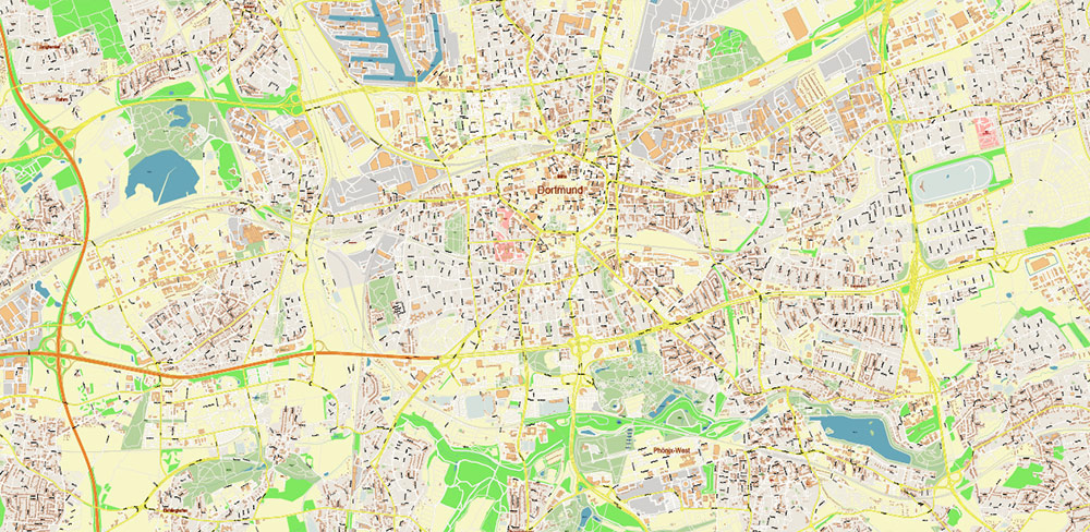
Dortmund ist eine Stadt in Deutschland im Bundesland Nordrhein-Westfalen. Zu den erwähnenswerten Sehenswürdigkeiten gehört das Westfalenstadion – die Heimspielstätte der Borussia. Ganz in der Nähe, im Westfalenpark, erhebt sich der Florianturm mit Aussichtsplattform. Das von einem riesigen U gekrönte Gebäude des Dortmunder-U-Turms beherbergt die Ausstellungen des Museums für Gegenwartskunst Ostwall. Der Botanische Garten Romberg Park bietet einheimische Baumarten und Gewächshäuser mit Kakteen und tropischen Pflanzen.
Fläche: 280,7 km²
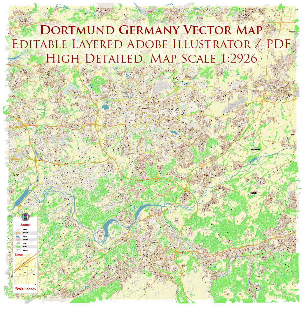
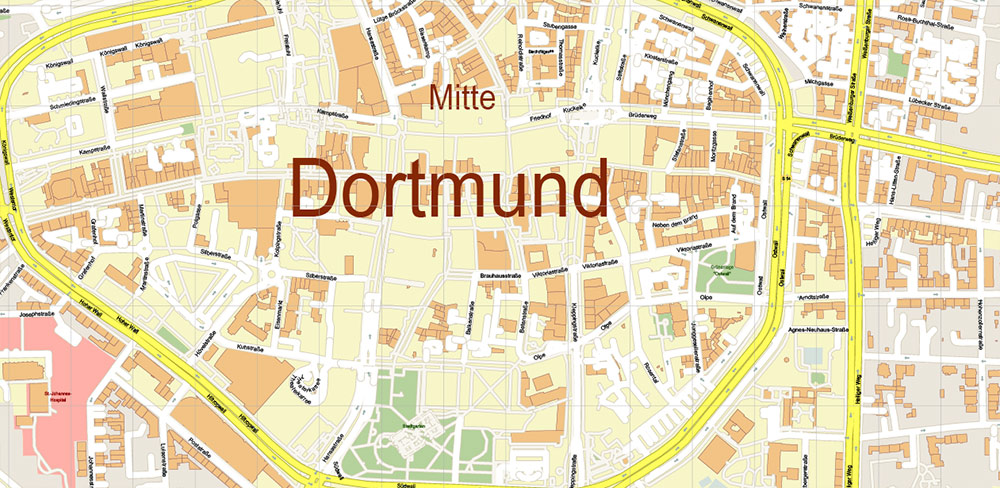
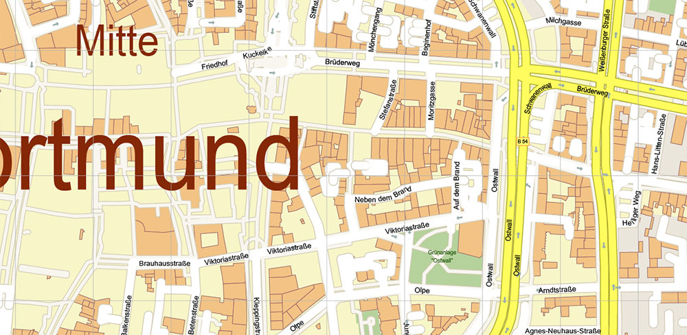
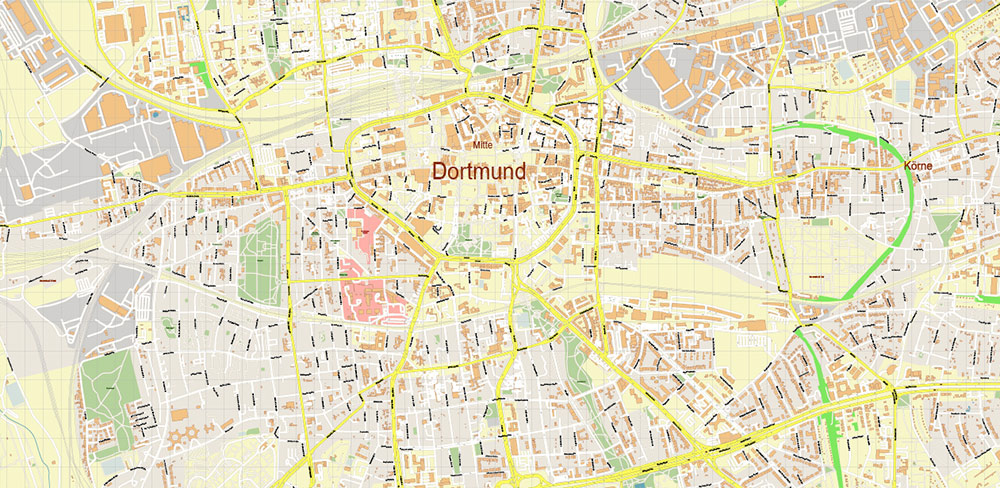
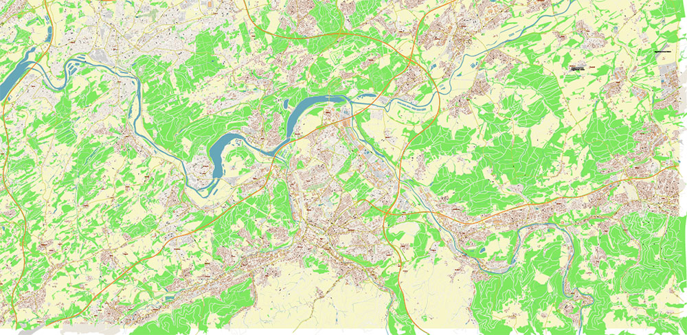
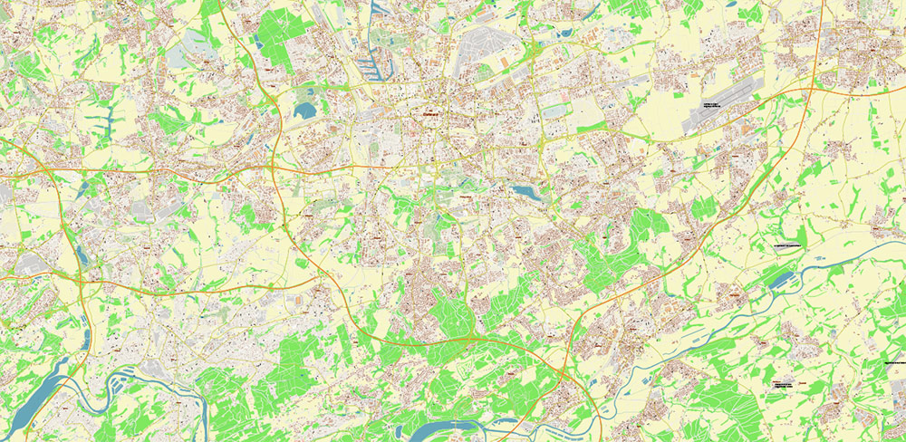
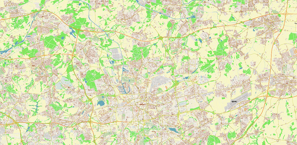
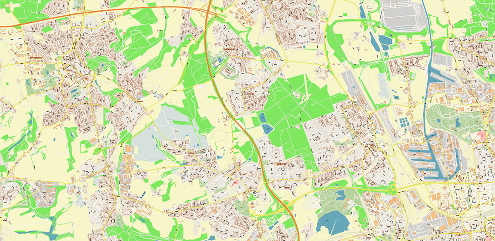
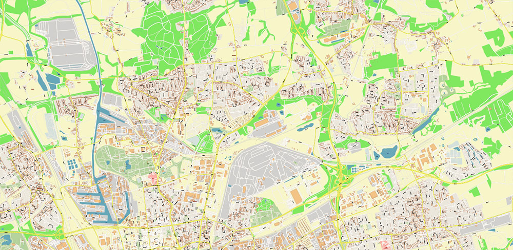
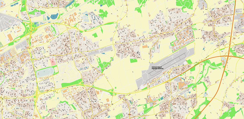
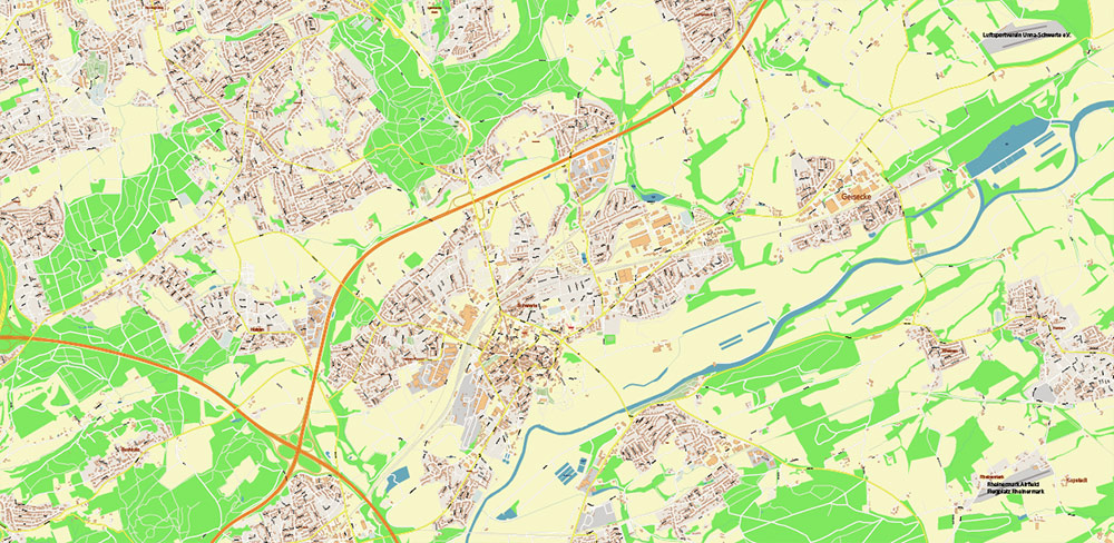
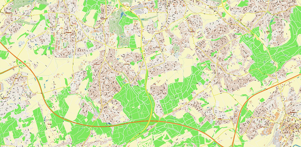
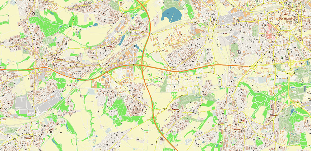
Dortmund Germany Map Vector City Plan High Detailed Street Map editable Adobe Illustrator in layers
Printable Vector Map of Dortmund Germany High Detailed City Plan scale 1:2926 full editable Adobe Illustrator Street Map in layers, scalable, text/curves format all names, 56 MB ZIP
All street names, Main Objects, Buildings. Map for design, printing, arts, projects, presentations, for architects, designers, and builders, business, logistics.
Also: We can add (additional layer for this map), any other objects for you. It’s free for our customers.
Also: We can add the RELIEF (Topo Isolines or shaded relief)
If you need any OTHER format – DWG, DXF, Corel, or something else – please, email us
Dortmund Germany Map Vector City Plan High Detailed Street Map editable Adobe Illustrator in layers
Druckbare Vektorkarte von Dortmund Deutschland Hochdetaillierter Stadtplan Maßstab 1:2926 voll editierbarer Adobe Illustrator Straßenkarte in Ebenen, skalierbar, Text-/Kurvenformat alle Namen, 56 MB ZIP
Alle Straßennamen, Hauptobjekte, Gebäude. Karte für Design, Druck, Kunst, Projekte, Präsentationen, für Architekten, Designer und Bauherren, Wirtschaft, Logistik.
Außerdem: Wir können (zusätzliche Ebene für diese Karte) beliebige andere Objekte für Sie hinzufügen. Für unsere Kunden ist es kostenlos.
Außerdem: Wir können das RELIEF hinzufügen (Topo Isolines oder schattiertes Relief)
Dortmund Germany Map Vector City Plan High Detailed Street Map editable Adobe Illustrator in layers
Layers list:
- Legend
- Grids
- Labels of roads
- Names of places (city, hamlet, etc.)
- Names of objects (hospitals, parks, water)
- Names of main streets
- Names of residential streets
- Arrows of street directions
- Main Streets, roads
- Residential streets
- Railroads
- Buildings
- Waterways
- Water objects (rivers, lakes, ponds, marshes)
- Airports and Heliports
- Color fills (parks, hospital areas, land use, etc.)
- Background
Dortmund Germany Map Vector City Plan High Detailed Street Map editable Adobe Illustrator in layers
Dortmund Germany Map Vector City Plan High Detailed Street Map editable Adobe Illustrator in layers
Dortmund Germany Map Vector City Plan High Detailed Street Map editable Adobe Illustrator in layers
Dortmund Germany Map Vector City Plan High Detailed Street Map editable Adobe Illustrator in layers
Dortmund Germany Map Vector City Plan High Detailed Street Map editable Adobe Illustrator in layers
Dortmund Germany Map Vector City Plan High Detailed Street Map editable Adobe Illustrator in layers
Dortmund Germany Map Vector City Plan High Detailed Street Map editable Adobe Illustrator in layers

Dortmund Germany Map Vector City Plan High Detailed Street Map editable Adobe Illustrator in layers
Dortmund Germany Map Vector City Plan High Detailed Street Map editable Adobe Illustrator in layers
Dortmund Germany Map Vector City Plan High Detailed Street Map editable Adobe Illustrator in layers
Dortmund Germany Map Vector City Plan High Detailed Street Map editable Adobe Illustrator in layers
Dortmund Germany Map Vector City Plan High Detailed Street Map editable Adobe Illustrator in layers

 Author: Kirill Shrayber, Ph.D. FRGS


