Extended Description of the Vector Map
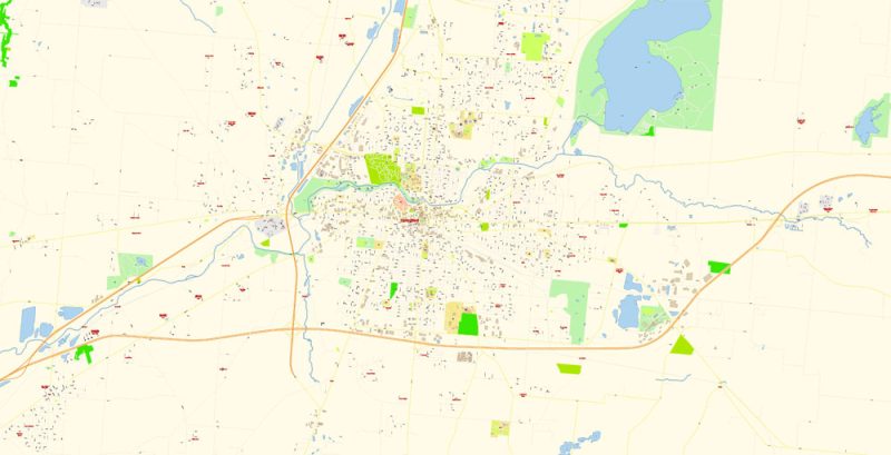
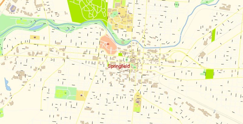
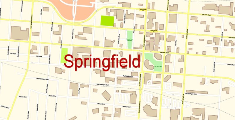
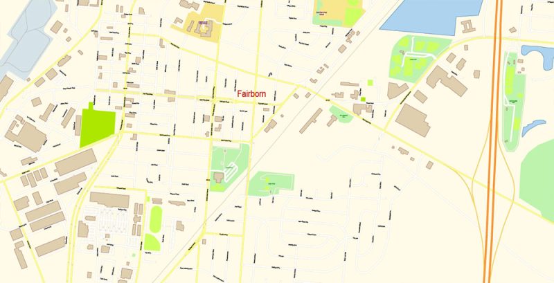
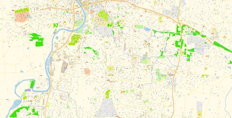
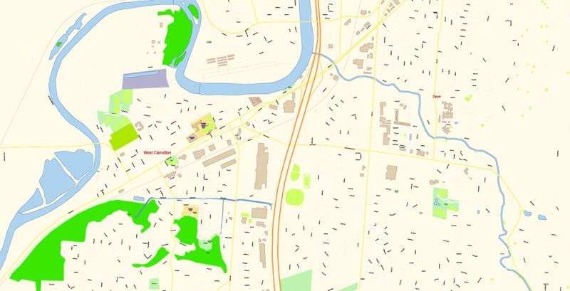
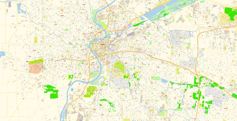
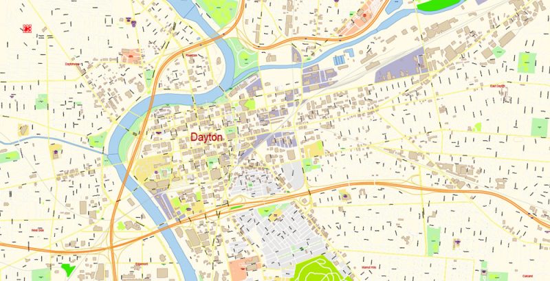
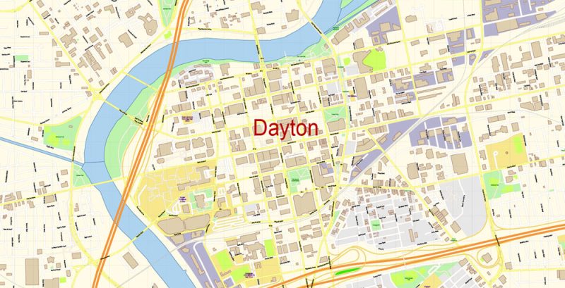
Printable PDF Vector Map of Dayton + Springfield Ohio US detailed City Plan scale 100 m 1:3610 full editable Adobe PDF Street Map in layers, scalable, text format all names, 107 MB ZIP
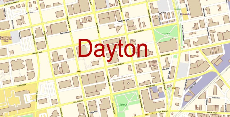
All street names, Main Objects, Buildings. Map for design, printing, arts, projects, presentations, for architects, designers, and builders, business, logistics.
Layers: color_fills, water, streets_roads, labels_roads, names_objects, names_streets, names_places, arrows_streets, buildings, legend, etc.
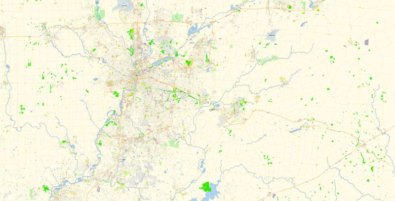
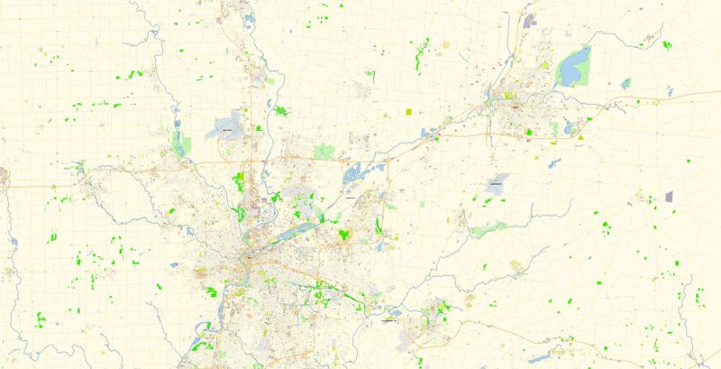
The most exact and detailed map of the city in scale.
IF YOU NEED: We can add the layer areas and numbers zip (postal) codes. Free for you.
For Editing and High-Quality Printing
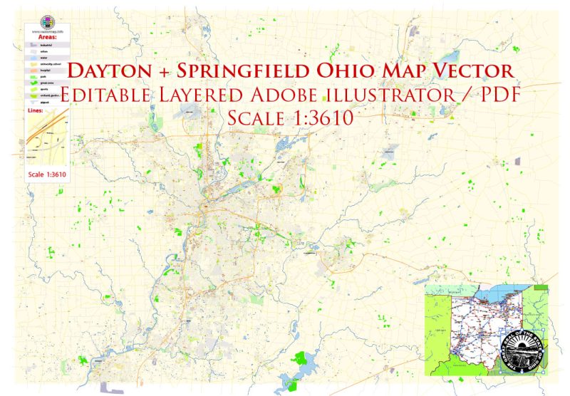
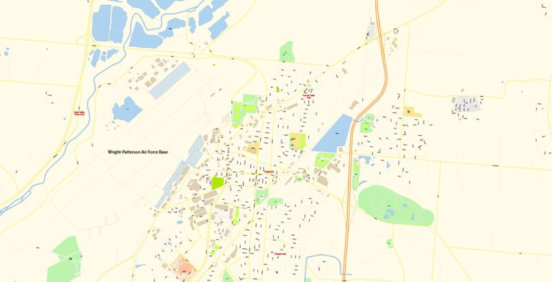
Dayton + Springfield Ohio US PDF Map Vector Exact City Plan High Detailed Street Map editable Adobe PDF in layers
Dayton
City in Ohio
Dayton is a city in western Ohio. It’s home to the National Museum of the U.S. Air Force, with a vast collection of aircraft from early 1900s planes to a space shuttle exhibit. Carillon Historical Park contains a Wright Brothers plane, 19th-century buildings and antique trains. The Boonshoft Museum of Discovery has kids’ science exhibits and a small zoo. International fine art is on view at the Dayton Art Institute.
Springfield
City in Ohio
Springfield is a city in the U.S. state of Ohio and the county seat of Clark County. The municipality is located in southwestern Ohio and is situated on the Mad River, Buck Creek, and Beaver Creek, approximately 45 miles west of Columbus and 25 miles northeast of Dayton.
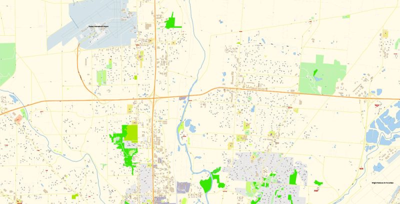
Dayton + Springfield Ohio US PDF Map Vector Exact City Plan High Detailed Street Map editable Adobe PDF in layers
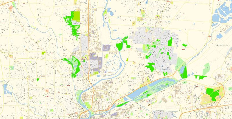
Dayton + Springfield Ohio US PDF Map Vector Exact City Plan High Detailed Street Map editable Adobe PDF in layers
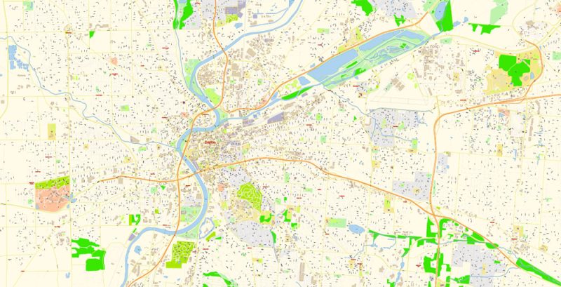
Dayton + Springfield Ohio US PDF Map Vector Exact City Plan High Detailed Street Map editable Adobe PDF in layers
Dayton + Springfield Ohio US PDF Map Vector Exact City Plan High Detailed Street Map editable Adobe PDF in layers
Dayton + Springfield Ohio US PDF Map Vector Exact City Plan High Detailed Street Map editable Adobe PDF in layers
Dayton + Springfield Ohio US PDF Map Vector Exact City Plan High Detailed Street Map editable Adobe PDF in layers
Dayton + Springfield Ohio US PDF Map Vector Exact City Plan High Detailed Street Map editable Adobe PDF in layers
Dayton + Springfield Ohio US PDF Map Vector Exact City Plan High Detailed Street Map editable Adobe PDF in layers
Dayton + Springfield Ohio US PDF Map Vector Exact City Plan High Detailed Street Map editable Adobe PDF in layers
Dayton + Springfield Ohio US PDF Map Vector Exact City Plan High Detailed Street Map editable Adobe PDF in layers
Dayton + Springfield Ohio US PDF Map Vector Exact City Plan High Detailed Street Map editable Adobe PDF in layers
Dayton + Springfield Ohio US PDF Map Vector Exact City Plan High Detailed Street Map editable Adobe PDF in layers
Dayton + Springfield Ohio US PDF Map Vector Exact City Plan High Detailed Street Map editable Adobe PDF in layers
Dayton + Springfield Ohio US PDF Map Vector Exact City Plan High Detailed Street Map editable Adobe PDF in layers
Dayton + Springfield Ohio US PDF Map Vector Exact City Plan High Detailed Street Map editable Adobe PDF in layers
Dayton + Springfield Ohio US PDF Map Vector Exact City Plan High Detailed Street Map editable Adobe PDF in layers


 Author: Kirill Shrayber, Ph.D. FRGS


