Extended Description of the Vector Map
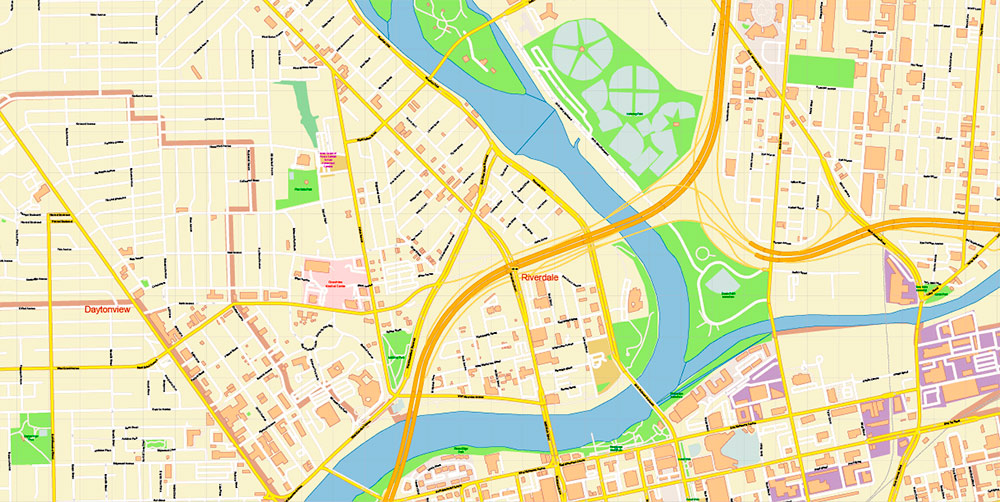
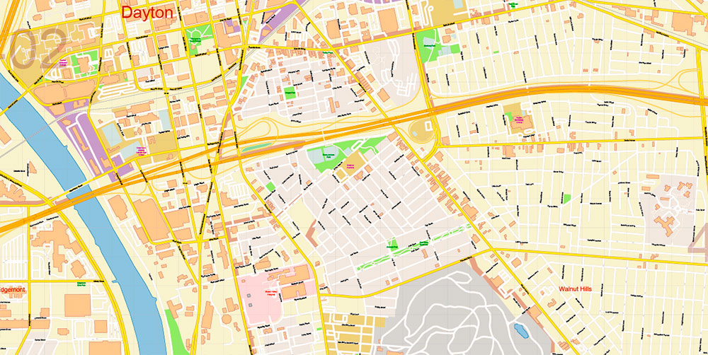
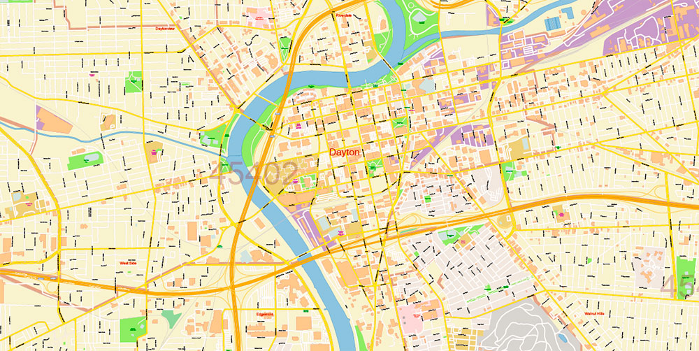
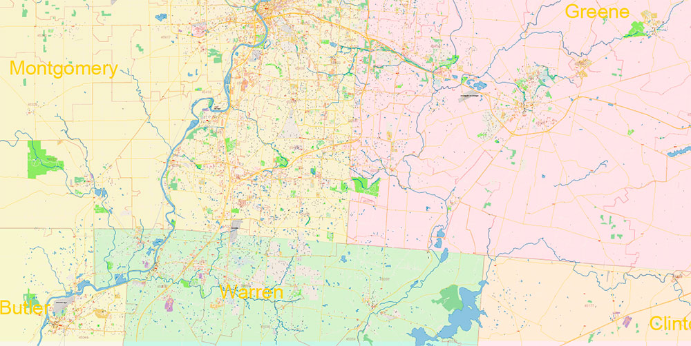
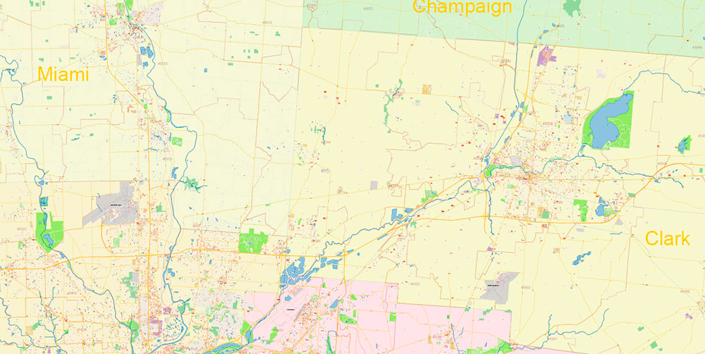
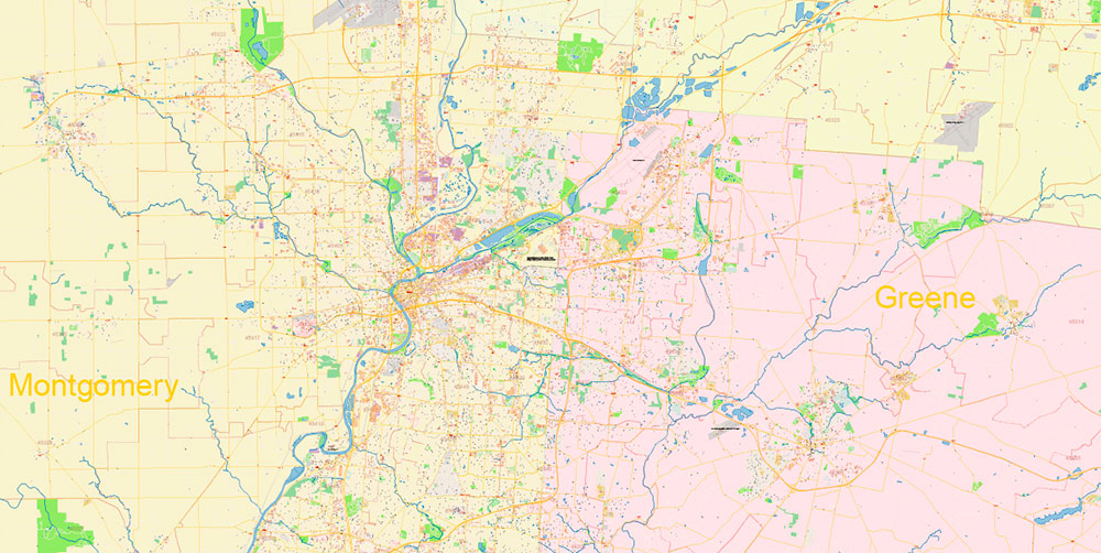
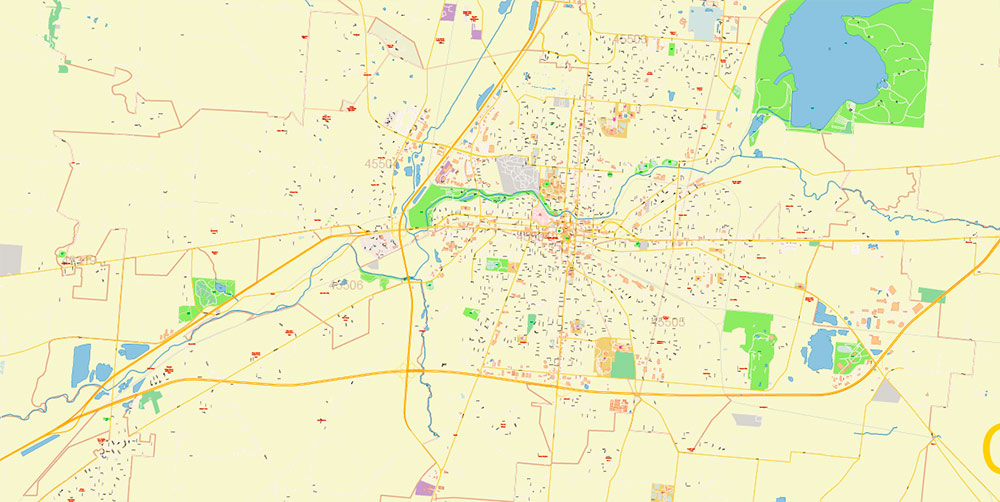
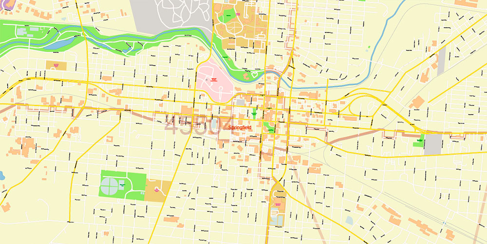
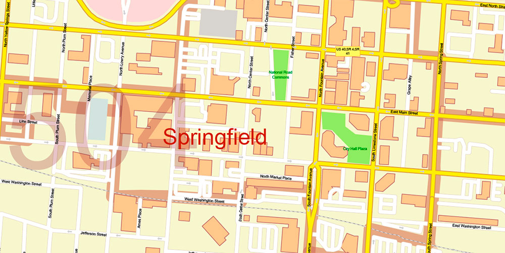
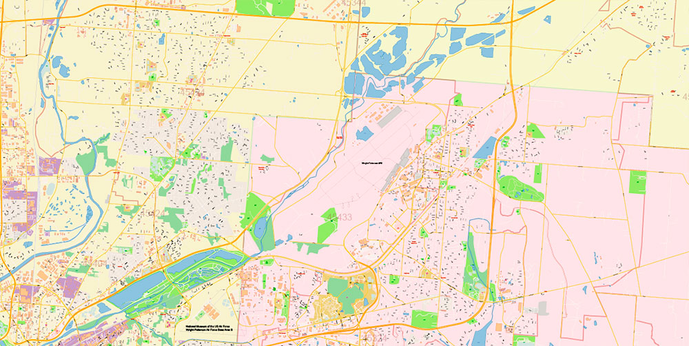
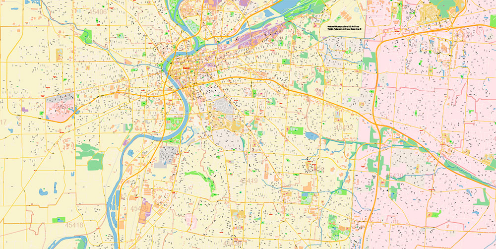
Printable Vector Map of Dayton Springfield Ohio US detailed City Plan + Counties areas + ZIP (postal) Codes areas with numbers, scale 1:3609 full editable Adobe Illustrator Street Map in layers, scalable, text format all names, 21 MB ZIP
All street names, Main Objects, Buildings, ZIP Codes areas, counties. Map for design, printing, arts, projects, presentations, for architects, designers, and builders, business, logistics.
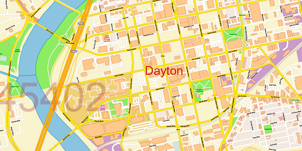
Download FREE fragment of Dayton High Detailed Vector Map 6 MB ZIP >>>>>
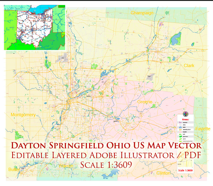
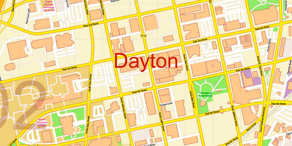
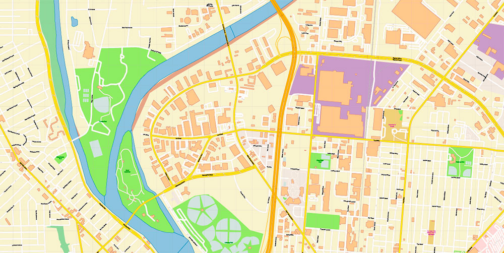
Dayton Springfield Ohio US Map Vector Exact City Plan High Detailed Street Map + ZIP-Codes editable Adobe Illustrator in layers
Layers list:
- Legend
- Grids
- Labels of roads
- Names of places (city, hamlet, etc.)
- Names of objects (hospitals, schools, parks, water)
- Names of main streets
- Names of civil streets
- Arrows of streets
- Main Streets, roads, railroads, lines
- Civil streets
- ZIP Codes numbers
- ZIP Codes areas
- Railroads
- Buildings
- Airports and heliports
- Water objects (rivers, lakes, ponds)
- Waterways
- Color fills (parks, hospital areas, school areas, land use, etc.)
- Names Counties
- Counties areas
- Background
Dayton Springfield Ohio US Map Vector Exact City Plan High Detailed Street Map + ZIP-Codes editable Adobe Illustrator in layers
Dayton is located in Western Ohio, in Montgomery County. Located on the Miami River, it is not only the logistics center of the region but also one of the leading centers of aerospace and aviation research in the United States. The city even has a National Museum of the US air force on the territory of the Wright-Petterson military base, as well as the aviation Hall of fame.
Dayton Springfield Ohio US Map Vector Exact City Plan High Detailed Street Map + ZIP-Codes editable Adobe Illustrator in layers
In 1796, 12 people, known as the” Thompson company”, traveling on pirogues from Cincinnati up the Miami River, landed on the territory of an Indian settlement and remained there to live. A year later, a permanent river connection was established with Cincinnati, and in 1805 the settlement received the status of a city and became known as Dayton – in honor of the hero of the war of independence of the United States, captain Jonathan Dayton.
Dayton Springfield Ohio US Map Vector Exact City Plan High Detailed Street Map + ZIP-Codes editable Adobe Illustrator in layers
The city is known to the world as the birthplace of the Wright brothers aviation pioneers. They spent their entire lives in Dayton, patenting several inventions, including the self-guided airplane. In General, Dayton has been an all-American leader in innovation and invention since the 1870s. Dayton has held the status of a prominent center of engineering and new industrial technologies for many decades. Many of the city’s architectural attractions are associated with this area.
Dayton Springfield Ohio US Map Vector Exact City Plan High Detailed Street Map + ZIP-Codes editable Adobe Illustrator in layers
In addition, there are many old mansions, beautiful churches, and modern sports arenas in Dayton. There are also places to spend cultural leisure: several museums, galleries, and theaters. The annual Daytona air show is one of the largest in the United States. Another significant holiday in the city is the Celtic festival, which attracts up to 30 thousand participants.
Dayton Springfield Ohio US Map Vector Exact City Plan High Detailed Street Map + ZIP-Codes editable Adobe Illustrator in layers
Dayton Springfield Ohio US Map Vector Exact City Plan High Detailed Street Map + ZIP-Codes editable Adobe Illustrator in layers
Dayton Springfield Ohio US Map Vector Exact City Plan High Detailed Street Map + ZIP-Codes editable Adobe Illustrator in layers
Dayton Springfield Ohio US Map Vector Exact City Plan High Detailed Street Map + ZIP-Codes editable Adobe Illustrator in layers
Dayton Springfield Ohio US Map Vector Exact City Plan High Detailed Street Map + ZIP-Codes editable Adobe Illustrator in layers
Dayton Springfield Ohio US Map Vector Exact City Plan High Detailed Street Map + ZIP-Codes editable Adobe Illustrator in layers
Dayton Springfield Ohio US Map Vector Exact City Plan High Detailed Street Map + ZIP-Codes editable Adobe Illustrator in layers
Dayton Springfield Ohio US Map Vector Exact City Plan High Detailed Street Map + ZIP-Codes editable Adobe Illustrator in layers
Dayton Springfield Ohio US Map Vector Exact City Plan High Detailed Street Map + ZIP-Codes editable Adobe Illustrator in layers
Dayton Springfield Ohio US Map Vector Exact City Plan High Detailed Street Map + ZIP-Codes editable Adobe Illustrator in layers

 Author: Kirill Shrayber, Ph.D. FRGS


