Extended Description of the Vector Map
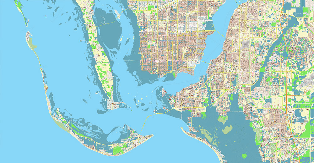
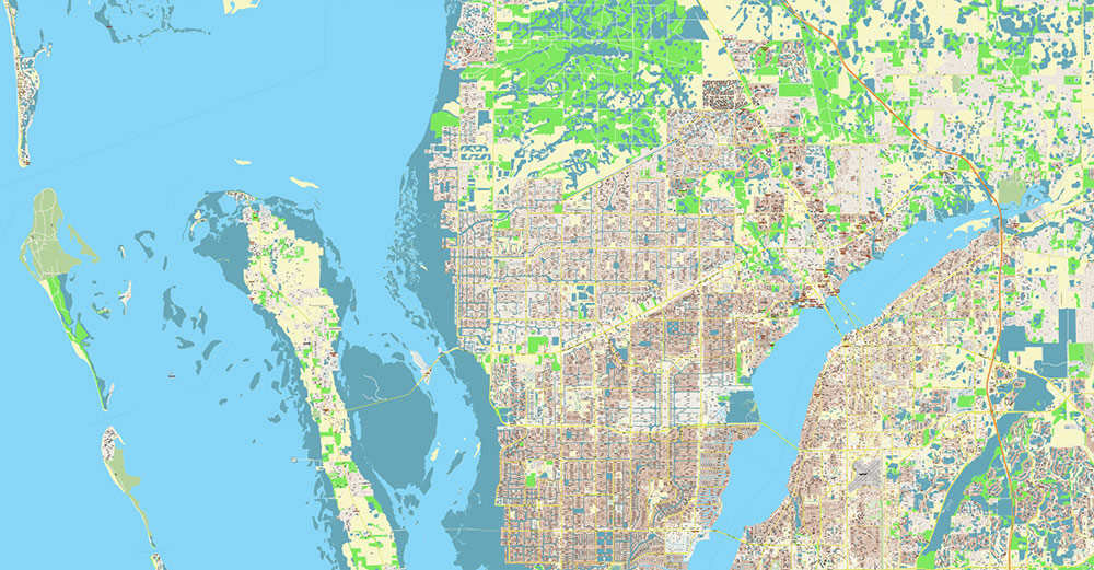
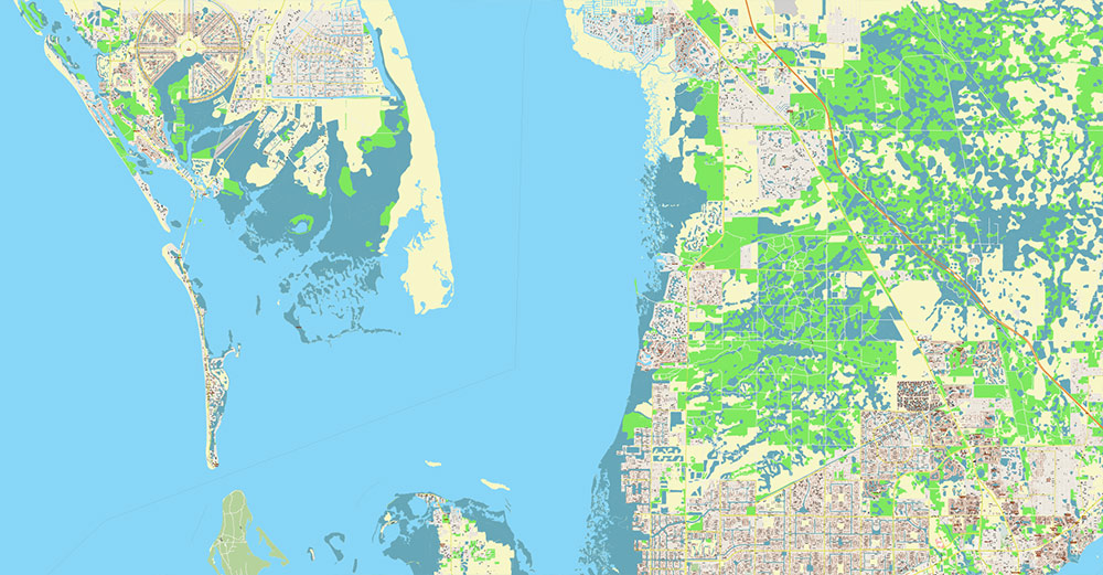
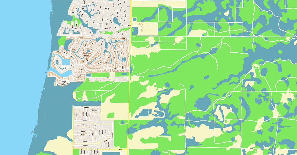
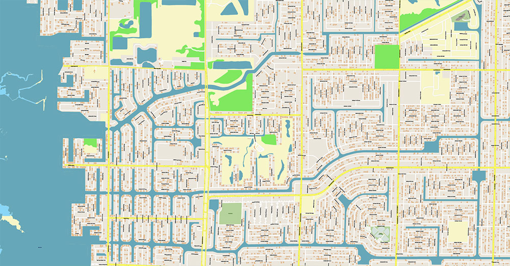
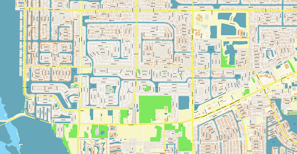
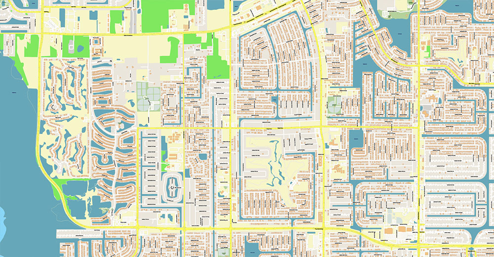
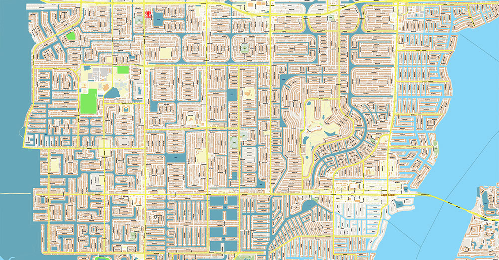
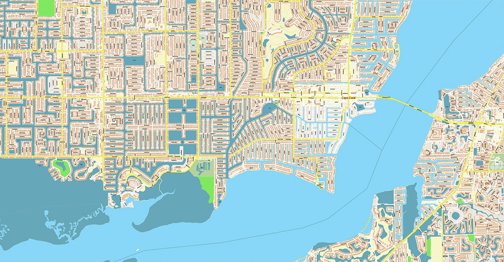
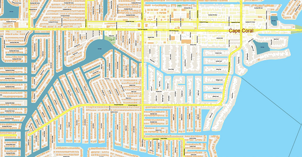
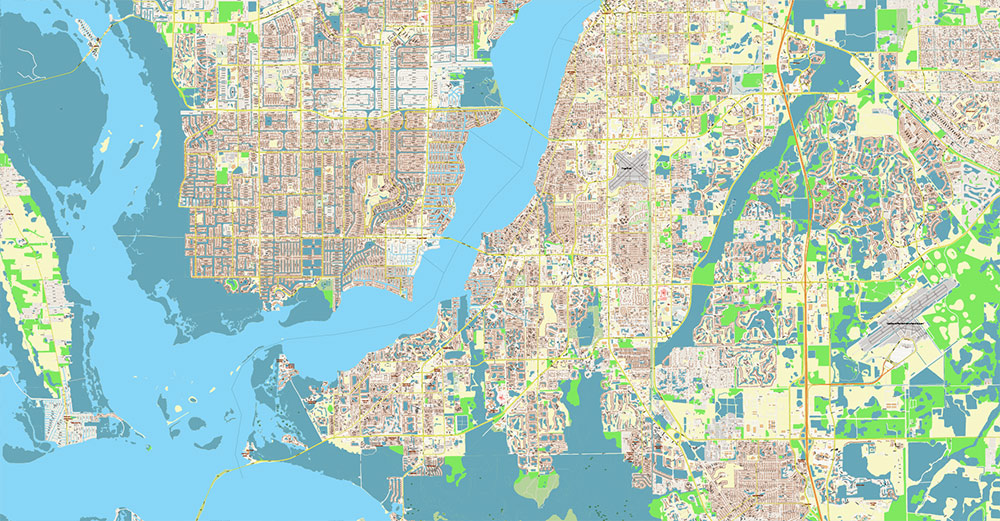
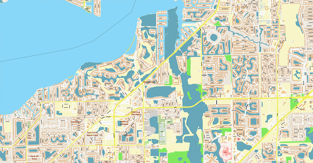
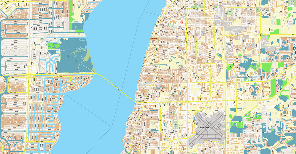
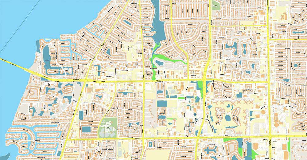
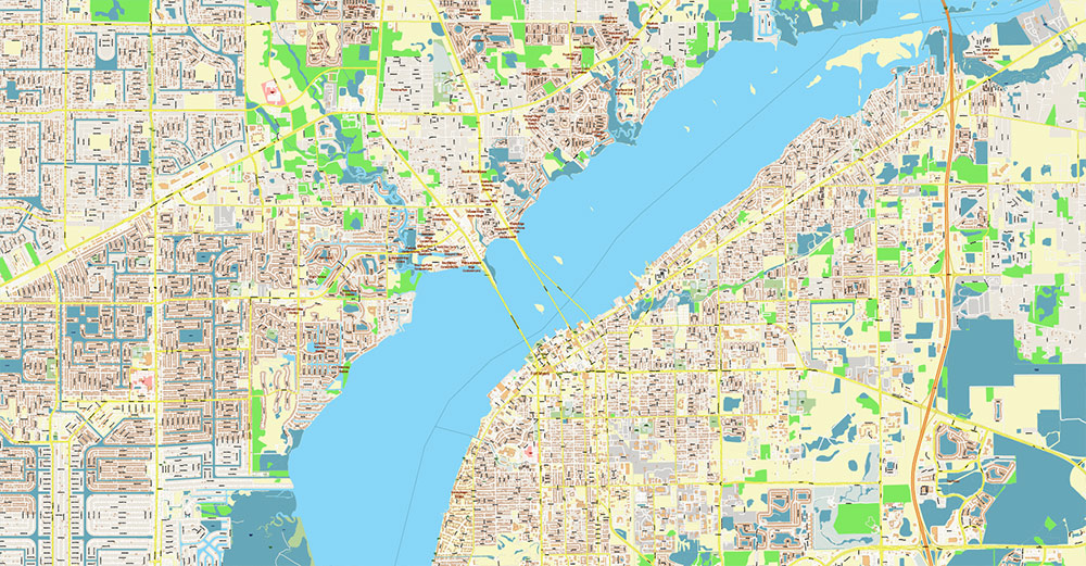
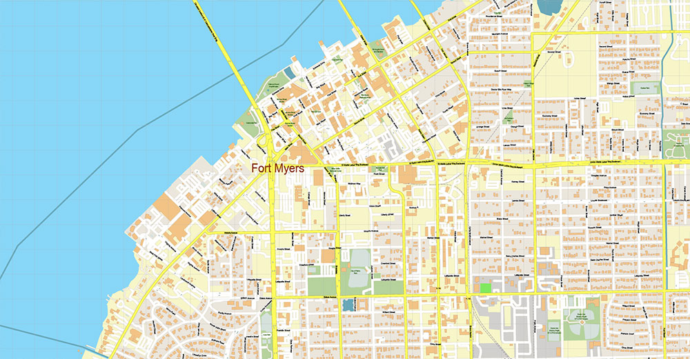
Printable PDF Vector Map of Cape Coral + Fort Myers Florida US High Detailed City Plan scale 1:4200 fully editable Adobe PDF Street Map in layers, scalable, text/curves format all names, 170 MB ZIP
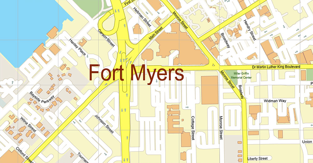
All street names, Main Objects, Buildings. Map for design, printing, arts, projects, presentations, for architects, designers, and builders, business, logistics.
Also: We can add (additional layer for this map), any other objects for you. It’s free for our customers.
If you need any OTHER format – DWG, DXF, Corel, or something else – please, email us
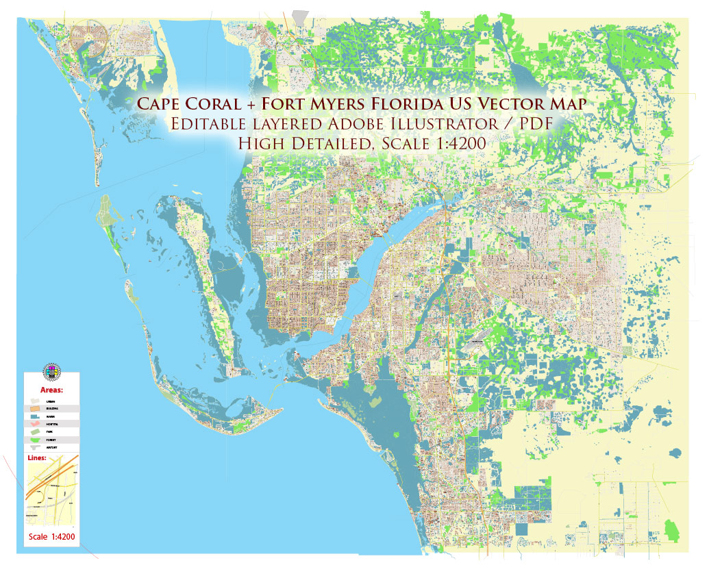
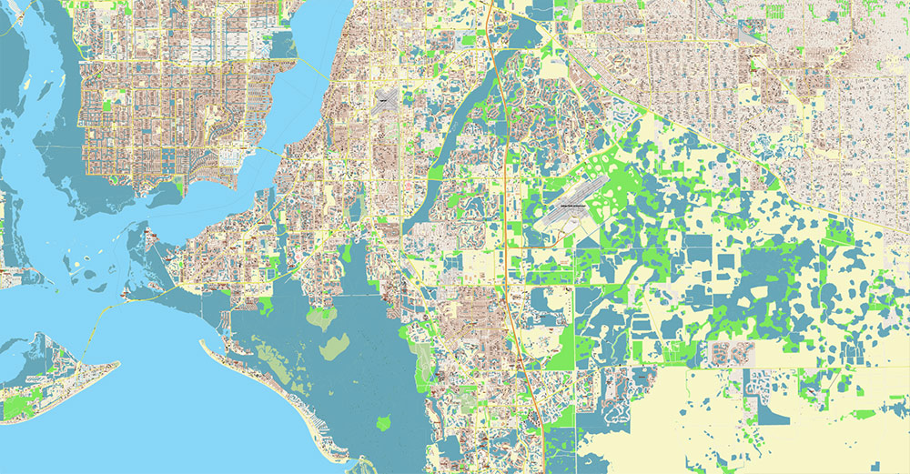
Cape Coral + Fort Myers Florida US PDF Map Vector City Plan High Detailed Street Map editable Adobe PDF in layers
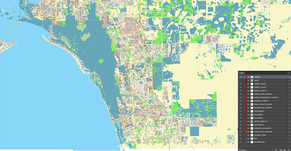
Layers list:
- Legend
- Grids
- Labels of roads
- Names of places (city, hamlet, etc.)
- Names of objects (hospitals, parks, water)
- Names of main streets
- Names of residential streets
- Arrows of street directions
- Main Streets, roads
- Residential streets
- Railroads
- Buildings
- Waterways
- Water objects (rivers, lakes, ponds, marshes)
- Airports, Heliports areas
- Color fills (parks, hospital areas, land use, etc.)
- Islands
- Background and sea
AO BRIEF — Fort Myers – Cape Coral Urban Area (Florida)
Area profile
-
Urban type: Bi-city coastal metro separated by a tidal river; one of the fastest-growing zones in Southwest Florida.
-
Metro population: ~861,000 (Cape Coral – Fort Myers MSA).
-
Urban form: Low-density, auto-oriented sprawl with water-structured layout (canals, estuaries, wetlands).
Physical geography
-
Elevation: Mostly 0–10 m above sea level.
-
Terrain: Flat coastal plain; high water table; artificial canal networks dominate Cape Coral.
-
Hydrology: Caloosahatchee River (east–west flow) is the primary barrier/axis; connects Lake Okeechobee to the Gulf.
-
Land cover mix (approx.):
-
Residential/urban: ~45–50% developed footprint in core zones
-
Wetlands/mangroves: ~20% regional environment
-
Water surfaces (canals, bays, estuaries): visually and functionally dominant
-
Climate: Humid subtropical; ~1,300–1,400 mm annual rainfall; hurricane return risk high (Atlantic basin exposure).
Transportation network (quantified hierarchy)
Interstate
US highways
State/arterial routes
-
SR-82 (Daniels Pkwy): Airport corridor; 6-lane segments; growth front eastward
-
SR-80 (Palm Beach Blvd): Historic east corridor; river-adjacent settlements
-
Pine Island Rd: Main east-west commercial spine in Cape Coral
Bridge crossings (critical bottlenecks)
| Bridge |
Function |
Role |
| Midpoint Bridge |
Colonial Blvd ↔ Veterans Pkwy |
Primary commuter crossing |
| Cape Coral Bridge |
College Pkwy axis |
South urban connector |
| Caloosahatchee Bridge |
US-41 |
Downtown/North access |
Traffic flow concentrates on 3 crossings → high sensitivity to incidents or storms.
Urban districts (functional zoning)
Fort Myers
-
Downtown/River District — civic, nightlife, waterfront redevelopment
-
McGregor Blvd corridor — heritage residential, cultural tourism
-
South FM/Gateway — logistics, airport-adjacent employment
-
Beach access corridors — seasonal tourism flow
Cape Coral
-
SE Cape — densest commercial/bridge-proximate zone
-
SW Cape — high-value waterfront housing
-
North Cape — fastest residential expansion
-
Canal sectors — fragmented street continuity; arterial dependence
Economy (sector distribution est.)
| Sector |
Share (approx.) |
Notes |
| Tourism & hospitality |
18–22% |
Beaches, seasonal population |
| Healthcare & social services |
17–20% |
Large hospital systems |
| Construction/real estate |
15–18% |
In-migration driven |
| Retail/services |
14–16% |
Strip-based corridors |
| Marine trades |
5–7% |
Boat storage, repair |
Seasonal economic amplitude significant (winter peak population surge).
Demographics
| Indicator |
Cape Coral |
Fort Myers |
| Population |
~233k |
~100k |
| Median age |
~47–48 yrs |
~39–40 yrs |
| 65+ share |
High (retiree concentration) |
Moderate |
| Growth trend |
Rapid suburban expansion |
Urban infill + migration |
Large retiree cohort → healthcare demand + daytime traffic patterns differ from commuter metros.
Mobility & infrastructure
-
Airport: Southwest Florida International Airport (RSW) ~16 km SE of Fort Myers core.
-
Public transit: Limited bus network; <5% commute share.
-
Modal split: >85% private vehicle.
-
Port functions: Small marinas; no major deepwater commercial port in the urban core.
Environmental & operational constraints
-
Storm surge zones along river mouths and barrier islands
-
Drainage sensitivity during heavy rainfall events
-
Bridge dependence = evacuation vulnerability
-
Urban heat + humidity affect outdoor operations
Strategic summary
-
Movement structure = I-75 backbone + 3 river bridges + airport corridor
-
Urban continuity weaker than road map suggests due to canals
-
High seasonal population swing affects capacity planning
-
Best mapping layers: elevation/flood zones, arterial hierarchy, bridge chokepoints, canal barriers
Cape Coral + Fort Myers Florida US PDF Map Vector City Plan High Detailed Street Map editable Adobe PDF in layers
Cape Coral + Fort Myers Florida US PDF Map Vector City Plan High Detailed Street Map editable Adobe PDF in layers
Cape Coral + Fort Myers Florida US PDF Map Vector City Plan High Detailed Street Map editable Adobe PDF in layers
Cape Coral + Fort Myers Florida US PDF Map Vector City Plan High Detailed Street Map editable Adobe PDF in layers
Cape Coral + Fort Myers Florida US PDF Map Vector City Plan High Detailed Street Map editable Adobe PDF in layers
Cape Coral + Fort Myers Florida US PDF Map Vector City Plan High Detailed Street Map editable Adobe PDF in layers
Cape Coral + Fort Myers Florida US PDF Map Vector City Plan High Detailed Street Map editable Adobe PDF in layers
Cape Coral + Fort Myers Florida US PDF Map Vector City Plan High Detailed Street Map editable Adobe PDF in layers
Cape Coral + Fort Myers Florida US PDF Map Vector City Plan High Detailed Street Map editable Adobe PDF in layers
Cape Coral + Fort Myers Florida US PDF Map Vector City Plan High Detailed Street Map editable Adobe PDF in layers
Cape Coral + Fort Myers Florida US PDF Map Vector City Plan High Detailed Street Map editable Adobe PDF in layers
Cape Coral + Fort Myers Florida US PDF Map Vector City Plan High Detailed Street Map editable Adobe PDF in layers
Cape Coral + Fort Myers Florida US PDF Map Vector City Plan High Detailed Street Map editable Adobe PDF in layers
Cape Coral + Fort Myers Florida US PDF Map Vector City Plan High Detailed Street Map editable Adobe PDF in layers
Cape Coral + Fort Myers Florida US PDF Map Vector City Plan High Detailed Street Map editable Adobe PDF in layers
Cape Coral + Fort Myers Florida US PDF Map Vector City Plan High Detailed Street Map editable Adobe PDF in layers
Cape Coral + Fort Myers Florida US PDF Map Vector City Plan High Detailed Street Map editable Adobe PDF in layers
Cape Coral + Fort Myers Florida US PDF Map Vector City Plan High Detailed Street Map editable Adobe PDF in layers
Cape Coral + Fort Myers Florida US PDF Map Vector City Plan High Detailed Street Map editable Adobe PDF in layers

 Author: Kirill Shrayber, Ph.D. FRGS
 US Map Vector Exact City Plan High Detailed Street Map editable Adobe Illustrator in layers")
