Extended Description of the Vector Map
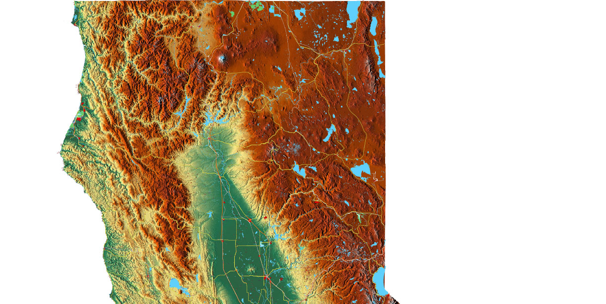
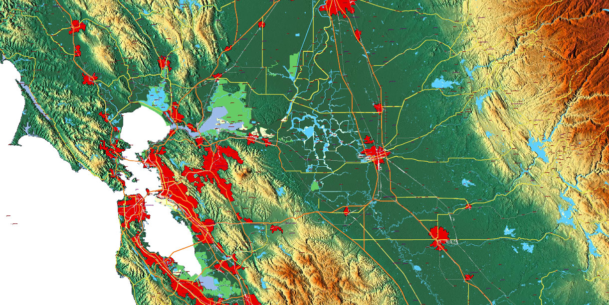
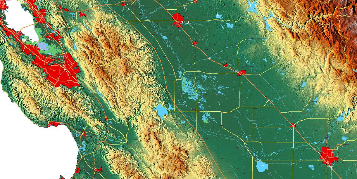
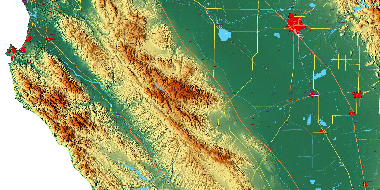
Printable PDF + DXF Relief Vector Map California State (Full Area), US detailed fully editable Road Map in layers, scalable, text/curves format all names, 510 MB ZIP
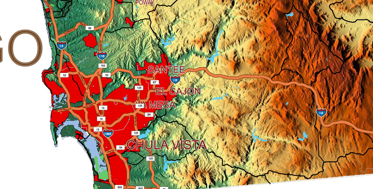
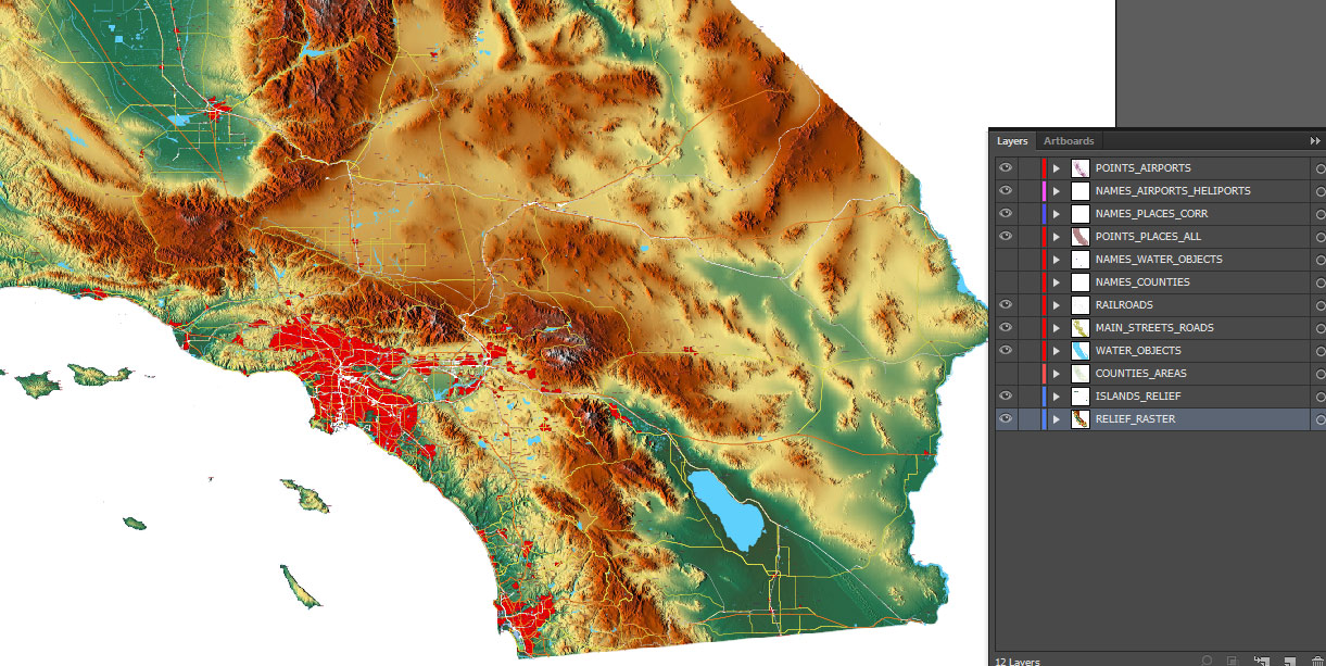
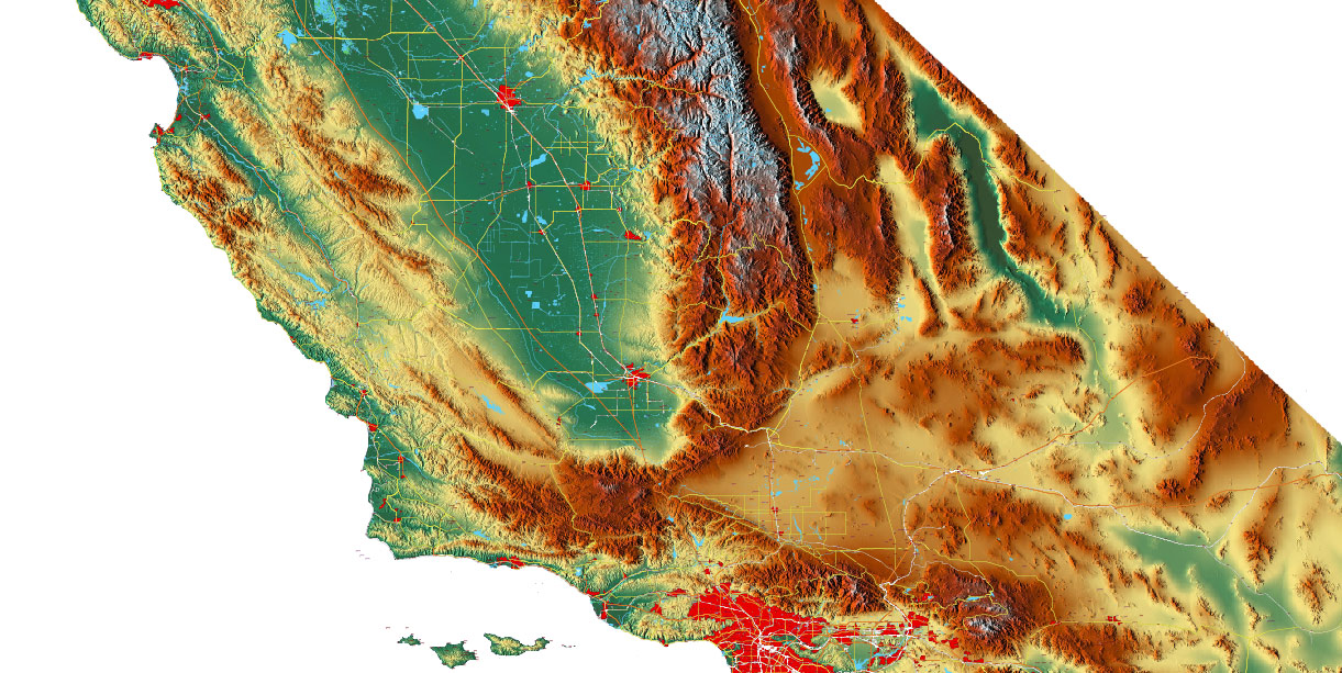
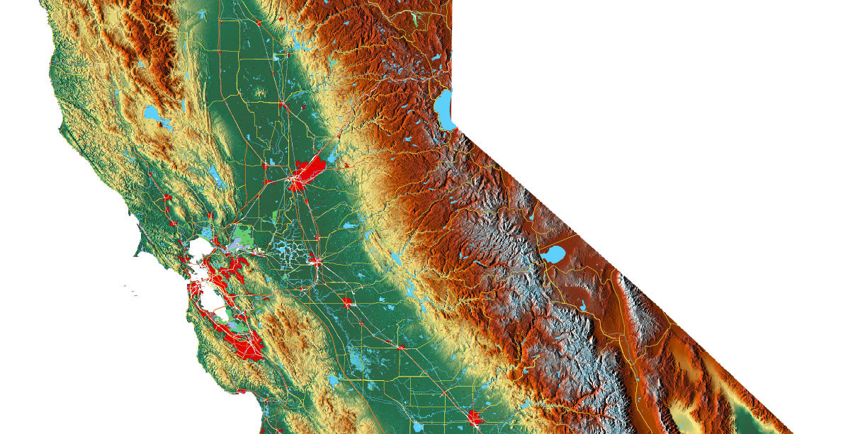
Main streets and roads, Cities and Towns, Water Objects, Railroads, Airports, Relief raster, foe Print Size 4 ft.. Map for design, printing, arts, projects, presentations, for architects, designers, and builders, business, logistics.
Note: 2 complete road lines, 2 complete places names, road shields.
Also: We can add (additional layer for this map), any other objects for you. It’s free for our customers.
If you need any OTHER format – DWG, Corel, or something else – please, email us
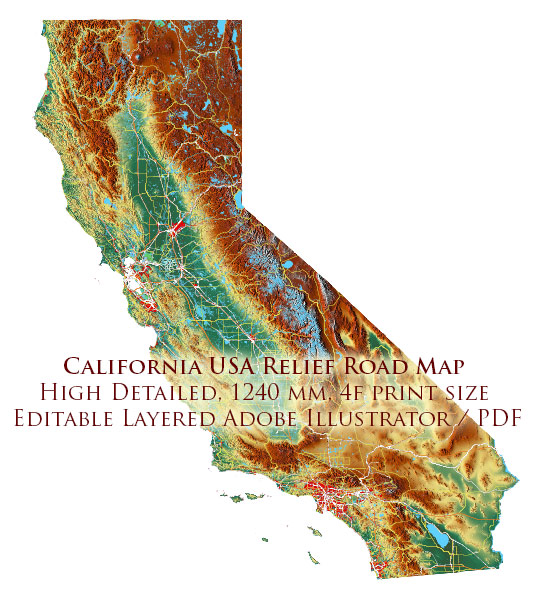
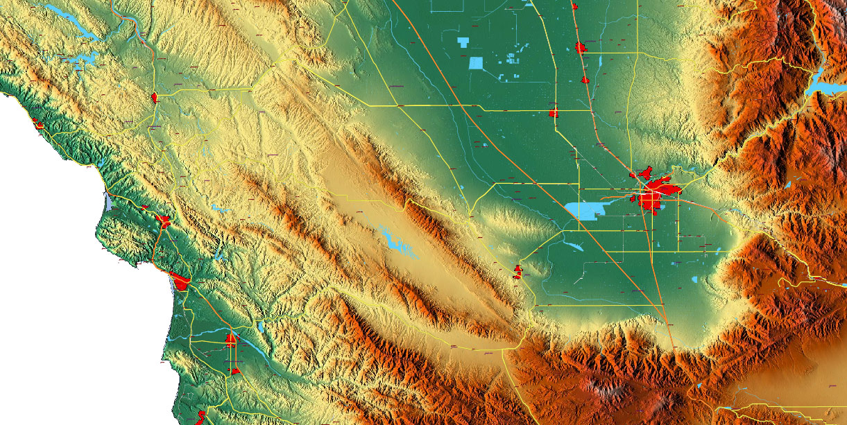
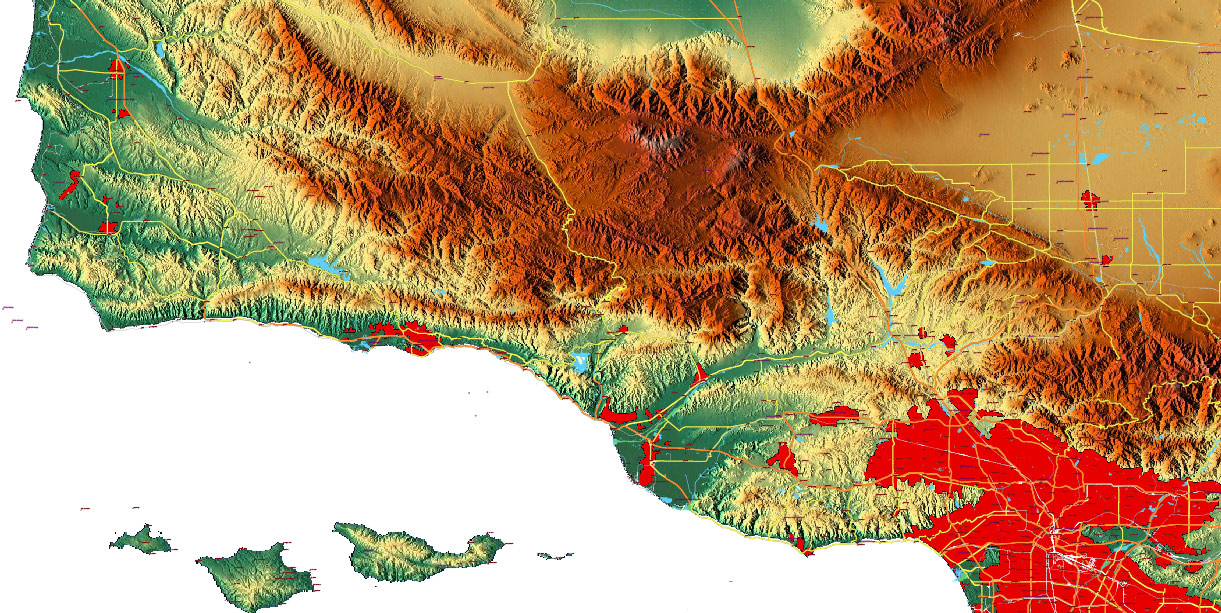
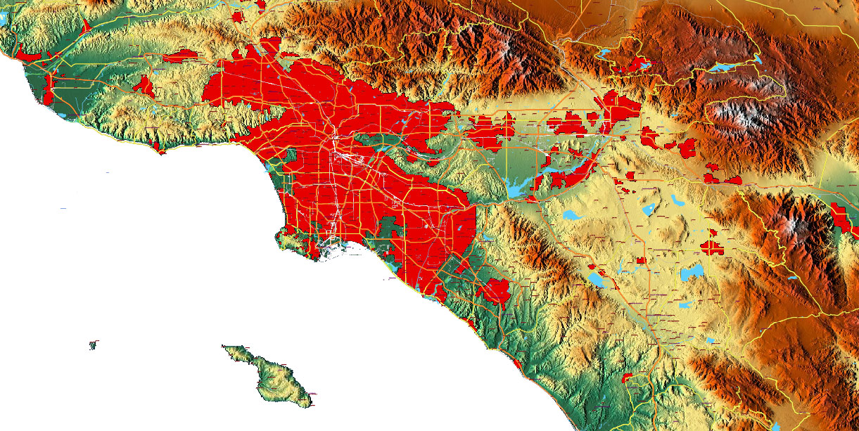
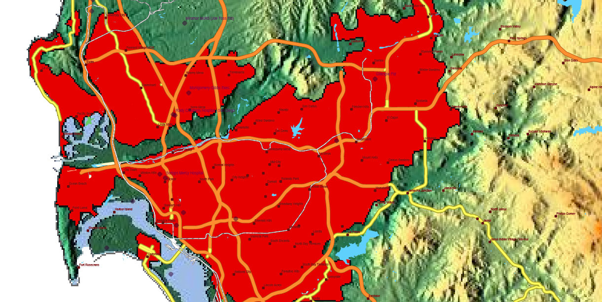
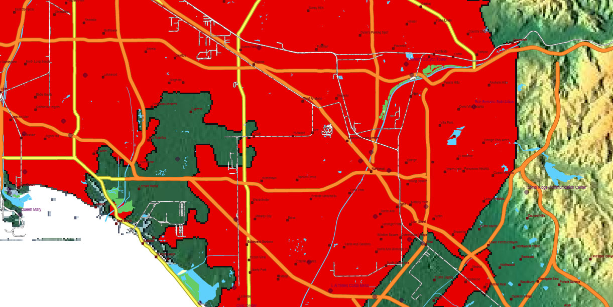
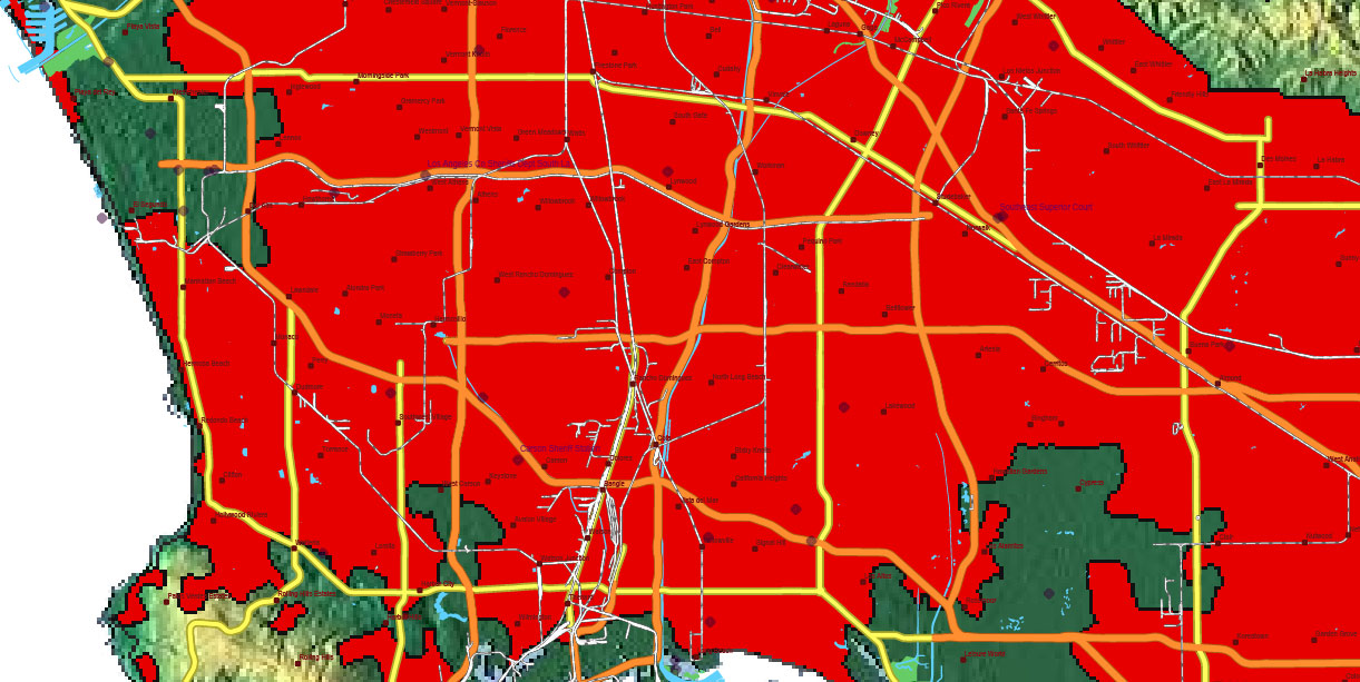
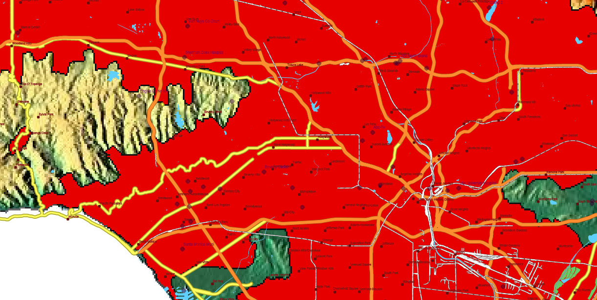
California State US Map Vector PDF + DXF Exact High Detailed Roads Map + Relief Topo (raster) editable Adobe PDF + CAD DXF in layers
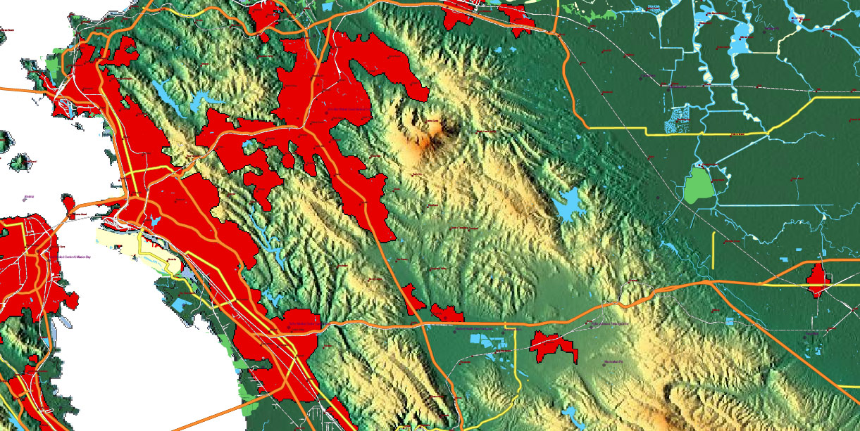
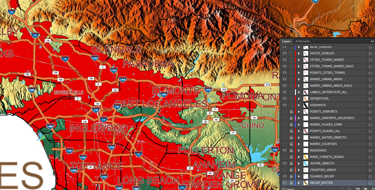
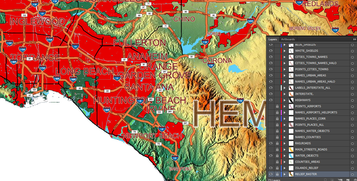
Layers list: (see preview)
- Names of Airports
- Points of Airports
- Names of places (city, hamlet, etc.) 1,2
- Points of places 1, 2
- Names of urban areas
- Names Highways
- Road labels (shields)
- Main streets and roads 1,2
- Railroads
- Water objects (areas)
- Counties areas
- Islands raster PNG images
- Relief Topo raster PNG image
California State US Map Vector PDF + DXF Exact High Detailed Roads Map + Relief Topo (raster) editable Adobe PDF + CAD DXF in layers
California State US Map Vector PDF + DXF Exact High Detailed Roads Map + Relief Topo (raster) editable Adobe PDF + CAD DXF in layers
California State US Map Vector PDF + DXF Exact High Detailed Roads Map + Relief Topo (raster) editable Adobe PDF + CAD DXF in layers
California State US Map Vector PDF + DXF Exact High Detailed Roads Map + Relief Topo (raster) editable Adobe PDF + CAD DXF in layers
California, United States
Overview
-
Location: U.S. West Coast; borders Oregon (N), Nevada/Arizona (E), Mexico (S), Pacific Ocean (W).
-
Terrain: Four dominant belts N–S: Coast Ranges (rugged littoral), Central Valley (flat, irrigated), Sierra Nevada (high alpine spine), Great Basin & Mojave deserts (east/southeast). Elevation from sea level to >4,300 m (Mt. Whitney).
-
Key corridors: Movement canalized by coastal gaps, Central Valley floor, Sierra passes, and desert basins.
Key Roads / Lines of Communication
-
North–South spines:
-
I-5 (primary MSR along Central Valley; links Mexico ↔ Oregon).
-
US-101 (coastal MSR through LA–SF corridor).
-
CA-99 (Fresno–Bakersfield–Sacramento ag belt).
-
US-395 (east of Sierra; Owens Valley).
-
East–West trunks / passes:
-
I-80 (SF Bay ↔ Sacramento ↔ Sierra/Donner Pass ↔ Reno).
-
I-10 (Los Angeles ↔ Inland Empire ↔ Arizona).
-
I-40 (Barstow ↔ Needles ↔ Arizona).
-
I-8 (San Diego ↔ Imperial Valley ↔ Arizona).
-
I-580/I-680 (Bay Area bypass), I-405 (LA bypass).
-
CA-58 (Bakersfield ↔ Tehachapi Pass ↔ Mojave/Barstow; rail & highway chokepoint).
-
SR-14 (LA ↔ Antelope Valley), CA-46/41 (coast ↔ Central Valley).
-
Chokepoints: Grapevine (I-5/Tejon Pass), Tehachapi/CA-58, Donner Pass (I-80), LA/OC freeways, Bay bridges.
Urban / Key Nodes
-
Los Angeles Basin (LA, Long Beach, Anaheim, Inland Empire): largest population/industry; port complex.
-
San Francisco Bay Area (SF, Oakland, San José): tech/finance, container port at Oakland, multiple bridges.
-
San Diego (border metropolis, major naval hub).
-
Sacramento (state capital; government/logistics hub).
-
Fresno–Bakersfield (ag/energy in Central Valley).
-
Other anchors: Stockton/Modesto, Santa Barbara/Ventura, Riverside, Santa Rosa, Redding.
Water / Hydrology
-
Rivers: Sacramento (north → Delta), San Joaquin (south → Delta), Klamath (far north), Colorado (SE border).
-
Delta & Bay: Sacramento–San Joaquin Delta drains to San Francisco Bay; vital levees, tidal influence.
-
Major reservoirs: Shasta, Oroville, Folsom, San Luis, Trinity, Don Pedro, Isabella (flood control/power/irrigation).
-
Aqueducts: California Aqueduct (State Water Project), Los Angeles Aqueduct, Colorado River Aqueduct—long-haul water to SoCal.
-
Coastline: Long littoral with natural/engineered harbors (LA/Long Beach, San Diego, San Pedro, Oakland).
-
Hazards: Levee failure risk in Delta; drought variability; debris flows after fires.
Climate / Seasonality
-
Mediterranean on coast/valleys: Wet winters (Nov–Mar), dry summers; marine layer along coast.
-
Sierra Nevada: Heavy winter snow; spring melt swells rivers; many high passes closed or restricted in winter.
-
Deserts (Mojave/Colorado): Very hot, arid; dust, monsoon thunderstorms late summer.
-
Wildfire season: Late summer–autumn (peaks with Santa Ana/Diablo winds); smoke impacts visibility/air ops.
-
Seismic: Active faults (San Andreas, Hayward, San Jacinto) — infrastructure vulnerability.
Demography / Human Terrain
-
Population: ~39–40 million; highly urbanized along LA Basin, Bay Area, San Diego, with continuous towns along I-5/CA-99.
-
Economy: Tech/biotech, entertainment, ports/logistics, aerospace/defense, agriculture (almonds, citrus, grapes, dairy), energy (Central Valley oil/gas, renewables).
-
Languages/Culture: English dominant; widespread Spanish; diverse immigrant communities; strong environmental/regulatory frameworks.
Ports / Airheads / Rail
-
Seaports: Los Angeles & Long Beach (largest U.S. container complex), Oakland, San Diego (naval/commercial), Richmond, Hueneme (vehicles/ag).
-
Airports (power projection): LAX, SFO, SAN, SJC, OAK, SAC/SMF, ONT, LGB; numerous joint-use/DoD fields (Edwards AFB, Vandenberg/VSFB, Travis AFB, MCAS Miramar).
-
Rail MSRs (UP/BNSF): Tehachapi Pass (Bakersfield–Mojave), Donner Pass (I-80), Cajon Pass (Inland Empire–High Desert), Altamont (Bay–Valley).
Hazards / Threats
-
Wildfire & smoke, mud/debris flows after storms, drought/heat waves, earthquakes (lifeline disruption), landslides along coastal highways (e.g., Big Sur on US-1).
-
Flooding in Central Valley during atmospheric rivers; Delta levee breaches = wide-area impacts.
-
Traffic density on LA/OC/Bay networks; bridge/tunnel dependencies.
Logistics / Sustainment
-
Primary MSR: I-5 spine with lateral links (I-80, CA-58, I-10/40/8).
-
Alternates: US-101 (coastal), CA-99 (Valley), US-395 (east flank).
-
Fuel: Abundant along interstates; refineries clustered in LA Basin and Bay Area.
-
Water: Reliant on aqueducts/reservoirs; local restrictions in drought—plan for organic purification and distribution.
Command Takeaways
-
Control of passes (Grapevine/Tejon, Cajon, Tehachapi, Donner) and bridge nodes (Bay crossings, Delta levees) = control of maneuver and sustainment.
-
I-5/I-10/I-80 triad is the state’s strategic backbone; protect against fire, quake, and traffic disruption.
-
Wildfire/air quality and winter Sierra closures are the predictable operational limiters.
-
Ports (LA/LB, Oakland) and airheads (LAX/SFO/Travis) enable rapid entry; deconflict with dense civilian traffic patterns.
California State US Map Vector PDF + DXF Exact High Detailed Roads Map + Relief Topo (raster) editable Adobe PDF + CAD DXF in layers
California State US Map Vector PDF + DXF Exact High Detailed Roads Map + Relief Topo (raster) editable Adobe PDF + CAD DXF in layers
California State US Map Vector PDF + DXF Exact High Detailed Roads Map + Relief Topo (raster) editable Adobe PDF + CAD DXF in layers
California State US Map Vector PDF + DXF Exact High Detailed Roads Map + Relief Topo (raster) editable Adobe PDF + CAD DXF in layers
California State US Map Vector PDF + DXF Exact High Detailed Roads Map + Relief Topo (raster) editable Adobe PDF + CAD DXF in layers
California State US Map Vector PDF + DXF Exact High Detailed Roads Map + Relief Topo (raster) editable Adobe PDF + CAD DXF in layers
California State US Map Vector PDF + DXF Exact High Detailed Roads Map + Relief Topo (raster) editable Adobe PDF + CAD DXF in layers
California State US Map Vector PDF + DXF Exact High Detailed Roads Map + Relief Topo (raster) editable Adobe PDF + CAD DXF in layers
California State US Map Vector PDF + DXF Exact High Detailed Roads Map + Relief Topo (raster) editable Adobe PDF + CAD DXF in layers
California State US Map Vector PDF + DXF Exact High Detailed Roads Map + Relief Topo (raster) editable Adobe PDF + CAD DXF in layers
California State US Map Vector PDF + DXF Exact High Detailed Roads Map + Relief Topo (raster) editable Adobe PDF + CAD DXF in layers
California State US Map Vector PDF + DXF Exact High Detailed Roads Map + Relief Topo (raster) editable Adobe PDF + CAD DXF in layers
California State US Map Vector PDF + DXF Exact High Detailed Roads Map + Relief Topo (raster) editable Adobe PDF + CAD DXF in layers
California State US Map Vector PDF + DXF Exact High Detailed Roads Map + Relief Topo (raster) editable Adobe PDF + CAD DXF in layers
California State US Map Vector PDF + DXF Exact High Detailed Roads Map + Relief Topo (raster) editable Adobe PDF + CAD DXF in layers
California State US Map Vector PDF + DXF Exact High Detailed Roads Map + Relief Topo (raster) editable Adobe PDF + CAD DXF in layers
California State US Map Vector PDF + DXF Exact High Detailed Roads Map + Relief Topo (raster) editable Adobe PDF + CAD DXF in layers

 Author: Kirill Shrayber, Ph.D. FRGS

