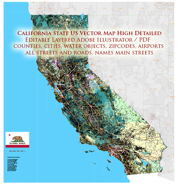
Vector Map Full State California US, located in the western United States, stretches along the Pacific Ocean from the border with Oregon to the Mexican border for almost 1,400 km. Its terrain is very diverse: here are the beaches surrounded by cliffs, sequoia forests, the Sierra Nevada mountains, the agricultural lands of the California Valley and the Mojave Desert. The most interesting area for tourists in Los Angeles is Hollywood, the capital of the American film industry. The city of San Francisco has gained worldwide fame for the Golden Gate Bridge, Alcatraz Island and the cable car.
Capital: Sacramento
Population: 39.35 million
Instant download archives: royalty free, editable vector maps of Full State California US in high resolution digital PDF and Adobe Illustrator format.
All of our editable Full State California US vector maps are digital files,
which can be instantly downloaded in editable PDF or Adobe Illustrator format.
Objects on maps are usually divided into layers according to their types – lines, polygons, street names, object names (see map description!!!!)
Each of our Full State California US digital maps is available in Adobe Illustrator or editable PDF format, (or on request in any other known format for the same price)
which use a vector approach to display images,
you can easily enlarge any part of our maps without compromising text, line or graphic quality,
with any increase or decrease ratio.
Using a vector graphics editor such as Adobe Illustrator, CorelDraw, Inkscape, or Freehand
you can easily crop parts of the map, add custom characters, and change colors and font attributes as needed.
We have a variety of Full State California US vector maps with different levels of detail, from simple empty paths to highly detailed maps with roads and terrain layers.
The history of railroads and road systems in California is rich and vital to the state’s development.
Vectormap.Net provide you with the most accurate and up-to-date vector maps in Adobe Illustrator, PDF and other formats, designed for editing and printing. Please read the vector map descriptions carefully.
Here’s a detailed overview:
Railroads:
- Early Railroads (19th Century):
- The first railroad in California was the Sacramento Valley Railroad, which began operating in 1856. It connected Sacramento with Folsom and was primarily built to transport gold discovered in the Sierra Nevada.
- The Central Pacific Railroad, part of the First Transcontinental Railroad, started construction in Sacramento in 1863. It played a crucial role in connecting the West Coast with the rest of the country, reaching Promontory, Utah, in 1869.
- Southern Pacific Railroad:
- The Southern Pacific Railroad, formed in 1865, became a dominant force in California’s rail history. It expanded its network, connecting major cities and facilitating transportation of goods and people.
- The completion of the Southern Pacific’s Sunset Route in 1883 provided a direct rail link between California and the Gulf of Mexico.
- Impact on Economic Growth:
- The railroads played a pivotal role in the economic development of California, facilitating the transportation of agricultural products, timber, and minerals.
- The railroads also contributed to population growth by making it easier for people to migrate to and settle in California.
- Expansion and Competition:
- The late 19th and early 20th centuries saw the expansion of various railroad companies, leading to competition and the development of new routes.
- Railroads were essential for the growth of industries such as agriculture, logging, and manufacturing.
- Decline and Consolidation:
- The mid-20th century witnessed a decline in rail travel and freight as automobiles and trucks became more popular. The decline led to the consolidation of many railroads.
- Modern Era:
- Today, railroads in California are still significant, with both freight and passenger services. Amtrak operates several routes, including the Pacific Surfliner and the Capitol Corridor.
Road Systems:
- Early Roads and Highways (19th Century):
- Early transportation in California relied on stagecoaches and wagon roads. The Old Spanish Trail and the El Camino Real were essential routes.
- The 20th century saw the development of the California State Highway System, with the creation of the California Highway Commission in 1895.
- Automobile Era:
- The rise of automobiles in the early 20th century led to the demand for better roads. The construction of paved highways and the adoption of the U.S. Route system connected cities and regions.
- The Pacific Highway, part of the U.S. Route 101, became a major north-south route along the coast.
- Interstate System and Freeways:
- The Federal-Aid Highway Act of 1956 led to the construction of the Interstate Highway System, and California played a crucial role in its development.
- The construction of freeways like the iconic Pacific Coast Highway (California State Route 1) and the Los Angeles freeway network became emblematic of California’s car culture.
- Traffic and Challenges:
- California’s road system faced challenges with increasing population and traffic congestion. Efforts have been ongoing to improve and expand the road infrastructure.
- Public Transportation:
- California has also invested in public transportation systems, including buses and light rail, to address urban congestion and promote sustainable transportation options.
In summary, the history of railroads and road systems in California reflects the state’s growth and transformation, from the early days of westward expansion to the modern, interconnected transportation network supporting a diverse and dynamic economy.
Don’t see exactly what you’re looking for? Contact us to receive a special offer for an individual Full State California US map for your project.


 Author: Kirill Shrayber, Ph.D.