Extended Description of the Vector Map
Printable Shaded Relief V.2 PDF Vector Map California State (Full Area), US detailed fully editable Adobe PDF Road Map in layers, scalable, text/curves format all names, 472 MB ZIP
Main streets and roads, Cities and Towns, Water Objects, Railroads, Airports, Relief raster, for Print Size 4 ft.. Map for design, printing, arts, projects, presentations, for architects, designers, and builders, business, logistics.
Note: 2 complete road lines, 2 complete places names, road shields.
Also: We can add (additional layer for this map), any other objects for you. It’s free for our customers.
If you need any OTHER format – DWG, DXF, Corel, or something else – please, email us
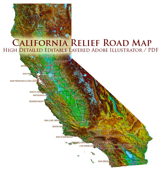
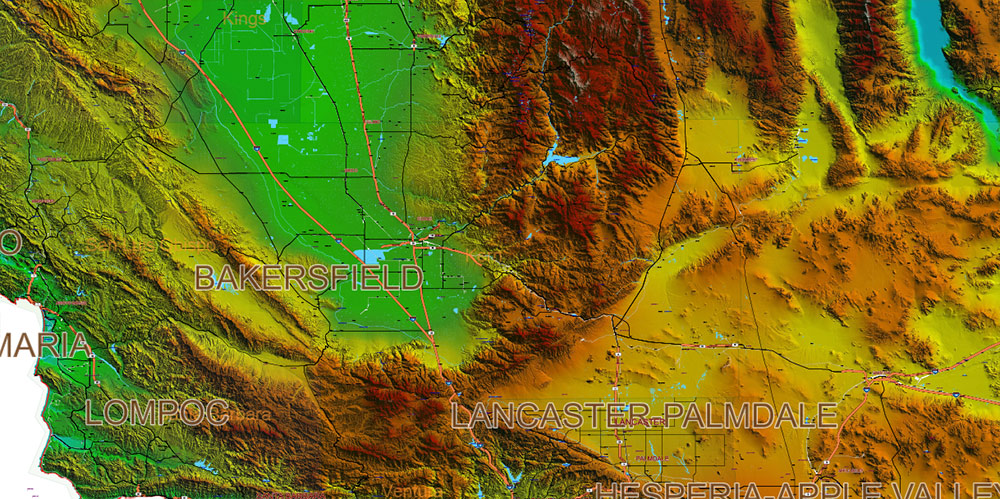
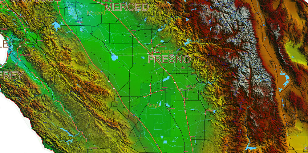
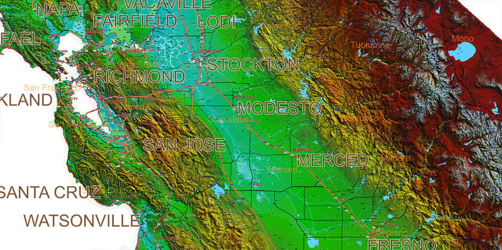
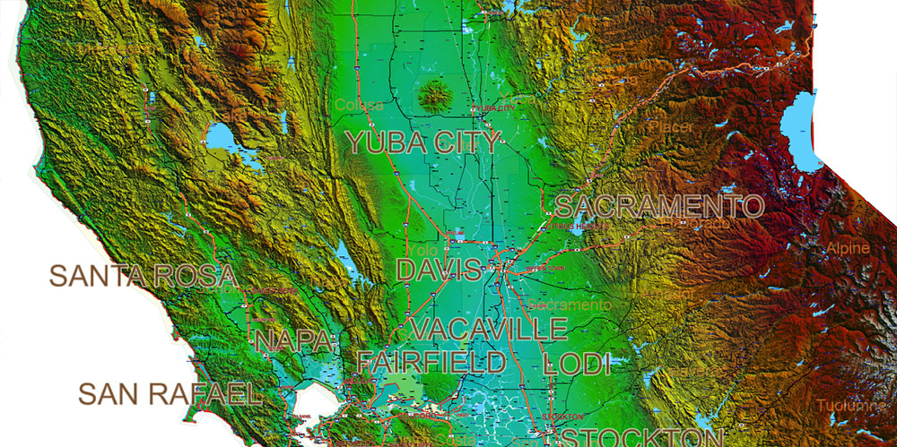
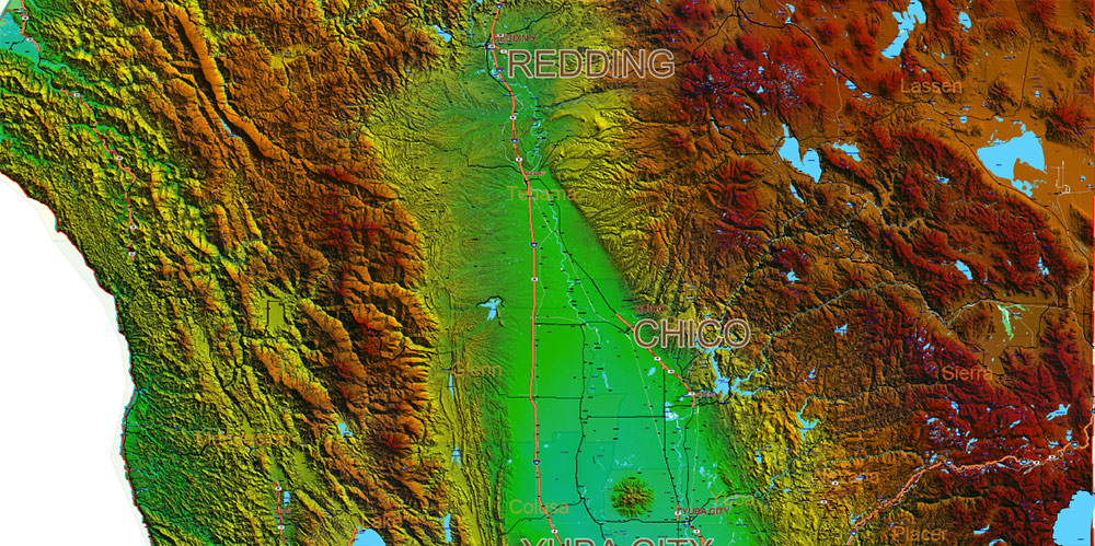
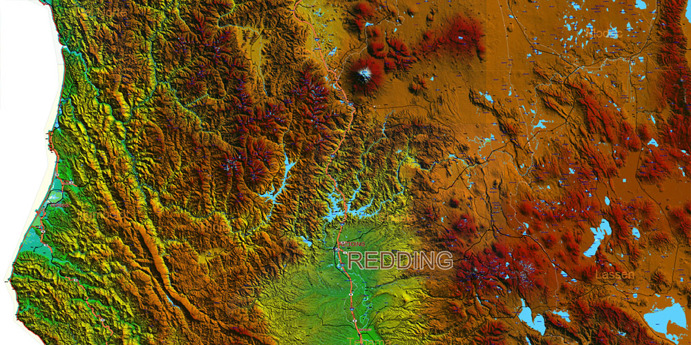
California State US Map PDF Vector Exact High Detailed Roads Map V.2 + Shaded Relief editable Adobe PDF in layers
AO BRIEF — CALIFORNIA (STATEWIDE)
Operational Overview
Statewide, full-coverage shaded relief vector map of California. High-resolution terrain visualization combined with complete transport and settlement framework. Designed for large-format print, analytical design, and professional cartographic use.
Terrain & Relief
-
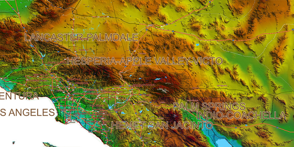
Complex and highly variable relief: coastal plains, Central Valley basin, Coast Ranges, Sierra Nevada, Transverse and Peninsular Ranges
-
Clear elevation gradients and terrain breaks rendered via shaded relief raster
-
Mountain chains, passes, valleys, basins, and coastal escarpments are visually legible at macro and micro scales
-
Optimized for terrain-driven analysis, visual hierarchy, and depth perception in print
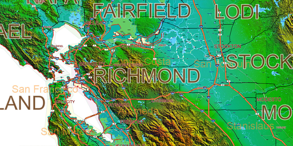
Lines of Communication (Roads & Rail)
-
Complete hierarchy of road networks: interstates, highways, primary and secondary roads
-
Rail corridors integrated and spatially aligned with terrain constraints
-
Suitable for logistics planning, transport visualization, and infrastructure design
Urban & Human Terrain
-
All cities and towns included, consistently labeled
-
Settlement patterns clearly correlated with terrain, water availability, and transport axes
-
Effective for demographic, economic, and development-oriented layouts
Hydrography & Water Objects
-
Rivers, lakes, reservoirs, coastal waters fully mapped
-
Water systems readable in direct relation to relief and elevation
-
Supports environmental, planning, and resource-focused visual projects
Aviation & Strategic Nodes
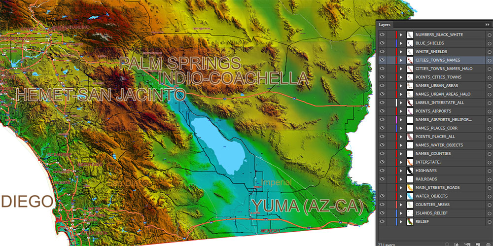
Map Engineering & Format
-
Fully editable vector PDF with layered structure
-
All labels as text and curves — no rasterized names
-
Scalable without loss of detail, optimized for prints up to 4 ft
-
Designed for architects, designers, publishers, planners, and technical presentations
Command Takeaways
-
Terrain-first visualization with strong spatial depth
-
Clean separation of relief, transport, hydrography, and settlements
-
Ready for high-end print, analytical graphics, and professional design workflows
-
Built for users who require precision, scale, and control — not simplified illustration
Layers list: (see preview)
- Names of Airports
- Points of Airports
- Names of places (city, hamlet, etc.) 1,2
- Points of places 1, 2
- Names of urban areas
- Names Highways
- Road labels (shields)
- Main streets and roads 1,2
- Railroads
- Water objects (areas)
- Counties areas
- Shaded Relief Topo raster JPG image
California State US Map PDF Vector Exact High Detailed Roads Map V.2 + Shaded Relief editable Adobe PDF in layers
California State US Map PDF Vector Exact High Detailed Roads Map V.2 + Shaded Relief editable Adobe PDF in layers
California State US Map PDF Vector Exact High Detailed Roads Map V.2 + Shaded Relief editable Adobe PDF in layers
California State US Map PDF Vector Exact High Detailed Roads Map V.2 + Shaded Relief editable Adobe PDF in layers
California State US Map PDF Vector Exact High Detailed Roads Map V.2 + Shaded Relief editable Adobe PDF in layers
California State US Map PDF Vector Exact High Detailed Roads Map V.2 + Shaded Relief editable Adobe PDF in layers
California State US Map PDF Vector Exact High Detailed Roads Map V.2 + Shaded Relief editable Adobe PDF in layers
California State US Map PDF Vector Exact High Detailed Roads Map V.2 + Shaded Relief editable Adobe PDF in layers
California State US Map PDF Vector Exact High Detailed Roads Map V.2 + Shaded Relief editable Adobe PDF in layers

 Author: Kirill Shrayber, Ph.D. FRGS
")
 editable Adobe Illustrator in layers")