Extended Description of the Vector Map
Printable PDF Vector Boston Greater Massachusetts US, exact detailed editable layered Adobe PDF scalable, editable, curves format all names, 60 MB ZIP
Names principal streets, ready for print size 24×36 inches
Map for design, printing, arts, projects, presentations, for architects, designers, and builders, business, logistics.
The most exact and detailed map of Boston Greater Massachusetts US
Map for editing and High-Quality Printing
Boston Greater Massachusetts US PDF Vector Map editable layered Adobe PDF 24×36 inch ready for print
Layers list:
- Legend
- Grids
- Labels of Roads
- Names Main Streets
- Names Objects
- Names Places
- Main Streets and Roads
- Residential roads and streets
- Railroads
- Airports and Heliports
- Landuse areas
- Water objects (areas)
- Waterways
- Background and Sea

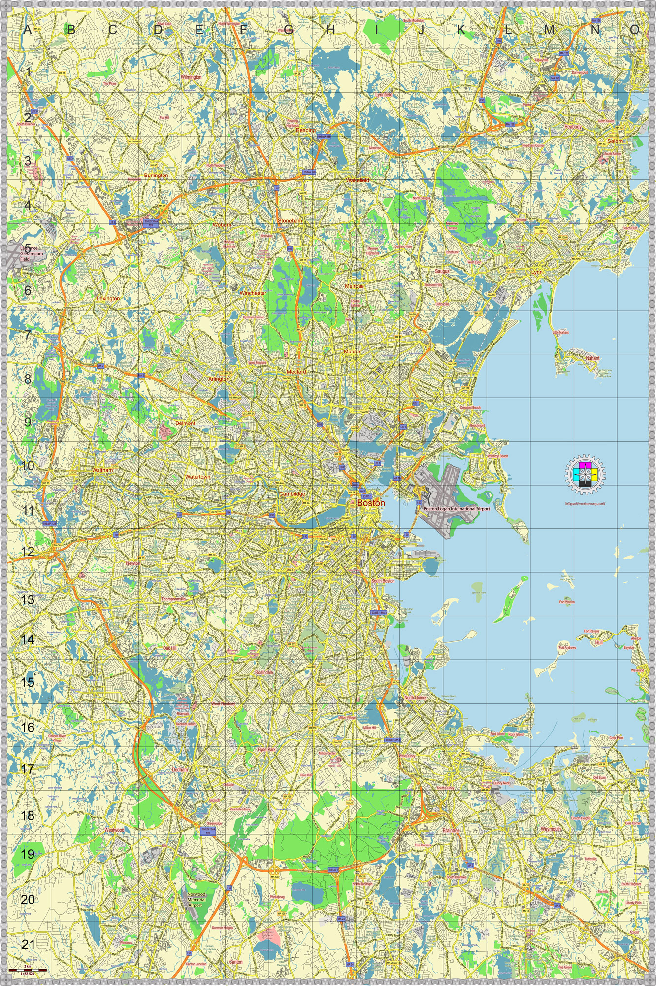
Boston Greater Massachusetts US PDF Vector Map editable layered Adobe PDF 24×36 inch ready for print

Boston Greater Massachusetts US PDF Vector Map editable layered Adobe PDF 24×36 inch ready for print

Boston Greater Massachusetts US PDF Vector Map editable layered Adobe PDF 24×36 inch ready for print

Boston Greater Massachusetts US PDF Vector Map editable layered Adobe PDF 24×36 inch ready for print
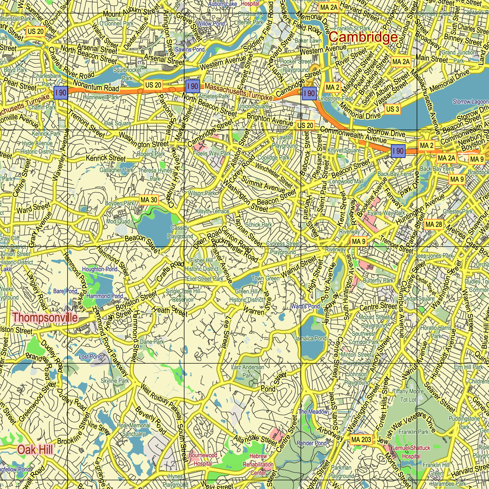
Boston Greater Massachusetts US PDF Vector Map editable layered Adobe PDF 24×36 inch ready for print
Boston Greater Massachusetts US PDF Vector Map editable layered Adobe PDF 24×36 inch ready for print

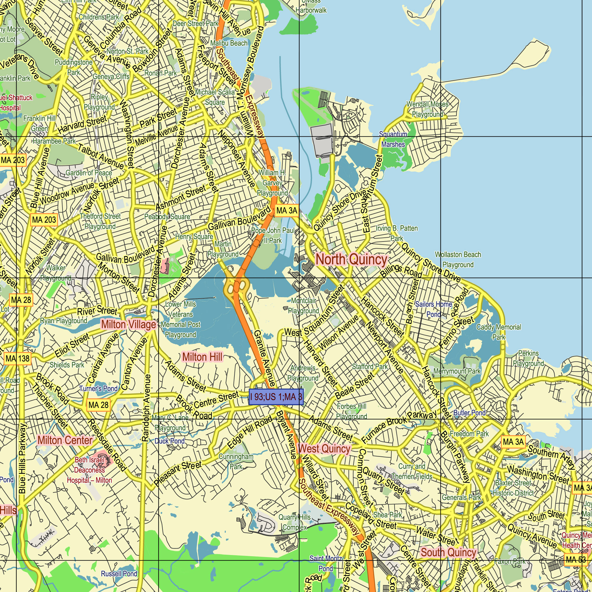
Boston Greater Massachusetts US PDF Vector Map editable layered Adobe PDF 24×36 inch ready for print

Boston Greater Massachusetts US PDF Vector Map editable layered Adobe PDF 24×36 inch ready for print

Boston Greater Massachusetts US PDF Vector Map editable layered Adobe PDF 24×36 inch ready for print

 Author: Kirill Shrayber, Ph.D. FRGS

