Extended Description of the Vector Map
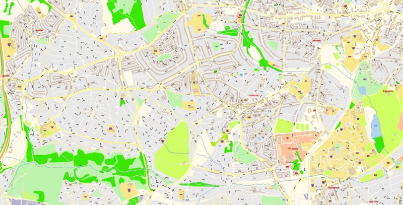
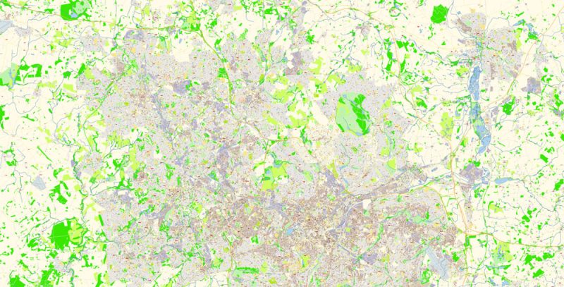
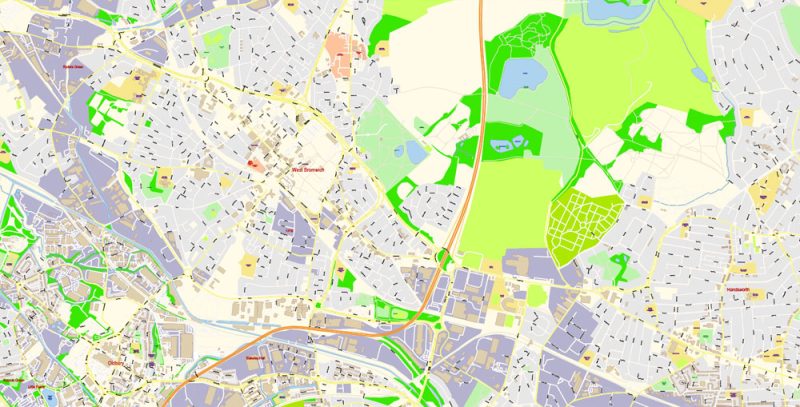
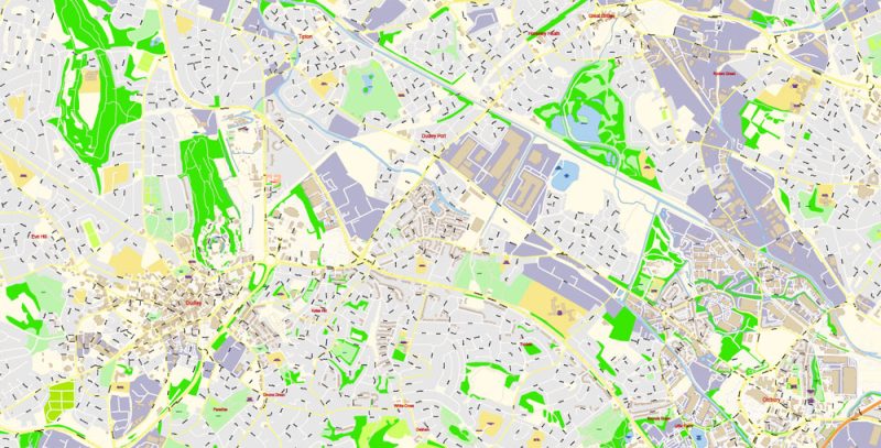
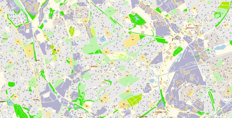
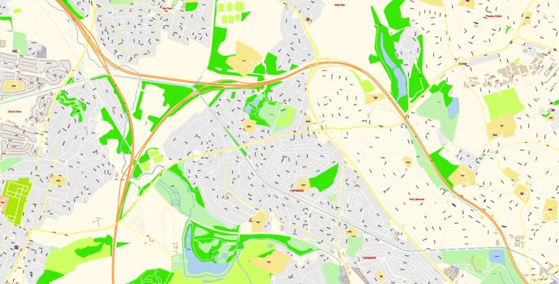
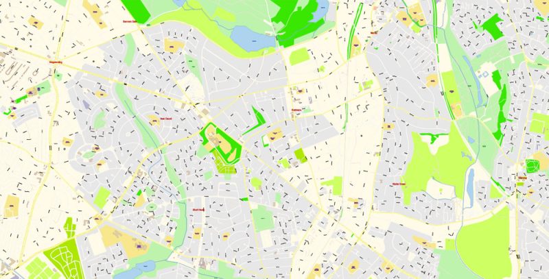
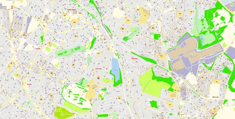
Printable PDF Vector Map of Birmingham UK detailed City Plan scale 100 m 1:2860 full editable Adobe PDF Street Map in layers, scalable, text format all names, 193 MB ZIP
All street names, Main Objects, Buildings. Map for design, printing, arts, projects, presentations, for architects, designers, and builders, business, logistics.
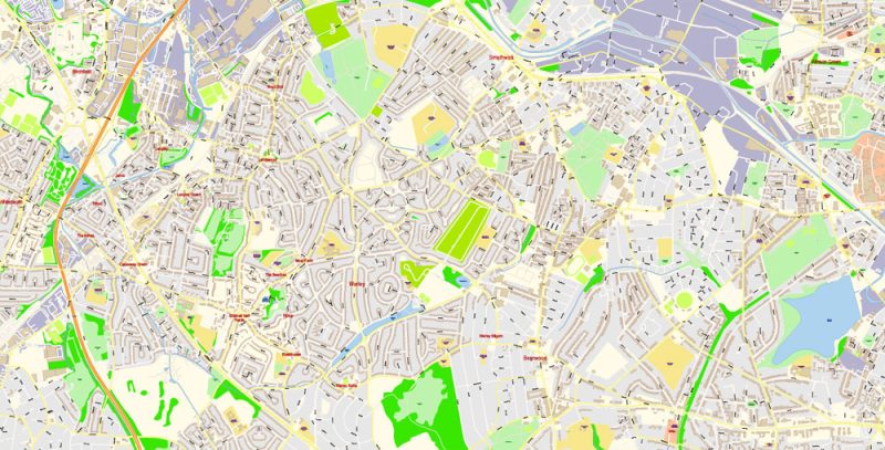
Layers: color_fills, water, streets_roads, labels_roads, names_objects, names_streets, names_places, arrows_streets, buildings, legend, etc.
The most exact and detailed map of the city in scale.
IF YOU NEED: We can convert map file to any other format – DWG, DXF, CDR, Shape, and other.
For Editing and High-Quality Printing
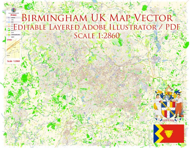
Birmingham UK PDF Map Vector Exact City Plan High Detailed Street Map editable Adobe PDF in layers
BIRMINGHAM
Birmingham in England is the second-largest city after London. Birmingham has a population of over one million. Birmingham is a separate district of Birmingham city and is considered the center of the West Midlands region.
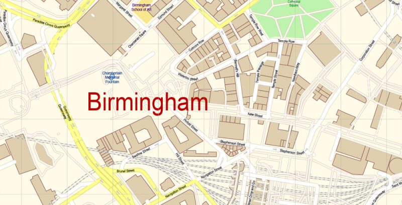
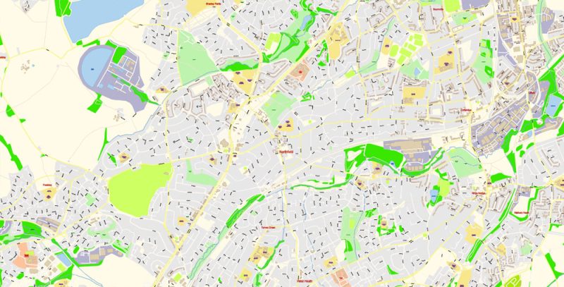
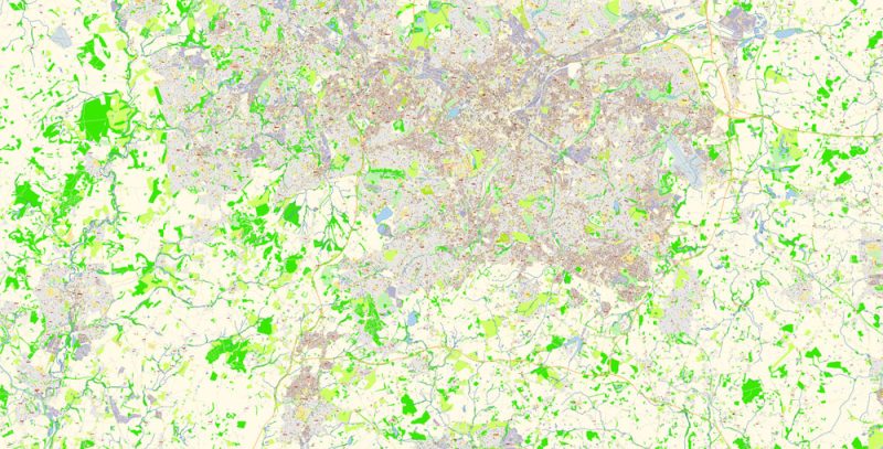
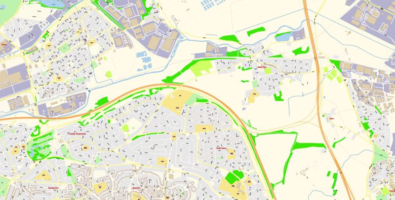
Birmingham UK PDF Map Vector Exact City Plan High Detailed Street Map editable Adobe PDF in layers
This city is famous for its University and school education. In Birmingham, there are three universities, including the famous and prestigious Birmingham University, and two University colleges. The city’s schools are among the best in the annual ranking of schools.
Many of Birmingham’s attractions and landmarks are linked to its rich history.
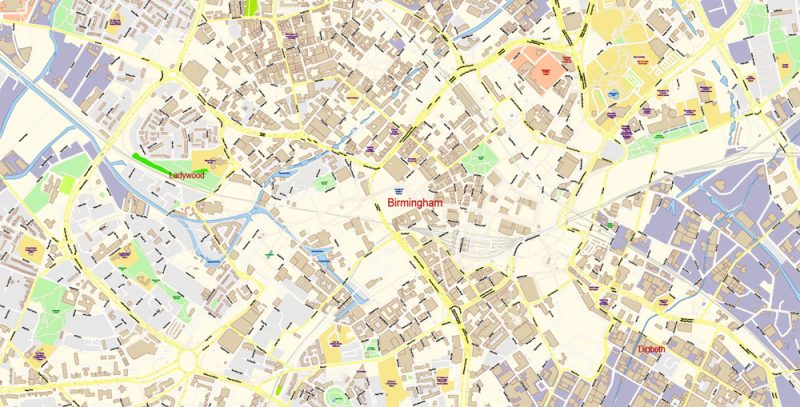
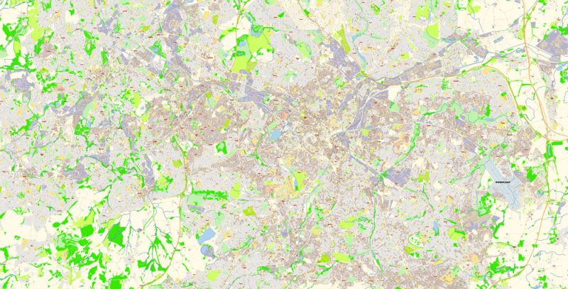
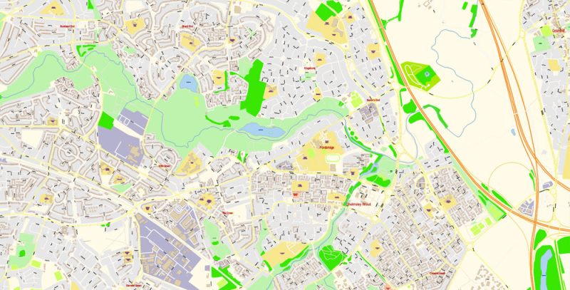
Birmingham UK PDF Map Vector Exact City Plan High Detailed Street Map editable Adobe PDF in layers
History Of Birmingham
It is established that the first settlements on the territory of modern Birmingham appeared many thousands of years ago. Then, the area was under the grip of the Romans.
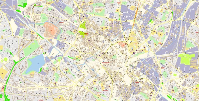
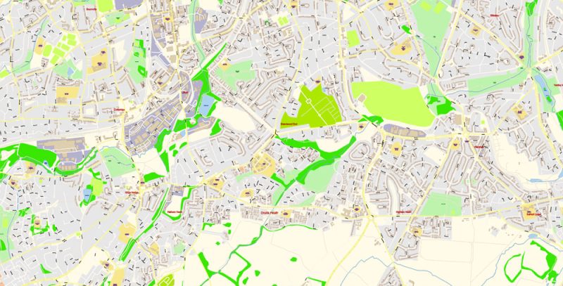
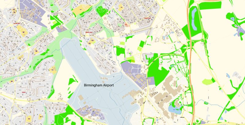
Birmingham UK PDF Map Vector Exact City Plan High Detailed Street Map editable Adobe PDF in layers
The modern city was founded here in the VI century. It developed quite rapidly and in the XII century was a major city and an important shopping center. In the XVI century, the city gained fame as a major industrial center, where small arms were manufactured: metallurgy developed here and coal and iron ore were mined.
Birmingham UK PDF Map Vector Exact City Plan High Detailed Street Map editable Adobe PDF in layers
During the industrial revolution, Birmingham used the most advanced manufacturing technology, unlike other cities where they worked on old equipment and used unskilled labor.
The people of Birmingham were resourceful, highly skilled. In addition, more inventions were patented in Birmingham during the industrial revolution than in any other British city.
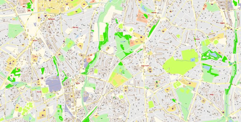
Birmingham UK PDF Map Vector Exact City Plan High Detailed Street Map editable Adobe PDF in layers
Here there are new options Spradlin, blast furnace, originated in the chemical industry – mass received sulfuric acid and alkali. Immediately began the use of steam engines in industry.
In addition to popularity due to the industrial success of the city, it is gradually gaining political popularity. In the first half of the XIX century, meetings are held here, where important and necessary changes are planned for the country.
Birmingham UK PDF Map Vector Exact City Plan High Detailed Street Map editable Adobe PDF in layers
With the further development of the city, an extensive system of canals and a railway are being built. By the end of the 19th century, Birmingham had a population of about half a million, making it the second-most populous city in England.
Queen Victoria granted Birmingham city status in 1889. In 1900, the first University opened here – Birmingham.
During the Second world war, Birmingham suffered greatly from the attack of German bombers. Later, the city was restored and somewhat altered.
Birmingham UK PDF Map Vector Exact City Plan High Detailed Street Map editable Adobe PDF in layers
Birmingham UK PDF Map Vector Exact City Plan High Detailed Street Map editable Adobe PDF in layers
Birmingham UK PDF Map Vector Exact City Plan High Detailed Street Map editable Adobe PDF in layers
Birmingham UK PDF Map Vector Exact City Plan High Detailed Street Map editable Adobe PDF in layers
Birmingham UK PDF Map Vector Exact City Plan High Detailed Street Map editable Adobe PDF in layers
Birmingham UK PDF Map Vector Exact City Plan High Detailed Street Map editable Adobe PDF in layers
Birmingham UK PDF Map Vector Exact City Plan High Detailed Street Map editable Adobe PDF in layers
Birmingham UK PDF Map Vector Exact City Plan High Detailed Street Map editable Adobe PDF in layers
Birmingham UK PDF Map Vector Exact City Plan High Detailed Street Map editable Adobe PDF in layers
Birmingham UK PDF Map Vector Exact City Plan High Detailed Street Map editable Adobe PDF in layers
Birmingham UK PDF Map Vector Exact City Plan High Detailed Street Map editable Adobe PDF in layers
Birmingham UK PDF Map Vector Exact City Plan High Detailed Street Map editable Adobe PDF in layers
Birmingham UK PDF Map Vector Exact City Plan High Detailed Street Map editable Adobe PDF in layers
Birmingham UK PDF Map Vector Exact City Plan High Detailed Street Map editable Adobe PDF in layers


 Author: Kirill Shrayber, Ph.D. FRGS


