Extended Description of the Vector Map
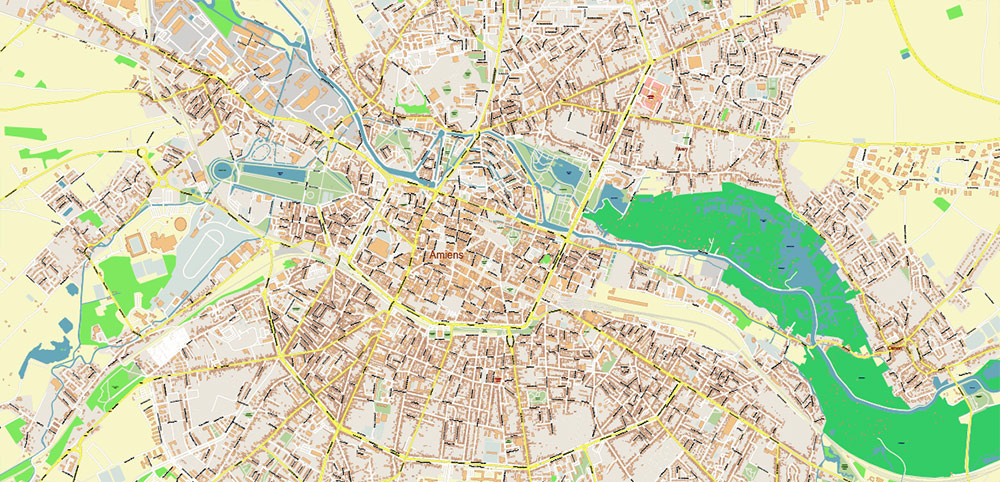
Printable Vector Map of Amiens France detailed street map scale 1:3026 fully editable Layered Adobe Illustrator scalable, text format all names, 14 MB ZIP
All street names, Main Objects, Buildings. Map for design, printing, arts, projects, presentations, for architects, designers, and builders, business, logistics.
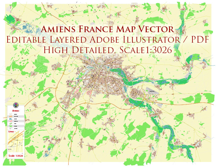
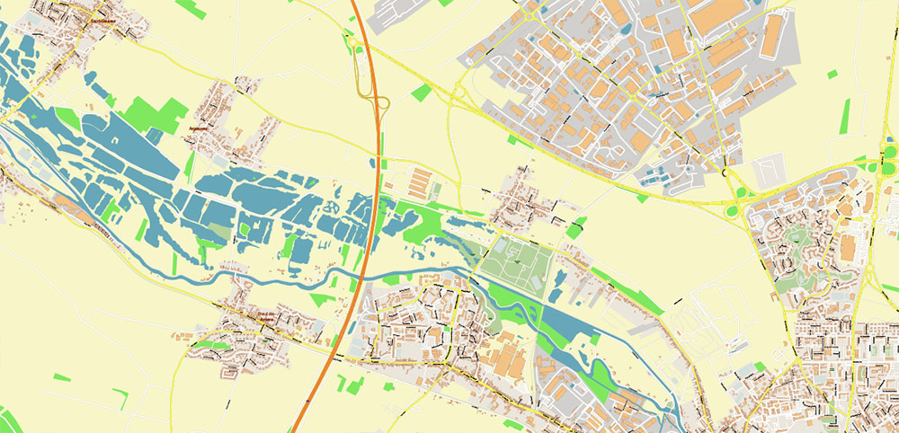
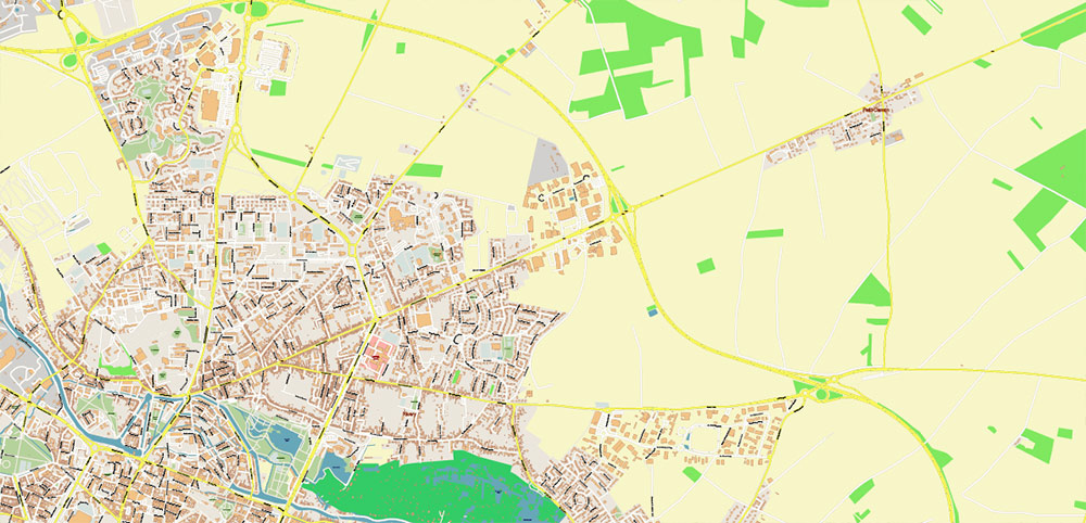
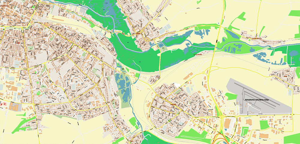
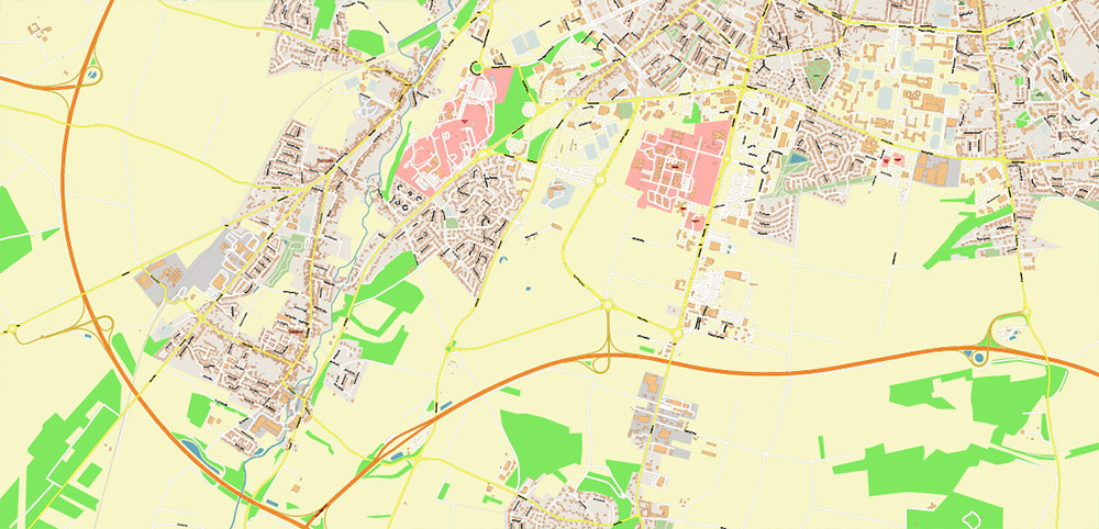
Amiens France Vector Map High Detailed fully editable Street Map Adobe Illustrator in layers
Layers list:
- Legend
- Grids
- Labels of roads
- Names of places (city, hamlet, etc.)
- Names of objects (parks, water)
- Names of main streets
- Names of civil streets
- Arrows of streets
- Main Streets, roads
- Civil streets
- Buildings
- Railroads
- Water objects (rivers, lakes, ponds)
- Waterways
- Airports and Heliports
- Color fills (parks, land use, etc.)
- Background
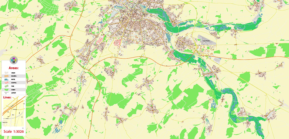
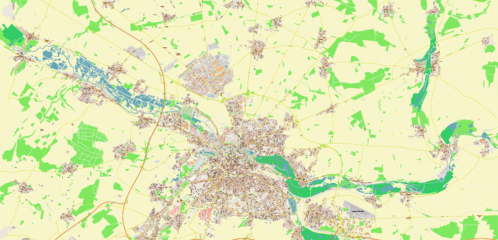
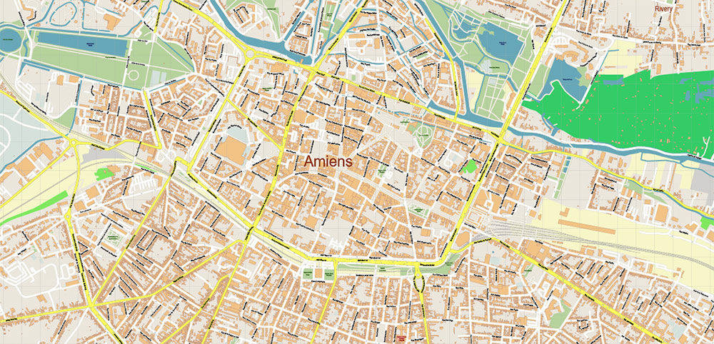
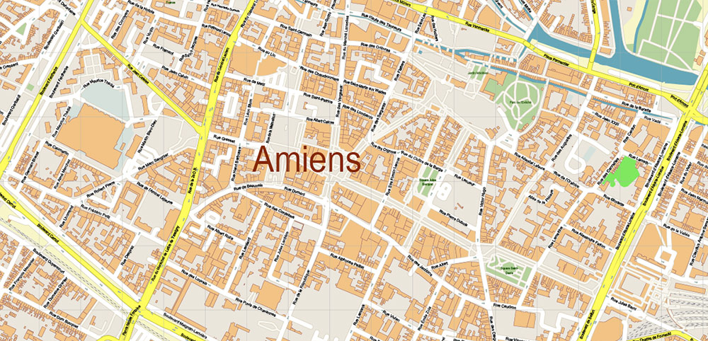
The most exact and detailed map of the city in scale.
For Editing and High-Quality Printing
Amiens France Vector Map High Detailed fully editable Street Map Adobe Illustrator in layers
Amiens France Vector Map High Detailed fully editable Street Map Adobe Illustrator in layers
Amiens France Vector Map High Detailed fully editable Street Map Adobe Illustrator in layers
Detailed geographical description of the Amiens France + main streets
Amiens, France, is a city located in the Somme River valley in northern France, about 120 km north of Paris and 100 km southwest of Lille. It is the capital of the Somme department in the Hauts-de-France region. The city covers an area of approximately 4,946 hectares with an altitude ranging from 14 to 106 meters.
Geographical Features
Rivers and Canals: The River Somme runs through Amiens, shaping much of its landscape and urban development. The city developed around a natural narrowing of the river caused by the Picard plateau, where the Amiens citadel is situated on a limestone butte. The Somme is joined near the city by its tributaries, the Avre and the Selle. The Selle enters from the northwest with branches passing through various city landmarks like the Promenade de la Hotoie and the zoo. The Canal de la Somme, dating from the early 19th century, also passes through Amiens and includes locks for leisure boats.
Neighborhoods: Amiens is composed of several distinct neighborhoods:
Saint-Leu: A medieval district north of the city center known for its canals, timber-framed houses, and vibrant cafés and shops. It is a lively area with bars and restaurants around Place du Don and Quai Bélu. The neighborhood also houses university faculties and theaters.
Saint-Maurice: Located west of the citadel and east of La Madeleine Cemetery, this historic working-class and industrial area is undergoing renovation. It includes university art and engineering schools and the Jardin des Plantes (also called Jardin du Roy).
Henriville: South of the city center, built mainly in the 19th century, featuring bourgeois houses and mansions, including the house of Jules Verne.
Main Streets and Important Locations
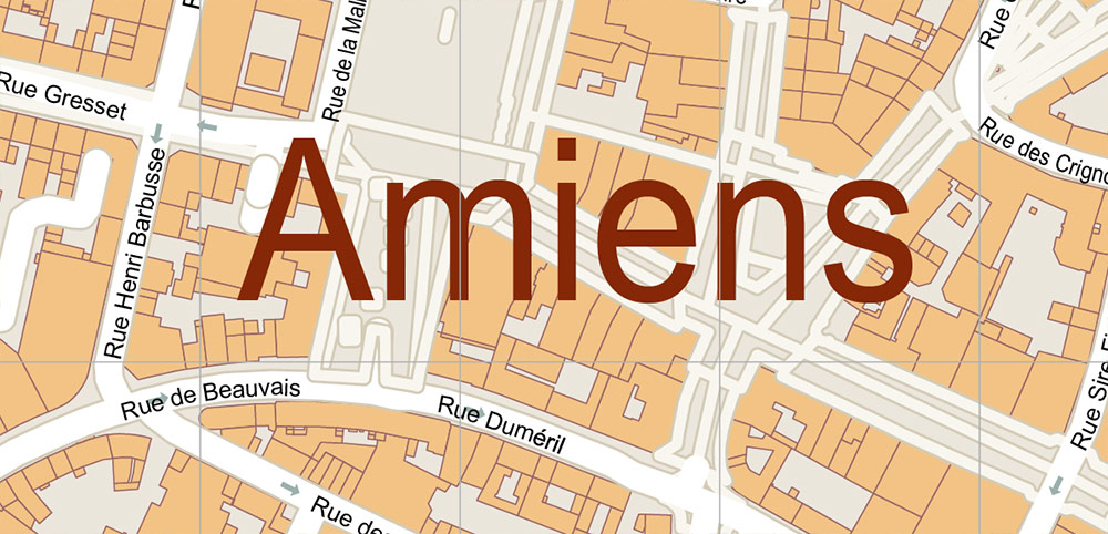
Rue des Trois Cailloux: The main pedestrian street in Amiens, named after the former Hôtel des Trois-Cailloux. It is a major shopping street attracting locals and tourists with numerous boutiques.
Rue du Don and Rue Adéodat Lefèvre: Charming streets leading to the Parc de l’Evêché near the cathedral, popular for walking and sightseeing.
Place Gambetta: Historically an important tram network hub.
Rue Saint-Leu: Located in the Saint-Leu neighborhood, near the church and university faculties.
Quai Bélu: A waterside street along the Somme River in Saint-Leu, known for its lively atmosphere and proximity to the old market.
Boulevards and Avenues: Some notable thoroughfares include Avenue François Mitterrand, Boulevard des Fédérés, Boulevard des Fusillés, and Boulevard Faidherbe.
Urban Layout and Transport
Amiens is built around the Somme River with a network of canals and bridges, reflecting its medieval origins and industrial past. The city has been rebuilt with wider streets after World War II to ease traffic congestion. It is served by major roads and motorways including the A16 and A29 autoroutes, and national roads RN1 and RN25, which form a ring road (Rocade d’Amiens) around the city.
Summary
Amiens is a historically rich city with a varied geography centered on the Somme River and its tributaries. Its neighborhoods like Saint-Leu and Saint-Maurice feature canals, historic buildings, and university campuses. The city’s main pedestrian and commercial street is Rue des Trois Cailloux, complemented by other important streets such as Rue du Don and Quai Bélu. The urban structure balances medieval heritage with modern infrastructure and green spaces like the Jardin des Plantes.
This combination of waterways, historic districts, and key streets makes Amiens a distinctive city blending natural geography with cultural and urban development
Amiens France Vector Map High Detailed fully editable Street Map Adobe Illustrator in layers
Amiens France Vector Map High Detailed fully editable Street Map Adobe Illustrator in layers
Amiens France Vector Map High Detailed fully editable Street Map Adobe Illustrator in layers
Amiens France Vector Map High Detailed fully editable Street Map Adobe Illustrator in layers
Amiens France Vector Map High Detailed fully editable Street Map Adobe Illustrator in layers
Amiens France Vector Map High Detailed fully editable Street Map Adobe Illustrator in layers
Amiens France Vector Map High Detailed fully editable Street Map Adobe Illustrator in layers

 Author: Kirill Shrayber, Ph.D. FRGS

