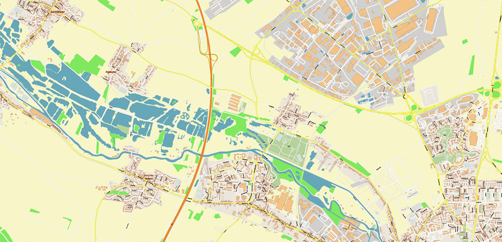
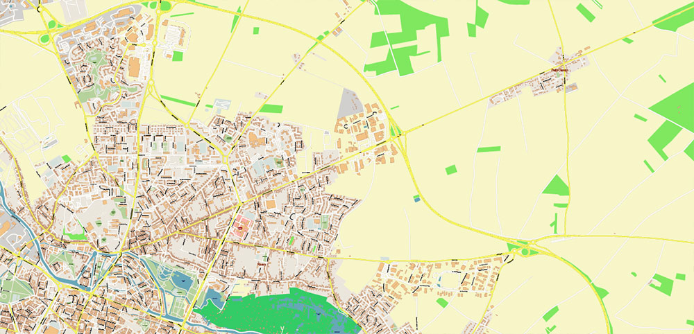
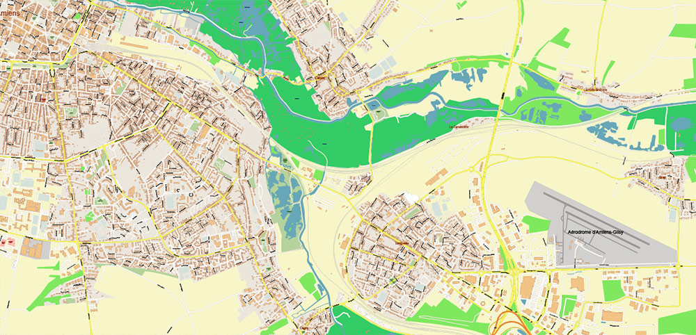
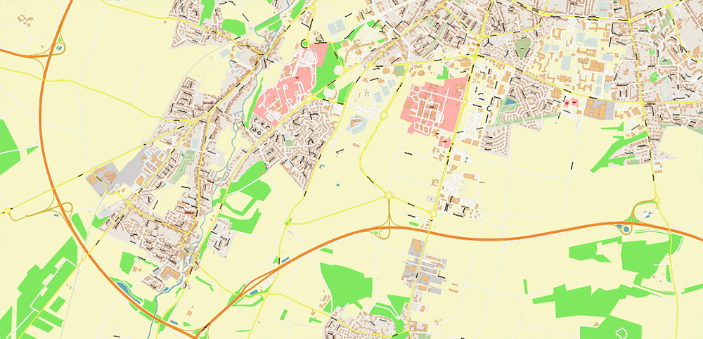
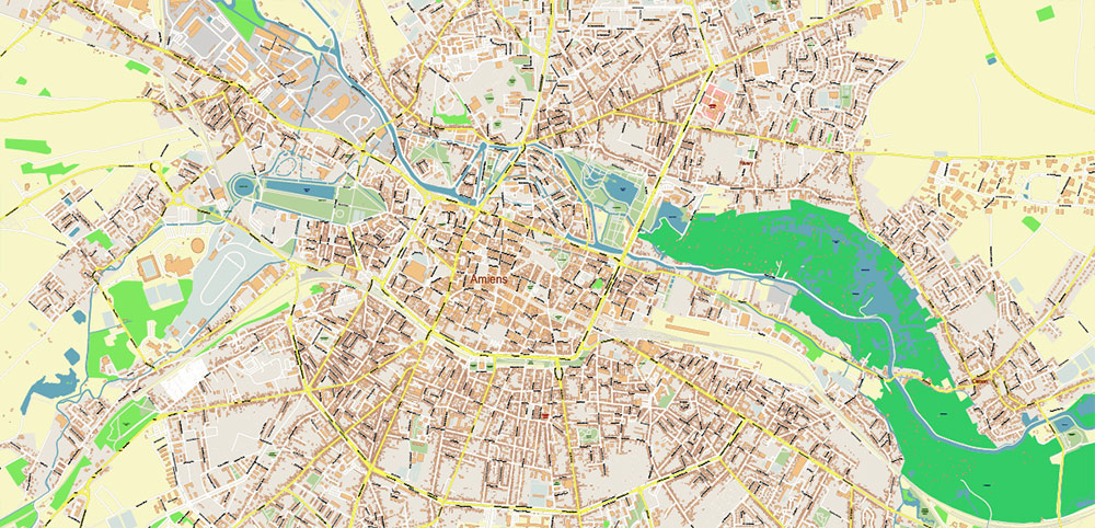
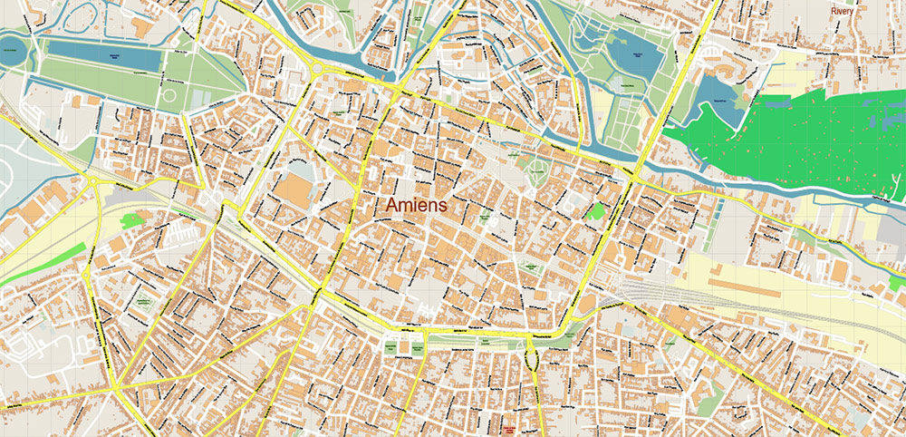
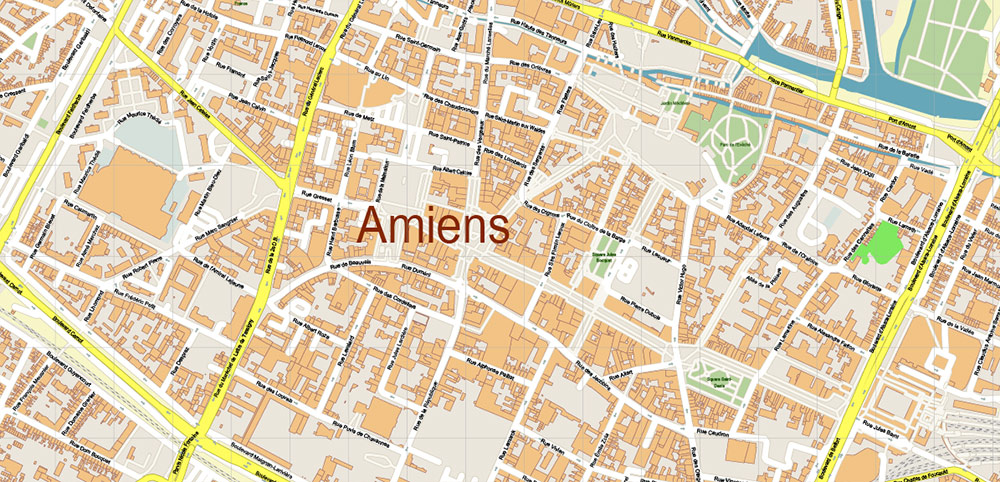
Printable PDF Vector Map of Amiens France detailed street map scale 1:3026 fully editable Layered Adobe PDF scalable, text format all names, 36 MB ZIP
All street names, Main Objects, Buildings. Map for design, printing, arts, projects, presentations, for architects, designers, and builders, business, logistics.
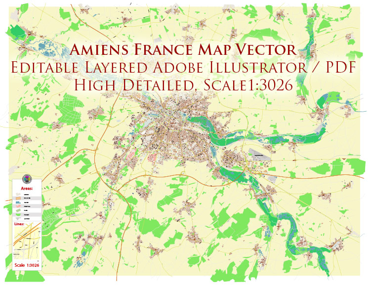
Amiens France PDF Vector Map High Detailed fully editable Street Map Adobe PDF in layers
Layers list:
- Legend
- Grids
- Labels of roads
- Names of places (city, hamlet, etc.)
- Names of objects (parks, water)
- Names of main streets
- Names of civil streets
- Arrows of streets
- Main Streets, roads
- Civil streets
- Buildings
- Railroads
- Water objects (rivers, lakes, ponds)
- Waterways
- Airports and Heliports
- Color fills (parks, land use, etc.)
- Background
The most exact and detailed map of the city in scale.
For Editing and High-Quality Printing
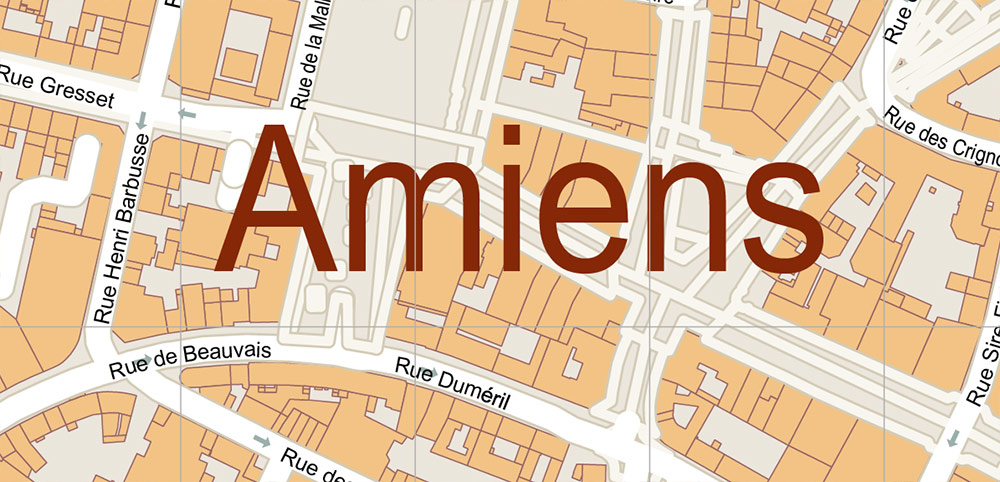
Amiens France PDF Vector Map High Detailed fully editable Street Map Adobe PDF in layers
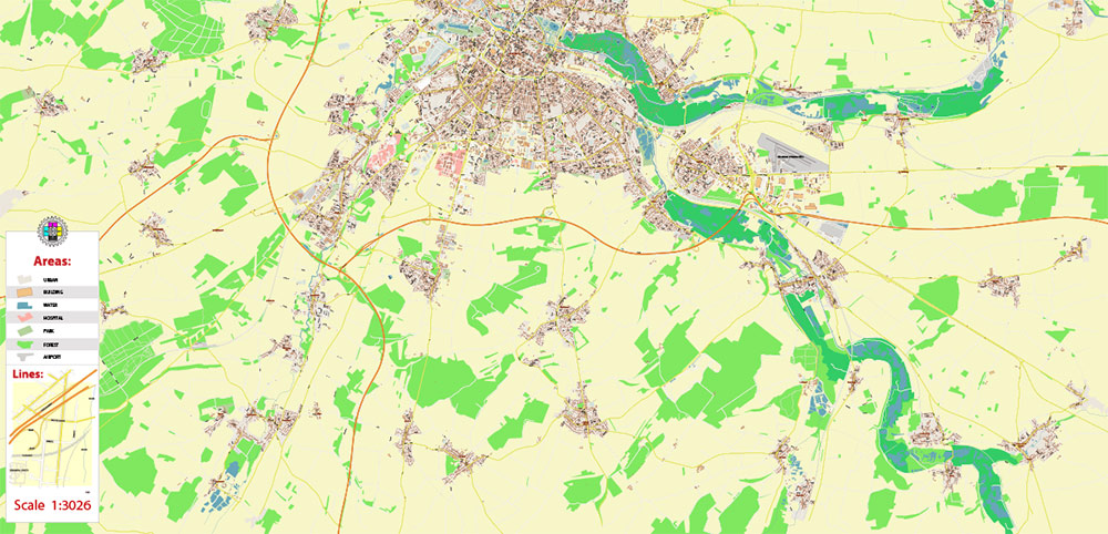
Amiens France PDF Vector Map High Detailed fully editable Street Map Adobe PDF in layers
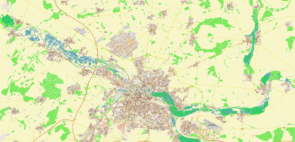
Amiens France PDF Vector Map High Detailed fully editable Street Map Adobe PDF in layers
History of Amiens France
Ancient and Medieval Periods
The earliest known settlement was Samarobriva, the central town of the Ambiani tribe in Gaul. Under Roman rule, it was called Ambianum, meaning settlement of the Ambiani people. Christianity was introduced in the 4th century, with St. Firmin becoming its first bishop and establishing the Roman Catholic Diocese of Amiens in the 3rd century.
During the early Middle Ages, Amiens was frequently attacked by barbarian tribes and Normans, who sacked the city in 859 and 882, burning the cathedral in the latter raid. The city gained a municipal charter in 1117 and was formally recognized by King Louis VI in 1113, joining the Crown of France in 1185.
Construction of the iconic Amiens Cathedral began in 1220, largely completed by 1270, becoming one of the finest examples of Gothic architecture in France.
In the 13th century, Amiens played a role in international arbitration, notably the Mise of Amiens in 1264, a settlement between King Henry III of England and rebellious barons.
Early Modern Period
The city changed hands multiple times, including under Philip the Good of Burgundy in 1435 and returning to French control in 1477. It experienced sieges, such as the Siege of Amiens in 1597 when Spanish forces occupied the city before Henry IV recaptured it.
The 18th century saw the founding of cultural institutions like the Amiens Academy of Sciences, Humanities and Arts (1750) and the creation of the Jardin des Plantes (1751).
19th Century
Amiens became a center of textile production, especially known for velours fabrics. The city walls were demolished during the Industrial Revolution, allowing for expansion and the creation of large boulevards and new neighborhoods like Henriville.
The Treaty of Amiens was signed in 1802, marking a brief peace during the Napoleonic Wars between France and the United Kingdom.
Railways arrived in the mid-19th century, linking Amiens to Paris and Boulogne-sur-Mer, altering the city’s geography and economy.
The city suffered occupation by Prussian forces during the 1870 Franco-Prussian War.
20th Century and World Wars
Amiens was heavily affected by both World Wars. In World War I, it was near the front lines of the Battle of the Somme (1916) and the 1918 Battle of Amiens, a key offensive leading to the war’s end. The city served as a logistical and medical center for soldiers.
During World War II, Amiens was occupied by German forces and suffered significant bombing damage by the Royal Air Force.
Post-war reconstruction was led by architect Pierre Dufau, focusing on wider streets and modern materials. Auguste Perret designed the Gare d’Amiens train station and the nearby Tour Perret, symbolizing the city’s modernization.
Cultural Heritage
Amiens Cathedral is a UNESCO World Heritage Site, recognized for its architectural and historical significance.
The city’s heritage includes medieval buildings, museums, and cultural institutions that reflect its long history as a political, religious, and economic center in northern France.
In summary, Amiens evolved from a Roman settlement to a medieval stronghold, a textile industry hub in the 19th century, and a city marked by resilience through two world wars, preserving its cultural and architectural heritage while adapting to modernity.
Amiens France PDF Vector Map High Detailed fully editable Street Map Adobe PDF in layers
Amiens France PDF Vector Map High Detailed fully editable Street Map Adobe PDF in layers
Amiens France PDF Vector Map High Detailed fully editable Street Map Adobe PDF in layers
Amiens France PDF Vector Map High Detailed fully editable Street Map Adobe PDF in layers
Amiens France PDF Vector Map High Detailed fully editable Street Map Adobe PDF in layers
Amiens France PDF Vector Map High Detailed fully editable Street Map Adobe PDF in layers
Amiens France PDF Vector Map High Detailed fully editable Street Map Adobe PDF in layers

 Author: Kirill Shrayber, Ph.D. FRGS

