Extended Description of the Vector Map
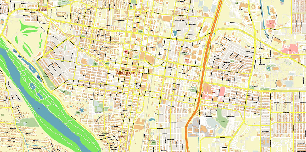
Printable PDF Vector Map of Albuquerque New Mexico USA High detailed street map scale 1:3840 fully editable Layered Adobe PDF scalable, text format all names, 113 MB ZIP
All street names, Main Objects, Buildings. Map for design, printing, arts, projects, presentations, for architects, designers, and builders, business, logistics.

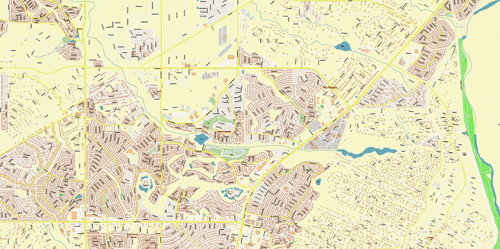
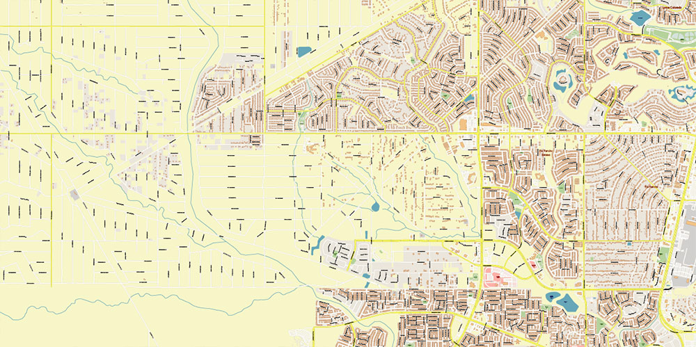
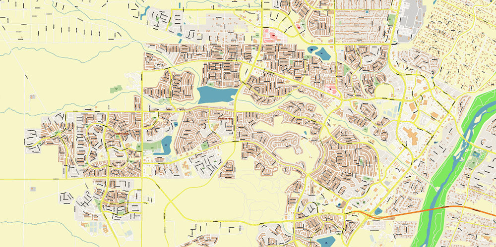
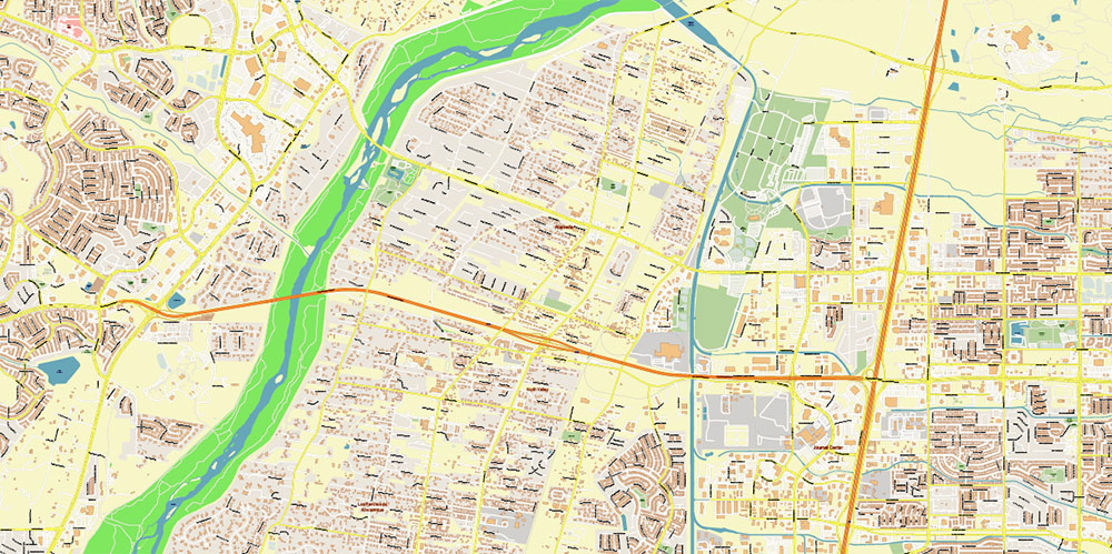
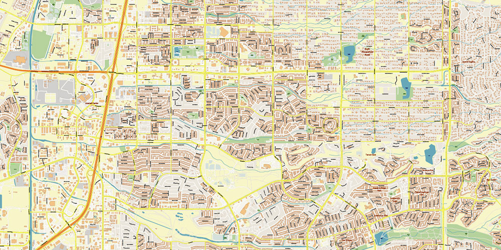
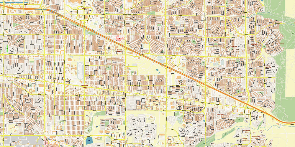
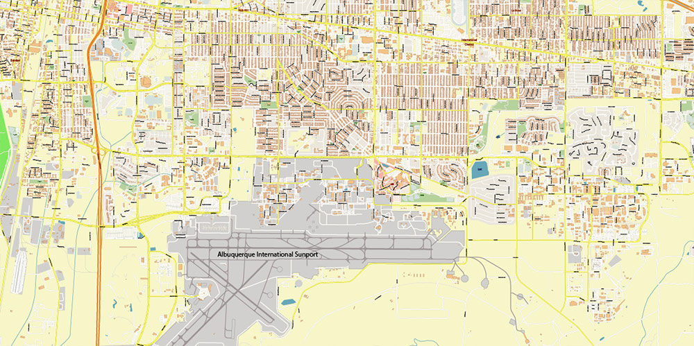
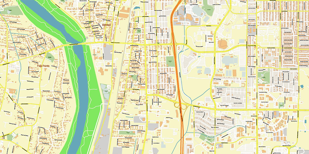
Albuquerque New Mexico USA PDF Map Vector Exact Plan High Detailed Street Map editable Adobe PDF in layers
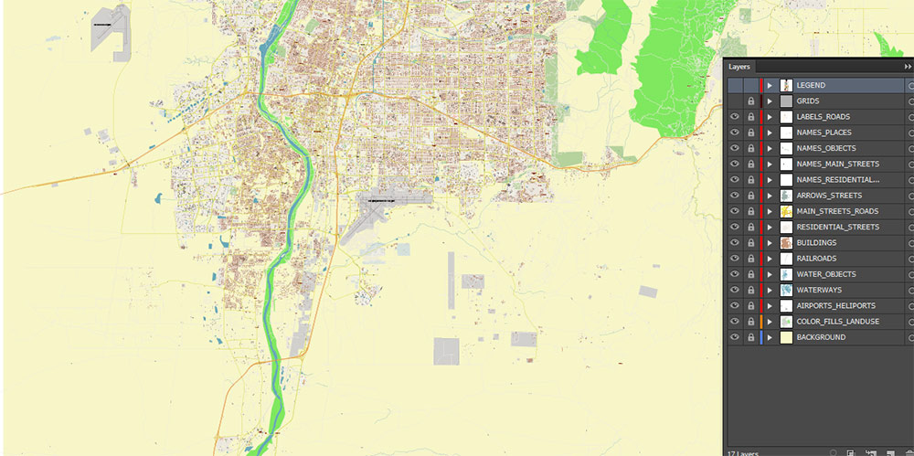
Layers list:
- Legend
- Names of places (city, hamlet, etc.)
- Names of objects (parks, hospital, water)
- Names of main streets
- Names of residential streets
- Main Streets, roads
- Residential streets
- Railroads
- Buildings
- Water objects (rivers, lakes, ponds)
- Waterways
- Color fills (parks, land use, etc.)
- Background
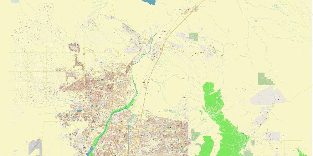
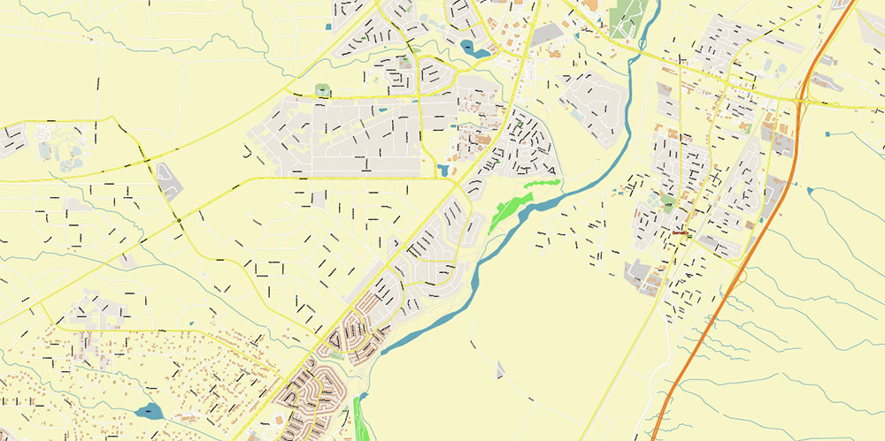
The most exact and detailed map of the Albuquerque New Mexico USA in scale.
For Editing and High-Quality Printing
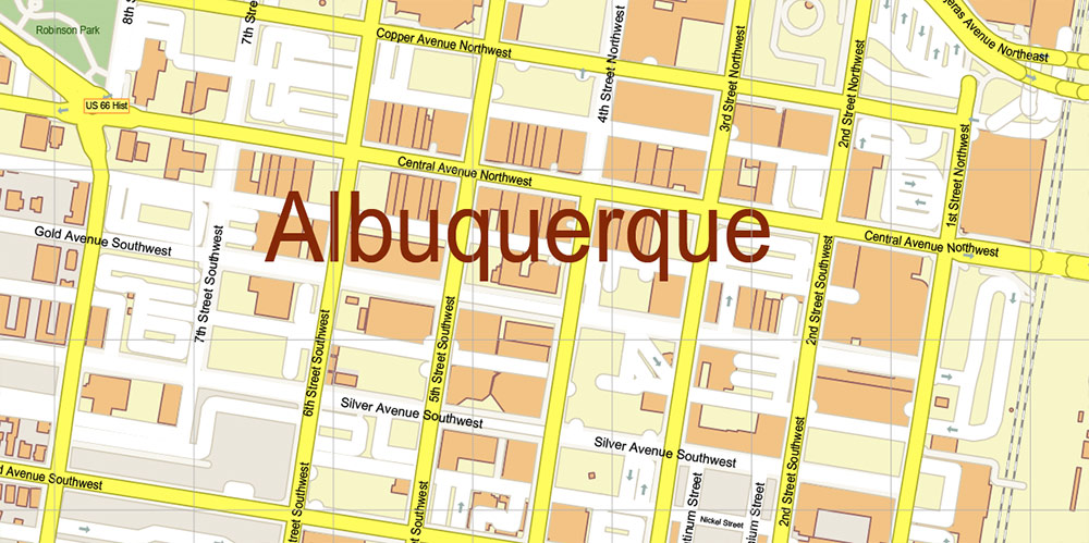
Albuquerque New Mexico USA PDF Map Vector Exact Plan High Detailed Street Map editable Adobe PDF in layers
AO BRIEF — ALBUQUERQUE, NEW MEXICO (ABQ METRO)
Overview
-
Area: Albuquerque metropolitan area (Bernalillo County core) with operational reach north to Santa Fe, south toward Belen/Los Lunas, and east–west across the Middle Rio Grande Valley.
-
Terrain: High-desert basin at ~5,300 ft (1,600 m) elevation, bounded by the Sandia–Manzano Mountains to the east and volcanic mesas to the west. Broad valley floor with sharp escarpments and arroyos.
-
Key natural lines: Rio Grande (north–south lifeline), Sandia Crest ridgeline, West Mesa escarpment, and multiple arroyos (seasonal drainage channels) cutting through the urban fabric.
Demography / Human Terrain
-
Population density: Moderate; dense urban core with expansive low-rise sprawl.
-
Urban centers: Albuquerque (primary), Rio Rancho (NW), Bernalillo (north), Los Lunas (south).
-
Socio-economic profile: Government and defense research (Kirtland AFB, Sandia Labs), logistics, healthcare, tourism, and a strong Hispanic/Native American cultural base.
-
Cultural notes: Bilingual (English/Spanish); strong Pueblo influence; historic Old Town contrasts with modern suburban growth.
Key Roads / Lines of Communication (LOC)
-
I-25: Primary north–south spine (Santa Fe ↔ Albuquerque ↔ Las Cruces). Critical for regional sustainment.
-
I-40: Major east–west transcontinental corridor (Arizona ↔ Texas). Defines logistics and commercial access.
-
I-25 / I-40 “Big I” Interchange: Strategic chokepoint; disruption impacts the entire metro.
-
US-550: Northwest connector to Farmington and Four Corners.
-
NM-528: Links Albuquerque ↔ Rio Rancho (rapid suburban access).
-
Coors Blvd / Paseo del Norte: West-side arterial loop; bridges over the Rio Grande are limited and critical.
-
Central Ave (Historic Route 66): Urban east–west axis through the city core.
Rail, Air, and Intermodal
-
Rail: BNSF freight mainline parallels the Rio Grande; Rail Runner Express passenger line connects Santa Fe–ABQ–Belen.
-
Air: Albuquerque International Sunport (ABQ)—dual civilian/military utility; proximity to Kirtland AFB adds strategic depth.
-
Intermodal nodes: Industrial zones near I-40/I-25 corridors and south-valley rail yards.
Climate / Seasonality
-
Climate: High-desert continental.
-
Summers: Hot, dry; monsoon thunderstorms (Jul–Sep).
-
Winters: Cool to cold nights; light snow possible.
-
Operational factors: Dust, heat, and altitude affect endurance and machinery; sudden flash flooding in arroyos during storms.
Hazards / Constraints
-
Terrain breaks: Escarpments and arroyos constrain east–west movement off major routes.
-
Limited river crossings: Few Rio Grande bridges—key vulnerabilities.
-
Wildfire risk: Foothills and bosque interface zones.
-
Seismic/volcanic: Low-probability, localized risks; dormant volcanic features west of the city.
Logistics / Sustainment
-
Best movement posture: Maintain control of I-25 / I-40 and Rio Grande crossings; use West Mesa arterials for bypass.
-
Supply considerations: Long distances to major metros; reliance on interstate corridors.
-
Energy/water: High dependence on managed water systems; drought sensitivity.
Command Takeaways
-
Two interstates define the AO: Control of I-25, I-40, and the Big I dictates operational tempo.
-
Natural barriers shape the city: Mountains, mesas, and the river funnel movement.
-
Strategic but isolated: Strong internal infrastructure with long external supply lines.
-
Altitude and climate matter: Plan for heat, dust, and reduced performance.
Albuquerque New Mexico USA PDF Map Vector Exact Plan High Detailed Street Map editable Adobe PDF in layers
Albuquerque New Mexico USA PDF Map Vector Exact Plan High Detailed Street Map editable Adobe PDF in layers
Albuquerque New Mexico USA PDF Map Vector Exact Plan High Detailed Street Map editable Adobe PDF in layers
Albuquerque New Mexico USA PDF Map Vector Exact Plan High Detailed Street Map editable Adobe PDF in layers
Albuquerque New Mexico USA PDF Map Vector Exact Plan High Detailed Street Map editable Adobe PDF in layers
Albuquerque New Mexico USA PDF Map Vector Exact Plan High Detailed Street Map editable Adobe PDF in layers
Albuquerque New Mexico USA PDF Map Vector Exact Plan High Detailed Street Map editable Adobe PDF in layers
Albuquerque New Mexico USA PDF Map Vector Exact Plan High Detailed Street Map editable Adobe PDF in layers

Albuquerque New Mexico USA PDF Map Vector Exact Plan High Detailed Street Map editable Adobe PDF in layers
Albuquerque New Mexico USA PDF Map Vector Exact Plan High Detailed Street Map editable Adobe PDF in layers
Albuquerque New Mexico USA PDF Map Vector Exact Plan High Detailed Street Map editable Adobe PDF in layers
Albuquerque New Mexico USA PDF Map Vector Exact Plan High Detailed Street Map editable Adobe PDF in layers
Albuquerque New Mexico USA PDF Map Vector Exact Plan High Detailed Street Map editable Adobe PDF in layers

Albuquerque New Mexico USA PDF Map Vector Exact Plan High Detailed Street Map editable Adobe PDF in layers

 Author: Kirill Shrayber, Ph.D. FRGS

