Extended Description of the Vector Map
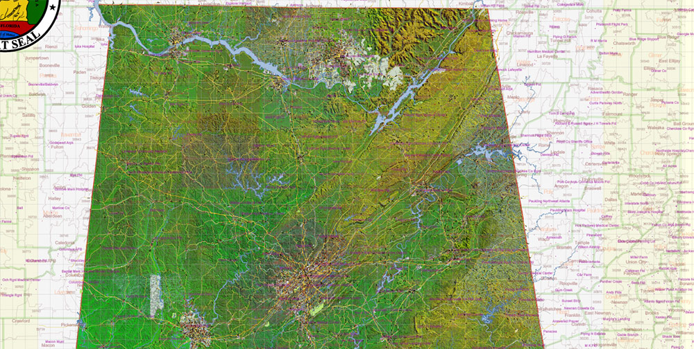
Printable PDF Shaded Relief Vector Map of Alabama State, US High Detailed Plan scale 1:63417 full editable Adobe PDF Road Admin Map in layers, scalable, text format all names, 1846 MB ZIP
All streets and roads, Principal street names, All Cities and Towns, Zipcodes, Airports and Heliports, Main Objects, Counties, raster Shaded Relief HD. Map for design, printing, arts, projects, presentations, for architects, designers, and builders, business, logistics.
The most exact and detailed map of the state in scale.
For Editing and High-Quality Printing, Royalty free
Included: Simple map of Alabama.
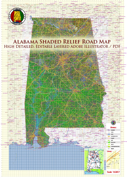
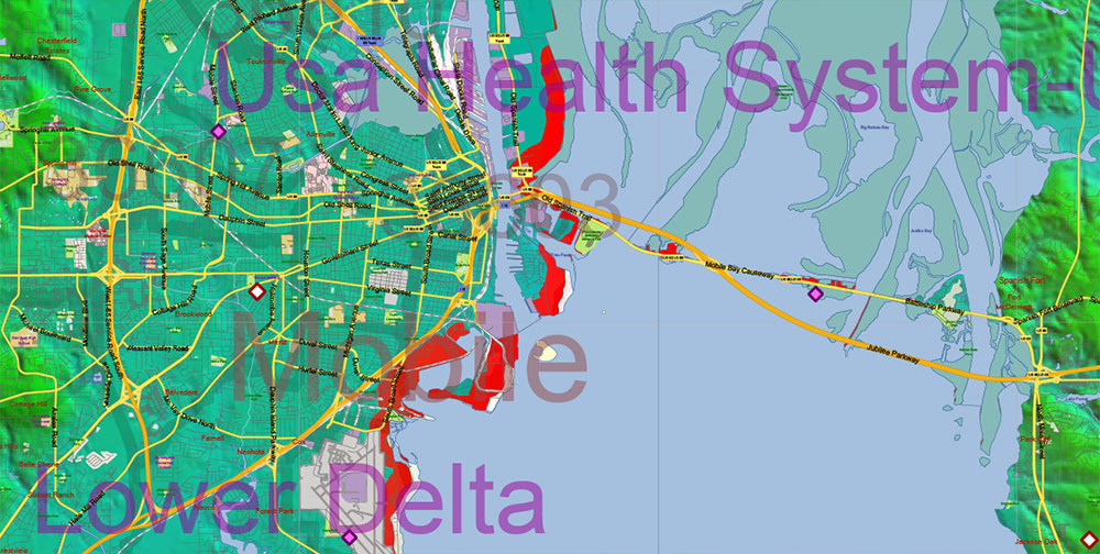
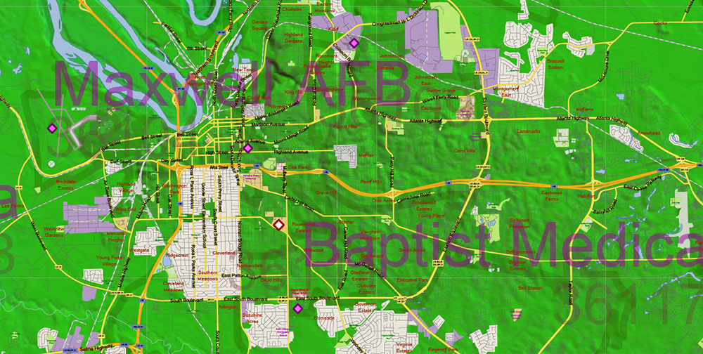
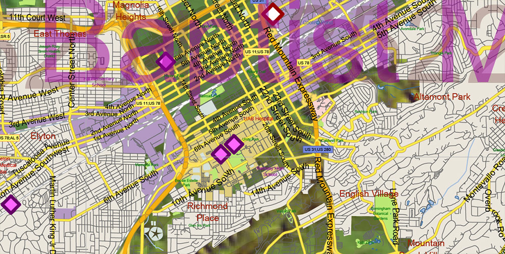
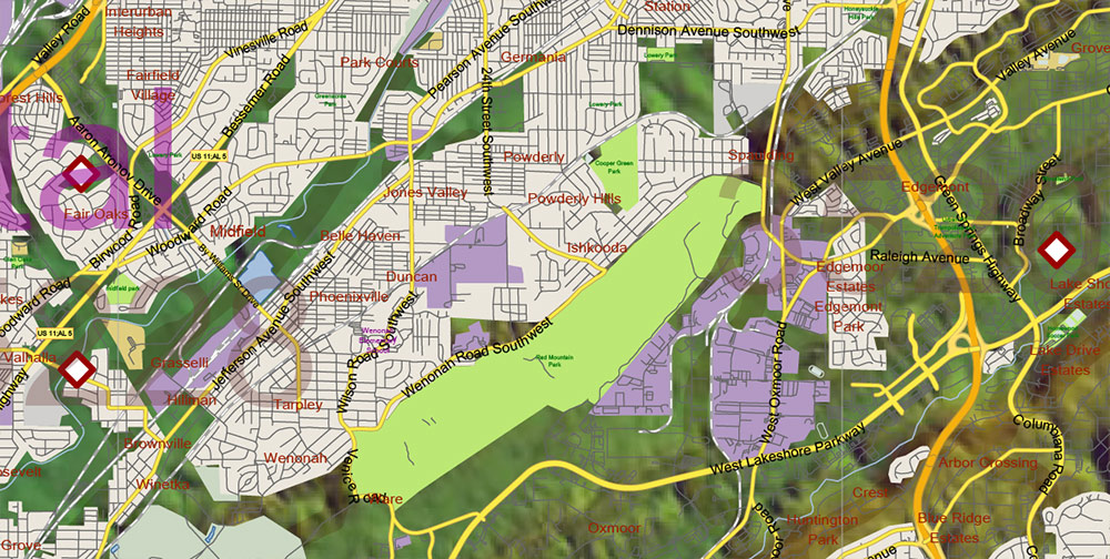
Alabama State US PDF Map Vector Exact Shaded Reliaf and Roads High Detailed Map + Counties + Zipcodes editable Adobe PDF in layers
Layers list:
- Legend
- Grids
- Labels of roads
- Names of places (city, hamlet, etc.)
- City, towns names 2
- Points of the Cities and Towns 2
- Airports and Heliports names
- Points of the Airports and Heliports
- Names of objects (hospitals, schools, parks, water)
- Names of main streets
- Names of Counties
- Principal Streets and Roads
- Residential streets
- Railroads
- ZIP Codes numbers
- ZIP Codes areas
- Airports and Heliports areas
- Water objects (rivers, lakes, ponds)
- Waterways
- Color fills (parks, hospital areas, school areas, land use, etc.)
- Islands
- Sea
- Counties areas
- Shader Relief Raster JPG HD
- Background
AO BRIEF — ALABAMA (STATEWIDE)
Shaded Relief • High-Detail Plan
Operational Overview
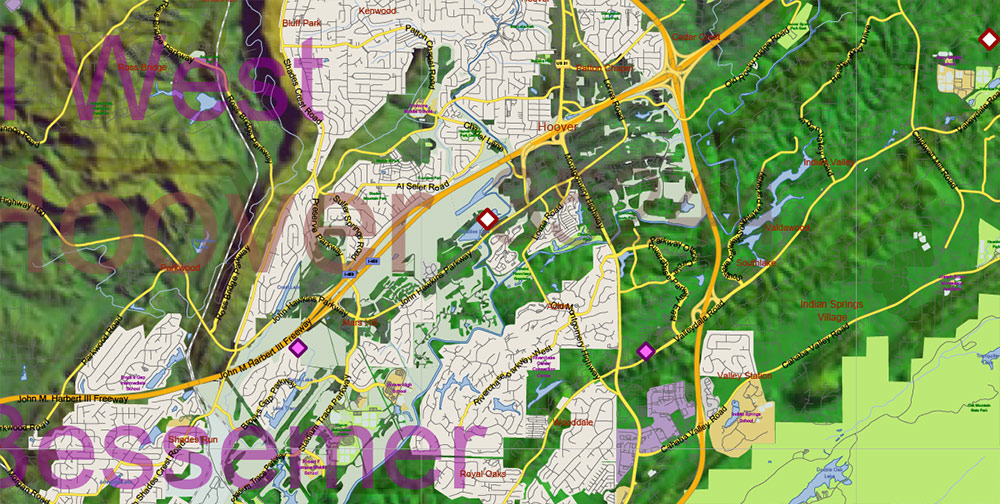
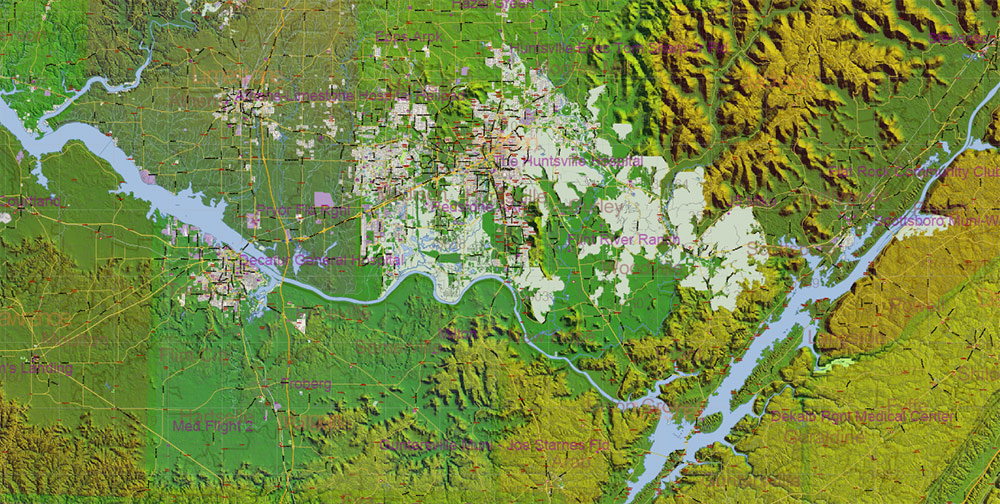
Statewide shaded relief vector map of Alabama engineered at high plan scale with maximum positional accuracy. Full coverage of transport, administrative, and settlement layers combined with high-definition shaded relief. Designed for precision editing and high-quality professional printing.
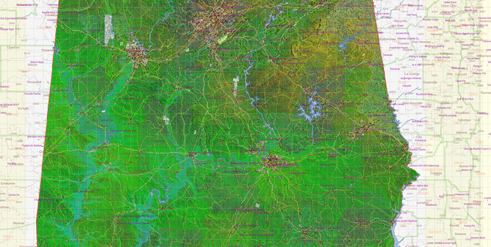
Terrain & Shaded Relief
-
HD shaded relief emphasizing Alabama’s varied terrain structure
-
Clear differentiation between Appalachian foothills, Cumberland Plateau, Piedmont uplands, and Gulf Coastal Plain
-
Terrain shading enhances depth while preserving legibility of dense road and urban layers
-
River valleys, elevation transitions, and coastal lowlands remain visually coherent
Lines of Communication (Road Network)
-
ALL streets and roads included, from primary highways to local streets
-
Principal street names explicitly labeled
-
Road hierarchy remains readable across urban and rural areas
-
Suitable for logistics planning, transport analysis, and infrastructure design
Urban & Human Terrain
-
All cities and towns included and labeled
-
Settlement patterns reflect terrain, hydrology, and transport corridors
-
Effective for regional planning, business analysis, and presentation graphics
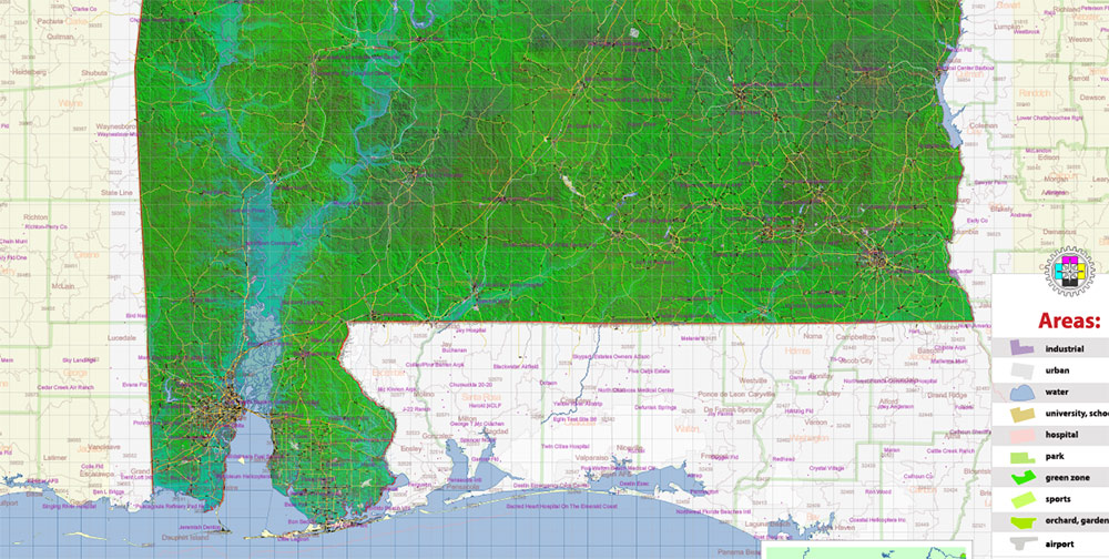
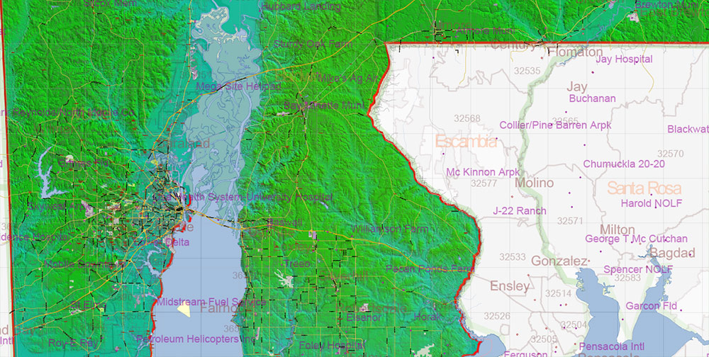
Administrative & Postal Structure
-
Counties fully delineated and labeled
-
ZIP code boundaries included as dedicated analytical layers
-
Supports planning, real estate, and operational mapping tasks
Aviation & Strategic Infrastructure
Hydrography & Natural Features
-
Major rivers, reservoirs, and water bodies clearly represented
-
Water systems aligned with shaded relief for terrain-aware visualization
Map Engineering & Data Integrity
-
Fully editable layered vector Adobe PDF
-
All names provided in text format — no rasterized labels
-
High-definition shaded relief supplied as raster layer
-
Scalable for high-quality printing without resolution loss
-
Royalty-free usage for design and production workflows
Supplementary Content
Command Takeaways
-
Extremely detailed and precise statewide cartography
-
Shaded relief enhances terrain comprehension without clutter
-
Built for architects, designers, planners, logistics, and professional print
-
Suitable for demanding technical and presentation environments
Alabama State US PDF Map Vector Exact Shaded Reliaf and Roads High Detailed Map + Counties + Zipcodes editable Adobe PDF in layers
Alabama State US PDF Map Vector Exact Shaded Reliaf and Roads High Detailed Map + Counties + Zipcodes editable Adobe PDF in layers
Alabama State US PDF Map Vector Exact Shaded Reliaf and Roads High Detailed Map + Counties + Zipcodes editable Adobe PDF in layers
Alabama State US PDF Map Vector Exact Shaded Reliaf and Roads High Detailed Map + Counties + Zipcodes editable Adobe PDF in layers
Alabama State US PDF Map Vector Exact Shaded Reliaf and Roads High Detailed Map + Counties + Zipcodes editable Adobe PDF in layers
Alabama State US PDF Map Vector Exact Shaded Reliaf and Roads High Detailed Map + Counties + Zipcodes editable Adobe PDF in layers

Alabama State US PDF Map Vector Exact Shaded Reliaf and Roads High Detailed Map + Counties + Zipcodes editable Adobe PDF in layers
Alabama State US PDF Map Vector Exact Shaded Reliaf and Roads High Detailed Map + Counties + Zipcodes editable Adobe PDF in layers
Alabama State US PDF Map Vector Exact Shaded Reliaf and Roads High Detailed Map + Counties + Zipcodes editable Adobe PDF in layers
Alabama State US PDF Map Vector Exact Shaded Reliaf and Roads High Detailed Map + Counties + Zipcodes editable Adobe PDF in layers

Alabama State US PDF Map Vector Exact Shaded Reliaf and Roads High Detailed Map + Counties + Zipcodes editable Adobe PDF in layers

Alabama State US PDF Map Vector Exact Shaded Reliaf and Roads High Detailed Map + Counties + Zipcodes editable Adobe PDF in layers
Alabama State US PDF Map Vector Exact Shaded Reliaf and Roads High Detailed Map + Counties + Zipcodes editable Adobe PDF in layers
Alabama State US PDF Map Vector Exact Shaded Reliaf and Roads High Detailed Map + Counties + Zipcodes editable Adobe PDF in layers

 Author: Kirill Shrayber, Ph.D. FRGS

