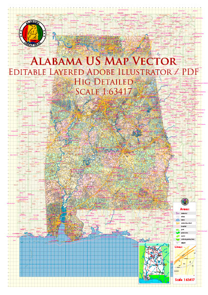
ALABAMA TRANSPORTATION OVERVIEW
Alabama’s comprehensive
transportation network allows for
easy travel and efficient shipping to
destinations worldwide.
Highways
Six interstate highways converge in
Alabama (I-10, I-20, I-59, I-65, I-85 &
I-22) allowing goods to be shipped to
major markets.
Airways
Commercial passengers are served by
four major commercial airlines and
several commuter airlines through
seven airports. International flights are
easily accessible via direct flights from
major connecting cities.
Five airports provide air cargo service.
These airports have designated
Foreign Trade Zones for the
promotion of international commerce
through the duty-free, quota-free entry
of foreign goods under U.S. Customs
supervision. Alabama is also located
between two of the country’s largest
air cargo centers – Memphis and
Atlanta.
Alabama’s air transportation network
includes 92 public use airports, and
most are able to accommodate
corporate jets.
Railways
Passenger rail service is provided by
Amtrak with three Alabama stops
along the Crescent route running daily
between New York City and New
Orleans.
Freight service needs are
accommodated through an extensive
rail system served by several railroad
companies over 3,800 miles (6,100+
km) of track. Excellent main line
connections give shippers good access
to all major market centers.
Five Class I railway companies
providing service to the state include:
- BNSF Railway
- Canadian National Railway
- CSX Transportation
- Kansas City Southern Railway
- Norfolk Southern
Intermodal Centers
Significant investments in intermodal
infrastructure have been made in Alabama,
adding and improving a number of
intermodal facilities to better serve domestic
and international markets.
NS Crescent Intermodal, outside of
Birmingham, serves as a major gateway for
truck-competitive freight moving between
the South and Northeast and enable Norfolk
Southern to launch new service from
Birmingham to the Northeast and to
Mexico .
The International Intermodal Center located
in the Port of Huntsville Global Logistics
Park, provides a single hub location
specializing in receiving, transferring,
storing, and distributing international and
domestic cargo via air, rail, and highway.
The Alabama Port Authority spent nearly
$50 million in site development for a new
intermodal container transfer facility
(intermodal rail) at the Port of Mobile.
These investments offer shippers improved
carrier services and shipping options
between major global, Southeast and
Midwest markets.
Inland and Coastal Waterways
Alabama has one of the longest
inland waterway systems in the
nation.
Alabama’s waterway corridors
include:
- Gulf Intracoastal Waterway
- Tennessee Waterway
- Tennessee-Tombigbee Waterway
- Warrior-Tombigbee Waterway
Alabama’s water corridors are part
of the national inland waterway
system, connecting to over 15,000
miles (24,000+ km) of inland and
intracoastal waterways, river ports,
and sea ports in 23 states via the
Tennessee-Tombigbee and the Gulf
Intracoastal water system.
Port of Mobile
Port of Mobile offers carrier services and
shipping options between major global,
US Gulf, Southeast and Midwest
markets. Since 2001, The Alabama State
Port Authority has invested more than
$700 million in port infrastructure.
At 45 feet (13.7 meters), the port’s main
channel is one of the deepest
permanently-navigable channels in the
South. In 2010, Mobile Harbor Turning
Basin opened, extending the capacity of
the ship channel to make it easier for
large ships to utilize three major
terminals at the port.
The port has immediate access to two
interstate systems, five Class I railroads,
and nearly 15,000 miles (24,000+ km) of
inland waterway connections. Brookley
Aeroplex, located adjacent to the port,
offers immediate access to freight
forwarding transportation services.
Source: https://edpa.org/wp-content/uploads/2019/11/Alabamas-Transportation-Overview.pdf


 Author: Kirill Shrayber, Ph.D.