Extended Description of the Vector Map
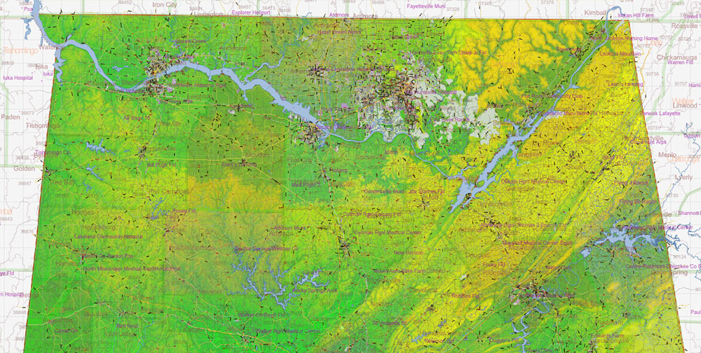
Printable Colored Relief Vector Map of Alabama State, US High Detailed Plan scale 1:63417 full editable Adobe Illustrator Road Admin Map in layers, scalable, text format all names, 1235 MB ZIP
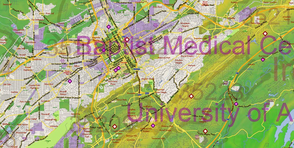
All streets and roads, Principal street names, All Cities and Towns, Zipcodes, Airports and Heliports, Main Objects, Counties, raster Colored Relief HD. Map for design, printing, arts, projects, presentations, for architects, designers, and builders, business, logistics.
The most exact and detailed map of the state in scale.
For Editing and High-Quality Printing, Royalty free
Included: Simple map of Alabama.
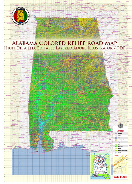
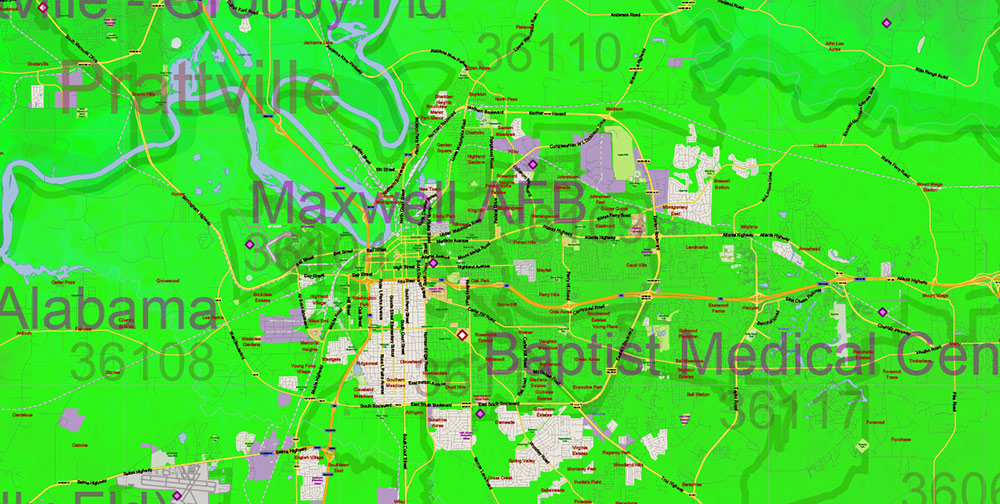
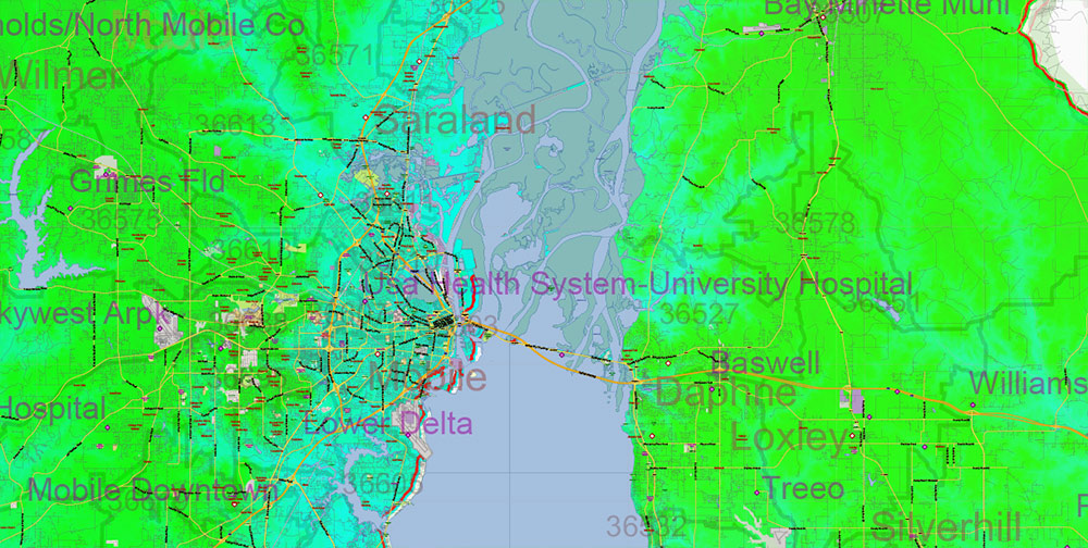
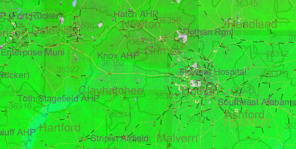
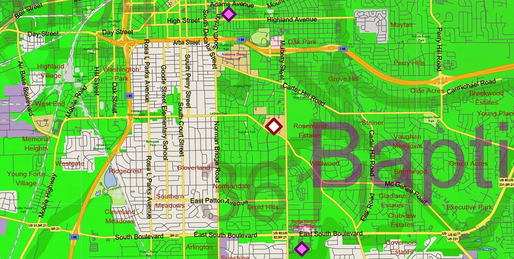
Alabama State US PDF Map Vector Exact Colored Reliaf and Roads High Detailed Map + Counties + Zipcodes editable Adobe PDF in layers
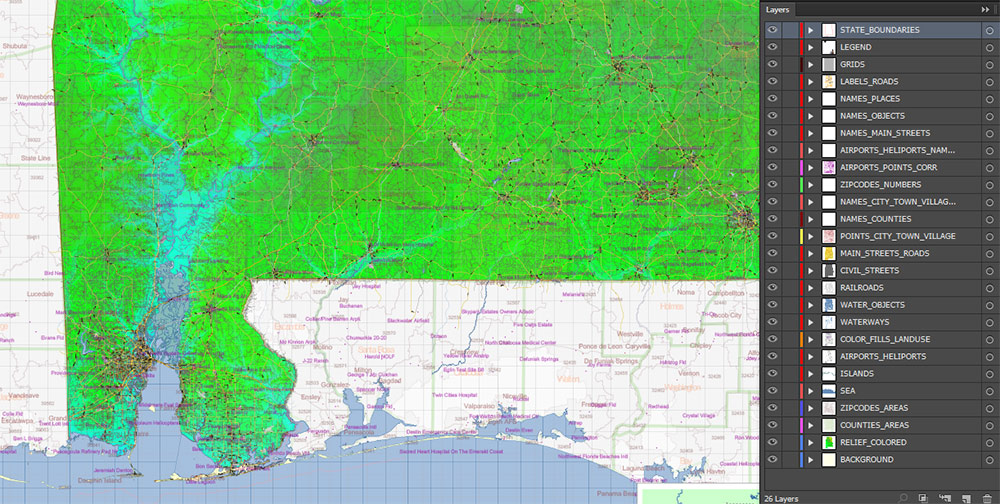
Layers list:
- Legend
- Grids
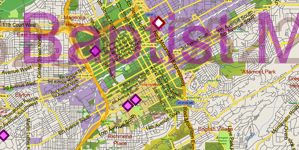
- Labels of roads
- Names of places (city, hamlet, etc.)
- City, towns names 2
- Points of the Cities and Towns 2
- Airports and Heliports names
- Points of the Airports and Heliports
- Names of objects (hospitals, schools, parks, water)
- Names of main streets
- Names of Counties
- Principal Streets and Roads
- Residential streets
- Railroads
- ZIP Codes numbers
- ZIP Codes areas
- Airports and Heliports areas
- Water objects (rivers, lakes, ponds)
- Waterways
- Color fills (parks, hospital areas, school areas, land use, etc.)
- Islands
- Sea
- Counties areas
- Colored Relief Raster JPG HD
- Background
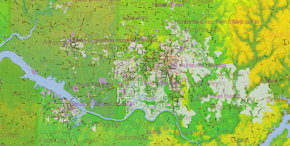
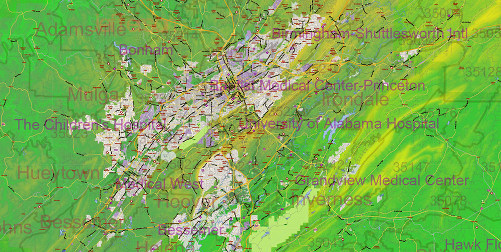
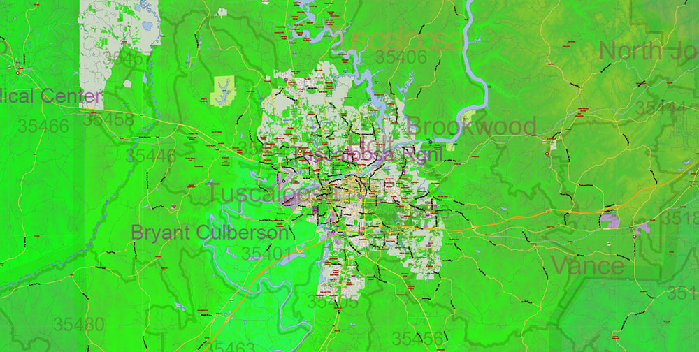
AO BRIEF — ALABAMA (STATEWIDE)
Colored Relief • No Shading • Print & Design Focus
Operational Overview
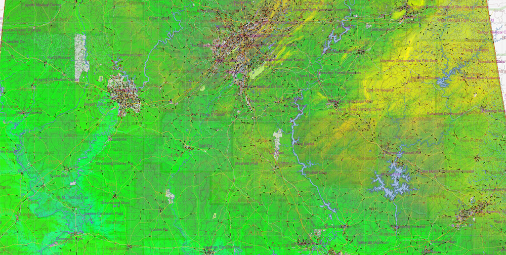
Statewide color relief vector map of Alabama using elevation-based color layers without terrain shading. Designed for clean, high-density cartography where visual balance, neutrality, and print quality are primary requirements.
Relief Representation
-
Elevation expressed through calibrated color bands only
-
No shadows or directional lighting — consistent and timeless appearance
-
Clear differentiation between uplands, plateaus, river basins, and coastal lowlands
-
Terrain structure remains readable without visual noise
Visual Balance & Composition
-
Even tonal distribution optimized for professional printing
-
Color relief supports dense road, administrative, and settlement layers
-
Designed to remain visually stable at large print sizes
Human & Administrative Geography
-
All cities and towns clearly labeled
-
Counties and ZIP code boundaries readable without dominating the layout
-
Suitable for planning, business graphics, and decorative cartographic products
Transport & Infrastructure Framework
-
Complete road and street network integrated with restrained visual weight
-
Principal streets emphasized without overpowering the composition
-
Effective for wall maps, reports, and presentation layouts
Hydrography & Regional Structure
-
Rivers, reservoirs, and water bodies rendered with clean contrast
-
Water systems provide visual structure and geographic coherence
-
Coastal lowlands and inland drainage patterns clearly expressed
Print Engineering
-
Fully editable layered vector Adobe PDF
-
All names in text format, scalable and print-safe
-
No resolution limits for posters, wall maps, or large-format installations
-
Suitable for fine art prints, framed maps, and interior design projects
Aesthetic Intent
-
Restrained, modern cartographic style focused on clarity and longevity
-
Balanced between geographic accuracy and visual harmony
-
Designed for long-term display in offices, studios, and public interiors
Command Takeaways
-
Color relief without shading for clean, print-oriented presentation
-
High legibility with dense data layers
-
Unlimited print scalability
-
Ideal for professional printing, wall art, and refined design use
Alabama State US PDF Map Vector Exact Colored Reliaf and Roads High Detailed Map + Counties + Zipcodes editable Adobe PDF in layers
Alabama State US PDF Map Vector Exact Colored Reliaf and Roads High Detailed Map + Counties + Zipcodes editable Adobe PDF in layers

Alabama State US PDF Map Vector Exact Colored Reliaf and Roads High Detailed Map + Counties + Zipcodes editable Adobe PDF in layers
Alabama State US PDF Map Vector Exact Colored Reliaf and Roads High Detailed Map + Counties + Zipcodes editable Adobe PDF in layers

Alabama State US PDF Map Vector Exact Colored Reliaf and Roads High Detailed Map + Counties + Zipcodes editable Adobe PDF in layers
Alabama State US PDF Map Vector Exact Colored Reliaf and Roads High Detailed Map + Counties + Zipcodes editable Adobe PDF in layers

Alabama State US PDF Map Vector Exact Colored Reliaf and Roads High Detailed Map + Counties + Zipcodes editable Adobe PDF in layers
Alabama State US PDF Map Vector Exact Colored Reliaf and Roads High Detailed Map + Counties + Zipcodes editable Adobe PDF in layers
Alabama State US PDF Map Vector Exact Colored Reliaf and Roads High Detailed Map + Counties + Zipcodes editable Adobe PDF in layers
Alabama State US PDF Map Vector Exact Colored Reliaf and Roads High Detailed Map + Counties + Zipcodes editable Adobe PDF in layers
Alabama State US PDF Map Vector Exact Colored Reliaf and Roads High Detailed Map + Counties + Zipcodes editable Adobe PDF in layers
Alabama State US PDF Map Vector Exact Colored Reliaf and Roads High Detailed Map + Counties + Zipcodes editable Adobe PDF in layers
Alabama State US PDF Map Vector Exact Colored Reliaf and Roads High Detailed Map + Counties + Zipcodes editable Adobe PDF in layers
Alabama State US PDF Map Vector Exact Colored Reliaf and Roads High Detailed Map + Counties + Zipcodes editable Adobe PDF in layers
Alabama State US PDF Map Vector Exact Colored Reliaf and Roads High Detailed Map + Counties + Zipcodes editable Adobe PDF in layers

 Author: Kirill Shrayber, Ph.D. FRGS

