Extended Description of the Vector Map
Printable Relief Vector Map California State (Full Area), US detailed fully editable Adobe Illustrator Road Map in layers, scalable, text/curves format all names, 123 MB ZIP
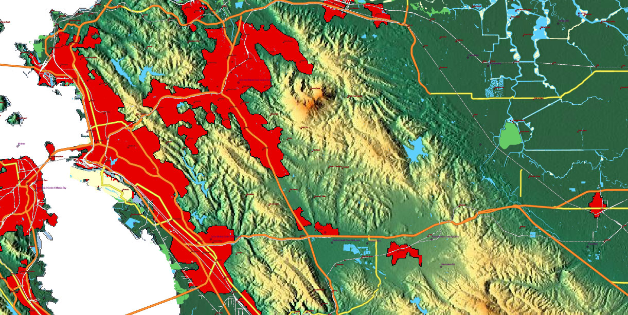
Main streets and roads, Cities and Towns, Water Objects, Railroads, Airports, Relief raster, foe Print Size 4 ft.. Map for design, printing, arts, projects, presentations, for architects, designers, and builders, business, logistics.
Note: 2 complete road lines, 2 complete places names, road shields.
Also: We can add (additional layer for this map), any other objects for you. It’s free for our customers.
If you need any OTHER format – DWG, DXF, Corel, or something else – please, email us
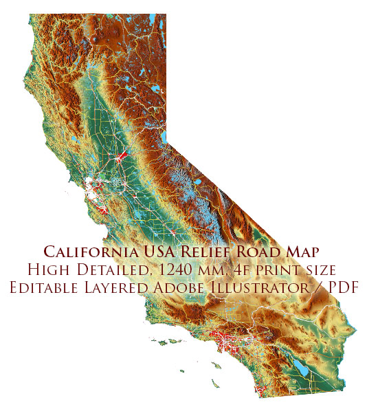
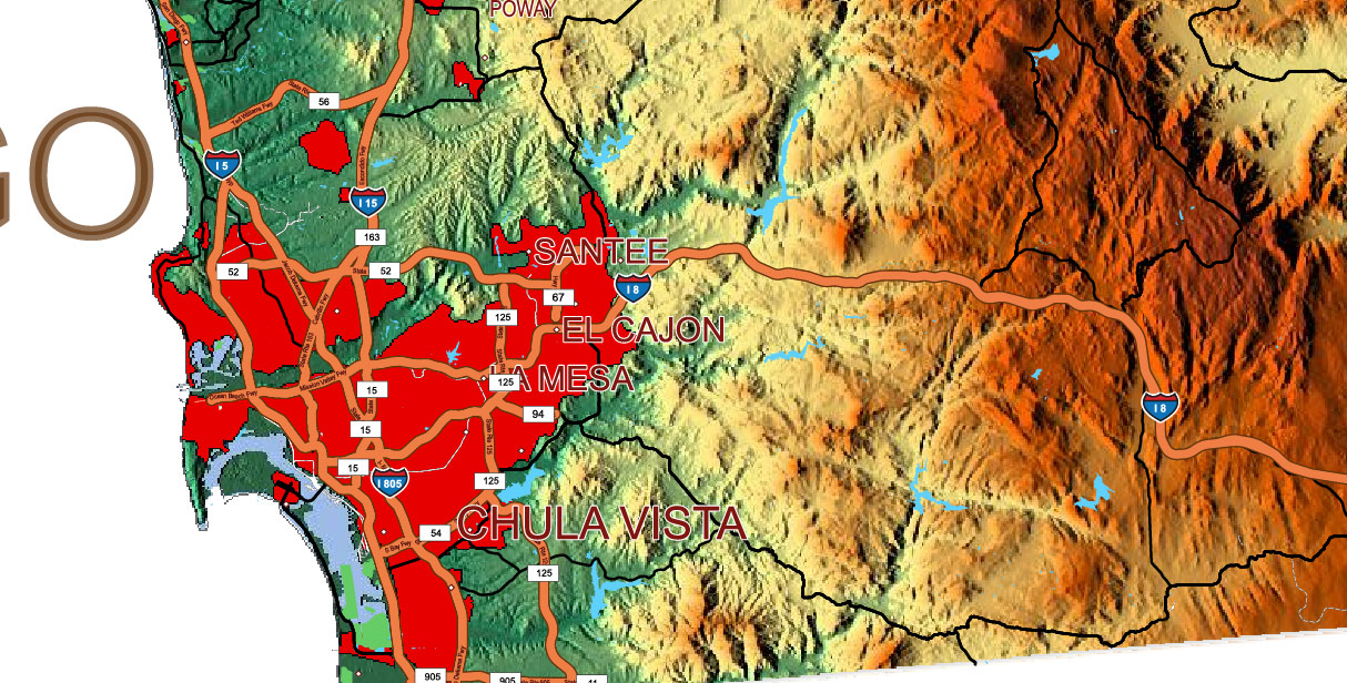
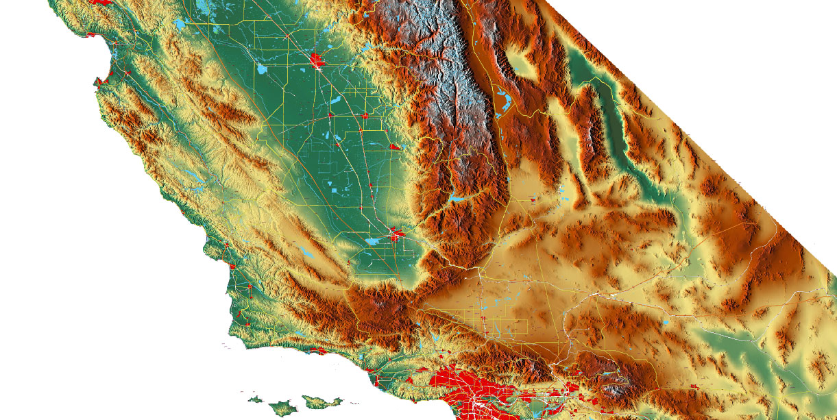
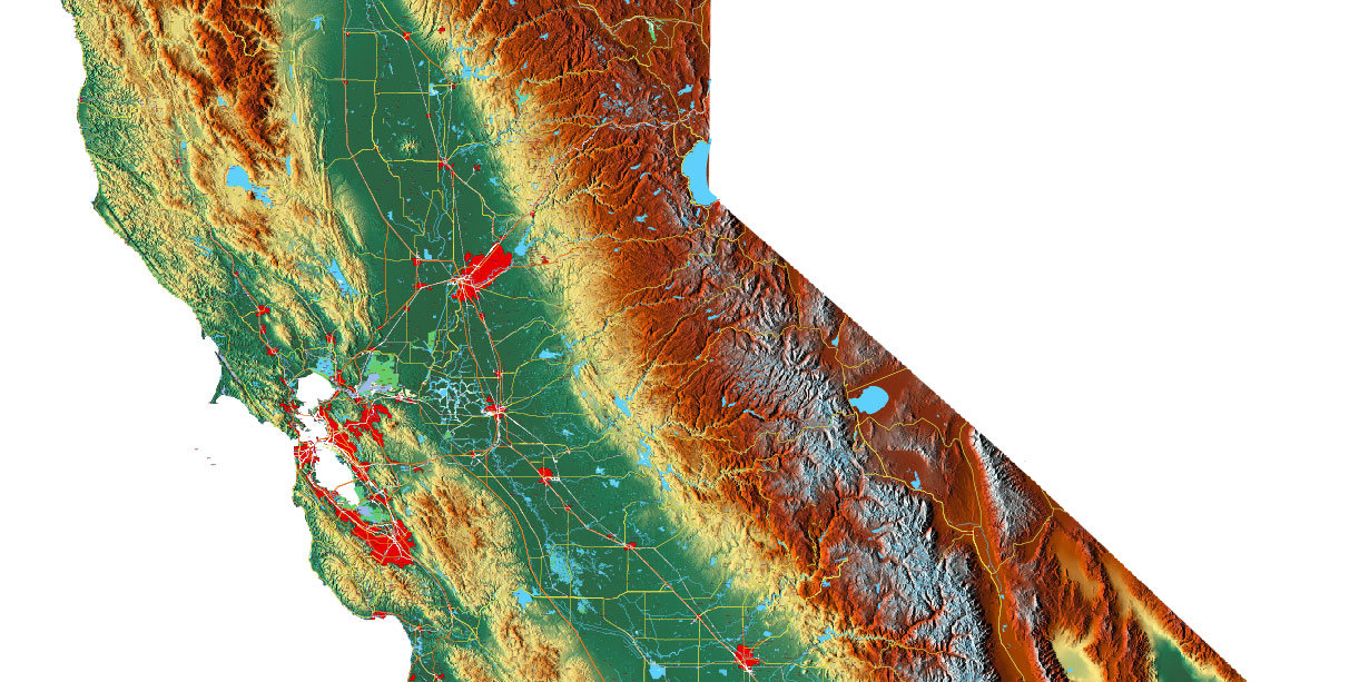
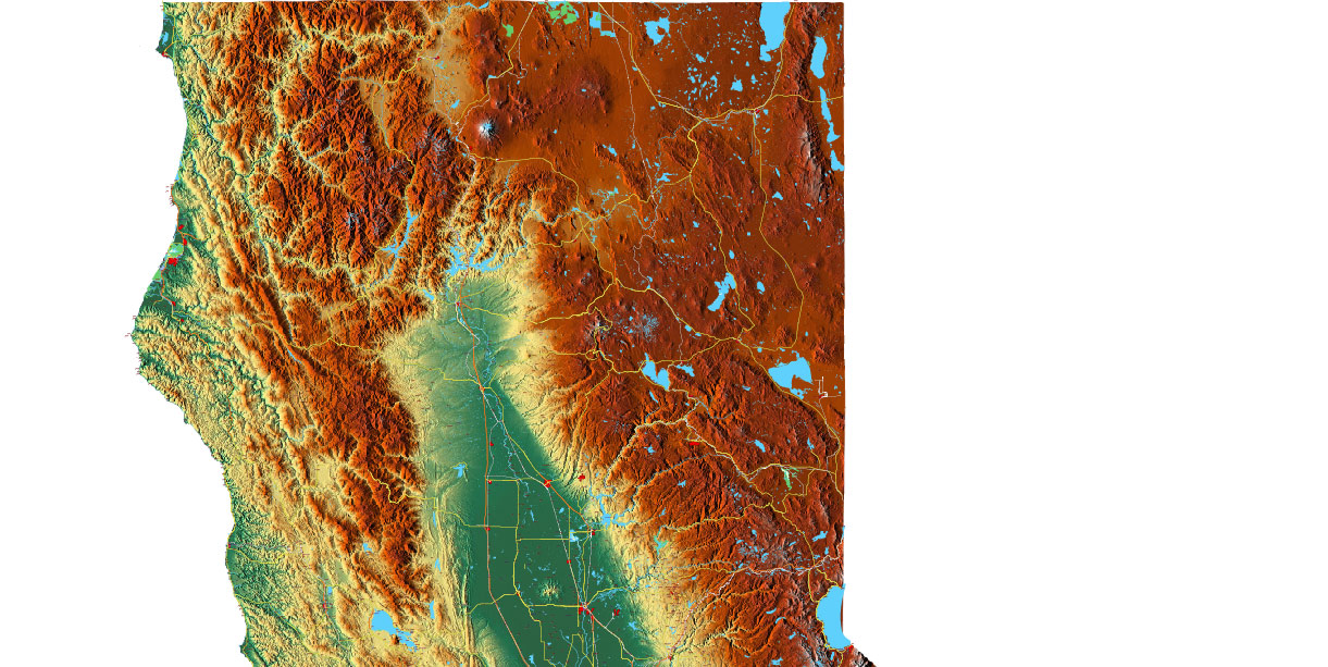
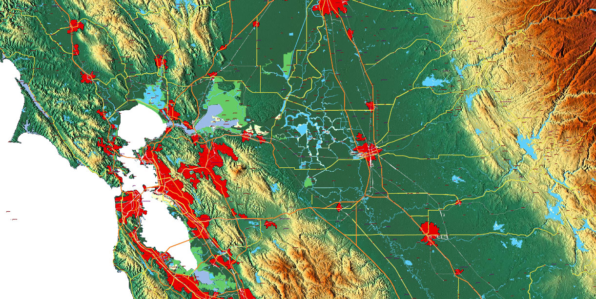
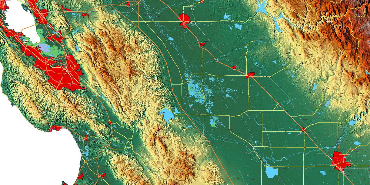
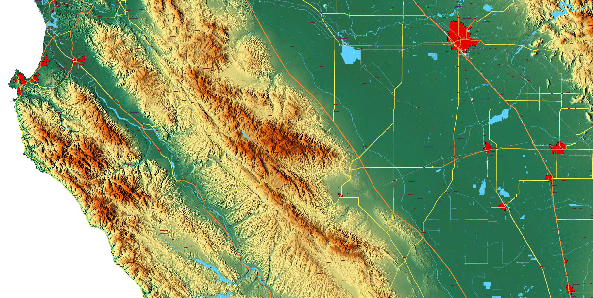
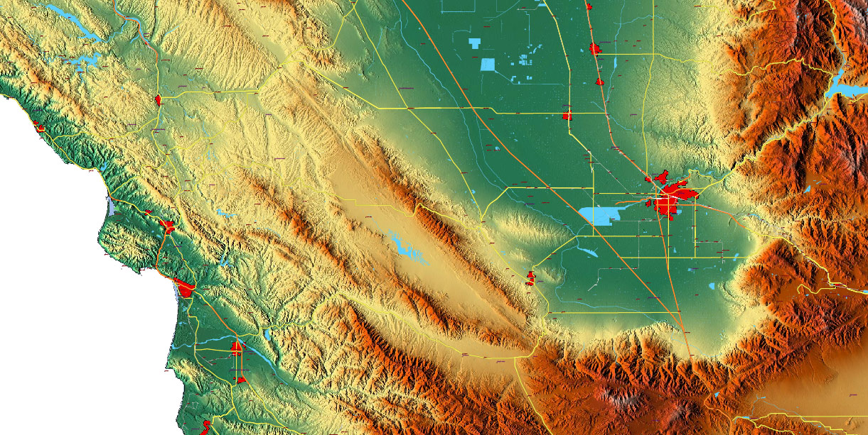
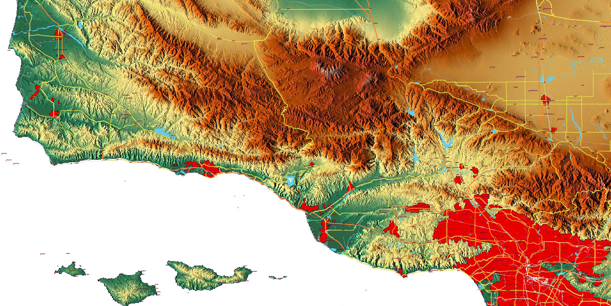
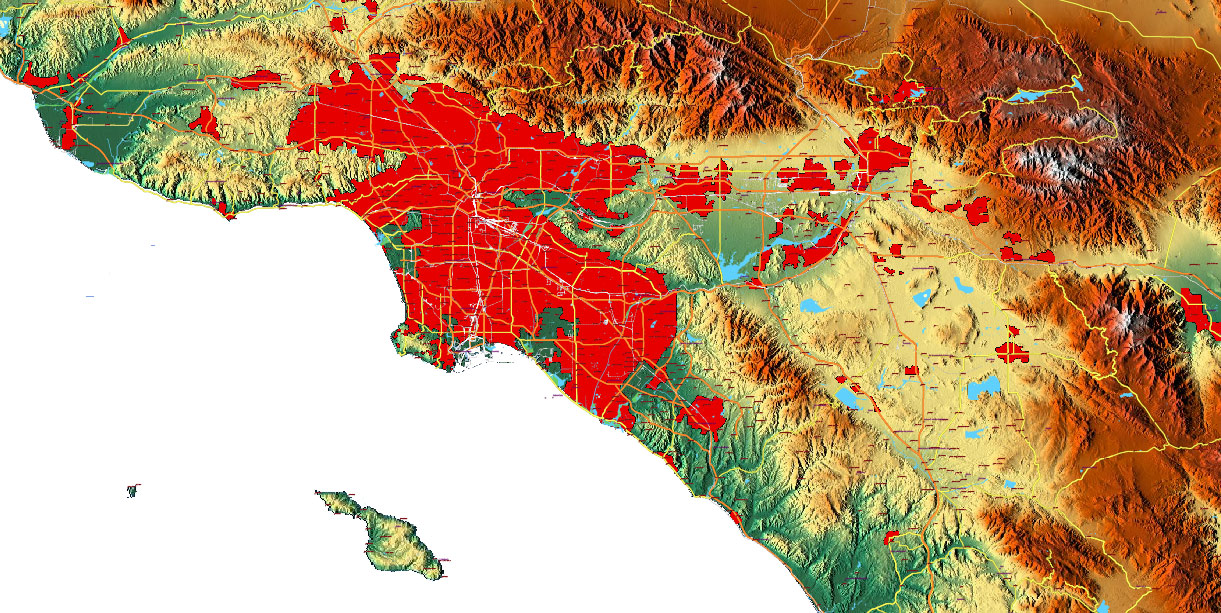
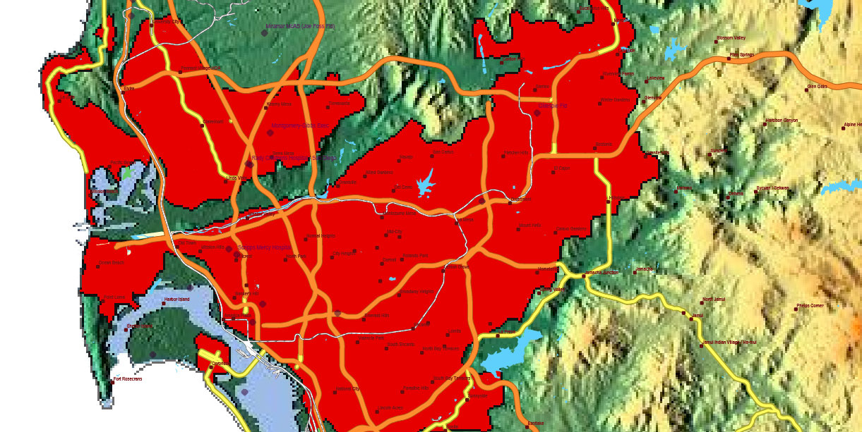
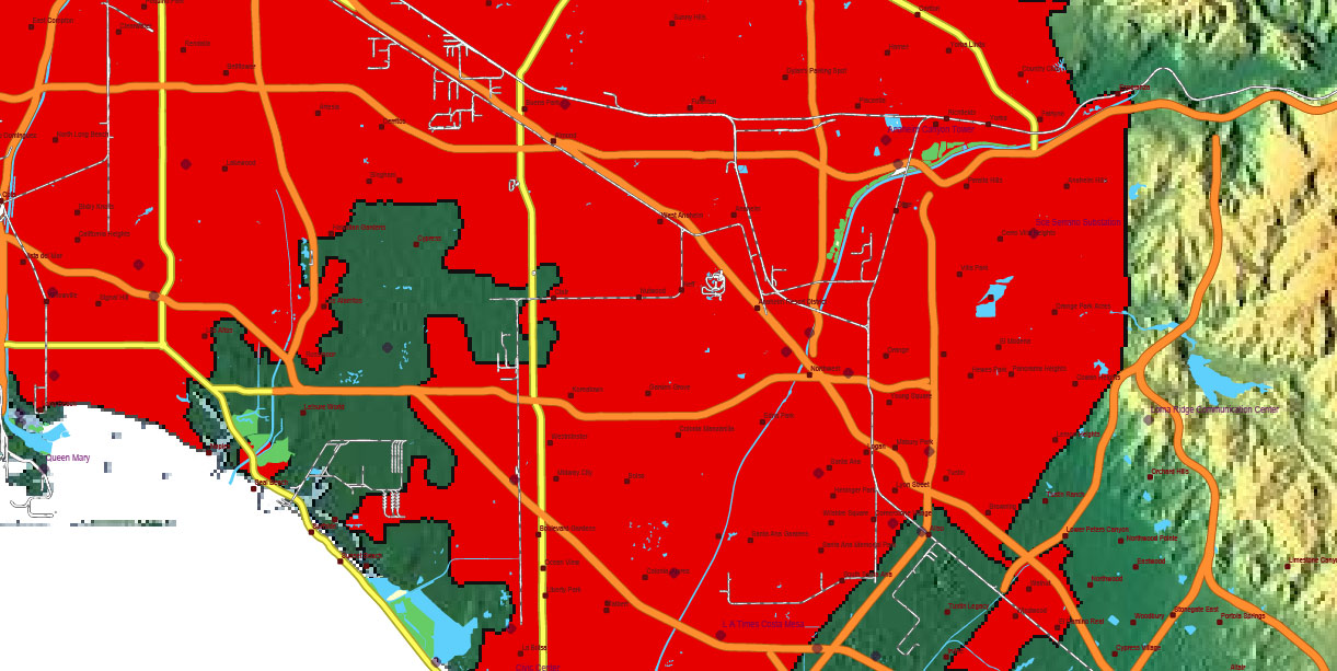
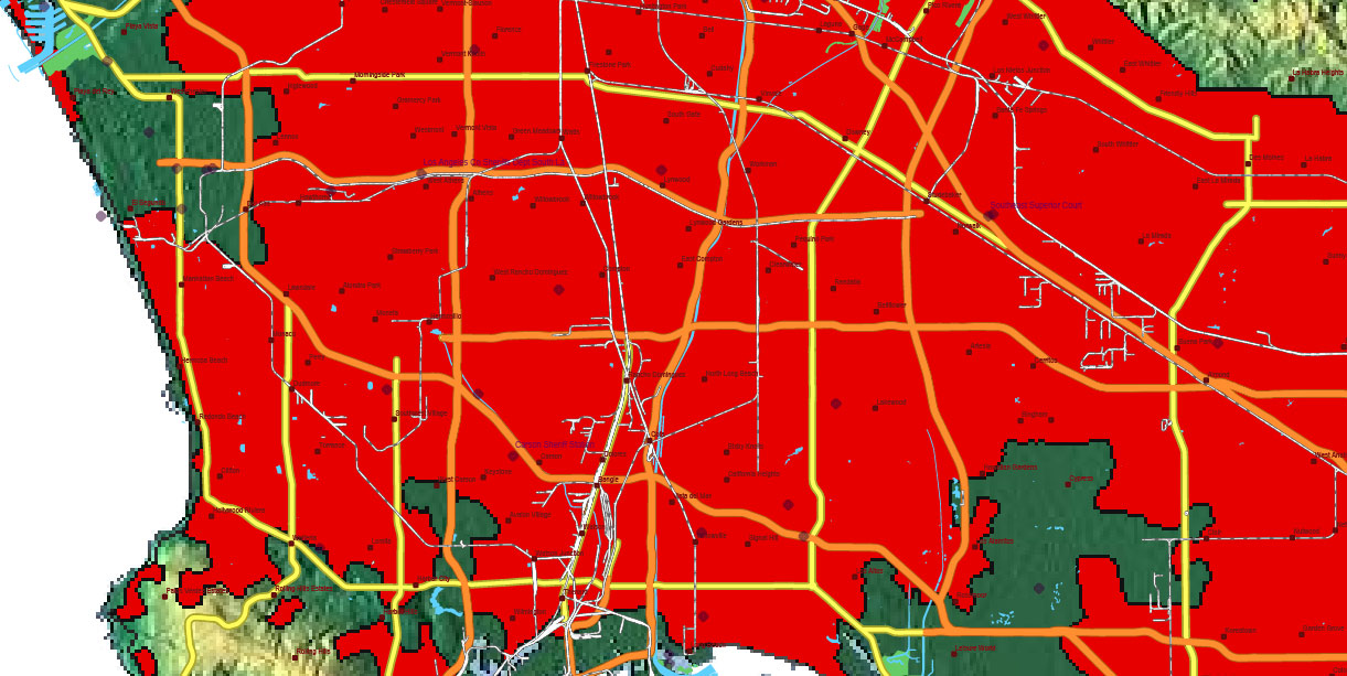
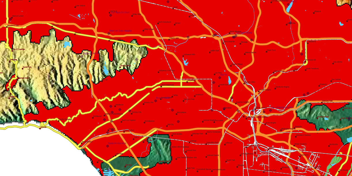
California State US Map Vector Exact High Detailed Roads Map + Relief Topo (raster) editable Adobe Illustrator in layers
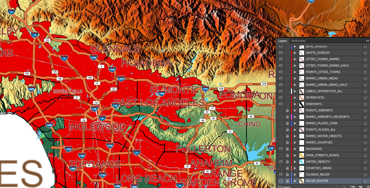
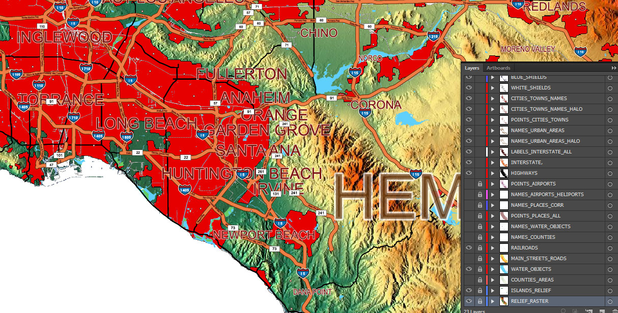
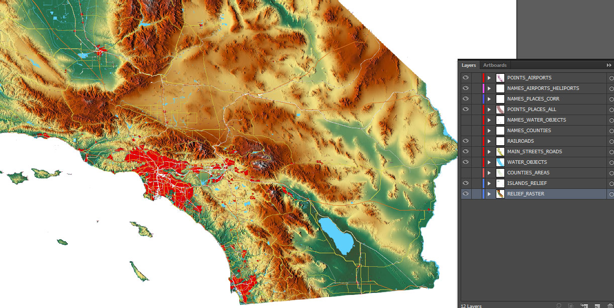
Layers list: (see preview)
- Names of Airports
- Points of Airports
- Names of places (city, hamlet, etc.) 1,2
- Points of places 1, 2
- Names of urban areas
- Names Highways
- Road labels (shields)
- Main streets and roads 1,2
- Railroads
- Water objects (areas)
- Counties areas
- Islands raster PNG images
- Relief Topo raster PNG image
California State US Map Vector Exact High Detailed Roads Map + Relief Topo (raster) editable Adobe Illustrator in layers
California State US Map Vector Exact High Detailed Roads Map + Relief Topo (raster) editable Adobe Illustrator in layers
California State US Map Vector Exact High Detailed Roads Map + Relief Topo (raster) editable Adobe Illustrator in layers
California State US Map Vector Exact High Detailed Roads Map + Relief Topo (raster) editable Adobe Illustrator in layers
California State US Map Vector Exact High Detailed Roads Map + Relief Topo (raster) editable Adobe Illustrator in layers
California State US Map Vector Exact High Detailed Roads Map + Relief Topo (raster) editable Adobe Illustrator in layers
California State US Map Vector Exact High Detailed Roads Map + Relief Topo (raster) editable Adobe Illustrator in layers
California State US Map Vector Exact High Detailed Roads Map + Relief Topo (raster) editable Adobe Illustrator in layers
California State US Map Vector Exact High Detailed Roads Map + Relief Topo (raster) editable Adobe Illustrator in layers
California State US Map Vector Exact High Detailed Roads Map + Relief Topo (raster) editable Adobe Illustrator in layers
California State US Map Vector Exact High Detailed Roads Map + Relief Topo (raster) editable Adobe Illustrator in layers
California State US Map Vector Exact High Detailed Roads Map + Relief Topo (raster) editable Adobe Illustrator in layers
California State US Map Vector Exact High Detailed Roads Map + Relief Topo (raster) editable Adobe Illustrator in layers
California State US Map Vector Exact High Detailed Roads Map + Relief Topo (raster) editable Adobe Illustrator in layers
California State US Map Vector Exact High Detailed Roads Map + Relief Topo (raster) editable Adobe Illustrator in layers
California State US Map Vector Exact High Detailed Roads Map + Relief Topo (raster) editable Adobe Illustrator in layers
California State US Map Vector Exact High Detailed Roads Map + Relief Topo (raster) editable Adobe Illustrator in layers
California State US Map Vector Exact High Detailed Roads Map + Relief Topo (raster) editable Adobe Illustrator in layers
California State US Map Vector Exact High Detailed Roads Map + Relief Topo (raster) editable Adobe Illustrator in layers
California State US Map Vector Exact High Detailed Roads Map + Relief Topo (raster) editable Adobe Illustrator in layers

 Author: Kirill Shrayber, Ph.D. FRGS
")
