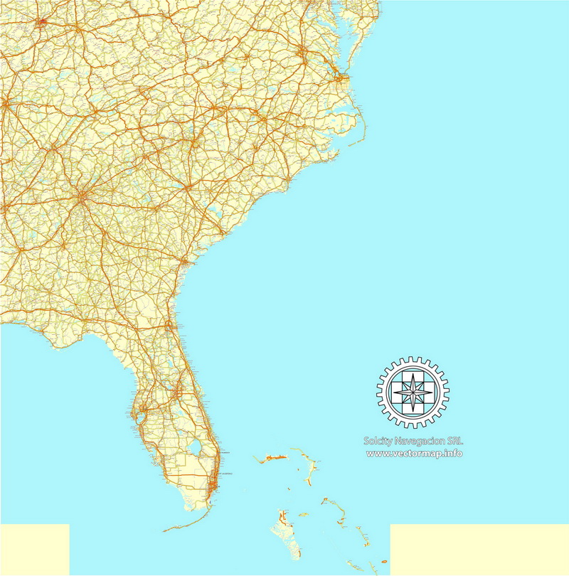
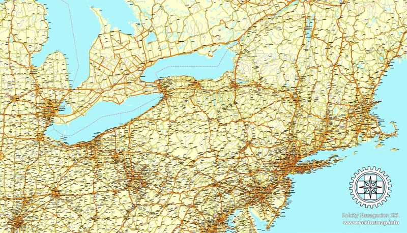
USA + Canada Country vector map roads, Mercator Projection, Adobe Illustrator, North America
Archive size: 224,2 Mb, zipped .AI
DPI: 300
This vector maps of USA + Canada Country is created using 2016 data.
License: Royalty Free
Separated layers, all names in text format.
Good for print in format = 2A0
USA + Canada Country vector map roads, Mercator Projection, Adobe Illustrator format (.AI) features (check the preview images):
35 parts, full territory
Highways,
Major Roads,
Collector roads
Big and small Rivers, small streams also,
Lakes, ponds and other water bodies.
Cities and towns with names
US MAP CATALOG BY STATE NAME: you can see all maps of the cities and counties by click on the name of state
 Alabama AL
 ![]() Alaska AK
Alaska AK ![]() Arizona AZ
Arizona AZ ![]() Arkansas AR
Arkansas AR ![]() California CA
California CA ![]() Colorado CO
Colorado CO ![]() Connecticut CT
Connecticut CT
![]() Delaware DE
Delaware DE  District Columbia DC
 ![]() Florida FL
Florida FL ![]() Georgia GA
Georgia GA ![]() Hawaii HI
Hawaii HI ![]() Idaho ID
Idaho ID ![]() Illinois IL
Illinois IL
![]() Indiana IN
Indiana IN ![]() Iowa IA
Iowa IA ![]() Kansas KS
Kansas KS ![]() Kentucky KY
Kentucky KY ![]() Louisiana LA
Louisiana LA ![]() Maine ME
Maine ME ![]() Maryland MD
Maryland MD
![]() Massachusetts MA
Massachusetts MA ![]() Michigan MI
Michigan MI ![]() Minnesota MN
Minnesota MN ![]() Mississippi MS
Mississippi MS ![]() Missouri MO
Missouri MO ![]() Montana MT
Montana MT ![]() Nebraska NE
Nebraska NE
![]() Nevada NV
Nevada NV ![]() New Hampshire NH
New Hampshire NH ![]() New Jersey NJ
New Jersey NJ ![]() New Mexico NM
New Mexico NM ![]() New York NY
New York NY ![]() North Carolina NC
North Carolina NC
![]() North Dakota ND
North Dakota ND ![]() Ohio OH
Ohio OH ![]() Oklahoma OK
Oklahoma OK ![]() Oregon OR
Oregon OR ![]() Pennsylvania PA
Pennsylvania PA ![]() Puerto Rico PR
Puerto Rico PR
![]() Rhode Island RI
Rhode Island RI ![]() South Carolina SC
South Carolina SC ![]() South Dakota SD
South Dakota SD ![]() Tennessee TN
Tennessee TN ![]() Texas TX
Texas TX ![]() Utah UT
Utah UT
![]() Vermont VT
Vermont VT ![]() Virginia VA
Virginia VA ![]() Washington WA
Washington WA ![]() West Virginia WV
West Virginia WV ![]() Wisconsin WI
Wisconsin WI ![]() Wyoming WY
Wyoming WY
 Author: Kirill Shrayber, Ph.D. FRGS