Free download vector map San Francisco California us city plan simple ai DOWNLOAD NOW >>>>>
Free download vector map San Francisco California us city plan simple ai DOWNLOAD NOW
San Francisco
City in California
San Francisco, in northern California, is a hilly city on the tip of a peninsula surrounded by the Pacific Ocean and San Francisco Bay. It’s known for its year-round fog, iconic Golden Gate Bridge, cable cars and colorful Victorian houses. The Financial District’s Transamerica Pyramid is its most distinctive skyscraper. In the bay sits Alcatraz Island, site of the notorious former prison.
Population: 884,363
See also: Other vector maps San Francisco, California extra detailed and low detailed for small print size, fully editable, layered
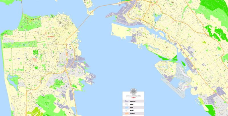
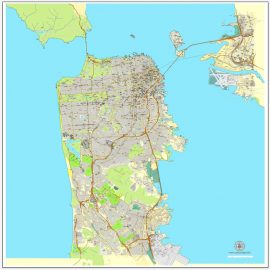
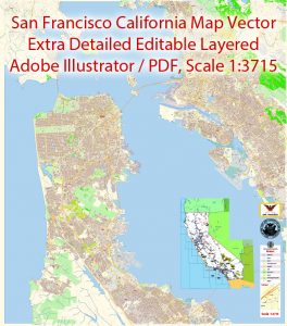 San Francisco + Oakland California Map Vector Exact City Plan extra detailed Street Map editable Adobe Illustrator in layers |
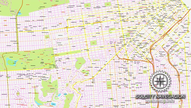
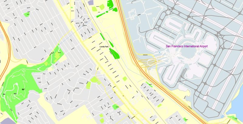
Printable Vector Map of San Francisco + Oakland California US extra detailed City Plan scale 100 m 1:3715 full editable Adobe Illustrator Street Map in layers, scalable, text format all names, 54 MB ZIP All street names, Main Objects, All Buildings. Map for design, printing, arts, projects, presentations, for architects, designers, and builders, business, logistics. Layers: color_fills, water, streets_roads, labels_roads, names_objects, names_streets, names_places, arrows_streets, buildings, grids, legend, etc. The most exact and detailed map of the city in scale. For Editing and High-Quality Printing |
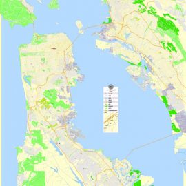
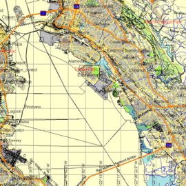
 San Francisco PDF Map, California, US, exact vector Map |
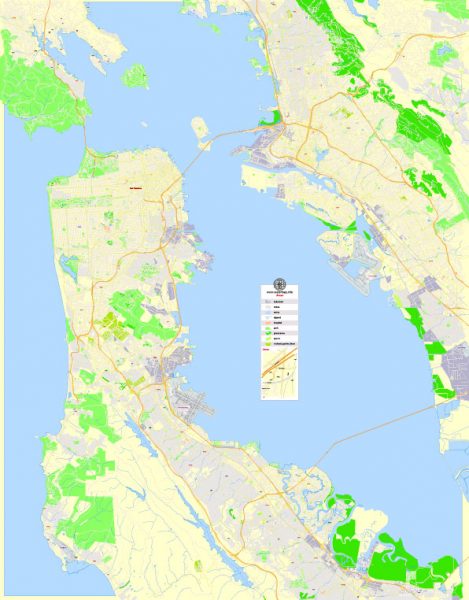
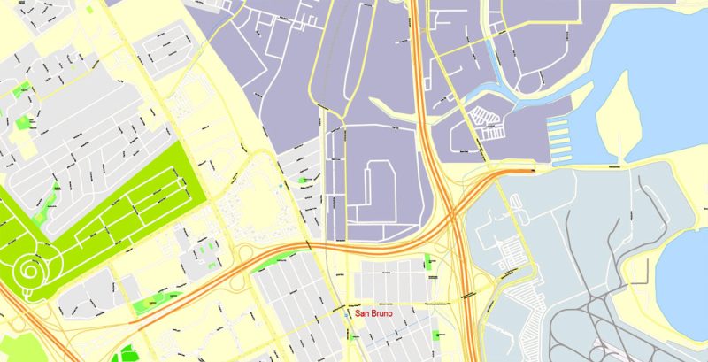
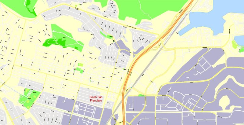
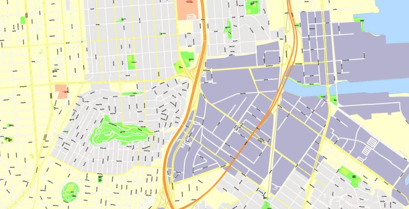
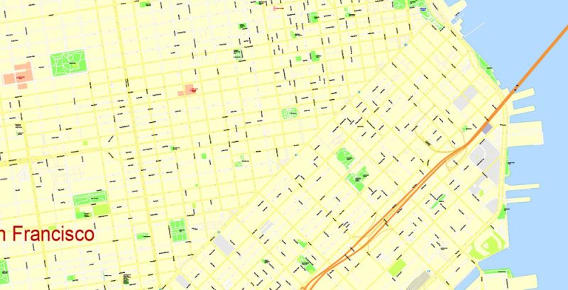
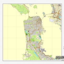
Printable Map San Francisco, California, US, exact vector Map street G-View City Plan Level 17 (100 meters scale) fully editable, Adobe Illustrator, full vector, scalable, editable text format street names, 14 MB ZIP All streets named, Main Objects, No buildings. Map for design, printing, arts, projects, presentations, for architects, designers, and builders, business, logistics. Layers: color fills, streets_roads, arrows_streets, labels_roads, objects, names objects, names_streets, names_places, grids, legend. The most exact and detailed map of the city. The coverage area of this map: San Francisco, Oakland, Berkeley, Sausalito, San Mateo, Daly City, Alameda, San Leandro For print LARGE (WALL) format. |
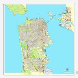
 Map San Francisco + Oakland California US |
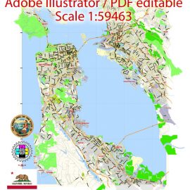
Printable Vector Map San Francisco + Oakland California US, exact City Plan scale 1:59463 full editable Adobe Illustrator Street Map in layers, scalable, editable text format street names, 5 MB ZIP Principal streets names, Main Objects. Map for design, printing, arts, projects, presentations, for architects, designers, and builders, business, logistics. Included maps Albany, Berkeley, San Mateo, etc. Layers: color_fills, streets_roads, labels_roads, names_objects, names_streets, names_places, grids, legend. The most exact and detailed map of the city. For High-Quality Printing Large or Small format. |
US MAP CATALOG BY STATE NAME: you can see all maps of the cities and counties by click on the name of state
 Alabama AL
 ![]() Alaska AK
Alaska AK ![]() Arizona AZ
Arizona AZ ![]() Arkansas AR
Arkansas AR ![]() California CA
California CA ![]() Colorado CO
Colorado CO ![]() Connecticut CT
Connecticut CT
![]() Delaware DE
Delaware DE  District Columbia DC
 ![]() Florida FL
Florida FL ![]() Georgia GA
Georgia GA ![]() Hawaii HI
Hawaii HI ![]() Idaho ID
Idaho ID ![]() Illinois IL
Illinois IL
![]() Indiana IN
Indiana IN ![]() Iowa IA
Iowa IA ![]() Kansas KS
Kansas KS ![]() Kentucky KY
Kentucky KY ![]() Louisiana LA
Louisiana LA ![]() Maine ME
Maine ME ![]() Maryland MD
Maryland MD
![]() Massachusetts MA
Massachusetts MA ![]() Michigan MI
Michigan MI ![]() Minnesota MN
Minnesota MN ![]() Mississippi MS
Mississippi MS ![]() Missouri MO
Missouri MO ![]() Montana MT
Montana MT ![]() Nebraska NE
Nebraska NE
![]() Nevada NV
Nevada NV ![]() New Hampshire NH
New Hampshire NH ![]() New Jersey NJ
New Jersey NJ ![]() New Mexico NM
New Mexico NM ![]() New York NY
New York NY ![]() North Carolina NC
North Carolina NC
![]() North Dakota ND
North Dakota ND ![]() Ohio OH
Ohio OH ![]() Oklahoma OK
Oklahoma OK ![]() Oregon OR
Oregon OR ![]() Pennsylvania PA
Pennsylvania PA ![]() Puerto Rico PR
Puerto Rico PR
![]() Rhode Island RI
Rhode Island RI ![]() South Carolina SC
South Carolina SC ![]() South Dakota SD
South Dakota SD ![]() Tennessee TN
Tennessee TN ![]() Texas TX
Texas TX ![]() Utah UT
Utah UT
![]() Vermont VT
Vermont VT ![]() Virginia VA
Virginia VA ![]() Washington WA
Washington WA ![]() West Virginia WV
West Virginia WV ![]() Wisconsin WI
Wisconsin WI ![]() Wyoming WY
Wyoming WY
Also:
Detailed Layered Editable map of San Francisco, Oakland, Berkeley, Sausalito, San Mateo, Daly City, Alameda, San Leandro in Adobe Illustrator >>>>>
PDF Editable Map San Francisco and neighborhoods >>>>>
Printable Map San Francisco, California, US, exact vector Map street G-View City Plan Level 17 (100 meters scale) fully editable, Adobe Illustrator
Printable Map San Francisco, California, US, exact vector Street Map detailed City Plan 100 meters scale fully editable, Adobe Illustrator, scalable, editable text format street names, 14 MB ZIP
All streets named, Main Objects, No buildings. Map for design, printing, arts, projects, presentations, for architects, designers, and builders, business, logistics.
Layers: color fills, streets_roads, arrows_streets, labels_roads, objects, names objects, names_streets, names_places, grids, legend.
The most exact and detailed map of the city.
The coverage area of this map: San Francisco, Oakland, Berkeley, Sausalito, San Mateo, Daly City, Alameda, San Leandro
Printable Map San Francisco, California, US, exact vector Street Map detailed City Plan 100 meters scale fully editable, Adobe Illustrator, scalable, editable text format street names, 14 MB ZIP
Printable Map San Francisco, California, US, exact vector Street Map detailed City Plan 100 meters scale fully editable, Adobe Illustrator, scalable, editable text format street names, 14 MB ZIP
Printable Map San Francisco, California, US, exact vector Street Map detailed City Plan 100 meters scale fully editable, Adobe Illustrator, scalable, editable text format street names, 14 MB ZIP
Printable Map San Francisco, California, US, exact vector Street Map detailed City Plan 100 meters scale fully editable, Adobe Illustrator, scalable, editable text format street names, 14 MB ZIP
Printable Map San Francisco, California, US, exact vector Street Map detailed City Plan 100 meters scale fully editable, Adobe Illustrator, scalable, editable text format street names, 14 MB ZIP
Printable Map San Francisco, California, US, exact vector Street Map detailed City Plan 100 meters scale fully editable, Adobe Illustrator, scalable, editable text format street names, 14 MB ZIP

This work is licensed under a Creative Commons Attribution 4.0 International License.
See also: Other vector Maps San Francisco California


 Author: Kirill Shrayber, Ph.D. FRGS