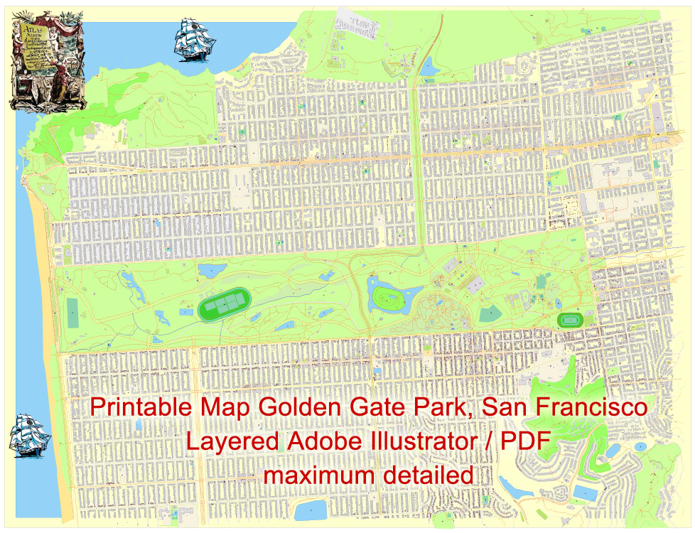
Printable Map Golden Gate Park, San Francisco, US, exact vector Map street G-View City Plan Level 20 (25 m scale 1:928), full editable, Adobe Illustrator, full vector, scalable, editable text format street names, maximum detailed 11 mb ZIP
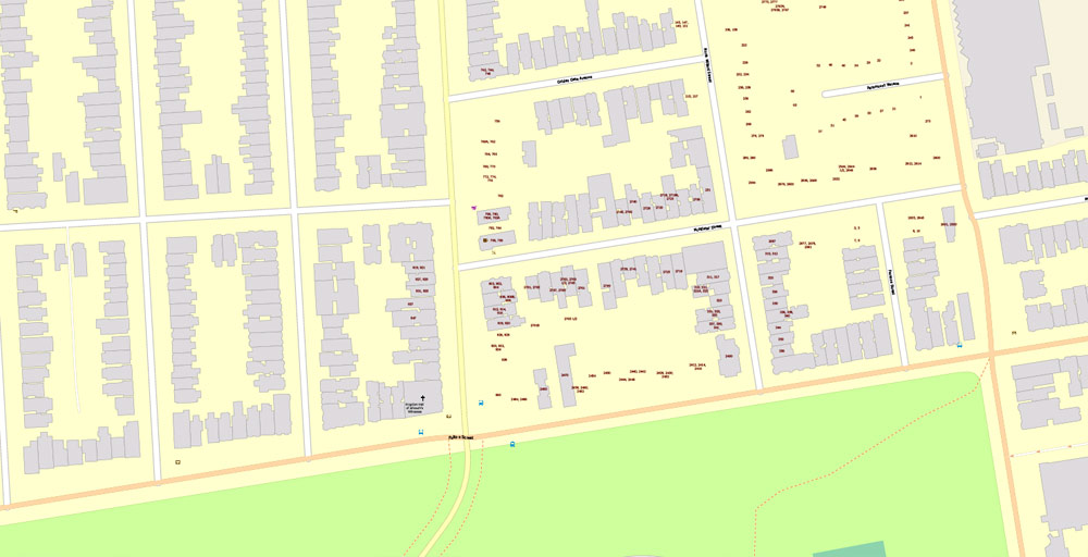
All streets named, A lot of Objects POI, All buildings. Map for design, printing, arts, projects, presentations, for architects, designers and builders, business, logistics.
Layers: color fills, streets_roads, arrows_streets, labels_roads, objects, names objects, names_streets, names_places, numbers_buildings.
The most exact and detailed map of the city.
For print LARGE (WALL) format.
DWG, DXF, CDR and other formats – on request, same price, please, contact
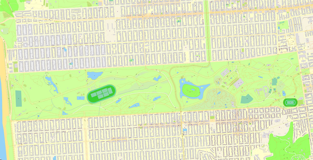
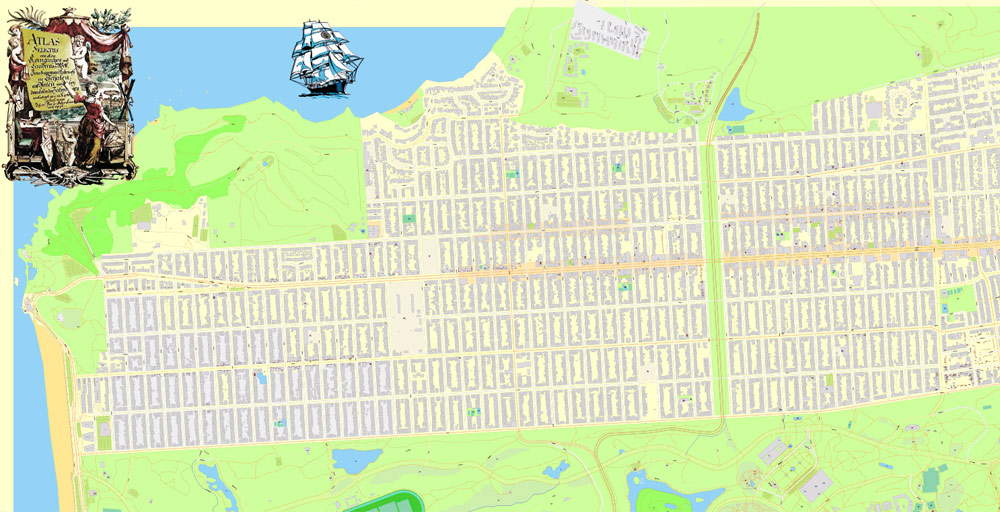
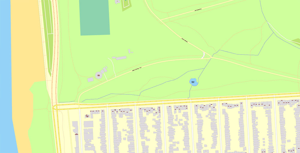
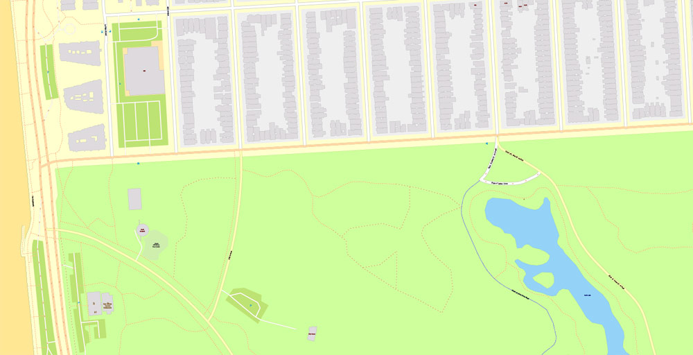
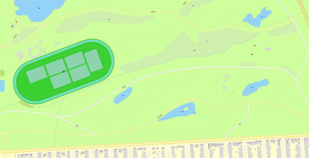
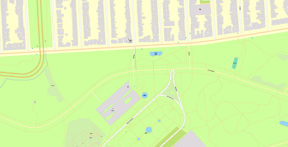
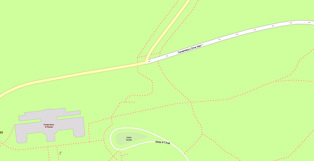
Golden Gate Park.
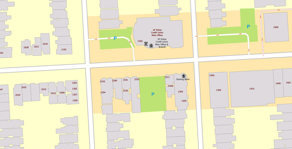
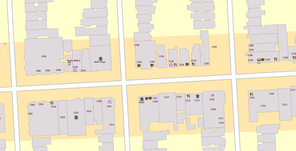
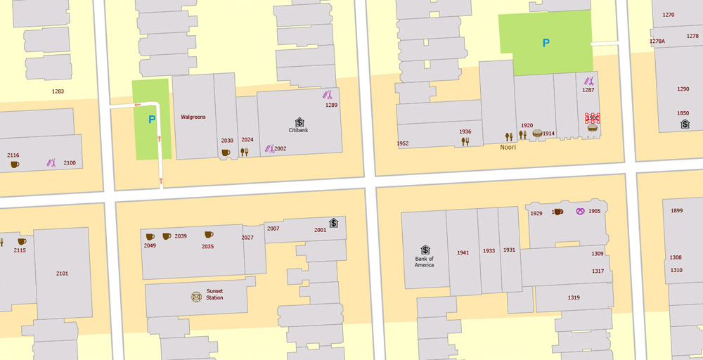
This vector map of Golden Gate Park is used as a basis for design, editing, and further printing.
This is the most detailed, exact map of Golden Gate Park for high-quality printing and polygraphy. You can always clarify the map development date by contacting us.
For your convenience, all objects on Golden Gate Park vector map are divided into layers. And the editing is very easy – colors, lines, etc.
You can easily add any objects needed (e.g. shops, salons, sale points, gas station or attraction) on any layer of Golden Gate Park vector map.
Golden Gate Park, located in San Francisco, California, United States, is a large urban park consisting of 1,017 acres (412 ha) of public grounds. It is administered by the San Francisco Recreation & Parks Department, which began in 1871 to oversee the development of Golden Gate Park. Configured as a rectangle, it is similar in shape but 20 percent larger than Central Park in New York, to which it is often compared. It is over three miles (4.8 km) long east to west, and about half a mile (0.8 km) north to south. With 13 million visitors annually, Golden Gate is the fifth most-visited city park in the United States after Central Park in New York City, Lincoln Park in Chicago, and Balboa and Mission Bay Parks in San Diego.
One of the advantages of Golden Gate Park vector maps of our production is the relevance of cartographic data, we constantly update all our products.
This vector map of Golden Gate Park is used by:
designers, layout designers, printers, advertisers and architects. Our product – vector maps – is designed for further editing and printing in large formats – from @Wall format (a few meters) to A-0 and A-1, A-2, A-3.
The Golden Gate Park map in vector format is used for design, urban planning, presentations and media visualizations.
The advertising and presentation map of Golden Gate Park (usually the final designer marks the routes, and puts the client’s objects (shops, saloons, gas stations etc.)
The undoubted advantage is that people will NEVER throw out this advertising product – the map. In fact, as an advertising medium, a map is the most “long-playing” of the well-known polygraphic advertising media, with the longest lifespan, and the maximum number of interactions with the customer.
For travelers, maps are sold at the airports and gas stations around the world. Often the source is our vector maps.
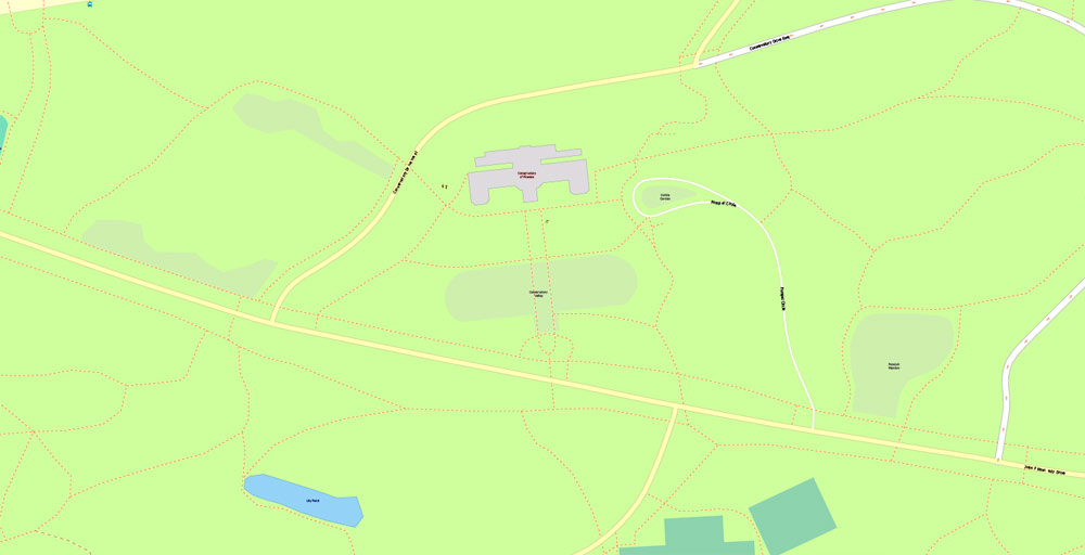
Golden Gate Park Nursery
Established in 1870, the Golden Gate Park Nursery has remained one of the few places in the park restricted to the public. This nursery began with donated plants from around the world and expanded over the years with the care of past Golden Gate Park gardeners. The nursery has moved around the park thrice; first to where McLaren Lodge stands today, then to where Kezar Stadium is currently located and finally to its current location of Martin Luther King Jr. Drive. This Nursery houses over 800 species of plants, some of which are exclusive to the nursery, and are sold to the public on the third Saturday of the month. Every week over 3,000 plants are dispersed within the city and park.
When the park requires repairing or is in need of empty beds filled, the Nursery provides its wide variety of plants to fill in the blank spaces. Indoors, the plants are set up in neat rows and beds, showing off the nursery’s green diversity for the buyers picking. The Golden Gate Park Nursery is one of the city’s main green providers and is greatly responsible for the city’s plant life.
Take a look, who purchases our vector maps of Golden Gate Park in “Our Clients and Friends” page – these are large and small companies, from super-brands like Volvo and Starbucks, to small design studios and printing houses.
It’s very easy to work with vector maps of Golden Gate Park city, even for a not very experienced designer who can turn on and off the map layers, add new objects, change the colors of fill and lines according to customer requirements.
The undoubted advantage of Golden Gate Park vector maps in printing is an excellent and detailed visualization, when customer can expand a large paper map and instantly define his location, find a landmark, an object or address on map, unlike using the popular electronic formats of Google and Yandex maps for example.
Printable vector maps of Golden Gate Park are much more convenient and efficient than any electronic maps on your smartphone, because ALL DETAILS are displayed in the entire space of Golden Gate Park map.
Homeless population
There are approximately 7,500 homeless people living in San Francisco. Due to high housing costs that have seen a rise since the mid-’70s, a significant portion of the homeless find residence in Golden Gate Park. Around 40 to 200 of these 7,000 people reside in the park. Around half of the homeless population in Golden Gate Park are short-term residents that leave after a certain amount of time, and the other half are more long-term residents. Short-term residents tend to be younger, while permanent residents tend to be older, military veterans. Most of the homeless population is male. It is estimated that around 60% of the population may have a mental disability. However, it is hard to gather data about the population due to a variable population. Living in Golden Gate Park is discouraged by the city of San Francisco, with no-sleeping and anti-lodging laws being put in place.
Useful tips on working with vector maps of cities and countries in Adobe Illustrator.
«V» – launches the Selection tool (cursor, black arrow), which makes active any vector line.
«А» – launches the Direct Selection tool (white cursor), allows you to select curve elements and drag them to the desired place.
«R» – activates the Rotate tool, which helps you rotating selected objects around the center point by 360 degrees.
«E» – gives you the opportunity to use the Eraser tool and erase unnecessary parts.
«X» – switches between Fill and Stroke in the Tools section. Try to get used to this hot key and
you will quickly understand that you can’t live and work without it.
Guides are not limited to vertical and horizontal in Adobe Illustrator. You can also create a diagonal guide for example. Moreover, you can turn any contours into guides. Select the outline and go to View > Guides > Make Guides (Create Guides), or simply press Cmd/Ctrl + 5. You can also turn the guides back into an editable object. Go to menu, View > Guides > Unlock Guides (Release Guides), select the guide you want to edit and select View > Guides > Release Guides (Reset Guides), or just press Cmd/Ctrl + Option / Alt + 5).
The city government of San Francisco has attempted to establish various outreach programs in order to help the homeless population. According to the city’s government, “current outreach efforts to inform park dwellers about support services are limited, and efforts that do take place are not documented in a way that makes it possible to analyze their efficiency or success”. The Community Housing Partnership’s program “Transitional Age Youth Housing” is available for younger homeless individuals, but it is not enough because of limited resources available. Overall, however, San Francisco has shifted its focus of emergency shelters to neighborhood support systems.
You will probably want to change the color scheme used on our Golden Gate Park vector map.
To quickly and effectively play with colors.
Of course, you can do it manually, all objects in our Golden Gate Park vector map are divided according to types and layers, and you can easily change the color gamma of vector objects in groups and layers.
But there is more effective way of working with the whole VECTOR MAP of Golden Gate Park and all layers:
The overview dialog «Edit colors»/«Repaint Graphic Object» (this dialog box name can change depending on the context):
If you have selected a part or a layer of Golden Gate Park vector map and open the dialog box by clicking the icon in the Control panel, on the Samples palette or the Color Catalog, or if you choose Edit > Edit Colors> Repaint Graphic Object, then the «Repaint Graphic Object» dialog box appears, and you get access to «Assign» and «Edit» tabs.
The City of San Francisco has grappled with what to do about camps of homeless people living in Golden Gate Park, which have been criticized as unsanitary, and “demoralizing” for park users and workers. The camps have been described by journalists as full of garbage, broken glass, hypodermic needles, and human excrement, and the people in them are described as suffering from serious addictions and often behaving aggressively with police and park gardeners.
If a picture or a map fragment is not selected, and you open the dialog box by clicking the icon in the Control panel, on the Samples palette or in the Color Catalog, the «Edit Colors» dialog box appears and you can only access the «Edit» tab.
Regardless of the name at the top of the dialog box, the right-hand side always displays the color group of the current document, as well as two default color groups: Print Color and Grayscale. These color groups can be selected and used any time.
Create and edit color groups of Golden Gate Park vector map, and also assign colors using the «Edit Colors»/ а «Repaint Graphic Object» dialog box.
A. Creating and editing of a color group on the «Edit» tab
B. Assigning colors on the «Assign» tab
C. Select a group of colors from the «Color groups» list
The option «Repaint a graphic object» in the lower part of the dialog box allows you to preview the colors on a selected layer of Vector map, or a group of elements, and specify whether its colors will be redefined when the dialog box is closed.
There have been occasional incidents of violence against homeless people in the park, including the 2010 park beating to death of a homeless man and an attack on park visitors by dogs owned by a park resident, also in 2010. In the 1990s, then-Mayor Willie Brown sought unsuccessfully to borrow the Oakland Police Department’s helicopters in order to find homeless people’s camps.
The main areas of the dialog box are:
«Edit»
The «Edit» tab is designed to create a new or edit the existing color groups.
The harmony rules Menu and the Color Wheel are used to conduct experiments with color harmonies. The color wheel shows how colors are related in color harmony, and the color bars allow you to view and manipulate an individual color values. In addition, you can adjust the brightness, add and remove colors, save color groups and view colors on the selected Vector Map of Golden Gate Park or a separated layers.
«Assign»
The «Assign» tab is used to view and control on how the original colors are replaced with colors from the color group like your corporate colors in the Vector Map of Golden Gate Park city.
The assign color ability is provided only if the entire map, layer or fragment is selected in the document. You can specify which of new colors replace the current colors, whether the spot colors should be preserved and how colors are replaced (for example, you can replace colors completely or changing the color tone while maintaining the brightness). The «Assign» tab allows you to redefine colors in the Vector Map of Golden Gate Park city, or in separate layers and fragments using the current color group or reducing the number of colors in the current Vector Map.
Color groups
Is a list of all saved color groups for current document (the same groups appear in the «Samples» palette). You can edit and delete the existing color groups, as well as creating a new ones using the list of “Color Groups” in the dialog box. All changes appear in the «Samples» palette.
The highlighted color group shows, which color group is currently edited.
Any color group can be selected and edited, or used to redefine the colors in the selected vector map of Golden Gate Park city, its fragments or elements.
Saving a color group adds this group to the specified list.
Opening the «Edit Colors»/«Repaint Graphic Object» dialog box.
Open the «Edit Colors»/«Repaint Graphic Object» dialog box using one of the following methods:
«Edit»> «Edit Colors»> «Repaint Graphic object» or «Repaint With Style».
Use these commands if you need to edit the colors in the selected vector map of Golden Gate Park city.
«Repaint Graphic object» button on the «Control» panel.
Use this button if you need to adjust colors of Golden Gate Park vector map using the а «Repaint graphic object» dialog box.
The specified button is available if the selected vector map or its fragment contains two or more colors.
Note. This color editing method is convenient for global color adjustment in a vector map, if global colors were not used when creating a Map of Golden Gate Park.
The «Edit colors» button or «Edit or apply colors» on the «Color Catalog» palette
Click this button if you need to edit colors on the «Color Catalog» palette or edit and then apply them to the selected Vector Map of Golden Gate Park or its fragment.
The «Edit color group» button or «Edit or apply color group» on the «Samples» palette.
Click this button if you need to edit the colors in the specific color group or edit and apply them to the selected Vector Map of Golden Gate Park or a group of its elements, for example, the whole layer “Streets and lines”. You can also double-click the color group in the Samples panel to open the dialog box.
If the map file is too large and your computer freezes or even can’t open it quickly:
1. Try to reduce the color resolution of the video card (display) to 256 colors while working with a large map.
2. Using Windows Task Manager, select all the application you don’t need, while working with map, just turn them off.
3. Launch Adobe Illustrator. (DO NOT OPEN the vector map file)
4. Start the Windows Task Manager using administrator rights > Find the “Illustrator” process > set the «real time» priority,
5. Open the file. When you see the LEGACY FONT popup window – click “OK” (do not update). You can restore the TEXT later.
6. Can also be useful: When file is opened – Edit > Settings > Basic Settings > disable smoothing. /// It looks scary, but works quickly)))
We recommend saving the file in Adobe Illustrator 10 version. It’s much more stable when working with VERY BIG size files.
Starting in 1988 under then-mayor Art Agnos, and continuing under the direction of subsequent mayors including Frank Jordan, Willie Brown, and Gavin Newsom, San Francisco police have conducted intermittent sweeps of the park aimed at eliminating the camps. Tactics have included information campaigns designed to inform homeless residents about city services available to help them; waking sleeping homeless people and making them leave the park; issuing citations for infractions and misdemeanors such as camping, trespassing, or public intoxication, which carry penalties of $75 to $100; and the seizure and removal from the park of homeless people’s possessions. During the night, police urge visitors to Golden Gate Park to be careful around homeless people.
The crackdowns have been criticized by anti-poverty activists and civil liberties groups, who say the measures attack only the symptoms of homelessness, while ignoring its root causes, and criminalize the poor for their poverty while ignoring their property rights and constitutional rights. In 2006, the American Civil Liberties Union brought a lawsuit against the city government on behalf of 10 homeless people, alleging property violations by the city during sweeps in Golden Gate Park the year before.
Golden Gate Park
Park in San Francisco, California
Golden Gate Park, located in San Francisco, California, United States, is a large urban park consisting of 1,017 acres of public grounds. Wikipedia
Address: San Francisco, CA 94122, USA
Type Urban Park
Location San Francisco, California, United States
Coordinates 37°46′11″N 122°28′37″WCoordinates: 37°46′11″N 122°28′37″W
Area 1,017 acres (412 ha) 4.1 km²
Created 1870s
Visitors 13 million
U.S. National Register of Historic Places
Architect William Hammond Hall
John McLaren
Calvert Vaux
Architectural style Olmsted, Vaux & Co.

Free Download Vector Map US County and State Adobe Illustrator
Free_Vector_Map_US_States_County_Map.ai
Free Download Vector Map US County and State Adobe PDF
Free_Vector_Map_US_States_County_Map.pdf

Free Download Vector Map US With States Names, Adobe Illustrator
Free_Map_of_USA_with_state_names_en.ai
Free Download Vector Map US With States Names, Adobe PDF
Free_Map_of_USA_with_state_names_en.pdf
From WIKI
Free vector map World, Adobe Illustrator, download now maps vector clipart
Map for design, projects, presentation free to use as you like.
See also: TERMS & CONDITIONS: SOFTWARE LICENSE AGREEMENT FOR DIGITAL CARTOGRAPHIC DATA.
Need more USA Vector Maps, printable and editable?

 Author: Kirill Shrayber, Ph.D. FRGS

