Extended Description of the Vector Map
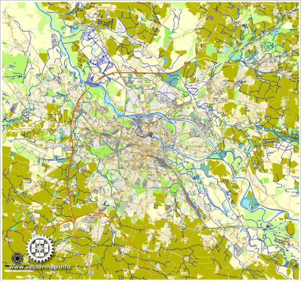
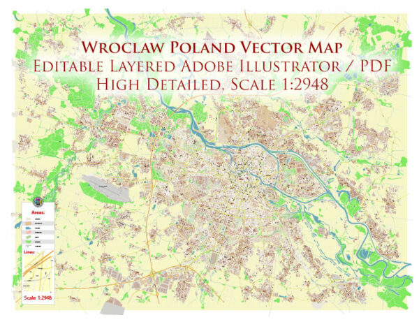
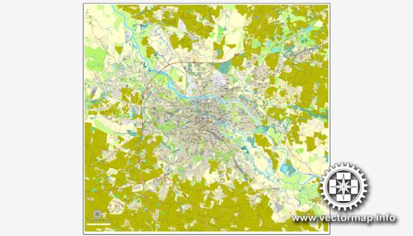
Printable PDF Vector Map of Wroclaw Metro Area Poland high detailed scale 1:2948 full editable Adobe PDF Street Map in layers, scalable, text / curves format all names, 115 MB ZIP
All street names, Main Objects, Buildings. Map for design, printing, arts, projects, presentations, for architects, designers, and builders, business, logistics.

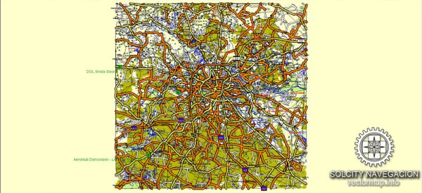
Wroclaw Metro Area Poland PDF Vector Map High Detailed Street Map Adobe PDF in layers
Layers list:
- Legend
- Grids
- Names of places 2 (cities, towns, hamlets)
- Names of main streets
- Names of Residencial streets
- Arrows of streets directions
- Main Streets, roads
- Railroads
- Residencial streets
- Buildings
- Buildings (transparent 50%)
- Airports and heliports
- Water objects (rivers, lakes, ponds)
- Color fills (parks, hospital areas, land use, etc.)
- Background
The most exact and detailed map of the city in scale.
For Editing and High-Quality Printing
Wrocław, Poland, is a vibrant city with a rich history and diverse architecture. It boasts numerous principal streets, roads, and squares that are central to its cultural and historical identity. Below is a detailed list of some of the most important thoroughfares and public spaces in Wrocław:
Principal Squares (Rynek and Other Key Squares)
- Rynek (Main Market Square)
- The heart of Wrocław’s Old Town, Rynek is one of the largest medieval market squares in Europe.
- Surrounded by colorful burgher houses, it features the iconic Town Hall (Ratusz) , which is a masterpiece of Gothic and Renaissance architecture.
- The square hosts markets, festivals, and outdoor events throughout the year.
- Plac Solny (Salt Square)
- A historic square originally used for salt trade in the Middle Ages.
- Today, it is surrounded by cafes, restaurants, and shops, making it a lively spot for locals and tourists alike.
- Plac Grunwaldzki
- Located on the northern bank of the Oder River, this large square is a hub of activity.
- It features the Monument of the Battle of Grunwald and serves as a gateway to the University of Wrocław campus.
- Plac Wolności (Freedom Square)
- A modernist square surrounded by early 20th-century buildings, including the White Stork Synagogue and the National Forum of Music .
- It is a symbol of Wrocław’s multicultural heritage and contemporary cultural life.
- Plac Teatralny (Theater Square)
- Home to the Wrocław Opera House and the Polish Theatre , this square is a center for performing arts and culture.
Principal Streets
- ul. Świdnicka
- A major east-west street connecting Rynek to Plac Grunwaldzki.
- Lined with shops, cafes, and historic buildings, it is one of the busiest streets in the city.
- ul. Piłsudskiego
- A key north-south artery leading from Plac Grunwaldzki to the Old Town.
- Known for its elegant pre-war architecture and proximity to the University of Wrocław.
- ul. Odrzańska
- Running along the Oder River, this scenic street offers beautiful views of the water and access to parks and promenades.
- ul. Kazimierza Wielkiego
- A historic street in the Old Town, lined with charming buildings and small boutiques.
- ul. Ruska
- Located in the multicultural district of Ostrów Tumski, this street reflects Wrocław’s diverse history.
- It connects to the Cathedral Island (Ostrów Tumski) and is near the Cathedral of St. John the Baptist .
- ul. Kuźnicza
- A picturesque street in the Old Town, known for its cobblestones and traditional Polish restaurants.
- ul. Legnicka
- A major road leading westward out of the city center, dotted with shopping centers and residential areas.
Key Bridges and Waterfront Areas
- Most Tumski (Tumski Bridge)
- A historic bridge connecting Ostrów Tumski (Cathedral Island) to the Old Town.
- Decorated with statues of saints and offering stunning views of the Cathedral of St. John the Baptist.
- Most Grunwaldzki (Grunwald Bridge)
- One of the oldest bridges in Wrocław, spanning the Oder River and connecting the Old Town to the northern districts.
- Most Pokoju (Peace Bridge)
- A modern bridge with an iconic design, providing pedestrian and cyclist access across the Oder River.
- Nabrzeże Wiślane (Vistula Embankment)
- A scenic riverside promenade popular for walking, cycling, and enjoying the views of Wrocław’s skyline.
Other Notable Locations
- Ostrów Tumski (Cathedral Island)
- The oldest part of Wrocław, home to the Cathedral of St. John the Baptist and other historic churches.
- A tranquil area with narrow streets and a peaceful atmosphere.
- Park Szczytnicki
- A large park in the eastern part of the city, featuring the Japanese Garden and the Centennial Hall (Hala Stulecia) , a UNESCO World Heritage Site.
- Wyspa Piasek (Sand Island)
- A small island in the Oder River, known for its quiet ambiance and historic churches.
- Plac Nowy Targ
- A smaller square adjacent to Rynek, often used for outdoor markets and events.
Summary
Wrocław’s principal streets, roads, and squares reflect its rich history and vibrant present. From the bustling Rynek to the serene Ostrów Tumski, these locations offer a blend of medieval charm, modern development, and cultural significance. Whether you’re exploring the Old Town, crossing the scenic bridges, or relaxing in the parks, Wrocław provides a wealth of experiences for visitors and residents alike.
The principal streets, roads, and squares of Wrocław include Rynek , Plac Solny , Plac Grunwaldzki , Plac Wolności , ul. Świdnicka , ul. Piłsudskiego , Most Tumski , and Ostrów Tumski , among others.

Wroclaw Metro Area Poland PDF Vector Map High Detailed Street Map Adobe PDF in layers

Wroclaw Metro Area Poland PDF Vector Map High Detailed Street Map Adobe PDF in layers

Wroclaw Metro Area Poland PDF Vector Map High Detailed Street Map Adobe PDF in layers

Wroclaw Metro Area Poland PDF Vector Map High Detailed Street Map Adobe PDF in layers

Wroclaw Metro Area Poland PDF Vector Map High Detailed Street Map Adobe PDF in layers

Wroclaw Metro Area Poland PDF Vector Map High Detailed Street Map Adobe PDF in layers

Wroclaw Metro Area Poland PDF Vector Map High Detailed Street Map Adobe PDF in layers

Wroclaw Metro Area Poland PDF Vector Map High Detailed Street Map Adobe PDF in layers

Wroclaw Metro Area Poland PDF Vector Map High Detailed Street Map Adobe PDF in layers

Wroclaw Metro Area Poland PDF Vector Map High Detailed Street Map Adobe PDF in layers

Wroclaw Metro Area Poland PDF Vector Map High Detailed Street Map Adobe PDF in layers

Wroclaw Metro Area Poland PDF Vector Map High Detailed Street Map Adobe PDF in layers

Wroclaw Metro Area Poland PDF Vector Map High Detailed Street Map Adobe PDF in layers

Wroclaw Metro Area Poland PDF Vector Map High Detailed Street Map Adobe PDF in layers

Wroclaw Metro Area Poland PDF Vector Map High Detailed Street Map Adobe PDF in layers

Wroclaw Metro Area Poland PDF Vector Map High Detailed Street Map Adobe PDF in layers

Wroclaw Metro Area Poland PDF Vector Map High Detailed Street Map Adobe PDF in layers


 Author: Kirill Shrayber, Ph.D. FRGS


