Extended Description of the Vector Map
Printable PDF + DWG Vector Map Winnipeg Canada, exact high detailed editable layered 2 files in 1 archive scalable, editable text format all names, 142 MB ZIP
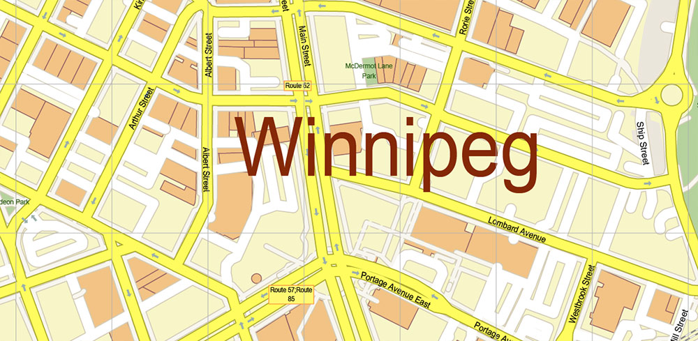
Names all streets, buildings
Map for design, printing, arts, projects, presentations, for architects, designers, and builders, business, logistics.
The most exact and detailed map of Winnipeg Canada
Map for editing and High-Quality Printing
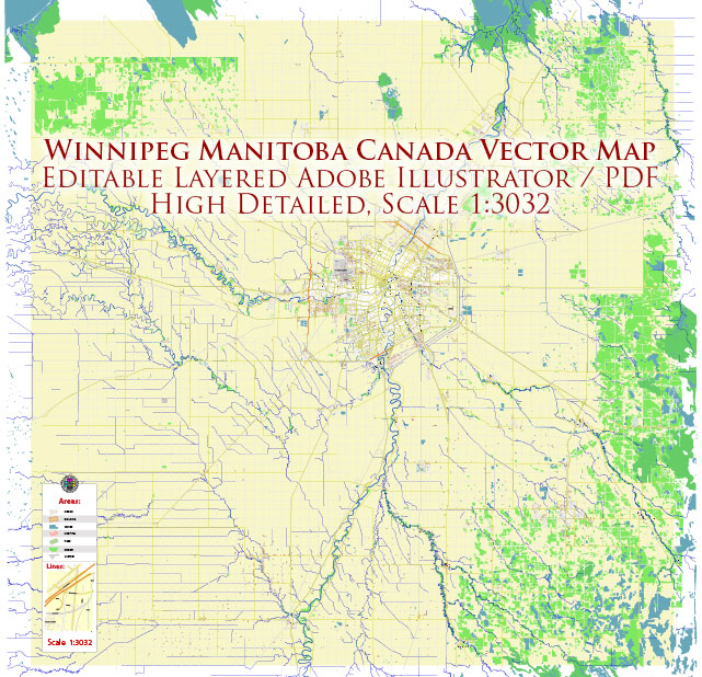
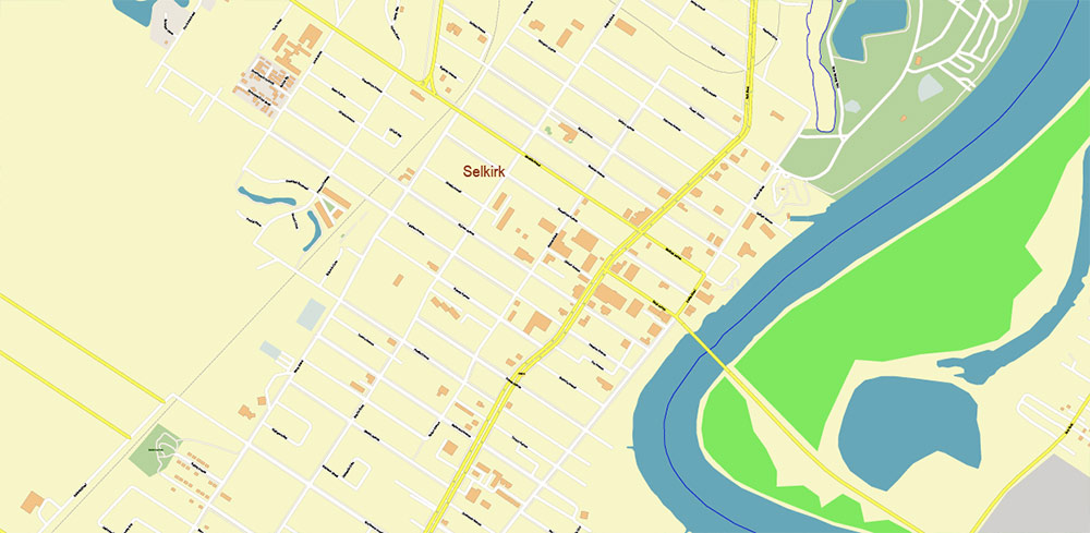
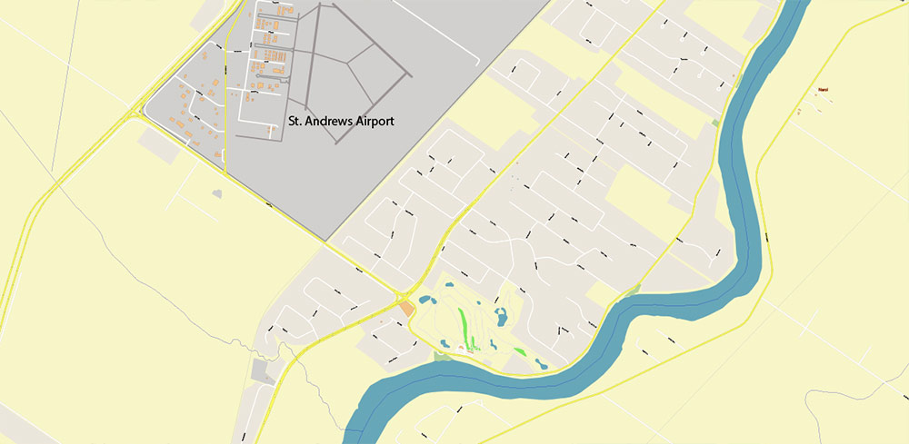
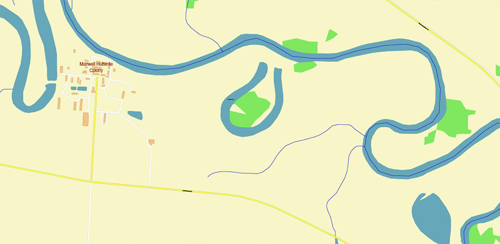
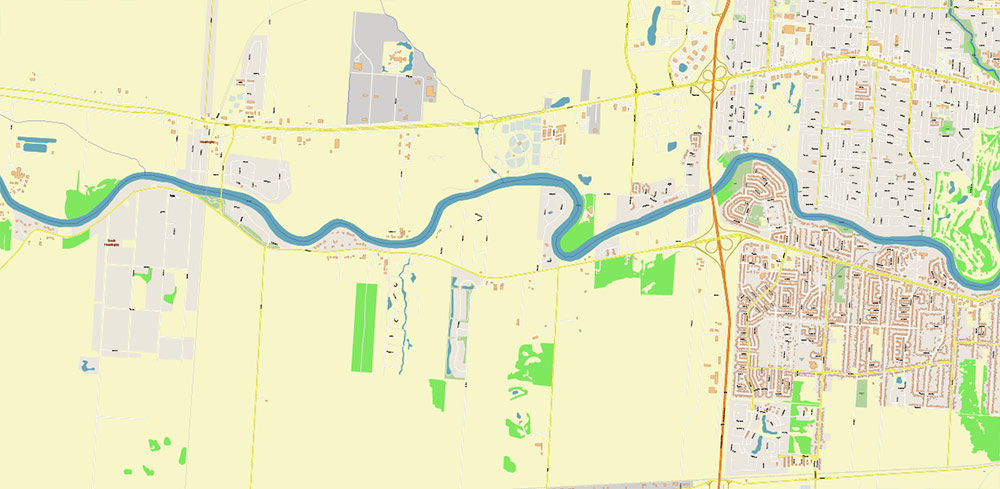
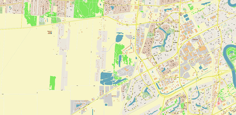
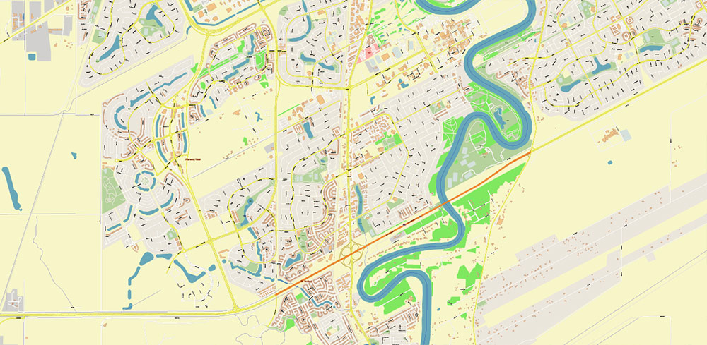
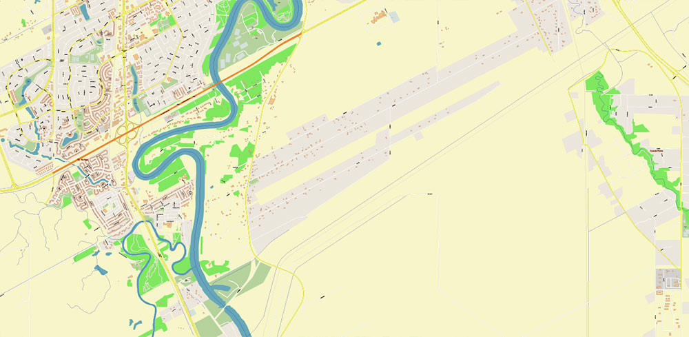
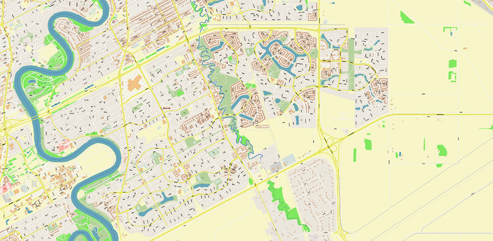
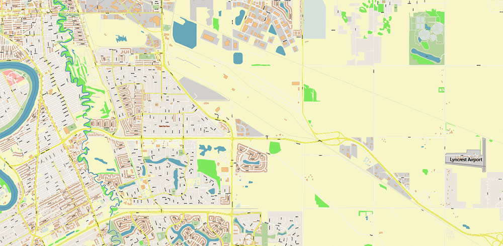
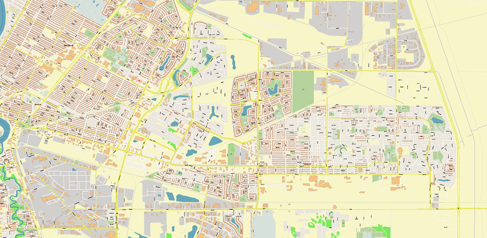
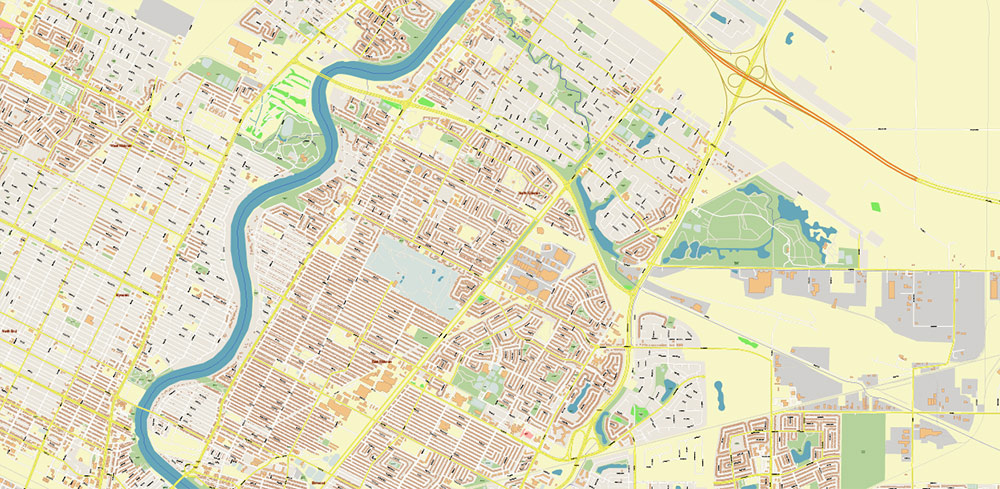
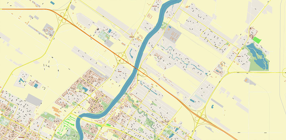
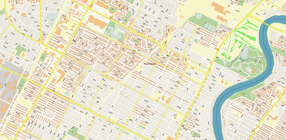
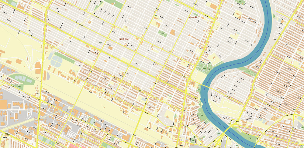
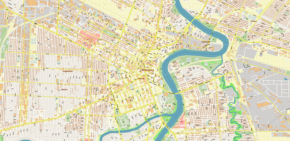
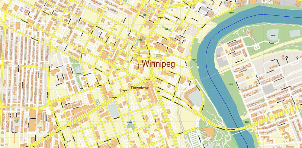
Winnipeg Manitoba Canada PDF + DWG Vector Map high detailed All Roads Streets Cities Towns map editable Layered (PDF and DWG in 1 archive)
Layers list:
- Legend
- Grids
- Labels of Roads
- Names Main Streets
- Names residential streets
- Names Objects
- Names Places
- Arrows of rge road directions
- Main Streets and Roads
- Residential roads and streets
- Buildings
- Railroads
- Airports and Heliports
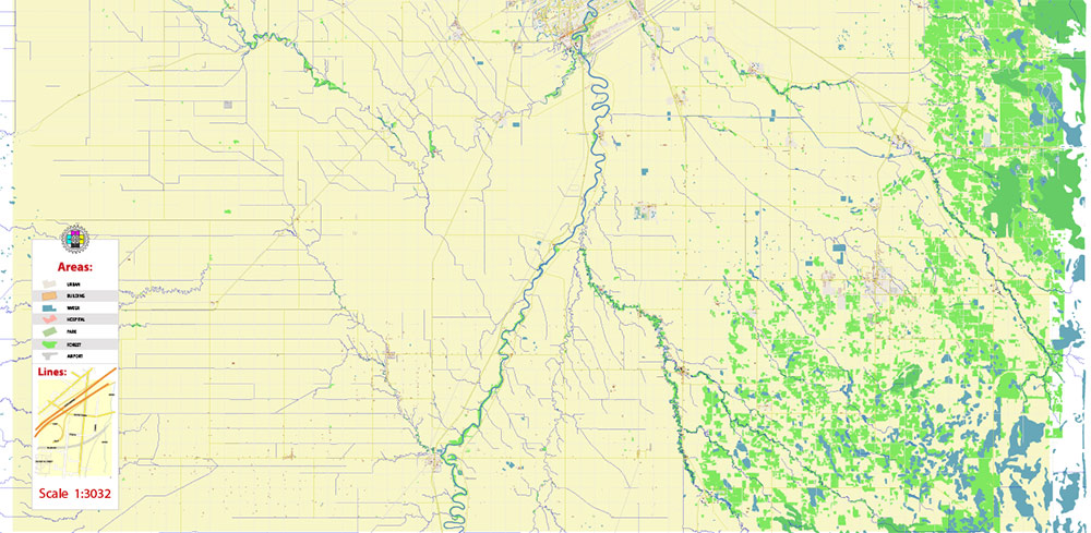
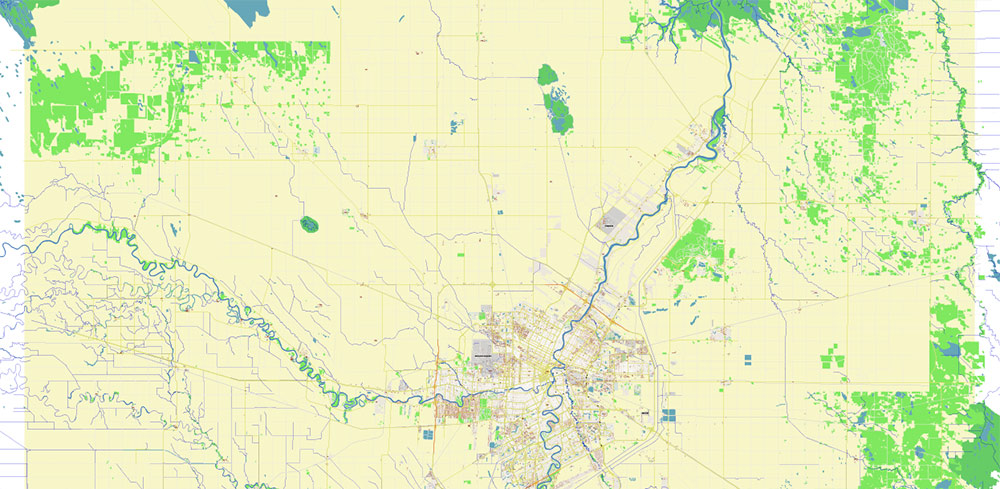
- Landuse areas
- Water objects (areas)
- Waterways
- Background
BRIEF — Winnipeg, Manitoba
Overview
-
Prairie capital on the Red–Assiniboine confluence; flat river plain with old meanders, flood protection works, and a wide urban footprint.
-
Core made of Downtown/Exchange District on the west bank, St. Boniface (francophone) east of the Red; ring of post-war suburbs, rail yards, and industrial parks on the Perimeter.
-
Regional hub for government, logistics, manufacturing, grain handling, and services; airport and rail make it the prairie crossroads.
Key Roads / Lines of Communication
-
Trans-Canada Hwy 1 / Portage Ave: E–W arterial through downtown; primary cross-country line.
-
Perimeter Hwy (PTH 100/101): full ring for trucks/bypass around urban core.
-
Route 90 (Kenaston Blvd / Oak Point Hwy): N–S freight/retail corridor; links airport to south suburbs.
-
Route 42 (Pembina Hwy–Osborne–Main St): N–S civic spine; enters downtown from S (US-MB approach via Hwy 75).
-
Lagimodiere Blvd (PTH 59): N–S eastern fast mover; access to St. Boniface / Transcona; link to US border via 59/12.
-
McGillivray Blvd (PTH 3) and Bishop Grandin / Abinojii Mikanah: E–W southern express corridors.
-
Chief Peguis Trail: E–W northern express link.
-
Bridges: Provencher/Esplanade Riel (ped), Disraeli, Main, Osborne, Maryland, St. James; chokepoints when iced or under maintenance.
-
Rail: CN Symington Yard (E), CP Winnipeg Yard (W); multiple at-grade conflicts on secondary routes.
-
Air: Winnipeg James Armstrong Richardson Intl (YWG) NW quadrant; 24/7 cargo ops.
Climate / Seasonality
-
Cold continental. Winters severe (prolonged sub-zero °C; blizzards, windchill), summers warm/short with convective storms.
-
Freeze–thaw March–April; spring flood risk on Red/Assiniboine; mosquito surge late spring to mid-summer.
-
Road surface: ice ruts, black ice on bridges; dust/sand in spring; heat-softened asphalt in July.
Demography / Human Terrain
-
City ≈ 750k; metro ≈ 830k (order of magnitude). Median age ~late-30s.
-
Diverse mix: strong Indigenous (First Nations, Métis), large Filipino community, Ukrainian, French, South Asian; English dominant, French present in St. Boniface.
-
Employment: public sector, healthcare/education, logistics, aerospace, food processing, retail.
Points of Interest / Key Sites
-
The Forks (confluence public space/market); Canadian Museum for Human Rights (iconic landmark).
-
Exchange District (heritage warehouses/creative scene).
-
Manitoba Legislative Building; Assiniboine Park & Zoo; St. Boniface Cathedral ruins; Royal Canadian Mint (ESE).
-
Sports/venues: Canada Life Centre (NHL Jets), IG Field (CFL Blue Bombers), University of Manitoba (south), Red River College nodes.
Hazards / Threats
-
Extreme cold and blizzard whiteouts; limited visibility, stalled vehicles, frostbite risk.
-
Spring flooding; low-lying neighborhoods and approaches to bridges vulnerable despite floodway.
-
Icing on bridges/ramps, snow windrows constricting lanes; freeze-ups of diesel/aux systems.
-
Rail/road conflicts near yards; long train blocks on secondary grids.
-
Mosquito density impacts outdoor operations; West Nile advisories episodic.
-
Seasonal construction detours; pothole damage late winter/spring.
Logistics / Sustainment
-
YWG: cargo-friendly, de-ice capacity, apron access to Route 90; fuel and MRO nearby.
-
Trucking: use Perimeter Hwy for heavy moves; multiple industrial parks along Route 90, Lagimodiere, and Inkster.
-
Fuel/parts widely available; 24-hr services around airport/Route 90/Perimeter interchanges.
-
Medical: major hospitals within 5–8 km of core (HSC near downtown, St. Boniface east of Red).
-
Accommodation clusters: Downtown/Exchange, Polo Park (near airport), South Pembina; classic HQ options Fort Garry Hotel, big-box chains near YWG.
Command Takeaways
-
Treat Portage/Trans-Canada and Perimeter Hwy as strategic movers; Route 90/Route 42 as core N–S spines.
-
Plan for cold-weather ops (windchill, battery/fuel management) and spring flood contingencies on river crossings.
-
Expect bridge chokepoints and rail delays; pre-brief alternates east/west of the Red.
-
Civic rhythm centers on The Forks/Exchange; St. Boniface is the francophone cultural node east of river—use for outreach/liaison if needed.
Winnipeg Manitoba Canada PDF + DWG Vector Map high detailed All Roads Streets Cities Towns map editable Layered (PDF and DWG in 1 archive)
Winnipeg Manitoba Canada PDF + DWG Vector Map high detailed All Roads Streets Cities Towns map editable Layered (PDF and DWG in 1 archive)
Winnipeg Manitoba Canada PDF + DWG Vector Map high detailed All Roads Streets Cities Towns map editable Layered (PDF and DWG in 1 archive)
Winnipeg Manitoba Canada PDF + DWG Vector Map high detailed All Roads Streets Cities Towns map editable Layered (PDF and DWG in 1 archive)
Winnipeg Manitoba Canada PDF + DWG Vector Map high detailed All Roads Streets Cities Towns map editable Layered (PDF and DWG in 1 archive)
Winnipeg Manitoba Canada PDF + DWG Vector Map high detailed All Roads Streets Cities Towns map editable Layered (PDF and DWG in 1 archive)
Winnipeg Manitoba Canada PDF + DWG Vector Map high detailed All Roads Streets Cities Towns map editable Layered (PDF and DWG in 1 archive)
Winnipeg Manitoba Canada PDF + DWG Vector Map high detailed All Roads Streets Cities Towns map editable Layered (PDF and DWG in 1 archive)
Winnipeg Manitoba Canada PDF + DWG Vector Map high detailed All Roads Streets Cities Towns map editable Layered (PDF and DWG in 1 archive)
Winnipeg Manitoba Canada PDF + DWG Vector Map high detailed All Roads Streets Cities Towns map editable Layered (PDF and DWG in 1 archive)
Winnipeg Manitoba Canada PDF + DWG Vector Map high detailed All Roads Streets Cities Towns map editable Layered (PDF and DWG in 1 archive)
Winnipeg Manitoba Canada PDF + DWG Vector Map high detailed All Roads Streets Cities Towns map editable Layered (PDF and DWG in 1 archive)
Winnipeg Manitoba Canada PDF + DWG Vector Map high detailed All Roads Streets Cities Towns map editable Layered (PDF and DWG in 1 archive)
Winnipeg Manitoba Canada PDF + DWG Vector Map high detailed All Roads Streets Cities Towns map editable Layered (PDF and DWG in 1 archive)
Winnipeg Manitoba Canada PDF + DWG Vector Map high detailed All Roads Streets Cities Towns map editable Layered (PDF and DWG in 1 archive)
Winnipeg Manitoba Canada PDF + DWG Vector Map high detailed All Roads Streets Cities Towns map editable Layered (PDF and DWG in 1 archive)
Winnipeg Manitoba Canada PDF + DWG Vector Map high detailed All Roads Streets Cities Towns map editable Layered (PDF and DWG in 1 archive)
Winnipeg Manitoba Canada PDF + DWG Vector Map high detailed All Roads Streets Cities Towns map editable Layered (PDF and DWG in 1 archive)
Winnipeg Manitoba Canada PDF + DWG Vector Map high detailed All Roads Streets Cities Towns map editable Layered (PDF and DWG in 1 archive)

 Author: Kirill Shrayber, Ph.D. FRGS

