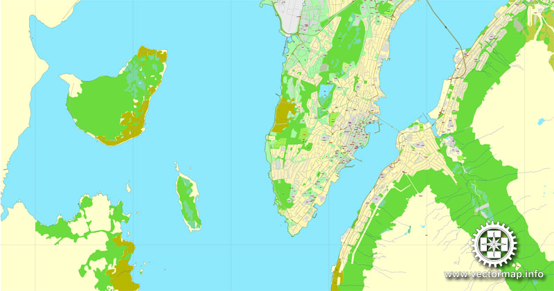
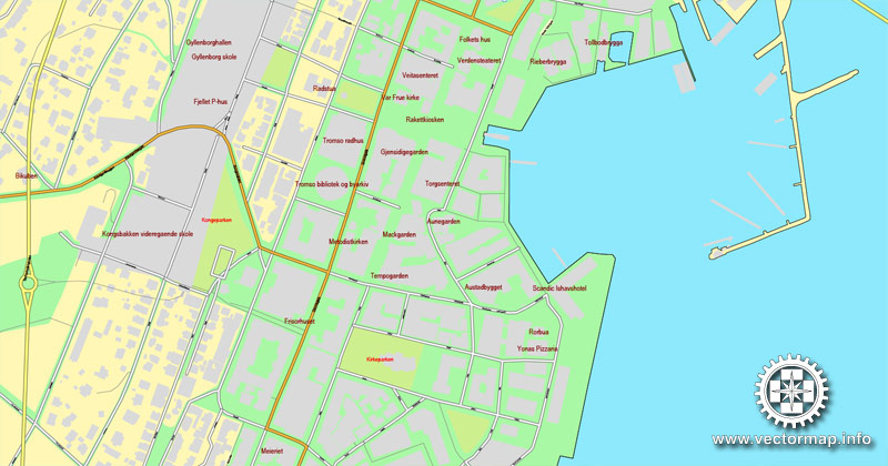
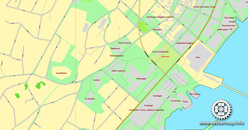
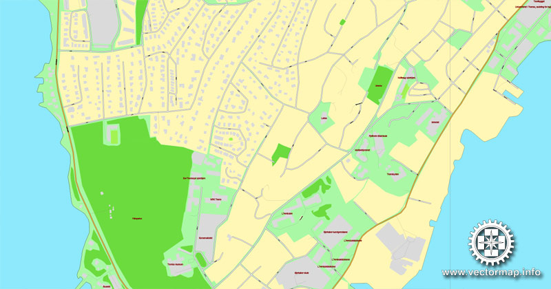
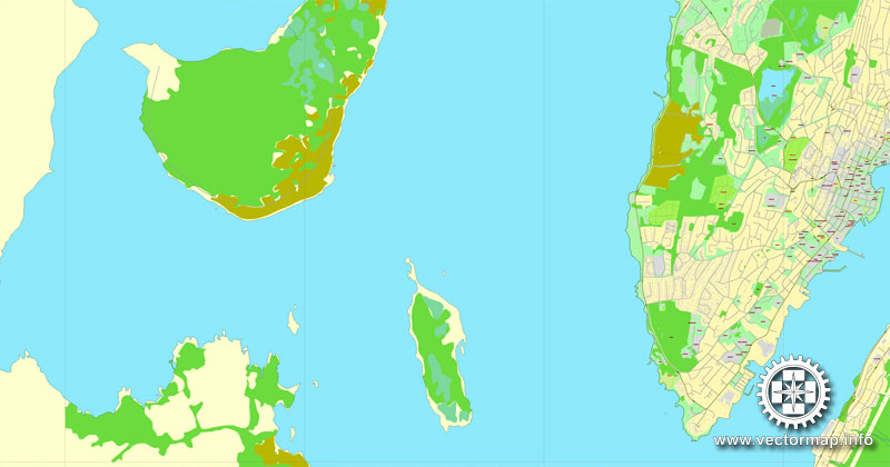
Tromsø / Tromso, Norway, printable vector street map, City Plan V.2, full editable, Adobe Illustrator, Royalty free, full vector, scalable, editable, text format street names, 2,1 mb ZIP
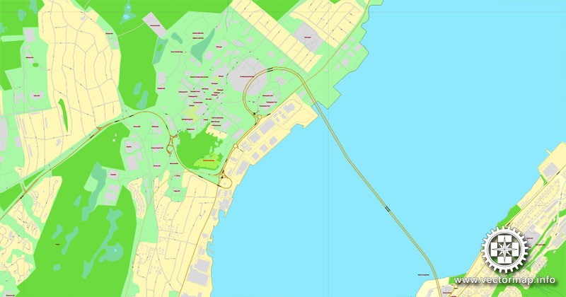
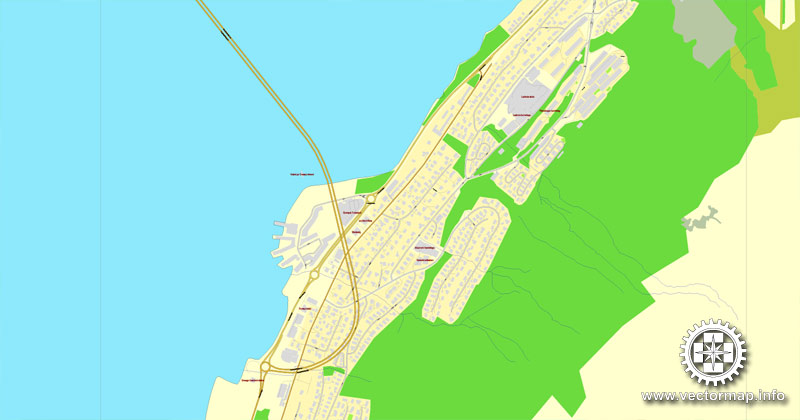
All streets, some more buildings.
Map for design, print, arts, projects, presentations, for architects, designers and builders.
Different font colors of the street names (black); object names by type (brown, red).
DXF, DWG, CDR and other formats – on request, same price, please, contact
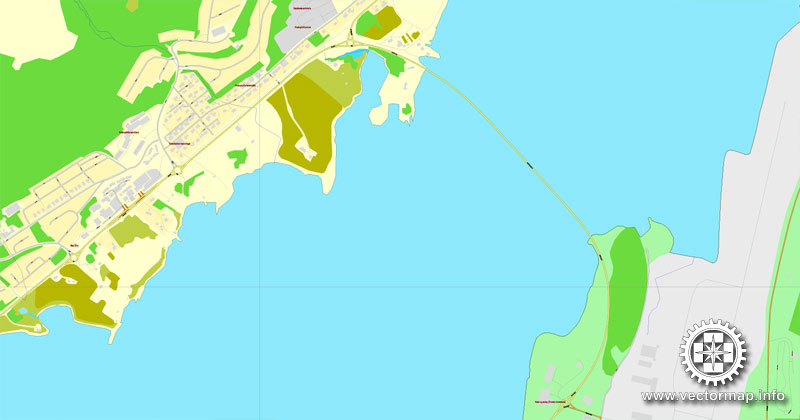
Tromso, Norway.
This vector map of Tromso is used as a basis for design, editing, and further printing.
This is the most detailed, exact map of Tromso for high-quality printing and polygraphy. You can always clarify the map development date by contacting us.
For your convenience, all objects on Tromso vector map are divided into layers. And the editing is very easy – colors, lines, etc.
You can easily add any objects needed (e.g. shops, salons, sale points, gas station or attraction) on any layer of Tromso vector map.
Tromsø is a municipality in Troms county, Norway. The administrative centre of the municipality is the city of Tromsø. Outside Norway, Tromso and Tromsö are alternative spellings of the name.

One of the advantages of Tromso vector maps of our production is the relevance of cartographic data, we constantly update all our products.
This vector map of Tromso is used by:
designers, layout designers, printers, advertisers and architects. Our product – vector maps – is designed for further editing and printing in large formats – from @Wall format (a few meters) to A-0 and A-1, A-2, A-3.
Tromso map in vector format is used for design, urban planning, presentations and media visualizations.
Advertising and presentation map of Tromso (usually the final designer marks the routes, and puts the client’s objects (shops, saloons, gas stations etc.)
The undoubted advantage is that people will NEVER throw out this advertising product – the map. In fact, as an advertising medium, a map is the most “long-playing” of the well-known polygraphic advertising media, with the longest lifespan, and the maximum number of interactions with the customer.
For travelers, maps are sold at the airports and gas stations around the world. Often the source is our vector maps.
Take a look, who purchases our vector maps of Tromso in “Our Clients and Friends” page – these are large and small companies, from super-brands like Volvo and Starbucks, to small design studios and printing houses.
It’s very easy to work with vector maps of Tromso, even for a not very experienced designer who can turn on and off the map layers, add new objects, change the colors of fill and lines according to customer requirements.
The undoubted advantage of Tromso vector maps in printing is an excellent and detailed visualization, when customer can expand a large paper map and instantly define his location, find a landmark, an object or address on map, unlike using the popular electronic formats of Google and Yandex maps for example.
Printable vector maps of Tromso are much more convenient and efficient than any electronic maps on your smartphone, because ALL DETAILS are displayed in the entire space of Tromso map.
Useful tips on working with vector maps of cities and countries in Adobe Illustrator.
«V» – launches the Selection tool (cursor, black arrow), which makes active any vector line.
«А» – launches the Direct Selection tool (white cursor), allows you to select curve elements and drag them to the desired place.
«R» – activates the Rotate tool, which helps you rotating selected objects around the center point by 360 degrees.
«E» – gives you the opportunity to use the Eraser tool and erase unnecessary parts.
«X» – switches between Fill and Stroke in the Tools section. Try to get used to this hot key and
you will quickly understand that you can’t live and work without it.
Guides are not limited to vertical and horizontal in Adobe Illustrator. You can also create a diagonal guide for example. Moreover, you can turn any contours into guides. Select the outline and go to View > Guides > Make Guides (Create Guides), or simply press Cmd/Ctrl + 5. You can also turn the guides back into an editable object. Go to menu, View > Guides > Unlock Guides (Release Guides), select the guide you want to edit and select View > Guides > Release Guides (Reset Guides), or just press Cmd/Ctrl + Option / Alt + 5).
You will probably want to change the color scheme used on our Tromso vector map.
To quickly and effectively play with colors.
Of course, you can do it manually, all objects in our Tromso vector map are divided according to types and layers, and you can easily change the color gamma of vector objects in groups and layers.
But there is more effective way of working with the whole VECTOR MAP of Tromso and all layers:
The overview dialog «Edit colors»/«Repaint Graphic Object» (this dialog box name can change depending on the context):
If you have selected a part or a layer of Tromso vector map and open the dialog box by clicking the icon in the Control panel, on the Samples palette or the Color Catalog, or if you choose Edit > Edit Colors> Repaint Graphic Object, then the «Repaint Graphic Object» dialog box appears, and you get access to «Assign» and «Edit» tabs.
If a picture or a map fragment is not selected, and you open the dialog box by clicking the icon in the Control panel, on the Samples palette or in the Color Catalog, the «Edit Colors» dialog box appears and you can only access the «Edit» tab.
Regardless of the name at the top of the dialog box, the right-hand side always displays the color group of the current document, as well as two default color groups: Print Color and Grayscale. These color groups can be selected and used any time.
Create and edit color groups of Tromso vector map, and also assign colors using the «Edit Colors»/ а «Repaint Graphic Object» dialog box.
A. Creating and editing of a color group on the «Edit» tab
B. Assigning colors on the «Assign» tab
C. Select a group of colors from the «Color groups» list
The option «Repaint a graphic object» in the lower part of the dialog box allows you to preview the colors on a selected layer of Vector map, or a group of elements, and specify whether its colors will be redefined when the dialog box is closed.
The main areas of the dialog box are:
«Edit»
The «Edit» tab is designed to create a new or edit the existing color groups.
The harmony rules Menu and the Color Wheel are used to conduct experiments with color harmonies. The color wheel shows how colors are related in color harmony, and the color bars allow you to view and manipulate an individual color values. In addition, you can adjust the brightness, add and remove colors, save color groups and view colors on the selected Vector Map of Tromso or a separated layers.
«Assign»
The «Assign» tab is used to view and control on how the original colors are replaced with colors from the color group like your corporate colors in the Vector Map of Tromso.
The assign color ability is provided only if the entire map, layer or fragment is selected in the document. You can specify which of new colors replace the current colors, whether the spot colors should be preserved and how colors are replaced (for example, you can replace colors completely or changing the color tone while maintaining the brightness). The «Assign» tab allows you to redefine colors in the Vector Map of Tromso, or in separate layers and fragments using the current color group or reducing the number of colors in the current Vector Map.
Color groups
Is a list of all saved color groups for current document (the same groups appear in the «Samples» palette). You can edit and delete the existing color groups, as well as creating a new ones using the list of “Color Groups” in the dialog box. All changes appear in the «Samples» palette.
The highlighted color group shows, which color group is currently edited.
Any color group can be selected and edited, or used to redefine the colors in the selected vector map of Tromso, its fragments or elements.
Saving a color group adds this group to the specified list.
Opening the «Edit Colors»/«Repaint Graphic Object» dialog box.
Open the «Edit Colors»/«Repaint Graphic Object» dialog box using one of the following methods:
«Edit»> «Edit Colors»> «Repaint Graphic object» or «Repaint With Style».
Use these commands if you need to edit the colors in the selected vector map of Tromso.
«Repaint Graphic object» button on the «Control» panel.
Use this button if you need to adjust colors of Tromso vector map using the а «Repaint graphic object» dialog box.
The specified button is available if the selected vector map or its fragment contains two or more colors.
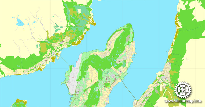
Tromsø lies in Northern Norway. The 2,521-square-kilometre (973 sq mi) municipality is the 18th largest by area out of the 422 municipalities in Norway. Tromsø is the 9th most populous municipality in Norway with a population of 75,638. The municipality’s population density is 30.6 inhabitants per square kilometre (79/sq mi) and its population has increased by 15.9% over the last decade. It is the largest urban area in Northern Norway and the third largest north of the Arctic Circle anywhere in the world (following Murmansk and Norilsk). Most of Tromsø, including the city centre, is located on the island of Tromsøya, 350 kilometres (217 mi) north of the Arctic Circle. In 2017, the city of Tromsø had a population of about 65,000 people spread out over Tromsøya and parts of Kvaløya and the mainland. Tromsøya is connected to the mainland by the Tromsø Bridge and the Tromsøysund Tunnel, and to the island of Kvaløya by the Sandnessund Bridge.

Note. This color editing method is convenient for global color adjustment in a vector map, if global colors were not used when creating a Map of Tromso.
The «Edit colors» button or «Edit or apply colors» on the «Color Catalog» palette
Click this button if you need to edit colors on the «Color Catalog» palette or edit and then apply them to the selected Vector Map of Tromso or its fragment.
The «Edit color group» button or «Edit or apply color group» on the «Samples» palette.
Click this button if you need to edit the colors in the specific color group or edit and apply them to the selected Vector Map of Tromso or a group of its elements, for example, the whole layer “Streets and lines”. You can also double-click the color group in the Samples panel to open the dialog box.
If the map file is too large and your computer freezes or even can’t open it quickly:
1. Try to reduce the color resolution of the video card (display) to 256 colors while working with a large map.
2. Using Windows Task Manager, select all the application you don’t need, while working with map, just turn them off.
3. Launch Adobe Illustrator. (DO NOT OPEN the vector map file)
4. Start the Windows Task Manager using administrator rights > Find the “Illustrator” process > set the «real time» priority,
5. Open the file. When you see the LEGACY FONT popup window – click “OK” (do not update). You can restore the TEXT later.
6. Can also be useful: When file is opened – Edit > Settings > Basic Settings > disable smoothing. /// It looks scary, but works quickly)))
We recommend saving the file in Adobe Illustrator 10 version. It’s much more stable when working with VERY BIG size files.
The municipality is warmer than most other places located on the same latitude, due to the warming effect of the Gulf Stream. Tromsø is even milder than places much farther south of it elsewhere in the world, such as on the Hudson Bay and in Far East Russia, with the warm-water current allowing for both relatively mild winters and tree growth in spite of its very high latitude.
The city centre of Tromsø contains the highest number of old wooden houses in Northern Norway, the oldest house dating from 1789. The city is a cultural centre for its region, with several festivals taking place in the summer. Torbjørn Brundtland and Svein Berge of the electronica duo Röyksopp and Lene Marlin grew up and started their careers in Tromsø. Noted electronic musician Geir Jenssen also hails from Tromsø.
Geography
Tromsø is the eighth-largest municipality in Norway with a population of 71,590, and the centre of the ninth-largest urban area, with a population of about 65,000. The city is home to the world’s northernmost university and also houses the northernmost botanical garden and planetarium.
The city centre is located on the east side of the Tromsøya island — over 300 kilometres (190 mi) north of the Arctic Circle at 69°40′33″N 18°55′10″E. Suburban areas include Kroken, Tromsdalen (on the mainland, east of Tromsøya), the rest of the Tromsøya island, and the eastern part of the large Kvaløya, west of the Tromsøya island. The Tromsø Bridge and Tromsøysund Tunnel both cross the Tromsøysundet strait connecting the mainland with Tromsøya by road. On the western side of the city, the Sandnessund Bridge connects Tromsøya island with Kvaløya island.
There are many tall mountains within the municipality including Hamperokken, Jiehkkevárri, Store Blåmann, Store Fornestinden, and Tromsdalstinden. The Lyngen Alps mountain range lies along the Tromsø-Lyngen municipal border. There are many islands within the municipality of Tromsø including Hillesøya, Kvaløya, Rebbenesøya, Ringvassøya, Sommarøya, and Tromsøya. There are also several fjords that are located in Tromsø including the Balsfjorden, Kaldfjorden, Malangen, and Ullsfjorden.
Tromsø
City in Norway
Tromsø, a city in Norway, is a major cultural hub above the Arctic Circle. It’s famed as a viewing point for colorful Northern Lights that sometimes light up the nighttime sky. The city’s historic center, on the island of Tromsø, is distinguished by its centuries-old wooden houses. The 1965 Arctic Cathedral, with its distinctive peaked roof and soaring stained-glass windows, dominates the skyline.
Area: 2,520 km²
Population: 72,066 (2012)
Official language form: Norwegian Language
Colleges and Universities: University of Tromsø
Tromsø is a city and municipality in Troms county, Norway. The administrative centre of the municipality is the city of Tromsø. Outside of Norway, Tromso and Tromsö are alternative spellings of the city. Tromsø is considered the northernmost city in the world with a population above 50,000. The most populous town north of it is Alta, Norway, with a population of 14,272 (2013).
Tromsø lies in Northern Norway. The municipality has a population of (2015) 72,066, but with an annual influx of students it has over 75,000 most of the year. It is the largest urban area in Northern Norway and the third largest north of the Arctic Circle (following Murmansk and Norilsk). Most of Tromsø, including the city centre, is located on the island of Tromsøya, 350 kilometres (217 mi) north of the Arctic Circle. In 2012, Tromsøya had a population of 36,088. Substantial parts of the urban area are also situated on the mainland to the east, and on parts of Kvaløya—a large island to the west. Tromsøya is connected to the mainland by the Tromsø Bridge and the Tromsøysund Tunnel, and to the island of Kvaløya by the Sandnessund Bridge. Tromsø Airport connects the city to many destinations in Europe. The city is warmer than most other places located on the same latitude, due to the warming effect of the Gulf Stream.
The city centre of Tromsø contains the highest number of old wooden houses in Northern Norway, the oldest house dating from 1789. The Arctic Cathedral, a modern church from 1965, is probably the most famous landmark in Tromsø. The city is a cultural centre for its region, with several festivals taking place in the summer. Some of Norway’s best-known musicians, Torbjørn Brundtland and Svein Berge of the electronica duo Röyksopp and Lene Marlin grew up and started their careers in Tromsø. Noted electronic musician Geir Jenssen also hails from Tromsø.
The most famous soccer team in the area, Tromsø IL, currently plays in the Norwegian Premier League.
Source Wiki

Free vector map World, Adobe Illustrator, download now maps vector clipart Map for design, projects, presentation free to use as you like. World map vector, Vector world map, World vector map, Map western europe, West europe maps, Map of the world modifiable, High resolution world map, World map illustrator, World map PDF editable, World vector map download,
Free vector map World, Adobe Illustrator, download now maps vector clipart
Map for design, projects, presentation free to use as you like.
Free Download All World Vector Maps here >>>>>
See also: TERMS & CONDITIONS: SOFTWARE LICENSE AGREEMENT FOR DIGITAL CARTOGRAPHIC DATA
Small guide: How to work with the vector map?
You can: Mass select objects by type and color – for example, the objects type “building” (they are usually dark gray) – and remove them from the map, if you do not need them in your print or design project. You can also easily change the thickness of lines (streets), just bulk selection the road by the line color.
The streets are separated by type, for example, type “residential road” are usually white with a gray stroke. Highway usually orange with a brown or dark gray stroke.
All objects are divided by types: different types of roads and streets, polygons of buildings, landfills, urban areas, parks and more other.
It is easy to change the font of inscriptions, all or each individually. Also, just can be make and any other manipulation of objects on the vector map in Adobe illustrator format.
Important: All the proportions on the map are true, that is, the relative sizes of the objects are true, because Map is based on an accurate GPS projection, and It transated into the (usual for all) the Mercator projection.
You can easily change the color, stroke and fill of any object on the map, zoom without loss of quality Image Verification.
Select object

Bulk selection the same objects on the vector map

See the bulk selected objects on the vector map

Bulk delete buildungs from the vector map

Select residencial road (small street) on the vector map

Bulk selection the same lines (streets, roads) on the full map

Create fat lines of the streets on the vector maps (bulk action) 1

Create fat lines of the streets on the vector maps (bulk action) 2

Create fat lines of the streets on the vector maps (bulk action) 3

You can easily change the color, stroke and fill of any object on the map, zoom without loss of quality Image Verification.

 Author: Kirill Shrayber, Ph.D. FRGS