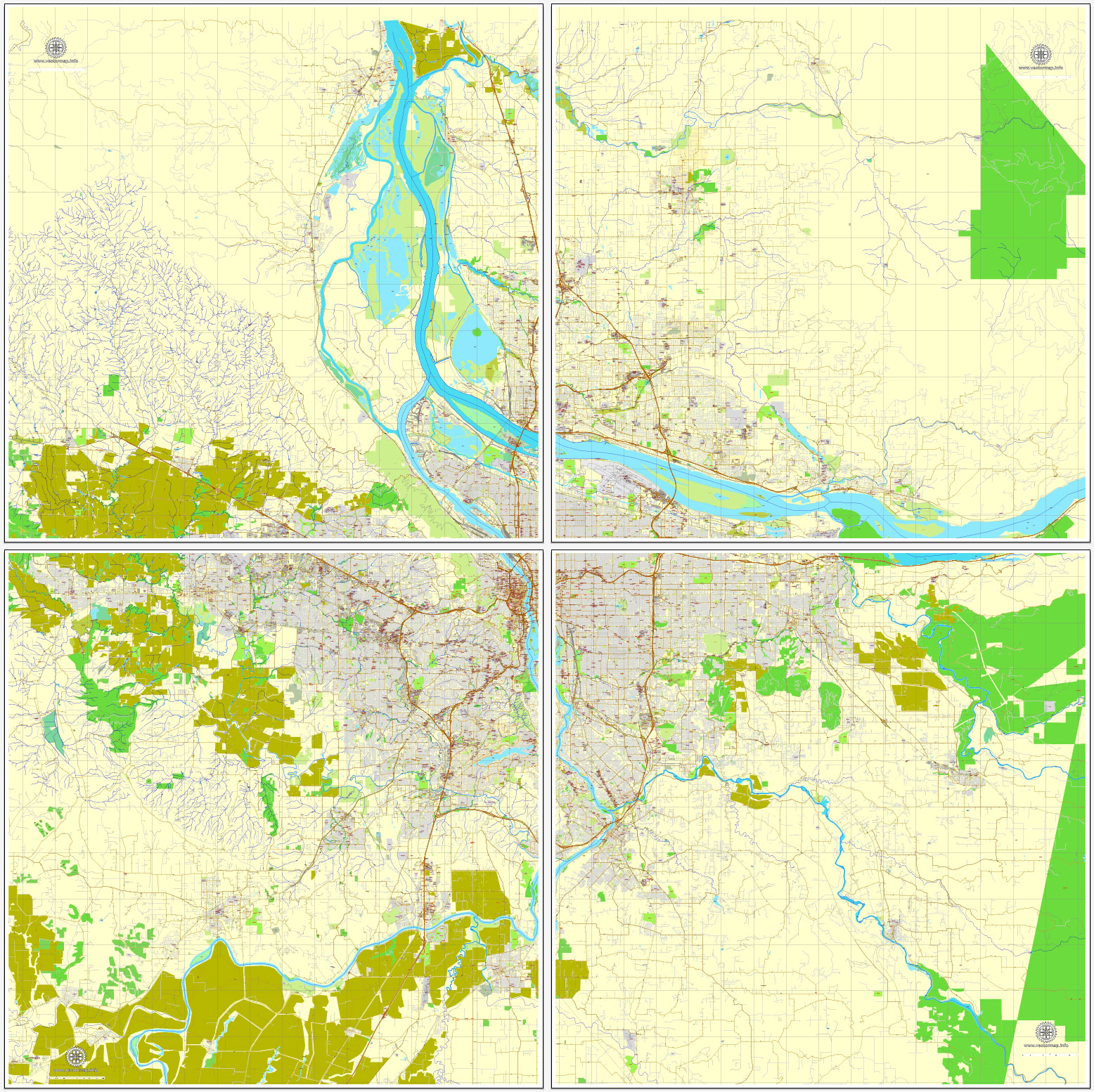
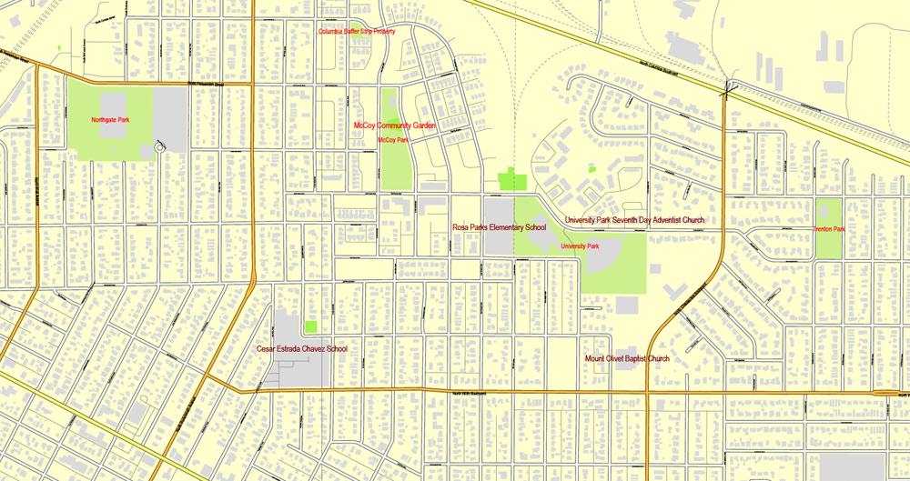
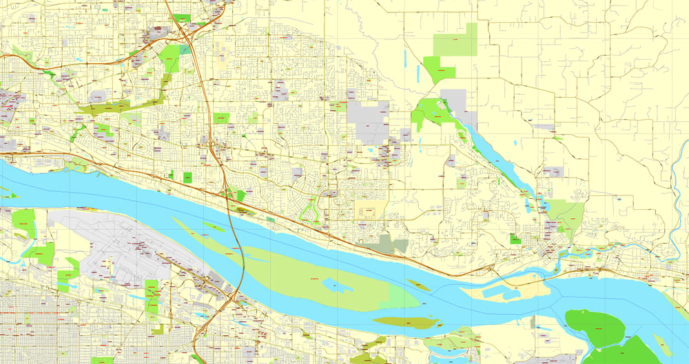
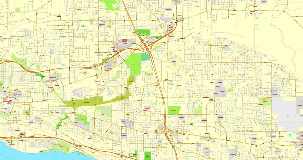
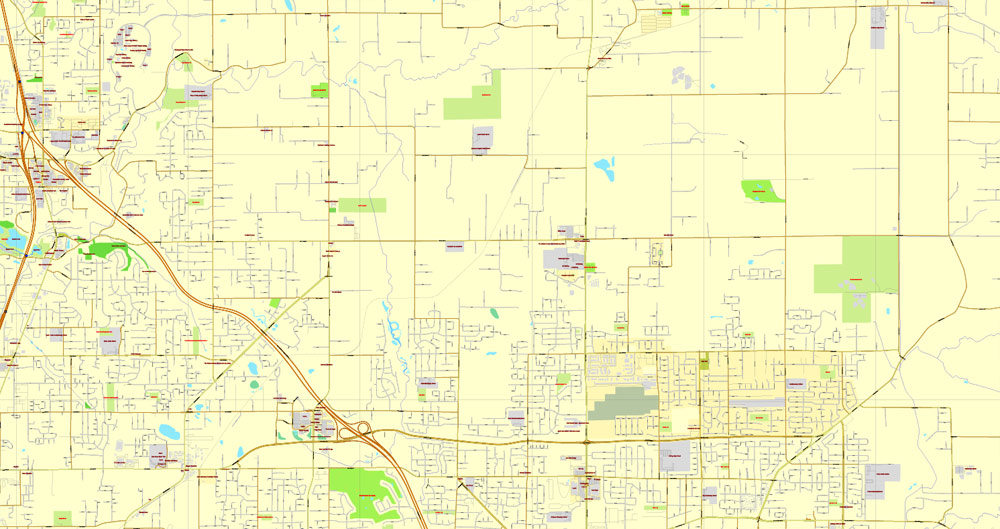
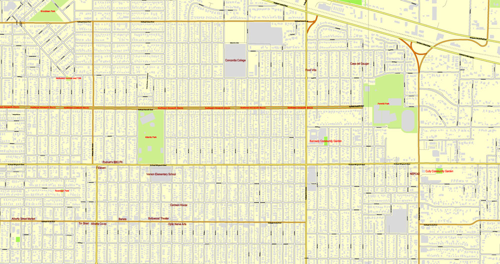
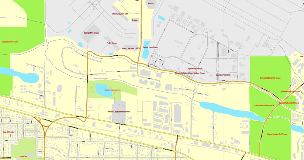
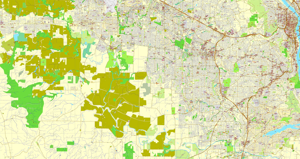
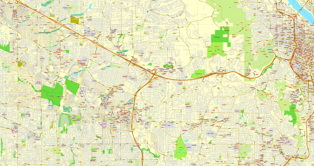
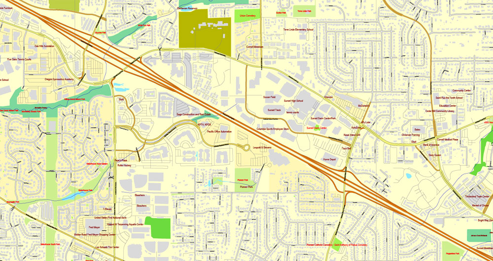
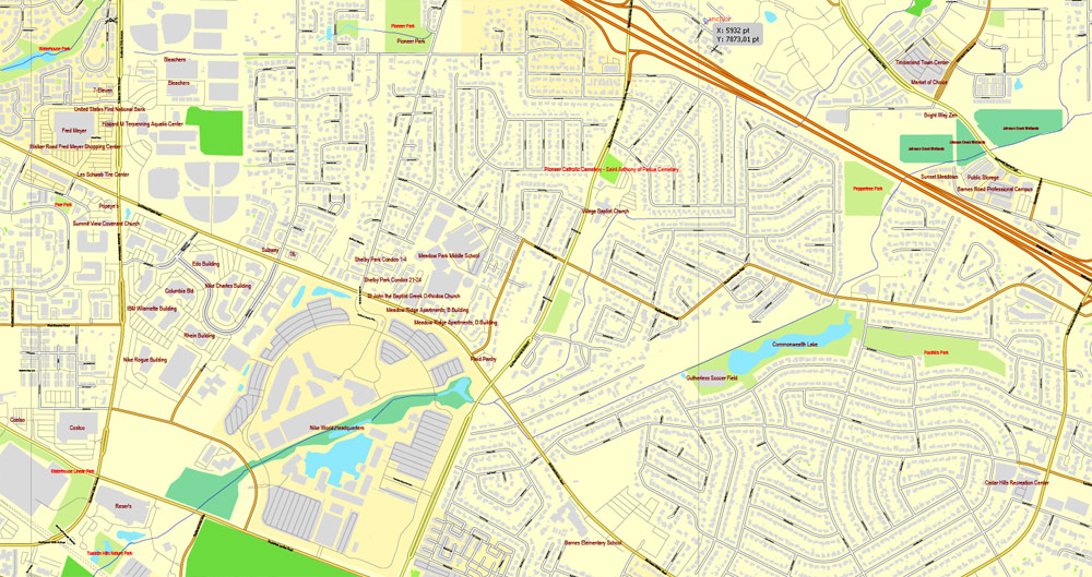
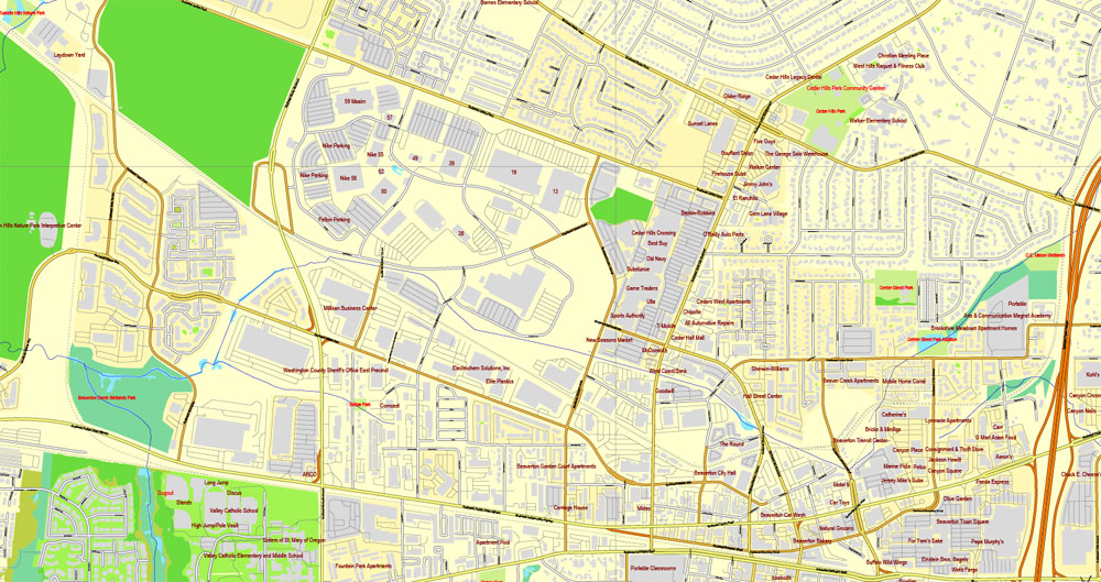
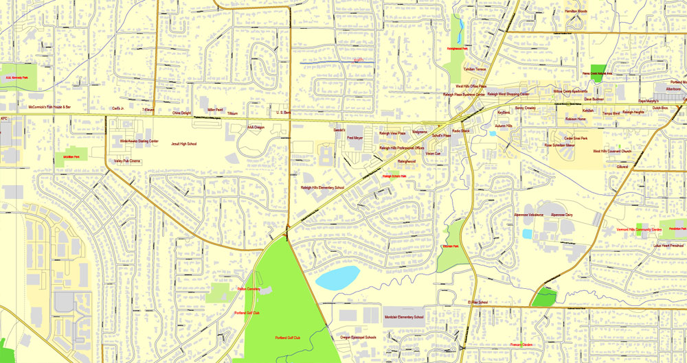
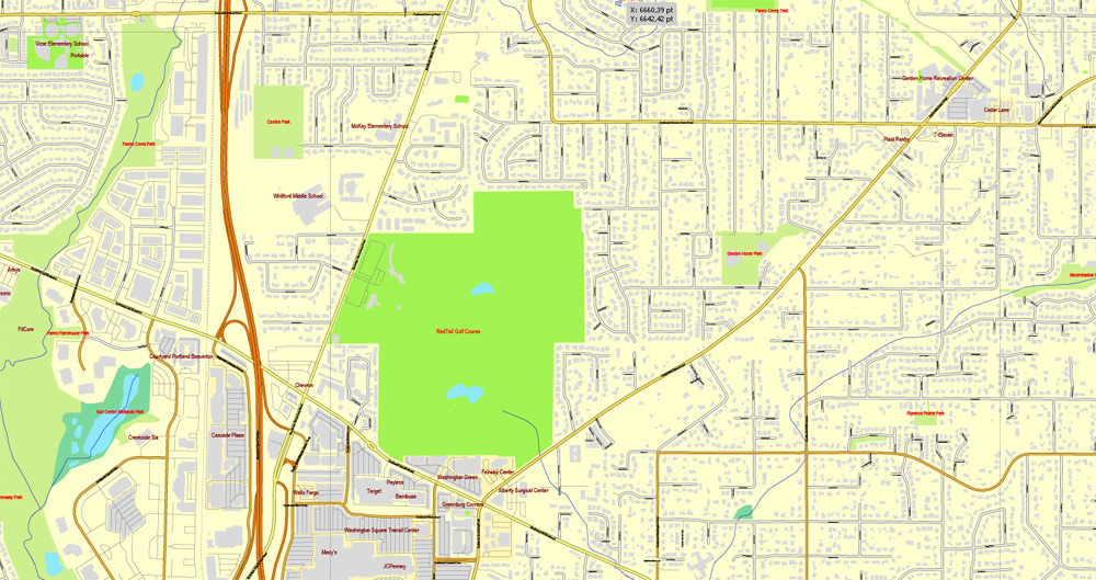
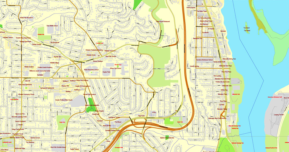
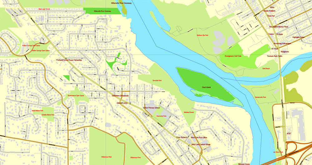
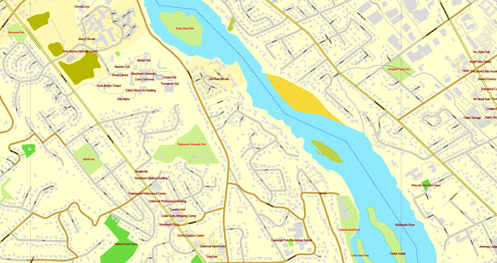
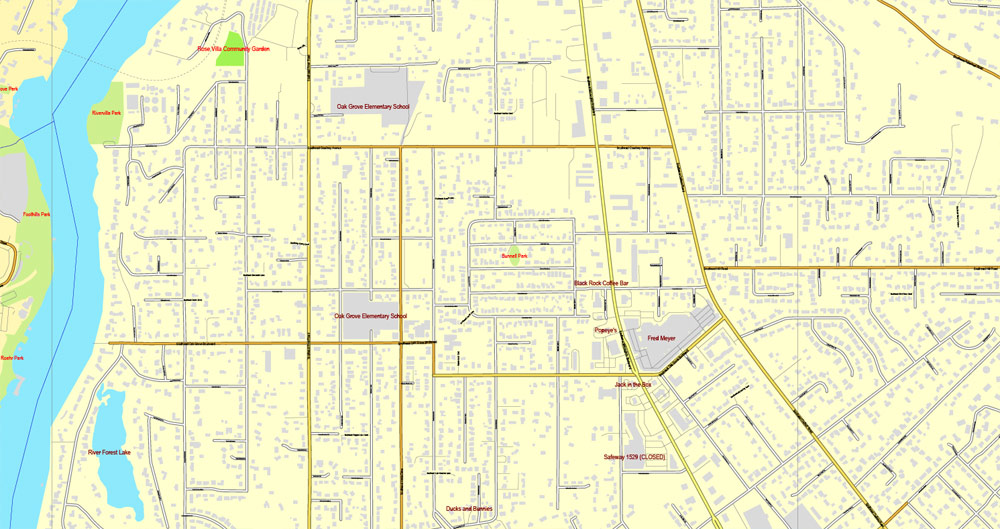
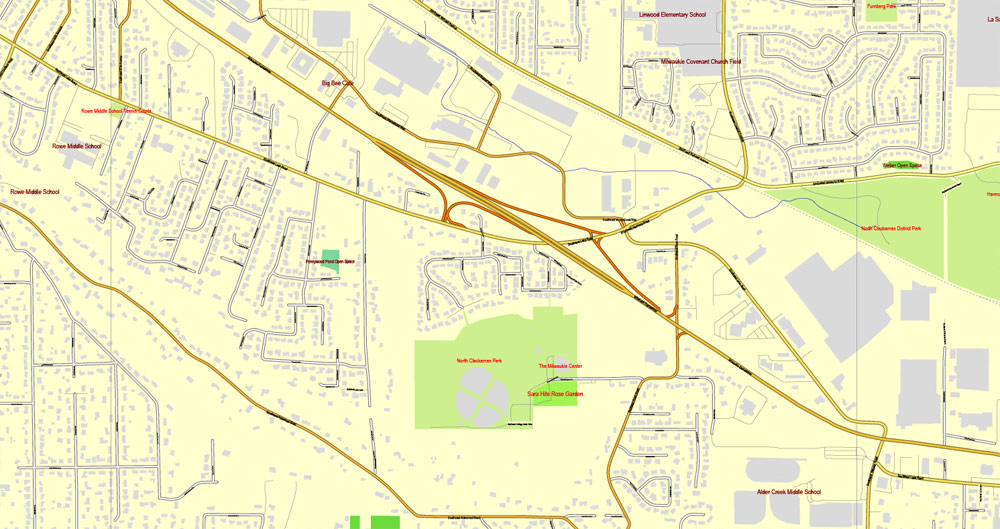
Portland, Oregon + Vancouver, Washington, US, vector map Adobe Illustrator editable 4 parts City Plan V3, full vector, scalable, editable, text format street names, 76 mb ZIP
All streets, All buildings. Map for design, printing, arts, projects, presentations, for architects, designers and builders.
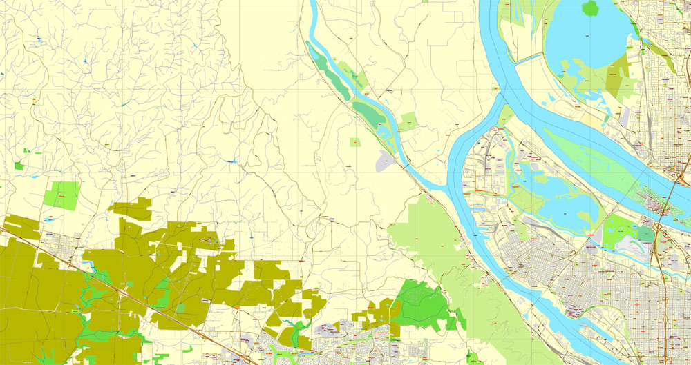
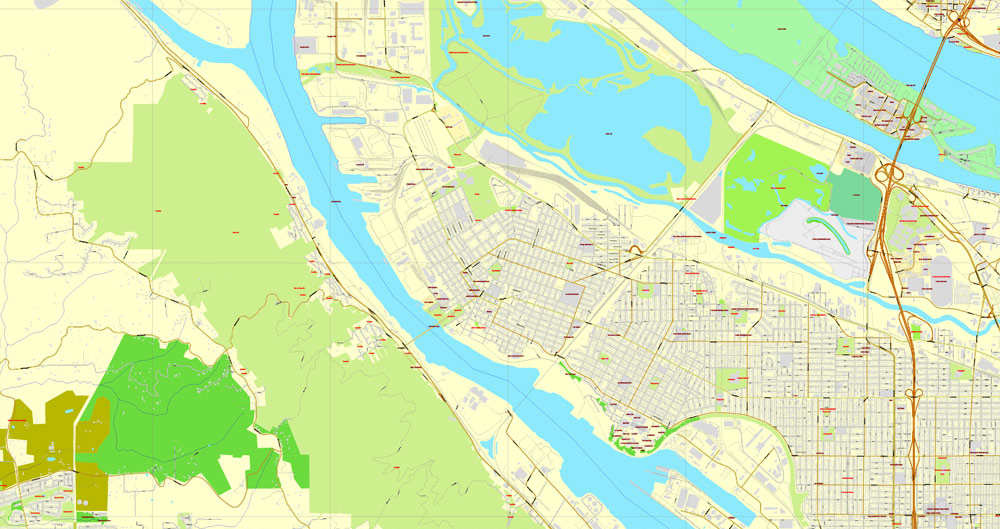
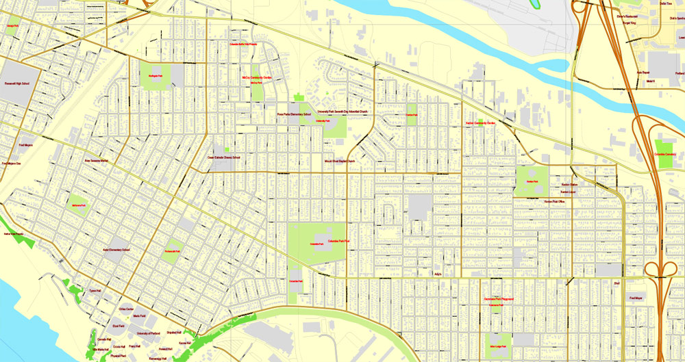
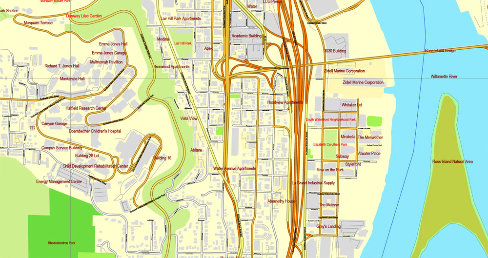
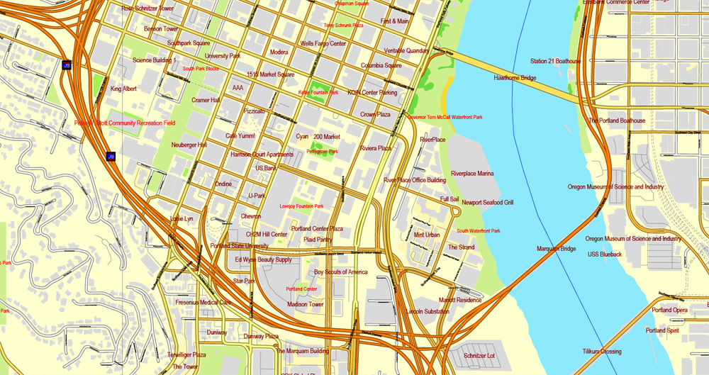
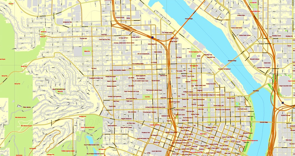
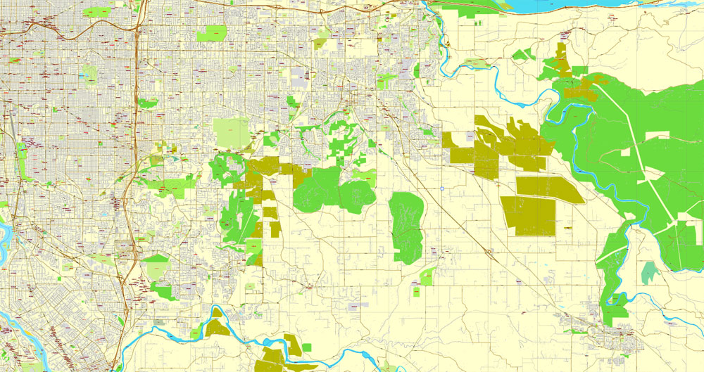
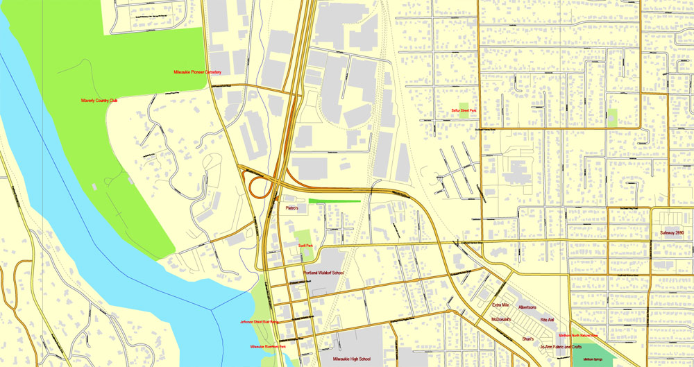
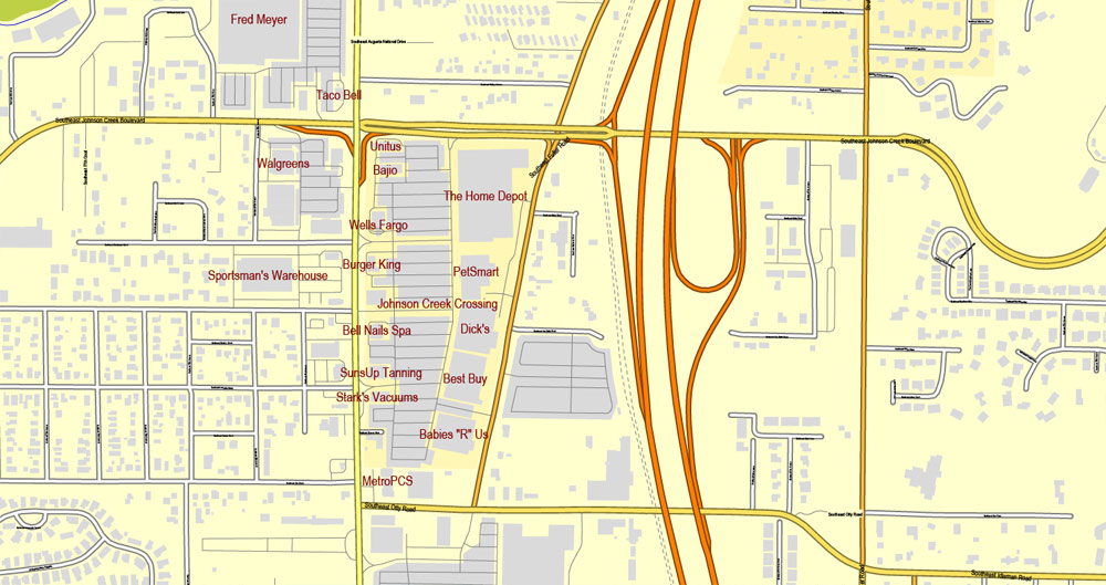
The most accurate and detailed map of the city.
CDR, DWG, DXF and other formats – on demand, same price, please, contact
Portland + Vancouver, Oregon, USA.
This vector map of Portland city is used as a basis for design, editing, and further printing.
This is the most detailed, exact map of Portland city for high-quality printing and polygraphy. You can always clarify the map development date by contacting us.
For your convenience, all objects on Portland vector city map are divided into layers. And the editing is very easy – colors, lines, etc.
You can easily add any objects needed (e.g. shops, salons, sale points, gas station or attraction) on any layer of Portland vector map.
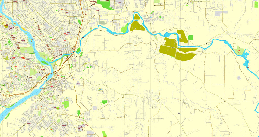
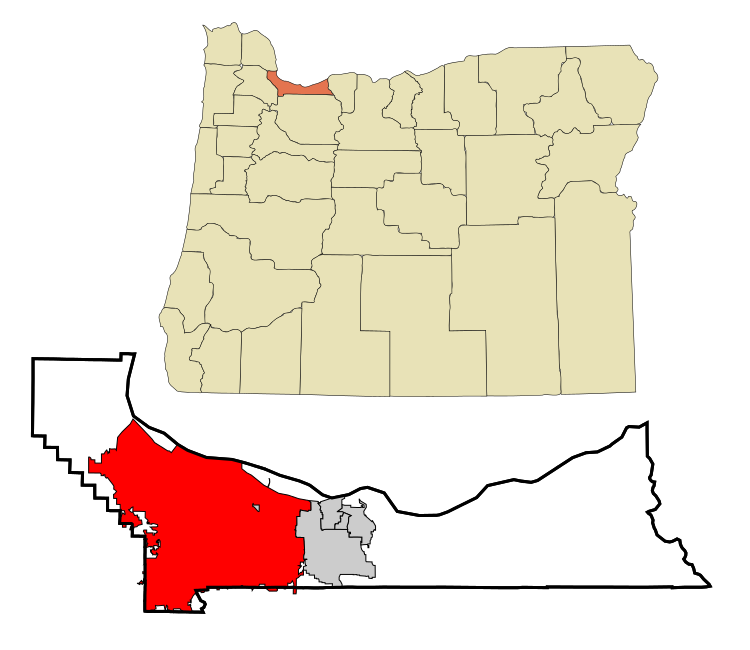
Portland is the largest city in the U.S. state of Oregon and the seat of Multnomah County. It is a major port in the Willamette Valley region of the Pacific Northwest, at the confluence of the Willamette and Columbia rivers.
This vector map of Portland city is used by:
designers, layout designers, printers, advertisers and architects. Our product – vector maps – is designed for further editing and printing in large formats – from @Wall format (a few meters) to A-0 and A-1, A-2, A-3.
The advertising and presentation map of Portland city (usually the final designer marks the routes, and puts the client’s objects (shops, saloons, gas stations etc.)
The undoubted advantage is that people will NEVER throw out this advertising product – the map. In fact, as an advertising medium, a city map is the most “long-playing” of the well-known polygraphic advertising media, with the longest lifespan, and the maximum number of interactions with the customer.
For travelers, maps are sold at the airports and gas stations around the world. Often the source is our vector maps.
Take a look, who purchases our vector maps of Portland city in “Our Clients and Friends” page – these are large and small companies, from super-brands like Volvo and Starbucks, to small design studios and printing houses.
It’s very easy to work with vector maps of Portland city, even for a not very experienced designer who can turn on and off the map layers, add new objects, change the colors of fill and lines according to customer requirements.
The city covers 145 square miles (380 square kilometers) and had an estimated population of 647,805 in 2017, making it the 26th most populous city in the United States, and the second-most populous in the Pacific Northwest. Approximately 2,424,955 people live in the Portland metropolitan statistical area (MSA), making it the 25th most populous MSA in the United States.
The undoubted advantage of Portland city vector maps in printing is an excellent and detailed visualization, when customer can expand a large paper map and instantly define his location, find a landmark, an object or address on map, unlike using the popular electronic formats of Google and Yandex maps for example.
Printable vector maps of Portland city are much more convenient and efficient than any electronic maps on your smartphone, because ALL DETAILS are displayed in the entire space of Portland city map.
Useful tips on working with vector maps of cities and countries in Adobe Illustrator.
«V» – launches the Selection tool (cursor, black arrow), which makes active any vector line.
«А» – launches the Direct Selection tool (white cursor), allows you to select curve elements and drag them to the desired place.
«R» – activates the Rotate tool, which helps you rotating selected objects around the center point by 360 degrees.
«E» – gives you the opportunity to use the Eraser tool and erase unnecessary parts.
«X» – switches between Fill and Stroke in the Tools section. Try to get used to this hot key and
you will quickly understand that you can’t live and work without it.
Its Combined Statistical Area (CSA) ranks 18th with a population of 3,160,488. Roughly 60% of Oregon’s population resides within the Portland metropolitan area. Named after Portland, Maine, the Oregon settlement began to be populated in the 1830s near the end of the Oregon Trail. Its water access provided convenient transportation of goods, and the timber industry was a major force in the city’s early economy.
Guides are not limited to vertical and horizontal in Adobe Illustrator. You can also create a diagonal guide for example. Moreover, you can turn any contours into guides. Select the outline and go to View > Guides > Make Guides (Create Guides), or simply press Cmd/Ctrl + 5. You can also turn the guides back into an editable object. Go to menu, View > Guides > Unlock Guides (Release Guides), select the guide you want to edit and select View > Guides > Release Guides (Reset Guides), or just press Cmd/Ctrl + Option / Alt + 5).
You will probably want to change the color scheme used on our Portland vector city map.
At the turn of the 20th century, the city had a reputation as one of the most dangerous port cities in the world, a hub for organized crime and racketeering. After the city’s economy experienced an industrial boom during World War II, its hard-edged reputation began to dissipate. Beginning in the 1960s, Portland became noted for its growing progressive political values, earning it a reputation as a bastion of counterculture.
To quickly and effectively play with colors.
Of course, you can do it manually, all objects in our Portland city vector map are divided according to types and layers, and you can easily change the color gamma of vector objects in groups and layers.
But there is more effective way of working with the whole VECTOR MAP of Portland city and all layers:
The overview dialog «Edit colors»/«Repaint Graphic Object» (this dialog box name can change depending on the context):
If you have selected a part or a layer of Portland city vector map and open the dialog box by clicking the icon in the Control panel, on the Samples palette or the Color Catalog, or if you choose Edit > Edit Colors> Repaint Graphic Object, then the «Repaint Graphic Object» dialog box appears, and you get access to «Assign» and «Edit» tabs.
The city operates with a commission-based government guided by a mayor and four commissioners as well as Metro, the only directly elected metropolitan planning organization in the United States. The city government is notable for its land-use planning and investment in public transportation. Portland is frequently recognized as one of the world’s most environmentally conscious cities because of its high walkability, large community of bicyclists, farm-to-table dining, expansive network of public transportation options, and over 10,000 acres (4,000 hectares) of public parks. Its climate is marked by warm, dry summers and cool, rainy winters. This climate is ideal for growing roses, and Portland has been called the “City of Roses” for over a century.
If a picture or a map fragment is not selected, and you open the dialog box by clicking the icon in the Control panel, on the Samples palette or in the Color Catalog, the «Edit Colors» dialog box appears and you can only access the «Edit» tab.
Regardless of the name at the top of the dialog box, the right-hand side always displays the color group of the current document, as well as two default color groups: Print Color and Grayscale. These color groups can be selected and used any time.
Create and edit color groups of Portland city vector map, and also assign colors using the «Edit Colors»/ а «Repaint Graphic Object» dialog box.
A. Creating and editing of a color group on the «Edit» tab
B. Assigning colors on the «Assign» tab
C. Select a group of colors from the «Color groups» list
The option «Repaint a graphic object» in the lower part of the dialog box allows you to preview the colors on a selected layer of Vector map, or a group of elements, and specify whether its colors will be redefined when the dialog box is closed.
Geography
Geology
Portland lies on top of an extinct volcanic field known as the Boring Lava Field, named after the nearby bedroom community of Boring. The Boring Lava Field has at least 32 cinder cones such as Mount Tabor, and its center lies in southeast Portland. Mount St. Helens, a highly active volcano 50 miles (80 km) northeast of the city in Washington state, is easily visible on clear days and is close enough to have dusted the city with volcanic ash after its eruption on May 18, 1980. The rocks of the Portland area range in age from late Eocene to more recent eras.
The main areas of the dialog box are:
«Edit»
The «Edit» tab is designed to create a new or edit the existing color groups.
The harmony rules Menu and the Color Wheel are used to conduct experiments with color harmonies. The color wheel shows how colors are related in color harmony, and the color bars allow you to view and manipulate an individual color values. In addition, you can adjust the brightness, add and remove colors, save color groups and view colors on the selected Vector Map of Portland city or a separated layers.
Earthquakes
Multiple shallow, active fault lines traverse the Portland metropolitan area. Among them are the Portland Hills Fault on the city’s west side, and the East Bank Fault on the east side. According to a 2017 survey, several of these faults were characterized as “probably more of a hazard” than the Cascadia subduction zone due to their proximities to population centers, with the potential of producing magnitude 7 earthquakes.
«Assign»
The «Assign» tab is used to view and control on how the original colors are replaced with colors from the color group like your corporate colors in the Vector Map of Portland city.
The assign color ability is provided only if the entire map, layer or fragment is selected in the document. You can specify which of new colors replace the current colors, whether the spot colors should be preserved and how colors are replaced (for example, you can replace colors completely or changing the color tone while maintaining the brightness). The «Assign» tab allows you to redefine colors in the Vector Map of Portland city, or in separate layers and fragments using the current color group or reducing the number of colors in the current Vector Map.
Notable earthquakes that have impacted the Portland area in recent history include the 6.8-magnitude Nisqually earthquake in 2001, and a 5.6-magnitude earthquake that struck on March 25, 1993.
Per a 2014 report, over 7,000 locations within the Portland area are at high-risk for landslides and soil liquefaction in the event of a major earthquake, including much of the city’s west side (such as Washington Park) and sections of Clackamas County.
Color groups
Is a list of all saved color groups for current document (the same groups appear in the «Samples» palette). You can edit and delete the existing color groups, as well as creating a new ones using the list of “Color Groups” in the dialog box. All changes appear in the «Samples» palette.
The highlighted color group shows, which color group is currently edited.
Any color group can be selected and edited, or used to redefine the colors in the selected vector map of Portland city, its fragments or elements.
Topography
Portland is 60 miles (97 km) east of the Pacific Ocean at the northern end of Oregon’s most populated region, the Willamette Valley. Downtown Portland straddles the banks of the Willamette River, which flows north through the city center and separates the city’s east and west neighborhoods. Less than 10 miles (16 km) from downtown, the Willamette River flows into the Columbia River, the fourth-largest river in the United States, which divides Oregon from Washington state. Portland is approximately 100 miles (160 km) upriver from the Pacific Ocean on the Columbia.
Saving a color group adds this group to the specified list.
Opening the «Edit Colors»/«Repaint Graphic Object» dialog box.
Open the «Edit Colors»/«Repaint Graphic Object» dialog box using one of the following methods:
«Edit»> «Edit Colors»> «Repaint Graphic object» or «Repaint With Style».
Use these commands if you need to edit the colors in the selected vector map of Portland city.
«Repaint Graphic object» button on the «Control» panel.
Use this button if you need to adjust colors of Portland city vector map using the а «Repaint graphic object» dialog box.
Though much of downtown Portland is relatively flat, the foothills of the Tualatin Mountains, more commonly referred to locally as the “West Hills”, pierce through the northwest and southwest reaches of the city. Council Crest Park, commonly thought of as the highest point within city limits, is in the West Hills and rises to an elevation of 1,073 feet (327 m) The city’s actual high point is a little-known and infrequently accessed point of 1,180 feet (360 m) near Forest Park. The highest point east of the river is Mt. Tabor, an extinct volcanic cinder cone, which rises to 636 feet (194 m).
The specified button is available if the selected vector map or its fragment contains two or more colors.
Note. This color editing method is convenient for global color adjustment in a vector map, if global colors were not used when creating a City Map of Portland.
The «Edit colors» button or «Edit or apply colors» on the «Color Catalog» palette
Click this button if you need to edit colors on the «Color Catalog» palette or edit and then apply them to the selected Vector Map of Portland city or its fragment.
The «Edit color group» button or «Edit or apply color group» on the «Samples» palette.
Nearby Powell Butte and Rocky Butte rise to 614 feet (187 m) and 612 feet (187 m), respectively. To the west of the Tualatin Mountains lies the Oregon Coast Range, and to the east lies the actively volcanic Cascade Range. On clear days, Mt. Hood and Mt. St. Helens dominate the horizon, while Mt. Adams and Mt. Rainier can also be seen in the distance.
Click this button if you need to edit the colors in the specific color group or edit and apply them to the selected Vector Map of Portland city or a group of its elements, for example, the whole layer “Streets and lines”. You can also double-click the color group in the Samples panel to open the dialog box.
If the map file is too large and your computer freezes or even can’t open it quickly:
1. Try to reduce the color resolution of the video card (display) to 256 colors while working with a large map.
2. Using Windows Task Manager, select all the application you don’t need, while working with map, just turn them off.
3. Launch Adobe Illustrator. (DO NOT OPEN the vector map file)
4. Start the Windows Task Manager using administrator rights > Find the “Illustrator” process > set the «real time» priority,
5. Open the file. When you see the LEGACY FONT popup window – click “OK” (do not update). You can restore the TEXT later.
6. Can also be useful: When file is opened – Edit > Settings > Basic Settings > disable smoothing. /// It looks scary, but works quickly)))
We recommend saving the file in Adobe Illustrator 10 version. It’s much more stable when working with VERY BIG size files.
Though much of downtown Portland is relatively flat, the foothills of the Tualatin Mountains, more commonly referred to locally as the “West Hills”, pierce through the northwest and southwest reaches of the city. Council Crest Park, commonly thought of as the highest point within city limits, is in the West Hills and rises to an elevation of 1,073 feet (327 m) The city’s actual high point is a little-known and infrequently accessed point of 1,180 feet (360 m) near Forest Park. The highest point east of the river is Mt. Tabor, an extinct volcanic cinder cone, which rises to 636 feet (194 m).
Nearby Powell Butte and Rocky Butte rise to 614 feet (187 m) and 612 feet (187 m), respectively. To the west of the Tualatin Mountains lies the Oregon Coast Range, and to the east lies the actively volcanic Cascade Range. On clear days, Mt. Hood and Mt. St. Helens dominate the horizon, while Mt. Adams and Mt. Rainier can also be seen in the distance.
According to the United States Census Bureau, the city has an area of 145.09 square miles (375.78 km2), of which 133.43 square miles (345.58 km2) is land and 11.66 square miles (30.20 km2) is water. Although almost all of Portland is within Multnomah County, small portions of the city are within Clackamas and Washington Counties, with populations estimated at 785 and 1,455, respectively.
Neighborhoods of Portland, Oregon
There are five sections of Portland, Oregon, though a sixth is planned, and 95 officially recognized neighborhoods, each of which is represented by a volunteer-based neighborhood association. These associations serve as the liaison between residents and the city government, as coordinated by the city’s Office of Community & Civic Life, which was created in 1974 and known as the Office of Neighborhood Involvement until July 2018. The city subsequently provides funding to this “network of neighborhoods” through district coalitions, which are groupings of neighborhood associations. On June 6, 2018, Portland City Council voted to add a sixth section to Portland; it will be called South Portland and the transition to the new system is expected to start in May 2020.
Southwest
Downtown Portland lies in the Southwest section between the I-405 freeway loop and the Willamette River, centered on Pioneer Courthouse Square (“Portland’s living room”). Downtown and many other parts of inner Portland have compact square blocks (200 ft [60 m] on a side) and narrow streets (64 ft [20 m] wide), a pedestrian-friendly combination.
Beyond downtown, the Southwest section also includes:
The campuses of Oregon Health & Science University (OHSU), Lewis & Clark College, and Portland Community College/Sylvania
Neighborhoods like South Portland (formerly Corbett-Terwilliger-Lair Hill), South Burlingame, Hillsdale, and Multnomah, with unique residential houses and well defined commercial and retail districts
Alpenrose Dairy in the Hayhurst neighborhood, the grounds of which host track cycling and Little League sports
Washington Park, site of North America’s deepest transit station, the Oregon Zoo, Hoyt Arboretum, the International Rose Test Garden, the Portland Japanese Garden, the Vietnam Veterans Memorial, and many hiking trails.
The south Willamette riverfront along SW Macadam Ave., over 100 acres (0.4 km²) of former industrial land. This area is undergoing redevelopment as a mixed-use, high-density neighborhood, with an anticipated 2,700 residential units and 5,000 high-tech jobs after build-out.
Northwest
Northwest Portland includes the Pearl District, most of Old Town Chinatown, the Northwest District, and various residential and industrial neighborhoods. A range of streets primarily in Northwest Portland is named alphabetically from Ankeny through York (the street following York is Reed Street). The street between Wilson and York was called “X Street” until it was renamed as Roosevelt Street. Burnside Street, the “B” in the sequence, divides the Northeast and Northwest quadrants of the city from the Southeast and Southwest.
The Pearl District is a recent name for a former warehouse and industrial area just north of downtown. Many of the warehouses have been converted into lofts, and new multistory condominiums have also been developed on previously vacant land. The increasing density has attracted a mix of restaurants, brewpubs, shops, and art galleries. The galleries sponsor simultaneous artists’ receptions every month, in an event known as First Thursday.
Between the Pearl District and the Willamette is the Old Town Chinatown neighborhood. It includes Portland’s Chinatown, marked by a pair of lions at its entrance at NW 4th Ave. and W Burnside St. and home to the Portland Classical Chinese Garden. Before World War II, this area was known as Japan Town; Chinatown was previously located just south of W. Burnside St. along the riverfront.
Farther west is the compact but thriving NW 21st and 23rd Avenue restaurant and retail area, the core of the Northwest District. Parts of this area are also called Uptown and Nob Hill. Nicknames include Snob Hill and Trendy Third. The residential areas adjacent to the shopping district include the Alphabet Historic District (with large Victorian and Craftsman homes built in the years before and shortly after 1900) and a large district centered on Wallace Park. The neighborhood has a mix of Victorian-era houses, apartment buildings from throughout the 20th century, and various businesses centered on Legacy Good Samaritan Medical Center. The Portland Streetcar connects Nob Hill to downtown, via the Pearl.
West of the developed areas is the northern portion of Portland’s West Hills, including the majority of extensive Forest Park and the Willamette Heights, Hillside, Sylvan, Skyline and Forest Heights neighborhoods.
North
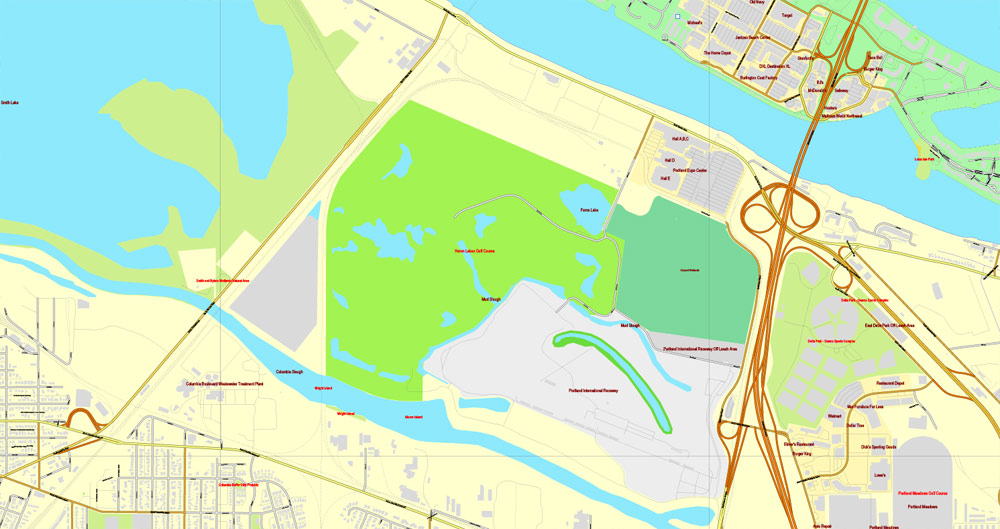
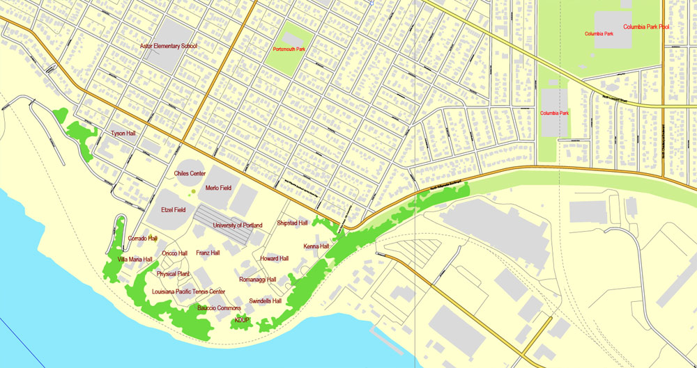
North Portland is a diverse mixture of residential, commercial, and industrial areas. It includes the Portland International Raceway, the University of Portland, and massive cargo facilities of the Port of Portland. Nicknames for it include “NoPo” and “the Fifth Quadrant” (for being the odd-man out from the four-cornered logic of SE, NE, SW, and NW).
North Portland is connected to the industrial area of Northwest Portland by the St. Johns Bridge, a 2,067 ft (630.0 m) long suspension bridge completed in 1931 and extensively rehabilitated in 2003-05.
During World War II, a planned development named Vanport was constructed to the north of this section between the city limits and the Columbia River. It grew to be the second largest city in Oregon, but was wiped out by a disastrous flood in 1948. Columbia Villa, another wartime housing project in the Portsmouth Neighborhood, is being rebuilt; the renewed community opened in 2005 is known as New Columbia and offers public housing, rental housing, and single family home ownership units. Since 2004, a light rail line runs along Interstate Avenue, which parallels I-5, stopping short of crossing the Columbia River.
Northeast
Northeast Portland contains a diverse collection of neighborhoods. For example, while Irvington and the Alameda Ridge feature some of the oldest and most expensive homes in Portland, nearby King is a more working-class neighborhood. Because it is so large, Northeast Portland can essentially be divided ethnically, culturally, and geographically into inner and outer sections. The inner Northeast neighborhoods that surround Martin Luther King Jr. Blvd. were once predominantly African American, resembling typical urban inner-city environments found in most major U.S. cities. However, the demographics are now changing due to the process of gentrification. In 2010, the King neighborhood was 25.9% Black or African-American, a 41.3% decrease since 2000. Inner Northeast includes several shopping areas, such as the Lloyd District, Alberta Arts District (Portland, Oregon) and Hollywood, and part of the affluent Irvington, Alameda, Grant Park, Sullivan’s Gulch and Laurelhurst neighborhoods and nearby developments. The city plan targets Lloyd District as another mixed-use area, with high-density residential development.
Straddling the base of the borders of North and Northeast is the Rose Quarter. It is named after the Rose Garden, home of the Portland Trail Blazers (now named the Moda Center), and also includes the Blazers’ former home, the Memorial Coliseum. The Coliseum is the home to Portland’s hockey team, the Portland Winter Hawks, of the Western Hockey League, though they often play at the Moda Center. The newest Rose Quarter tenants are the LumberJax of the National Lacrosse League. The city still holds the lease to the land and owns the Coliseum, but the Moda Center and other buildings were owned by private business interests until they went into receivership. The area is quite active during the teams’ home games, and the city hopes to extend the activity by promoting a major increase in residential units in the quarter using zoning and tax incentives.
At the base of Northeast where its border meets Southeast, an area near the Burnside Bridge has been redeveloped into a bustling nightlife and entertainment district. The area features bars like The Chesterfield and music venues like The Doug Fir Lounge. In 2006, the area was established enough to get its own nickname: LoBU.
Southeast
See also: National Register of Historic Places listings in Southeast Portland, Oregon
The Bagdad Theater in the Hawthorne district.
Southeast Portland stretches from the warehouses along the Willamette through historic Ladd’s Addition to the Hawthorne and Belmont districts out to Gresham. Southeast Portland has blue-collar roots and has evolved to encompass a wide mix of backgrounds. The Hawthorne district in particular is known for its hippie/radical crowd and small subculturally oriented shops; not far away is Reed College, whose campus expands from Woodstock Boulevard to Steele Street, and from the 28th to the 39th Avenues.
Between the 1920s and the 1960s, Southeast was home to Lambert Gardens. Southeast Portland also features Mt. Tabor, a cinder cone volcano that has become one of Portland’s more scenic and popular parks. Peacock Lane is a street known locally for lavish Christmas decorations and displays.
South
South Portland, once established in May 2020, will exist in the current South Waterfront, Collins View and Riverdale neighborhoods. It will be bordered to the east by the Willamette River and to the west by Southwest Naito Parkway and the Tryon Creek State Natural area. The Portland City Council voted to establish this sixth sextant of the city in June 2018, primarily because of addressing concerns that created serious impediments to emergency services.
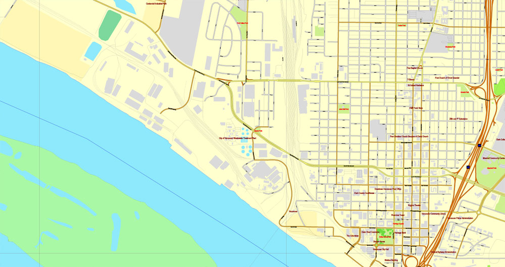
Vancouver, Washington, USA.
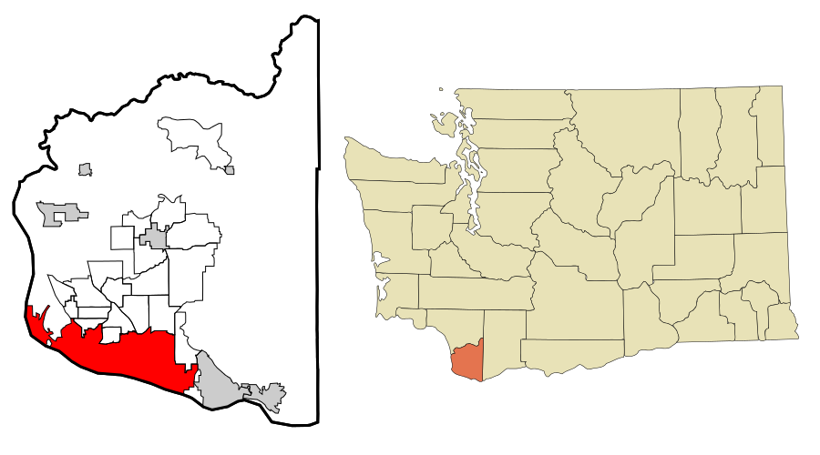
Vancouver is a city on the north bank of the Columbia River in the U.S. state of Washington, and the largest suburb of Portland, Oregon. Incorporated in 1857, it is the fourth largest city in the state, with a population of 161,791 as of April 1, 2010 census. Vancouver is the county seat of Clark County and forms part of the Portland-Vancouver metropolitan area, the 23rd largest metropolitan area in the United States. Originally established in 1825 around Fort Vancouver, a fur-trading outpost, the city is located on the Washington/Oregon border along the Columbia River, directly north of Portland. In 2005, Money magazine named it No. 91 on its list of best places in America to live. In 2016, WalletHub ranks Vancouver the 39th best place in the US for families to live.
Geography and climate
Vancouver is located just north of the Columbia River, just west of where the Columbia River Gorge bisects the volcanic Cascade Range and just east of where the Willamette River enters the Columbia. The city of Vancouver is in the Western Lowlands region of Washington. When clouds do not blanket the Puget-Willamette trough formed by the Cascade and Coast Range, Mount Hood, Mount Saint Helens, Mount Jefferson and Mount Adams are all visible from Vancouver.
According to the United States Census Bureau, the city has a total area of 49.86 square miles (129.14 km2), of which, 46.46 square miles (120.33 km2) is land and 3.40 square miles (8.81 km2) is water.
Vancouver lies just north of Portland, Oregon and shares a similar climate. Both are classified as dry-summer subtropical (Csb) on the Köppen climate classification, with certain key exceptions. High pressures east of the Cascade Range create something of a venturi effect, leading to cold east winds down the Columbia River Gorge. Unsheltered by the Willamette Valley, Vancouver has historically seen colder temperatures, including “silver thaw” storms where freezing rain cakes limbs and power lines. Such storms can paralyze Vancouver. This occasionally freezes the river, and in 1916 cut electric power in the city for almost two weeks. Rainfall occurs frequently throughout the fall, winter, and spring, but ceases around the middle of June, with dry and warm weather lasting through September. Average annual precipitation is 42 inches (1,100 mm). Heavy snowfalls are infrequent and snow often falls and doesn’t stick, with major snowstorms only occurring every 2–4 years. Close proximity to the river was also a concern for flooding, before dams constricted the river, destroying features such as Celilo Falls. Periodic floods have been a nuisance, with two of the most destructive in June 1894 and May 1948. The 1948 Memorial Day flood almost topped the Interstate Bridge’s support piers and completely destroyed nearby Vanport, Oregon. Other unusual storms include the Columbus Day windstorm of 1962 and an April 5, 1972 tornado which rated F3 on the Fujita scale, striking a local school. A F1 tornado struck on January 10, 2008 just after noon causing moderate damage along a 2-mile (3.2 km) path from Vancouver Lake to the unincorporated Hazel Dell area.
Because many Vancouver residents work in Portland, there is typically significant rush hour traffic congestion on two bridges that cross the Columbia River — the Interstate Bridge and the Glenn Jackson Bridge. In 2006 there were 278,043 weekday vehicle crossings on the two bridges.
Portland
City in Oregon
Portland, Oregon’s largest city, sits on the Columbia and Willamette rivers, in the shadow of snow-capped Mount Hood. It’s known for its parks, bridges and bicycle paths, as well as for its eco-friendliness and its microbreweries and coffeehouses. Iconic Washington Park encompasses sites from the formal Japanese Garden to Oregon Zoo and its railway. The city hosts thriving art, theater and music scenes.
Named for: Portland
Population: 609,456 (2013)
Portland is the largest city in the U.S. state of Oregon and the seat of Multnomah County. It is located in the Willamette Valley region of the Pacific Northwest, at the confluence of the Willamette and Columbia Rivers. The city covers 145 square miles (376 km²) and had an estimated population of 632,309 in 2015, making it the 26th most populous city in the United States. Approximately 2,389,228 people live in the Portland metropolitan statistical area (MSA), the 23rd most populous MSA in the United States. Its Combined Statistical Area (CSA) ranks 17th with a population of 3,022,178. Roughly 60% of Oregon’s population resides within the Portland metropolitan area.
Free download this file >>> free_vector_map_portland_or_us
Named after the city on the coast of Maine (which was named after the English Isle of Portland), the Oregon settlement began to be populated in the 1830s near the end of the Oregon Trail. Its water access provided convenient transportation of goods, and the timber industry was a major force in the city’s early economy. At the turn of the 20th century, the city had developed a reputation as one of the most dangerous port cities in the world, a hub for organized crime and racketeering. After the city’s economy experienced an industrial boom during World War II, its hard-edged reputation began to dissipate. Beginning in the 1960s, Portland became noted for its growing liberal political values, and the city has earned a reputation as a bastion of counterculture, a view that proceeded into the 21st century. According to a 2009 Pew Research Center study, Portland ranks as the eighth most popular American city, based on where people want to live.
The city operates with a commission-based government guided by a mayor and four commissioners as well as Metro, the only directly elected metropolitan planning organization in the United States. The city government is notable for its land-use planning and investment in public transportation. Portland is frequently recognized as one of the most environmentally conscious cities in the world because of its high walkability, large community of bicyclists, farm-to-table dining, expansive network of public transportation options, and 10,000+ acres of public parks. Its climate is marked by warm, dry summers and chilly, rainy winters. This climate is ideal for growing roses, and Portland has been called the “City of Roses” for over a century. “Keep Portland Weird” is an unofficial slogan for the city.
Area
• City 145 sq mi (376 km2)
• Land 133 sq mi (346 km2)
• Water 12 sq mi (30 km2)
Elevation 50 ft (15.2 m)
Highest elevation 1,188 ft (362 m)
Lowest elevation 0.62 ft (0.19 m)
Population (2010)
• City 583,776
• Estimate (2015) 632,309
• Rank US: 26th
• Density 4,375.1/sq mi (1,689.2/km2)
• Urban 1,849,898 (US: 24th)
• Metro 2,389,228 (US: 23rd)
• CSA 3,110,906 (US: 18th)
Demonym(s) Portlander
Time zone PST (UTC-8)
• Summer (DST) PDT (UTC-7)
ZIP codes 97086-97299
Area code(s) 503 and 971
https://en.wikipedia.org/wiki/Portland,_Oregon
Vancouver
City in Washington
Vancouver is a city on the north bank of the Columbia River in the U.S. State of Washington. Incorporated in 1857, it is the fourth-largest city in the state, with a population of 161,791 as of April 1, 2010 census.
Elevation: 52 m
Population: 167,405 (2013)
Free download this file >>> free_vector_map_vancouver_wa_us
Vancouver is a city on the north bank of the Columbia River in the U.S. State of Washington. Incorporated in 1857, it is the fourth-largest city in the state, with a population of 161,791 as of April 1, 2010 census. Vancouver is the county seat of Clark County and forms part of the Portland-Vancouver metropolitan area, the 23rd-largest metropolitan area in the United States. Originally established in 1825 around Fort Vancouver, a fur trading outpost, the city is located on the Washington-Oregon border along the Columbia River, directly north of Portland. In 2005, Money magazine named it No. 91 on its list of best places in America to live. In 2015, WalletHub ranks Vancouver the 60th best place to live for families in US.
Area
• City 49.86 sq mi (129.14 km2)
• Land 46.46 sq mi (120.33 km2)
• Water 3.40 sq mi (8.81 km2)
Elevation 171 ft (52 m)
Population (2010)
• City 161,791
• Estimate (2015) 172,860
• Rank US: 144th
• Density 3,482.4/sq mi (1,344.6/km2)
• Metro 2,389,228 (US: 23rd)
Time zone Pacific (UTC−8)
• Summer (DST) PDT (UTC−7)
Area code(s) 360
https://en.wikipedia.org/wiki/Vancouver,_Washington
Free vector map World, Adobe Illustrator, download now maps vector clipart
Map for design, projects, presentation free to use as you like.
Free Download All World Vector Maps here >>>>>
See also: TERMS & CONDITIONS: SOFTWARE LICENSE AGREEMENT FOR DIGITAL CARTOGRAPHIC DATA

 Author: Kirill Shrayber, Ph.D. FRGS
