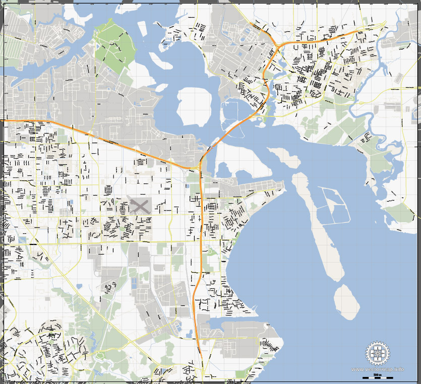
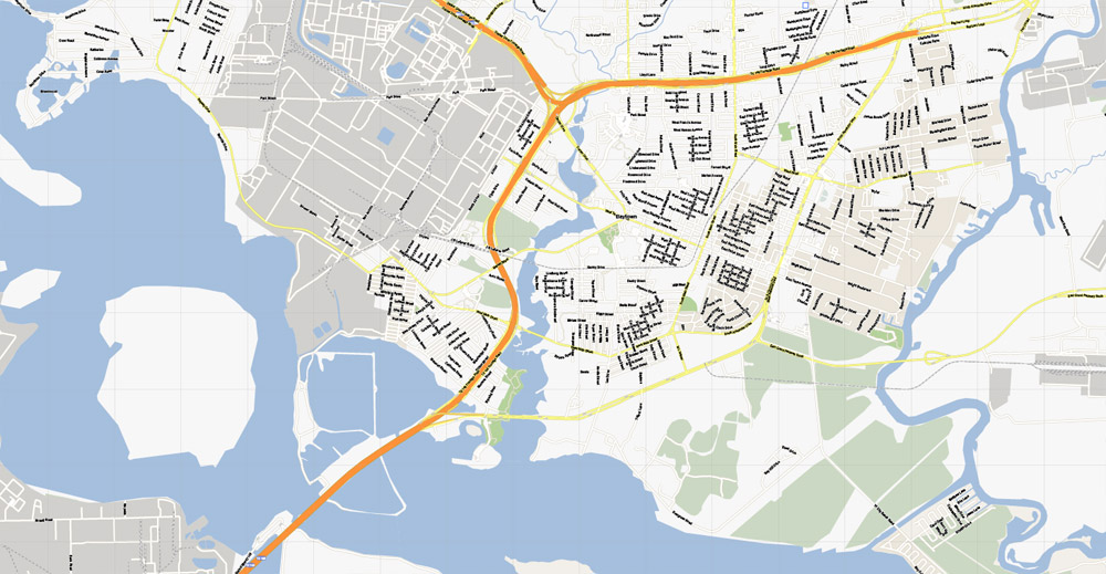
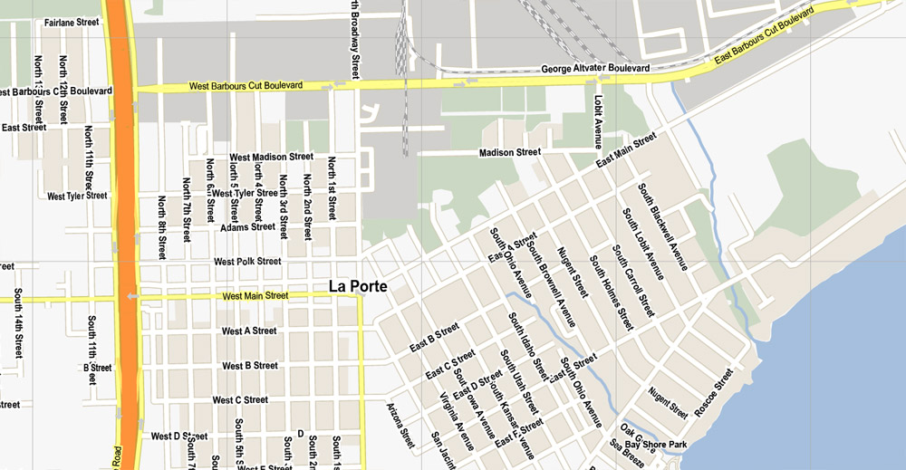
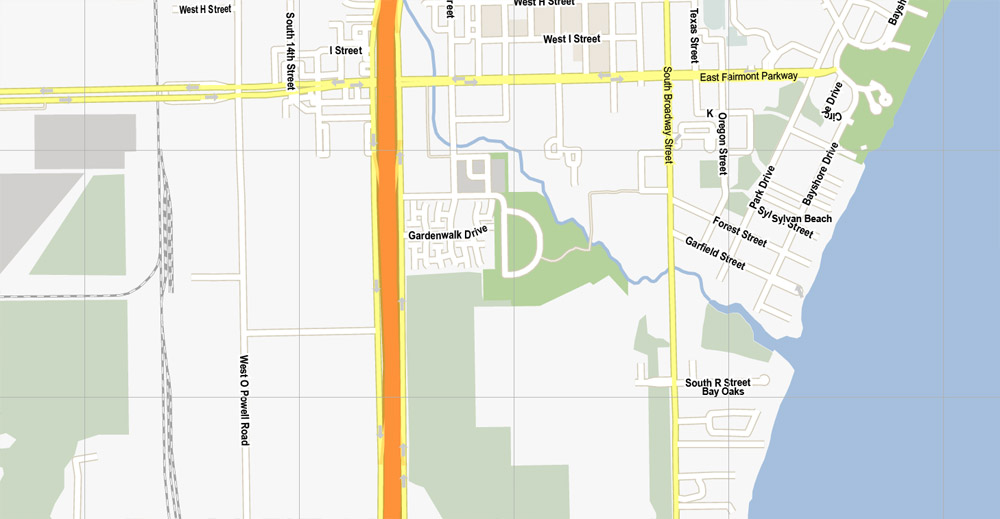
La Porte + Baytown, Texas, US, printable vector street G-View map level 15, full editable, Adobe Illustrator, full vector, scalable, editable, text format street names, 5 mb
ZIP
All streets, No buildings. 500 m scale, for small printing. Map for design, printing, arts, projects, presentations, for architects, designers and builders, business, logistics.
The most accurate and detailed map of the city.
DXF, DWG, CDR and other formats – on request, same price, please, contact
La Porte + Baytown, Texas.
This vector map of La Porte is used as a basis for design, editing, and further printing.
This is the most detailed, exact map of La Porte for high-quality printing and polygraphy. You can always clarify the map development date by contacting us.
For your convenience, all objects on La Porte vector map are divided into layers. And the editing is very easy – colors, lines, etc.
You can easily add any objects needed (e.g. shops, salons, sale points, gas station or attraction) on any layer of La Porte vector map.
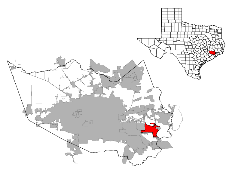
La Porte is a city in Harris County, Texas, United States, within the Bay Area of the Houston–Sugar Land–Baytown metropolitan area. As of the 2010 census, the city population was 33,800. La Porte is the fourth-largest incorporated city in Harris County.
One of the advantages of La Porte vector maps of our production is the relevance of cartographic data, we constantly update all our products.
This vector map of La Porte is used by:
designers, layout designers, printers, advertisers and architects. Our product – vector maps – is designed for further editing and printing in large formats – from @Wall format (a few meters) to A-0 and A-1, A-2, A-3.
La Porte map in vector format is used for design, urban planning, presentations and media visualizations.
Advertising and presentation map of La Porte (usually the final designer marks the routes, and puts the client’s objects (shops, saloons, gas stations etc.)
The undoubted advantage is that people will NEVER throw out this advertising product – the map. In fact, as an advertising medium, a map is the most “long-playing” of the well-known polygraphic advertising media, with the longest lifespan, and the maximum number of interactions with the customer.
For travelers, maps are sold at the airports and gas stations around the world. Often the source is our vector maps.
Take a look, who purchases our vector maps of La Porte in “Our Clients and Friends” page – these are large and small companies, from super-brands like Volvo and Starbucks, to small design studios and printing houses.
It’s very easy to work with vector maps of La Porte, even for a not very experienced designer who can turn on and off the map layers, add new objects, change the colors of fill and lines according to customer requirements.
The undoubted advantage of La Porte vector maps in printing is an excellent and detailed visualization, when customer can expand a large paper map and instantly define his location, find a landmark, an object or address on map, unlike using the popular electronic formats of Google and Yandex maps for example.
Printable vector maps of La Porte are much more convenient and efficient than any electronic maps on your smartphone, because ALL DETAILS are displayed in the entire space of La Porte map.
Useful tips on working with vector maps of cities and countries in Adobe Illustrator.
«V» – launches the Selection tool (cursor, black arrow), which makes active any vector line.
«А» – launches the Direct Selection tool (white cursor), allows you to select curve elements and drag them to the desired place.
«R» – activates the Rotate tool, which helps you rotating selected objects around the center point by 360 degrees.
«E» – gives you the opportunity to use the Eraser tool and erase unnecessary parts.
«X» – switches between Fill and Stroke in the Tools section. Try to get used to this hot key and
you will quickly understand that you can’t live and work without it.
Guides are not limited to vertical and horizontal in Adobe Illustrator. You can also create a diagonal guide for example. Moreover, you can turn any contours into guides. Select the outline and go to View > Guides > Make Guides (Create Guides), or simply press Cmd/Ctrl + 5. You can also turn the guides back into an editable object. Go to menu, View > Guides > Unlock Guides (Release Guides), select the guide you want to edit and select View > Guides > Release Guides (Reset Guides), or just press Cmd/Ctrl + Option / Alt + 5).
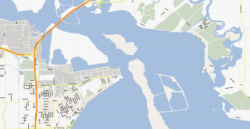
When La Porte celebrated its centennial in 1992, it was the home of Barbours Cut Terminal, operated by the Port of Houston Authority since 1977. Fifteen years later, the Port of Houston’s newest addition, Bayport Terminal, was established just south of La Porte. The area around La Porte has served an increasingly important role in international trade since the 1970s.
You will probably want to change the color scheme used on our La Porte vector map.
To quickly and effectively play with colors.
Of course, you can do it manually, all objects in our La Porte vector map are divided according to types and layers, and you can easily change the color gamma of vector objects in groups and layers.
But there is more effective way of working with the whole VECTOR MAP of La Porte and all layers:
The overview dialog «Edit colors»/«Repaint Graphic Object» (this dialog box name can change depending on the context):
If you have selected a part or a layer of La Porte vector map and open the dialog box by clicking the icon in the Control panel, on the Samples palette or the Color Catalog, or if you choose Edit > Edit Colors> Repaint Graphic Object, then the «Repaint Graphic Object» dialog box appears, and you get access to «Assign» and «Edit» tabs.
If a picture or a map fragment is not selected, and you open the dialog box by clicking the icon in the Control panel, on the Samples palette or in the Color Catalog, the «Edit Colors» dialog box appears and you can only access the «Edit» tab.
Regardless of the name at the top of the dialog box, the right-hand side always displays the color group of the current document, as well as two default color groups: Print Color and Grayscale. These color groups can be selected and used any time.
Create and edit color groups of La Porte vector map, and also assign colors using the «Edit Colors»/ а «Repaint Graphic Object» dialog box.
A. Creating and editing of a color group on the «Edit» tab
B. Assigning colors on the «Assign» tab
C. Select a group of colors from the «Color groups» list
The option «Repaint a graphic object» in the lower part of the dialog box allows you to preview the colors on a selected layer of Vector map, or a group of elements, and specify whether its colors will be redefined when the dialog box is closed.
The main areas of the dialog box are:
«Edit»
The «Edit» tab is designed to create a new or edit the existing color groups.
The harmony rules Menu and the Color Wheel are used to conduct experiments with color harmonies. The color wheel shows how colors are related in color harmony, and the color bars allow you to view and manipulate an individual color values. In addition, you can adjust the brightness, add and remove colors, save color groups and view colors on the selected Vector Map of La Porte or a separated layers.
«Assign»
The «Assign» tab is used to view and control on how the original colors are replaced with colors from the color group like your corporate colors in the Vector Map of La Porte.
The assign color ability is provided only if the entire map, layer or fragment is selected in the document. You can specify which of new colors replace the current colors, whether the spot colors should be preserved and how colors are replaced (for example, you can replace colors completely or changing the color tone while maintaining the brightness). The «Assign» tab allows you to redefine colors in the Vector Map of La Porte, or in separate layers and fragments using the current color group or reducing the number of colors in the current Vector Map.
Color groups
Is a list of all saved color groups for current document (the same groups appear in the «Samples» palette). You can edit and delete the existing color groups, as well as creating a new ones using the list of “Color Groups” in the dialog box. All changes appear in the «Samples» palette.
The highlighted color group shows, which color group is currently edited.
The area around modern La Porte gained fame early in Texas history as the location of the Battle of San Jacinto on April 21, 1836, which ended the Texas Revolution, establishing the independence of the Republic of Texas from Mexico. The San Jacinto Monument, in the unincorporated area of La Porte, commemorates the battle. During the early 20th century, particularly the 1920s and 1930s, La Porte’s Sylvan Beach became a nationally known tourist destination attracting some of the nation’s most well-known entertainers. As a result of changing economics in the Houston area and beach erosion, the tourist business declined while industrial development in the area grew. During World War II and afterward, La Porte’s economy rapidly shifted toward petroleum/petrochemicals and shipping, which developed as the dominant industries in the Pasadena-Baytown area.
Any color group can be selected and edited, or used to redefine the colors in the selected vector map of La Porte, its fragments or elements.
Saving a color group adds this group to the specified list.
Opening the «Edit Colors»/«Repaint Graphic Object» dialog box.
Open the «Edit Colors»/«Repaint Graphic Object» dialog box using one of the following methods:
«Edit»> «Edit Colors»> «Repaint Graphic object» or «Repaint With Style».
Use these commands if you need to edit the colors in the selected vector map of La Porte.
«Repaint Graphic object» button on the «Control» panel.
Use this button if you need to adjust colors of La Porte vector map using the а «Repaint graphic object» dialog box.
The specified button is available if the selected vector map or its fragment contains two or more colors.
Note. This color editing method is convenient for global color adjustment in a vector map, if global colors were not used when creating a Map of La Porte.
The «Edit colors» button or «Edit or apply colors» on the «Color Catalog» palette
Click this button if you need to edit colors on the «Color Catalog» palette or edit and then apply them to the selected Vector Map of La Porte or its fragment.
The «Edit color group» button or «Edit or apply color group» on the «Samples» palette.
Click this button if you need to edit the colors in the specific color group or edit and apply them to the selected Vector Map of La Porte or a group of its elements, for example, the whole layer “Streets and lines”. You can also double-click the color group in the Samples panel to open the dialog box.
If the map file is too large and your computer freezes or even can’t open it quickly:
1. Try to reduce the color resolution of the video card (display) to 256 colors while working with a large map.
2. Using Windows Task Manager, select all the application you don’t need, while working with map, just turn them off.
3. Launch Adobe Illustrator. (DO NOT OPEN the vector map file)
4. Start the Windows Task Manager using administrator rights > Find the “Illustrator” process > set the «real time» priority,
5. Open the file. When you see the LEGACY FONT popup window – click “OK” (do not update). You can restore the TEXT later.
6. Can also be useful: When file is opened – Edit > Settings > Basic Settings > disable smoothing. /// It looks scary, but works quickly)))
We recommend saving the file in Adobe Illustrator 10 version. It’s much more stable when working with VERY BIG size files.
Geography
According to the United States Census Bureau, the city has a total area of 20.0 square miles (51.8 km2), of which 18.6 square miles (48.3 km2) is land and 1.4 square miles (3.6 km2), or 6.91%, is water.
Baytown is a city within Harris County and partially in Chambers County in the Gulf Coast region of the U.S. state of Texas. Located within the Houston–The Woodlands–Sugar Land metropolitan area, it lies on the northern side of the Galveston Bay complex near the outlets of the San Jacinto River and Buffalo Bayou. It is the sixth-largest city within this metropolitan area. Major highways serving the city include State Highway 146 and Interstate 10. As of 2010, Baytown had a population of 71,802, and it had an estimated population of 75,992 in 2016. As of 2018 Baytown had an estimated population of 85,000 people.
Baytown is located at the mouth of the San Jacinto River on Galveston Bay, 26 miles (42 km) by road east of Houston.
According to the United States Census Bureau, the city has a total area of 36.5 square miles (94.6 km2), of which 35.4 square miles (91.8 km2) is land and 1.1 square miles (2.8 km2), 2.92%, is covered by water.
Baytown is located on the Gulf coastal plain, and its vegetation is classified as temperate grassland and marshes. The municipalities have been built on reclaimed marshes, swamps, and prairies, which are all still visible in undeveloped parts of the Bay Area. Baytown is bordered by water on three sides. Along the south and west is Galveston Bay. On the east is Cedar Bayou. The city is roughly bordered along the north by Interstate 10. Portions of the city to the east of Cedar Bayou lie in Chambers County.
Flatness of the local terrain and proximity to the bay have made flooding a recurring problem for the area. Baytown and surrounding communities once relied on groundwater for its needs, but severe land subsidence has forced much the city to turn to ground-level water sources.
La Porte, Texas, US
La Porte is a city in Harris County, Texas, United States, within the Bay Area of the Houston–Sugar Land–Baytown metropolitan area. As of the 2010 census, the city population was 33,800. La Porte is the fourth-largest incorporated city in Harris County.
When La Porte celebrated its centennial in 1992, it was the home of Barbours Cut Terminal, operated by the Port of Houston Authority since 1977. Fifteen years later,
the Port of Houston’s newest addition, Bayport Terminal, was established just south of La Porte. The area around La Porte has served an increasingly important role in
international trade since the 1970s.
The area around modern La Porte gained fame early in Texas history as the location of the Battle of San Jacinto on April 21, 1836, which ended the Texas Revolution,
establishing the independence of the Republic of Texas from Mexico. The San Jacinto Monument, in the unincorporated area of La Porte, commemorates the battle. During
the early 20th century, particularly the 1920s and 1930s, La Porte’s Sylvan Beach became a nationally known tourist destination attracting some of the nation’s most
well-known entertainers. As a result of changing economics in the Houston area and beach erosion, the tourist business declined while industrial development in the area
grew. During World War II and afterward, La Porte’s economy rapidly shifted toward petroleum/petrochemicals and shipping, which developed as the dominant industries in
the Pasadena-Baytown area.
Area
• Total 20.0 sq mi (51.8 km2)
• Land 18.6 sq mi (48.3 km2)
• Water 1.4 sq mi (3.6 km2)
Elevation 20 ft (6 m)
Population (2010)
• Total 33,800
• Density 1,700/sq mi (650/km2)
Time zone Central (CST) (UTC-6)
• Summer (DST) CDT (UTC-5)
ZIP codes 77571-77572
Area code(s) 281
Free download this map in the vector >>>>>
Harris_County_LaPorte.ai
Geography
According to the United States Census Bureau, the city has a total area of 20.0 square miles (51.8 km2), of which 18.6 square miles (48.3 km2) is land and 1.4 square
miles (3.6 km2), or 6.91%, is water.
La Porte has many small 1940s frame houses.
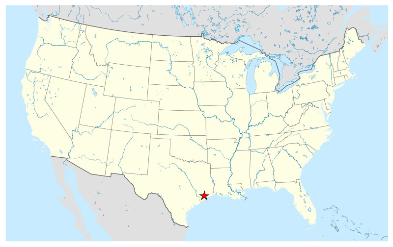
Free vector map US Location La Porte >>>>>
La_Porte_Free_Vector_Map_Usa_location_map.ai
Transportation
Harris County Transit provides public transportation in La Porte.
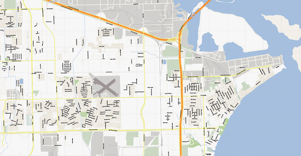
La Porte Municipal Airport is located in the La Porte city limits.
The closest major airports with commercial airline service are William P. Hobby Airport and George Bush Intercontinental Airport in Houston.
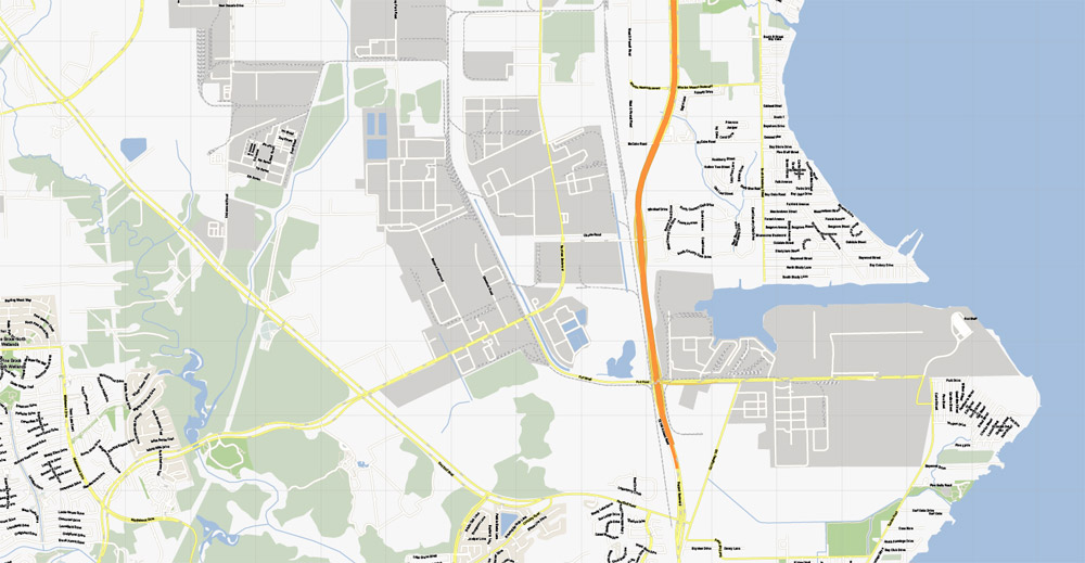
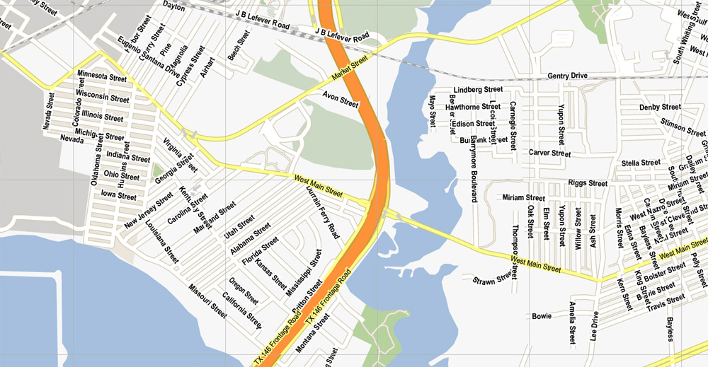
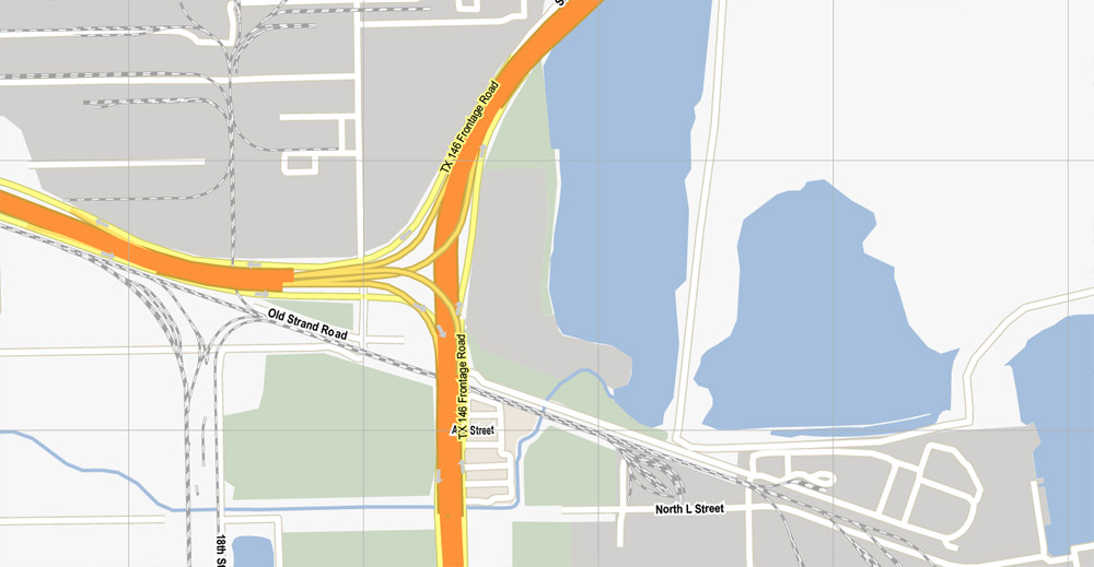
La Porte is linked to Interstate 10 (see map) by State Highway 146, crossing the Fred Hartman Bridge into the nearby city of Baytown; the bridge was built in 1995,
replacing the Baytown Tunnel, to allow deepening of the Houston Ship Channel.
La Porte is located on the northwest end of Galveston Bay at the mouth of Buffalo Bayou and the San Jacinto River.
https://en.wikipedia.org/wiki/La_Porte,_Texas
Free vector map World, Adobe Illustrator, download now maps vector clipart
Map for design, projects, presentation free to use as you like.
See also: TERMS & CONDITIONS: SOFTWARE LICENSE AGREEMENT FOR DIGITAL CARTOGRAPHIC DATA

 Author: Kirill Shrayber, Ph.D. FRGS

