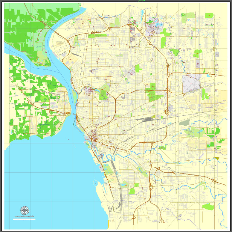
Buffalo, New York, US, printable vector street City Plan map full editable, Adobe Illustrator, full vector, scalable, editable, text format street names, 6 mb ZIP
All streets, some buildings. Map for design, printing, arts, projects, presentations, for architects, designers and builders, business, logistics.
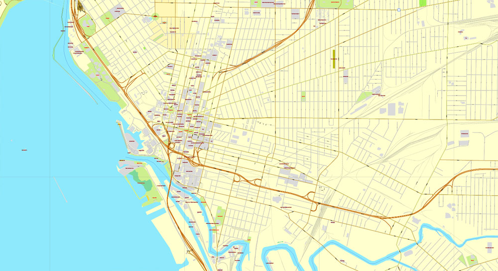
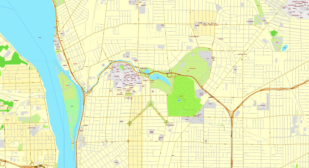
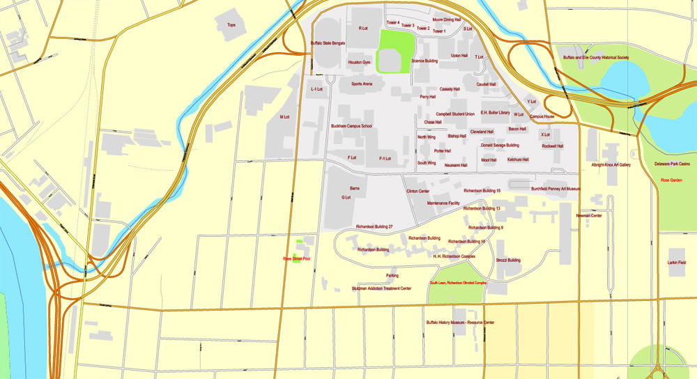
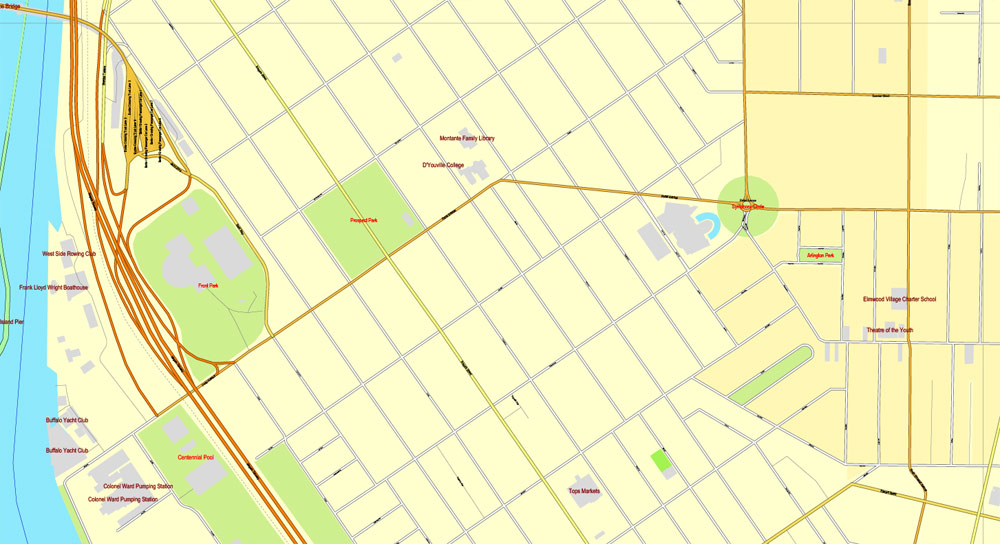
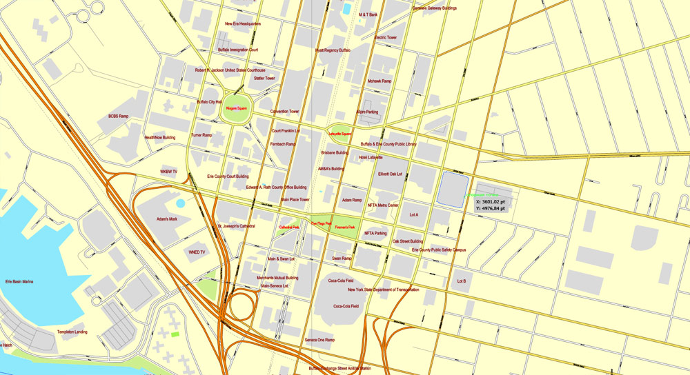
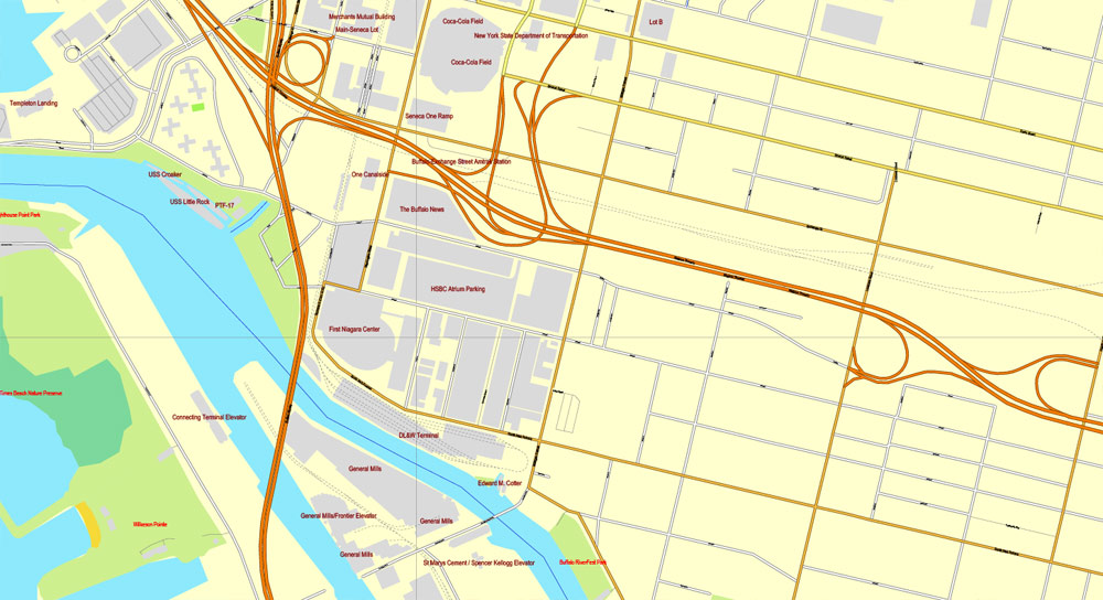
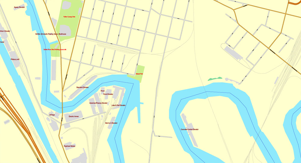
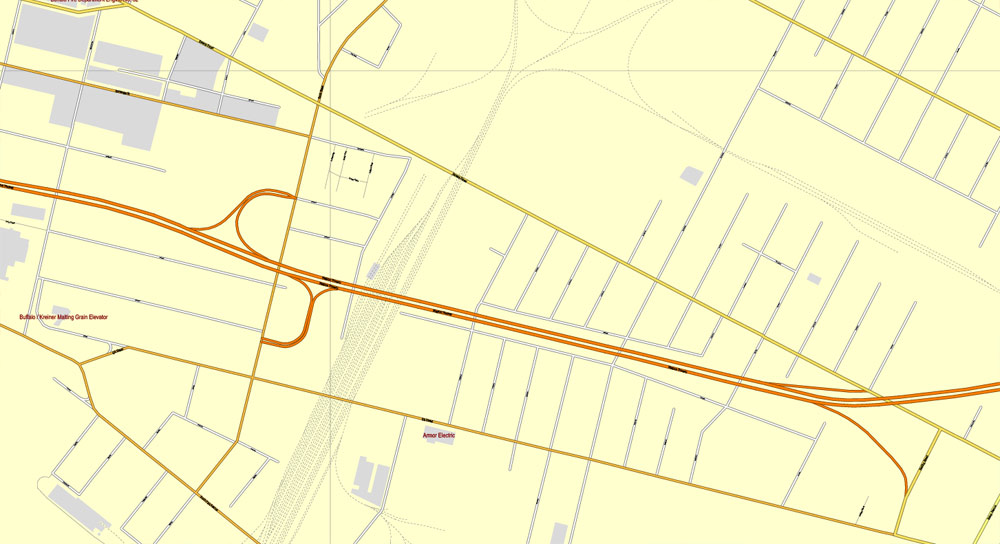
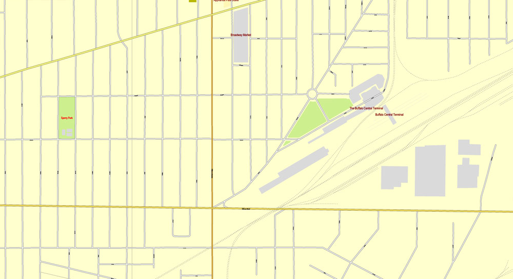
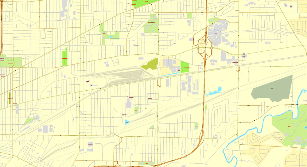
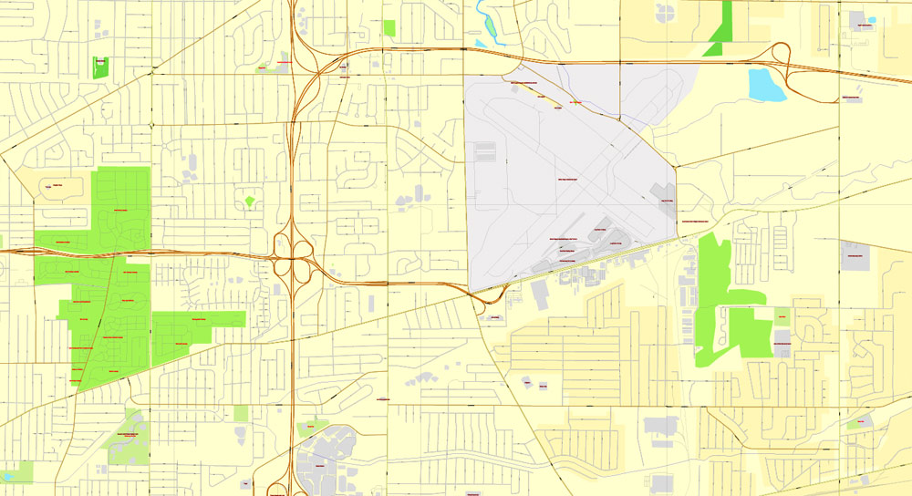
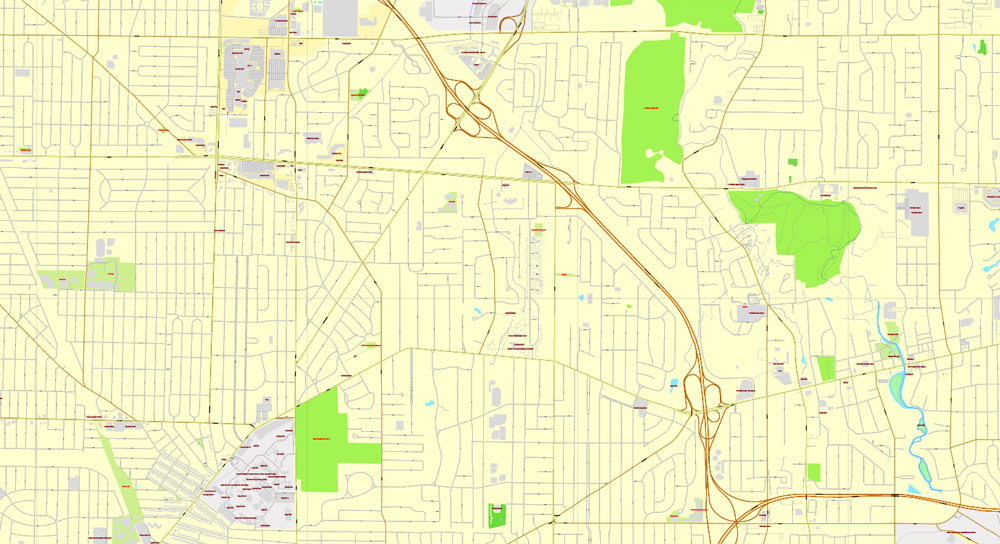
The most accurate and detailed map of the city.
Different font colors of the street names (black); object names by type (brown, red).
DXF, DWG, CDR and other formats – on request, same price, please, contact
Buffalo, New York, USA.
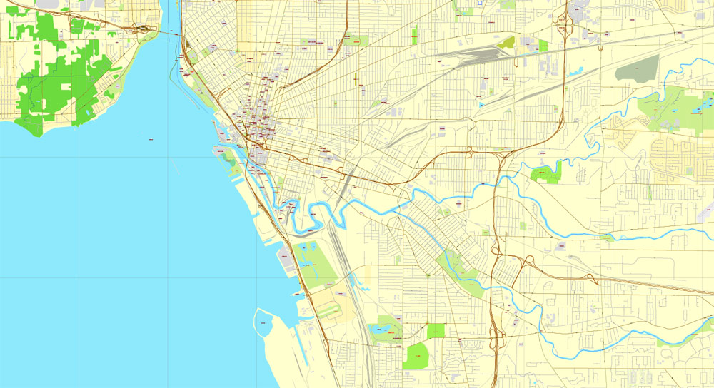
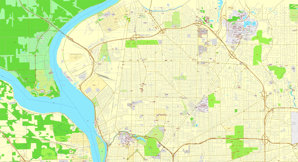
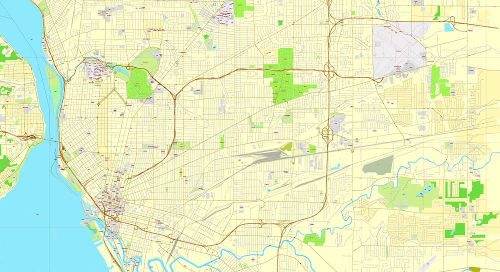
This vector map of Buffalo city is used as a basis for design, editing, and further printing.
This is the most detailed, exact map of Buffalo city for high-quality printing and polygraphy. You can always clarify the map development date by contacting us.
For your convenience, all objects on Buffalo vector city map are divided into layers. And the editing is very easy – colors, lines, etc.
You can easily add any objects needed (e.g. shops, salons, sale points, gas station or attraction) on any layer of Buffalo vector map.
Buffalo is the second largest city in the U.S. state of New York and the largest city in Western New York. As of July 2016, the population was 256,902. The city is the county seat of Erie County, and a major gateway for commerce and travel across the Canada–United States border, forming part of the bi-national Buffalo Niagara Region.
One of the advantages of Buffalo city vector maps of our production is the relevance of cartographic data, we constantly update all our products.
This vector map of Buffalo city is used by:
designers, layout designers, printers, advertisers and architects. Our product – vector maps – is designed for further editing and printing in large formats – from @Wall format (a few meters) to A-0 and A-1, A-2, A-3.
The Buffalo city map in vector format is used for design, urban planning, presentations and media visualizations.
The advertising and presentation map of Buffalo city (usually the final designer marks the routes, and puts the client’s objects (shops, saloons, gas stations etc.)
The undoubted advantage is that people will NEVER throw out this advertising product – the map. In fact, as an advertising medium, a city map is the most “long-playing” of the well-known polygraphic advertising media, with the longest lifespan, and the maximum number of interactions with the customer.
For travelers, maps are sold at the airports and gas stations around the world. Often the source is our vector maps.
The Buffalo area was inhabited before the 17th century by the Native American Iroquois tribe and later by French settlers. The city grew significantly in the 19th and 20th centuries as a result of immigration, the construction of the Erie Canal and rail transportation, and its close proximity to Lake Erie. This growth provided an abundance of fresh water and an ample trade route to the Midwestern United States while grooming its economy for the grain, steel and automobile industries that dominated the city’s economy in the 20th century. Since the city’s economy relied heavily on manufacturing, deindustrialization in the latter half of the 20th century led to a steady decline in population. While some manufacturing activity remains, Buffalo’s economy has transitioned to service industries with a greater emphasis on healthcare, research and higher education, which emerged following the Great Recession.
Take a look, who purchases our vector maps of Buffalo city in “Our Clients and Friends” page – these are large and small companies, from super-brands like Volvo and Starbucks, to small design studios and printing houses.
It’s very easy to work with vector maps of Buffalo city, even for a not very experienced designer who can turn on and off the map layers, add new objects, change the colors of fill and lines according to customer requirements.
The undoubted advantage of Buffalo city vector maps in printing is an excellent and detailed visualization, when customer can expand a large paper map and instantly define his location, find a landmark, an object or address on map, unlike using the popular electronic formats of Google and Yandex maps for example.
Printable vector maps of Buffalo city are much more convenient and efficient than any electronic maps on your smartphone, because ALL DETAILS are displayed in the entire space of Buffalo city map.
Useful tips on working with vector maps of cities and countries in Adobe Illustrator.
«V» – launches the Selection tool (cursor, black arrow), which makes active any vector line.
«А» – launches the Direct Selection tool (white cursor), allows you to select curve elements and drag them to the desired place.
«R» – activates the Rotate tool, which helps you rotating selected objects around the center point by 360 degrees.
«E» – gives you the opportunity to use the Eraser tool and erase unnecessary parts.
«X» – switches between Fill and Stroke in the Tools section. Try to get used to this hot key and
you will quickly understand that you can’t live and work without it.
Guides are not limited to vertical and horizontal in Adobe Illustrator. You can also create a diagonal guide for example. Moreover, you can turn any contours into guides. Select the outline and go to View > Guides > Make Guides (Create Guides), or simply press Cmd/Ctrl + 5. You can also turn the guides back into an editable object. Go to menu, View > Guides > Unlock Guides (Release Guides), select the guide you want to edit and select View > Guides > Release Guides (Reset Guides), or just press Cmd/Ctrl + Option / Alt + 5).
You will probably want to change the color scheme used on our Buffalo vector city map.
To quickly and effectively play with colors.
Of course, you can do it manually, all objects in our Buffalo city vector map are divided according to types and layers, and you can easily change the color gamma of vector objects in groups and layers.
But there is more effective way of working with the whole VECTOR MAP of Buffalo city and all layers:
The overview dialog «Edit colors»/«Repaint Graphic Object» (this dialog box name can change depending on the context):
If you have selected a part or a layer of Buffalo city vector map and open the dialog box by clicking the icon in the Control panel, on the Samples palette or the Color Catalog, or if you choose Edit > Edit Colors> Repaint Graphic Object, then the «Repaint Graphic Object» dialog box appears, and you get access to «Assign» and «Edit» tabs.
If a picture or a map fragment is not selected, and you open the dialog box by clicking the icon in the Control panel, on the Samples palette or in the Color Catalog, the «Edit Colors» dialog box appears and you can only access the «Edit» tab.
Buffalo is on the eastern shore of Lake Erie, at the head of the Niagara River, 16 miles south of Niagara Falls. Its early embrace of electric power led to the nickname “The City of Light”. The city is also famous for its urban planning and layout by Joseph Ellicott, an extensive system of parks designed by Frederick Law Olmsted, as well as significant architectural works. Its culture blends Northeastern and Midwestern traditions, with annual festivals including Taste of Buffalo and Allentown Art Festival, two professional sports teams (Buffalo Bills and Buffalo Sabres), and a music and arts scene.
Regardless of the name at the top of the dialog box, the right-hand side always displays the color group of the current document, as well as two default color groups: Print Color and Grayscale. These color groups can be selected and used any time.
Create and edit color groups of Buffalo city vector map, and also assign colors using the «Edit Colors»/ а «Repaint Graphic Object» dialog box.
A. Creating and editing of a color group on the «Edit» tab
B. Assigning colors on the «Assign» tab
C. Select a group of colors from the «Color groups» list
The option «Repaint a graphic object» in the lower part of the dialog box allows you to preview the colors on a selected layer of Vector map, or a group of elements, and specify whether its colors will be redefined when the dialog box is closed.
The main areas of the dialog box are:
«Edit»
The «Edit» tab is designed to create a new or edit the existing color groups.
The harmony rules Menu and the Color Wheel are used to conduct experiments with color harmonies. The color wheel shows how colors are related in color harmony, and the color bars allow you to view and manipulate an individual color values. In addition, you can adjust the brightness, add and remove colors, save color groups and view colors on the selected Vector Map of Buffalo city or a separated layers.
«Assign»
The «Assign» tab is used to view and control on how the original colors are replaced with colors from the color group like your corporate colors in the Vector Map of Buffalo city.
Geography
Buffalo is on Lake Erie’s eastern end, opposite Fort Erie, Ontario, Canada. It is located at the origin of the Niagara River, which flows northward over Niagara Falls and into Lake Ontario. The city is 50 miles (80 km) south-southeast from Toronto. Relative to downtown, the city is generally flat with the exception of area surrounding North and High streets, where a hill of 90 feet gradually develops approaching from the south and north. In the Southtowns are the Boston Hills, while the Appalachian Mountains sit in the Southern Tier below them. To the north and east, the region maintains a flatter profile descending to Lake Ontario. Various types of shale, limestone and lagerstätten are prevalent in the geographic makeup of Buffalo and surrounding areas, which line the waterbeds within and bordering the city.
The assign color ability is provided only if the entire map, layer or fragment is selected in the document. You can specify which of new colors replace the current colors, whether the spot colors should be preserved and how colors are replaced (for example, you can replace colors completely or changing the color tone while maintaining the brightness). The «Assign» tab allows you to redefine colors in the Vector Map of Buffalo city, or in separate layers and fragments using the current color group or reducing the number of colors in the current Vector Map.
Color groups
Is a list of all saved color groups for current document (the same groups appear in the «Samples» palette). You can edit and delete the existing color groups, as well as creating a new ones using the list of “Color Groups” in the dialog box. All changes appear in the «Samples» palette.
The highlighted color group shows, which color group is currently edited.
Any color group can be selected and edited, or used to redefine the colors in the selected vector map of Buffalo city, its fragments or elements.
Saving a color group adds this group to the specified list.
Opening the «Edit Colors»/«Repaint Graphic Object» dialog box.
Open the «Edit Colors»/«Repaint Graphic Object» dialog box using one of the following methods:
«Edit»> «Edit Colors»> «Repaint Graphic object» or «Repaint With Style».
Use these commands if you need to edit the colors in the selected vector map of Buffalo city.
«Repaint Graphic object» button on the «Control» panel.
Use this button if you need to adjust colors of Buffalo city vector map using the а «Repaint graphic object» dialog box.
The specified button is available if the selected vector map or its fragment contains two or more colors.
Note. This color editing method is convenient for global color adjustment in a vector map, if global colors were not used when creating a City Map of Buffalo.
The «Edit colors» button or «Edit or apply colors» on the «Color Catalog» palette
Click this button if you need to edit colors on the «Color Catalog» palette or edit and then apply them to the selected Vector Map of Buffalo city or its fragment.
The «Edit color group» button or «Edit or apply color group» on the «Samples» palette.
Click this button if you need to edit the colors in the specific color group or edit and apply them to the selected Vector Map of Buffalo city or a group of its elements, for example, the whole layer “Streets and lines”. You can also double-click the color group in the Samples panel to open the dialog box.
If the map file is too large and your computer freezes or even can’t open it quickly:
1. Try to reduce the color resolution of the video card (display) to 256 colors while working with a large map.
2. Using Windows Task Manager, select all the application you don’t need, while working with map, just turn them off.
3. Launch Adobe Illustrator. (DO NOT OPEN the vector map file)
4. Start the Windows Task Manager using administrator rights > Find the “Illustrator” process > set the «real time» priority,
5. Open the file. When you see the LEGACY FONT popup window – click “OK” (do not update). You can restore the TEXT later.
6. Can also be useful: When file is opened – Edit > Settings > Basic Settings > disable smoothing. /// It looks scary, but works quickly)))
We recommend saving the file in Adobe Illustrator 10 version. It’s much more stable when working with VERY BIG size files.
Although there have not been any recent or significant earthquakes, Buffalo sits atop of the Southern Great Lakes Seismic Zone, which is part of the Great Lakes tectonic zone.
Buffalo has four channels that flow through its boundaries: the Niagara River, Buffalo River and Creek, Scajaquada Creek, and the Black Rock Canal, which is adjacent to the Niagara River.
According to the United States Census Bureau, the city has an area of 52.5 square miles (136 km2), of which 40.6 square miles (105 km2) is land and the rest water. The total area is 22.66% water.
Buffalo is a city in Western New York and the seat of Erie County, on the eastern shores of Lake Erie at the head of the Niagara River. As of 2014, Buffalo is the state’s second most populous city after New York City with 258,703 residents, and with a population of 1.13 million, the metropolitan area is the 50th largest in the United States.
Buffalo grew significantly in the 19th and 20th centuries as a result of the Erie Canal, railroads and Lake Erie, providing an abundance of fresh water and an ample trade route to the Midwestern United States, while grooming its economy for the grain, steel and automobile industries during the 20th century. After an economic downturn in the latter half of the 20th century, Buffalo’s economy has transitioned to sectors that include financial services, technology, biomedical and education. 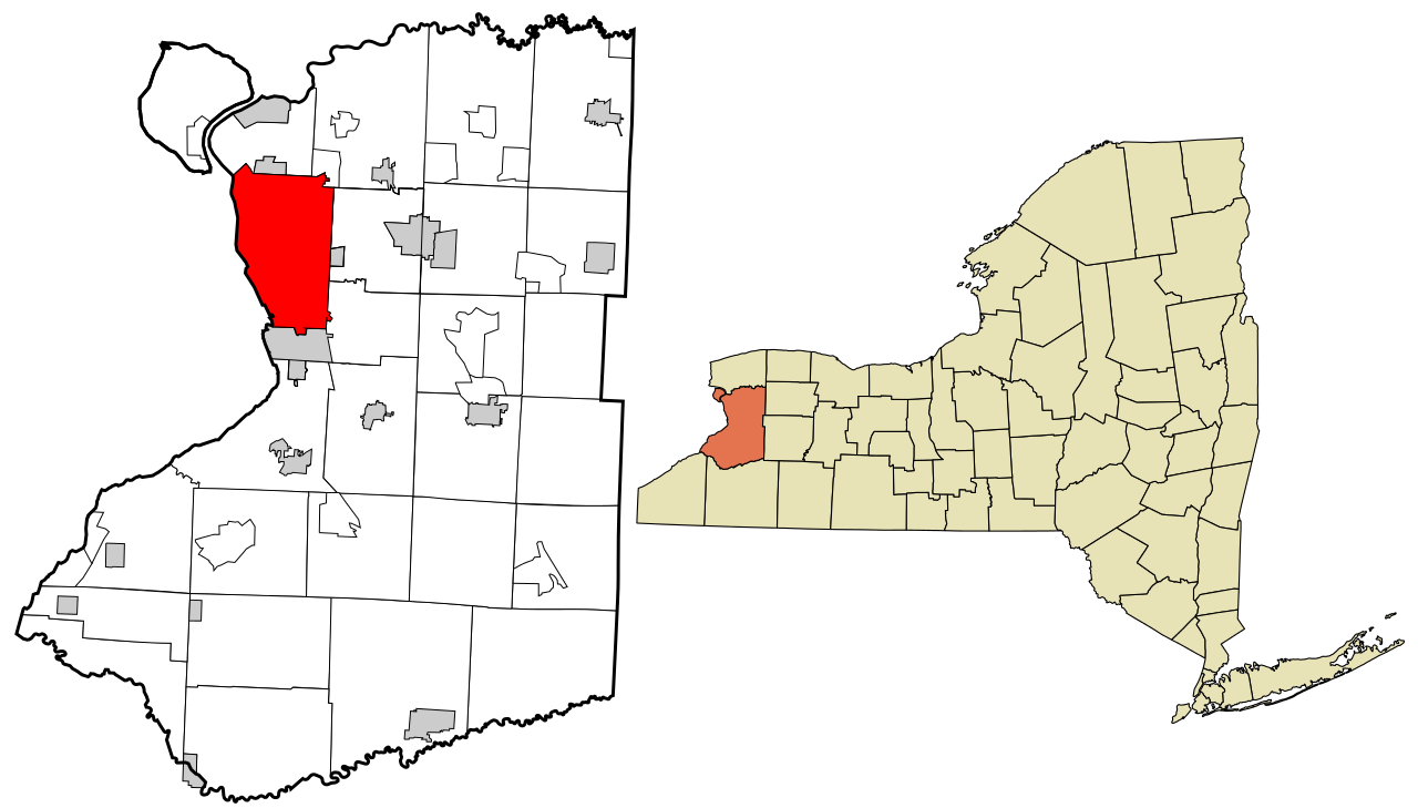
Download free this vector map >>>>>
Free_Vector_Map_Erie_County_New_York_Buffalo.ai
Residents of Buffalo are called “Buffalonians”. The city’s nicknames include “The Queen City”, “The Nickel City”, and “The City of Good Neighbors.”
Area
• City 52.5 sq mi (136.0 km2)
• Land 40.6 sq mi (105.2 km2)
• Water 11.9 sq mi (30.8 km2)
Elevation 600 ft (183 m)
Population (2013)
• City 258,959 (US: 73rd)
• Density 6,436.2/sq mi (2,568.8/km2)
• Urban 935,906 (US: 46th)
• Metro 1,134,210 (US: 49th)
• CSA 1,213,668 (US: 44th)
Demonym(s) Buffalonian
Time zone EST (UTC−5)
• Summer (DST) EDT (UTC−4)
ZIP code 142XX
Area code(s) 716
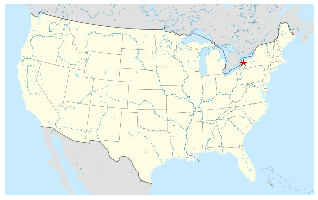
Download free Vector Map US, Buffalo Location >>>>>
Buffalo_Free_Vector_Map_Usa_location_map.ai
Geography
Buffalo is on Lake Erie’s eastern end, opposite Fort Erie, Ontario, and at the beginning of the Niagara River, which flows northward over Niagara Falls and into Lake Ontario. The city is 50 miles (80 km) south-southeast from Toronto. Buffalo’s position on Lake Erie, facing westward, makes it one of the few major cities on the East Coast to have sunsets over a body of water.
According to the United States Census Bureau, the city has a total area of 52.5 square miles (136 km2), of which 40.6 square miles (105 km2) is land and 11.9 square miles (31 km2) is water. The total area is 22.66% water.
https://en.wikipedia.org/wiki/Buffalo,_New_York
Free vector map World, Adobe Illustrator, download now maps vector clipart
Map for design, projects, presentation free to use as you like.
See also: TERMS & CONDITIONS: SOFTWARE LICENSE AGREEMENT FOR DIGITAL CARTOGRAPHIC DATA

 Author: Kirill Shrayber, Ph.D. FRGS


