The state of Tennessee is located in the Southern United States and belongs to the southeastern central states of the United States.
State Territory
Tennessee – 109,247 sq km (thirty-sixth place among the US states. Tennessee is bordered by the states of Kentucky and
Virginia to the north, North Carolina to the east, Georgia, Alabama, and Mississippi to the south, and Arkansas and Missouri to the west.
Tennessee is located in two time zones of the United States: eastern and central.
On the territory of the state, there are three physical and geographical regions: Eastern, Central and Western (these are symbolized by the three stars on the flag of Tennessee). Interestingly, unlike any other US state, the division into regions (along with the generally accepted division into districts) in Tennessee is confirmed by law and their borders are clearly defined. This is due to historically established quotas for the representation of regions in government (for example, out of five state Supreme Court justices from one region, there can be no more than two).
East Tennessee is part of the Appalachian Mountains. On the border with North Carolina, the Blue Ridge, covered with dense forests, stretches. It is here that Mount Klingman’s Dome (2,025 meters above sea level), the highest point of the state of Tennessee, is located, as well as the Appalachian Trail, which is very popular with American hikers (it begins in the south, in Georgia, and goes through the states of North Carolina, Tennessee, Virginia, West Virginia, Maryland, Pennsylvania, New Jersey, New York, Connecticut, Massachusetts, Vermont, New Hampshire, and Maine. It is also home to the Great Smoky Mountains National Park (one of the most popular tourist attractions in the United States) and the Cherokee National Forest.
West of the Blue Ridge Range is the Tennessee Valley (“Big Valley”), part of the Appalachian Ridge and Valley region (“Ridges and Valleys”). Numerous rivers and streams run down from the mountain slopes that divide the fertile valleys and form the sources of the largest Tennessee River in the state.
Further west, the Cumberland Plateau (part of the Appalachian Plateau) rises above the valleys. On this ravine-ridden plateau with a height of 450 to 600 meters, there are a lot of karst caves, the longest of which is Blue Spring (more than 38 km). Flowing southwest into Alabama, the Tennessee River has cut a gorge more than forty kilometers long into the Cumberland Plateau, one of the largest river canyons east of the Mississippi.
Central Tennessee is bounded on the east by the escarpment of the Cumberland Plateau, and on the west by the Tennessee River, which loops through Alabama and flows north into Kentucky. It is a rolling plain with fertile land, very similar to the Bluegrass region in the “Bluegrass State”.
West Tennessee – bounded by the Mississippi River to the west and the Tennessee River to the east, the lowlands are extremely fertile and perfectly suitable for agriculture. It is part of the” Mississippi Valley ” between the Appalachians and the Interior Highlands, filled over the millennia with alluvial (floodplain) sediments of North America’s greatest river.
Tennessee is characterized by a humid subtropical climate, and the mountainous areas in the east of the state are characterized by a humid continental climate. It has hot summers and warm winters, and precipitation falls fairly evenly throughout the year. The weather is strongly influenced by air masses coming from the Gulf of Mexico or the Great Plains and causing fluctuations in temperature and humidity. Here often (especially in spring) there are strong thunderstorms, accompanied by hail and heavy winds. On average, Tennessee is hit by tornadoes fifteen times a year.
Memphis, the state’s largest city in southwest Tennessee, has an average temperature of 0°C to 10°C in January, and 23°C to 33°C in July. In the state capital, Nashville, which is located in Central Tennessee, the temperature in the coldest month usually stays in the range of -2°C to 9°C, and in the hottest-from 21°C to 32°C. In western Tennessee, in the city of Knoxville, the temperature varies from -3°C to 9°C in winter, and from 20°C to 31°C in summer.
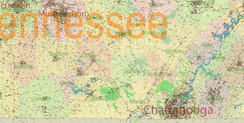
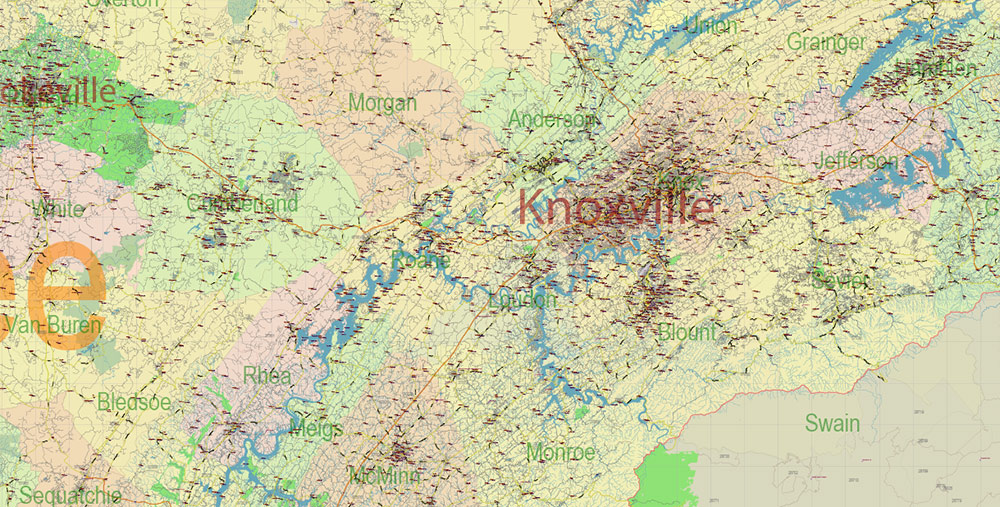
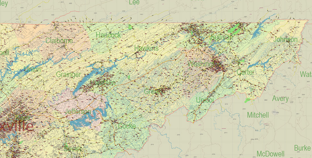
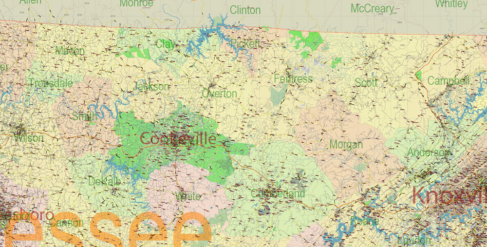
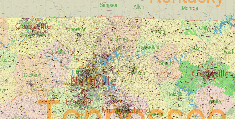
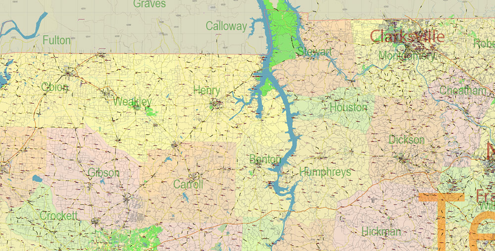
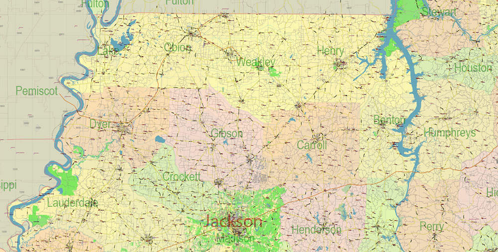
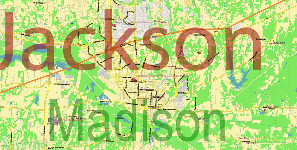
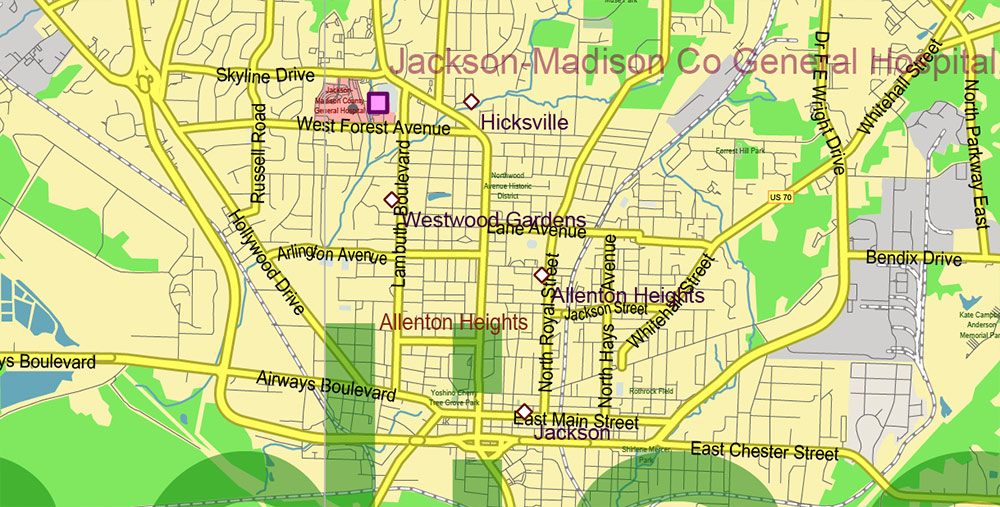
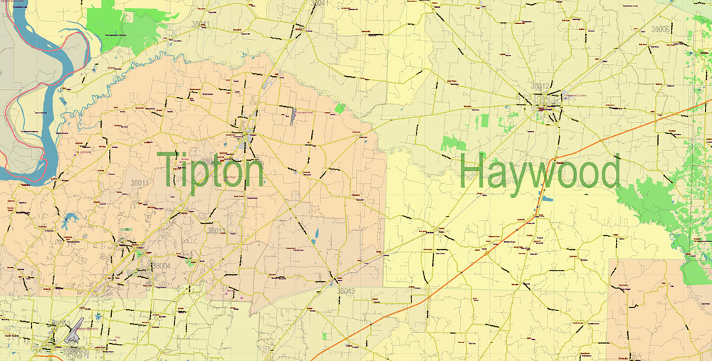
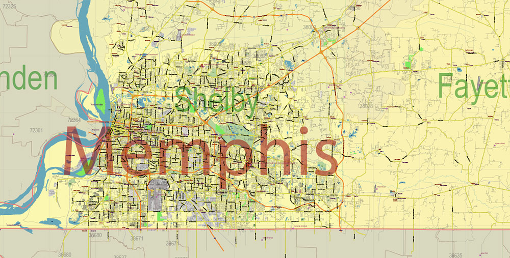
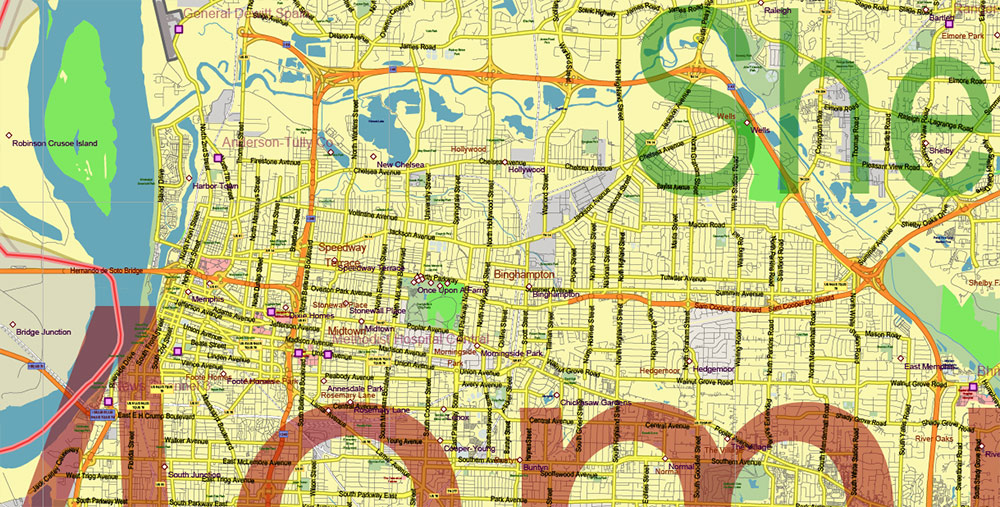
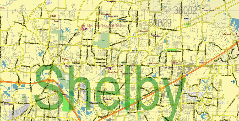
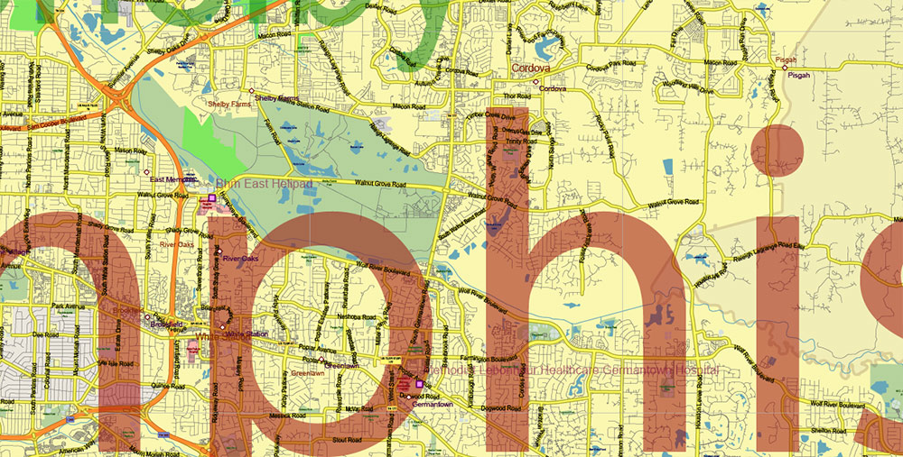
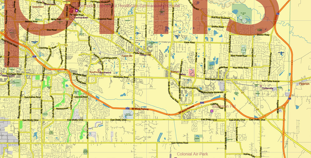
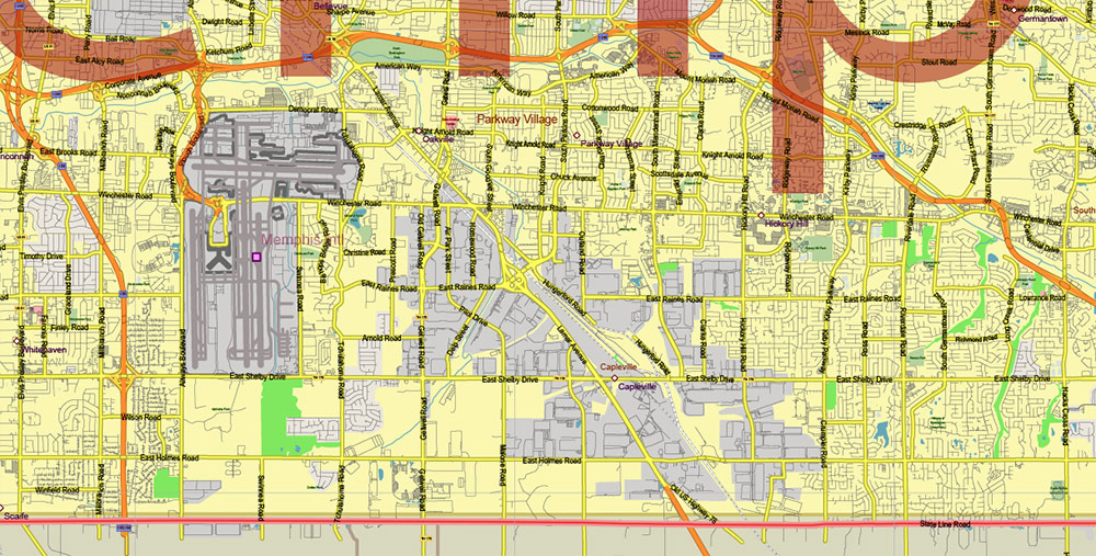
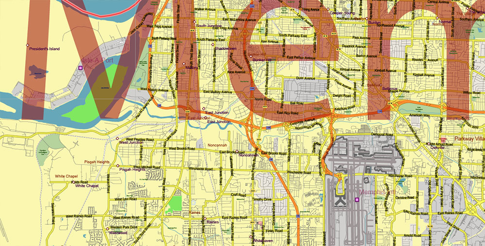
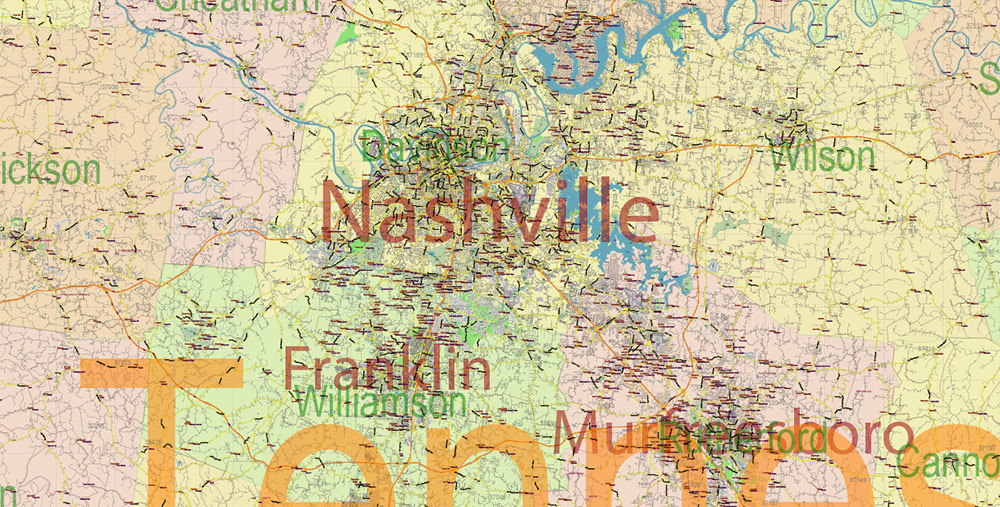
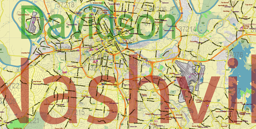
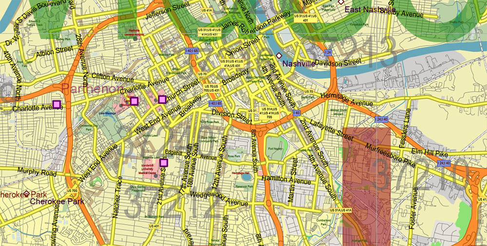
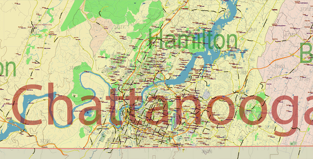
Printable Vector Map of Tennessee Full State US: All Streets and Roads + counties areas + zip-codes areas, fully editable Adobe Illustrator Map in layers, scalable, 91 MB ZIP
Scale: 1:60904
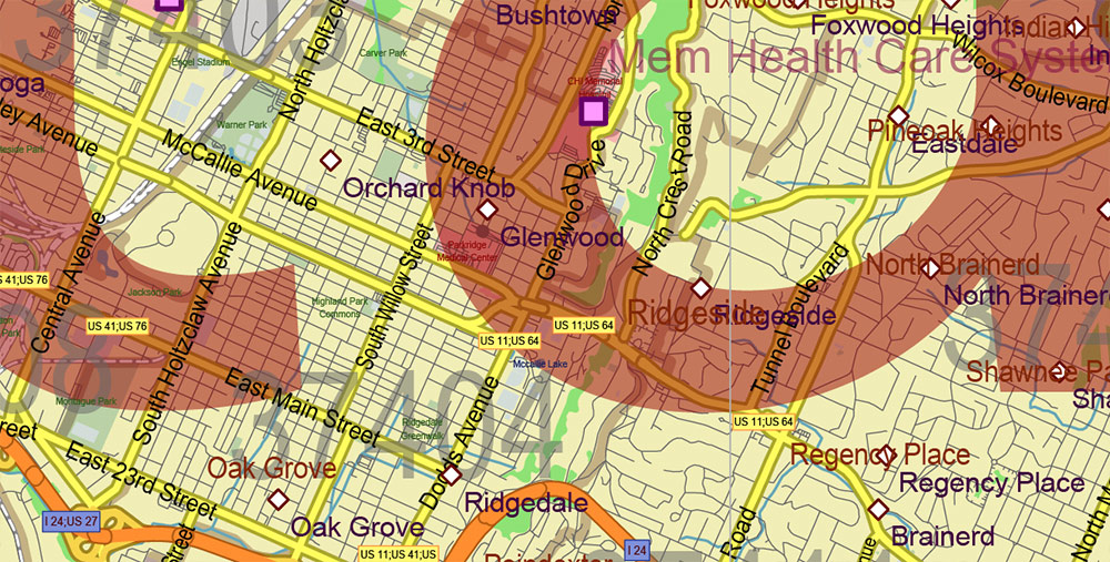
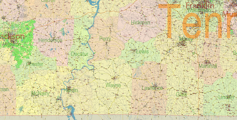
All streets and roads, Names of Principal streets, All Cities and Towns, Counties, All Geonames, airports, and heliports. Map for design, printing, arts, projects, presentations, for architects, designers, and builders, business, logistics.
NOTE! All objects are located on separate layers by type. The preview shows all layers together. When you work with this map, just turn off or delete those layers that are not needed for your project.
For Editing and High-Quality Printing, Royalty free
Need AutoCAD DWG / DXF, CDR, or any other format? Please, contact us!
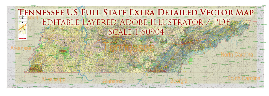
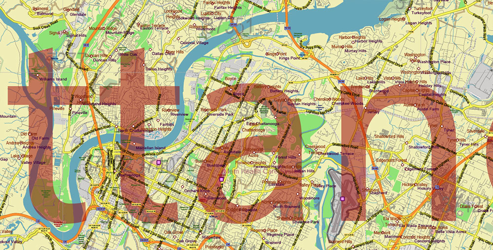
Tennessee US Map Vector Accurate Roads Plan High Detailed Street Map + Counties + Zipcodes editable Adobe Illustrator in layers
Layers list:
- Legend
- Grids
- Labels of roads (numbers) – highways, interstate
- All Geonames (cities, towns, villages, hamlets, islands)
- Points of the Geonames (cities, towns, villages, hamlets, islands)
- Names places: Names of all Cities, towns, villages and hamlets
- Names of the Airports and Heliports
- Points of the Airports and Heliports
- Numbers of ZIP codes
- Names of objects (water, park, hospital)
- Names of States
- Names of Counties
- Names of the Main Streets
- Major Roads and Streets – Highways
- Minor Roads and residential streets
- Railroads
- State boundaries
- Water objects (rivers, lakes, ponds, swamps, reefs)
- Waterways
- Ground objects (urban areas, parks, hospitals, etc.)
- ZIP-codes areas
- Counties areas (colored)
- States areas
- Background
Tennessee US Map Vector Exact State Plan High Detailed Road Map + admin + Zipcodes editable Adobe Illustrator in layers
Tennessee US Map Vector Exact State Plan High Detailed Road Map + admin + Zipcodes editable Adobe Illustrator in layers
Tennessee US Map Vector Exact State Plan High Detailed Road Map + admin + Zipcodes editable Adobe Illustrator in layers
Tennessee US Map Vector Exact State Plan High Detailed Road Map + admin + Zipcodes editable Adobe Illustrator in layers
Tennessee US Map Vector Exact State Plan High Detailed Road Map + admin + Zipcodes editable Adobe Illustrator in layers
Tennessee US Map Vector Exact State Plan High Detailed Road Map + admin + Zipcodes editable Adobe Illustrator in layers
Tennessee US Map Vector Exact State Plan High Detailed Road Map + admin + Zipcodes editable Adobe Illustrator in layers
Tennessee US Map Vector Exact State Plan High Detailed Road Map + admin + Zipcodes editable Adobe Illustrator in layers
Tennessee US Map Vector Exact State Plan High Detailed Road Map + admin + Zipcodes editable Adobe Illustrator in layers
Tennessee US Map Vector Exact State Plan High Detailed Road Map + admin + Zipcodes editable Adobe Illustrator in layers
Tennessee US Map Vector Exact State Plan High Detailed Road Map + admin + Zipcodes editable Adobe Illustrator in layers
Tennessee US Map Vector Exact State Plan High Detailed Road Map + admin + Zipcodes editable Adobe Illustrator in layers
Tennessee US Map Vector Exact State Plan High Detailed Road Map + admin + Zipcodes editable Adobe Illustrator in layers
Tennessee US Map Vector Exact State Plan High Detailed Road Map + admin + Zipcodes editable Adobe Illustrator in layers
Tennessee US Map Vector Exact State Plan High Detailed Road Map + admin + Zipcodes editable Adobe Illustrator in layers
Tennessee US Map Vector Exact State Plan High Detailed Road Map + admin + Zipcodes editable Adobe Illustrator in layers
Tennessee US Map Vector Exact State Plan High Detailed Road Map + admin + Zipcodes editable Adobe Illustrator in layers
Tennessee US Map Vector Exact State Plan High Detailed Road Map + admin + Zipcodes editable Adobe Illustrator in layers
Tennessee US Map Vector Exact State Plan High Detailed Road Map + admin + Zipcodes editable Adobe Illustrator in layers
Tennessee US Map Vector Exact State Plan High Detailed Road Map + admin + Zipcodes editable Adobe Illustrator in layers
Tennessee US Map Vector Exact State Plan High Detailed Road Map + admin + Zipcodes editable Adobe Illustrator in layers
Tennessee US Map Vector Exact State Plan High Detailed Road Map + admin + Zipcodes editable Adobe Illustrator in layers
Tennessee US Map Vector Exact State Plan High Detailed Road Map + admin + Zipcodes editable Adobe Illustrator in layers
Tennessee US Map Vector Exact State Plan High Detailed Road Map + admin + Zipcodes editable Adobe Illustrator in layers
Tennessee US Map Vector Exact State Plan High Detailed Road Map + admin + Zipcodes editable Adobe Illustrator in layers

 Author: Kirill Shrayber, Ph.D. FRGS

