Extended Description of the Vector Map
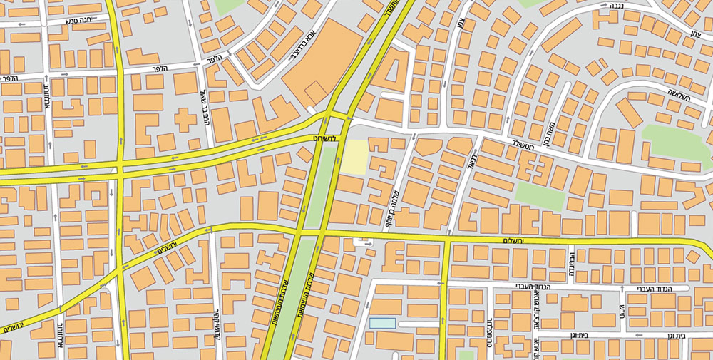
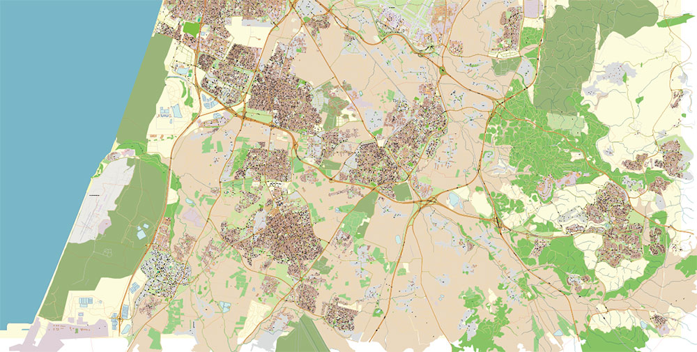
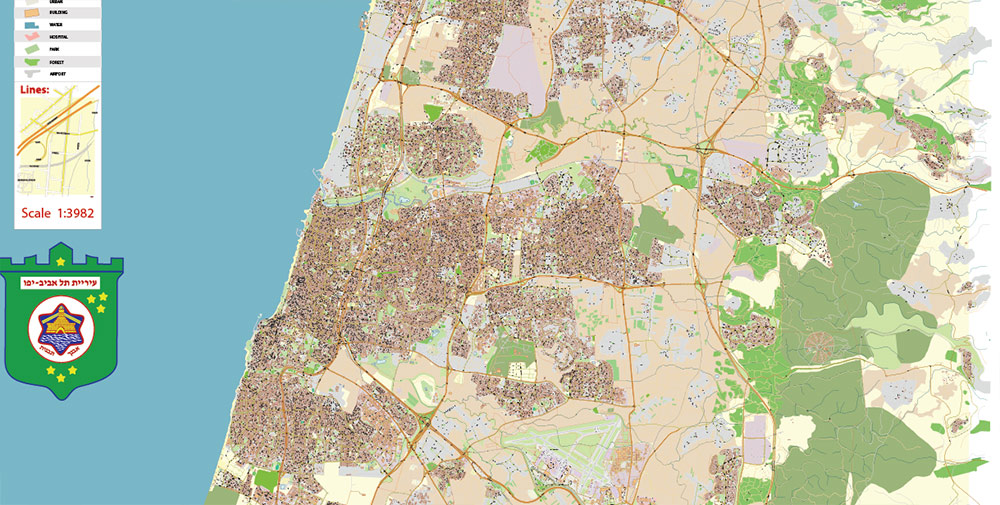
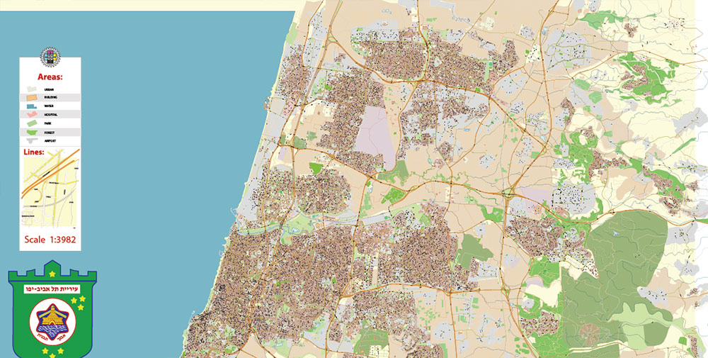
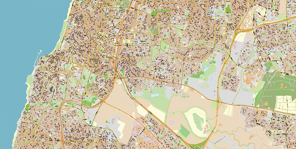
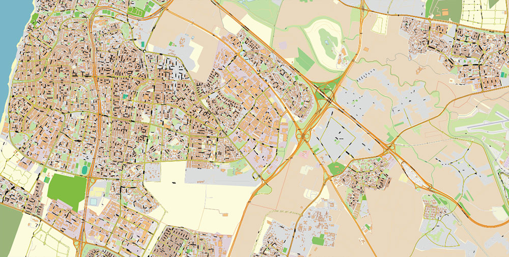
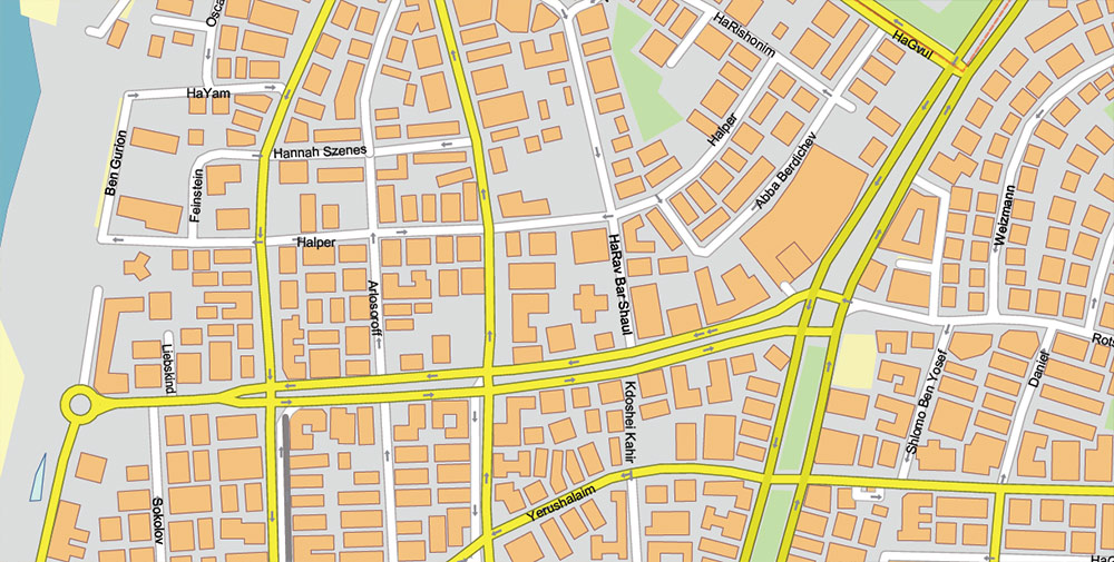
Printable Tel Aviv Israel PDF Vector Map 1971 high detailed layered Adobe Illustrator, All streets and roads, Water objects, in Mercator Projection fully editable, Adobe PDF in layers, full vector, scalable, text / curves format names, 121 mb ZIP
All street and roads with names (latin and hebrew), Water areas, Buildings. Map for design, printing, arts, projects, presentations, for architects, designers and builders, business, logistics, education.
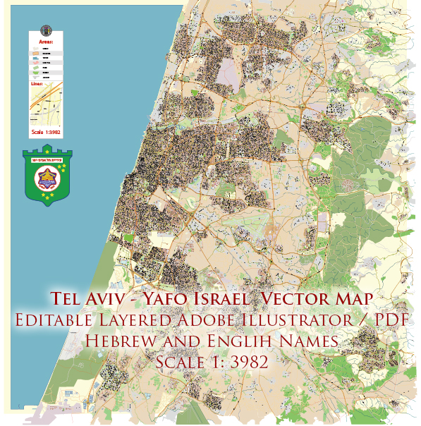
Tel Aviv Israel PDF Vector Map 1971 high detailed layered Adobe PDF (latin + hebrew names)
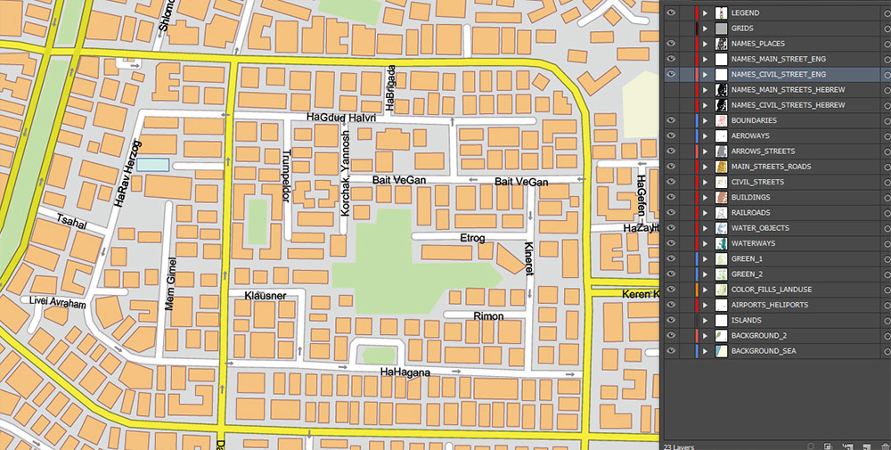
Layers:
- Legend
- Grids
- Road labels
- Names Places 1, 2, 3
- Names objects
- Names streets English
- Names main streets hebrew
- Names residencial streets hebrew
- Arrows of the street directions
- Main streets and roads
- Residencial roads and streets
- Buildings
- Water objects (areas)
- Waterways
- Landuse areas
- Background and Sea
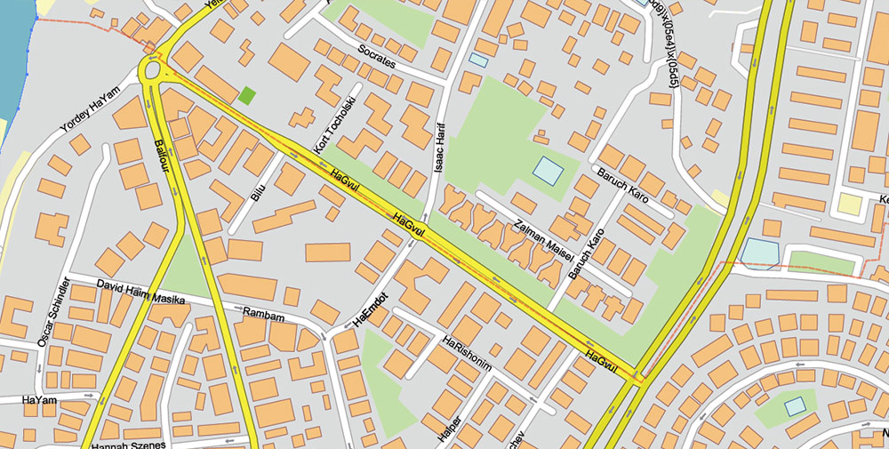
Tel Aviv Israel PDF Vector Map 1971 high detailed layered Adobe PDF (latin + hebrew names)
Tel Aviv Israel PDF Vector Map 1971 high detailed layered Adobe PDF (latin + hebrew names)
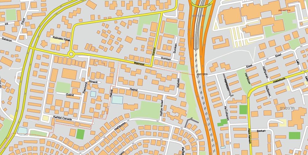
Tel Aviv Israel PDF Vector Map 1971 high detailed layered Adobe PDF (latin + hebrew names)
Tel Aviv Israel PDF Vector Map 1971 high detailed layered Adobe PDF (latin + hebrew names)
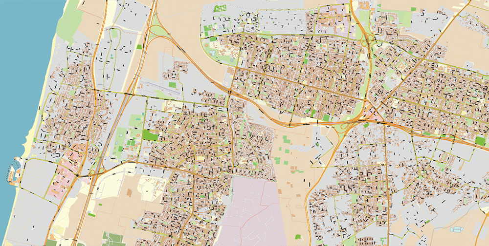
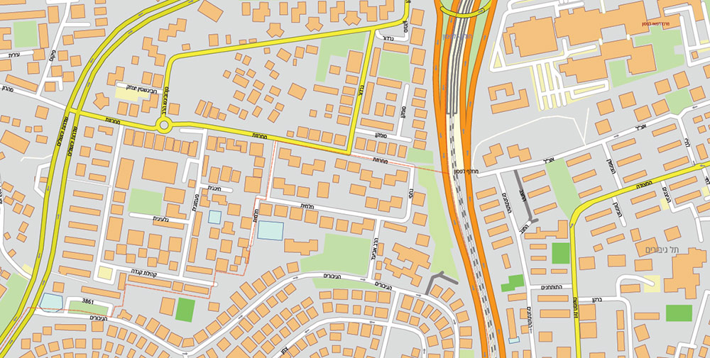
Tel Aviv Israel PDF Vector Map 1971 high detailed layered Adobe PDF (latin + hebrew names)
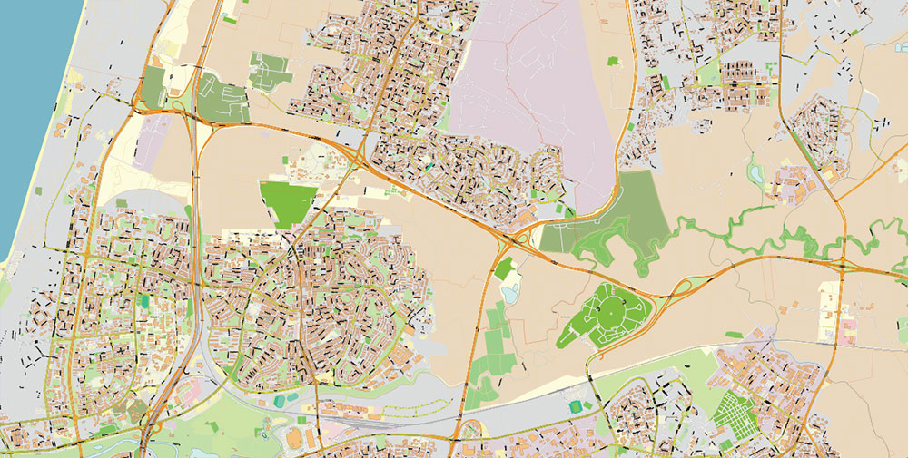
Tel Aviv Israel PDF Vector Map 1971 high detailed layered Adobe PDF (latin + hebrew names)
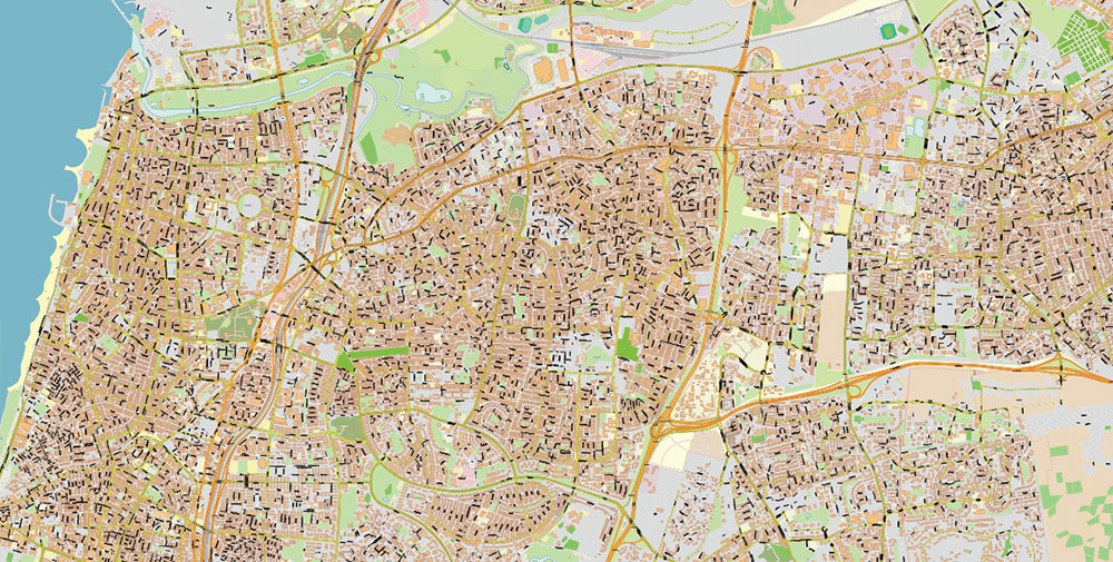
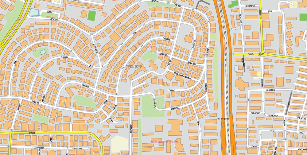
Tel Aviv Israel PDF Vector Map 1971 high detailed layered Adobe PDF (latin + hebrew names)
Tel Aviv Israel PDF Vector Map 1971 high detailed layered Adobe PDF (latin + hebrew names)
Tel Aviv Israel PDF Vector Map 1971 high detailed layered Adobe PDF (latin + hebrew names)
Tel Aviv Israel PDF Vector Map 1971 high detailed layered Adobe PDF (latin + hebrew names)
Tel Aviv Israel PDF Vector Map 1971 high detailed layered Adobe PDF (latin + hebrew names)
Tel Aviv Israel PDF Vector Map 1971 high detailed layered Adobe PDF (latin + hebrew names)
Tel Aviv Israel PDF Vector Map 1971 high detailed layered Adobe PDF (latin + hebrew names)
Tel Aviv Israel PDF Vector Map 1971 high detailed layered Adobe PDF (latin + hebrew names)
Tel Aviv Israel PDF Vector Map 1971 high detailed layered Adobe PDF (latin + hebrew names)

 Author: Kirill Shrayber, Ph.D. FRGS
 vector map Adobe Illustrator editable G-View Level 12 (5 km scale), full vector")
 vector map Adobe Illustrator editable G-View Level 17 (100 meters scale), full vector")