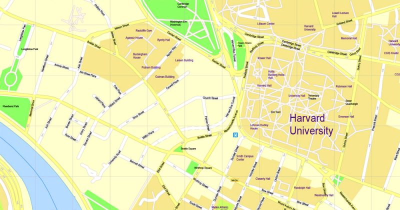
SVG vector Map Harvard University Cambridge MA, US, exact vector street G-View Level 17 (100 meters scale) map, V.21.12. fully editable, SVG full vector, scalable, editable text format of street names, 9 Mb ZIP.
All streets named, main objects, no buildings. Map for publishing, design, printing, publications, arts, projects, presentations, for architects, designers and builders, business, logistics. The most exact and detailed map.
Separated layers: streets and roads, color fills, road labels, names 1,2,3, street arrows, objects, scales, legend, grid.
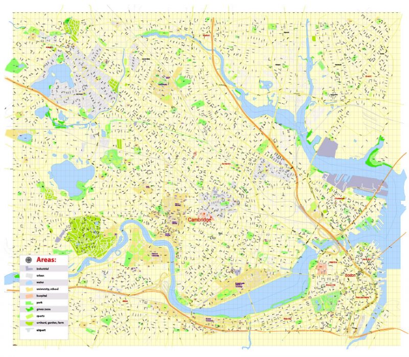
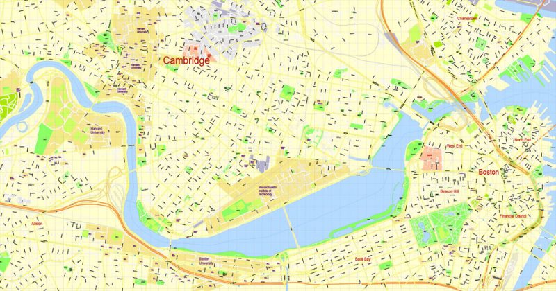
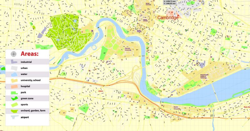
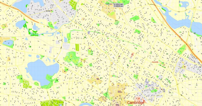
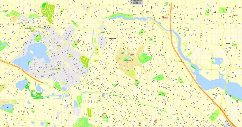
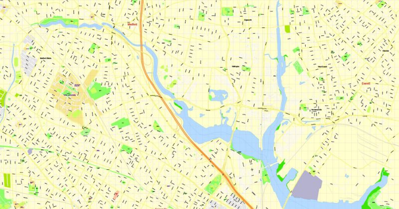
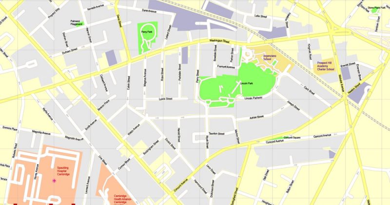
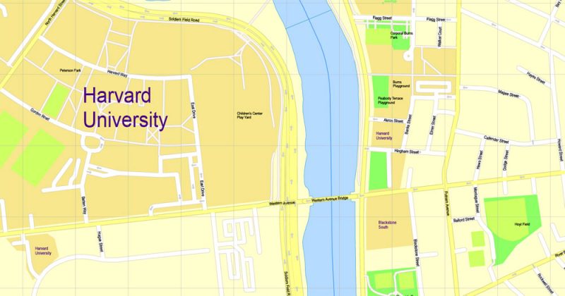
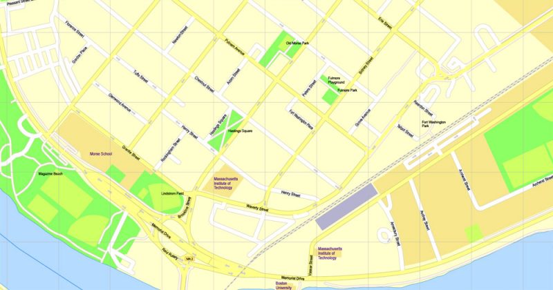
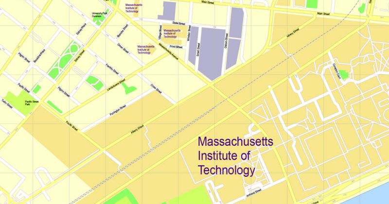
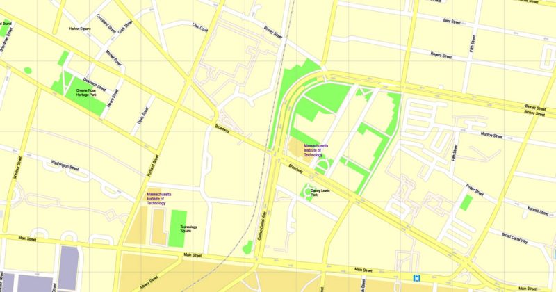
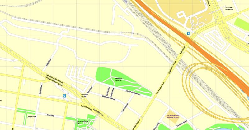
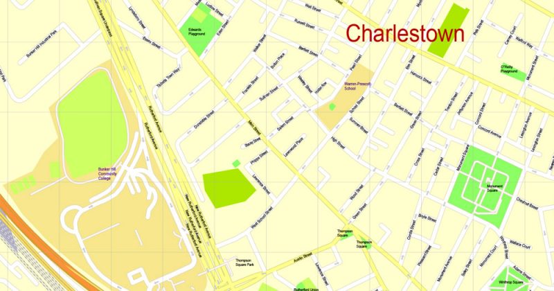
Included full Cambridge map, and the part of Boston.
For edit and use in the interactive vector apps, for example Jvectormaps
You can edit this file by Adobe Illustrator, Inkscape, Corel Draw.
File can be open and correct display in any internet browser.
DWG, DXF, CDR, ESRI Shapes, and other formats – by request, same price, please contact.
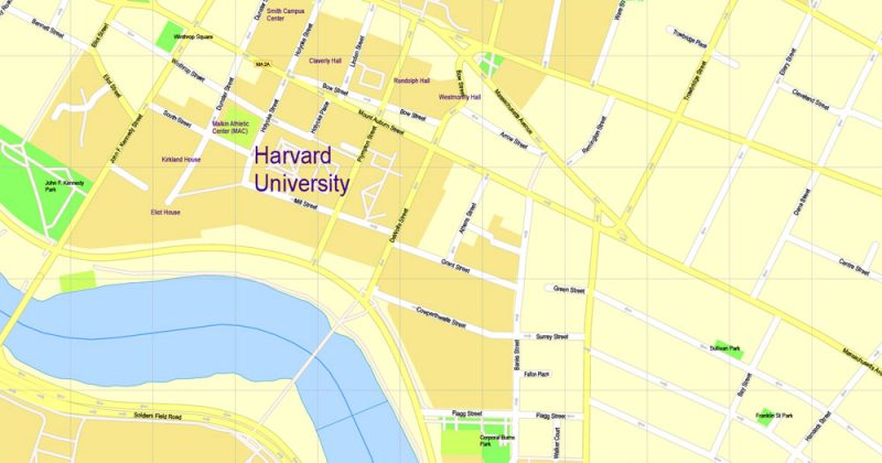
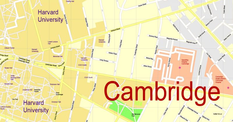
Harvard University, Cambridge, Massachusetts.
This vector map of Harvard University is used as a basis for design, editing, and further printing.
This is the most detailed, exact map of Harvard University for high-quality printing and polygraphy. You can always clarify the map development date by contacting us.
For your convenience, all objects on Harvard University vector map are divided into layers. And the editing is very easy – colors, lines, etc.
You can easily add any objects needed (e.g. shops, salons, sale points, gas station or attraction) on any layer of Harvard University vector map.
Harvard University is a private Ivy League research university in Cambridge, Massachusetts, with about 6,700 undergraduate students and about 15,250 post graduate students. Established in 1636 and named for its first benefactor, clergyman John Harvard, Harvard is the United States’ oldest institution of higher learning, and its history, influence, and wealth have made it one of the world’s most prestigious universities.
One of the advantages of Harvard University vector maps of our production is the relevance of cartographic data, we constantly update all our products.
This vector map of Harvard University is used by:
designers, layout designers, printers, advertisers and architects. Our product – vector maps – is designed for further editing and printing in large formats – from @Wall format (a few meters) to A-0 and A-1, A-2, A-3.
Harvard University map in vector format is used for design, urban planning, presentations and media visualizations.
Advertising and presentation map of Harvard University (usually the final designer marks the routes, and puts the client’s objects (shops, saloons, gas stations etc.)
The undoubted advantage is that people will NEVER throw out this advertising product – the map. In fact, as an advertising medium, a map is the most “long-playing” of the well-known polygraphic advertising media, with the longest lifespan, and the maximum number of interactions with the customer.
For travelers, maps are sold at the airports and gas stations around the world. Often the source is our vector maps.
Take a look, who purchases our vector maps of Harvard University in “Our Clients and Friends” page – these are large and small companies, from super-brands like Volvo and Starbucks, to small design studios and printing houses.
It’s very easy to work with vector maps of Harvard University, even for a not very experienced designer who can turn on and off the map layers, add new objects, change the colors of fill and lines according to customer requirements.
The undoubted advantage of Harvard University vector maps in printing is an excellent and detailed visualization, when customer can expand a large paper map and instantly define his location, find a landmark, an object or address on map, unlike using the popular electronic formats of Google and Yandex maps for example.
Printable vector maps of Harvard University are much more convenient and efficient than any electronic maps on your smartphone, because ALL DETAILS are displayed in the entire space of Harvard University map.
Useful tips on working with vector maps of cities and countries in Adobe Illustrator.
«V» – launches the Selection tool (cursor, black arrow), which makes active any vector line.
«А» – launches the Direct Selection tool (white cursor), allows you to select curve elements and drag them to the desired place.
«R» – activates the Rotate tool, which helps you rotating selected objects around the center point by 360 degrees.
«E» – gives you the opportunity to use the Eraser tool and erase unnecessary parts.
«X» – switches between Fill and Stroke in the Tools section. Try to get used to this hot key and
you will quickly understand that you can’t live and work without it.
Guides are not limited to vertical and horizontal in Adobe Illustrator. You can also create a diagonal guide for example. Moreover, you can turn any contours into guides. Select the outline and go to View > Guides > Make Guides (Create Guides), or simply press Cmd/Ctrl + 5. You can also turn the guides back into an editable object. Go to menu, View > Guides > Unlock Guides (Release Guides), select the guide you want to edit and select View > Guides > Release Guides (Reset Guides), or just press Cmd/Ctrl + Option / Alt + 5).
You will probably want to change the color scheme used on our Harvard University vector map.
To quickly and effectively play with colors.
Of course, you can do it manually, all objects in our Harvard University vector map are divided according to types and layers, and you can easily change the color gamma of vector objects in groups and layers.
But there is more effective way of working with the whole VECTOR MAP of Harvard University and all layers:
The overview dialog «Edit colors»/«Repaint Graphic Object» (this dialog box name can change depending on the context):
If you have selected a part or a layer of Harvard University vector map and open the dialog box by clicking the icon in the Control panel, on the Samples palette or the Color Catalog, or if you choose Edit > Edit Colors> Repaint Graphic Object, then the «Repaint Graphic Object» dialog box appears, and you get access to «Assign» and «Edit» tabs.
If a picture or a map fragment is not selected, and you open the dialog box by clicking the icon in the Control panel, on the Samples palette or in the Color Catalog, the «Edit Colors» dialog box appears and you can only access the «Edit» tab.
Regardless of the name at the top of the dialog box, the right-hand side always displays the color group of the current document, as well as two default color groups: Print Color and Grayscale. These color groups can be selected and used any time.
Create and edit color groups of Harvard University vector map, and also assign colors using the «Edit Colors»/ а «Repaint Graphic Object» dialog box.
A. Creating and editing of a color group on the «Edit» tab
B. Assigning colors on the «Assign» tab
C. Select a group of colors from the «Color groups» list
The option «Repaint a graphic object» in the lower part of the dialog box allows you to preview the colors on a selected layer of Vector map, or a group of elements, and specify whether its colors will be redefined when the dialog box is closed.
The main areas of the dialog box are:
«Edit»
The «Edit» tab is designed to create a new or edit the existing color groups.
The harmony rules Menu and the Color Wheel are used to conduct experiments with color harmonies. The color wheel shows how colors are related in color harmony, and the color bars allow you to view and manipulate an individual color values. In addition, you can adjust the brightness, add and remove colors, save color groups and view colors on the selected Vector Map of Harvard University or a separated layers.
«Assign»
The «Assign» tab is used to view and control on how the original colors are replaced with colors from the color group like your corporate colors in the Vector Map of Harvard University.
The assign color ability is provided only if the entire map, layer or fragment is selected in the document. You can specify which of new colors replace the current colors, whether the spot colors should be preserved and how colors are replaced (for example, you can replace colors completely or changing the color tone while maintaining the brightness). The «Assign» tab allows you to redefine colors in the Vector Map of Harvard University, or in separate layers and fragments using the current color group or reducing the number of colors in the current Vector Map.
Color groups
Is a list of all saved color groups for current document (the same groups appear in the «Samples» palette). You can edit and delete the existing color groups, as well as creating a new ones using the list of “Color Groups” in the dialog box. All changes appear in the «Samples» palette.
The highlighted color group shows, which color group is currently edited.
Any color group can be selected and edited, or used to redefine the colors in the selected vector map of Harvard University, its fragments or elements.
Saving a color group adds this group to the specified list.
Opening the «Edit Colors»/«Repaint Graphic Object» dialog box.
Open the «Edit Colors»/«Repaint Graphic Object» dialog box using one of the following methods:
«Edit»> «Edit Colors»> «Repaint Graphic object» or «Repaint With Style».
Use these commands if you need to edit the colors in the selected vector map of Harvard University.
«Repaint Graphic object» button on the «Control» panel.
Use this button if you need to adjust colors of Harvard University vector map using the а «Repaint graphic object» dialog box.
The specified button is available if the selected vector map or its fragment contains two or more colors.
Note. This color editing method is convenient for global color adjustment in a vector map, if global colors were not used when creating a Map of Harvard University.
The «Edit colors» button or «Edit or apply colors» on the «Color Catalog» palette
Click this button if you need to edit colors on the «Color Catalog» palette or edit and then apply them to the selected Vector Map of Harvard University or its fragment.
The «Edit color group» button or «Edit or apply color group» on the «Samples» palette.
Click this button if you need to edit the colors in the specific color group or edit and apply them to the selected Vector Map of Harvard University or a group of its elements, for example, the whole layer “Streets and lines”. You can also double-click the color group in the Samples panel to open the dialog box.
If the map file is too large and your computer freezes or even can’t open it quickly:
1. Try to reduce the color resolution of the video card (display) to 256 colors while working with a large map.
2. Using Windows Task Manager, select all the application you don’t need, while working with map, just turn them off.
3. Launch Adobe Illustrator. (DO NOT OPEN the vector map file)
4. Start the Windows Task Manager using administrator rights > Find the “Illustrator” process > set the «real time» priority,
5. Open the file. When you see the LEGACY FONT popup window – click “OK” (do not update). You can restore the TEXT later.
6. Can also be useful: When file is opened – Edit > Settings > Basic Settings > disable smoothing. /// It looks scary, but works quickly)))
We recommend saving the file in Adobe Illustrator 10 version. It’s much more stable when working with VERY BIG size files.
The Harvard Corporation is its first chartered corporation. Although never formally affiliated with any denomination, the early College primarily trained Congregational and Unitarian clergy. Its curriculum and student body were gradually secularized during the 18th century, and by the 19th century, Harvard had emerged as the central cultural establishment among Boston elites. Following the American Civil War, President Charles W. Eliot’s long tenure (1869–1909) transformed the college and affiliated professional schools into a modern research university; Harvard was a founding member of the Association of American Universities in 1900. A. Lawrence Lowell, who followed Eliot, further reformed the undergraduate curriculum and undertook aggressive expansion of Harvard’s land holdings and physical plant. James Bryant Conant led the university through the Great Depression and World War II and began to reform the curriculum and liberalize admissions after the war. The undergraduate college became coeducational after its 1977 merger with Radcliffe College.
The university is organized into eleven separate academic units—ten faculties and the Radcliffe Institute for Advanced Study—with campuses throughout the Boston metropolitan area: its 209-acre (85 ha) main campus is centered on Harvard Yard in Cambridge, approximately 3 miles (5 km) northwest of Boston; the business school and athletics facilities, including Harvard Stadium, are located across the Charles River in the Allston neighborhood of Boston and the medical, dental, and public health schools are in the Longwood Medical Area. Harvard’s endowment is worth $39.2 billion, making it the largest of any academic institution. Harvard is a large, highly residential research university. The nominal cost of attendance is high, but the university’s large endowment allows it to offer generous financial aid packages. The Harvard Library is the world’s largest academic and private library system, comprising 79 individual libraries holding over 18 million items. The University is cited as one of the world’s top tertiary institutions by various organizations.
Harvard’s alumni include eight U.S. presidents, more than thirty foreign heads of state, 62 living billionaires, 359 Rhodes Scholars, and 242 Marshall Scholars. As of October 2018, 158 Nobel laureates, 18 Fields Medalists, and 14 Turing Award winners have been affiliated as students, faculty, or researchers. In addition, Harvard students and alumni have won 10 Academy Awards, 48 Pulitzer Prizes, and 108 Olympic medals (46 gold, 41 silver and 21 bronze).
Harvard University
Harvard University is a private Ivy League research university in Cambridge, Massachusetts, established in 1636, whose history, influence, and wealth have made it one of the world’s most prestigious universities.
Address: Cambridge, MA 02138
Acceptance rate: 5.4% (2016)
Undergraduate tuition and fees: 43,280 USD (2016)
Mascot: John Harvard, the Pilgrim
Total enrollment: 22,000 (2016)
Color: Crimson
Cambridge
City in Massachusetts
Cambridge is a city in Massachusetts, across the Charles River from Boston. It’s home to Harvard University. At the heart of campus, grassy Harvard Yard is anchored by the neoclassical Widener Library. Harvard Square has cafes, bars and bookstores. The Harvard Art Museums comprise the Fogg, Busch-Reisinger and Arthur M. Sackler collections. Southeast is the prestigious Massachusetts Institute of Technology (MIT).
Area:
• Total 7.13 sq mi (18.47 km2)
• Land 6.43 sq mi (16.65 km2)
• Water 0.70 sq mi (1.81 km2)
Elevation: 40 ft (12 m)
Population:
• Total 109,694
Free vector maps:

Free download Vector Map US Interstate roads, Adobe PDF, V.2 Free_Map_US_Interstates_Roads_2.pdf
Free download Vector Map US Interstate roads, Adobe Illustrator, V.2 Free_Map_US_Interstates_Roads_2.ai

Free Download Vector Map US County and State Adobe Illustrator
Free_Vector_Map_US_States_County_Map.ai
Free Download Vector Map US County and State Adobe PDF
Free_Vector_Map_US_States_County_Map.pdf

Free Vector Map US Census Data Top US Ancestries by County Adobe Illustrator
Free_Vector_Map_US_Census-Data-Top-US-Ancestries-by-County.ai
Free Vector Map US Census Data Top US Ancestries by County Adobe PDF
Free_Vector_Map_US_Census-Data-Top-US-Ancestries-by-County.pdf
Free US Maps from WIKIPEDIA
Small guide: How to work with the vector map?
You can: Mass select objects by type and color – for example, the objects type “building” (they are usually dark gray) – and remove them from the map, if you do not need them in your print or design project. You can also easily change the thickness of lines (streets), just bulk selection the road by the line color.
The streets are separated by type, for example, type “residential road” are usually white with a gray stroke. Highway usually orange with a brown or dark gray stroke.
It is easy to change the font of inscriptions, all or each individually. Also, just can be make and any other manipulation of objects on the vector map in Adobe illustrator format.
Important: All the proportions on the map are true, that is, the relative sizes of the objects are true, because Map is based on an accurate GPS projection, and It transated into the (usual for all) the Mercator projection.
You can easily change the color, stroke and fill of any object on the map, zoom without loss of quality Image Verification.
Select object

Bulk selection the same objects on the vector map

See the bulk selected objects on the vector map

Bulk delete buildungs from the vector map

Select residencial road (small street) on the vector map

Bulk selection the same lines (streets, roads) on the full map

Create fat lines of the streets on the vector maps (bulk action) 1

Create fat lines of the streets on the vector maps (bulk action) 2

Create fat lines of the streets on the vector maps (bulk action) 3

You can easily change the color, stroke and fill of any object on the map, zoom without loss of quality Image Verification.

 Author: Kirill Shrayber, Ph.D. FRGS

